
The opening of the Metro Tunnel has upended decades of assumptions about how trains operate in Melbourne. Instead of trains going to the city and terminating at Flinders Street, they are through running, continuing out the other side.
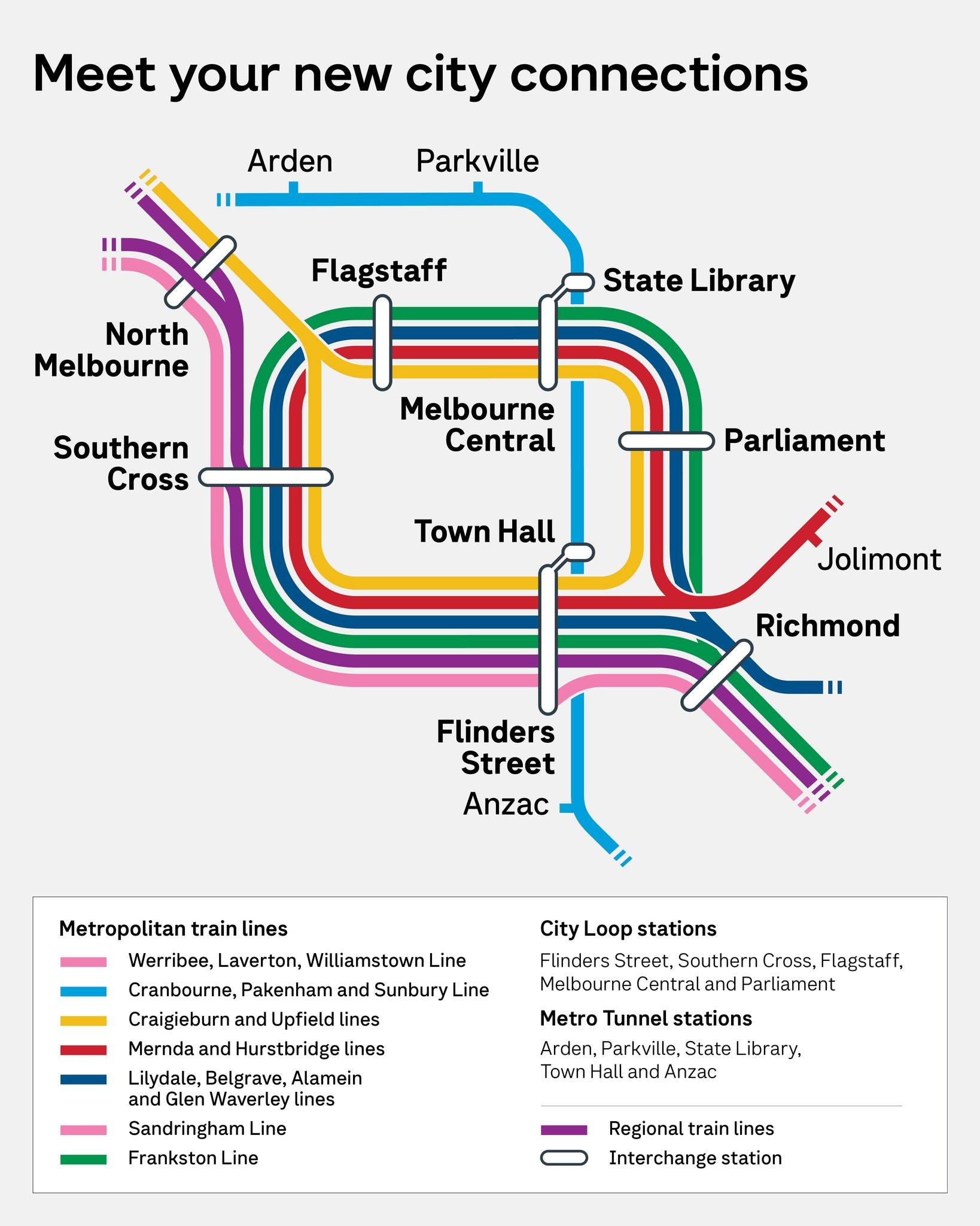
Whilst this is not unusual in a global context, it is taking time for passengers to get used to, and unfortunately, I do not think passenger information displays (PIDs) have helped.
Passengers coming from the southeast woke up to the “Big Switch”, seeing trains going to “West Footscray” or “Watergardens”, instead of “Flinders Street”. In the AM peak, in confusion many passengers did what they have learnt to do in disruptions when the train does not go to the city; they got off en masse at Caulfield and crowded onto Frankston services.
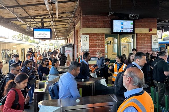
The kicker?
Those trains were still going to the city! But how were people supposed to know?
I overheard one passenger in the Officer area, a week or two after the Big Switch, remarking that they couldn’t find Flinders Street or Melbourne Central, and that they were unsure if they were on a train to the city.
Of course, Town Hall is directly connected to Flinders Street, as is State Library to Melbourne Central (the latter even more directly). In my opinion, it would have probably been best to have Town Hall simply be Flinders Street platforms 15-16 and for State Library to have been Melbourne Central platforms 5-6. It did not turn out like this, due to safety concerns from emergency services, with an added political bonus of allowing the government to proclaim they have opened five new stations.
Somehow, they are able to add platforms to existing stations and keep the same names in far-off cities such as Sydney (see Martin Place), but it’s too late, we are stuck with these names.
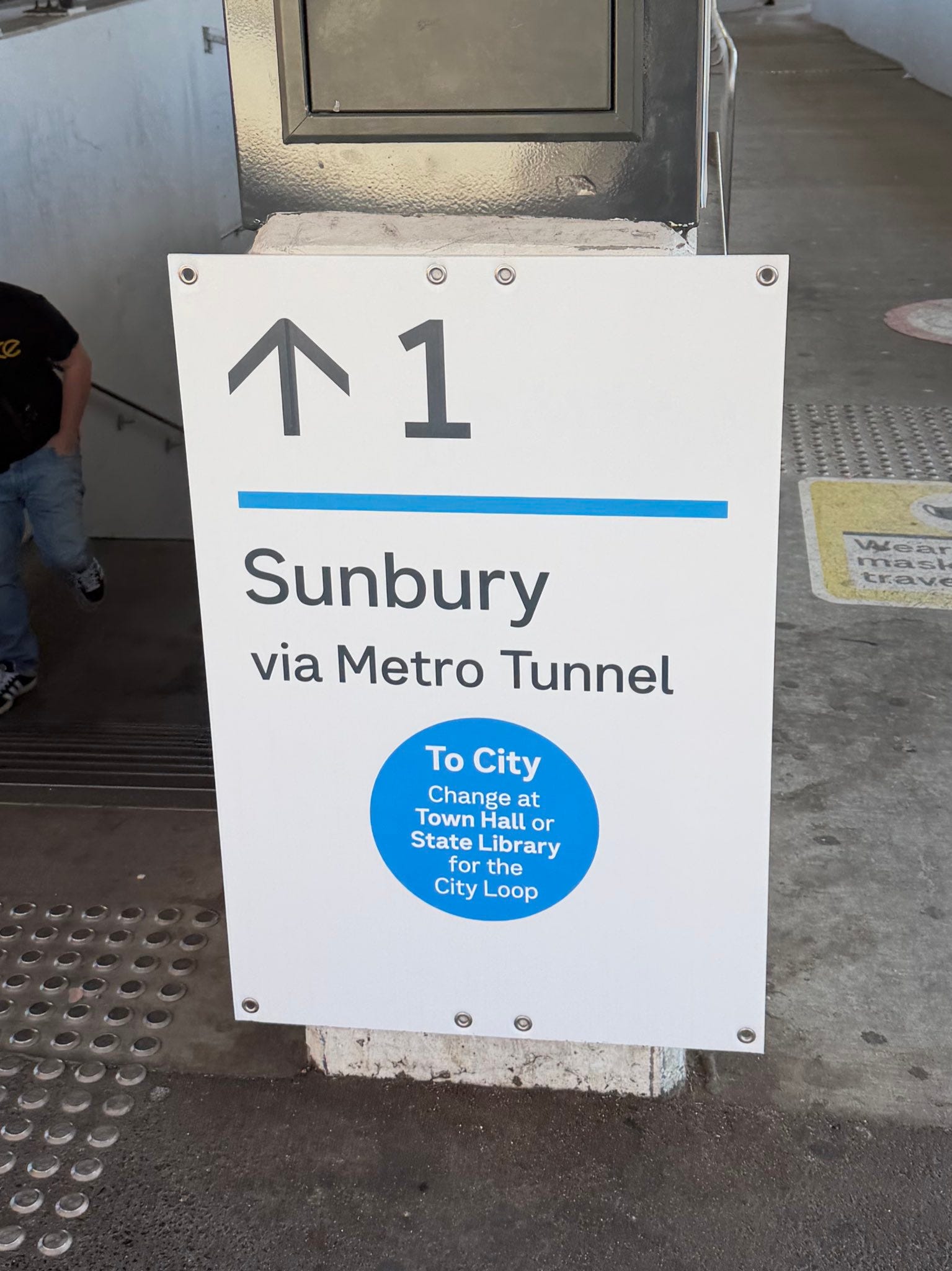
To address the passenger confusion, Metro Trains has belatedly put up posters around at stations informing passengers that these trains indeed go to the city.
However, even if the Metro Tunnel CBD stations had the classic City Loop names, we would run into what I see as a massive passenger information problem. On passenger information displays, a “route qualifier” often follows the title destination. The route qualifier consists of an “express statement” and a “via statement”.
For the old Frankston-Werribee/Williamstown cross-city trains, it would say “via Flinders Street”. This saved passengers the effort of reading through a big list of stations to find the most important destination that the train is passing through. Luckily, we actually already have “via statements” for trains running through the Metro Tunnel.
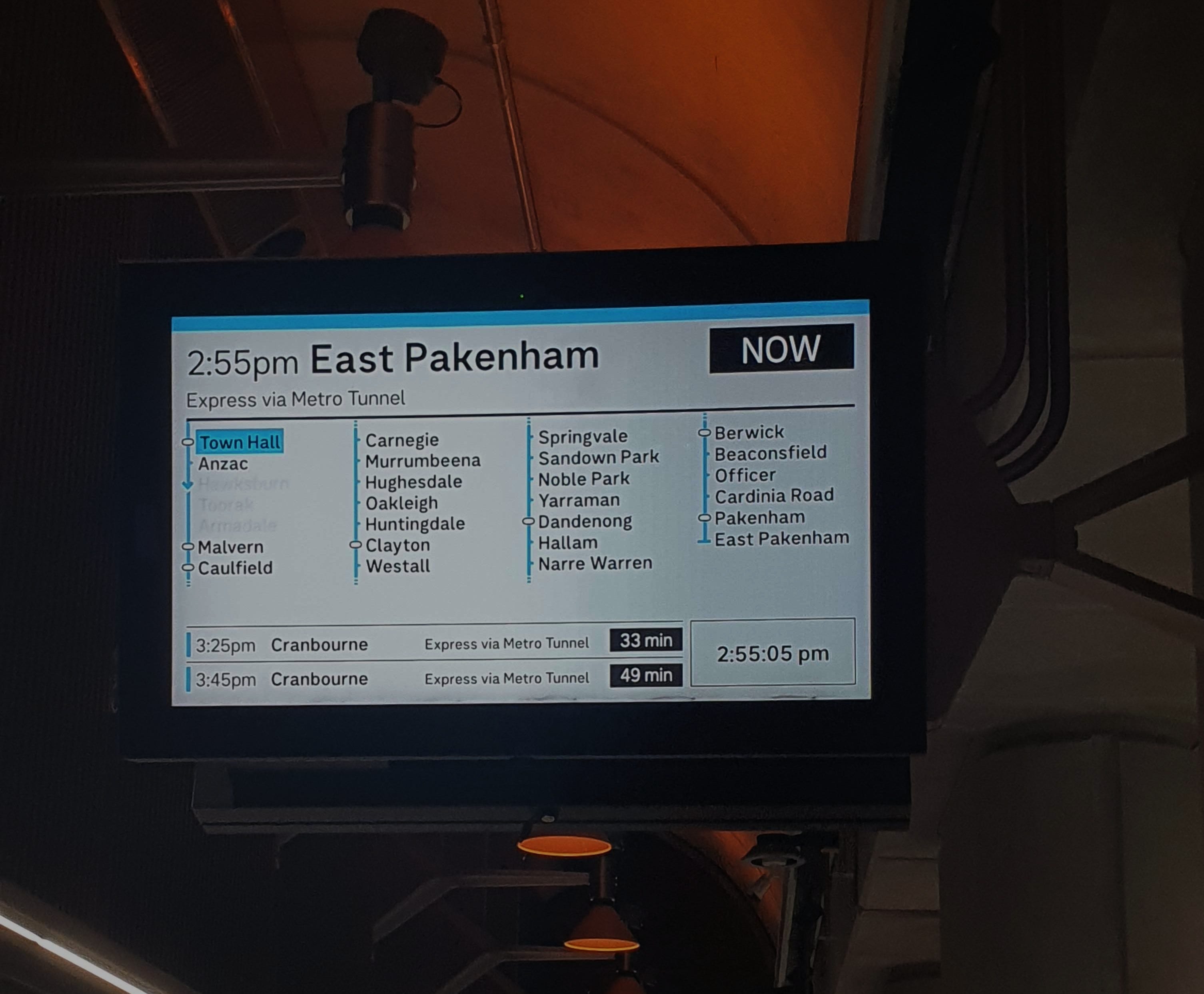
via… Metro Tunnel. Oh. That’s not great.
The Metro Tunnel is not a station. Unless passengers have been paying close attention to government communications (many have not), they do not know which stations are on the Metro Tunnel. The official map doesn’t even say which stations are on the Metro Tunnel. What happens in 10 years’ time when the Metro Tunnel promotions are a distant memory? Will “via Metro Tunnel” have to be learnt through guesswork by new passengers? Unfortunately, this seems like the ultimate outcome.
What’s worse is that passenger information displays will refer to services as being “via Metro Tunnel” even when you are already at a Metro Tunnel station. I already know it’s going through the Metro Tunnel! I’m at a Metro Tunnel station!
I think the clear solution is for information displays to refer to such services as “via Town Hall” (and via somewhere else if the display is at Town Hall). Town Hall station will be still around on every map, and become a well-known landmark in 10 years’ time, when the “Metro Tunnel” will start being forgotten by most Melburnians. Who knows, we might even build a “Metro Tunnel 2” in the future. That sure would make things confusing.
But this got me thinking. Why end the via statements at the city? Trains will still go to unimportant destinations such as East Pakenham through far more important stops. So how should we figure out which station the train shall be going “via”?
The simplest method is to pick the busiest station based on published patronage figures between the station we are at, and the final destination. Here is a graphic representation of this process:
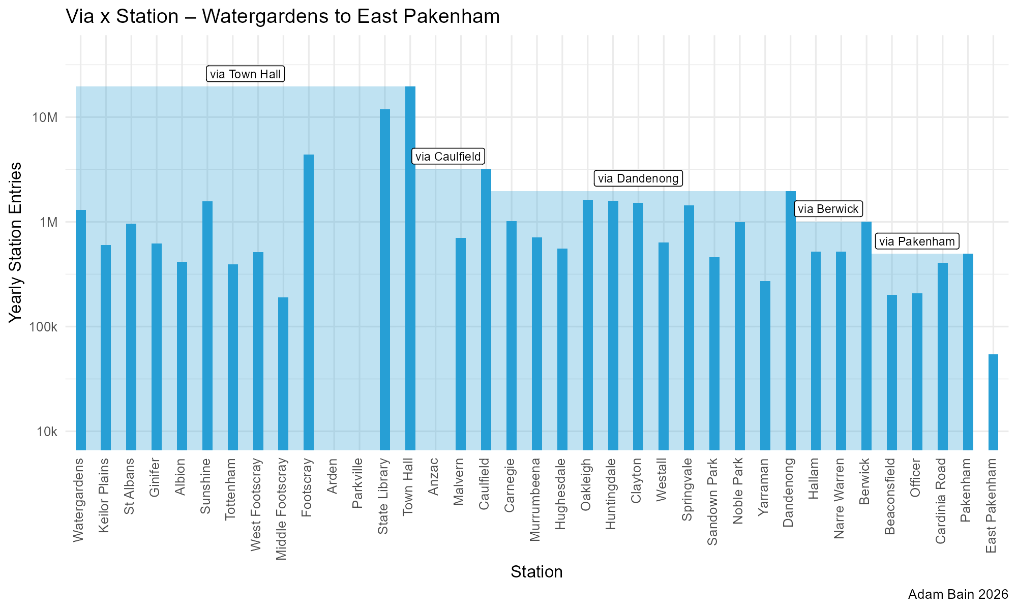
Groups of stations that share the same “via statement” all share the same rectangle in this diagram. For example, Stations from Caulfield to Yarraman all share “via Dandenong”, as it is the busiest station in the direction of travel.
One potential issue with this method is that stations on multiple lines have combined patronage counts. This could theoretically be unfairly showing Caulfield as a busy station on the Cranbourne/Pakenham Lines if most of the station entries are for the Frankston Line. However, without an accurate way to apportion station entries to lines, I think it’s actually not too bad using the total station entries because in a way it somewhat represents the importance of the station as an interchange.
Let’s have a look at what happens for the other direction through the Metro Tunnel:
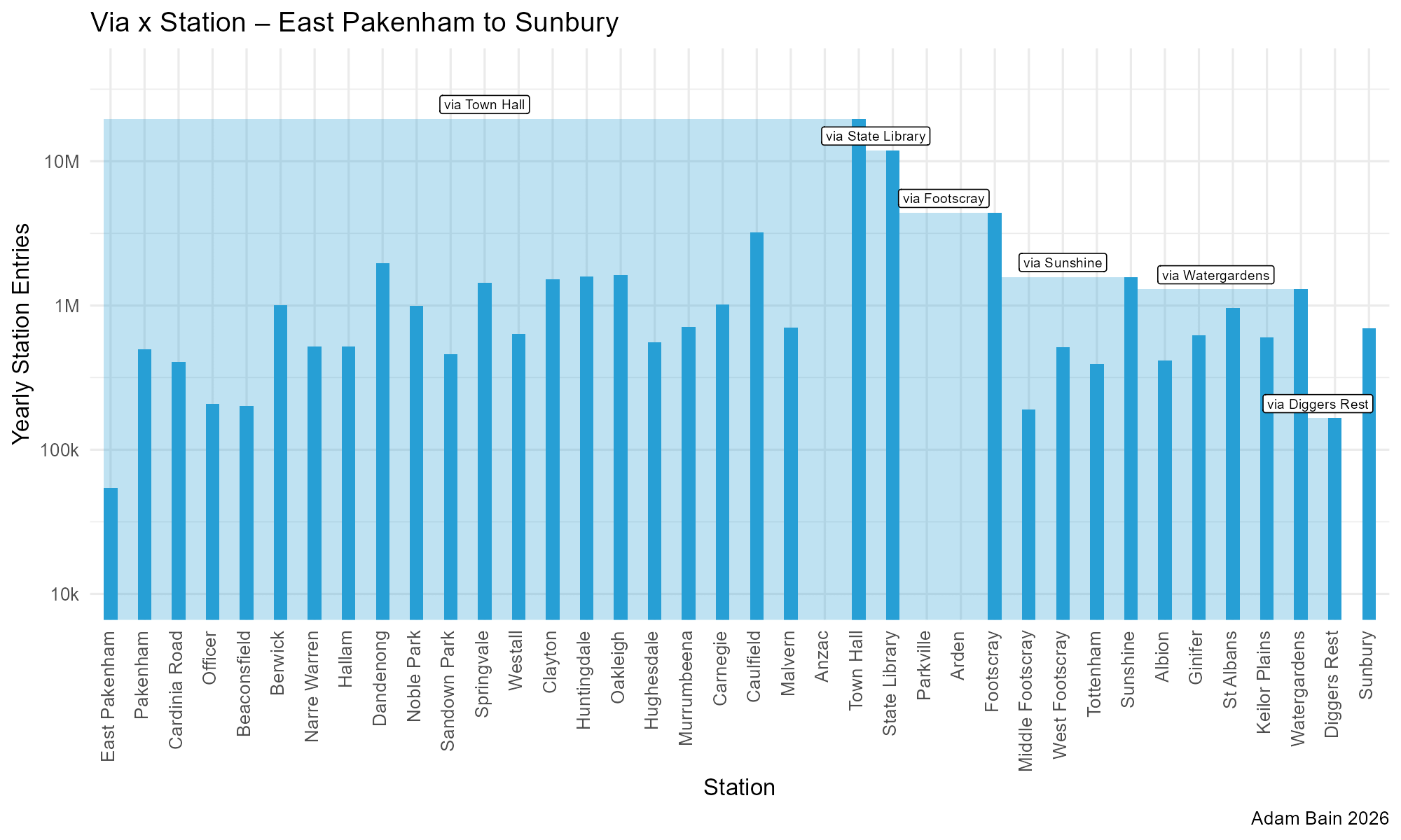
It follows a very similar logical pattern. However - one thing I am not happy with is the concept of boarding a train at Town Hall labeled as “via State Library”. I wonder if it would be better to bias the via statement towards stations roughly half-way along the remaining journey. An alternative method would be to avoid using non-Flinders Street/Town Hall CBD stations as the via statement if possible.
However, one cannot deny that State Library is the most important station heading Sunbury-bound from Town Hall.
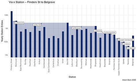
Here are some more similar diagrams showing the dynamic process for the Upfield, Mernda and Belgrave lines:
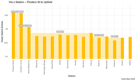
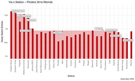
North Melbourne Station has functioned as a key interchange point in the Metro Trains network, for passengers travelling from the Northern Suburbs to the Western Suburbs. By far the most common destination in the Western Suburbs is Footscray, which up until the Metro Tunnel “Big Switch” has been accessible via all three of the Werribee, Williamstown and Sunbury Lines. The Metro Tunnel has moved the Sunbury Line out of North Melbourne.
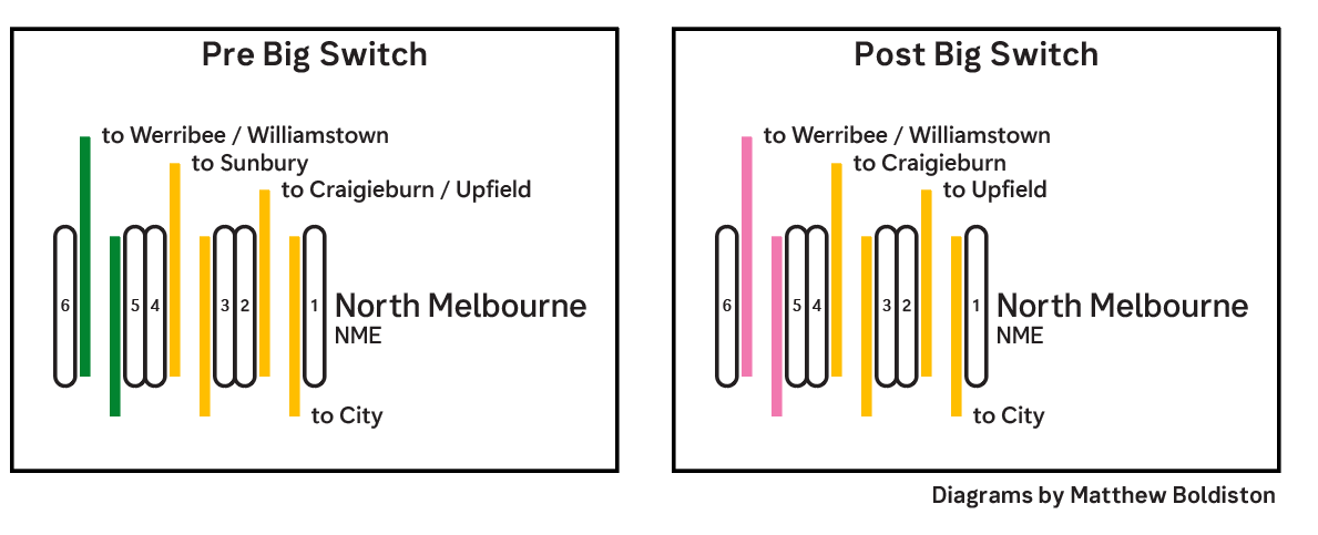
Many passengers from the Northern Suburbs became used to transferring to the Sunbury Line to access Footscray, but were confused with the change. Station staff had to explain to passengers that they could still take the Werribee or Williamstown lines to access Footscray, adding friction to the passenger experience.
The solution? Adding dynamic via statements to the passenger information displays so passengers can easily recognize the Werribee and Williamstown services as travelling “via Footscray”.
Whatever problems “via Metro Tunnel” is going to face in the future as the term becomes ambiguous, we can see right now that “City Loop” is already facing issues.
On most passenger information displays, “City Loop” refers to three underground stations Parliament, Melbourne Central and Flagstaff, stations opened in the 1980s as part of the Melbourne Underground Rail Loop. For many lines, trains can go either direction around the City Loop, so how is this shown?
If a train goes through the three underground stations before Flinders Street, the service is described as “City Loop”. If it goes first to Flinders Street, and continues round the City Loop, there is no indication that the train does this, being labeled simply as a “Flinders Street Service”.
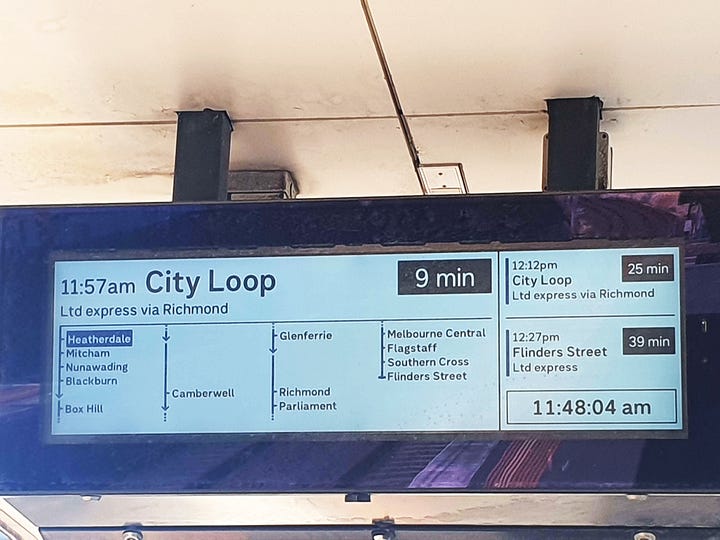
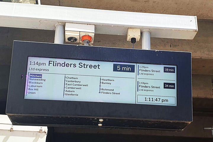
The reason given as to why the other city stations after Flinders Street are not provided is that every now and again, in disruptions trains might not continue around the City Loop. Whilst this is true, it is relatively uncommon, and I question the logic of designing passenger information around possible disruptions. After all, there is every chance that there will be a police request at Burnley, and trains from Belgrave to the City would have to terminate at Camberwell - should we not show the stations past Camberwell just in case?
So, the City Loop refers to those three underground stations, right? In the context of the infrastructure project from the 1970s-80s - yes, for Wikipedia - yes, and in much of the passenger information - yes. But when I talk to my friends who are not plugged into this stuff, the City Loop is overwhelmingly understood to be all five stations, including Flinders Street and Southern Cross. One friend (who regularly travels to Melbourne Central) when asked which stations are part of the City Loop, simply replied “Idk”, before thinking for a bit and listing all five stations.
You cannot blame people for thinking that the City Loop is all five stations. If you look at a map, and find the loop in the city, well that is made up of all five stations. And some passenger information displays even go by this logic.
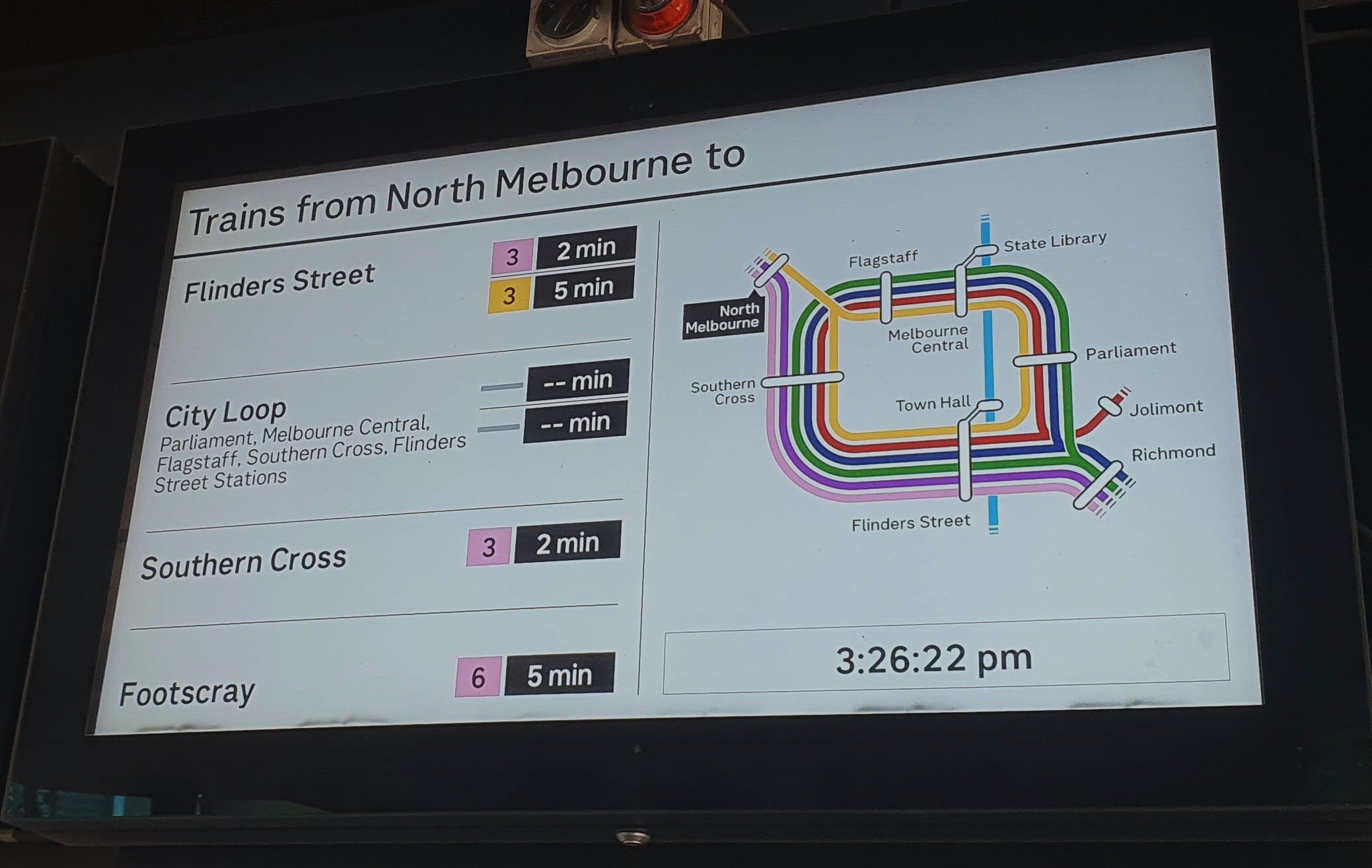
I actually want to say some things about this PID in particular, where we see the concept that all trains terminate at Flinders Street causing a perverse outcome. The yellow trains actually do continue past Flinders Street to Parliament etc, but from this PID there is no way to know this. Station staff often have to reassure passengers of this, telling them to stay on, but to check at Flinders Street just to be sure.
Despite the competing ideas of what the City Loop is, passengers seem to have figured out what “via City Loop” means, but for irregular users, tourists and young people starting a life of commuting into the city, this makes using the system confusing.
Public-facing information should be designed for the newest passenger with the least amount of time to read, so I believe that there should be drastic change to how the information regarding the City Loop is conveyed.
I have two potential solutions.
The first solution involves doing away with the concept of the “City Loop” entirely. The train destinations would be described as “Southern Cross” if they are coming from the southeast and would be given a via statement of either “via Melbourne Central” or “via Flinders Street”.
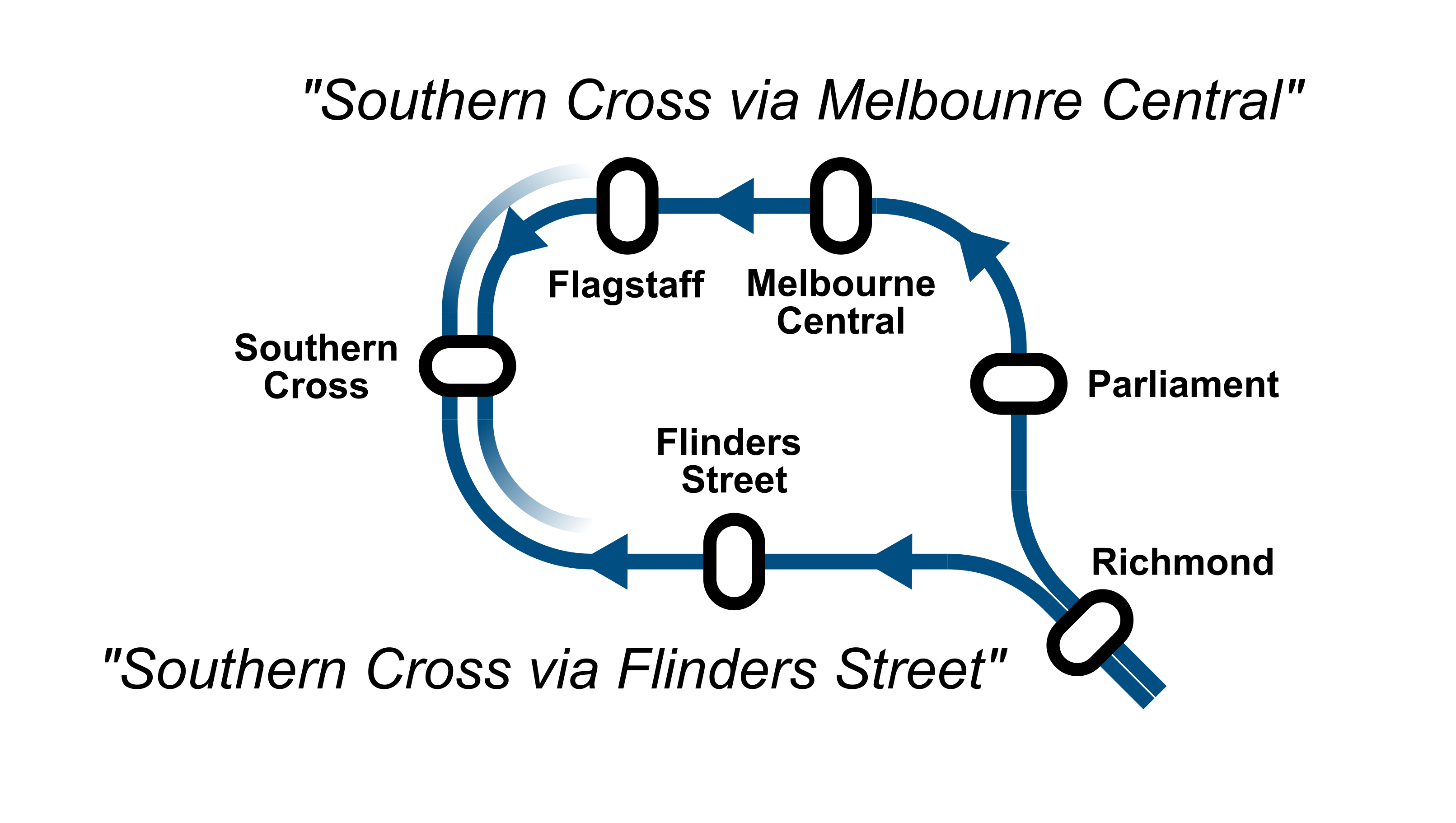
Why Southern Cross?
It is on the opposite end of the City Loop (five stations) to Richmond, meaning that the two different options are roughly equal time.
However, this solution is by no means perfect. What happens in the case of the Clifton Hill lines? There is only one way around the loop from Jolimont so perhaps by this system it should be “Parliament via Flinders Street”?
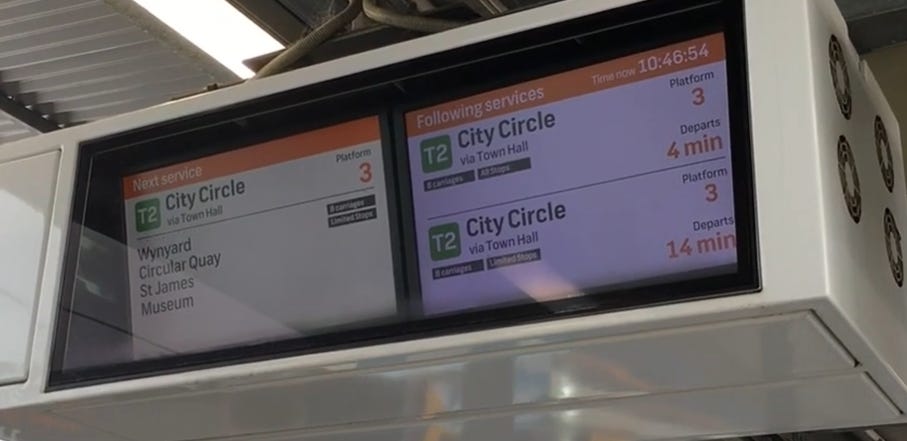
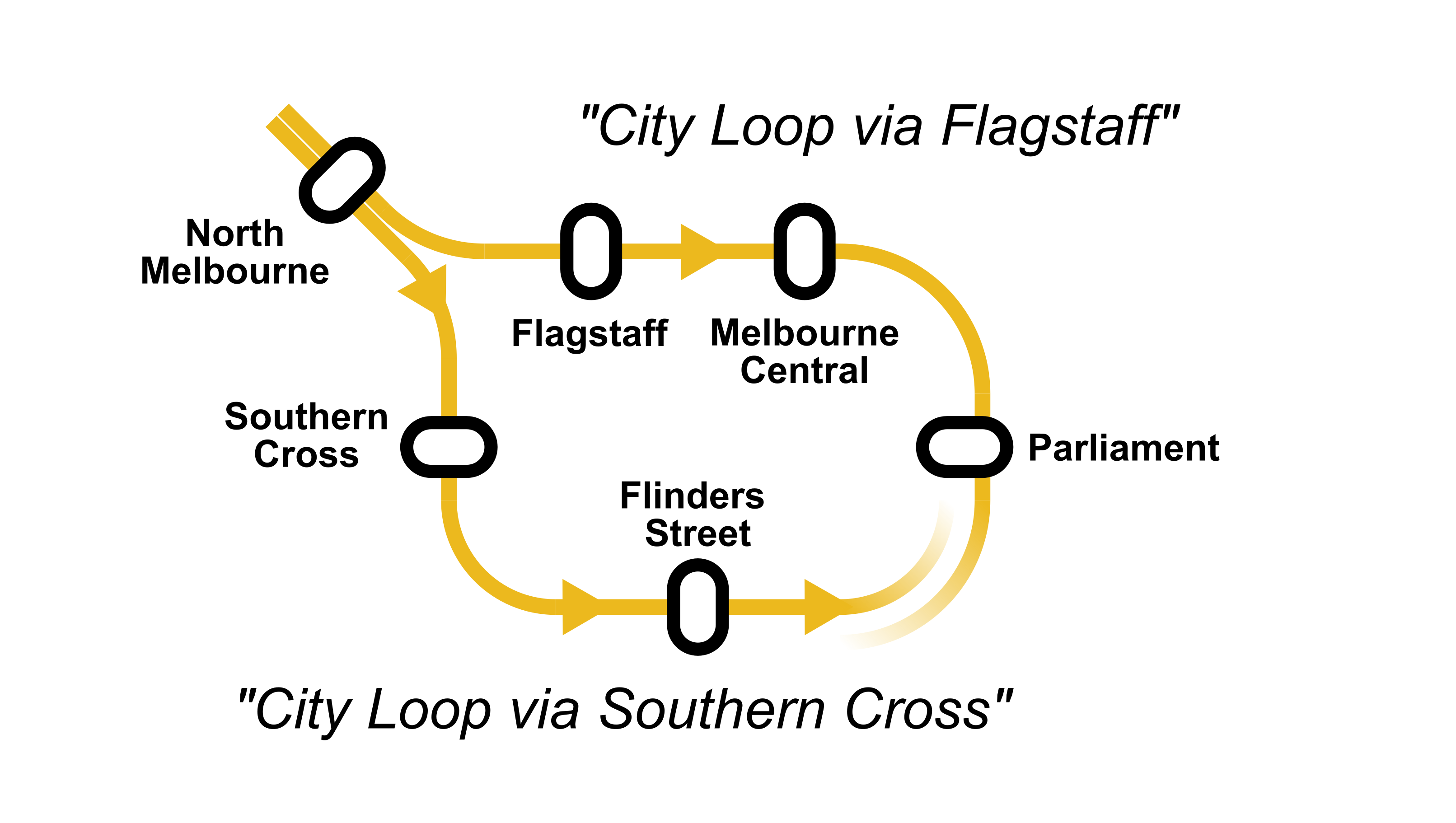
My other (preferred) solution is to retain the “City Loop” terminology, but to consistently refer to all five inner city stations. The destination would be “City Loop” and the via station would be whichever City Loop station comes first. This idea is inspired by information displays in Sydney, with their analogous City Circle.
So, a train that currently goes “Direct to Flinders Street” from the south-east and then continues round the loop, might become a “City Loop via Flinders Street”, and a train which is currently “Flinders Street via City Loop” would become “City Loop via Parliament” Here is a map for how this scheme would work for the Cragieburn and Upfield lines:
Passenger information displays will indicate if a trip is an express in their route qualifiers. I think combining this information with the via statements can make a good complete and useful route qualifier, e.g. “Express City Loop via Parliament”.
Sometimes expresses are described as “Limited Express”, supposedly to indicate that the express service makes intermediate stops. In my opinion, the word “Limited” is wasting space, a distinction only old-school rail pedants would care about. Express is enough for most people to understand and check to make sure they don’t board a skipped station.
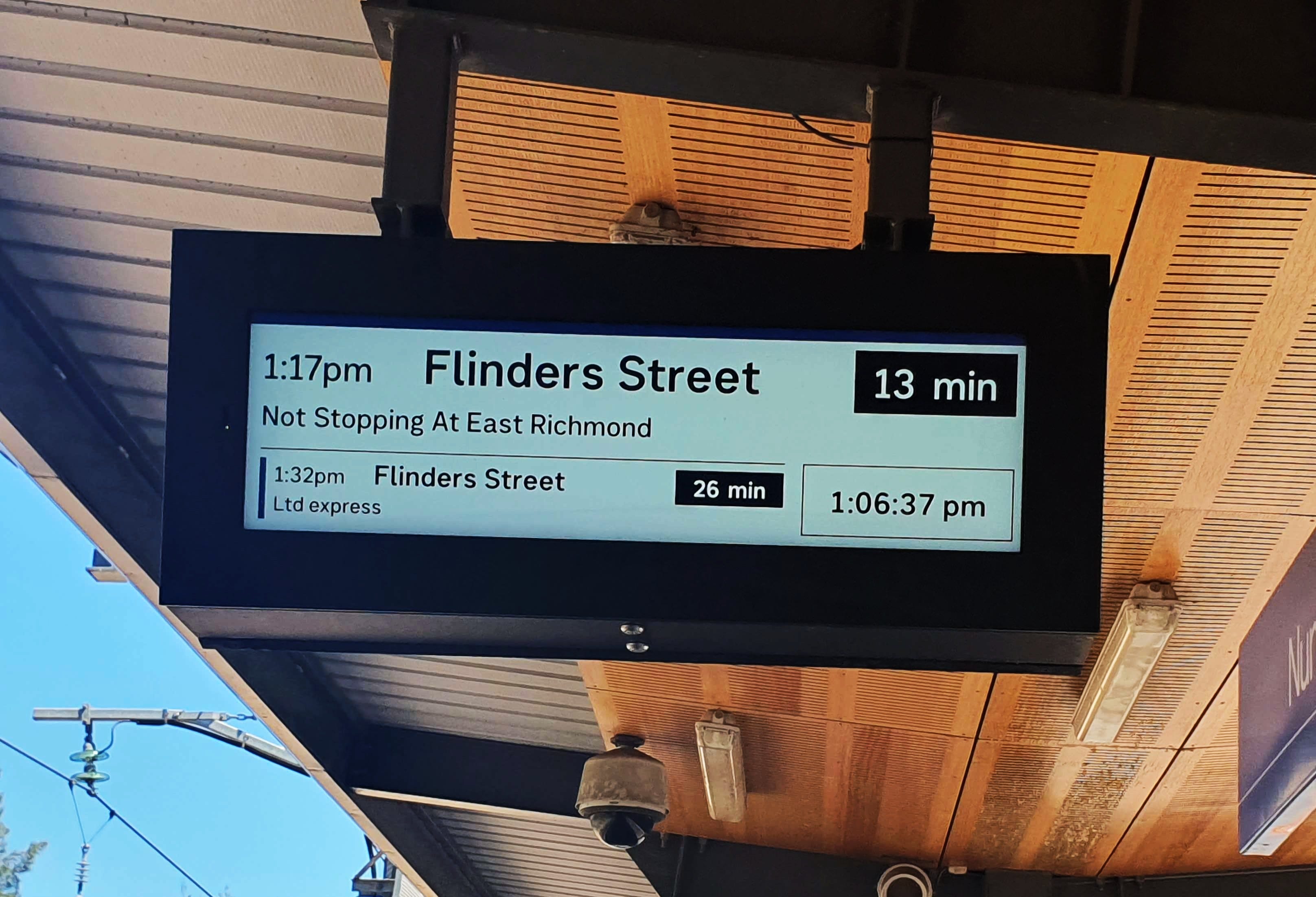
One interesting case is that sometimes when one station is skipped, the trip qualifier becomes “Not stopping at x”. I think this is a defensible explanation of what is going on, but it is inconsistently used. That “Ltd express” in that picture is the exact same service as the one above it.
Whilst “Express” is a term theoretically reserved for trains running to a destination with no intermediate stops, there is one example which flagrantly breaks the rule.
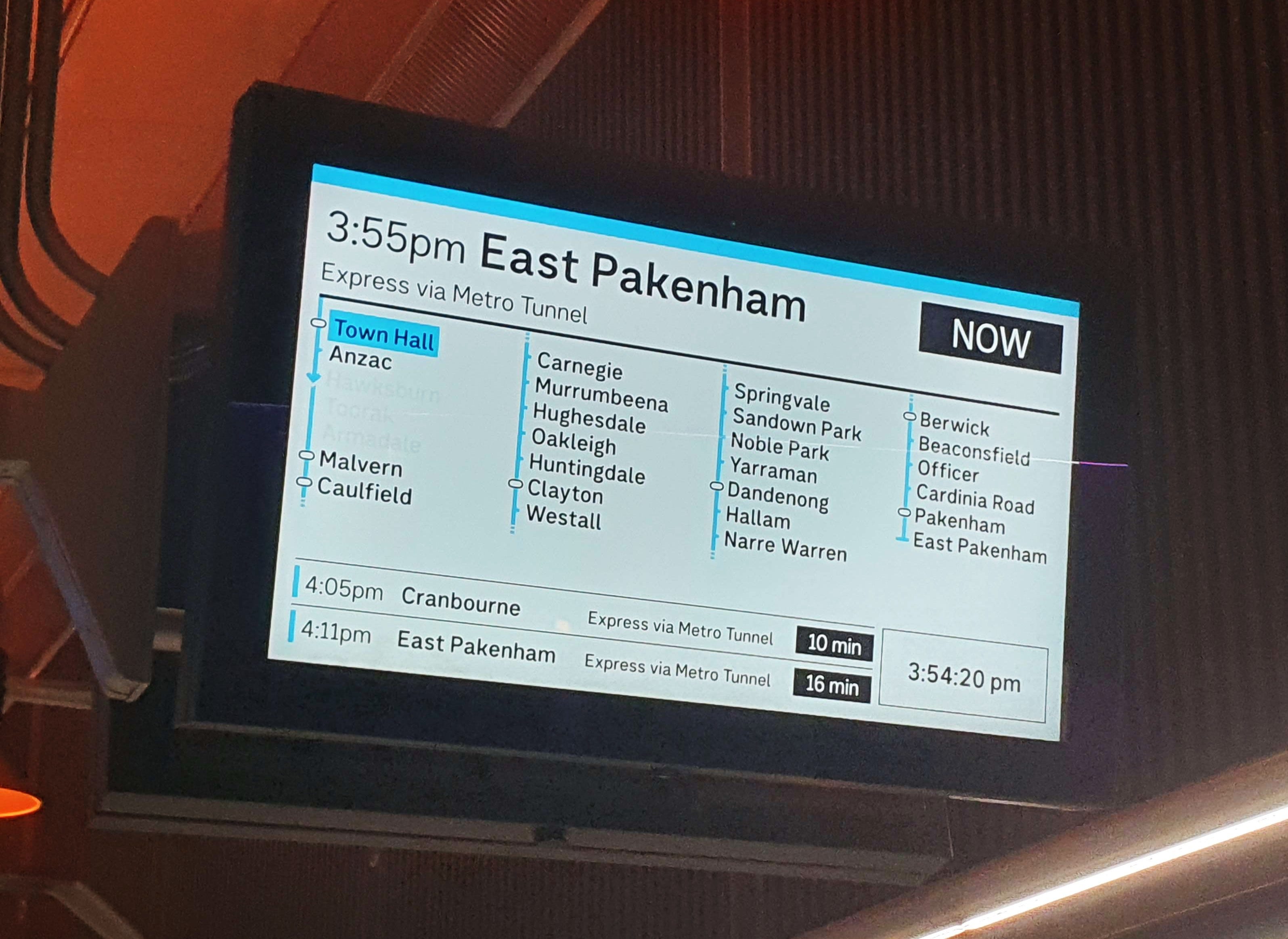
All Metro Tunnel trains are “Express”, skipping Armadale, Toorak and Hawksburn. What’s more is that those stations are served by the Frankston Line and never touched by Metro Tunnel trains in regular services.
We must ask if there is any point in calling these trains expresses. I don’t really think so, and removing this irrelevant information would make understanding the network simpler.
One may make the argument that it’s useful to see which stations on the track corridor are being skipped. But consider V/Line services from Ballarat. These are not “Limited Express” services because they skip the stations between Sunshine and Footscray. It would be strange to consider this to be an express service, no?
I can already see the commenters typing furiously that “but they could stop at Hawksburn, so it’s technically an express”. To such arguments, I would say, does the average passenger need to be made aware that this train could possibly stop at Hawksburn in a freak incident? COME ON … Of course not!
One really important use of “via statements” is to inform which path a train will take when there are multiple options for the train to take. One example in Sydney where a station has many paths to a destination, such as Glenfield.
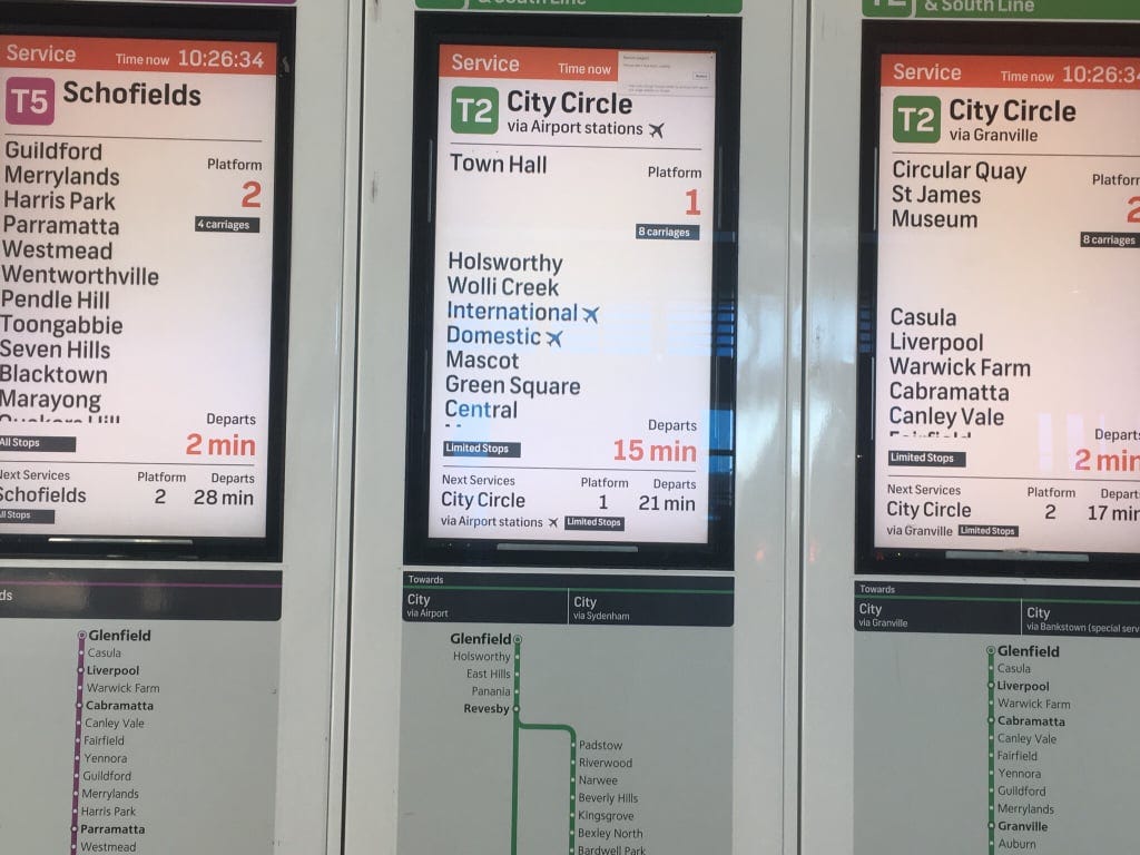
The via statements go a long way to help passengers quickly figure out which version of T2 they need to take. The northern option is “via Granville” and the Southern option is “via Airport stations ✈”. Sydney has since improved on this distinction by separating the T2 line into the T2 (via Granville) and the T8 (via Airport), as well as a similar split with the T1 becoming the T1 and the T9.
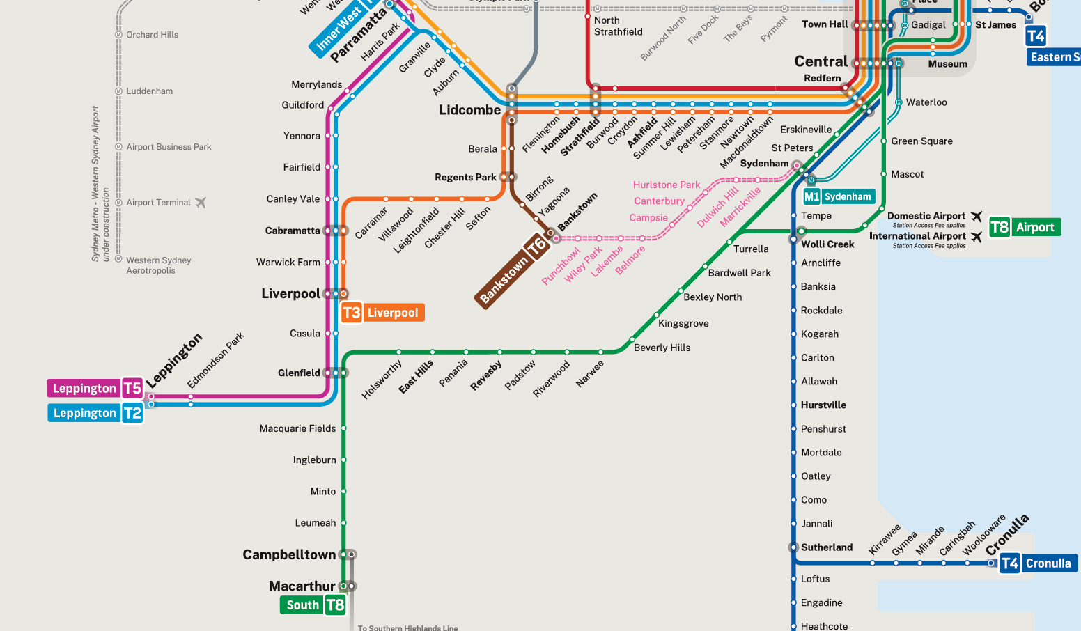
Unfortunately for Melbourne passengers, but possibly fortunately for their understanding of the network, we don’t have options like that in Melbourne but…
Something appears to be happening to the Werribee line on the latest Victorian train map.
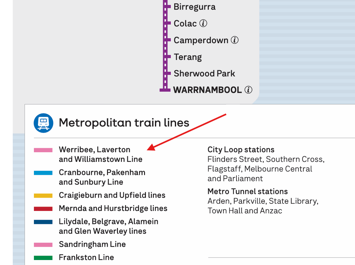
Laverton Line????
Ever since the Altona branch was connected to the Werribee line at Laverton, it has been described as being part of the Werribee line. If trains took the old direct route, they were considered to be skipping the Altona stations, even though the express tracks were far from the Altona stations. This makes sense from a passenger information perspective, as the network topology is identical to the more traditional extra-track-on-the-same-corridor expresses found in the Eastern Suburbs.
It still works this way, but we are seeing the slow appearance of the term “Laverton Line”, implying that this is separate from the Werribee line. It is speculated that this is a political strategy to allow the government to claim it has removed all level crossings on the Werribee line come 2029.
I believe that as long as at least some Werribee trains continue to stop at the Altona stations (and they almost certainly will, during the Night Network at the very least), this is a bad move for passenger information.
There is one unlikely case though where this suddenly becomes a meaningful distinction, which would be the reopening of Paisley Station. By having a station only accessible by the express tracks, it would mean that the “Laverton line” would no longer be simply the local to the Werribee’s express.
As the Laverton line unfortunately comes into existence, I think trains from Laverton and beyond should be ultra-clear about what service they are running. The express trains should continue to be labeled as expresses, even if they don’t skip any stations on their line (contradicting myself from earlier, but this is a bizarre edge case). Trains via Altona loop should be labeled as “via Altona”, even if Altona is not the busiest station in between the station we are at, and the end of the line.
Something I have seen in discussion spaces is when the confusing passenger information is raised, particularly surrounding the Metro Tunnel, there is a sentiment that the information is fine, and it’s the passengers’ fault for not knowing, and they will learn soon enough.
Whilst to some of us who have been following the Metro Tunnel construction since we were in high school, the general public’s lack of knowledge on the topic is frustrating, I think it is very important to acknowledge that good information is universal information. It should require as little prior knowledge of the system as possible to understand. That’s why for me the argument that passengers will learn soon enough what it all means does not cut it - information must be designed with first time passengers in mind.
In commercial product design, emphasis is always placed on making the experience for new users as frictionless as possible. And we should want new users to keep coming to Melbourne’s public transport network rather than being content with only having half a million regular users. New Melburnians should be able to board a train and understand as much about where they are going in the shortest possible time.
No posts
Comments
Nothing yet. Say the first thing.
Sign in to join the conversation.