
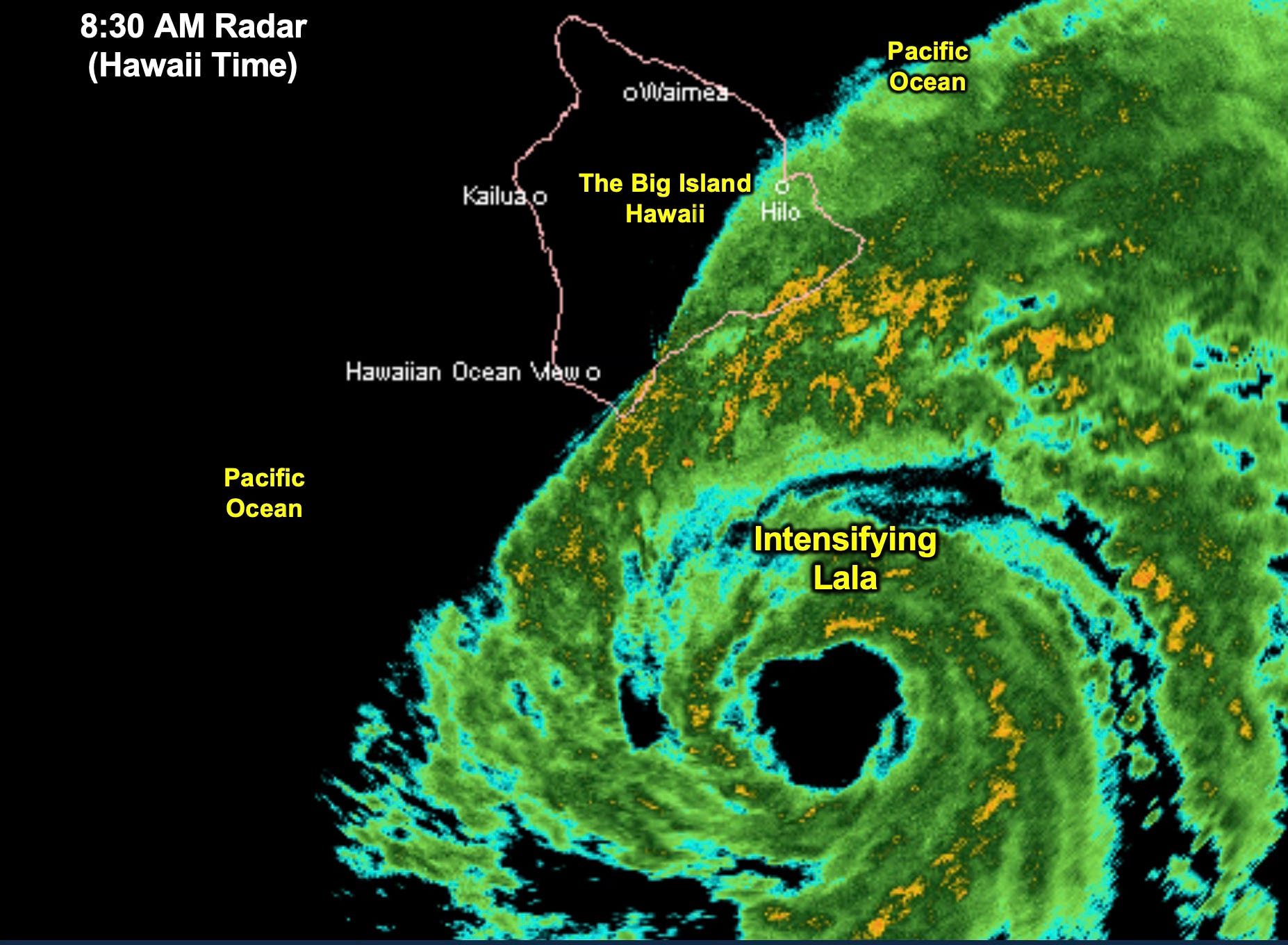
Intensifying Tropical Storm Lala is already beginning to impact the Hawaiian Islands, and it will likely be a hurricane by the time many of you read this report.
As Lala approaches Hawaii, it will encounter ocean temperatures that cool to just below 80°F, which may limit how much additional strengthening can occur. Regardless of its exact intensity, this is a potentially dangerous storm for Hawaii.
The greatest concerns will be life-threatening flooding, very high surf, and damaging winds, with gusts potentially exceeding 75 mph. All of the Hawaiian Islands could experience impacts from this system, although the severity will vary depending on Lala’s eventual track.
We’ll begin this Tropical Update with Lala and Hawaii, and then turn our attention to the Atlantic and what the LRC is telling us about what may come next.
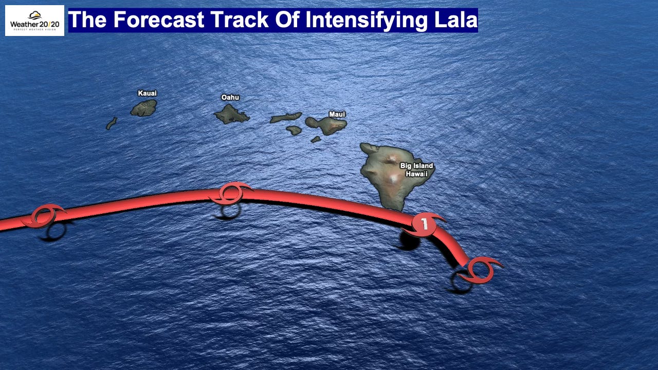
We are forecasting Lala to track very close to the southern tip of the Big Island before likely passing south of the other main Hawaiian Islands. Based on the current projected track, the Big Island of Hawaii will experience the greatest impacts, including the potential for flooding rain, high surf, and strong winds.
On a personal note, Hawaii is one of my favorite places. I’ve been to Kauai six times, Oahu three times, and Maui once—but I’ve never made it to the Big Island! How about you? Do you have a favorite Hawaiian island?
For everyone in Hawaii, please stay weather-aware as Lala approaches.
Here is today’s video:
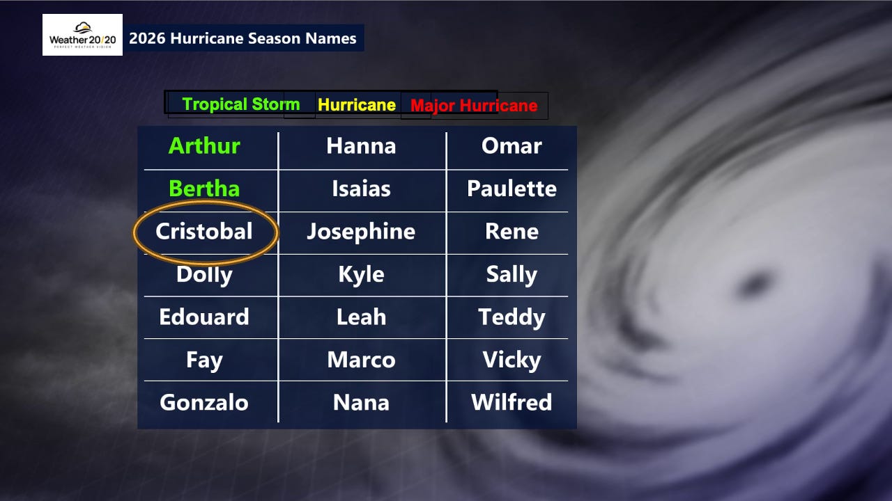
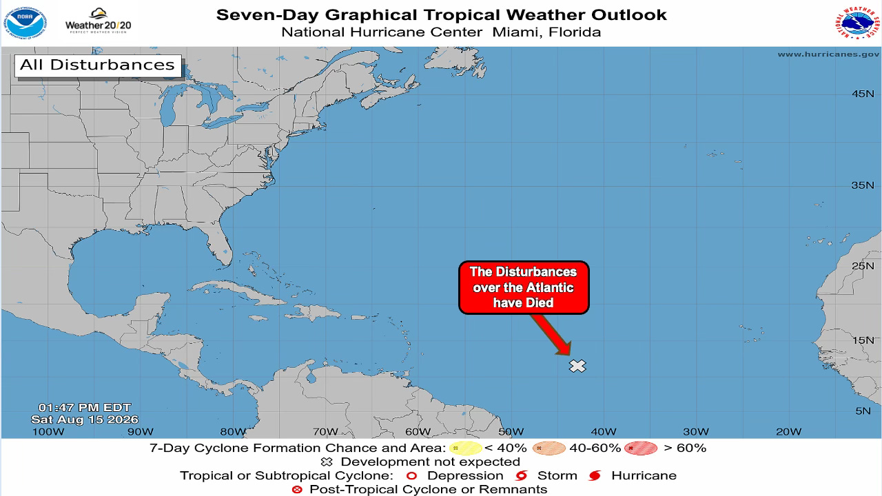
Cristobal formed over the northern Atlantic earlier this week and then quickly fell apart. Dolly will be the next named storm, and for a while it looked like we were going to have Dolly developing in the tropical Atlantic—but instead, it went poof!
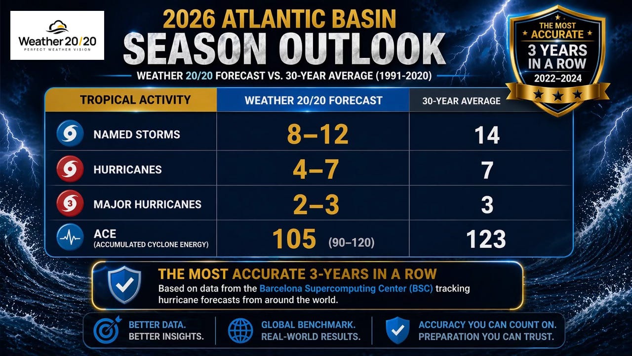
The strengthening El Niño may already be having an influence on the Atlantic hurricane season, helping create an environment that is less favorable for tropical systems to organize and strengthen. This quieter season is something we anticipated. Weather 20/20 forecast only 8–12 named storms this year, well below the long-term average.
But we aren’t letting our guard down. We still have important tropical windows ahead of us, and it only takes one significant hurricane to have a major impact.
We had been tracking two potential tropical systems across the Atlantic, but neither one has been able to organize as expected. As you can see below, both disturbances are now on life support.
The atmosphere simply has not been very supportive of tropical development so far this season. That fits well with our forecast for a quieter-than-average Atlantic hurricane season, although we still have some important forecast windows ahead of us.
Fall is now only five weeks away, and the atmosphere is beginning an important transition. The jet stream will gradually strengthen, El Niño continues to develop, and before long, the new LRC will begin evolving for the 2026–27 season.
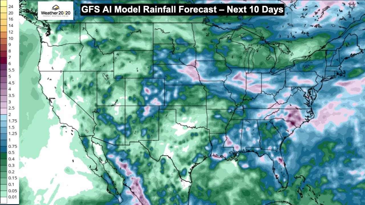
For agriculture, the timing becomes increasingly important. Harvest is approaching across the Grain Belt, and the placement of rainfall, periods of heat, and eventually the first stronger fall systems can have significant impacts.
We’ll take a much deeper look at the developing pattern and what it may mean for harvest in Tuesday’s Weather 20/20 Intelligence Report.
For now, here is the rainfall forecast for the next ten days:
If you have interests in Hawaii, please stay weather-aware and prepared through the weekend. The greatest impacts from Hurricane Lala are expected on Sunday, with the potential for strong winds, high surf, and very heavy rainfall. By Monday, Lala should be well past the Hawaiian Islands and conditions will begin improving.
Meanwhile, the Atlantic remains unusually quiet, El Niño continues to strengthen, and we are getting closer to the time when the new LRC begins to evolve.
Our next full Weather 20/20 Intelligence Report comes out Tuesday, when we’ll turn our attention toward the developing pattern and what it may mean as harvest approaches.
Stay safe, and have a great weekend!
Gary

No posts
Comments
Nothing yet. Say the first thing.
Sign in to join the conversation.