
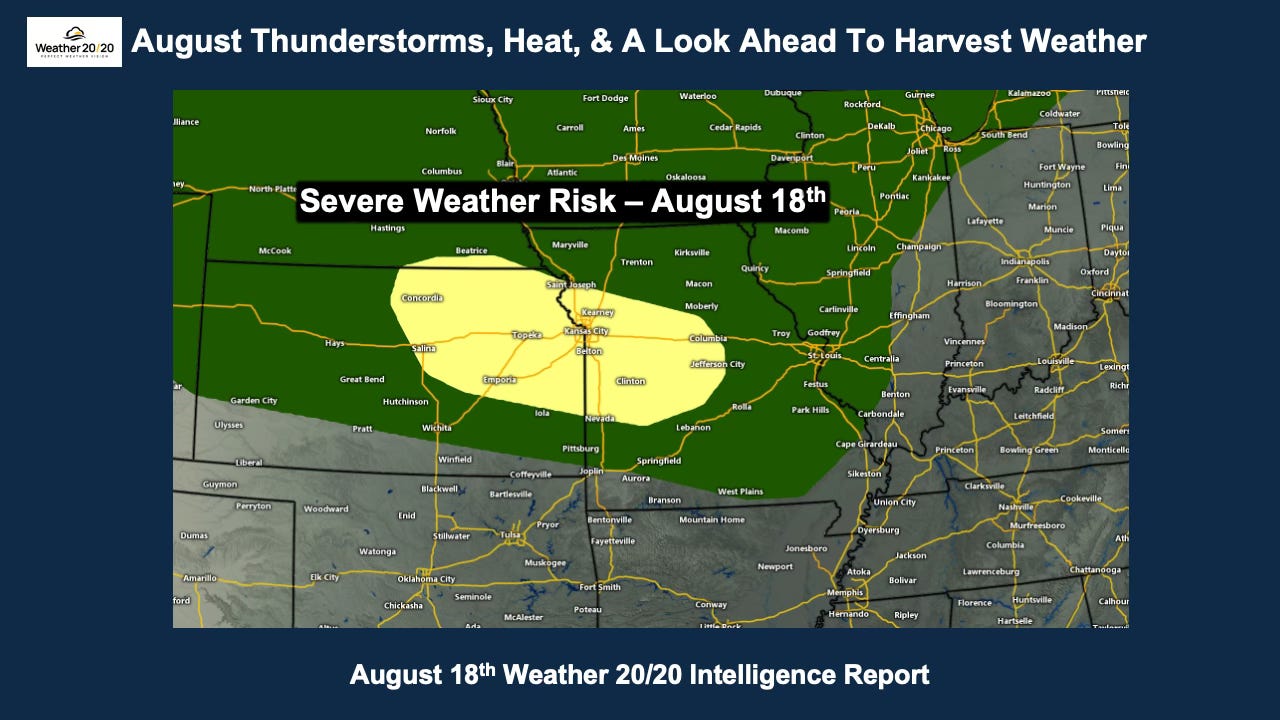
For those of you in northern Missouri, there has been some good news over the past week with areas of beneficial rainfall, including additional rain today. Let us know what you have received and how it has impacted your crops. We always appreciate hearing what is happening in your fields.
In today’s report, we’ll begin with the setup for severe thunderstorms today and tonight (if you’re reading this on Tuesday). We’ll then look ahead toward harvest weather before finishing with an important developing factor for fall and winter: a strengthening El Niño that is increasingly likely to become strong.
Let’s begin with a look from above—around 18,000 feet up in the atmosphere.
The map below shows the flow at the 500 mb level, where we can clearly see the features driving this week’s weather pattern.
A strong anticyclone—the large area of higher heights—is shifting south across the southern United States. At the same time, the jet stream is dipping south out of Canada and into the central United States.
This combination is setting the stage for thunderstorms to develop along the northern edge of the heat, with some of these storms capable of becoming severe.
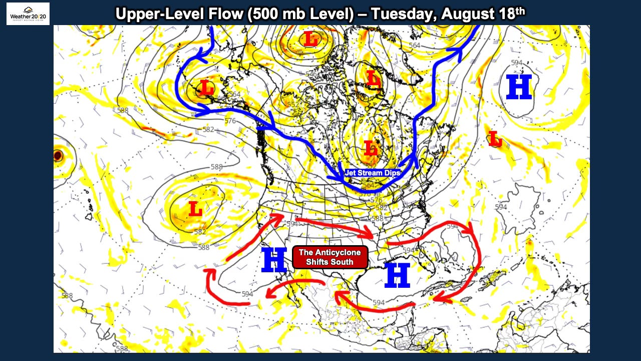
There’s a dip in the jet stream extending south across the Great Lakes, and this is placing eastern Kansas and western Missouri near the right-rear quadrant region of the upper-level jet tonight. This is an area where rising motion can be enhanced, helping set the stage for thunderstorms and the severe-weather risk shown below.
Meanwhile, the heat-wave-producing anticyclone remains strong, but it has been pushed a little farther south. We are now approaching September, and the jet stream is gradually beginning its seasonal shift southward.
The severe-weather risk tonight is centered near Kansas City, where there is a Level 2 out of 5 risk. The tornado risk is very low, but damaging winds and hail will be possible with the strongest thunderstorms, so we will be watching this summertime setup closely.
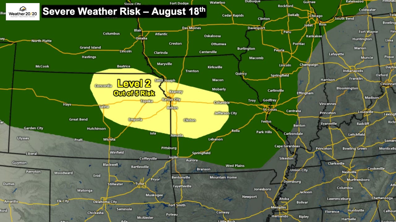
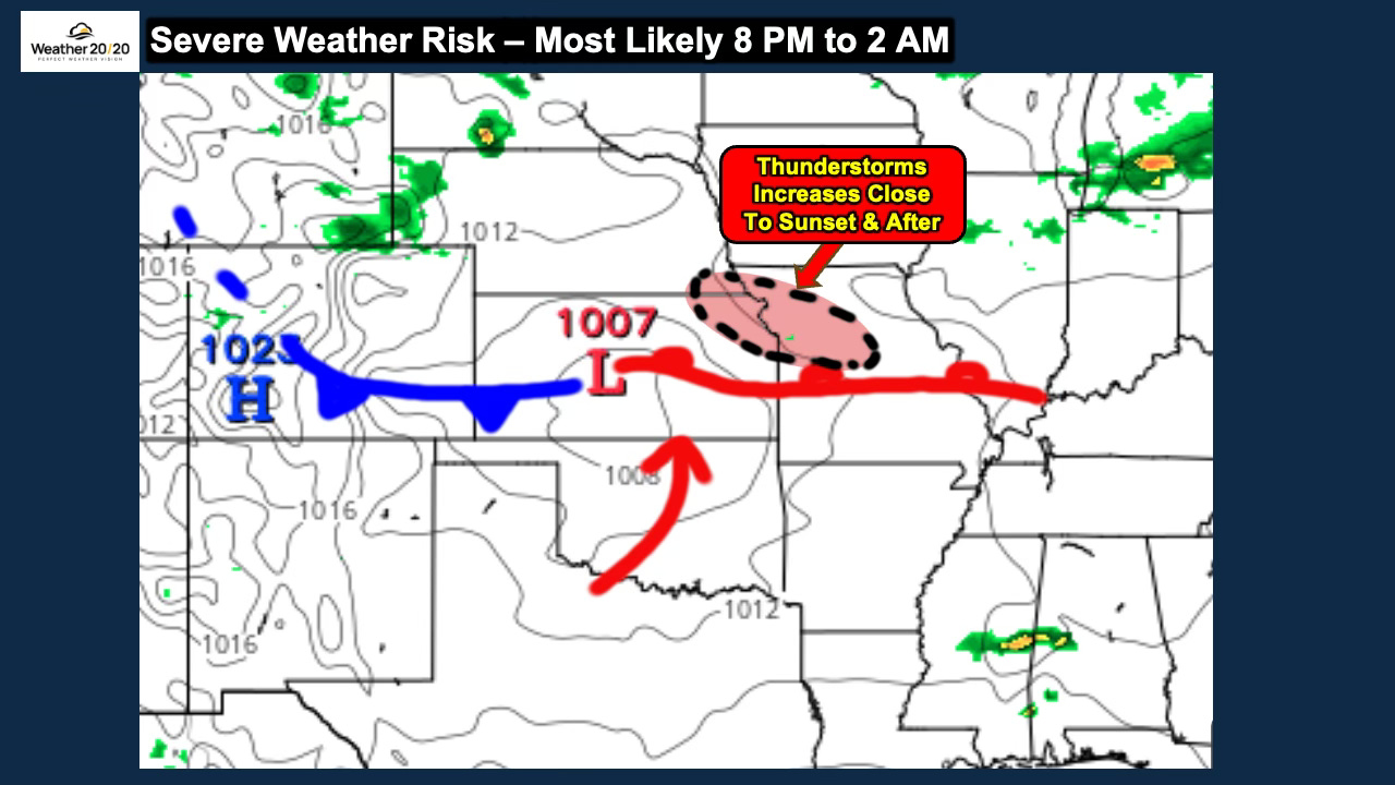
What is particularly interesting is how closely the zone I identified on the surface map lines up with the risk area from the Storm Prediction Center. Now we have to see exactly where that boundary sets up as we approach sunset.
n setups like this, the area north and northeast of the warm front can become particularly favorable for thunderstorm development. As the low-level jet strengthens near and after sunset, thunderstorms may rapidly increase, organize into a complex, and then grow upscale as they move through the region overnight.
The most likely window for the strongest thunderstorms appears to be from around 8 PM through 2 AM.
The map below shows rainfall as a percentage of average from August 1–18, and I left the individual numbers on the map so you can see just how dramatic some of the differences have been.
Remember, 100% is average rainfall for this period. A value of 200% means twice the average rainfall, while 50% means only half of average.
The wettest corridor has been impressive, stretching from portions of the central and northern Plains eastward into the Midwest and Ohio Valley. There are numerous locations showing 200%, 300%, 400% and even higher percentages of average rainfall.
Northern Missouri has also benefited from this wetter pattern, while the contrast becomes dramatic as you move farther south and southwest. Parts of Kansas, Oklahoma and especially Texas have received well below average rainfall so far this month, with some locations receiving very little at all.
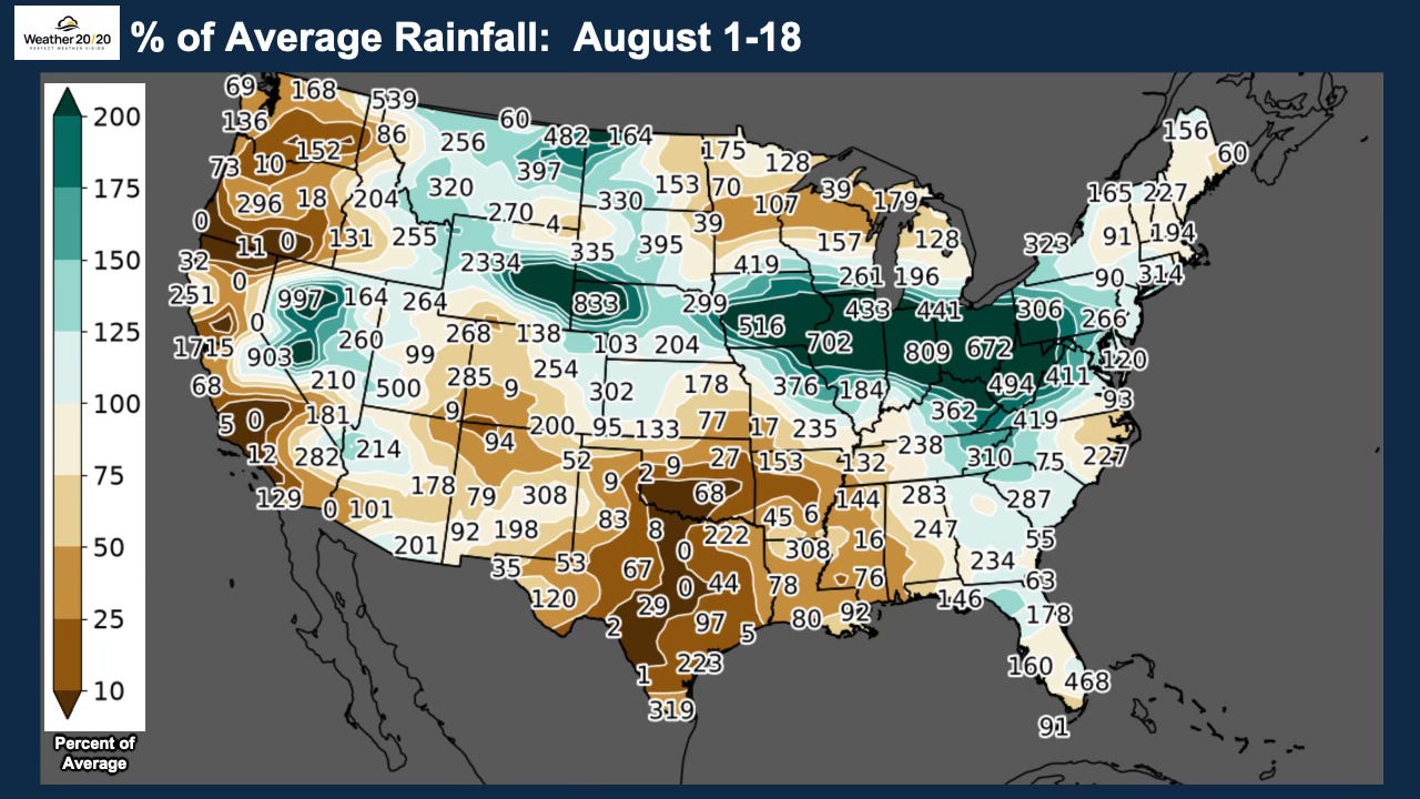
Notice the 516% of average rainfall, which means 5 times average for this first 18 days of the month stretch, near Des Moines increasing to 8 times average over Indiana. There has been significant flooding in these areas. Also notice how dry it has been over much of Oklahoma and Texas as the anticyclone dominates.
Before we move on and end up with the development of the strong El Nino, here is today’s in-depth video:
Comments
Nothing yet. Say the first thing.
Sign in to join the conversation.