
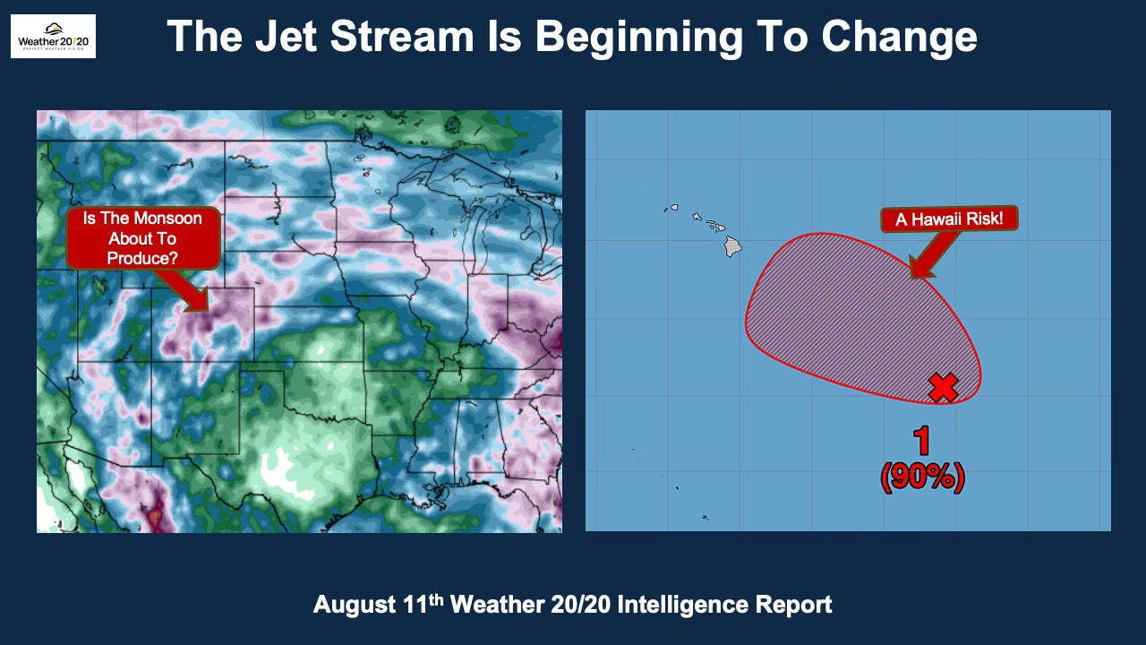
Some areas really need some rain within the next two weeks for their crops. We will look at the various models in just a second.
A warm welcome to all of our new subscribers around the world! Thank you for joining us on this exciting journey as we continue advancing long-range weather forecasting through the Lezak Recurring Cycle (LRC). Our goal is simple: to help you make more confident decisions by understanding the recurring patterns of the atmosphere weeks and months in advance.
There is now a growing threat of a tropical system developing and tracking toward Hawaii. At the same time, another system may organize in the Atlantic within the next week as we move into one of our forecast windows for tropical development.
As the tropics become more active, the jet stream has just reached its weakest average strength and farthest north average position of the year. This marks the beginning of its gradual strengthening as fall is now just six weeks away.
In this report, we’ll examine the subtle changes now developing in the atmosphere and how they may begin shifting precipitation patterns. We’ll also discuss what these changes could mean for agriculture as harvest season approaches.
So, let’s get started!
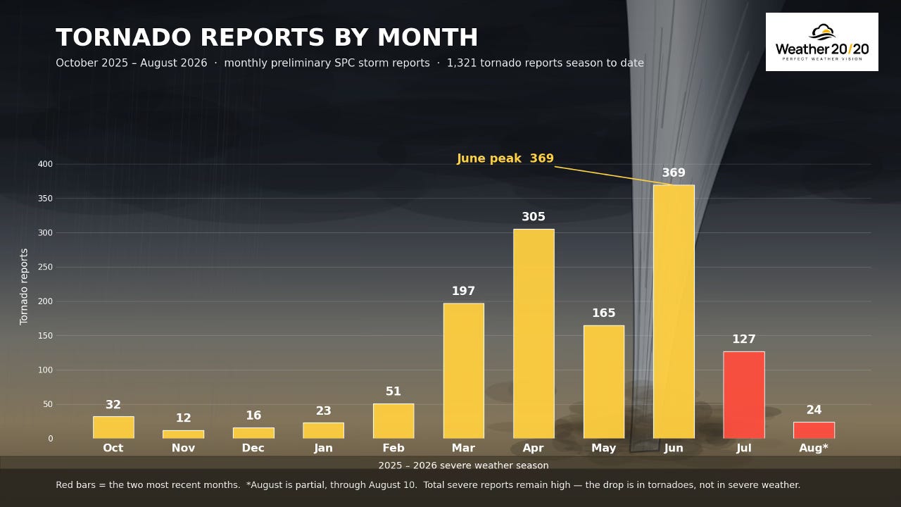
One of the reasons severe thunderstorms tend to become less intense during the summer is that the jet stream weakens and retreats farther north. With less upper-level energy available, the atmosphere often still produces severe thunderstorms, but the number of tornadoes typically decreases, as you can see here with August only have 24 tornadoes in the first 11 days of the month.
As the chart above shows, after the April and June peaks, tornado reports have steadily declined. In fact, just last week we experienced the first five-day stretch without a tornado since the spring severe weather season began. While severe thunderstorms have continued across parts of the country, tornado production has dropped off significantly.
There is often a second severe weather season in the fall as the jet stream begins strengthening and shifting southward. During this transition, it once again interacts with warm, humid air before autumn cooling stabilizes the atmosphere, creating another opportunity for severe thunderstorms and tornadoes.
Before we get to the analysis of the weather pattern and the outlooks, here is today’s video:
Comments
Nothing yet. Say the first thing.
Sign in to join the conversation.