

This is forecast post number 1015 — Day 237 of 2026.
Day 86 of Atlantic Hurricane Season | YTD 3 Named Storms, ACE = 3
Author: Dr. Ryan Maue (X @RyanWeather X @weathertrader)
Your support is greatly appreciated. 1 new subscriber and 5 renewals.
Weather Trader is entirely reader-supported publication (no ads). To receive all new posts and support our growing platform, consider becoming a paid subscriber / supporter.
Invest 96L has not become much better organized but could still become a tropical cyclone in the next day or two (70% chance) before encountering even more hostile conditions in the western half of the Main Development Region.
As we have observed over the past several weeks, tropical waves look VERY healthy and ambitious/eager to “catch fire” but then “blow a tire” or poof out after encounter very dry (Saharan) air layers, dust, and vertical wind shear. Invest 96L is yet another example.
So far so good for this rather large circulation. In any other non-El Niño summer, we’d probably be seeing a hurricane in the next few days. But, this isn’t happening as the tropical wave will probably struggle until it escapes the MDR in 5 days.
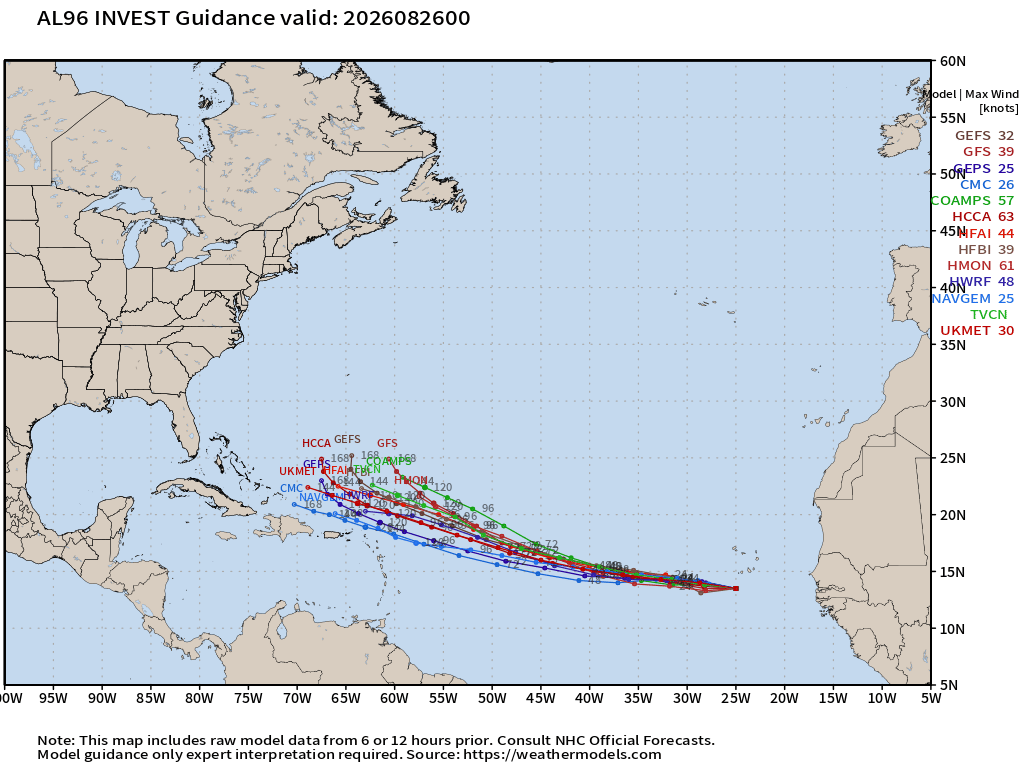
The track is fair straightforward with a WNW turn into the Southwest Atlantic north of Hispaniola in 7-days.
Tropical wave in Eastern Atlantic has not become a tropical depression, yet. NHC at 70% chance as it continues over the very warm waters of the eastern Main Development Region.
Invest 95L isn’t going to develop — ran out of time.
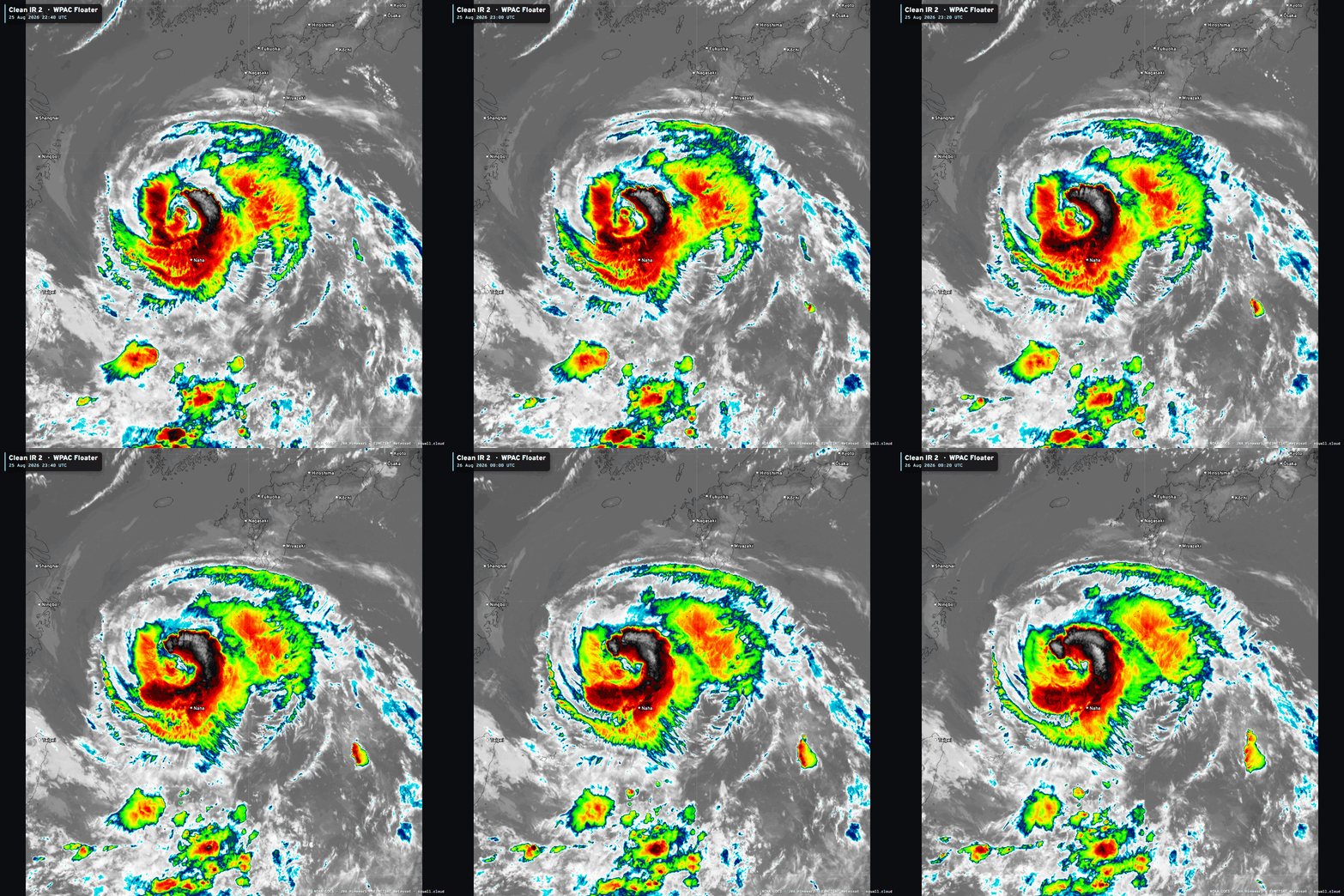
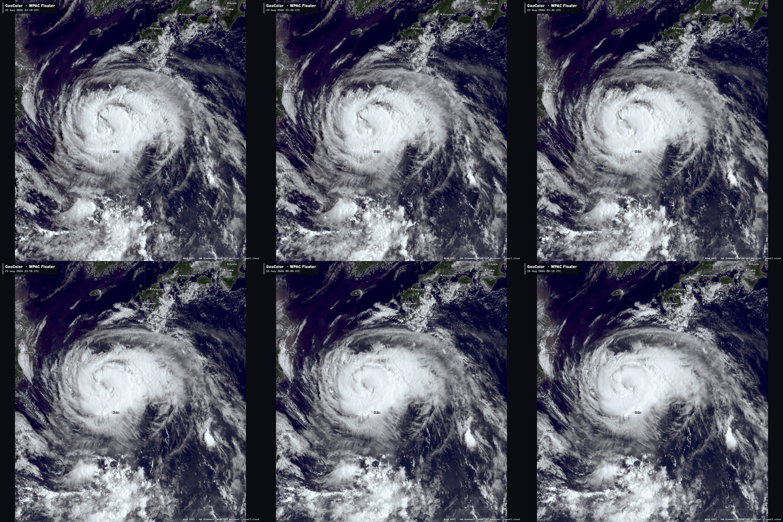
Typhoon Saudel (17W) in the Western Pacific still going at 80-knots (Cat 2) but the inner-core is less organized. Expect landfall in China as a strong tropical storm by this weekend.
In the Eastern Pacific, Tropical Storm Iselle (09E) did not become a hurricane, and has completely decoupled from its convection. Tropical Storm Julio was also absorbed into the circulation, and both are pretty much toast.
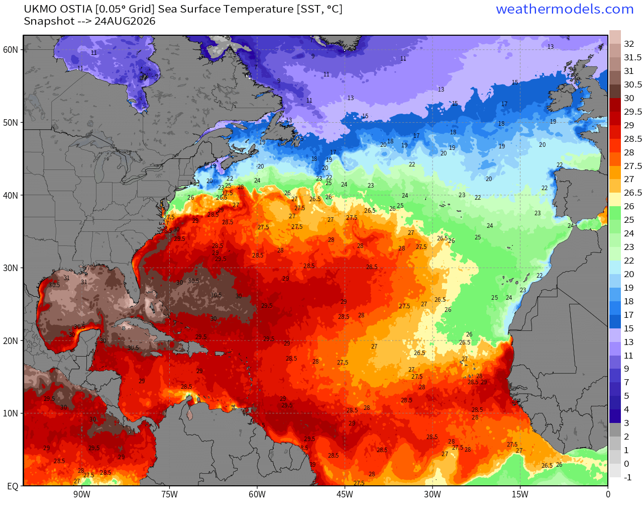
Sea Surface Temperatures across the Atlantic Basin (28°C — very warm = red)
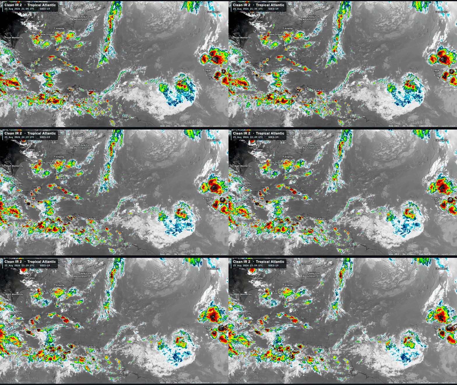
Robust convection with 96L — so it’s not going to take much more organization to become a tropical depression or storm — briefly. We will watch scatterometer passes in the coming 12-24 hours for indications of a sustained low-level circulation with westerly winds … and 35-knots.
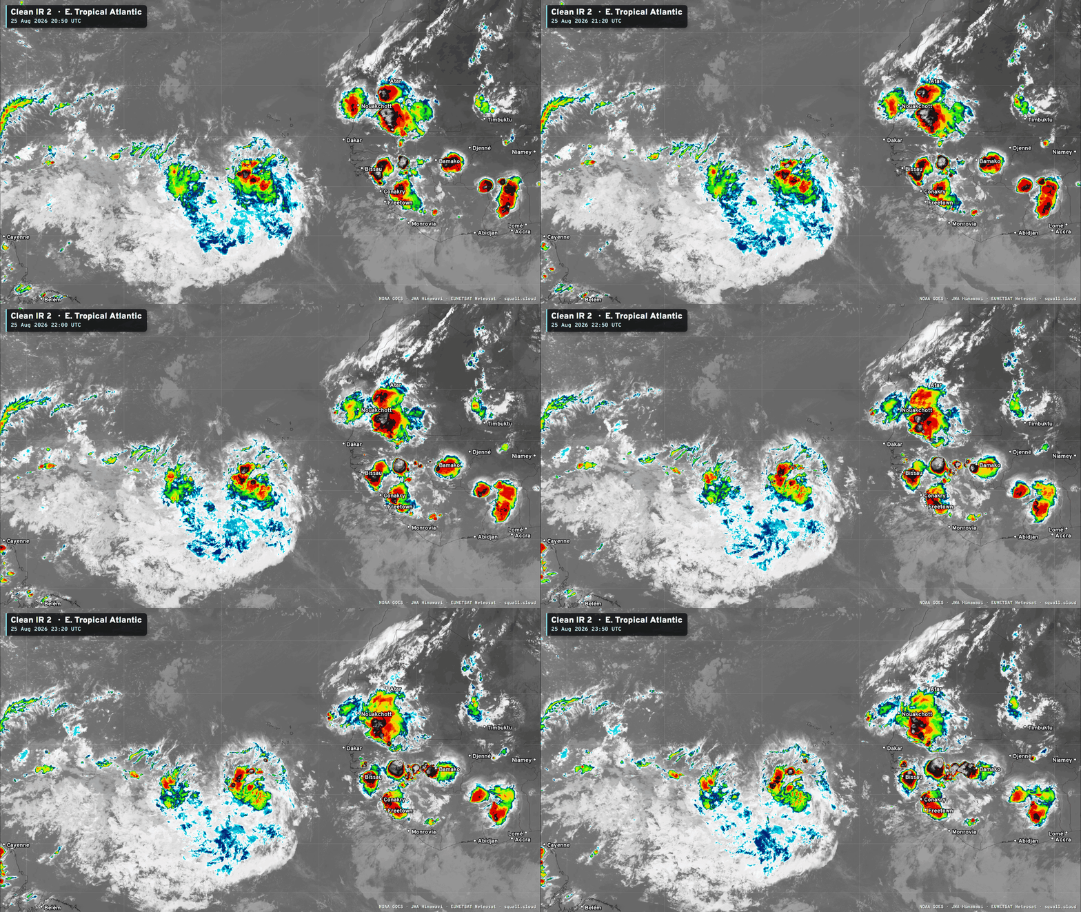

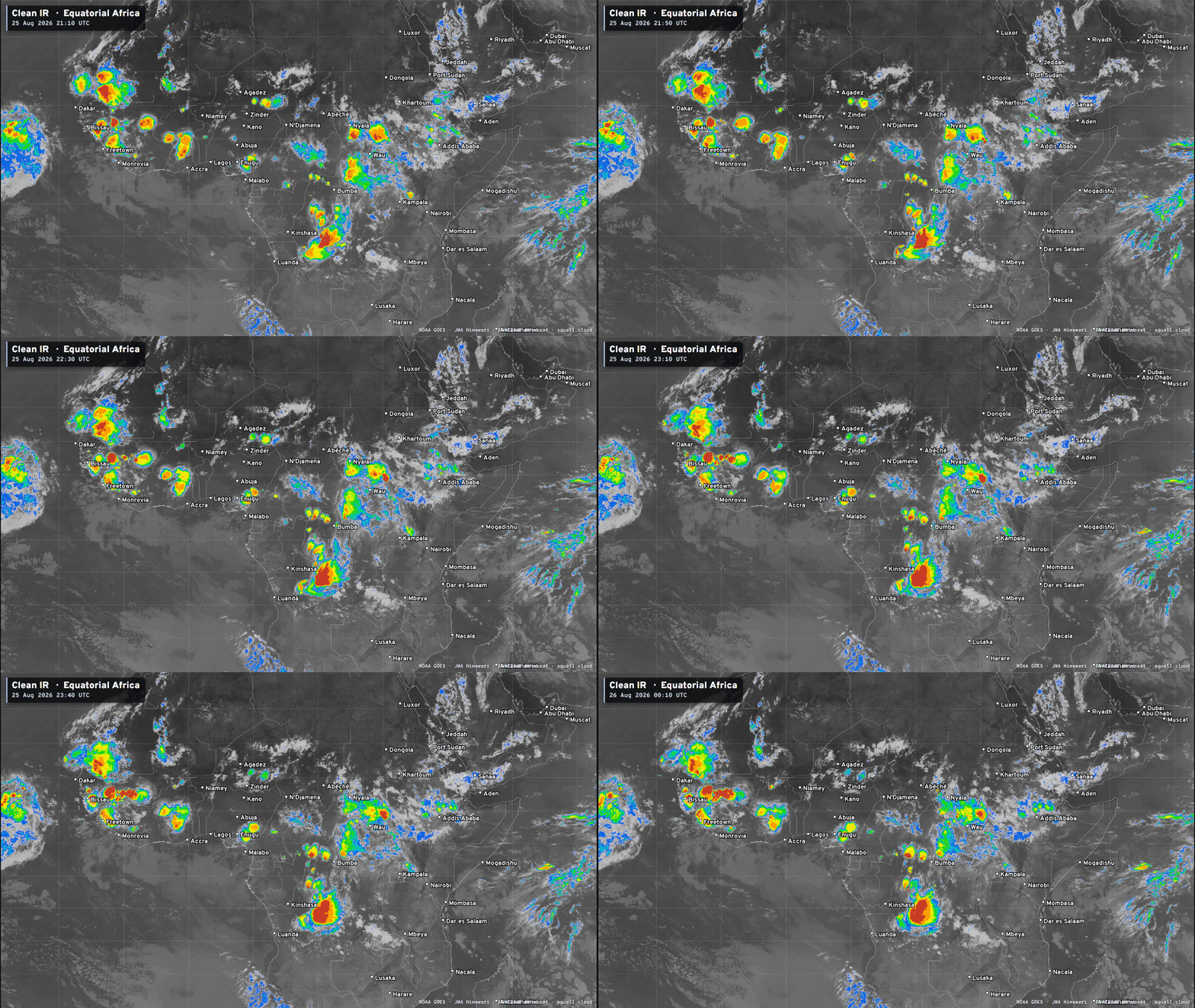
You can see more Satellite Imagery at Squall Cloud —> LINK
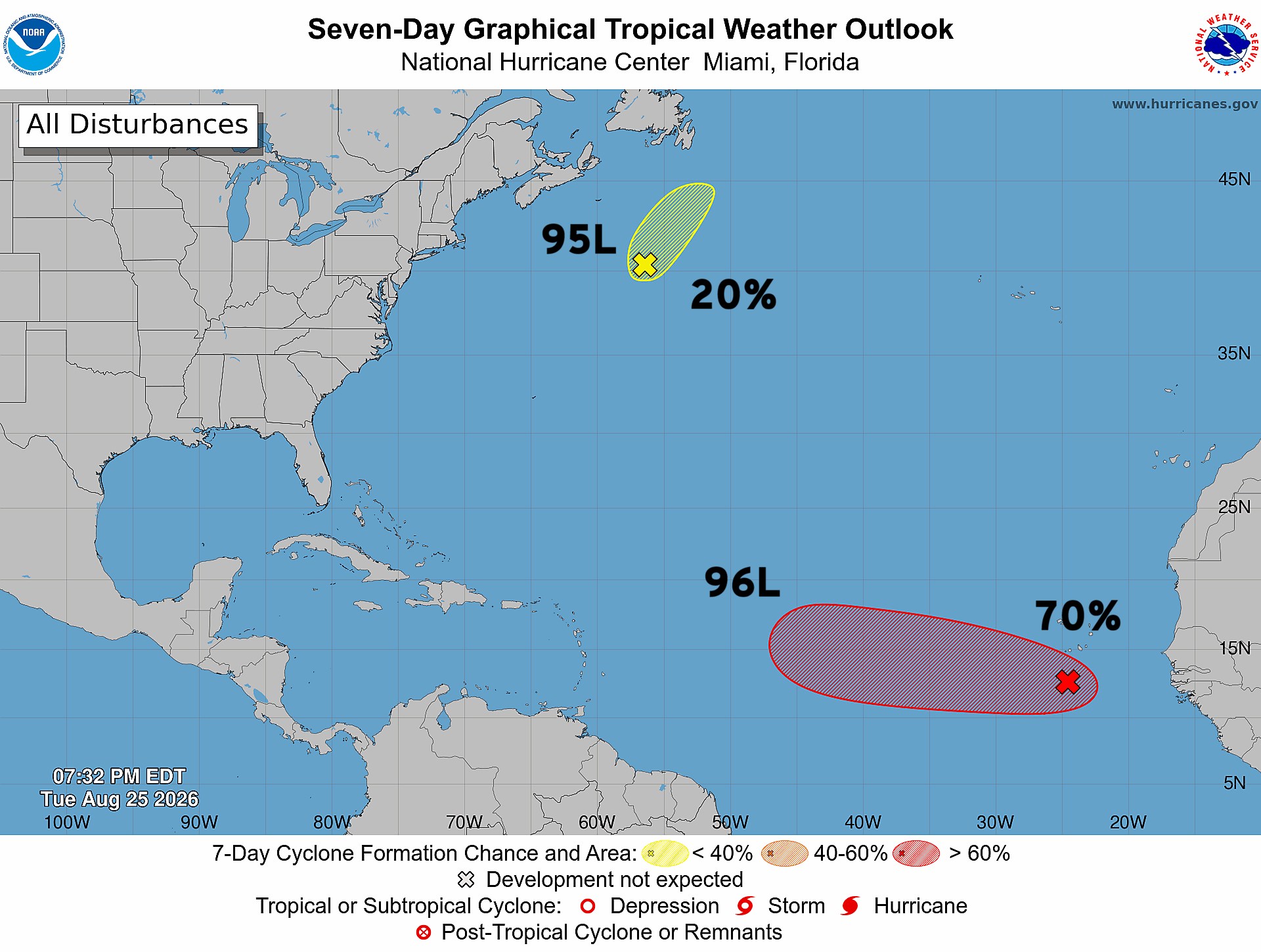
Invest 95L is out of time, and moving into the colder North Atlantic — not the tropics. Invest 96L up to 70% chance of development. Plenty of time to watch it.
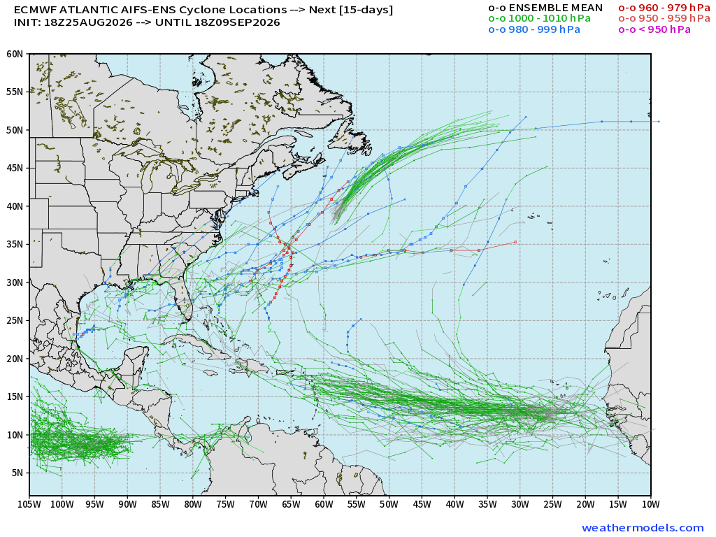
Tracks from 51-member ensemble of AIFS-18z show limited development down the road assuming 96L survives in the Western Atlantic. The A.I. ensembles were most bullish over the past few days, and then just dipped out on 96L.
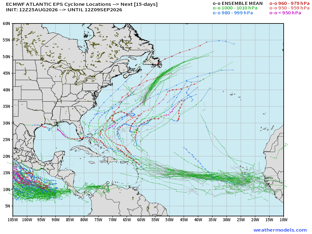
I’d count about a dozen (~25%) tracks that survive into the Western Atlantic and then blow up into a (major) hurricane. Still worth watching, but nothing is happening for several days. We’ll watch the MDR and Invest 96L and know more by this weekend.
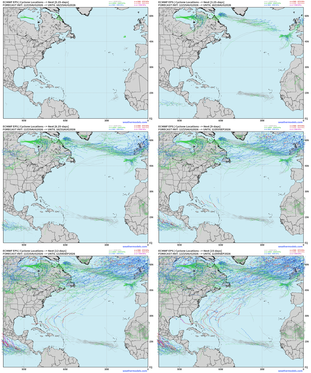
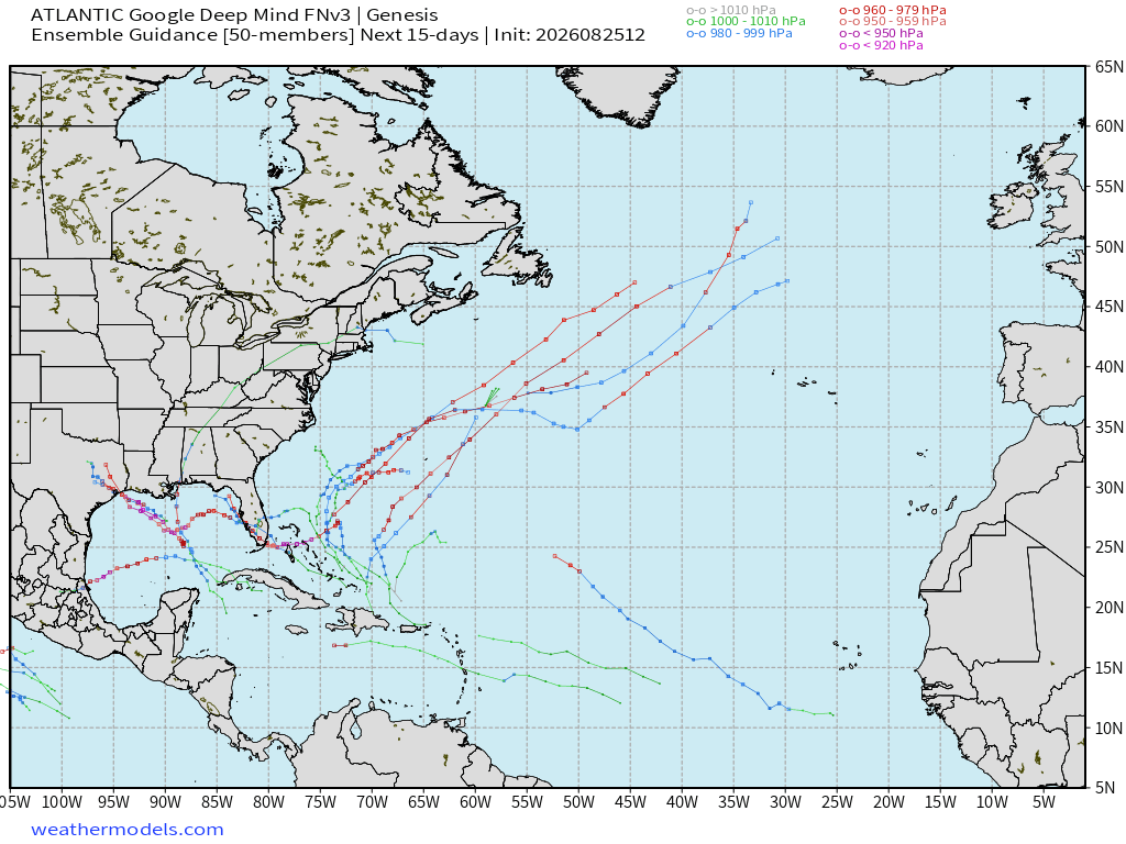
The FNv3 ensembles (18z) have really stepped back from their previous days’ excitement, but still a handful — 10 members so ~20% chance of development way down the road into early September. We can dial down the concern until these ensemble tracks fire back up. We hope they don’t!
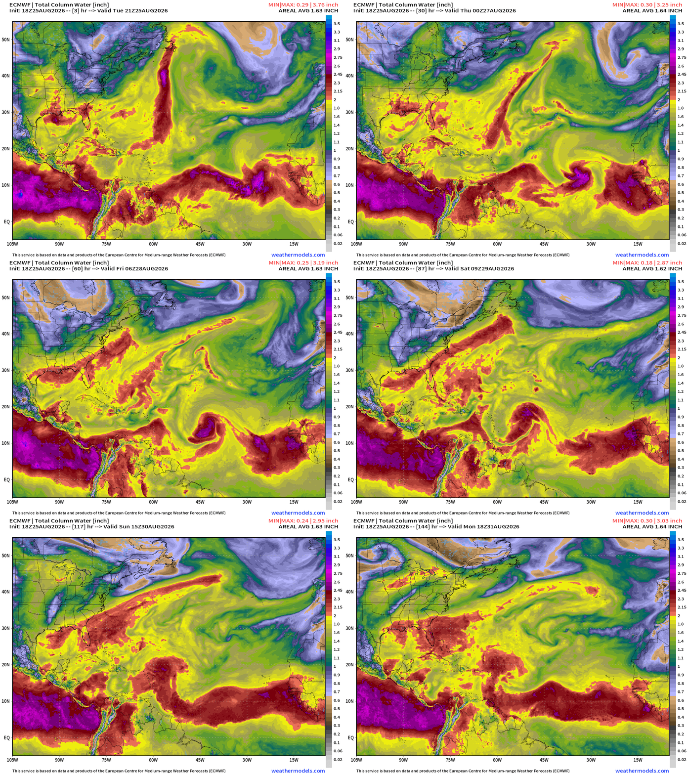
ECMWF 18z may have a TD/TS briefly into the weekend, but then loses the circulation thereafter. Atlantic is very hostile to tropical waves that would otherwise become strong hurricanes in a non-El Niño summer.
Flagship model: ECMWF AIFS 18z —> Integrated Vapor Transport next 12-days
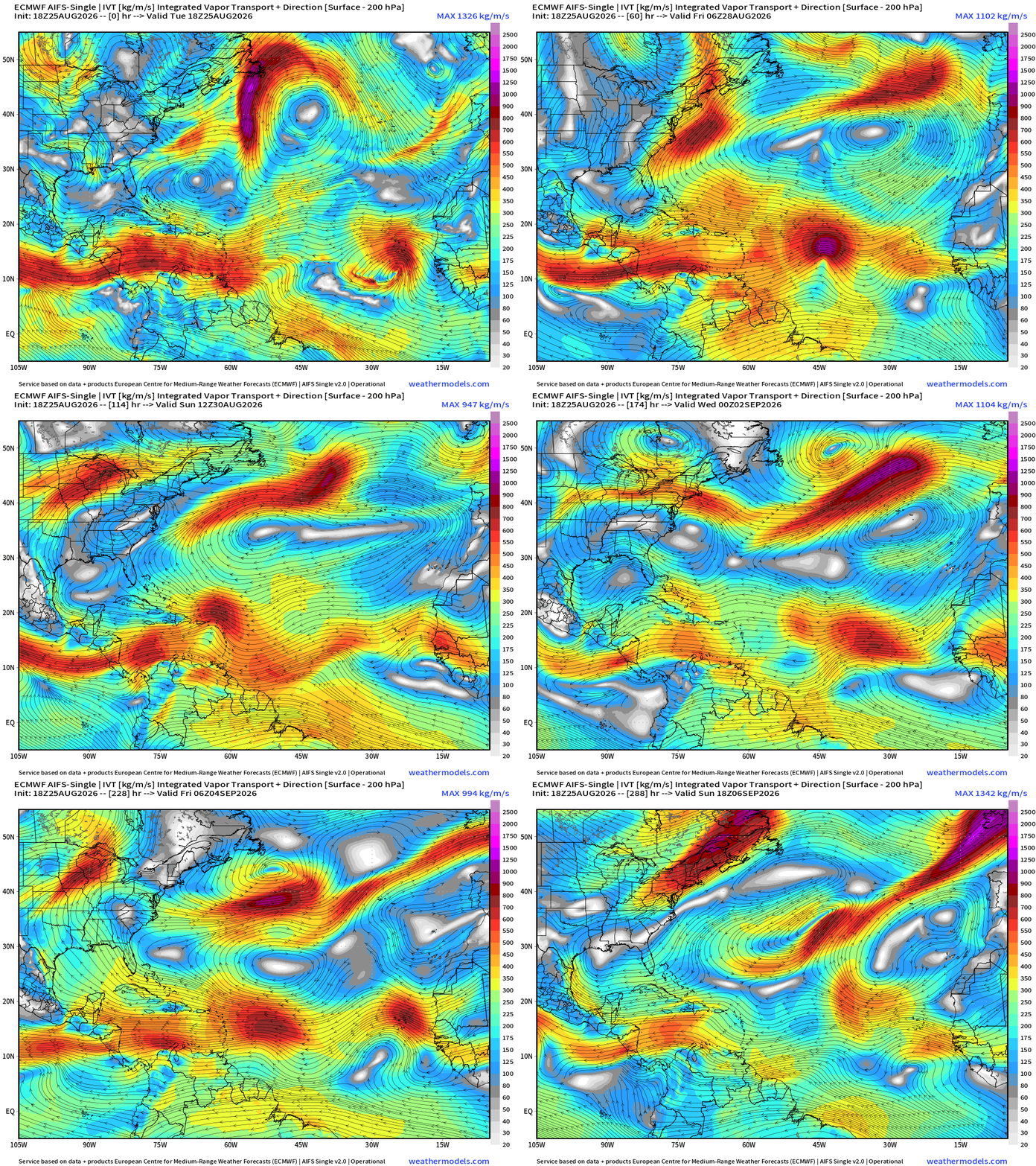
Plenty of tropical waves — but none catch fire. Just along for the ride in the trade winds flow!
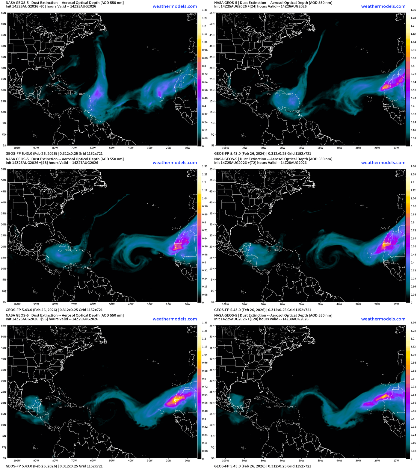
Some dust over the next 5-days … as another plume comes off the continent.
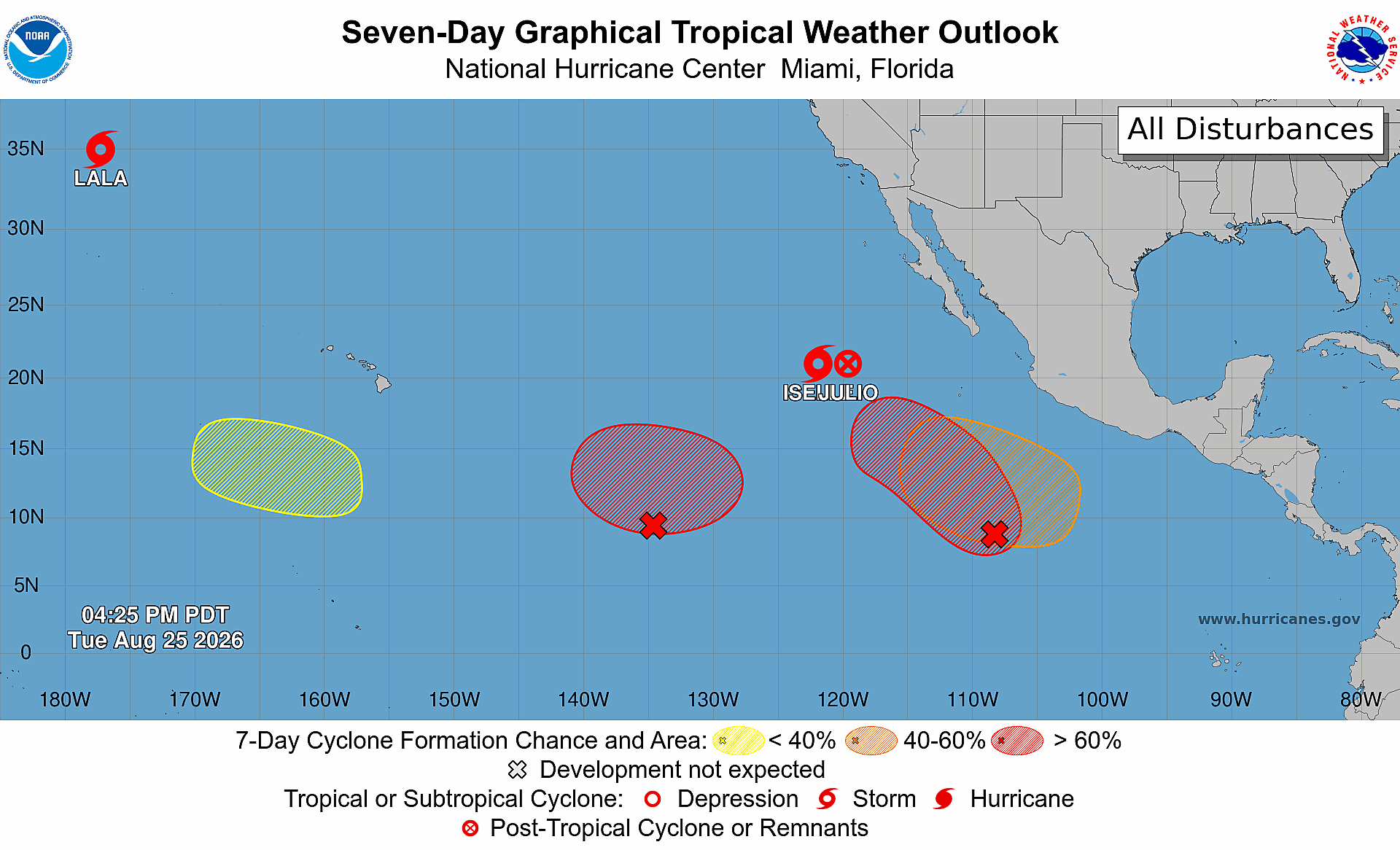
Iselle really fell apart in the past 6-hours … you can look closely and see the circulation of former Tropical Storm Julio merge into the convection of Iselle.
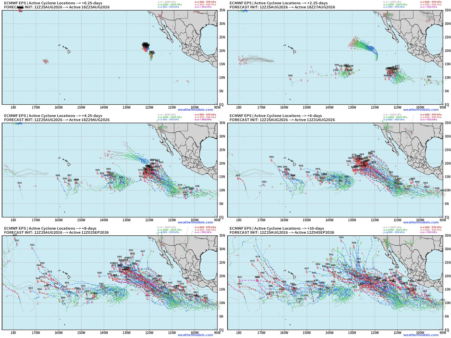
Two more storms — a small one + hurricane in the next 6-days.
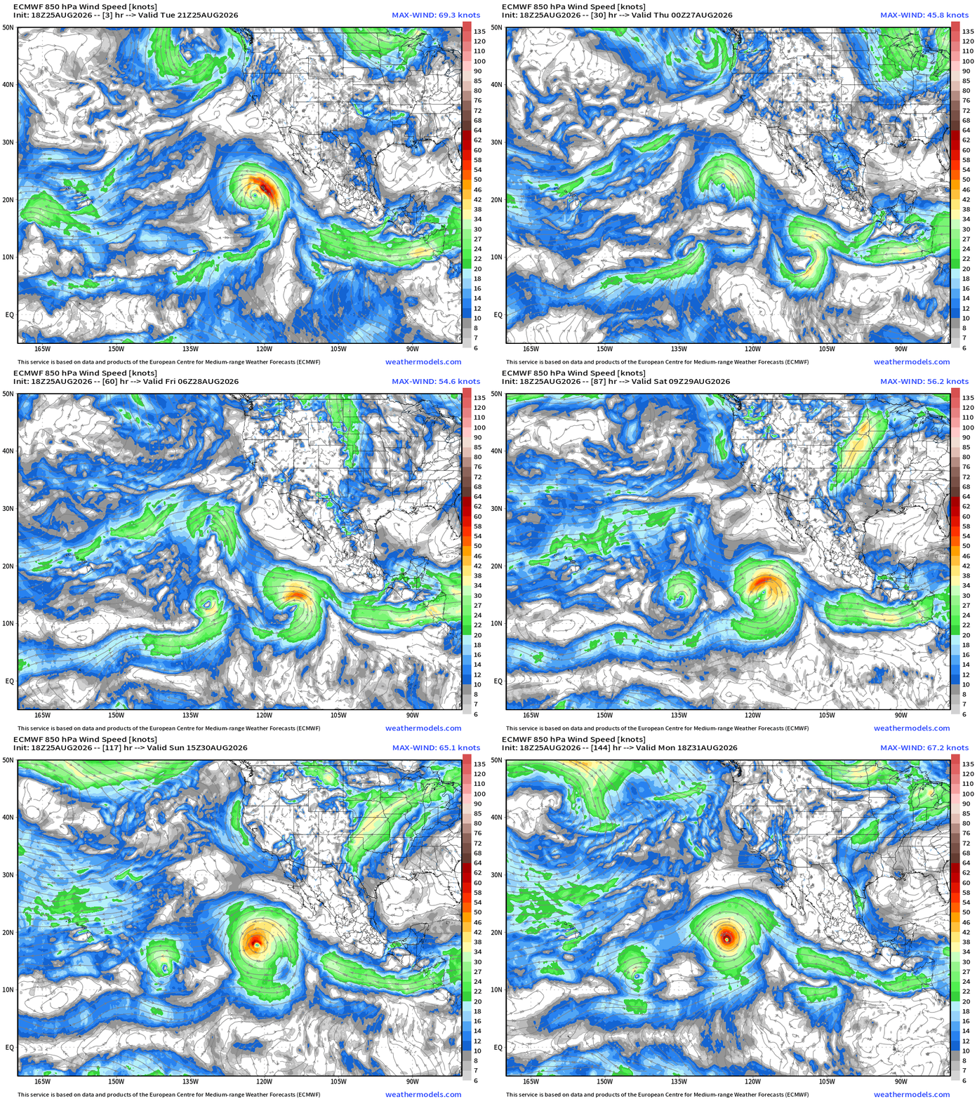
More storms on the way … maybe another one in the 6-10 day time frame a bit further east of the hurricane (Karina or Lowell).
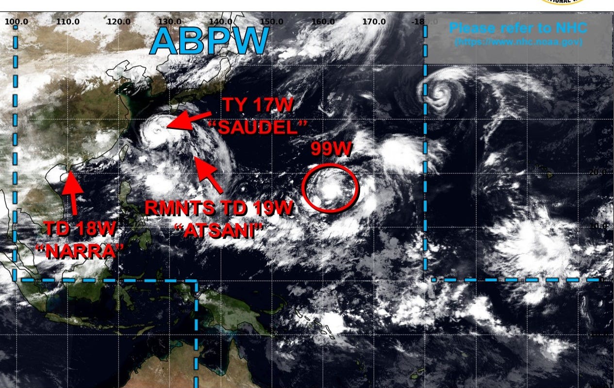
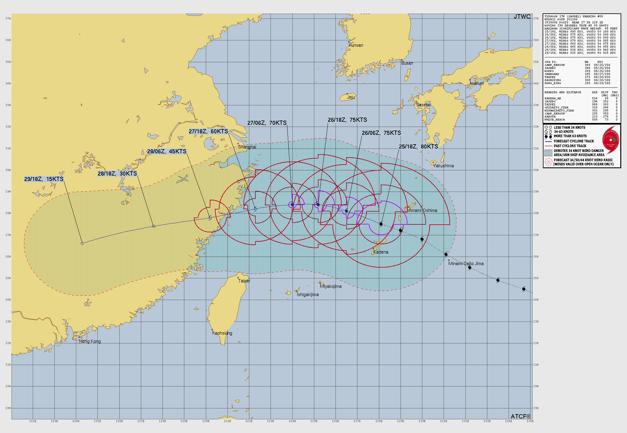
Typhoon Saudel nearing China in a few days but will weaken.
Still has an intense inner-core and eye.
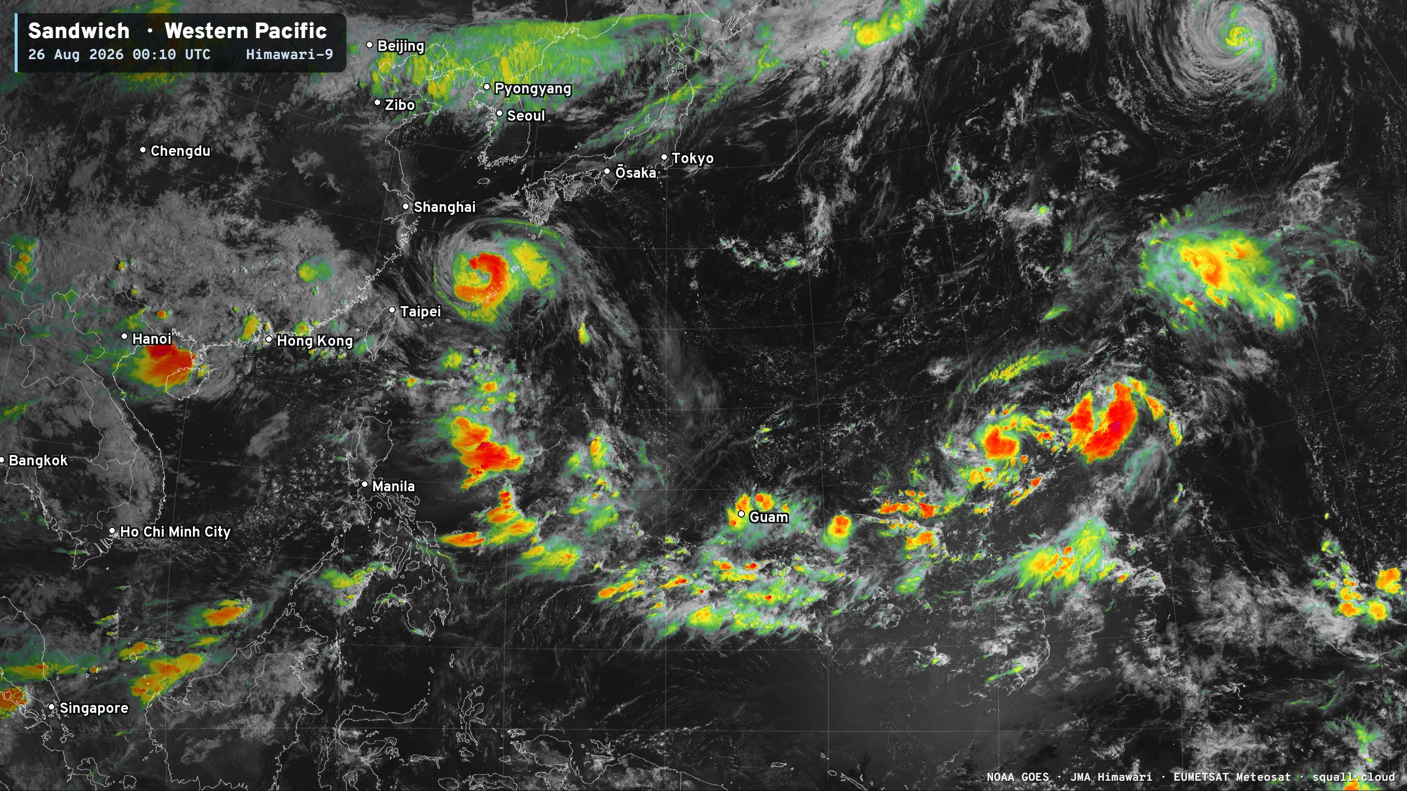
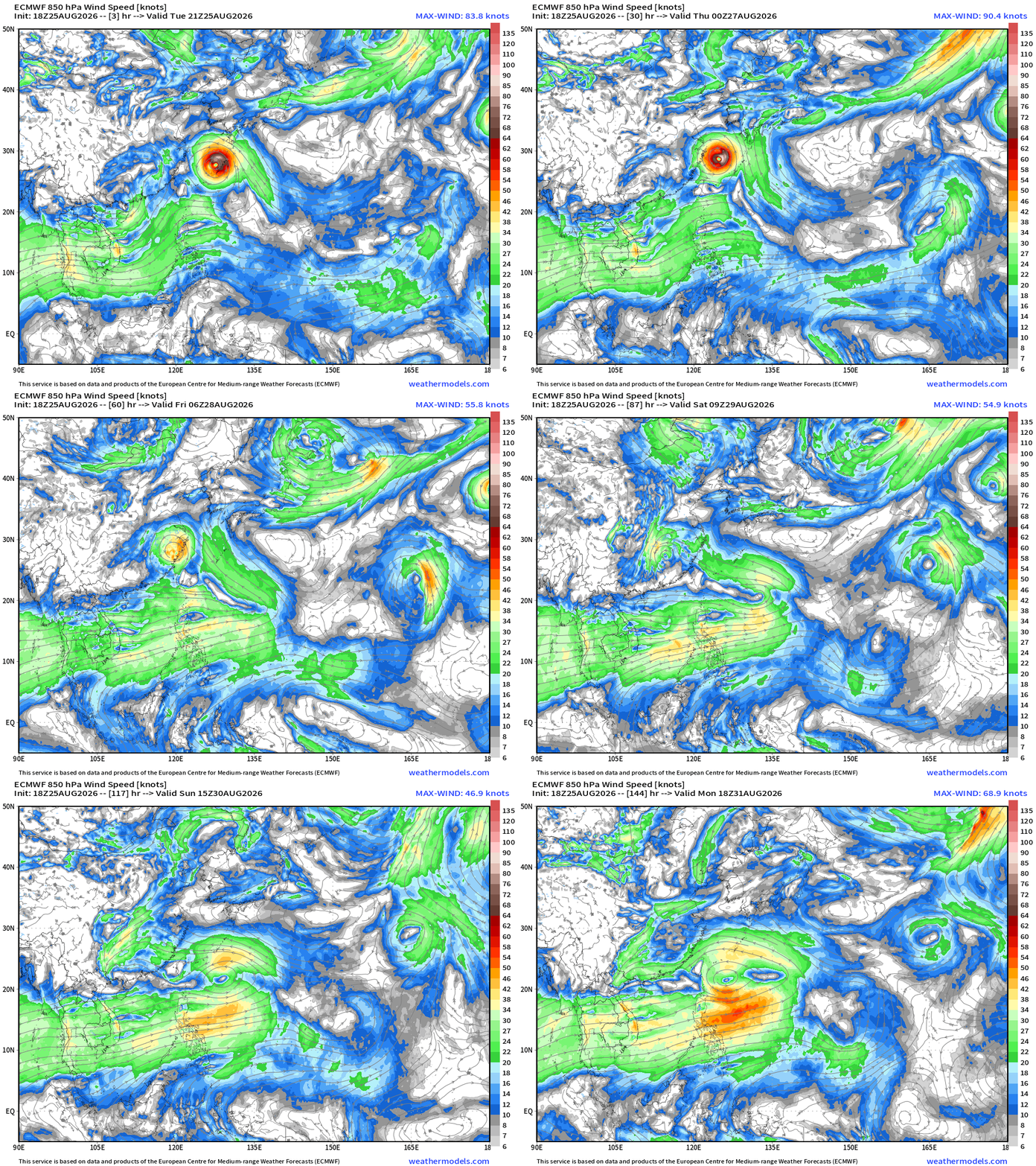
Not expecting much else in the coming days as a large monsoon gyre forms east of the Philippines.
My Atlantic Hurricane Season Forecast (2026)
From April 7, 2026: Atlantic Seasonal Hurricane Forecast: (11/5/2)
9-13 Named Storms (11 most likely)
4-7 Hurricanes (5 or 6 most likely)
1-3 Major Hurricanes (2 most likely)
Accumulated Cyclone Energy: 75-85 (well below normal)
NOAA 2026 Atlantic Hurricane Season Forecast
Comments
Nothing yet. Say the first thing.
Sign in to join the conversation.