

This is forecast post number 1016 — Day 238 of 2026.
Day 87 of Atlantic Hurricane Season | YTD 3 Named Storms, ACE = 3
Author: Dr. Ryan Maue (X @RyanWeather X @weathertrader)
Your support is greatly appreciated. 4 subscriber renewals.
Weather Trader is entirely reader-supported publication (no ads). To receive all new posts and support our growing platform, consider becoming a paid subscriber / supporter.
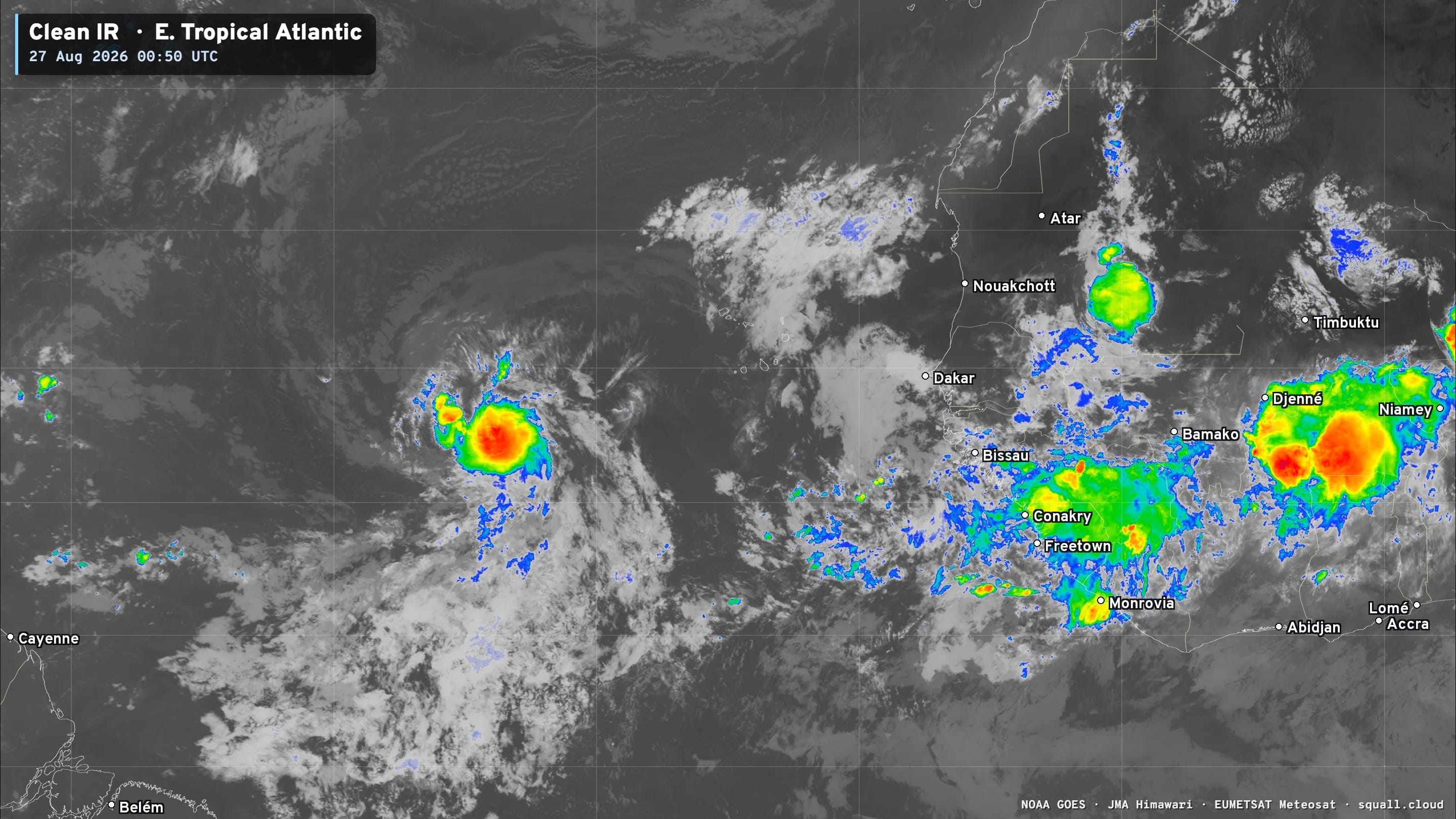
In the past 6-hours, Invest 96L has blossomed some strong convection presumably over a low-pressure center. This is rather impressive and if it persists, would trigger advisories on Tropical Depression 04L.
NHC has actually decreased the chance of further development to 60%.
Tropical wave in Eastern Atlantic has (still) not become a tropical depression, yet. NHC at 60% chance as it continues over the very warm waters of the eastern Main Development Region.
Typhoon Saudel (17W) in the Western Pacific still going at7 5-knots (Cat 1) nearing landfall into China on Thursday — looks impressive with a burst of strong inner-core convection around a ragged eye.
In the Eastern Pacific, multiple storms including at least 1 hurricane are on the way in the next few days. Overall, we could see another 3-4 named storms in the basin — fueled by El Niño.
Sea Surface Temperatures across the Atlantic Basin (28°C — very warm = red)
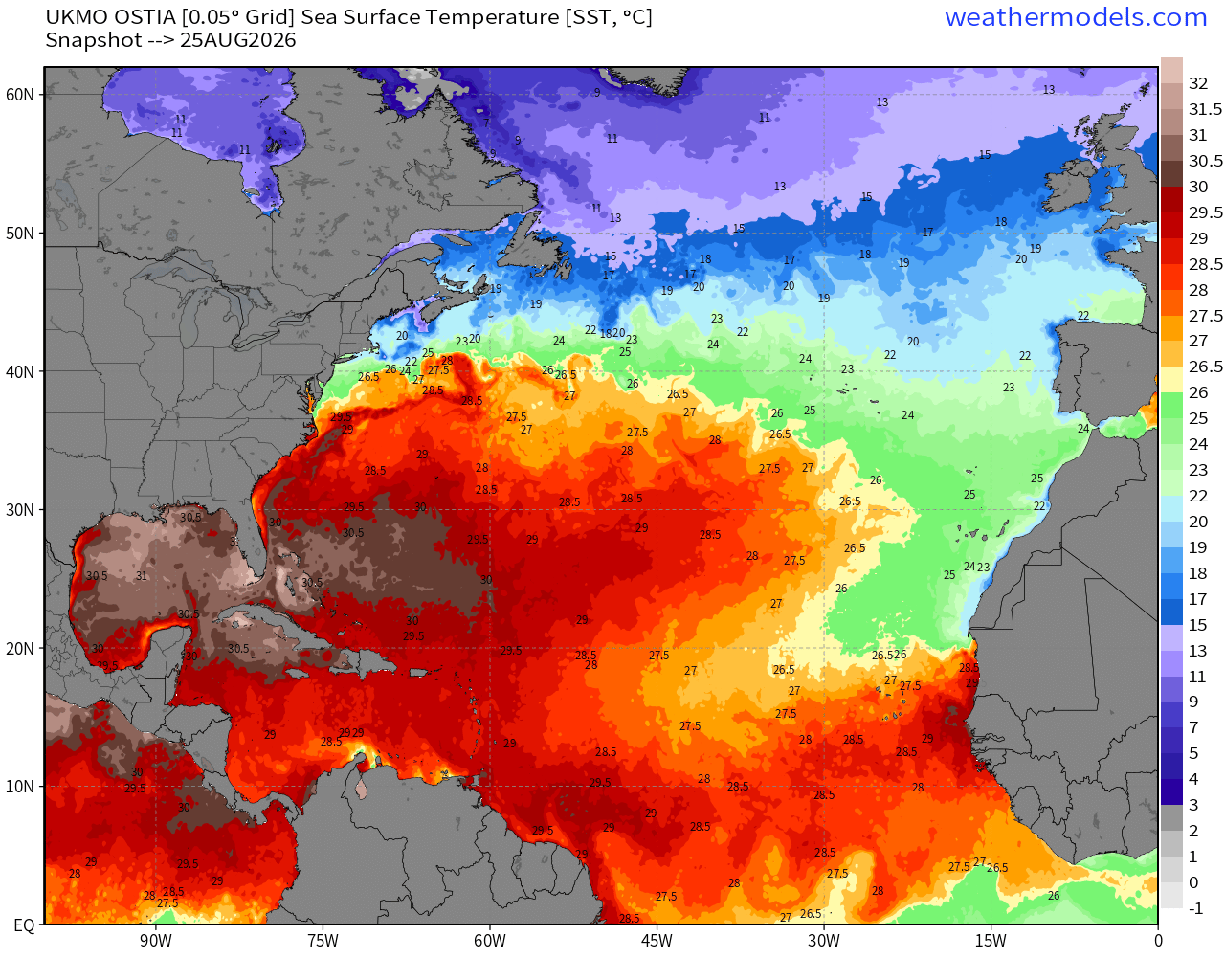
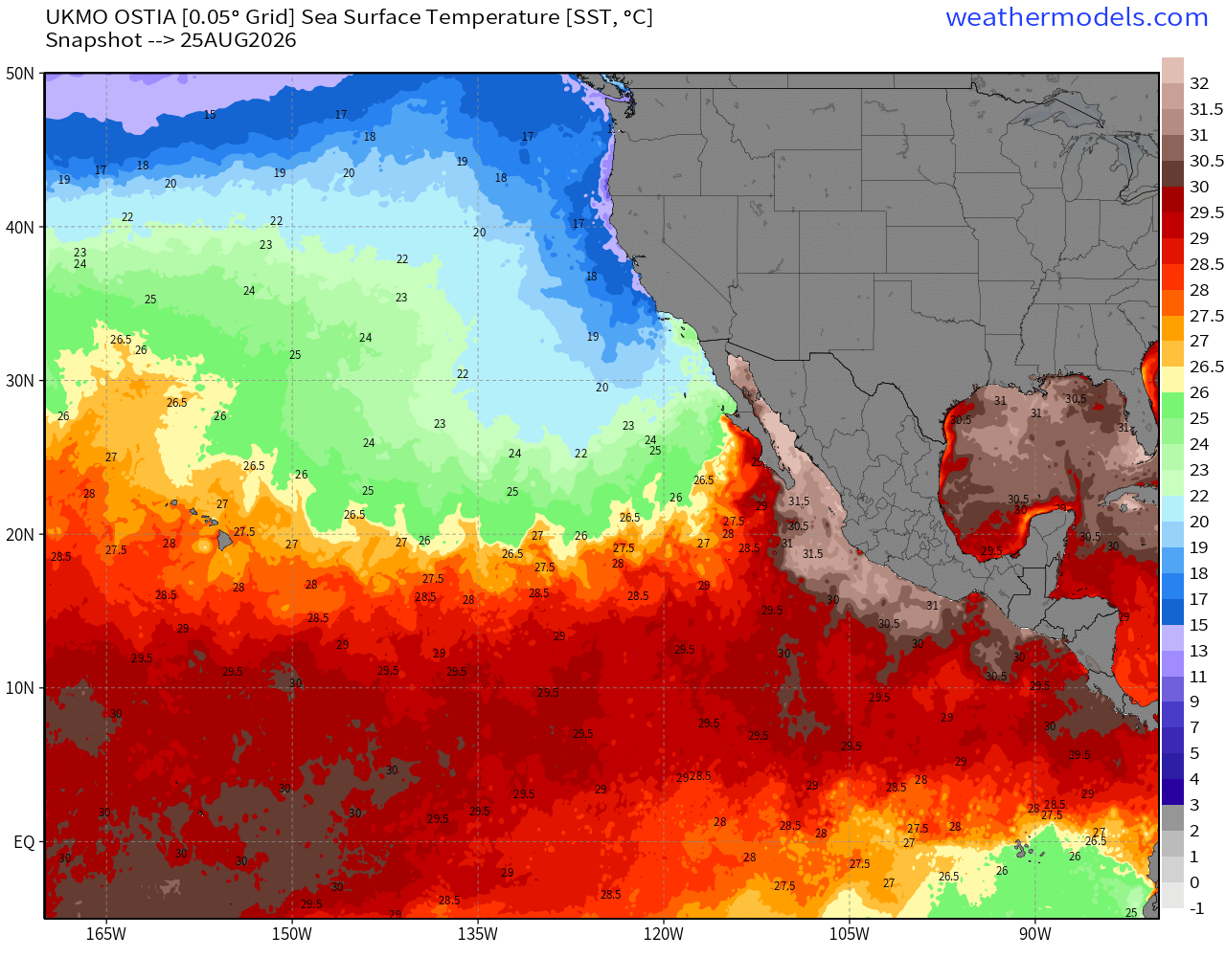
Note the 30°C warmth in the Gulf of Mexico — and along the Mexican coast in the Gulf of California — maybe closer to 32°C.
The only notable feature across the entire Atlantic basin is Invest 96L.

You can see more Satellite Imagery at Squall Cloud —> LINK
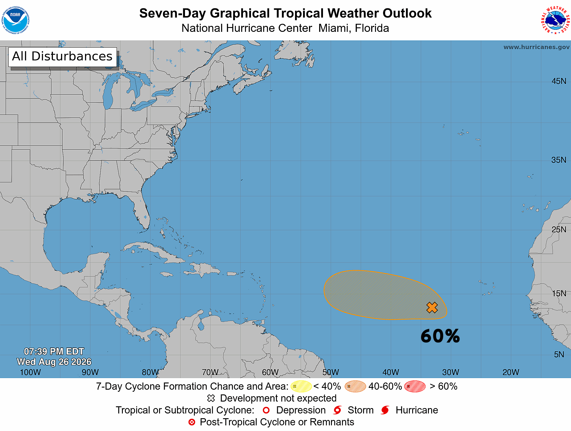
Invest 96L now at 60% chance of development over next 7-days.
Comments
Nothing yet. Say the first thing.
Sign in to join the conversation.