

This is forecast post number 1012 — Day 235 of 2026.
Day 84 of Atlantic Hurricane Season | YTD 3 Named Storms, ACE = 3
Author: Dr. Ryan Maue (X @RyanWeather X @weathertrader)
Your trust and support is greatly appreciated. 3 paid subscriber renewals.
Weather Trader is entirely reader-supported publication (no ads). To receive all new posts and support our growing platform, consider becoming a paid subscriber / supporter.
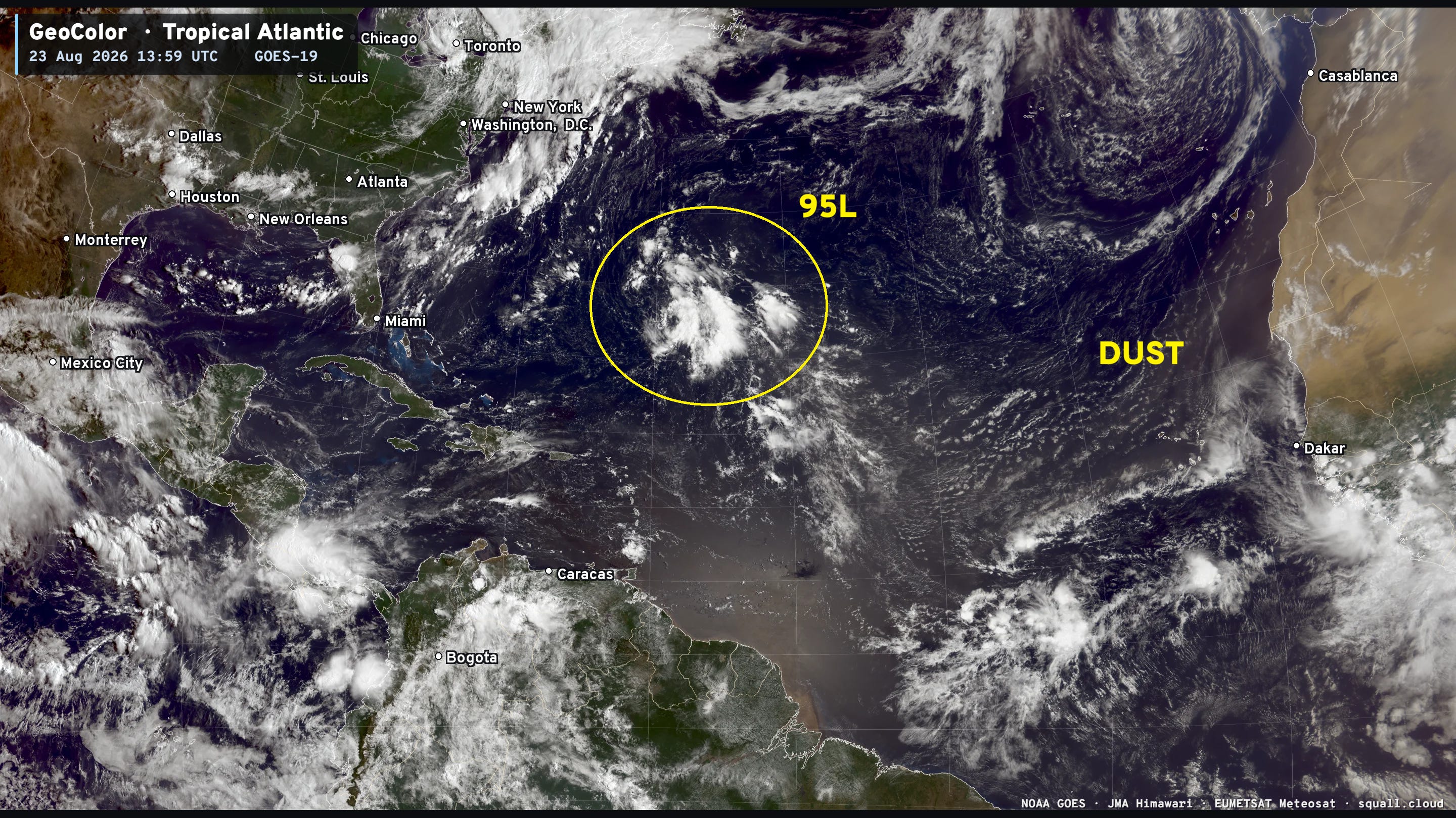
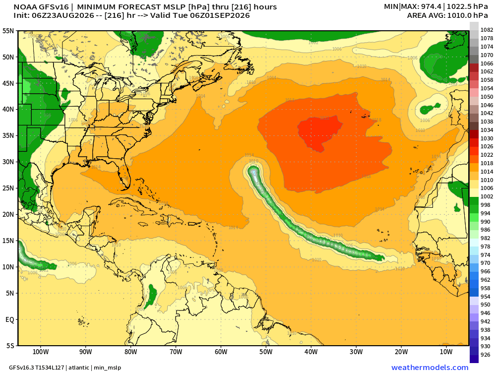
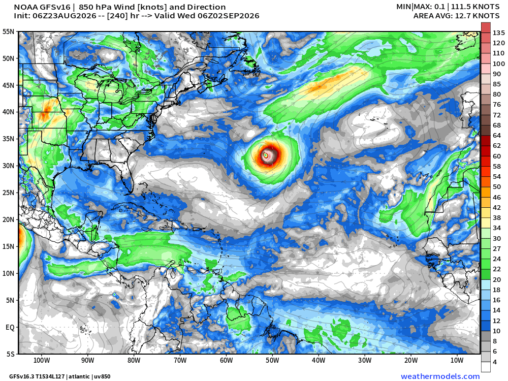
Atlantic basin comes back to life in next few days with models showing a tropical storm in the Main Development Region in 4-5 days. However, the environment is less than ideal, and not expecting much in the way of intensification beyond a tropical depression or storm for maybe 7-10 days when the system can escape into the Western Atlantic north of the Caribbean.
A non-tropical area of low pressure off the coast of Portugal is embedded with a mid-latitude trough and did not have time nor warm enough water to become fully tropical. No name.
Another small area of convection in the central subtropical Atlantic also has low potential (30%) but is being watched by NHC.
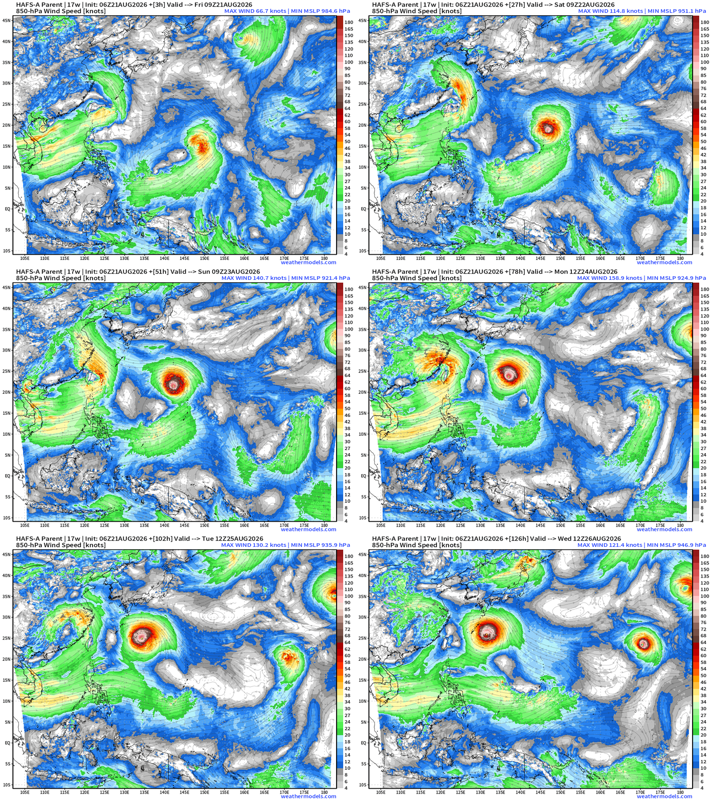
Typhoon Saudel (17W) in the Western Pacific is at 110-knots with a nice eye and convective structure. It will turn abruptly west and then southwest into China this coming week.
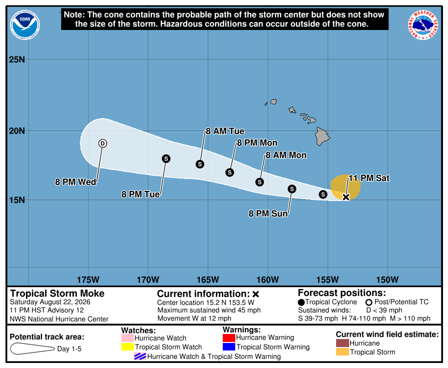
Tropical Storm Lala still going out in the open Central Pacific, and may take another 5-days to spin down below TS/TD strength. Tropical Storm Moke remains poorly organized and will not intensify further.
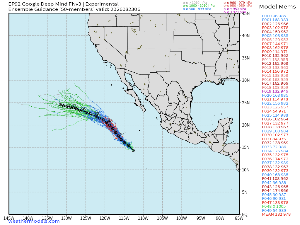
New formed Tropical Storm Iselle (09E) will become a hurricane but stay well away from land during it’s 5-day run.
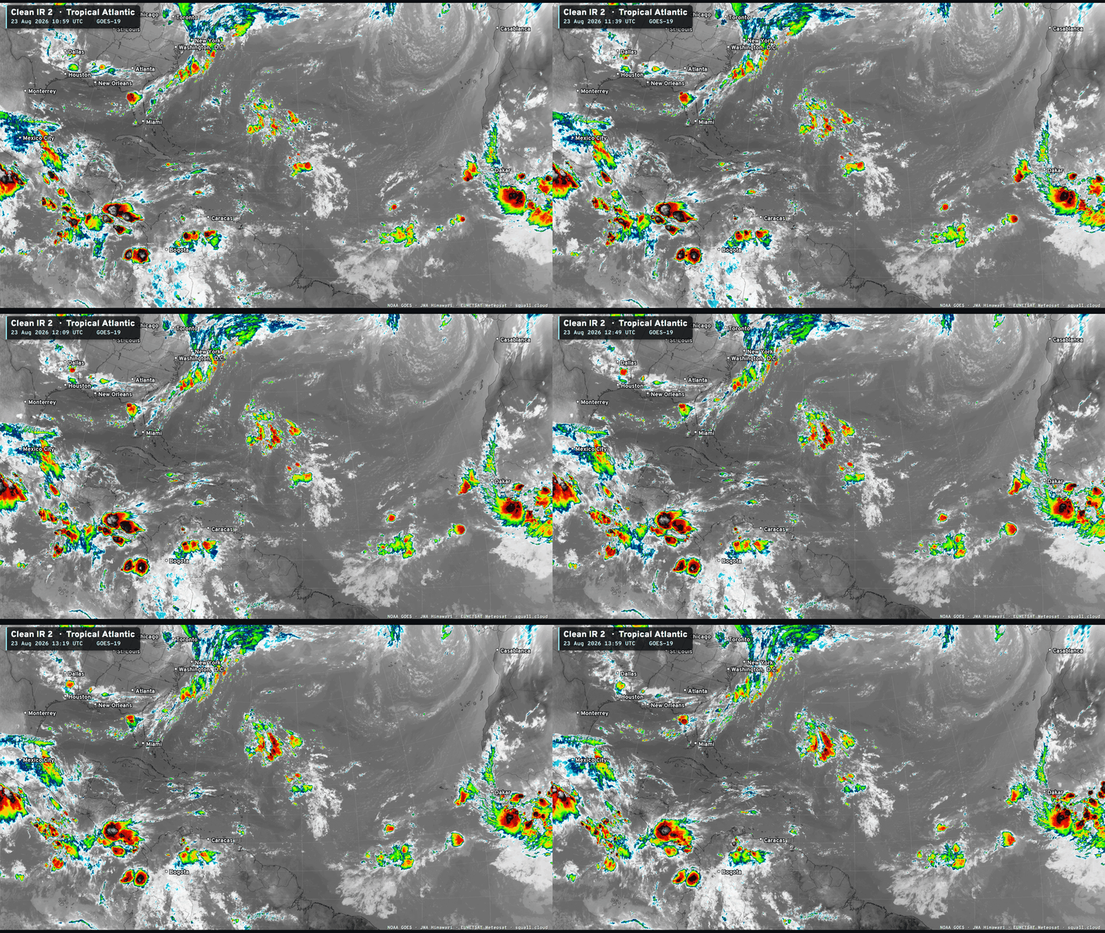
The tropical wave over Africa is the one we are watching — probably for the next 10-days as it treks across the Atlantic.

You can see more Satellite Imagery at Squall Cloud —> LINK
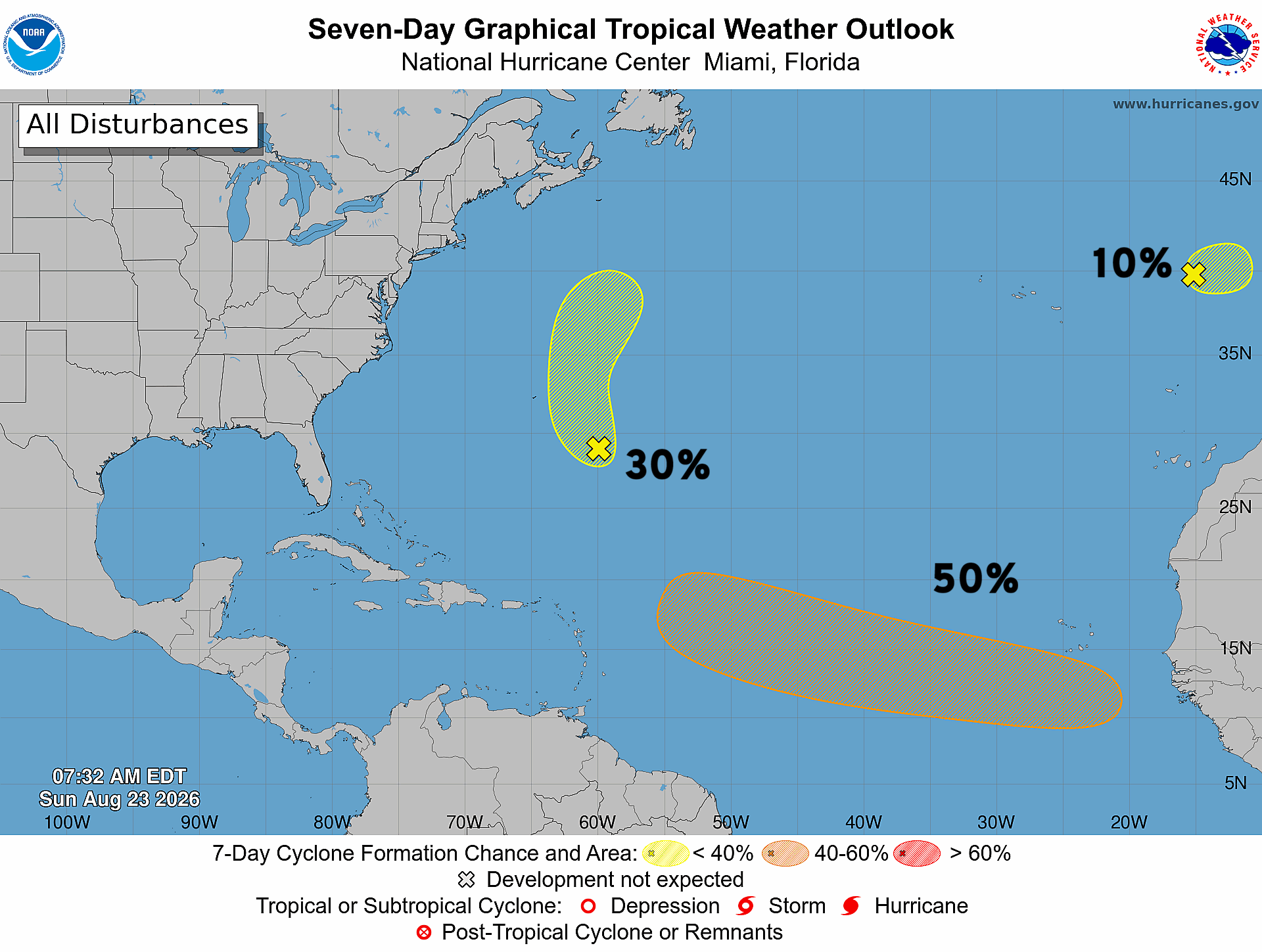
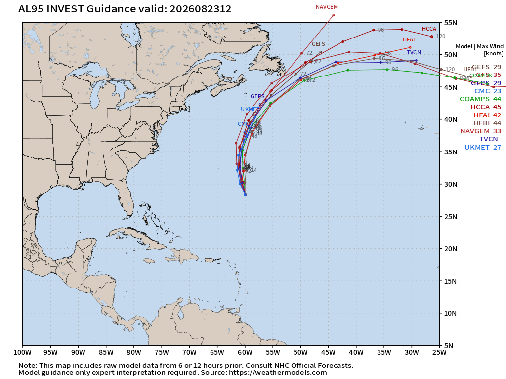
Invest 95L in the central Atlantic will continue northward, and may become Dolly briefly.
Tracks from 51-member ensemble of AIFS-06z …
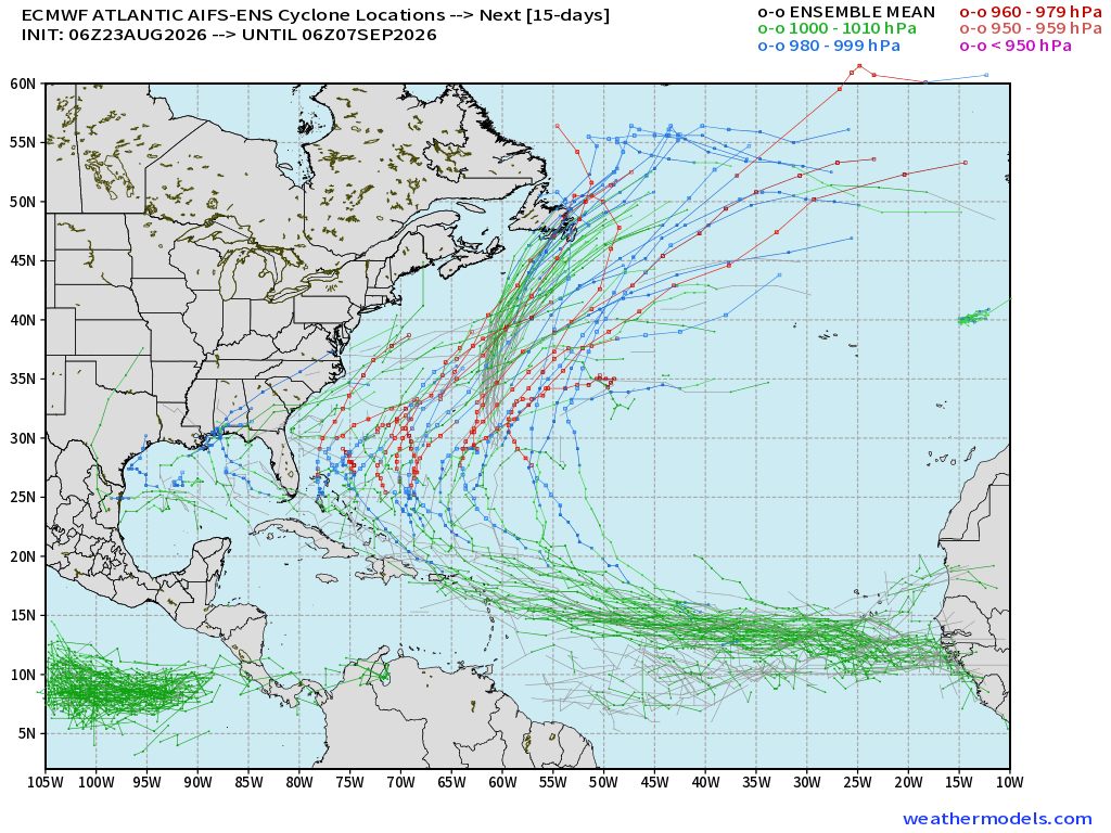
The tropical wave is tracked across the MDR at TD or low-TS intensity, but then has a better chance to intensify into a hurricane in 10-days assuming it heads quite far west. There are many members with major hurricane but off the U.S. East Coast.
Additional development in the Gulf needs to be watched in 2-weeks as many members have popped with TS/Hurricanes. Low chance, long range, so only something to watch.
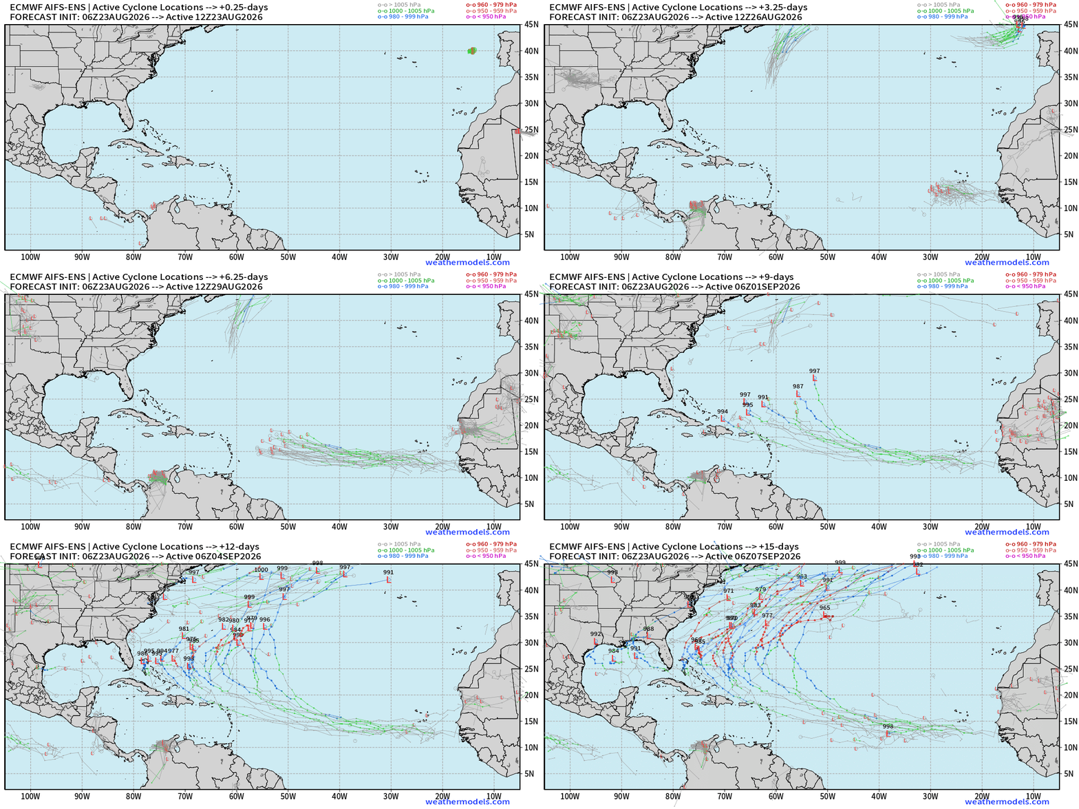
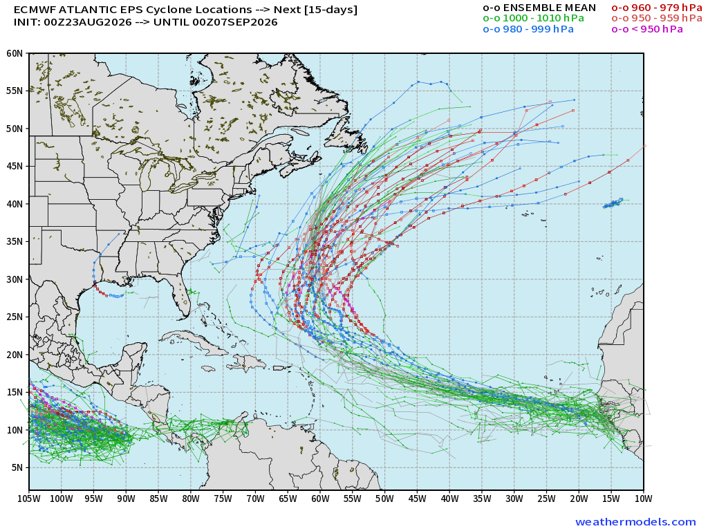
The main difference between AIFS and the full-physics EPS: recurve much sooner along 60°W.
To me, the machine learning trained system (AIFS) has a weaker system and that is allowed to drift further westward. But on the other hand, it may be removing a too-soon-to-recurve bias in the full physics system.
We need another vote!
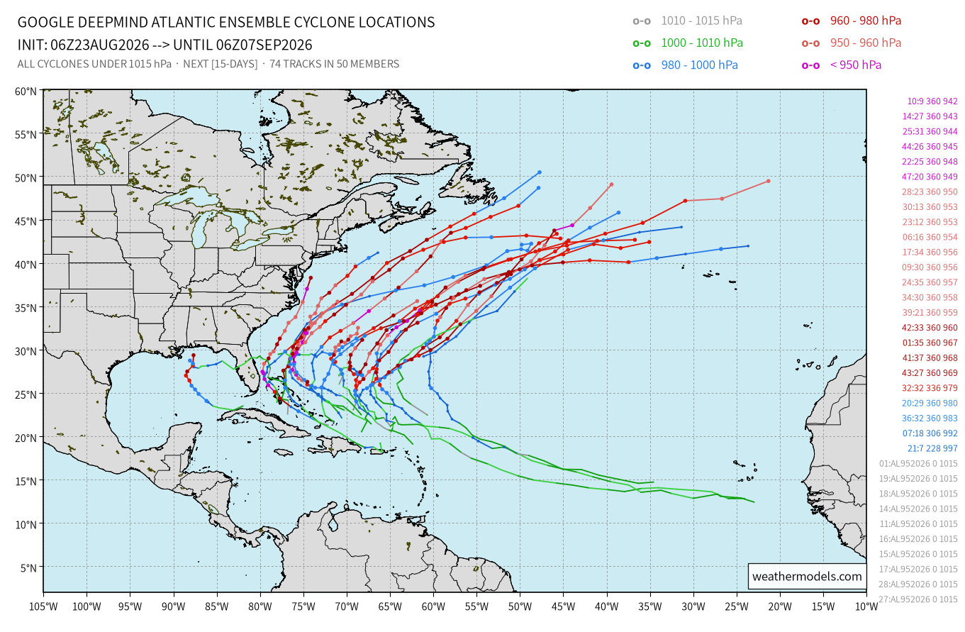
Quite a collection of very intense members off the East Coast into Day 10.
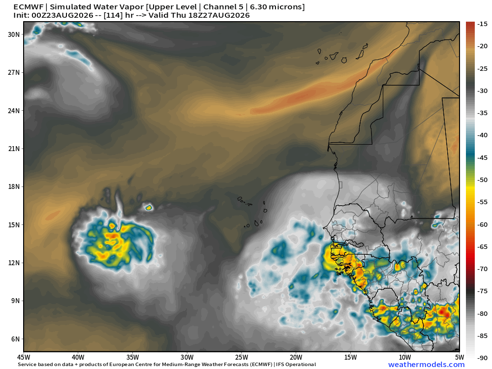
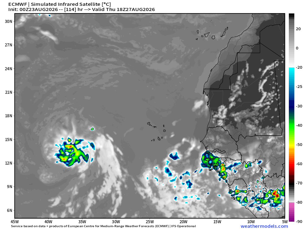
The tropical wave is robust with a strong circulation and plenty of moisture, but there is dry air (Saharan Air Layer) to the north, and that’s wrecked all previous waves regardless of model excitement. However, I think this one will survive — perhaps at a low-ebb for the next week.
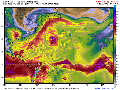

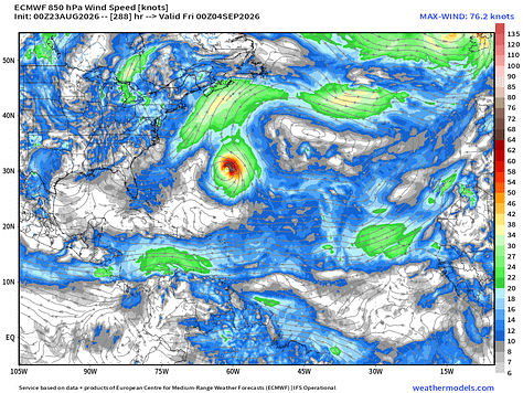
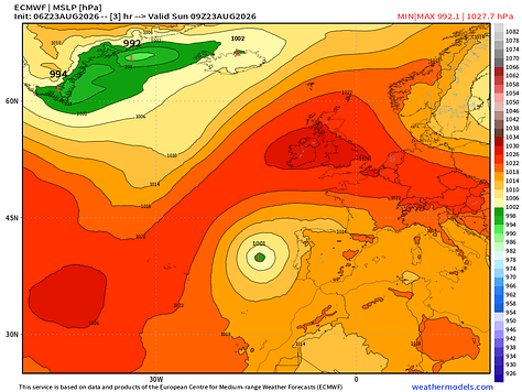
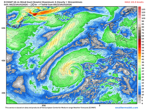
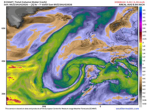
Non-tropical area of low pressure off Portugal did not intensify as a tropical cyclone. The midlatitude trough in which it is embedded has keep the system mostly cold-core through the mid-levels.
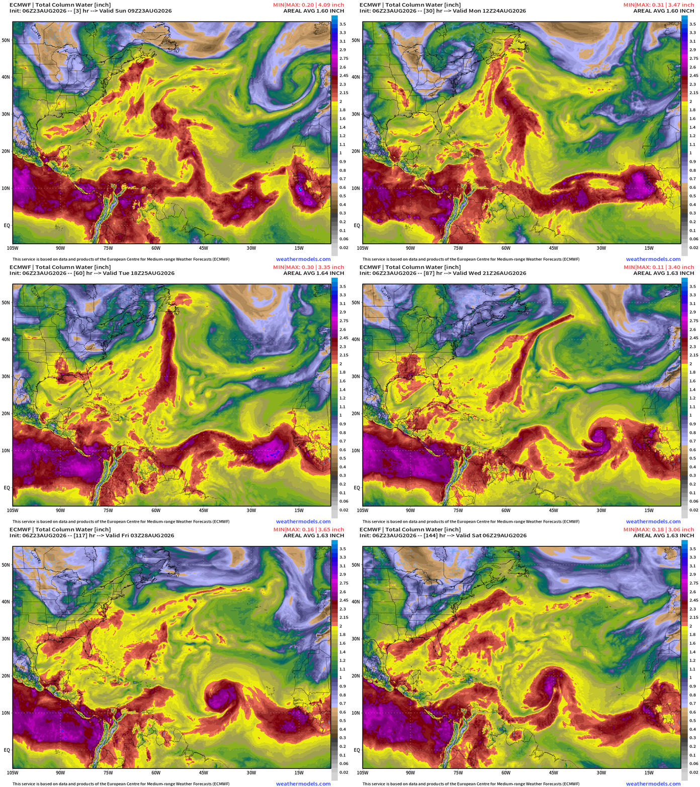
Tropical wave looks quite healthy — but the environment is hostile with dry air in the MDR. However, this looks like a tropical storm.
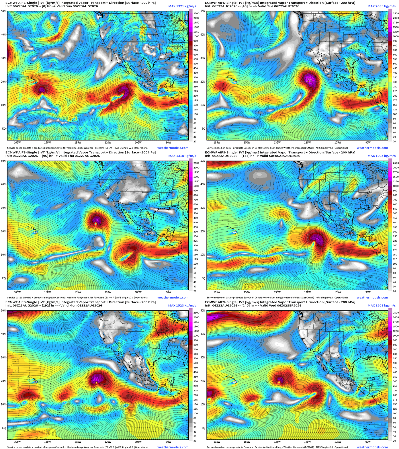
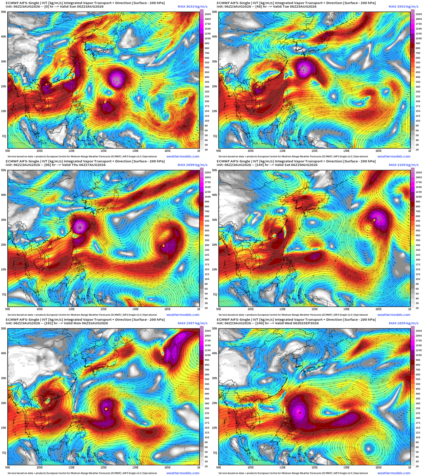
Flagship model: ECMWF AIFS 06z —> Integrated Vapor Transport next 12-days
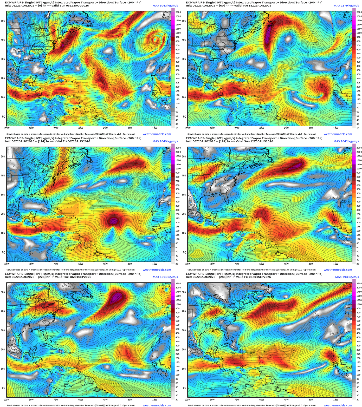
AIFS Single 06z is due west with the aforementioned tropical wave, with limited development.
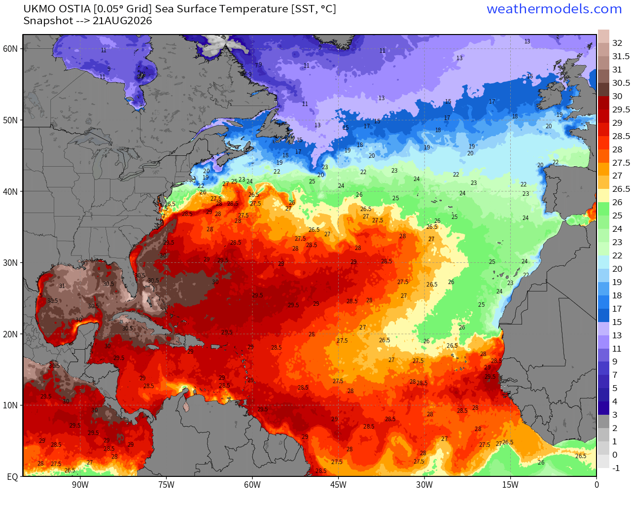
Very warm off Africa with 28.5°C to 30°C. The rest of the basin is also very warm including 30°C in the Gulf. The Caribbean is a bit cooler than normal but still plenty sufficient for any intensity hurricane. However, highly unlikely we’ll see one anytime soon in the “shear shredding” Caribbean.
ECMWF CAMS 00z — Saharan Air Layers continue to cruise across the Atlantic doing damage to tropical waves and stabilizing the tropical environment with warmth and dry air combined with subsidence at low levels.
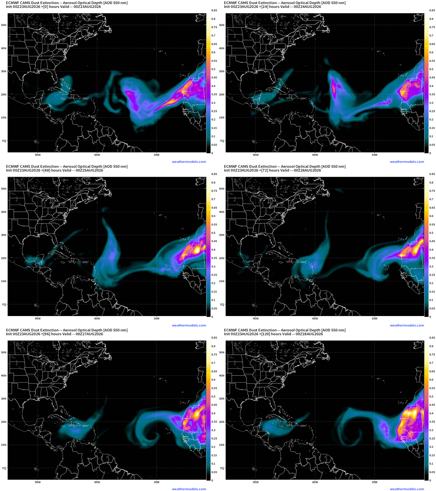
The SAL is not giving up, and may “somewhat” suppress the tropical wave we’ll be watching all week.
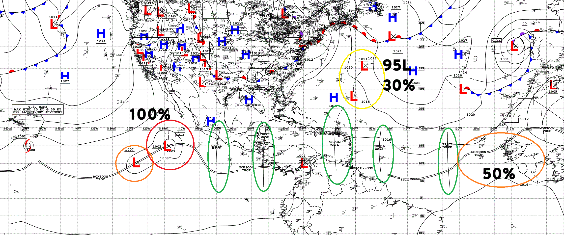
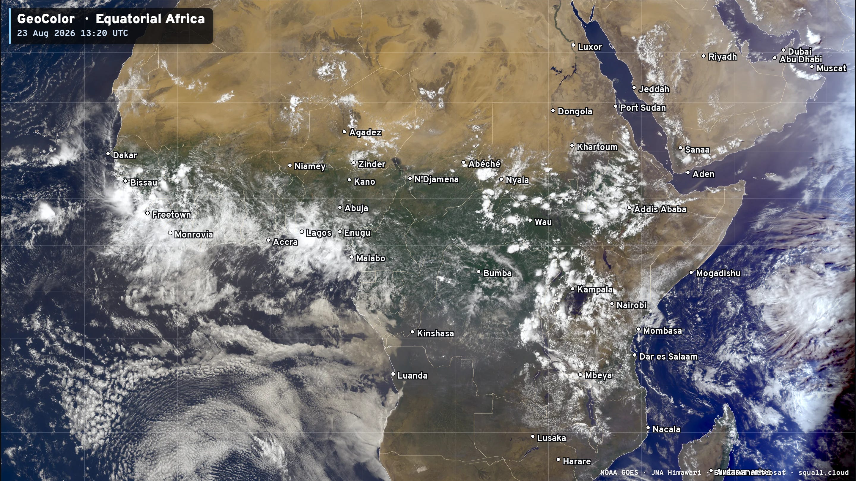
You can see the circulation / spin in a large scale sense already
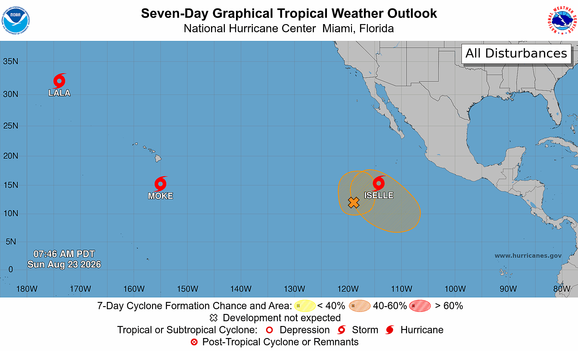
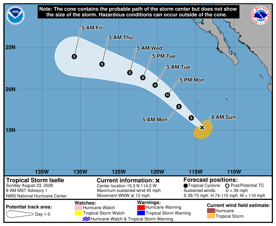
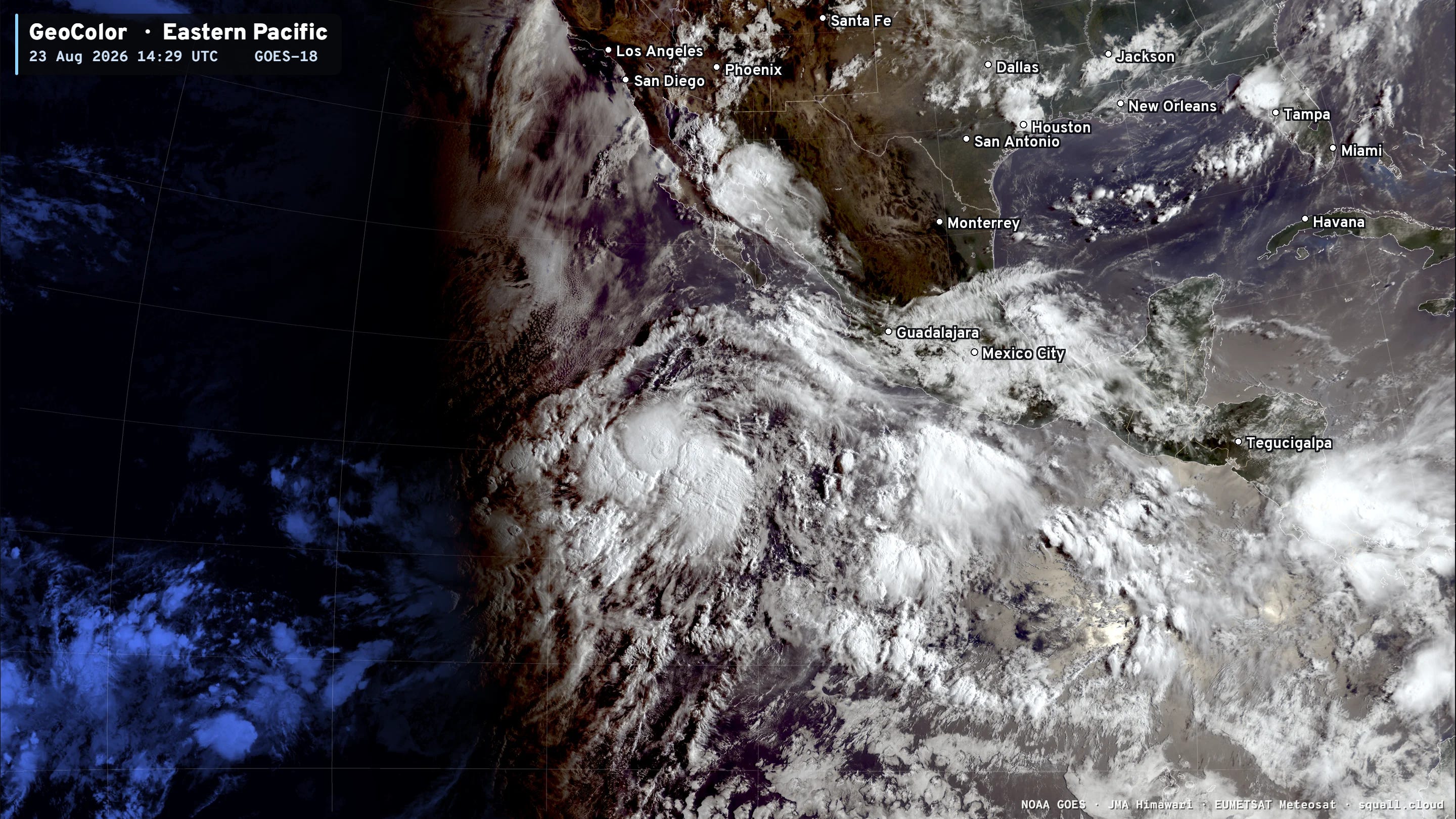
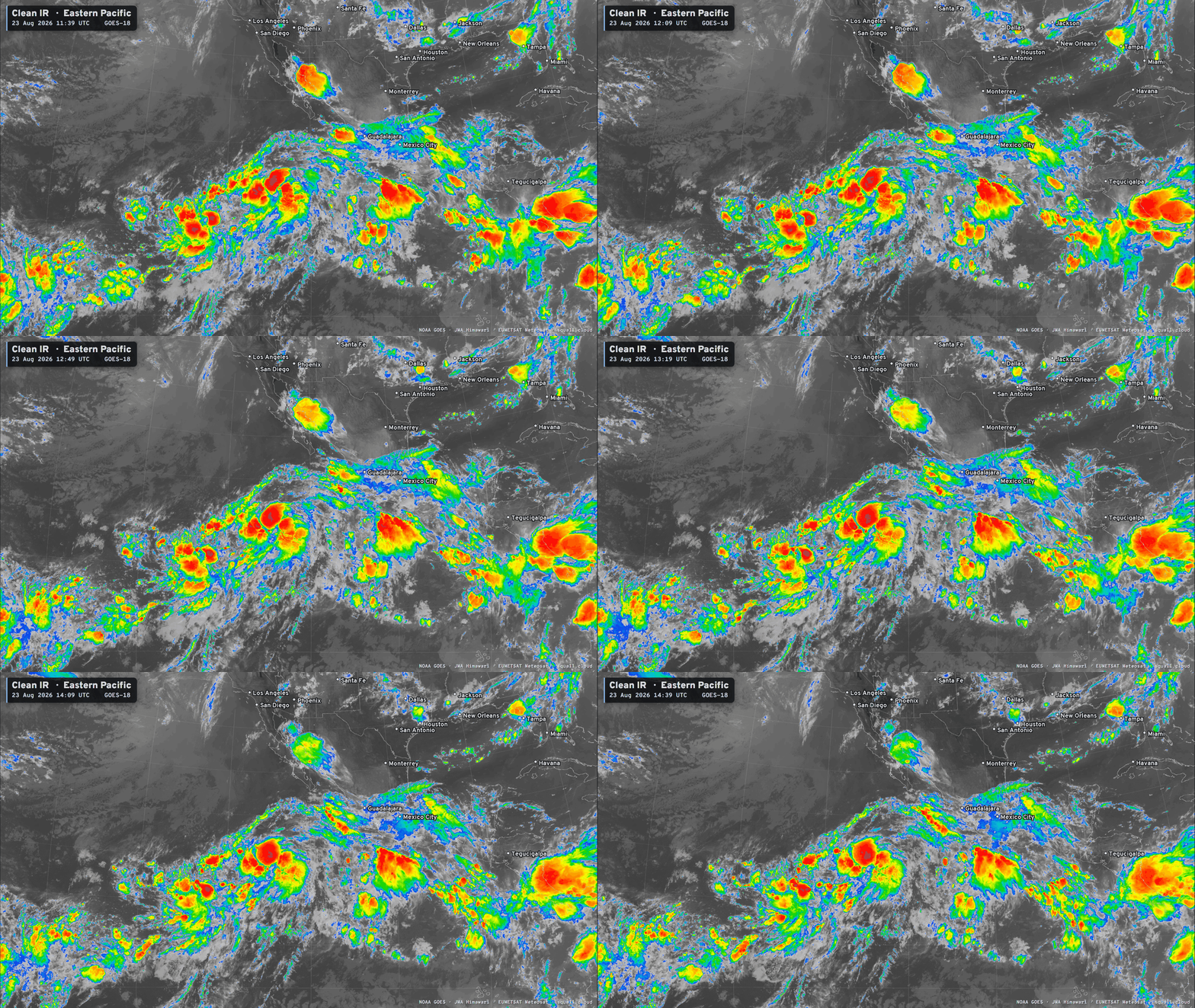
Iselle is forecast to become a hurricane — but remain away from land.
Tropical Storm Moke has not intensified well south of Hawaii with 45 mph winds.
More storms in the pipeline! Could be 1-2 more in 10-days
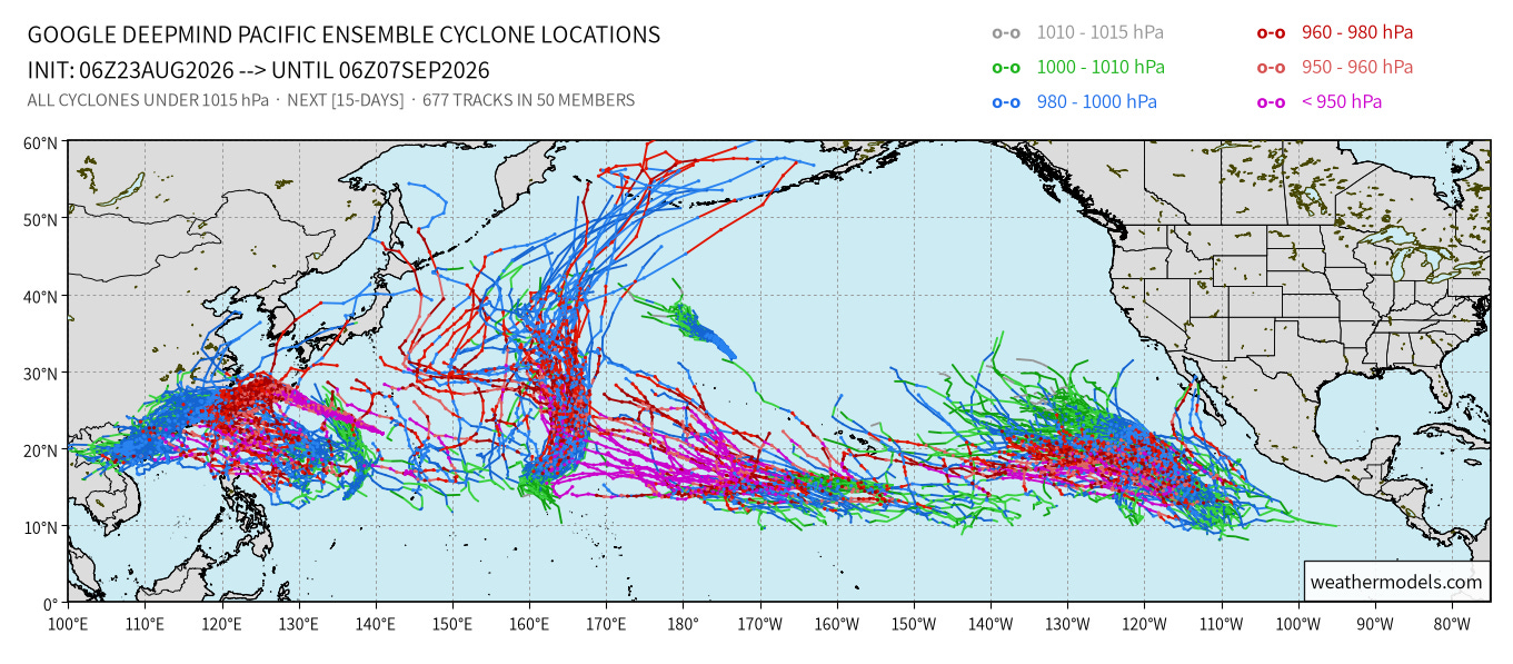
Pacific Hurricane And Typhoon Factory.
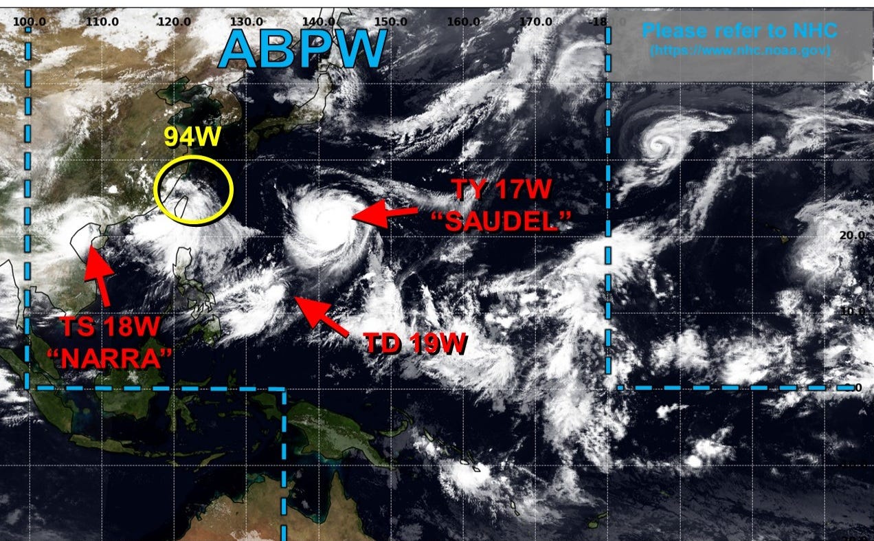
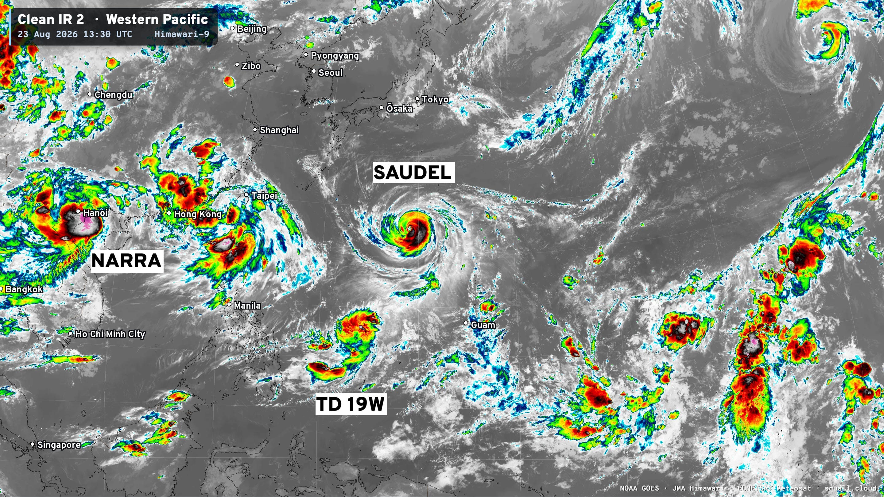
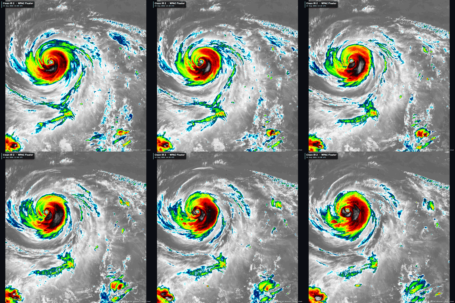
Track will turn to the west and southwest in 3-4 days but weaken as it heads into China — impact as a strong TS or weak Cat 1 Typhoon, but a very large system at this juncture.
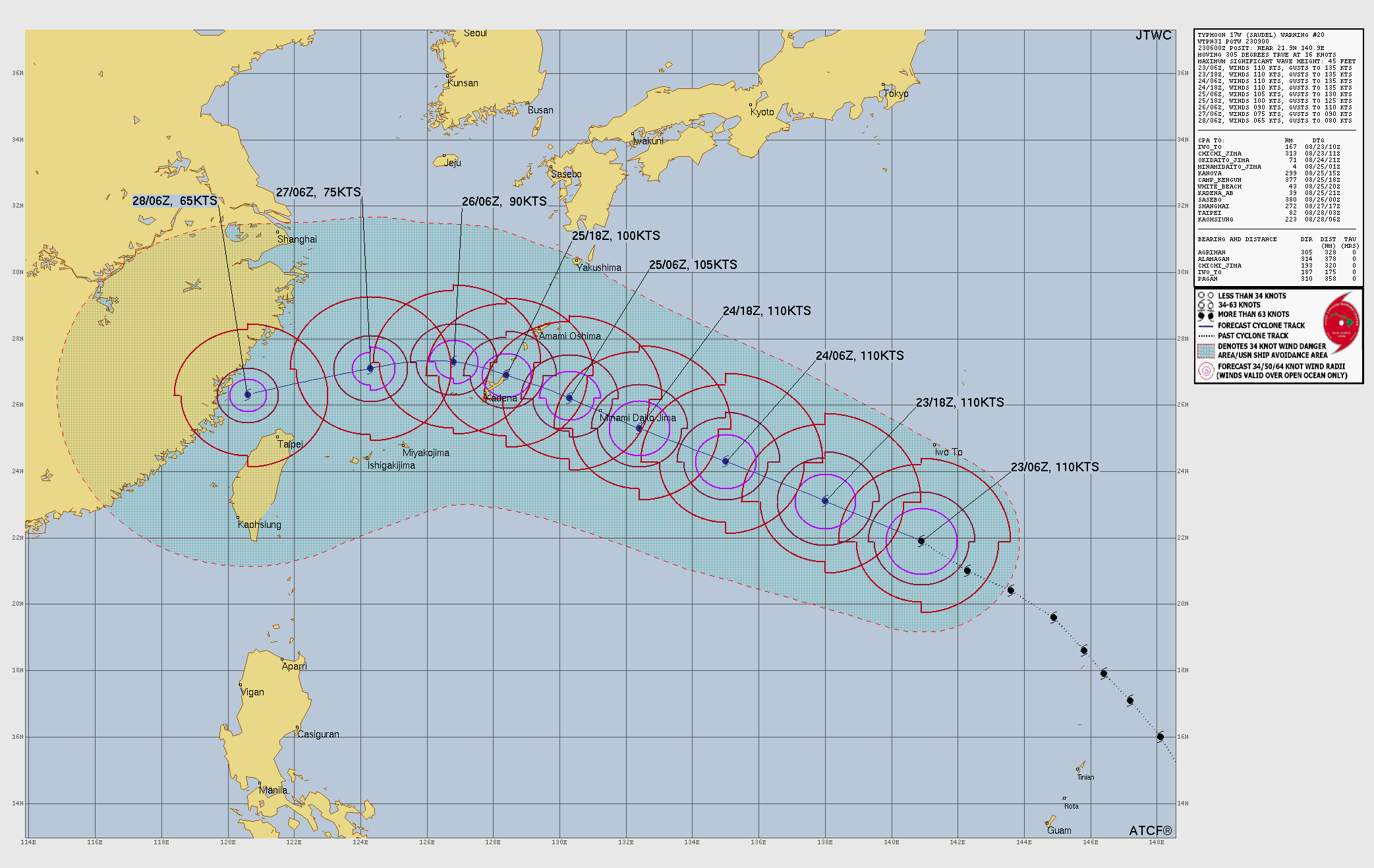
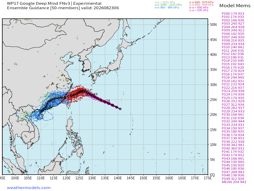
HAFS-A 06z mesoscale model (parent domain) shows large Typhoon Saudel bending westward in 4-5 days
Western Pacific —> Central Pacific remains VERY busy in coming 10-days
My Atlantic Hurricane Season Forecast (2026)
From April 7, 2026: Atlantic Seasonal Hurricane Forecast: (11/5/2)
9-13 Named Storms (11 most likely)
4-7 Hurricanes (5 or 6 most likely)
1-3 Major Hurricanes (2 most likely)
Accumulated Cyclone Energy: 75-85 (well below normal)
NOAA 2026 Atlantic Hurricane Season Forecast
Comments
Nothing yet. Say the first thing.
Sign in to join the conversation.