

This is forecast post number 1009 — Day 232 of 2026.
Day 81 of Atlantic Hurricane Season | YTD 3 Named Storms, ACE = 3
Author: Dr. Ryan Maue (X @RyanWeather X @weathertrader)
0 new subscribers but 4 renewals including 1 annual, plus free tier followers. Your trust and support is greatly appreciated.
Weather Trader is entirely reader-supported publication (no ads). To receive all new posts and support our growing platform, consider becoming a paid subscriber / supporter.
Atlantic basin comes back to life early next week with models showing a tropical storm or hurricane in the Main Development Region in 6-days
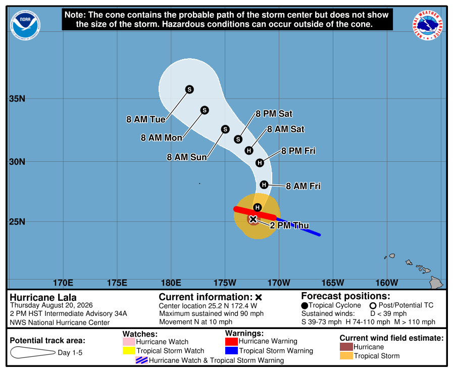
Hurricane Lala continues well away from Hawaii in Central Pacific
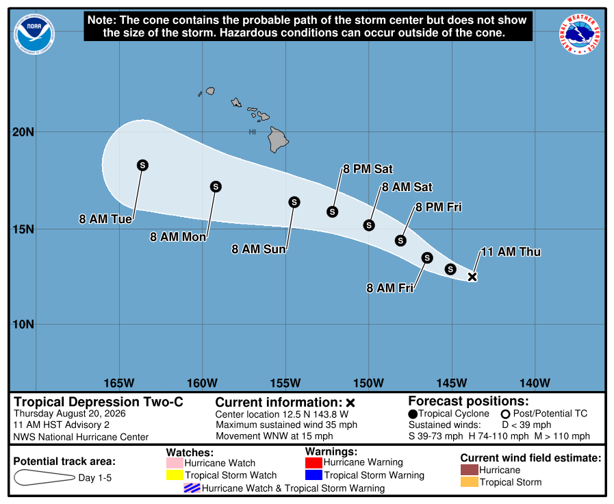
Another tropical storm will form Southeast of Hawaii —> next name is Moke — and slide south of the Hawaiian Islands
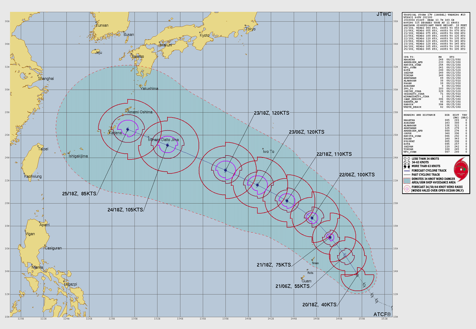
Tropical Storm Saudel has formed in the Western Pacific away from Guam — expected to become a powerful Typhoon.
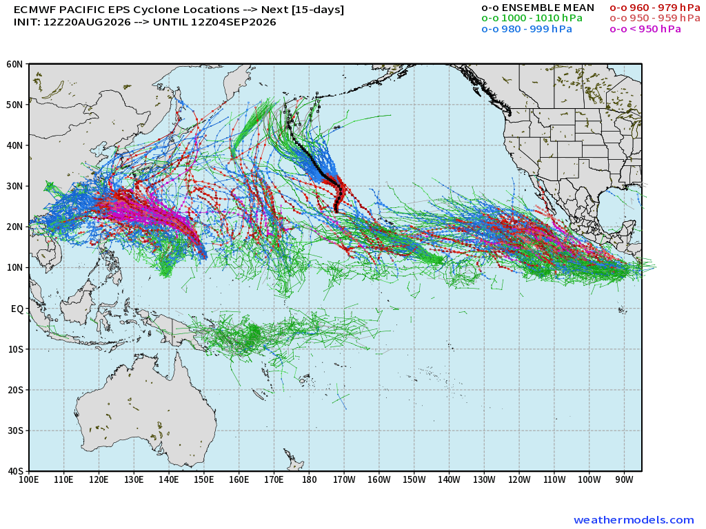
The entire Pacific basin is lit up — Super El Niño ACE Machine into early September
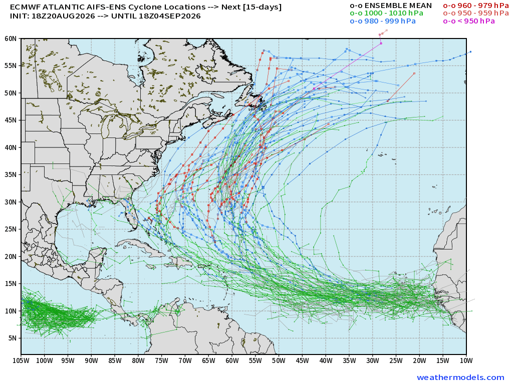
Nothing cooking in the main Atlantic basin for the next 5-days until a tropical wave exits Africa — that comes in HOT — we might have our best chance yet (or maybe of all of 2026) at a TS/Hurricane into end of August.
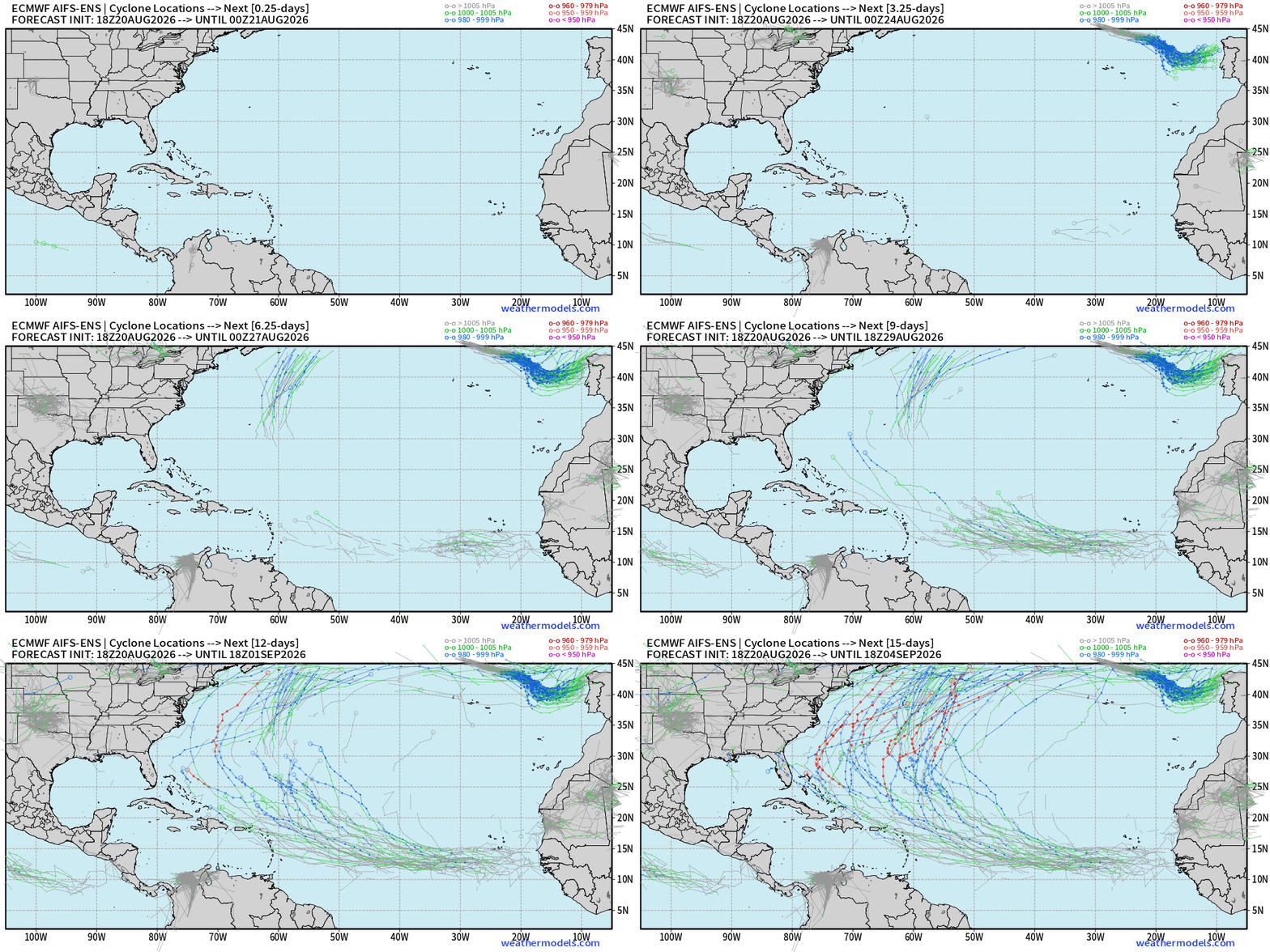
AIFS-ENS 18z picks up a tropical wave in the MDR at Days 6/7 with strong signal for development into a TS/Hurricane once it gains latitude.
ECMWF Ensemble 12z full-physics active tracks next 15-days
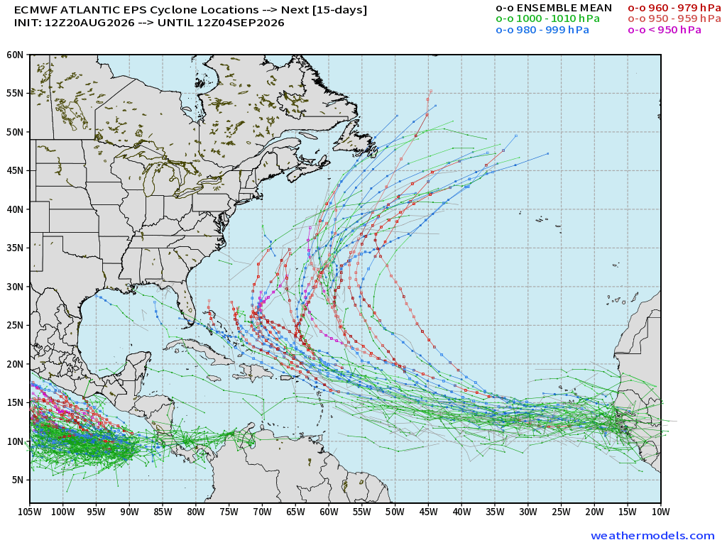
Full Physics EPS Ensemble system is VERY excited about this tropical wave … and has some members blowing up into a major hurricane right off the coast of Africa.
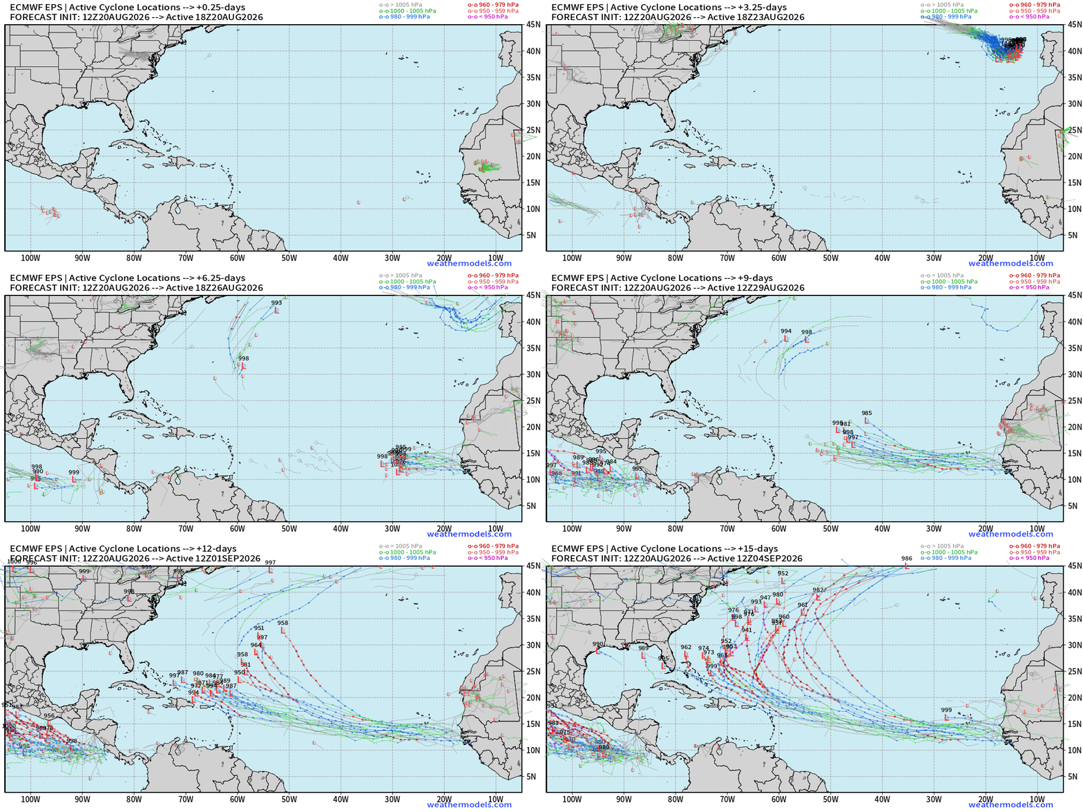
Typical “Cape Verde” hurricane — regardless of El NIño —> would be 13+ days before any U.S. impacts, but these usually go out to sea.
6-days — should have a TD/TS in the Eastern Main Development Region.
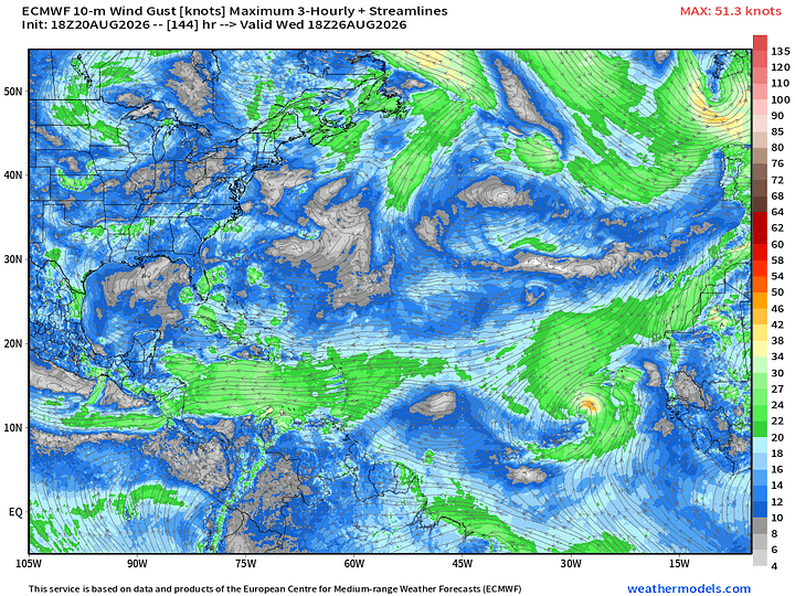
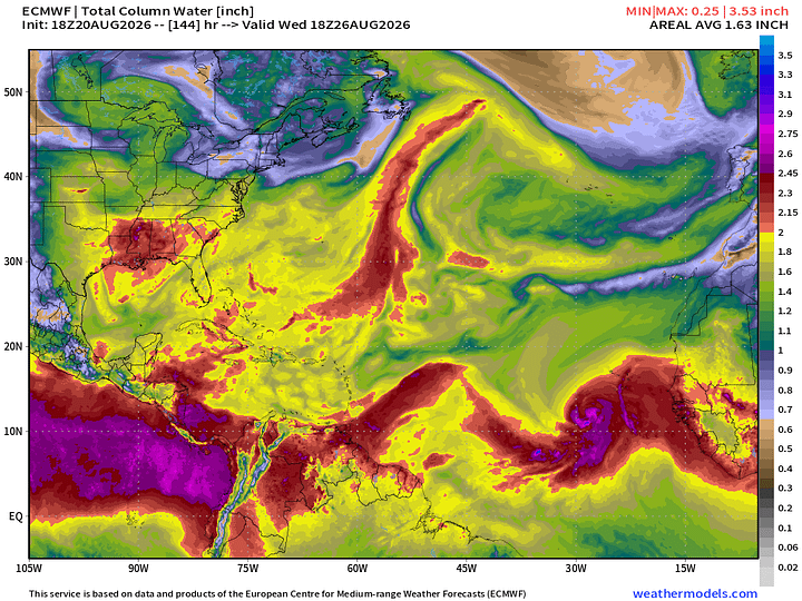
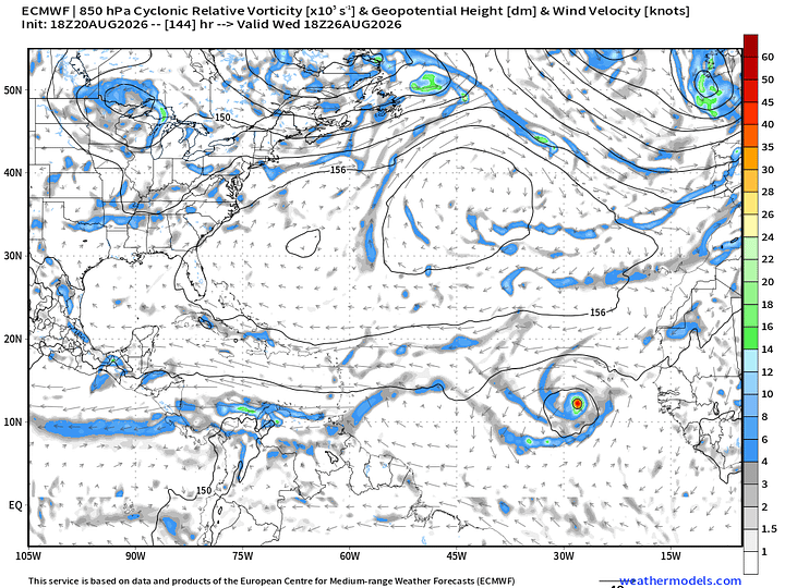
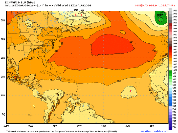
Tough Sledding for Tropical Waves — not enough firepower (convection) to overcome the wind shear and Saharan Air Layers + Dust for the next 5-days. But, then we’ll see a shift toward more activity thereafter.
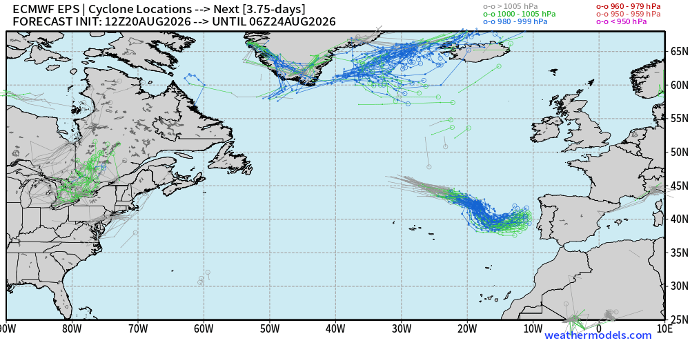
Should generate TS to near-hurricane force winds. This is a “warm seclusion” type tropical transition.
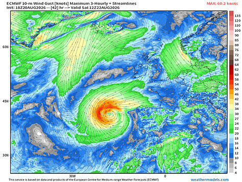
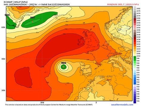
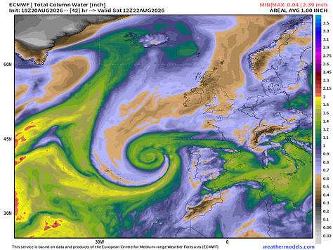
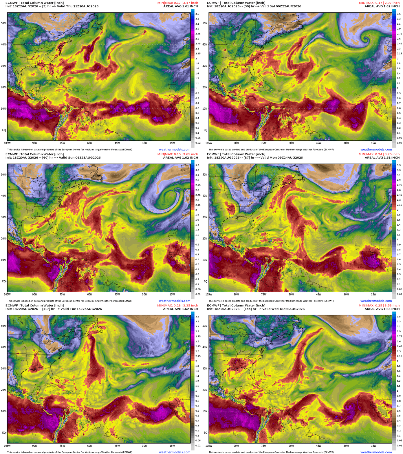
Watching the current batch of tropical waves getting wiped out by a Saharan Air Layer — you can see the front of the warm/dusty air wipe out the MDR into early next week. But, then a tropical storm or hurricane forms early next week.
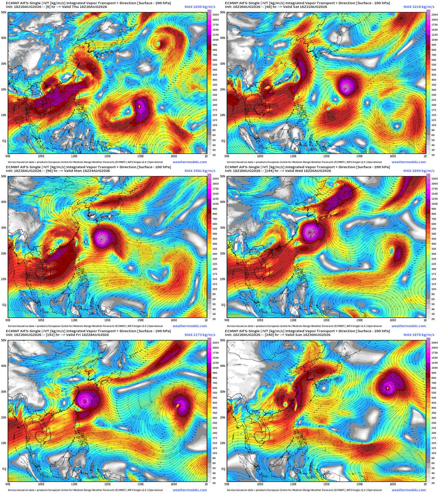
Flagship model: ECMWF AIFS 18z —> Integrated Vapor Transport next 10-days
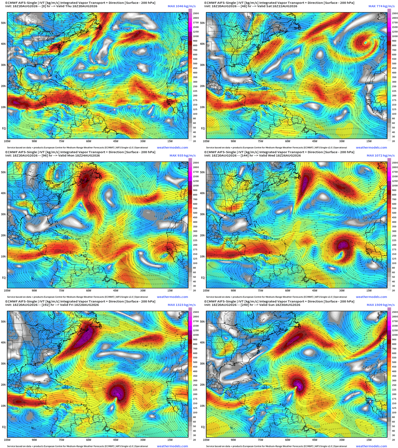
AIFS-Single 18z still very interested in the tropical wave into Days 5-6 (Aug 25-26) coming off Africa. That is probably a hurricane (in the model).
Limited convection across the Atlantic this evening.
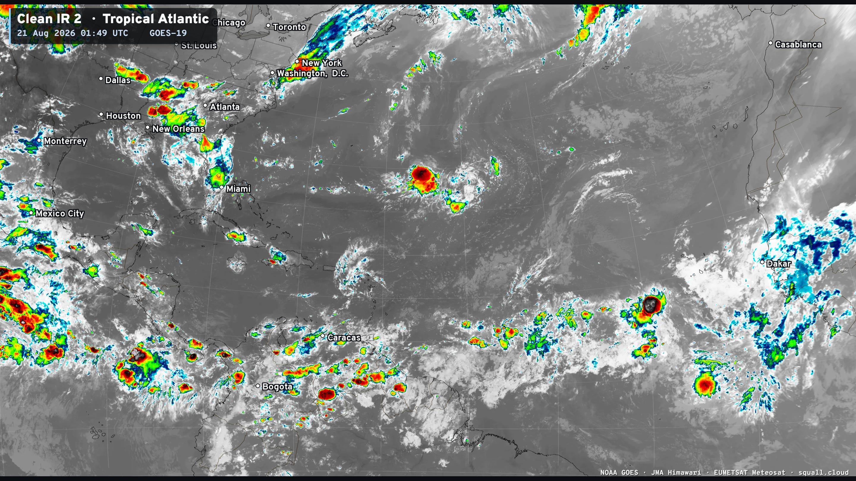
You can see more Satellite Imagery like this at Squall Cloud —> LINK
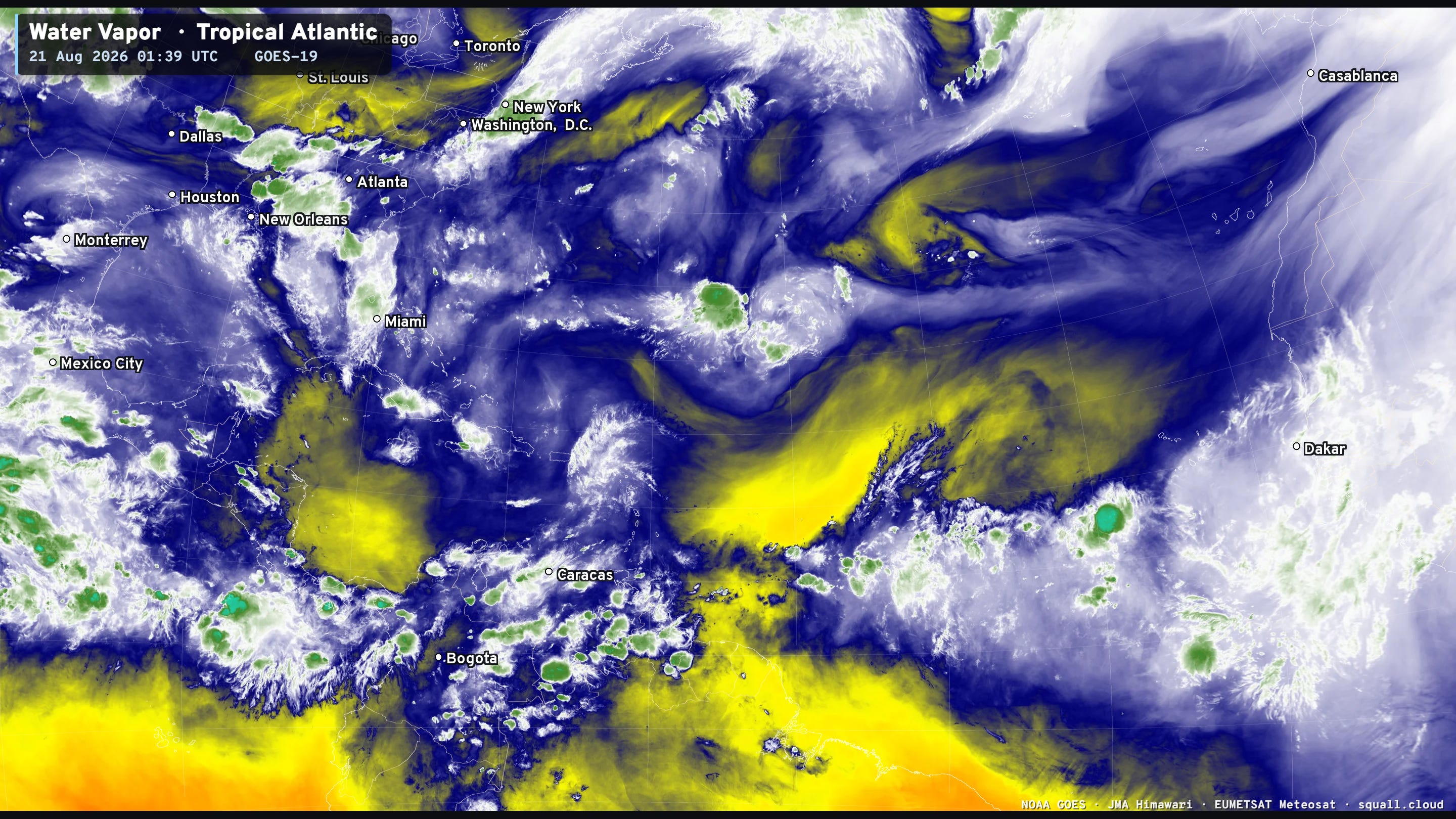
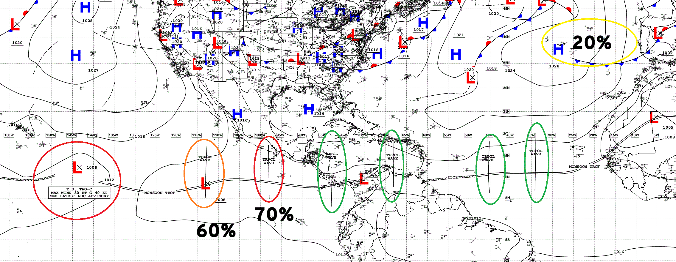
Multiple Atlantic tropical waves but all in hostile [dry] environment, but will have a chance to develop in the Eastern Pacific.
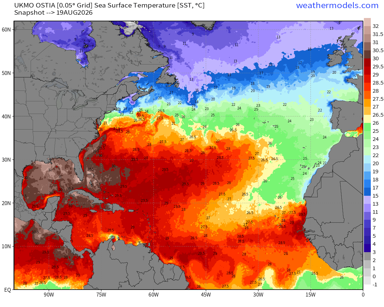
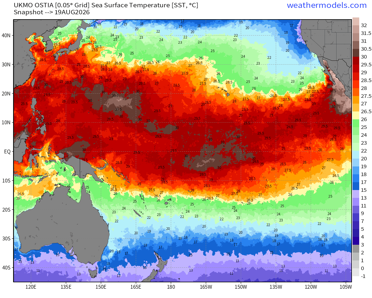
Very warm off Africa with 28.5°C to 30°C. The rest of the basin is also very warm including 30°C in the Gulf. The Caribbean is a bit cooler than normal but still plenty sufficient for any intensity hurricane. However, highly unlikely we’ll see one anytime soon in the “shear shredding” Caribbean.
NASA Dust (GEOS-5) 12z — Saharan Air Layers continue to cruise across the Atlantic doing damage to tropical waves and stabilizing the tropical environment with warmth and dry air combined with subsidence at low levels.
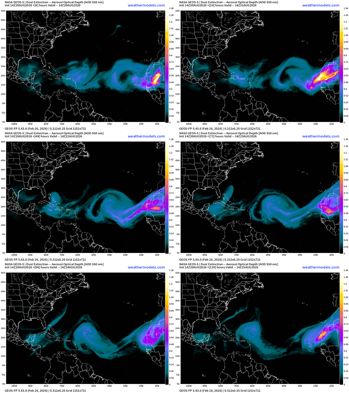
Still another large sandstorm over NW Africa that might or might not cut loose into the Atlantic. The intensity of the SAL + dust should markedly decrease heading into late August, but who knows with the El Niño.
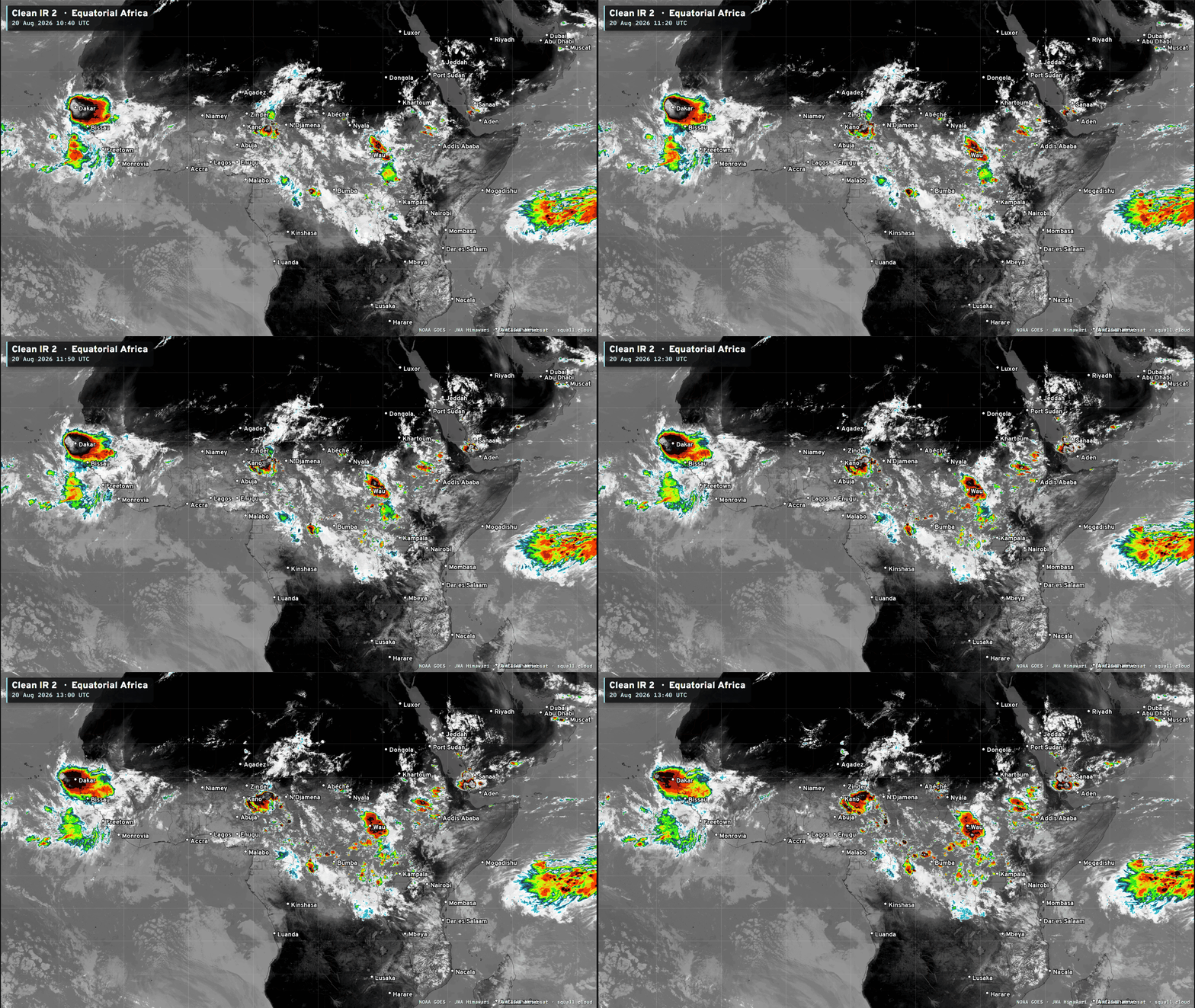
Very cool to see the African wave train lined up in sequence and firing huge convective blowups.
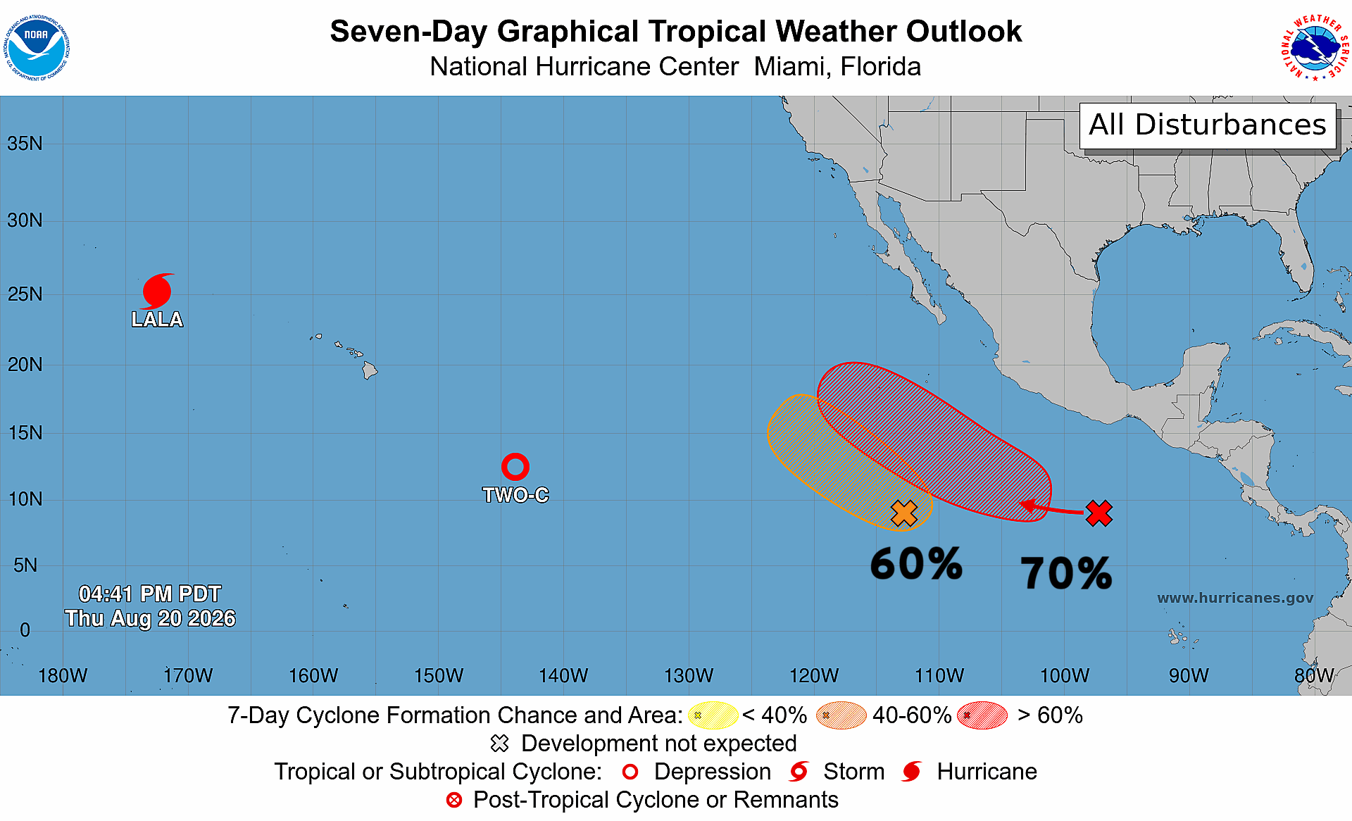
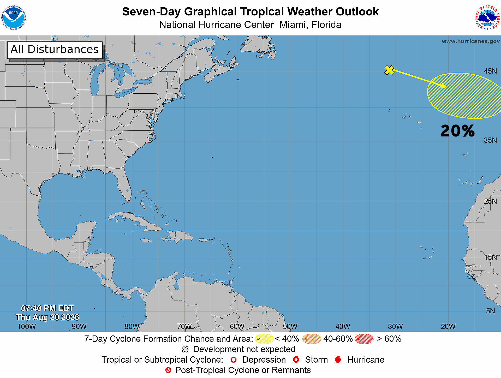
Multiple areas being watched — 4 total. And, ensemble support for the 2 Eastern Pacific systems + Tropical Depression (02C) to become Moke.
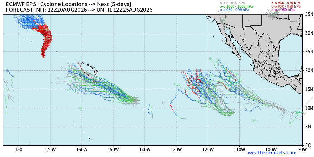
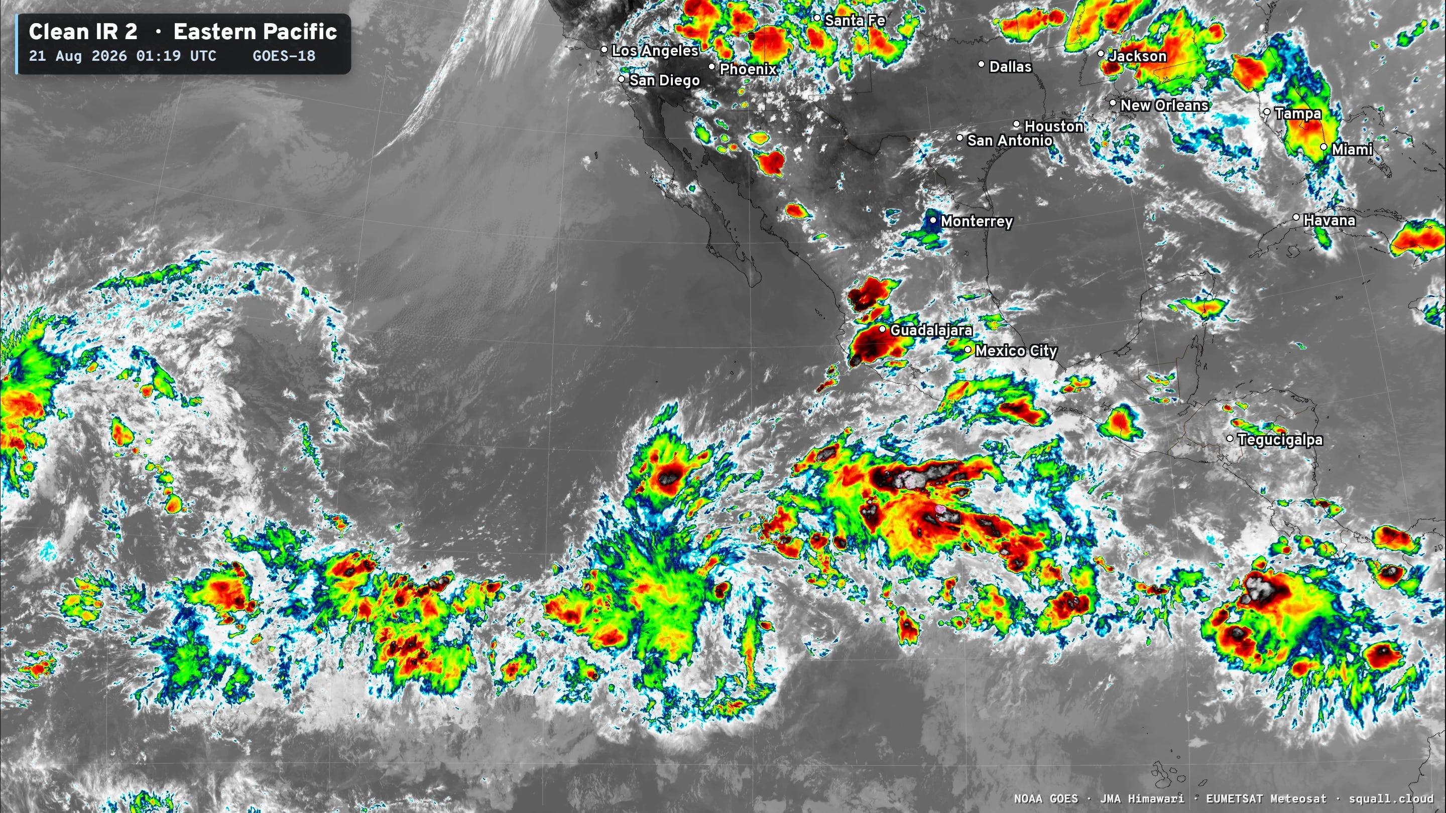
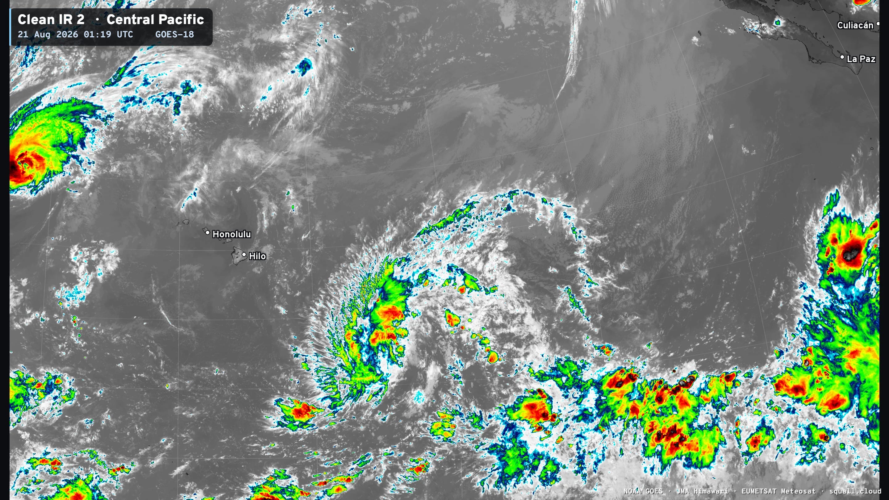
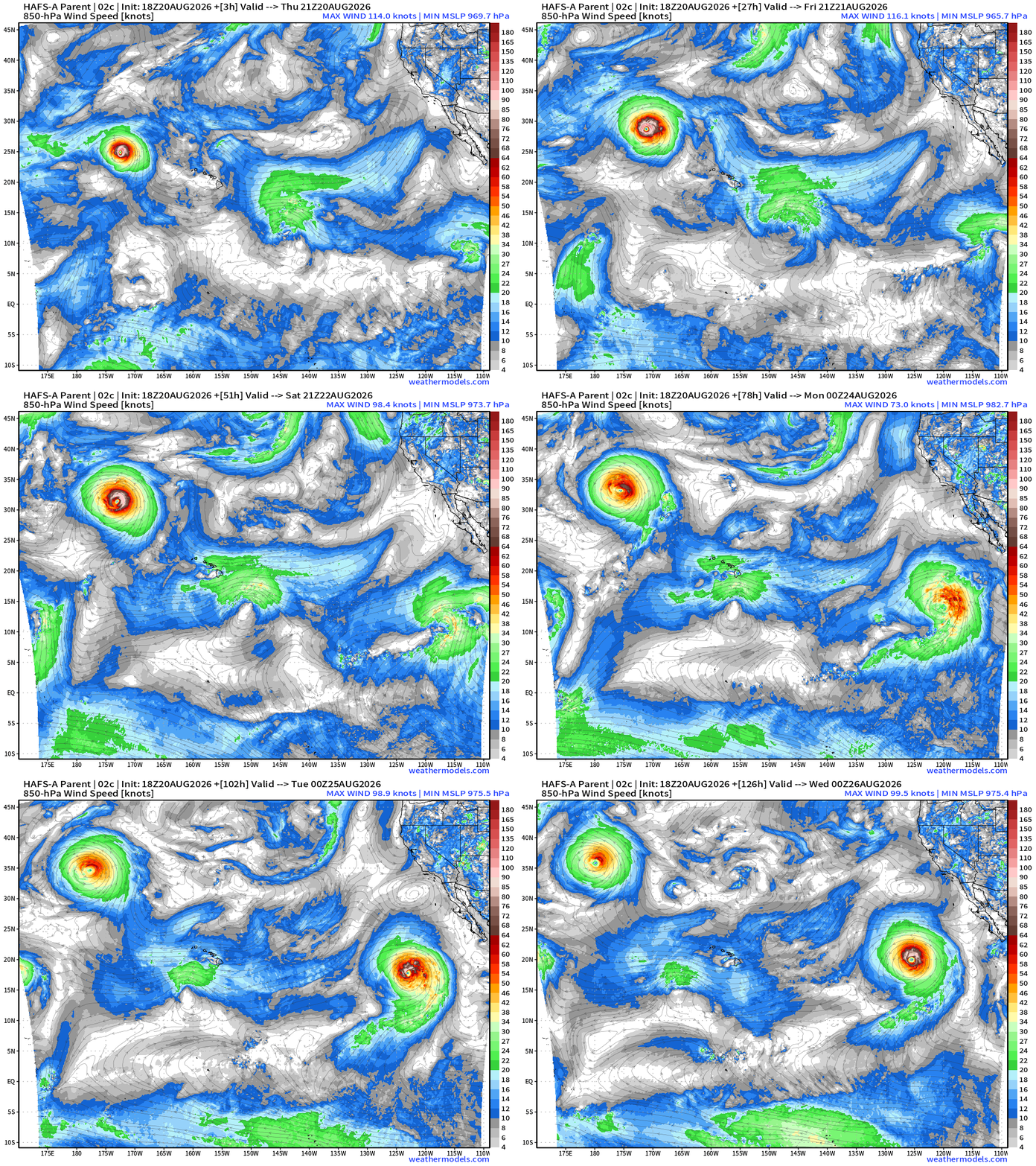
TD 02C —> Tropical Storm Moke but it really does not develop anymore in any models — Not sure why? That’s good news for Hawaii!
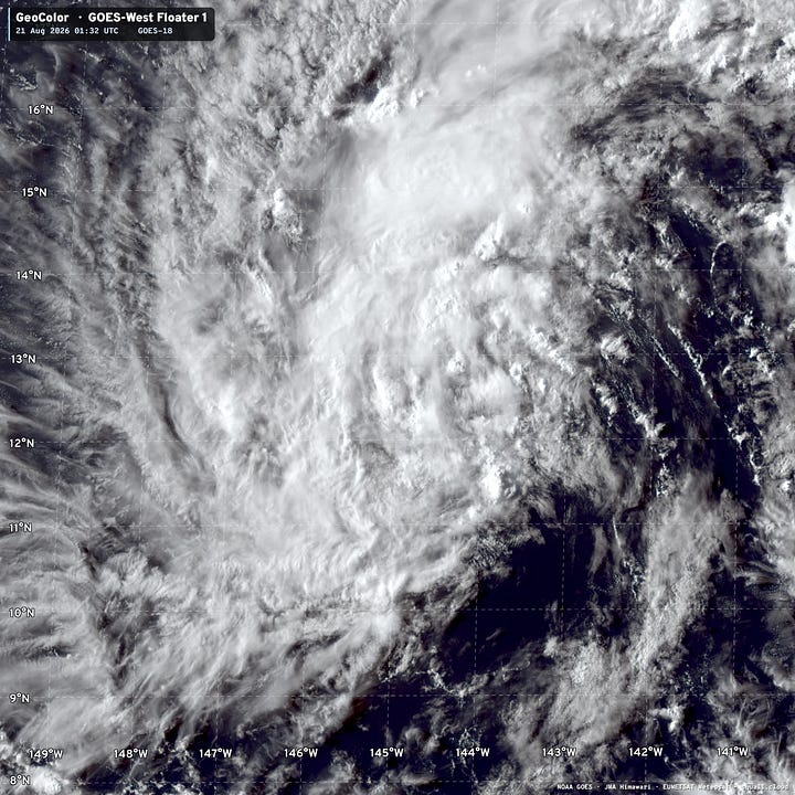
Visible satellite before bedtime for the tropical systems
Tropical Depression 02C has a large band of convection, but it has waned and become more sparse.
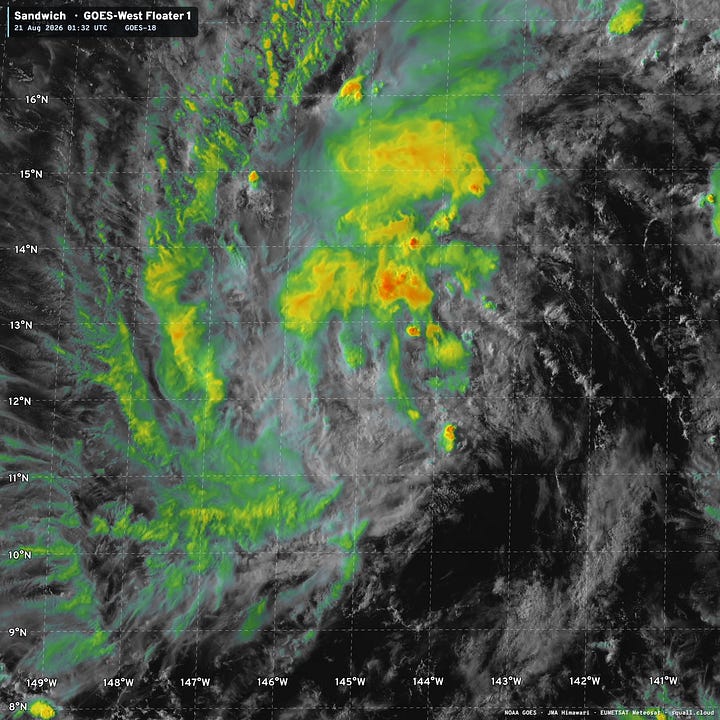
Thankfully the system will slide south of Hawaii Islands
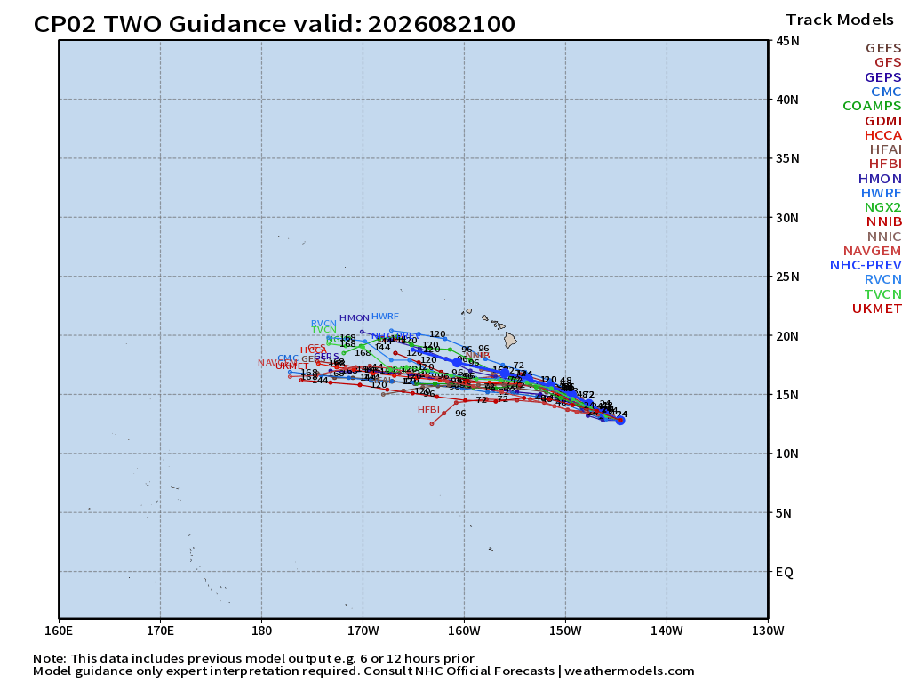
Tropical Depression 02C not expected any longer to become a hurricane.
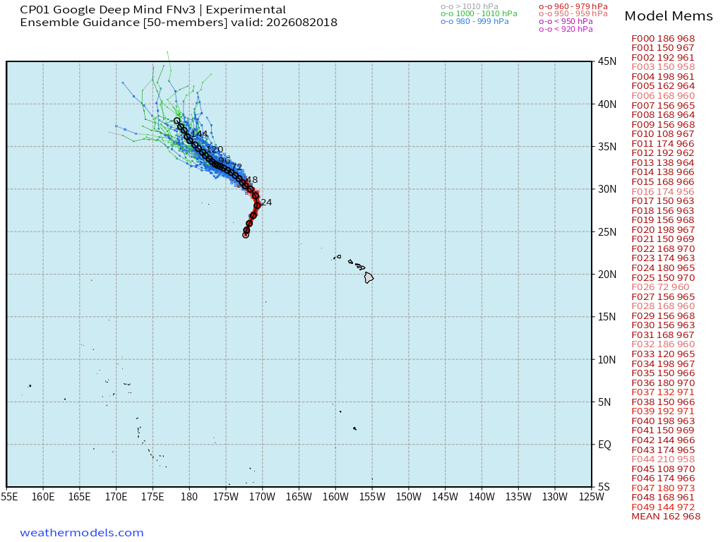
Hurricane Lala is still going over open water — mixing fish and adding ACE.
Ocean Temperatures very warm > 28°C south of about 20°N latitude — puts Hawaii in play for any developing TS/HU from the south
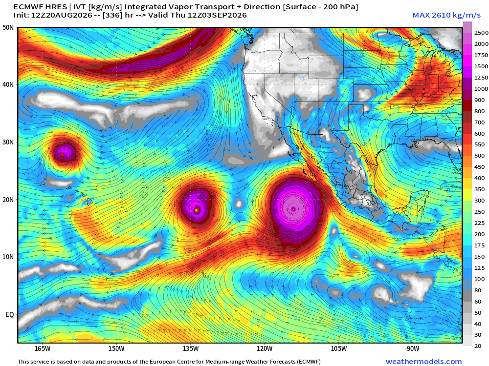
A lot more hurricanes to come in the Eastern & Central “El Niño fueled” hurricane factory. Here’s September 3rd HRES
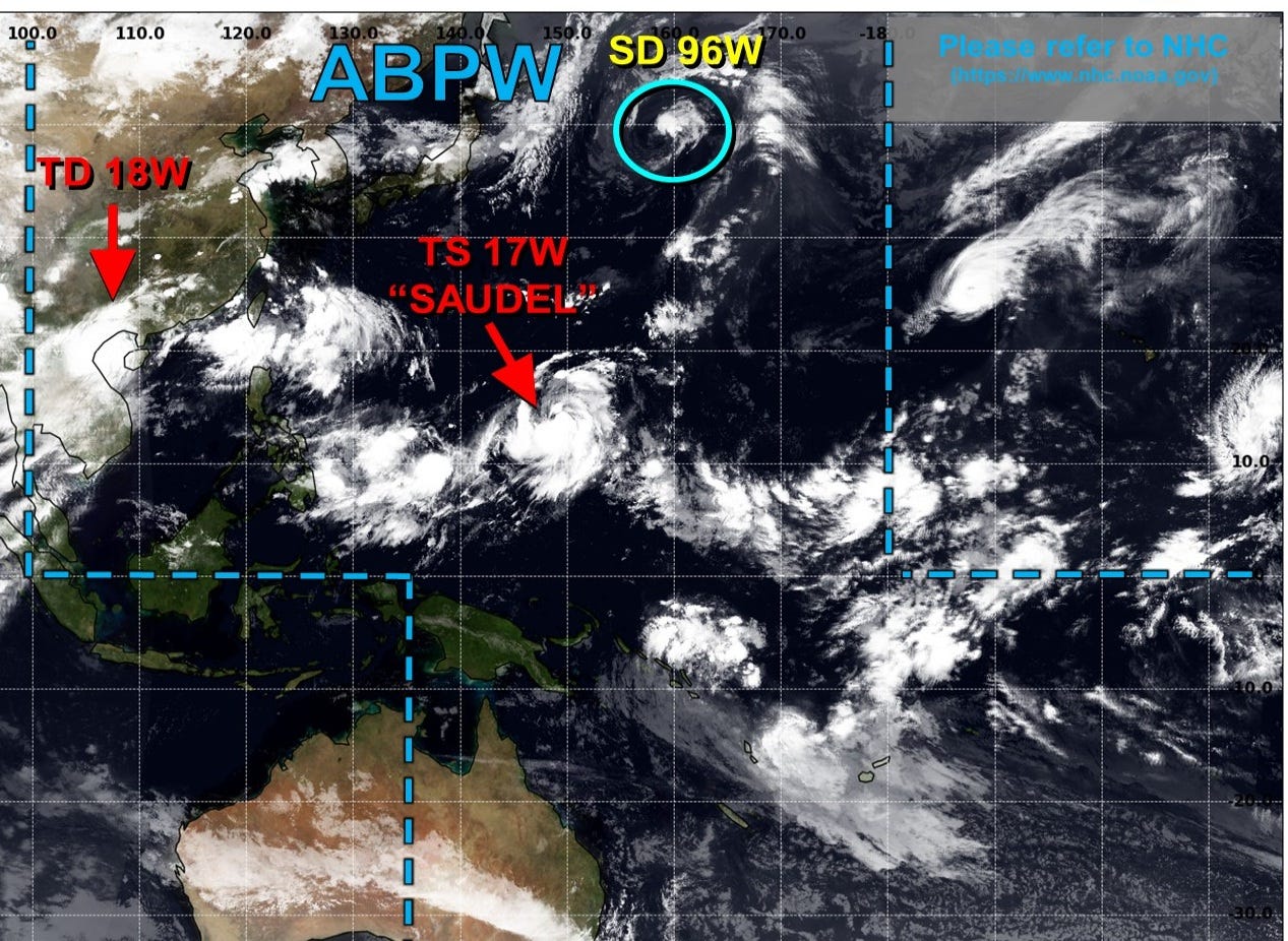
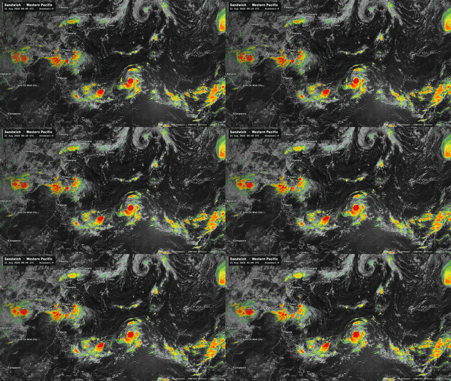
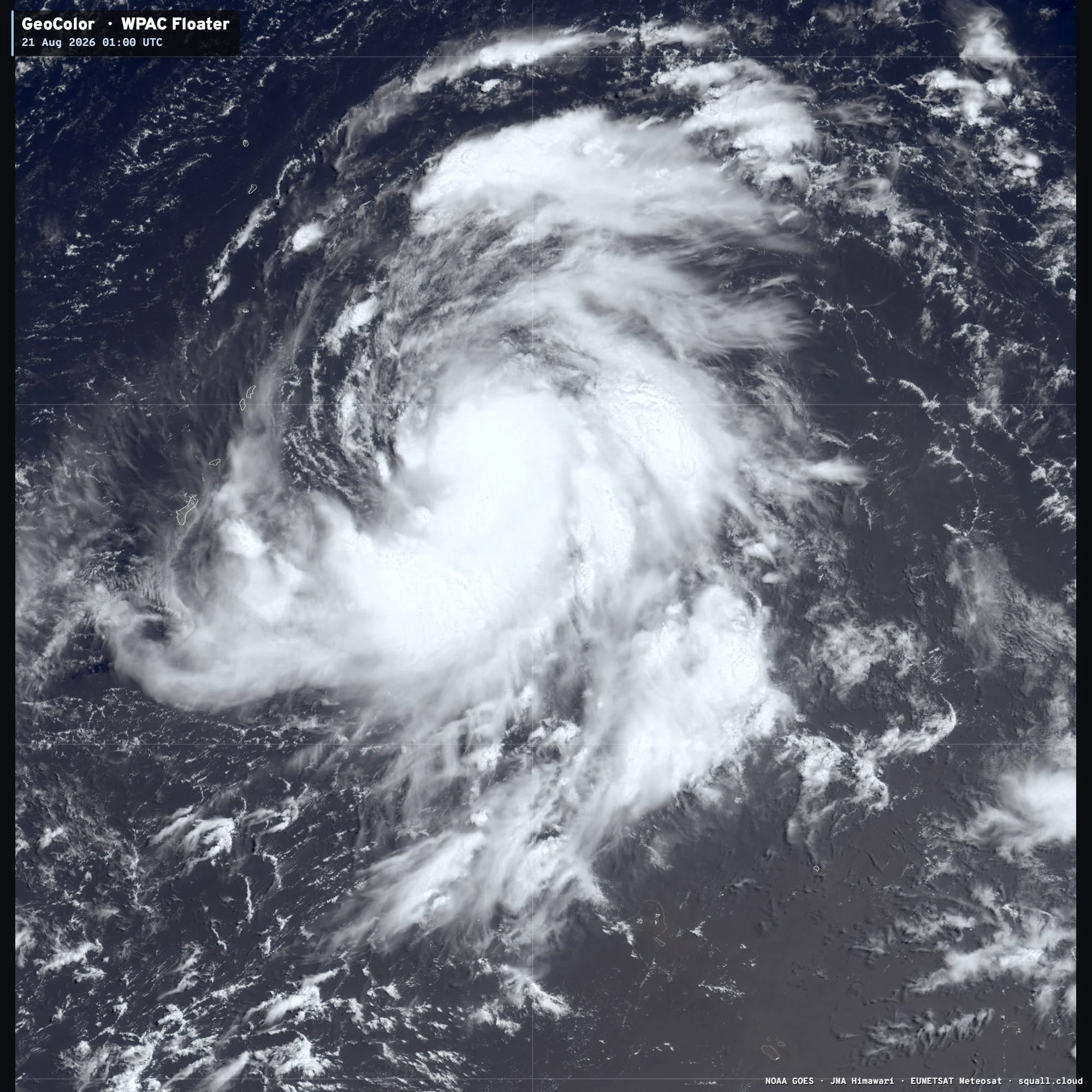
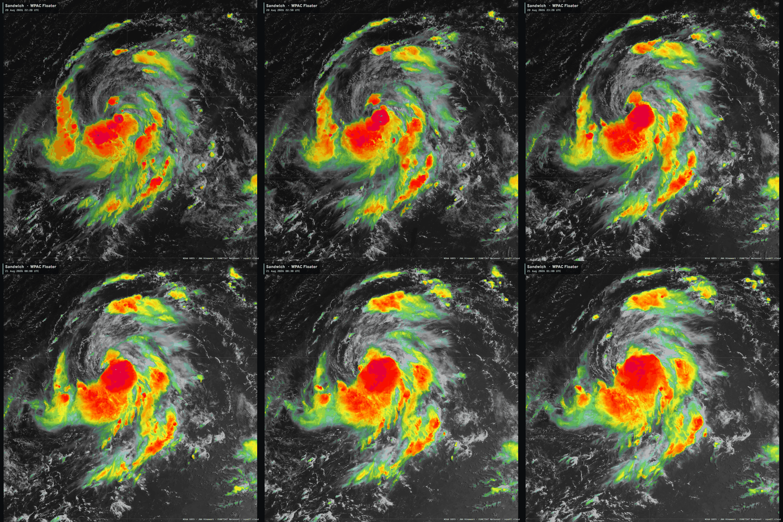
Tropical Storm Saudel (17W) just getting started —> Deep Mind members typical of high-end Category 4 or Category 5 in the 920s and 930s
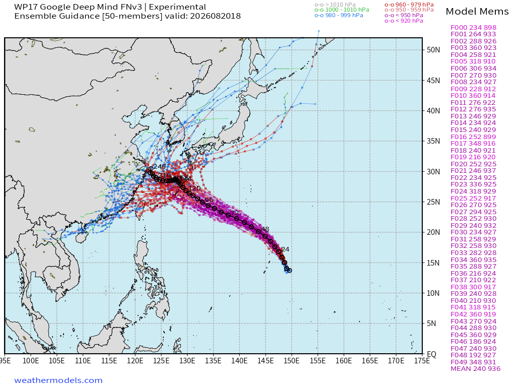
JTWC forecast track is NNW with a bend westward with latitude in 5-days
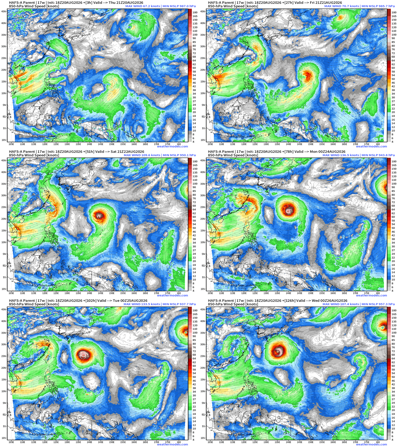
Will then track to area south of Japan in the next 5-6 days, and could become very intense e.g. Category 4/5: HAFS-A at 933 mb
Integrated Vapor Transport from ECMWF AIFS 18z — Next 10 days
My Atlantic Hurricane Season Forecast (2026)
From April 7, 2026: Atlantic Seasonal Hurricane Forecast: (11/5/2)
9-13 Named Storms (11 most likely)
4-7 Hurricanes (5 or 6 most likely)
1-3 Major Hurricanes (2 most likely)
Accumulated Cyclone Energy: 75-85 (well below normal)
NOAA 2026 Atlantic Hurricane Season Forecast
Comments
Nothing yet. Say the first thing.
Sign in to join the conversation.