
Every heritage traveler knows the feeling.
You pull into a town whose name you’ve read hundreds of times in history books. You expect to find exactly what you’ve imagined. Then, after spending a day exploring, you realize the real story is far more fascinating than the one you thought you knew.
That happened to me in Council Bluffs.
Like many people interested in the Lewis and Clark Expedition, I assumed Council Bluffs had always been...well...Council Bluffs. After all, the name appears throughout trail history. It recognizes the first meeting between the Lewis and Clark Expedition and a western Native tribe. Plus the location is associated with the great migrations along the Mormon, Oregon, and California trails, and, ultimately, the completion of the transcontinental railroad.
Except it wasn’t.
For much of its early history, this community was known as Kanesville, and the famous name “Council Bluffs” actually belonged somewhere else entirely.
Discoveries like this are why I love heritage travel.
The greatest rewards rarely come from checking famous sites off a list. They come from uncovering the unexpected connections that transform an ordinary stop into an unforgettable place.
When the Corps of Discovery ascended the Missouri River during the summer of 1804, one of President Jefferson’s instructions was clear: establish diplomatic relations with the Native Nations they encountered.
Lewis and Clark expected to hold what they called their “first council” with tribes somewhere along the middle Missouri. Early reports from traders suggested where that meeting might occur, but like many travelers relying on secondhand information, they discovered reality looked different on the ground.
After several days of searching, members of the Otoe and Missouria Nations finally arrived on August 2, and the formal council took place the following day on a commanding bluff overlooking the Missouri River in present-day Nebraska.
Captain Clark immediately recognized the site’s strategic importance, writing that it was perfectly suited for a future trading establishment and fort.
The Expedition named the location Council Bluff.
Not Council Bluffs.
Just Council Bluff.
Today, that historic location lies near present-day Fort Atkinson State Historical Park, where visitors can explore the reconstruction of a frontier fort built only fifteen years after the Expedition passed through. It remains one of the finest places to appreciate why Lewis and Clark believed this high ground would someday become an important military and trading post.
Meanwhile, about twenty miles downstream, another settlement was beginning to emerge.
Originally known as Traders Point, it became an important crossing along the Missouri River as fur traders, missionaries, Native communities, and eventually thousands of emigrants converged on the area.
In 1846 the town was renamed Kanesville, honoring Thomas L. Kane, whose assistance helped members of The Church of Jesus Christ of Latter-day Saints establish their temporary settlements along the Missouri River.
Here, Brigham Young was sustained as president of the Church inside the remarkable Kanesville Tabernacle, constructed in little more than two weeks by Mormon pioneers preparing for their journey west.
As the Mormon migration continued toward Utah, the growing river town searched for an identity that better reflected its expanding importance.
In 1852, community leaders adopted a name already famous throughout the West.
Kanesville became Council Bluffs.
The original Council Bluff remained where Lewis and Clark had named it nearly half a century earlier.
And thus emerges another personal discovery. Some history buff visitors know about the major Lewis and Clark museums and historic sites around Omaha and Council Bluffs.
Far fewer discover what I consider one of the greatest legacies of the Lewis and Clark Bicentennial.
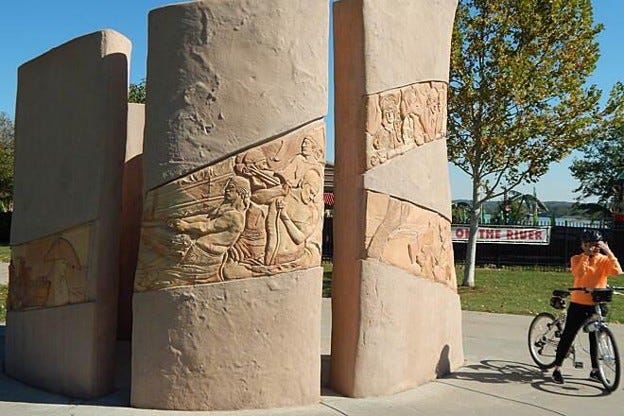
Scattered along both sides of the Missouri River in the greater Omaha and Council Bluffs area between Bellevue and Fort Atkinson is a remarkable collection of interpretive sculptures known as the Lewis and Clark Icon Trail.
Rather than one destination, the project invites travelers to experience the Expedition through a series of artistic installations stretching across the landscape where history unfolded.
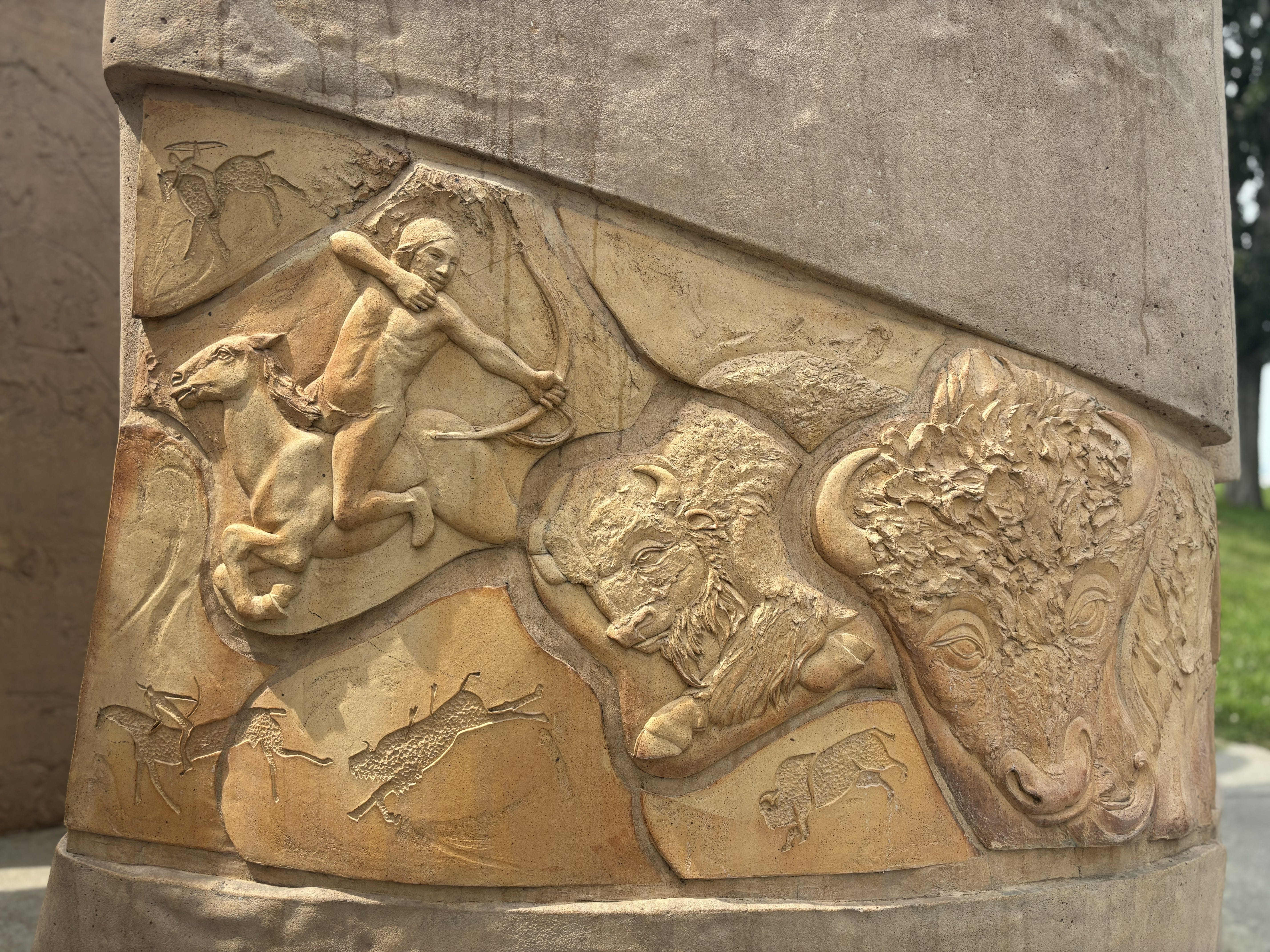
Each stop interprets a different chapter of the journey.
Some celebrate Native cultures. Others explore wildlife, river ecology, York’s contributions, the Expedition’s boats, or the Corps’ remarkable scientific observations.
Together they create an outdoor museum that many travelers drive past without ever realizing it exists.
There are nine sculptures in total on this Lewis & Clark Icon Trail.
As the link to the booklet states, “the most visible features at nine of the 15 interpretive sites are the 10 to 14‑foot tall concrete sculptures,” and then notes that two of these sculptures are six‑segment pieces and the other seven are single‑segment pieces.
This unique history and art project tells the story of the expedition through exhibits and sculptures in 15 parks and public spaces along both sides of the Missouri River. Across these sites, visitors also encounter 32 wayside exhibits (one to six per location), including six audio pieces featuring Otoe, Missouria and Omaha voices.
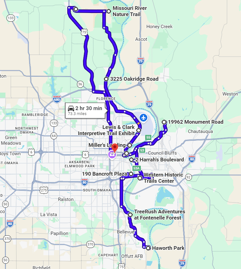
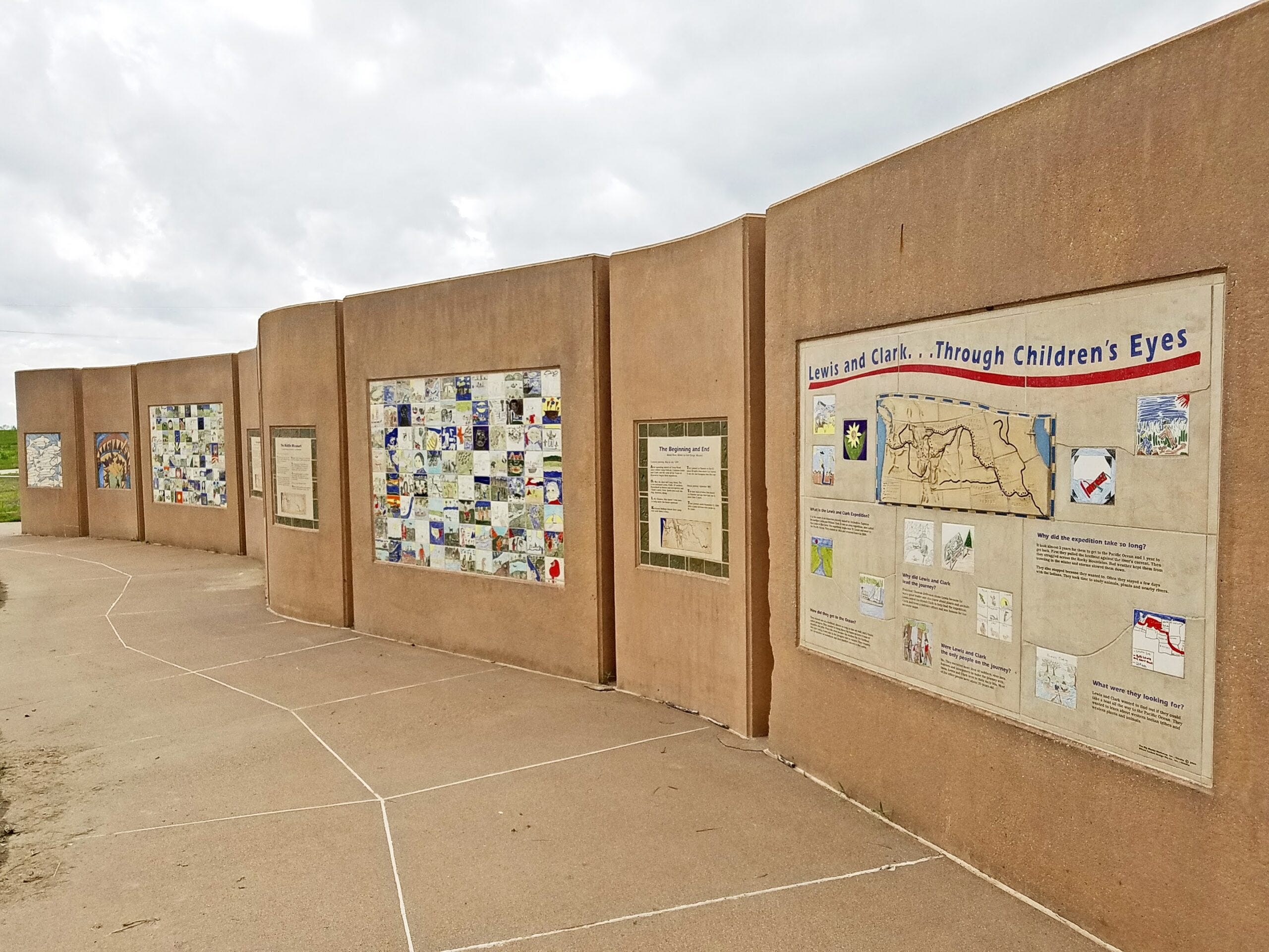
Begin at Haworth Park, where the Children’s Lewis & Clark Art Wall showcases ceramic artwork inspired by more than 700 students from communities along the Expedition route. Their interpretations remind us that every generation discovers Lewis and Clark in its own way.
At Lauritzen Gardens, an icon sculpture celebrates one of the Expedition’s botanical discoveries—the Osage orange, prized by Native Nations for crafting exceptional hunting bows.
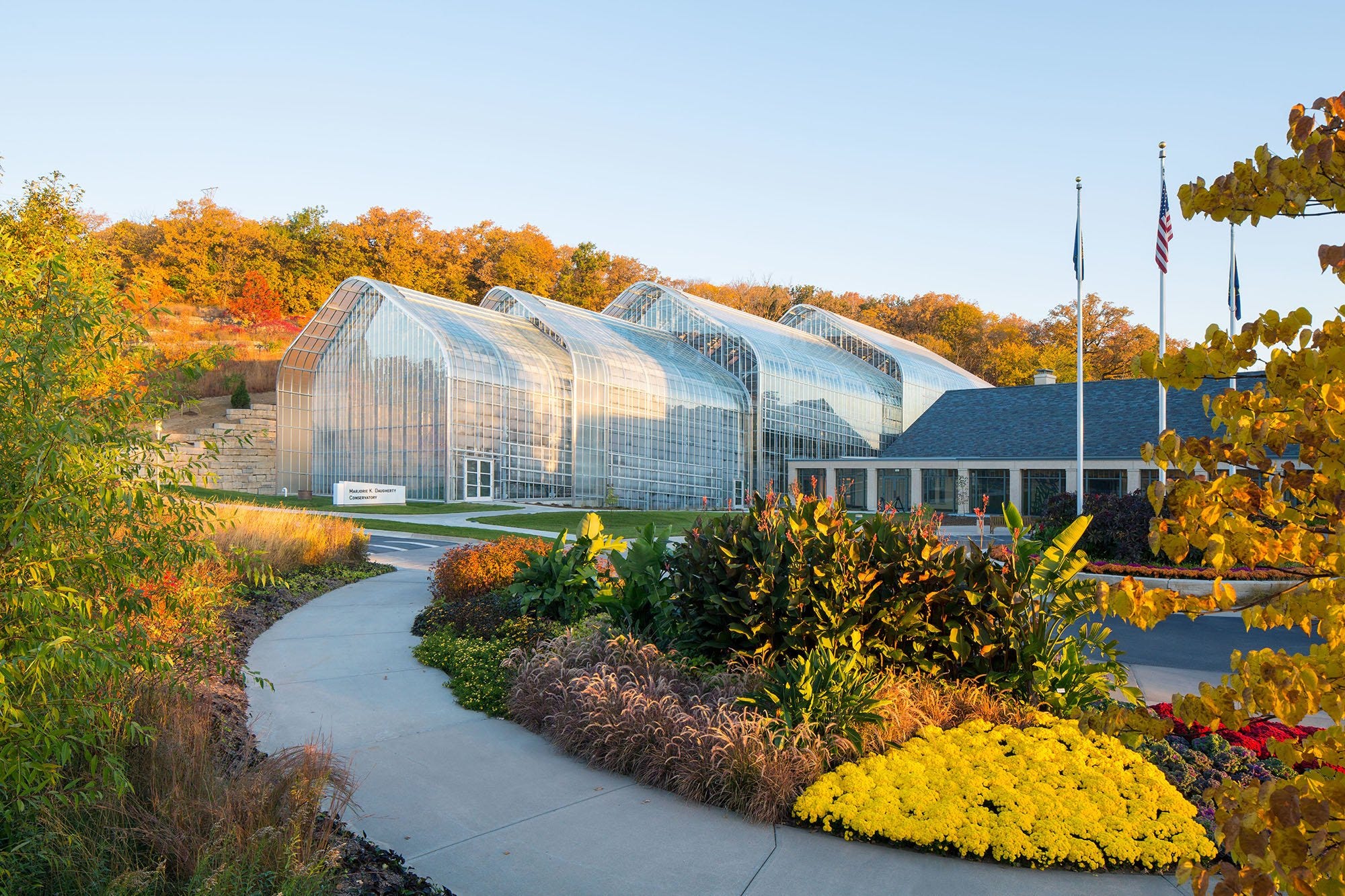
Continue north to Lewis and Clark Landing, now transformed from an industrial riverfront into one of Omaha’s premier public parks overlooking the Missouri River. Also on the riverfront is the National Park Service Regional Office and the headquarters of the Lewis and Clark National Historic Trail.
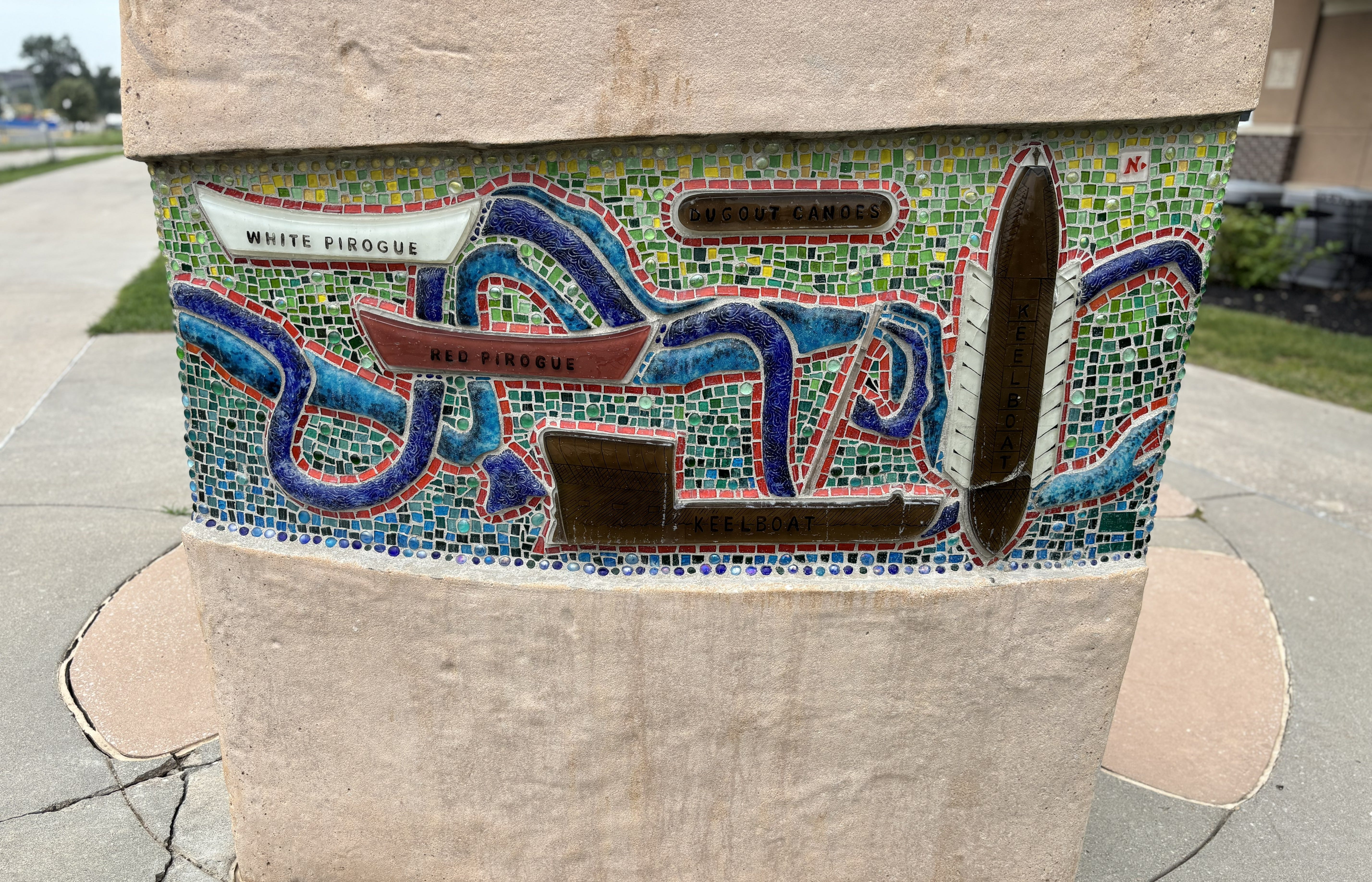
At the Dodge Riverside Golf Club (Iowa), “Missouri River Transit” illustrates the boats used on the Expedition. Artist Marcia Joffe-Bousaksi
The Western Trails Center building is not currently open, but the Icon Sculpture is a short walk from the Council Bluffs Recreation Complex Parking lot. There are connecting trails along the river bank and levee to walk and bike. Additionally, there are two wayside Exhibit panels in the baseball/softball complex.
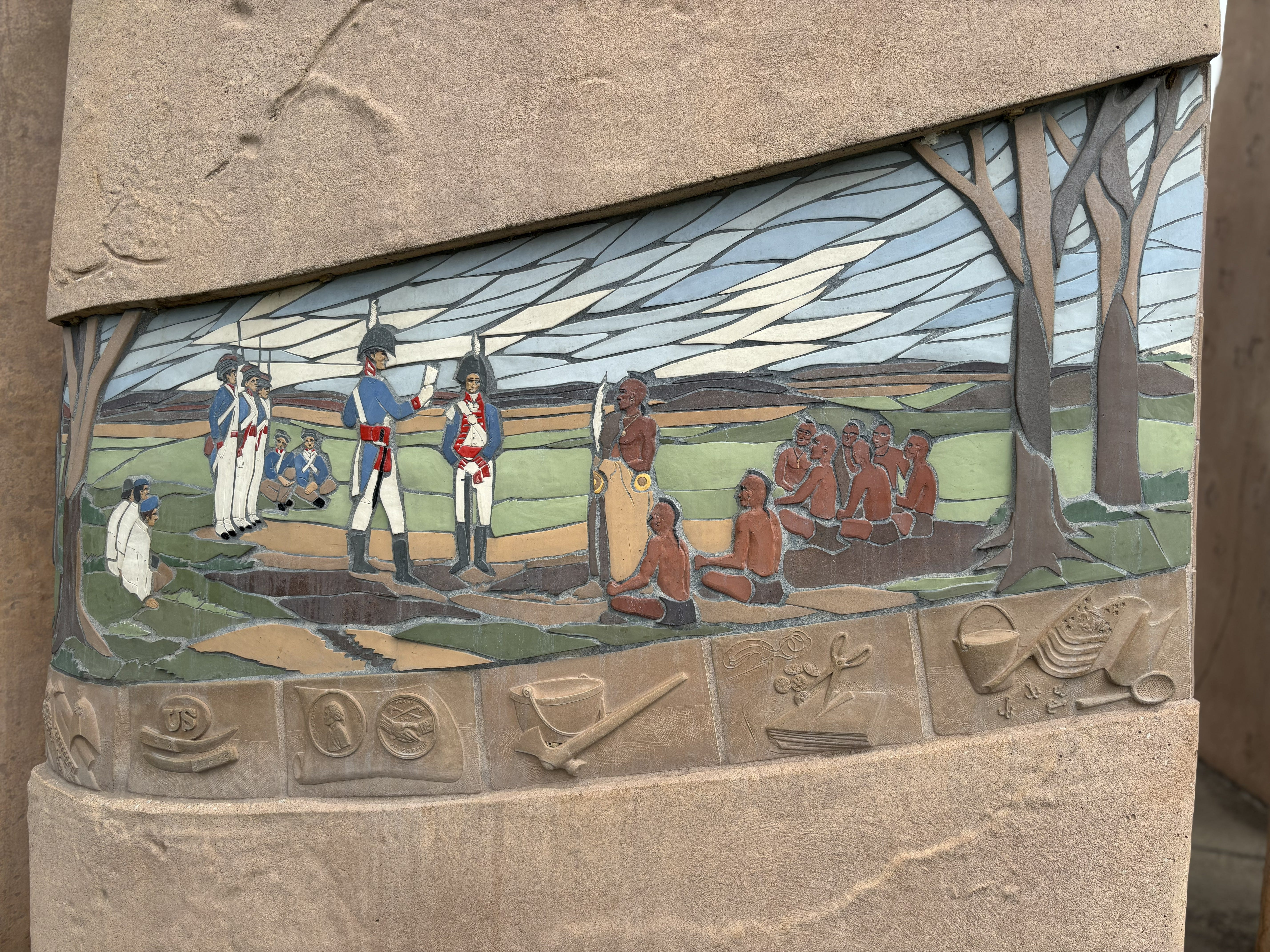
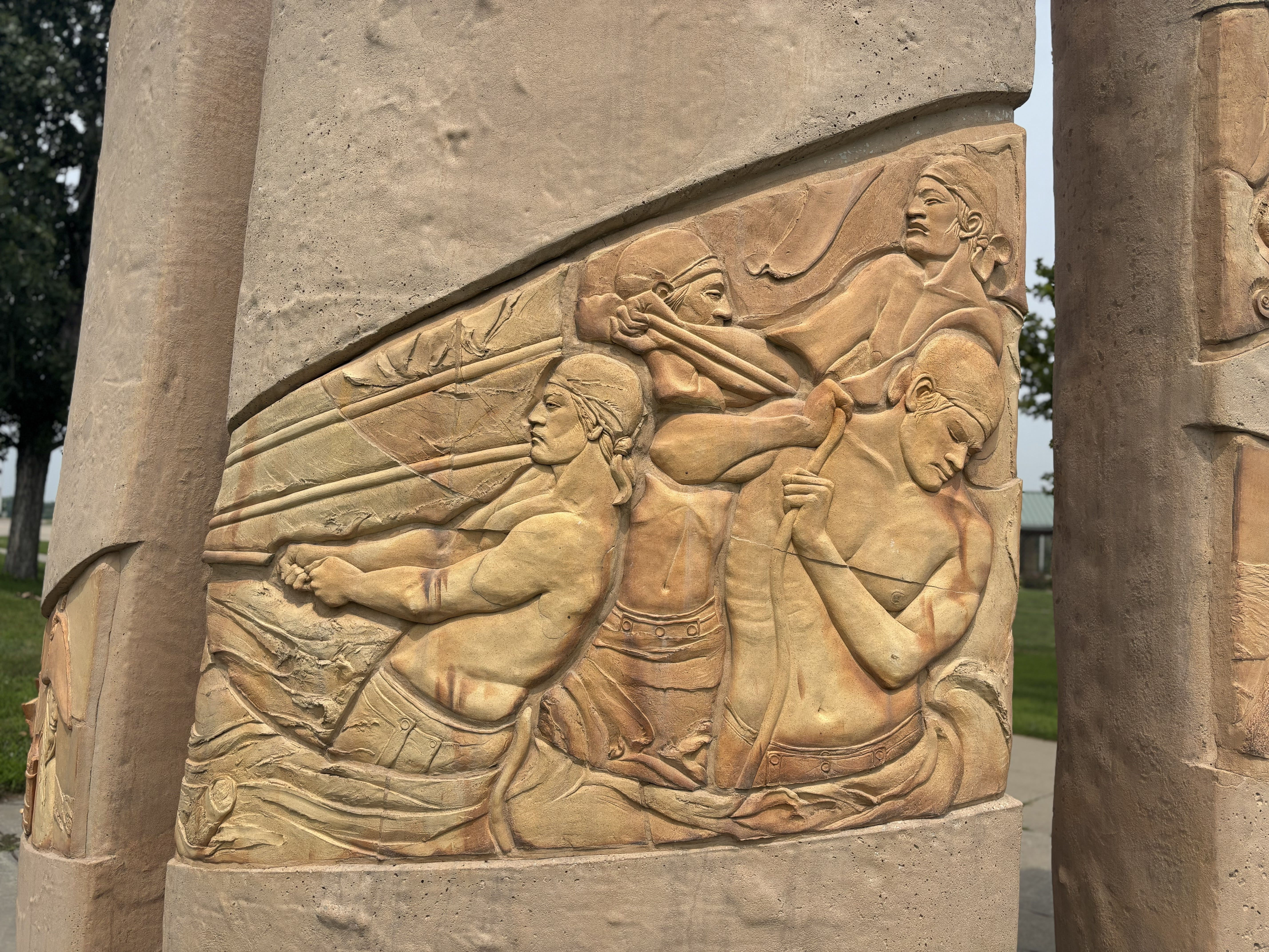
The shape of the sculpture at Millers Landing, designed to represent a river eddy, also conveys a feeling of personal discovery as you walk into the sculpture. Its shape was used as a logo on the wayside and orientation exhibits and other materials. The artwork on this Icon “A Panoramic Rendering of the Journey of Discovery” provides an overview of the Expedition, from bison on the plains, meetings with the Indian tribes, to dragging the keelboat up the Missouri and Lewis describing events in his journal.
At Levi Carter Park, exhibits focus on York and the diverse members of the Corps while also exploring how the ever-changing Missouri River has continually reshaped both the landscape and state boundaries.
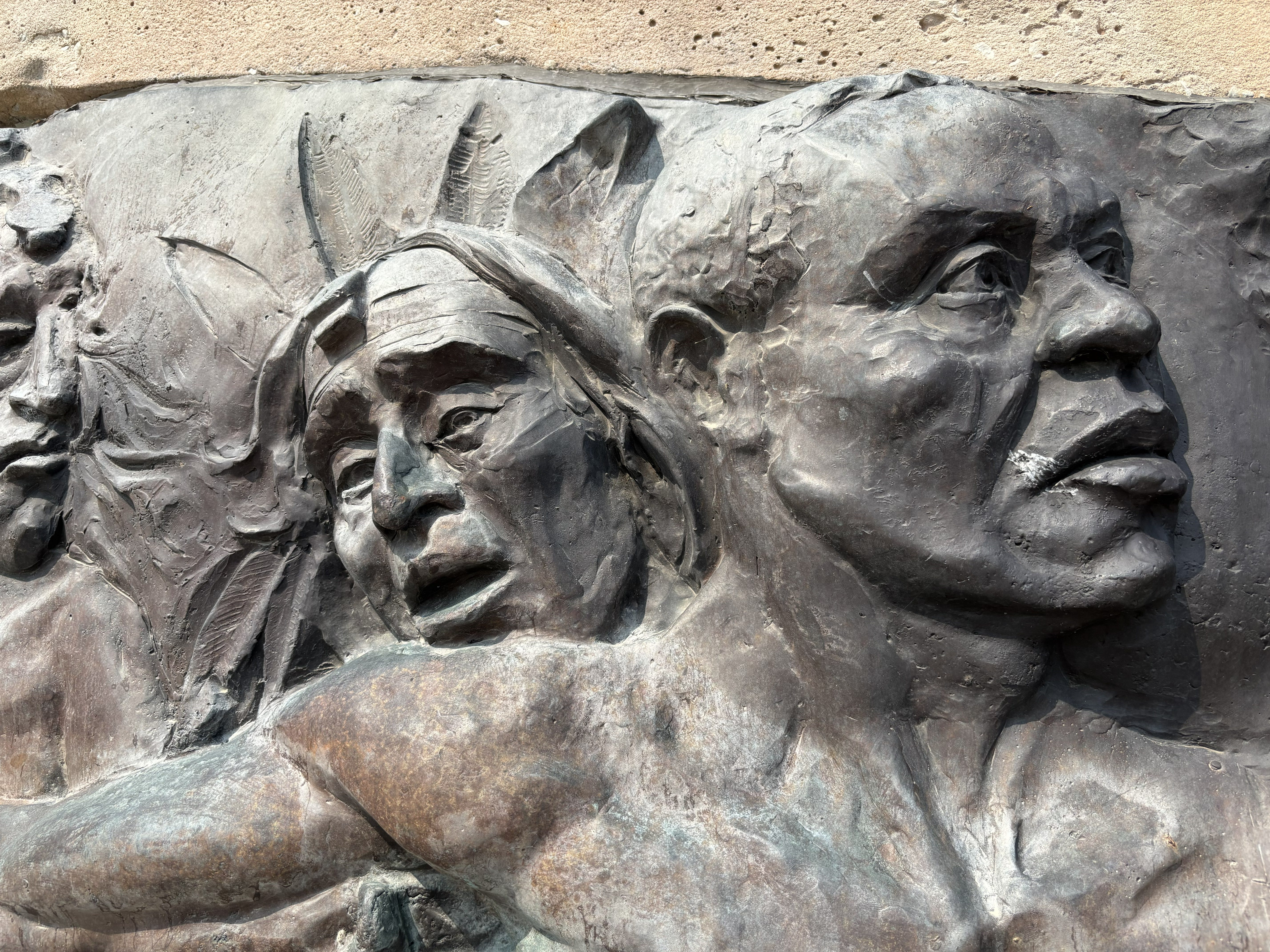
Further north, N. P. Dodge Park commemorates the Expedition’s first formal council with the Otoe and Missouria Nations.
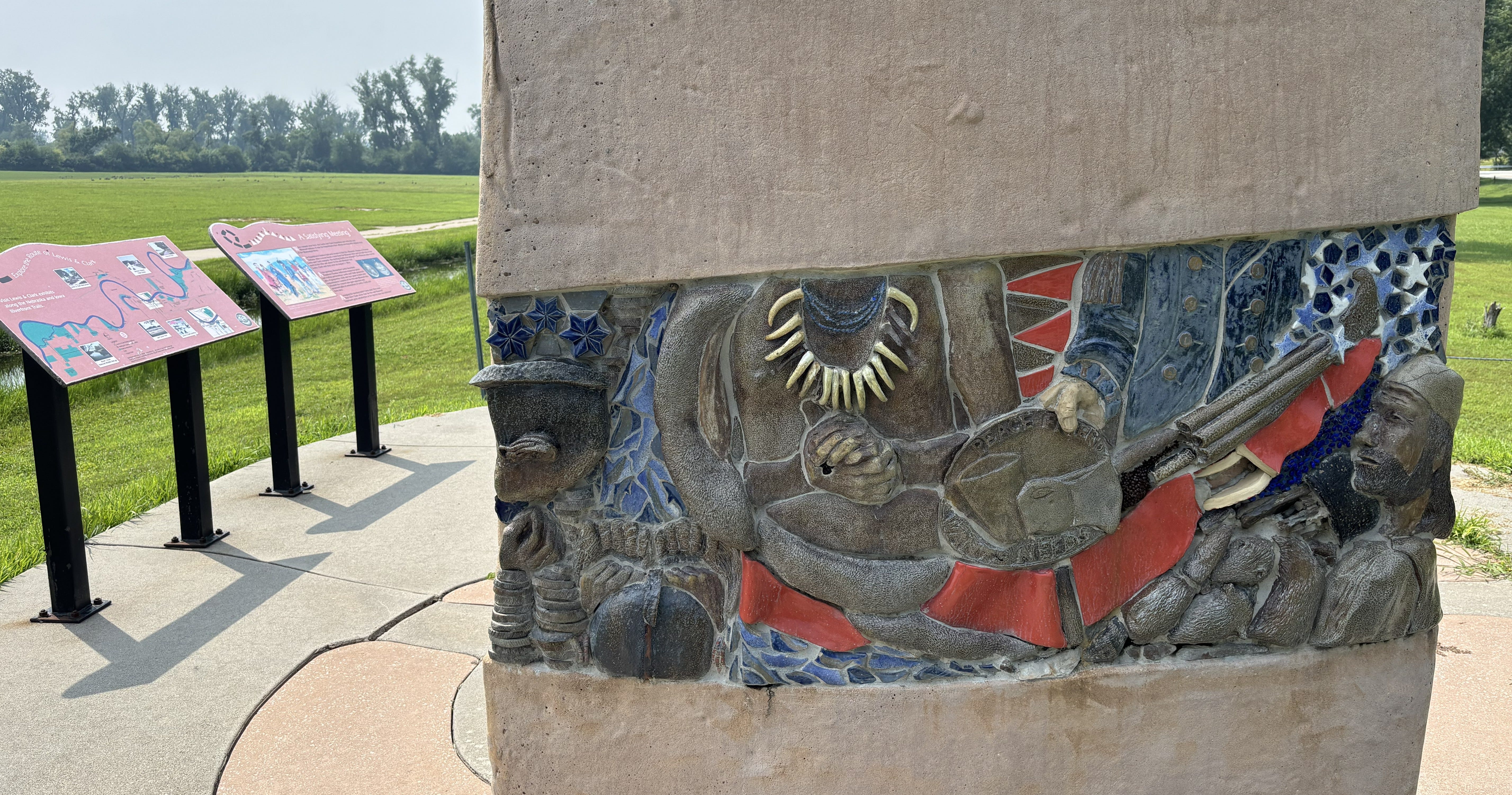
Nearby, Boyer Chute National Wildlife Refuge reminds visitors that understanding the Missouri River itself remains essential to understanding the Expedition.
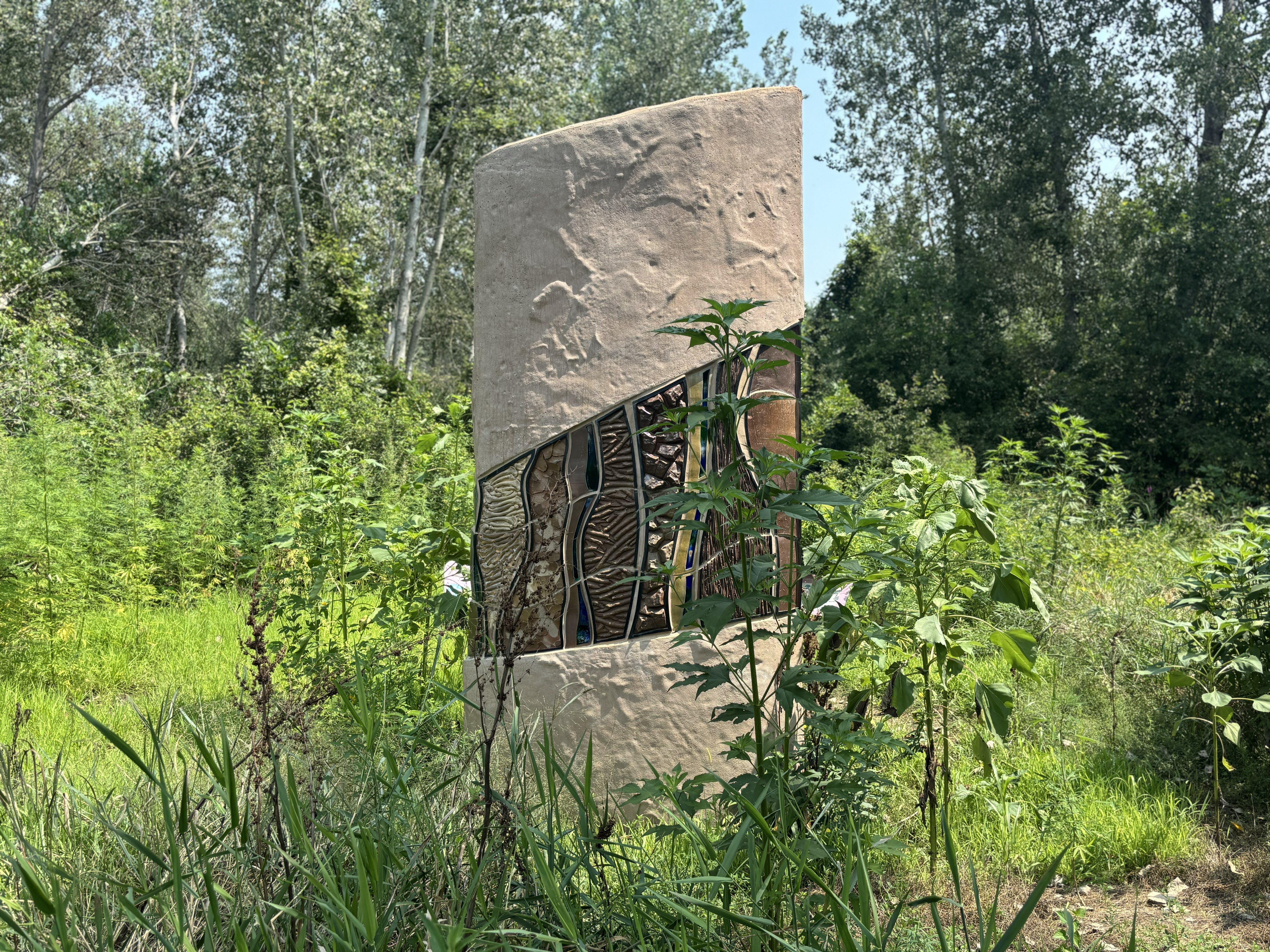
The journey concludes naturally at Fort Atkinson State Historical Park, where the reconstructed fort stands near the location Lewis envisioned as an ideal military outpost overlooking the Missouri.
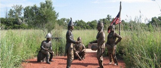
If time allows, several additional attractions enrich the experience:
Lewis & Clark National Historic Trail Headquarters & Visitor Center along Riverfront Drive in Omaha is a great place to start your journey, especially in the Omaha/Council Bluffs area.
Lewis and Clark Monument Park in Council Bluffs for panoramic views across the Missouri River Valley, expedition monument as well as an Icon statue.
Bob Kerrey Pedestrian Bridge, gracefully spanning the Missouri River where visitors can stand in both Nebraska and Iowa at once. Access the Nebraska side from Lewis and Clark Landing.
The Durham Museum, housed in Omaha’s magnificent Union Station features a permanent Lewis & Clark Expedition exhibit.
Hoff Family Arts & Culture Center in the Historic Haymarket District houses original Grant Wood paintings of Kanesville and the Lewis & Clark dioramas formerly at the Western Historic Trails Center.
Hike the magnificent Loess Hills National Scenic Byway of Western Iowa, starting at one of Pottawattamie County’s beautiful parks.
The Joslyn for its outstanding collection of American and Native art.
Steamboat Bertrand Museum, artifacts from a perfectly preserved Missouri River steamboat.
Mormon Trail Center at Historic Winter Quarters for the remarkable story of the Mormon migration west.
Historic General Dodge House, home of Civil War general Grenville Dodge.
Union Pacific Museum, housed in a beautifully preserved 1903 Carnegie Library, it tells the story of the railroad that helped transform America.
I’ve learned that the most memorable discoveries sometimes don’t appear on the cover of a travel brochure. Sometimes they’re hidden inside a town’s forgotten name. Sometimes they’re found in a sculpture tucked beside a bike trail.
Sometimes they’re revealed only after standing on a bluff where Lewis and Clark looked across the Missouri River and imagined what the future might hold.
Council Bluffs taught me that heritage travel isn’t simply about visiting famous places.
It’s about discovering the stories that connect them.
And occasionally, it’s about realizing that one of America’s best-known trail towns began its life with an entirely different name.
We are grateful for the generous support of our corporate and travel partners whose sponsorship helps make this work possible. When planning your travels along the Lewis and Clark Trail, we encourage you to support the businesses and organizations that invest in preserving and sharing these stories—your patronage helps sustain both the trail and the experiences that bring its history to life.



No posts
Comments
Nothing yet. Say the first thing.
Sign in to join the conversation.