
A sudden warming event has recently occurred in the Southern Polar Vortex in mid-August. Before you go packing up your ski gear, let’s take a look at what this means for the tail end of the winter season.
Southern Polar Vortex disturbances—technically classified as minor events—are becoming a regular fixture in our winter and spring climate cycles. In fact, we have seen notable disruptions happen almost every year since the massive landmark event of 2019.
Here’s a quick snapshot of our recent timeline:
2019 Event: A massive warming event dramatically weakened the Antarctic vortex, leading to an early breakup and a historically small ozone hole.
2024 Events: An unprecedented series of rare, back-to-back mid-winter disturbances in July and August caused consecutive warming pulses and a significant splitting of the vortex.
2025 Event: Another rare late-winter sudden stratospheric warming pulse heavily disrupted the polar vortex circulation.
These minor disruptions are not to be mistaken for their big, rare sibling known as a major Sudden Stratospheric Warming (SSW) event. There is no indication yet that this latest hiccup will turn into a full, wind-reversing SSW. However, these pulses absolutely “poke the bear,” making the vortex highly volatile and well worth monitoring.
Over the last 7 to 10 days, a large bubble of warm air has been ingested into the polar vortex in the upper stratosphere, roughly 30 km above the South Pole. This intrusion happens when giant planetary waves from the lower atmosphere break upward into the stratosphere. They dump heat directly into an atmospheric fortress that is ordinarily a frigid, tightly bound ring of hurricane-strength winds.
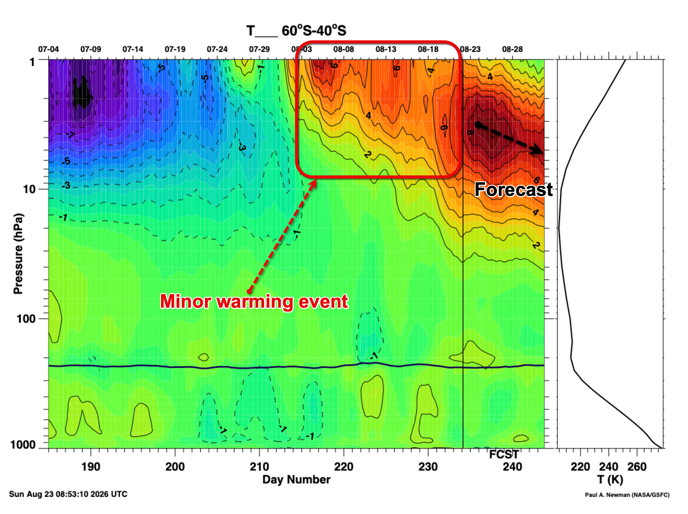
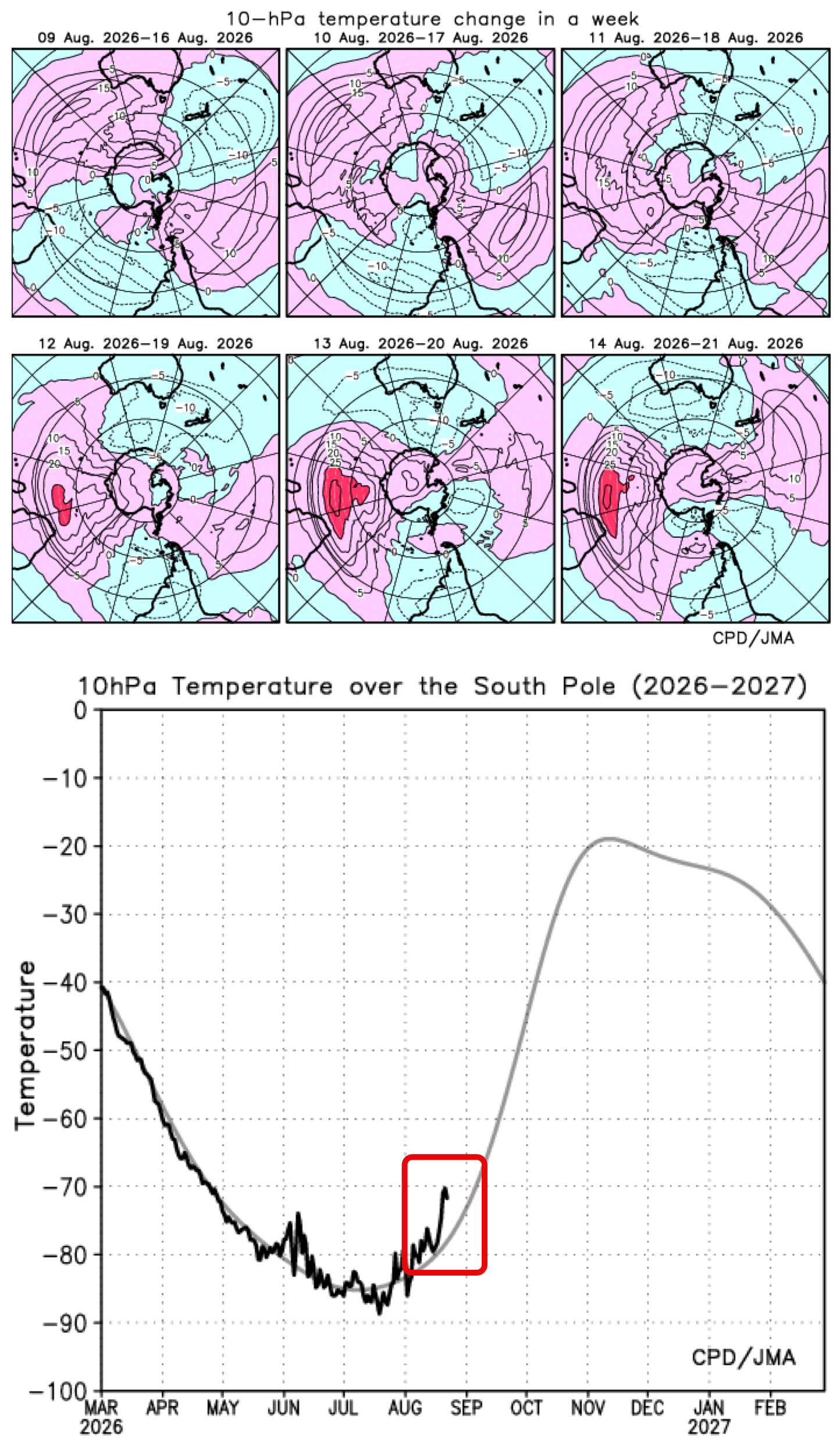
This sudden heat injection is expected to degrade and weaken the circulating winds of the polar vortex over the coming weeks.
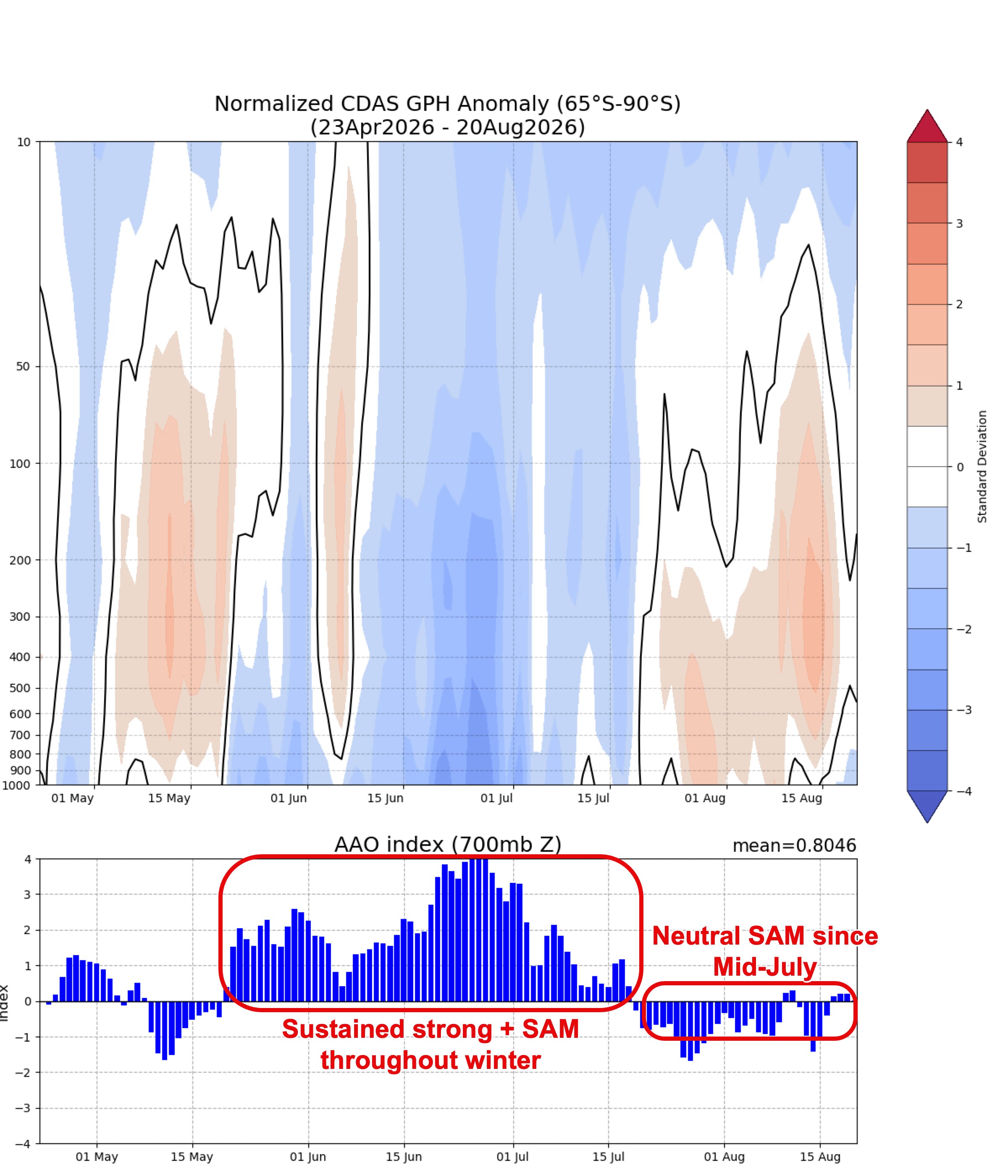
Interestingly, for much of this winter, the vortex was actually colder and stronger than average. This upper-atmosphere strength trickled down to the surface, pinning the cold fronts south and locking us into a persistent, dry Positive Southern Annular Mode (+SAM) phase. This recent disruption is about to turn that pattern completely on its head.
With the downward propagation from the stratosphere into the troposphere (where our weather happens), there is usually a 3-to-4 week lag. Because of this, we can expect the SAM to transition into a deep negative phase over the coming weeks, expanding westerly winds across southern Australia
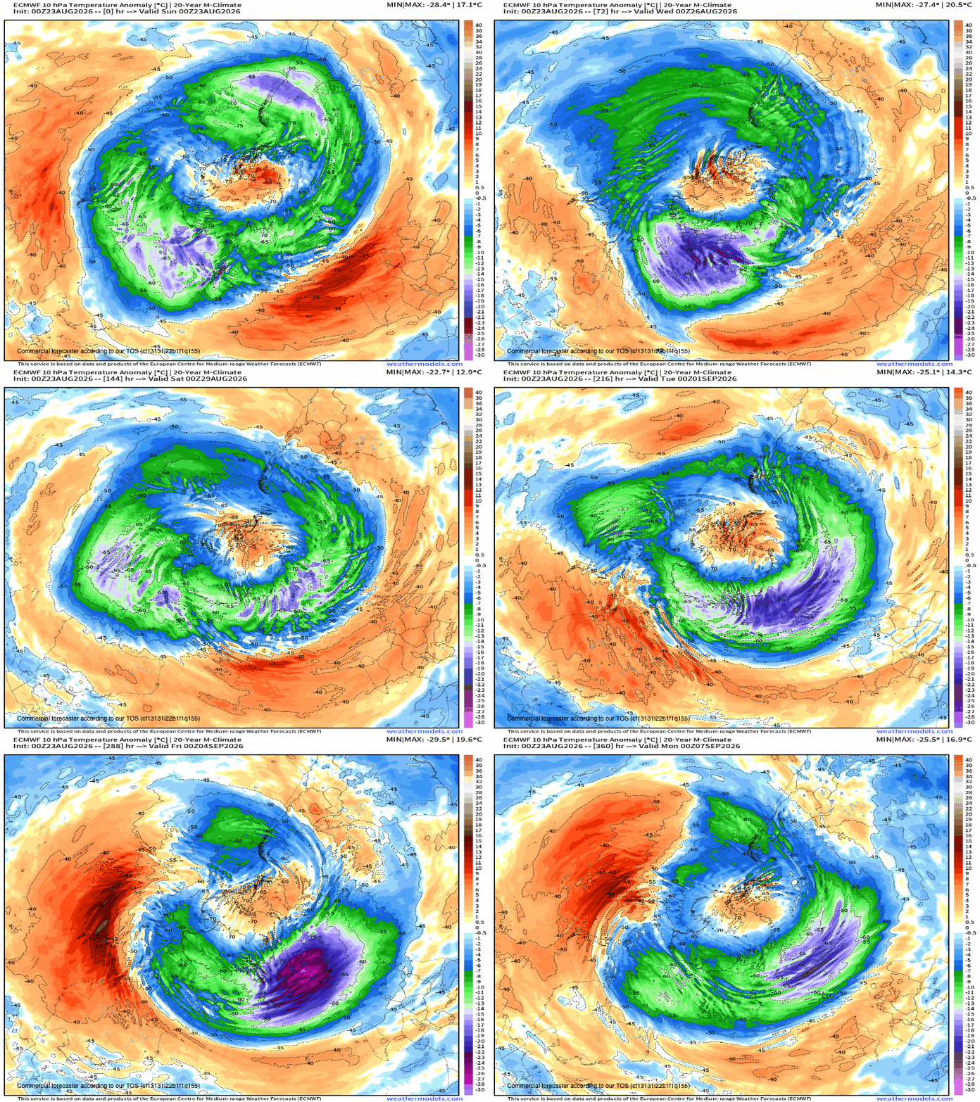
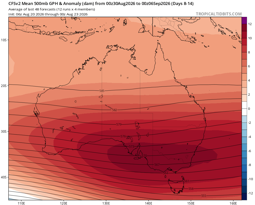
While this expansion does not guarantee rain-bearing frontal systems for the southeast mainland, it is a step in the right direction. Ultimately, this shifted airflow will direct warm, dry air masses out of the interior and across the southeast, unfavourably impacting the spring snowpack.
Here is what we can expect from the second and third week of September:
Strong Winds: Elevated wind speeds across Tasmania and the southern coasts of the mainland.
Increased Rainfall: Higher rainfall totals restricted to western and central Tasmania.
Warm, Dry Air: Elevated temperatures and lower humidity across Victoria and the alpine region.
Alpine Dust & Thaw: Increased dust settlement on the snowpack, lowering the surface reflectivity and accelerating the spring thaw.
Rain for the alpine early-mid week, this week with 30- 40 mm expected on the main range by Wednesday. A return to warm, springlike conditions for the remainder of the week, with unfortunately no snow systems in the long-term outlook. It is worth considering alternate plans for September, as snowmaking (if not already shelved for 2026) and lift operations will struggle beyond next week.
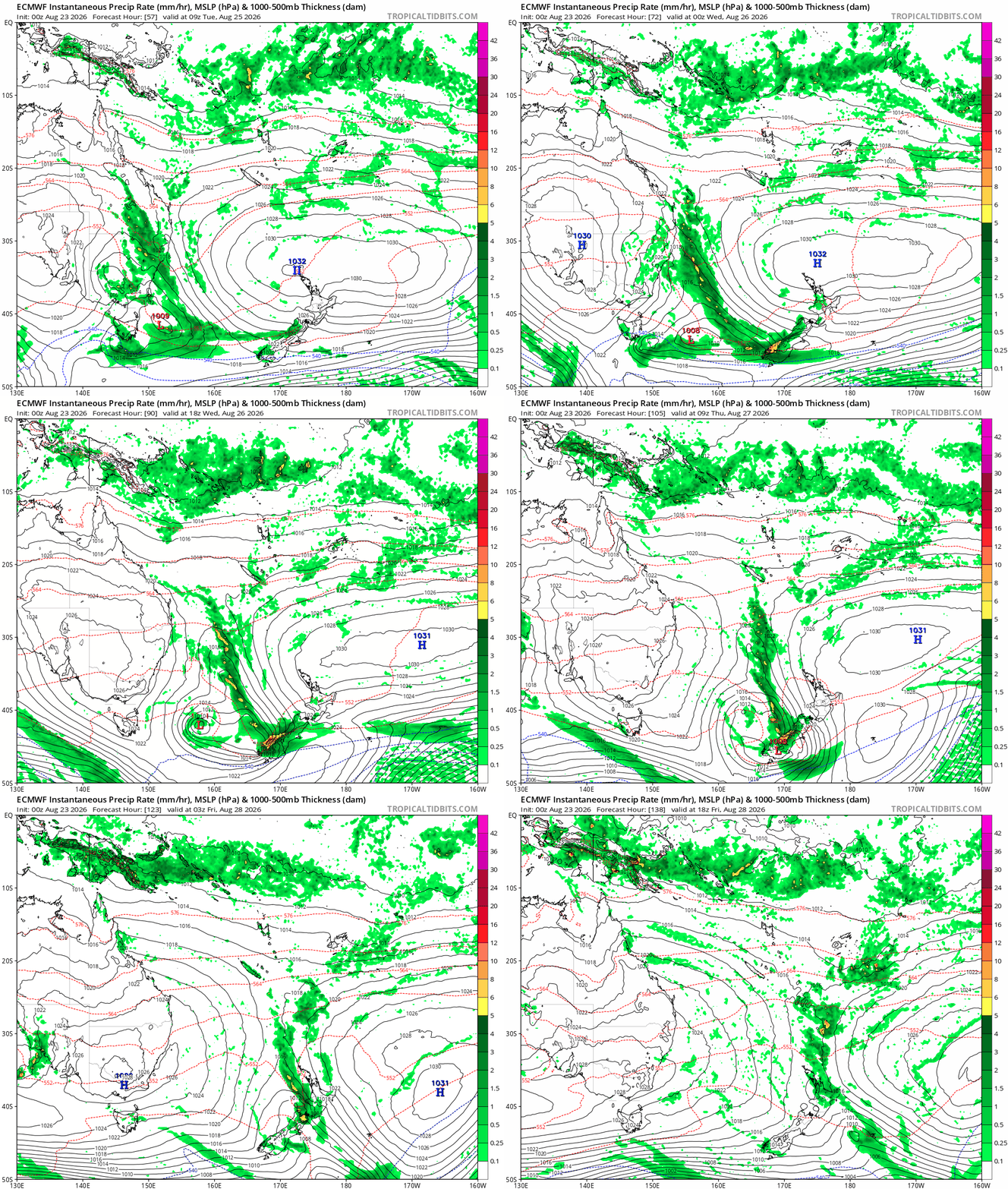
Across the ditch, things look a lot more constructive long-term, despite some of Australia’s weather systems meddling with New Zealand’s patterns over the coming week.
A marginal system will offer Kiwi ski areas a healthy top-up, with 20–40 cm expected in the Otago region from Tuesday afternoon. Ski areas above 1500 metres can expect steady snow gains, while lower fields may encounter rain at times due to a fluctuating snowline. Snow is expected to continue above 1500 metres through until Friday.
At long range, a frontal system is expected to arrive next weekend, bringing another 10 cm of fresh snow. Longer-term indicators also suggest an increased chance of marginal systems during the first week of September.
Looking further ahead, this active, snow-bearing pattern is likely to see a significant shift. As the current stratospheric polar vortex disturbance propagates downward over the next month, the resulting negative SAM phase typically shifts the main storm track northward. For New Zealand, this atmospheric flip changes the game, ushering in a prolonged period of stronger westerly to southwesterly winds, colder temperatures, and frequent storm systems for the South Island resort centres as spring progresses.
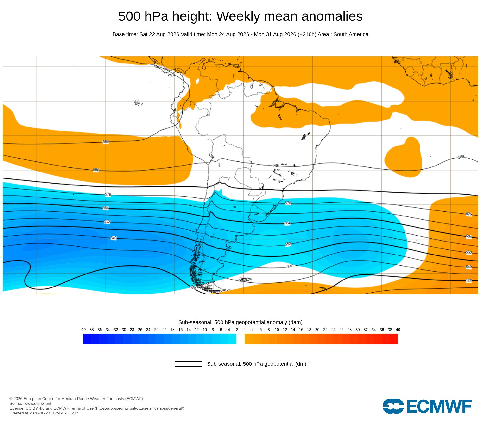
South America is the standout region for snowfall over the coming two to three weeks as a robust long-wave trough positions itself on the doorstep of the continent.
A large area of central Chile’s ski resorts can expect 70–100 cm of accumulation over the coming week as a series of active fronts push through the Andes.
This heavy snowfall is expected to subside during the first week of September as the main trough moves away. However, long-range indicators suggest that snow will likely return during the second week of September. This late-season resurgence aligns with the expected peak of the negative SAM phase, which typically forces stronger, moisture-laden westerly storm tracks directly into the southern and central Andes.
Comments
Nothing yet. Say the first thing.
Sign in to join the conversation.