
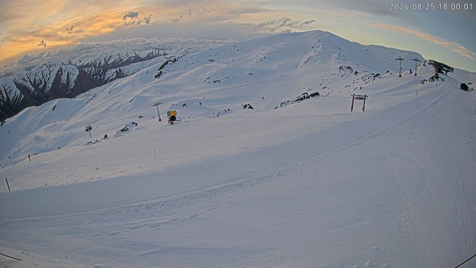
Tonight, a soaking (near-100 mm) event is pushing through the Australian Alps. But what begins as a relatively unseasonal rain event will undergo a remarkable transformation over the next 36 hours.
As the system moves into the Tasman Sea tomorrow, it will interact with a cold airmass, deepen rapidly, draw in a sliver of polar air and redevelop towards the Southern Alps. By Thursday, the result is expected to be an extraordinary burst of heavy snowfall, with several feet possible across parts of the alpine region.
In other words, tonight’s 100 mm event here in Aus is expected to translate into a near-100cm event in Central Otago and the Canterbury Lakes of the South Island, NZ.
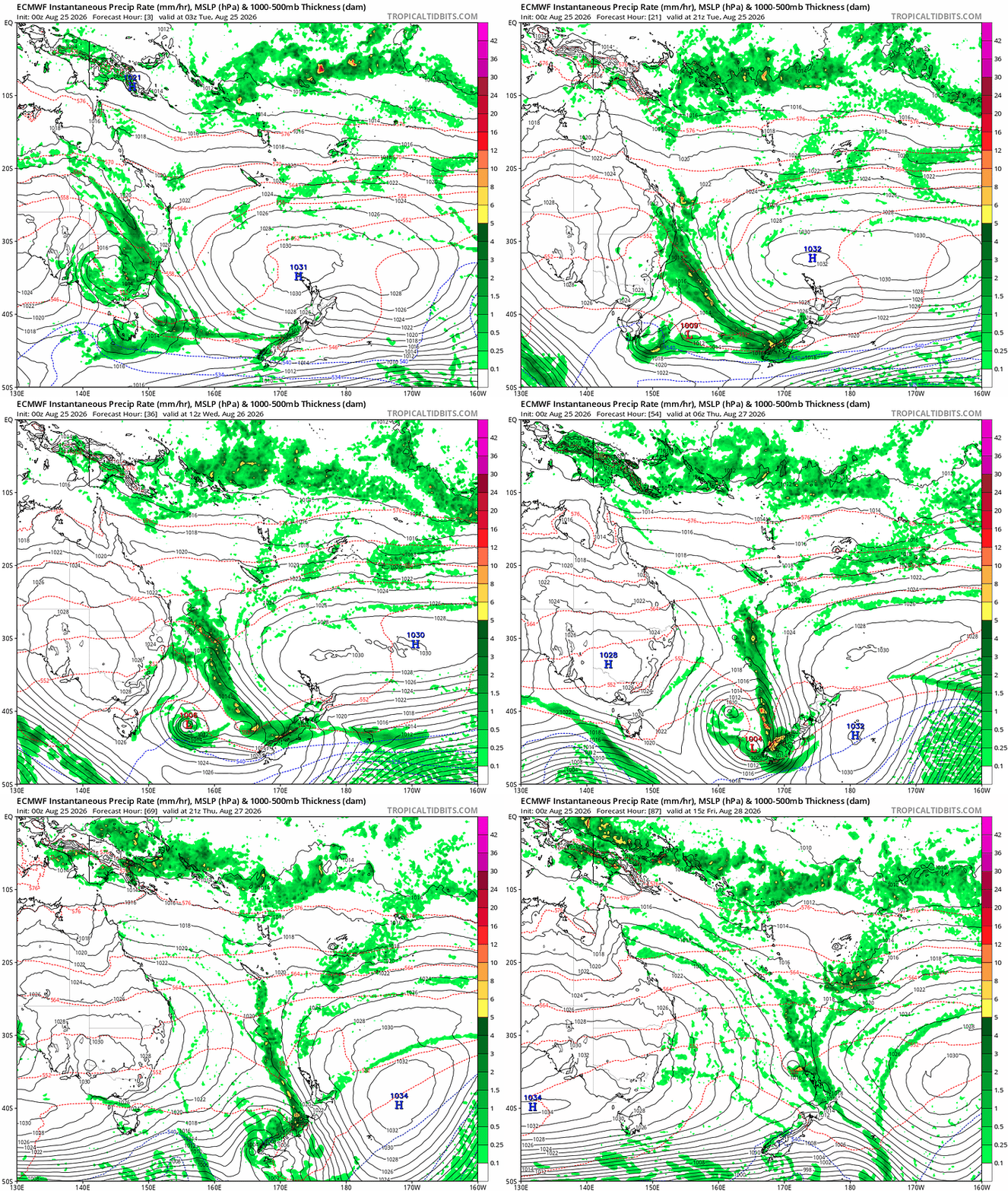
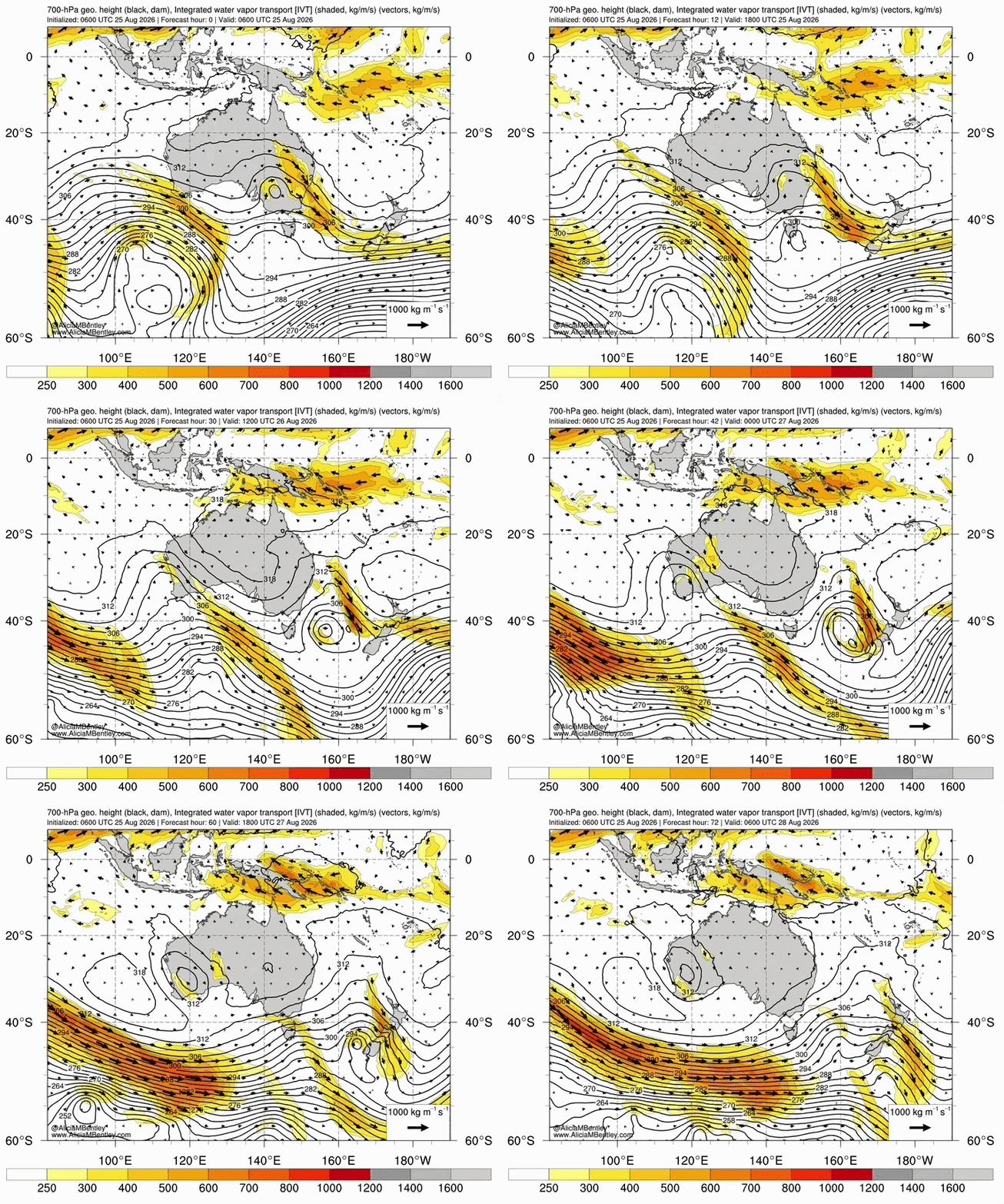
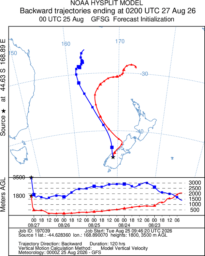
Over recent days, there’s been considerable concern over the availability of cold air for this system. However, since last night, the models have firmed up, now pointing to a solid nuking above 1600 m, with marginal snow possible at times below. It appears to be just the right balance between tropical moisture feed interacting with the polar air.
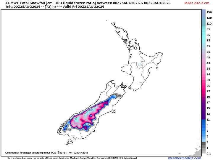
Mid-morning Thursday shows unique conditions with a highly saturated and stacked profile signalling periodic and sporadic low-level snowfall dropping snow as low as 500m in isolated regions of Canterbury and Central Otago.
By Thursday midday, the heaviest falls will be closely focused on the Central Otago and Canterbury regions, with firm agreement of salubrious snowfall rates of 7- 9 cm per hour - if it weren’t for the strong winds accompanying the falls, it would be fairy-tale stuff.
A high degree of caution is recommended for any high pass transits.
Given the harsh elements, these kinds of storms are often hard to quantify snowfall. However, given the short timeframe, it’s expected that some Central Otago and Canterbury ski areas could stand to receive 3 feet (~90 cm) of snow in 24 hours by Friday morning.
Leeward slopes could expect to see 3-5 metres of snow deposition.
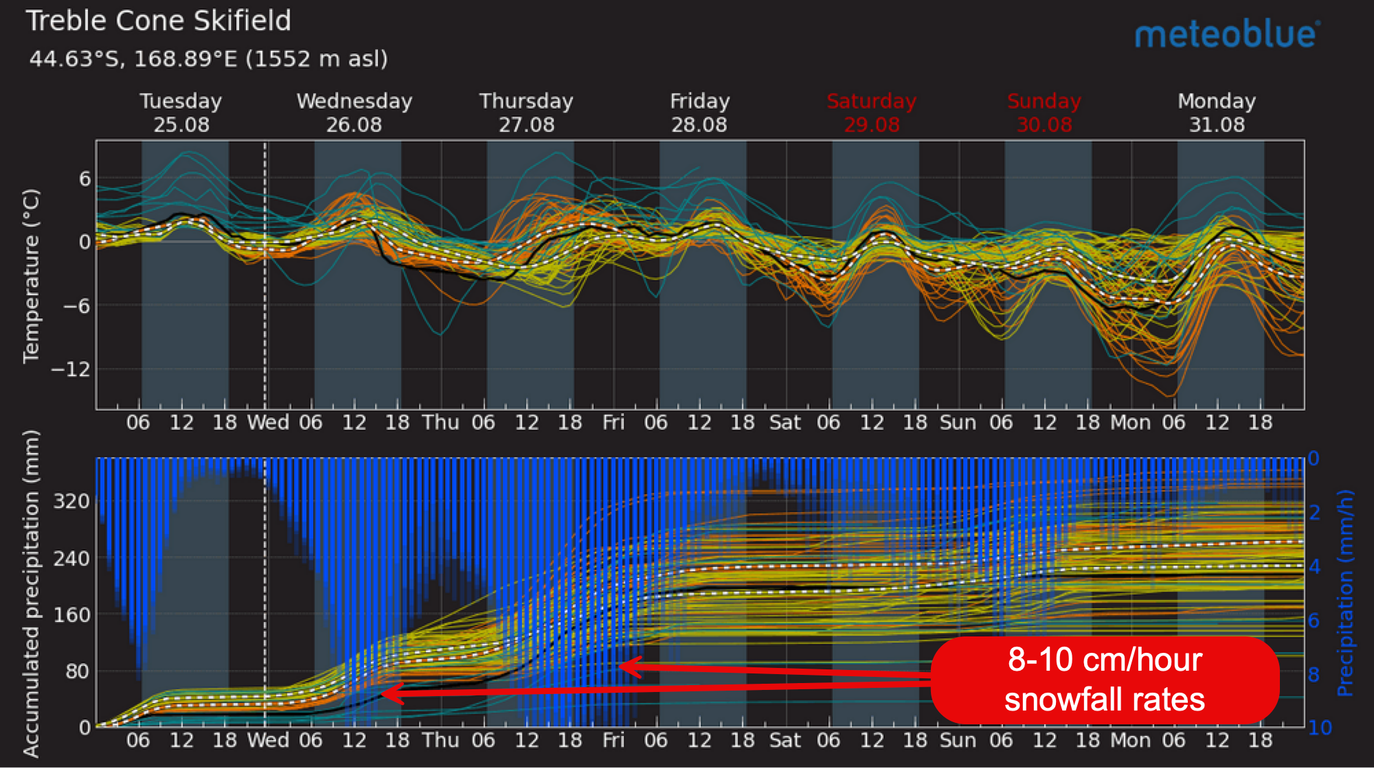
Marginal temperatures could hamper snowfall through Wednesday and on the fringes of the system Thursday night. However, where temperatures do remain sufficiently cold, exceptionally heavy snowfall rates could produce a rapid and significant increase in avalanche danger.
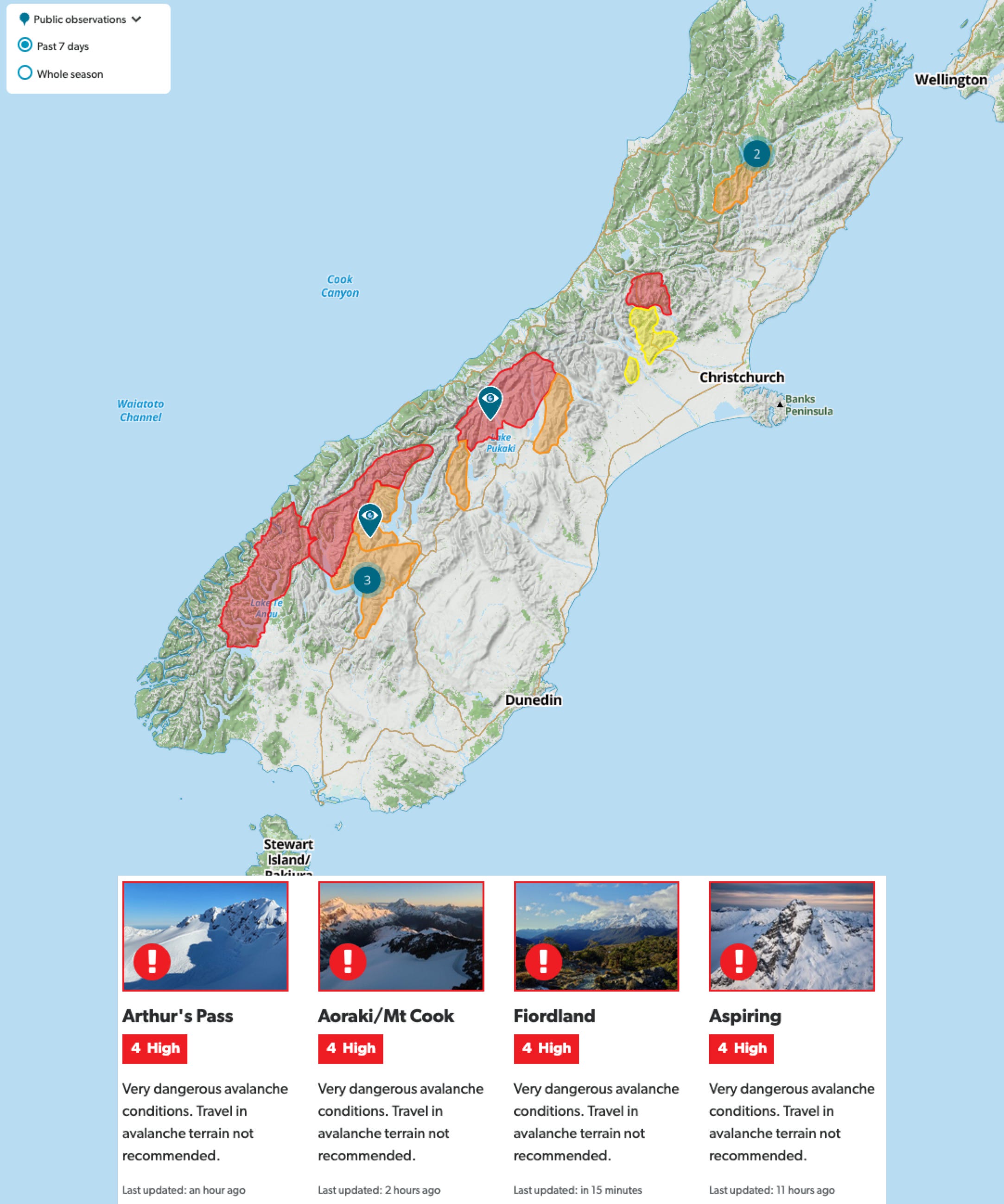
It would therefore be remiss not to flag the potential for precarious and potentially dangerous avalanche conditions by Friday morning. Where possible, consider sticking to inbound ski areas on Thursday and Friday.
Stay across the Mountain Safety Council’s updates in the wake of this next storm cycle:
https://www.avalanche.net.nz/
Comments
Nothing yet. Say the first thing.
Sign in to join the conversation.