
Strongest daily winter AAO/SAM signal since June 2016 (Strong El Nino)
Walker-circulation and ENSO moblise the MJO
A long wave trough is expected through south-east Aus, July 2-6
Significant pre-frontal rain is expected in the Aus alpine, July 1-2
10-15cm snow, expected across ski areas July 3-5
NZ snow returns July 4-6
South American Ski Areas low tide and in a holding pattern
Polar vortex is in high variability
Southeast Australia will benefit from the strong likelihood of light to moderate snowfall during the aforementioned July 2nd–6th window.
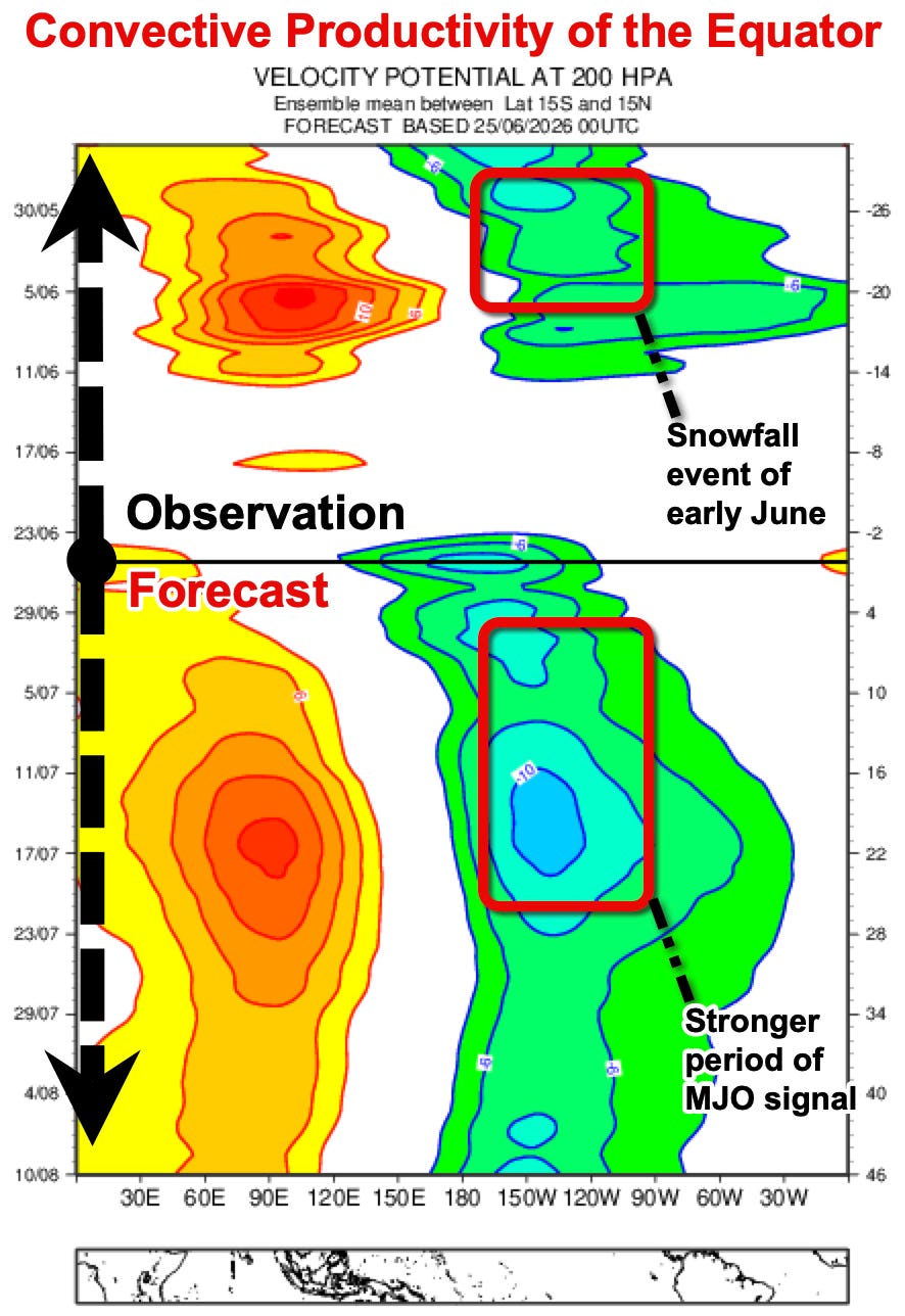
Thanks to the Madden-Julian Oscillation (MJO) and the Walker Circulation, the equatorial Western Pacific is forecast to enter a highly active convective phase over the next fortnight. For Australia, this setup strongly favours a longwave trough pattern that opens the door to—well—finally some snow. While early June's snowfalls across the southeast were also driven by the Madden-Julian Oscillation (MJO), this upcoming phase is shaping up to be a stronger, more sustained pulse. Crucially, however, a stronger pulse does not automatically translate to greater snow totals.
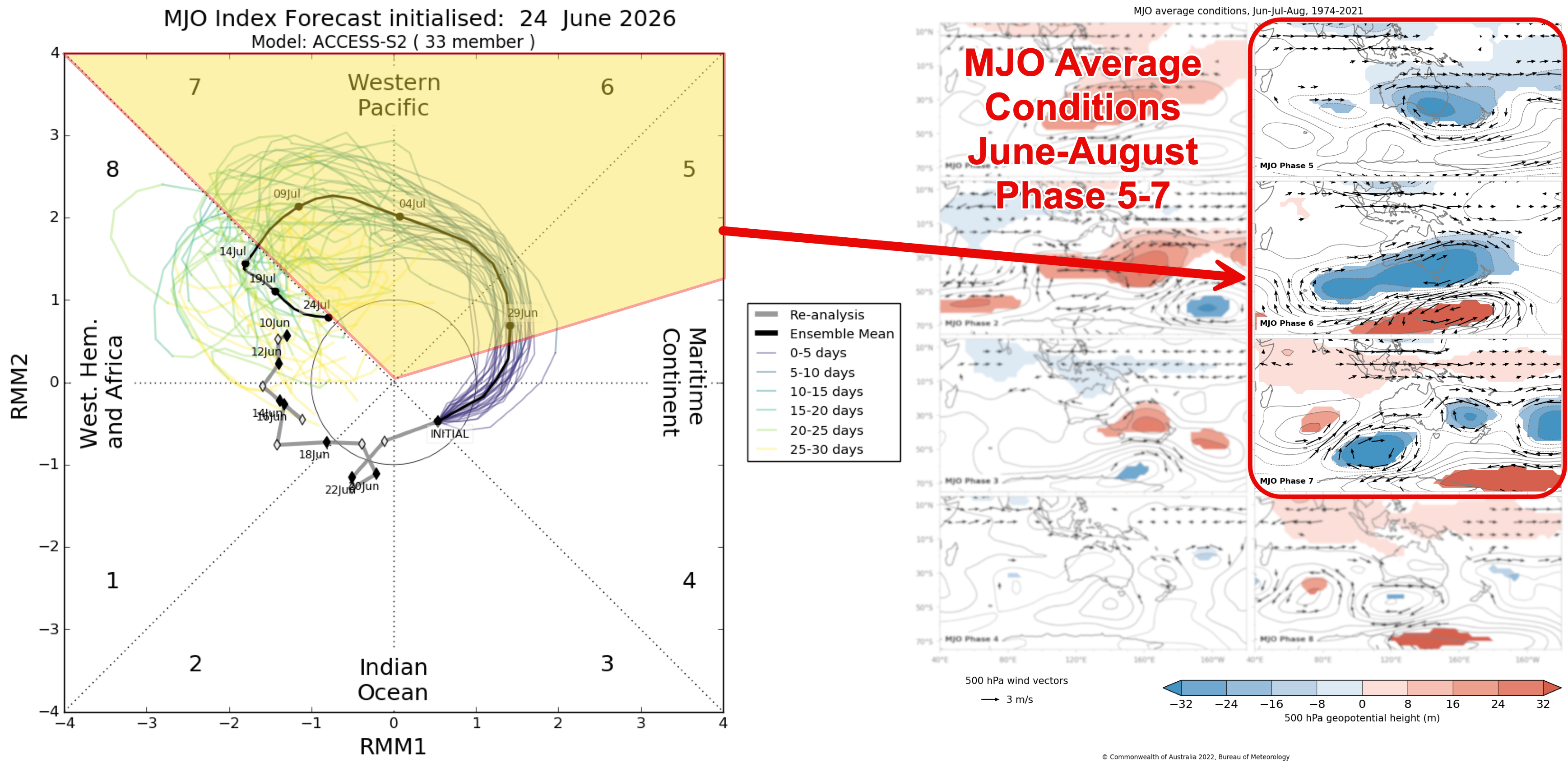
Sadly, a strong +SAM phase is keeping the polar air on tight leash, leaving high-pressure ridging firmly in control. On June 21st, the daily winter SAM peaked at +3.85—the highest winter reading in a decade, falling just shy of the +4.05 registered on June 14th, 2016.
NB. The highest recorded SAM value (of all seasons) was achieved the following Spring in Sep, 2016 where it registered +4.64.
As with the early June event, the Rossby wave is forecast to peak west of the Alps. This means the system is expected to sweep across southeast Australia on its downstroke, rather than delivering an immediate polar outbreak from the south.
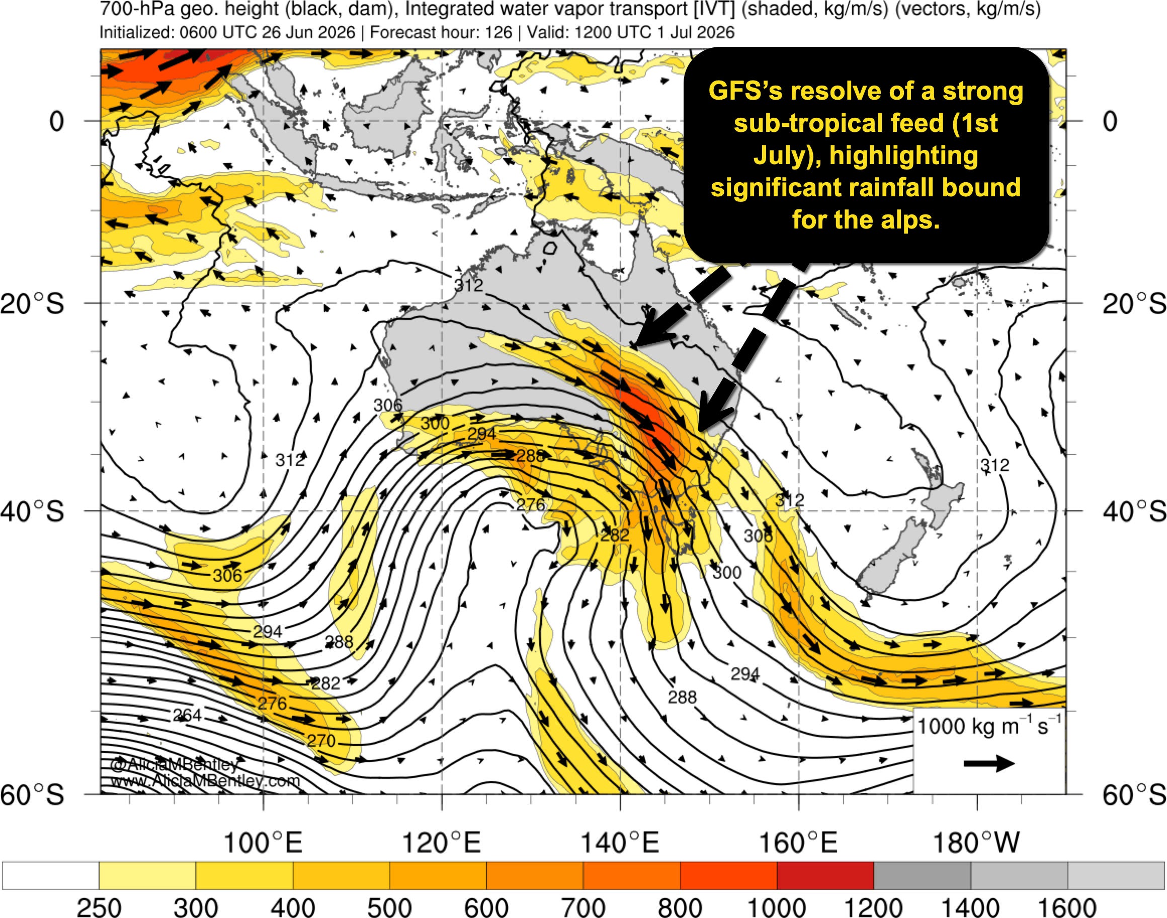
Meteorologically, this configuration promotes anticyclonic wave breaking, establishing a warm conveyor belt that funnels a tongue of subtropical moisture into the Alps ahead of the front. Because the Australian Alps currently have only a negligible snowpack, the rainfall is less problematic than it would be later in the season. Even so, a prolonged period of heavy rainfall is likely on June 30 and July 1 before colder polar air arrives behind the main feature, allowing precipitation to transition to snow.
60-80mm of rainfall is likely in this timeframe.
Comments
Nothing yet. Say the first thing.
Sign in to join the conversation.