
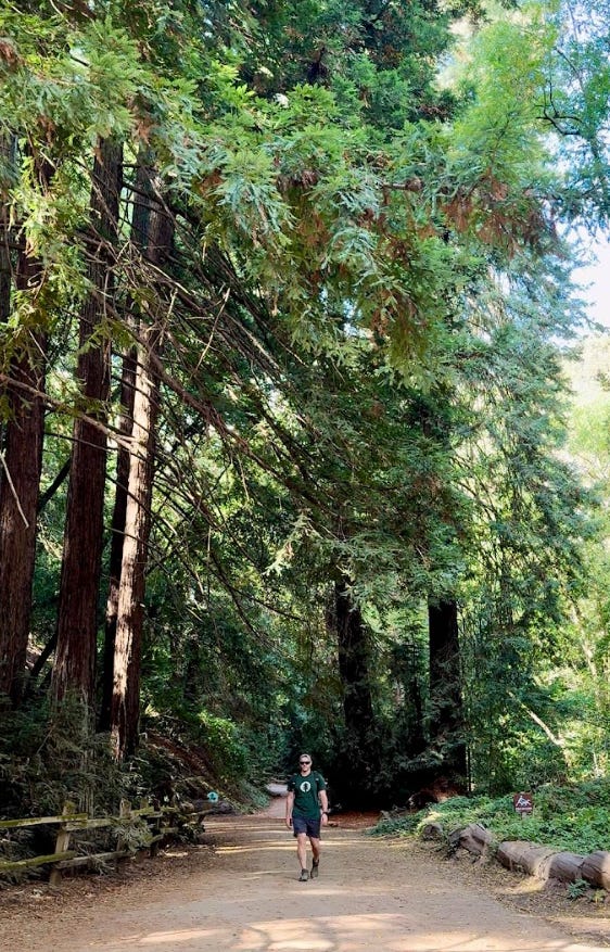
There’s a moment every December, usually right after I “accidentally” go back for seconds, that I remember:
“Oh yeah… this is one of the reasons why I hike.”
The holidays are one of my favorite times of year. Family in town, too many cookies on the counter, kids racing around the house in brand-new socks on slick wood floors (a sport in itself). It’s loud and messy and wonderful… and also a lot of calories.
Before we dive into the trails, I want to pause and say thank you.
This community has grown to well over 11,000 email subscribers and, somehow, many of you have decided my work is worth paying for. That number still blows my mind. Every map pin, trail guide, 4 a.m. alarm, and long drive to a remote trailhead is possible because you’re here, reading, sharing, and sometimes dragging your own friends and families onto the trail.
Which leads me to holiday gifting: if you’re looking for a unique, inexpensive gift for a California explorer in your life, a paid subscription is a pretty fun one: they get insider trail guides and maps, and you get the satisfaction of knowing you helped fuel the next round of hidden gems.
Just starting your journey? Subscribe to this blog for more of the best of the west:
Now, let’s talk about those extra helpings.
This month’s theme: hikes that help you work off what you ate. I’ve added a rough “turkey level” for each one, based on distance, elevation, and about how many calories you’re likely to burn:
🦃 = 1 Turkey: Light stroll. For people who “don’t really do appetizers.”
🦃🦃 = 2 Turkeys: Moderate effort. For those who went big on stuffing.
🦃🦃🦃 = 3 Turkeys: You found the fried mozzarella sticks.
🦃🦃🦃🦃 = 4 Turkeys: You also went back for extra pie.
☠️🦃🦃🦃🦃 = Extreme Turkey: Beer, brats, and zero self-control.
All calorie estimates are ballpark numbers: your mileage (and metabolism) may vary.
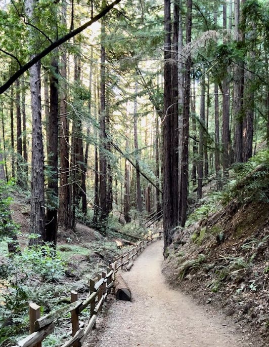
Oakland – “Steam” trail, but make it actually “Stream”
Stats (approx): 3 miles round trip, ~200 ft elevation, ~400 calories
Turkey Level: 🦃 (1 turkey, for the ‘appetizer skippers’) | Alltrails: link
If there’s a “holiday hike” I return to over and over, it’s Stream Trail in Dr. Aurelia Reinhardt Redwood Regional Park in Oakland. The name alone is a seasonal sorting hat, half the internet calls it “Steam Trail.” It’s not. It’s Stream Trail. There is no steam room; just the soft sound of water and wind sliding through redwood needles.
Starting from the Canyon Meadow staging area, the trail eases you into the forest along a nearly flat, creekside path. On rainy days, this canyon feels like you’ve stepped into a green tunnel. Water beads on fern fronds, the packed dirt darkens, and everything smells like wet earth and cedar. It’s the hiking equivalent of a weighted blanket.
This is a trail I’ve:
Stretched into a longer loop on my own, climbing out onto East Ridge when I’ve needed more miles.
Walked with my kids on drizzly afternoons when the playgrounds were mud pits but everyone needed to move.
Shared with my parents, who love redwoods but appreciate a path that lets them look up, not down at every step. (Hi, Mom and Dad. Yes, you’re in the newsletter)
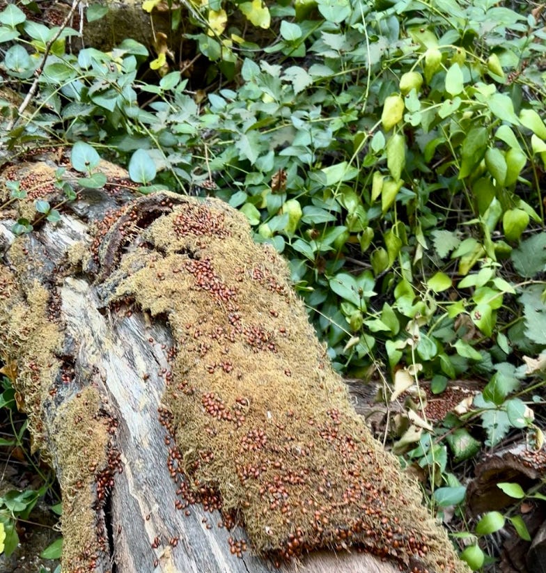
If you time it right, there’s a little bit of magic tucked along this trail: wintering ladybugs. From roughly late fall into winter, thousands of ladybugs cluster along the Stream Trail corridor, especially between the junctions with Prince and Eucalyptus Trails.
From Canyon Meadow, it’s about 1.5 miles of easy walking before you hit the prime ladybug zone. Look for:
Fence posts absolutely carpeted in red;
Clumps of ladybugs hanging off grasses and low branches;
An interpretive panel that explains what they’re doing (spoiler: they’re not just here for the holiday lights).
This stretch is paved for a good portion, dog-friendly (on leash), stroller-doable, and about as accessible as “holiday hiking” gets.
If you want to keep it mellow, turn around near the ladybugs and call it a 3-mile, ~400 calorie wander. Perfect for the folks who somehow managed to dodge the appetizer table and are feeling smug about it.
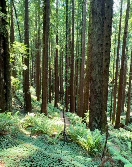
Arcata – Redwoods, moss, and a choose-your-own-adventure playground
Stats (approx): 4.2 miles, ~850 ft elevation, ~600 calories
Turkey Level: 🦃🦃 (2 turkeys – stuffing squad) | Alltrails: link
If Stream Trail is a gentle lullaby, Arcata Community Forest is the full band.
High above downtown Arcata, a maze of numbered trails weaves through thick, rain-soaked redwoods, moss-covered stumps, and damp singletrack that feels pulled straight from a Pacific Northwest daydream. This isn’t one single “destination” trail; it’s an entire network, and you can build loops like you’re stacking blocks.
For this holiday calorie-burn edition, I’m going with a favorite combo anchored on Fickle Hill Grade #9, looping with trails like Big Rock #4 and Meadow #3 for about 4 miles and 850 feet of gain.
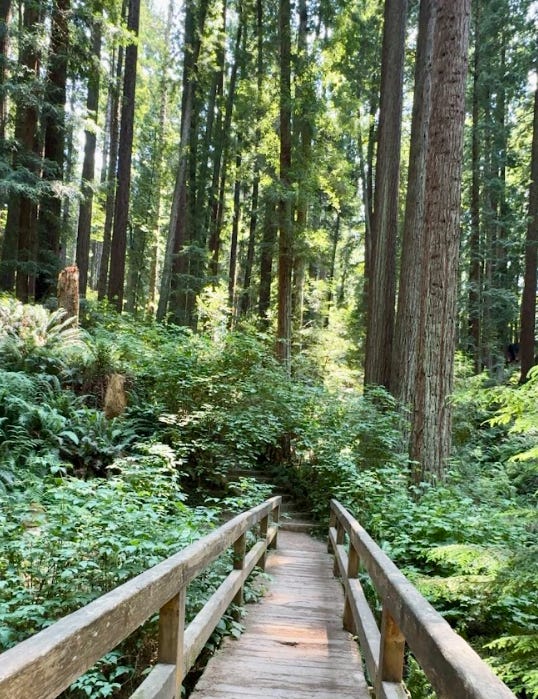
From the moment you leave the trailhead, you’re in it: Redwood trunks march up the hillside, ferns pour down the slopes like green waterfalls, and the air stays cool and wet even when town is mild. The trail rolls and twists as it climbs, giving you short, punchy sections of elevation that add up fast but never feel brutal.
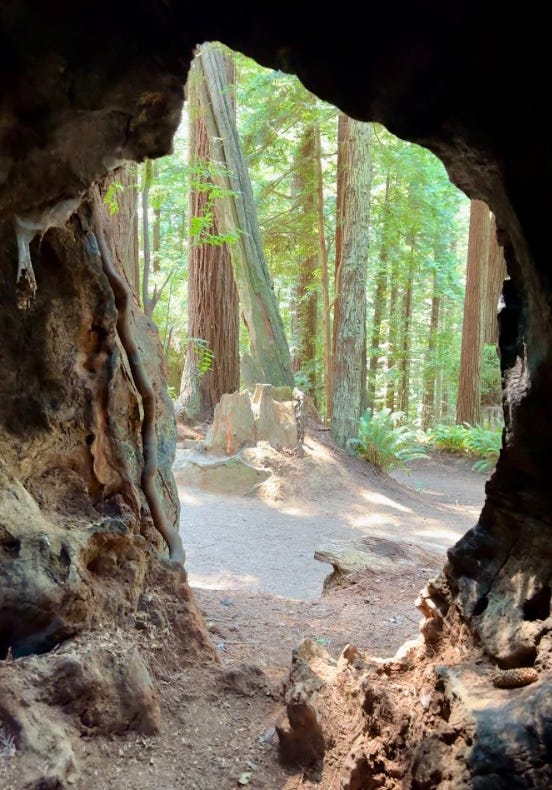
This forest is secretly three parks in one:
Mountain bike playground: Fickle Hill #9 was practically built for riders, with a downhill flow that makes you wish you’d brought your bike.
Disc golf course: Just outside the forest proper, you’ve got baskets tucked among trees, making it easy to pair a hike and a round if your group is mixed-interest.
Hidden carvings: Tucked off certain spurs and clearings, you’ll stumble on wooden carvings and forest “art”.
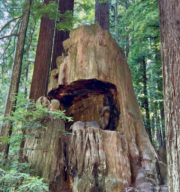
This is the perfect hike for the “I ate a mountain of stuffing but I’m not ready for full suffering yet” category. You’ll earn your 600 calories, get your heart rate up on the climbs, and still have enough energy left to wander downtown Arcata for post-hike coffee.
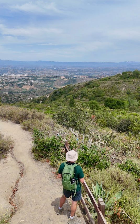
Laguna Beach – Views, caves, and a literal car in the canyon
Stats (approx): 6–7.5 miles, 950–1,100 ft elevation, ~1,150 calories
Turkey Level: 🦃🦃🦃 (3 turkeys – mozzarella stick repenters) | Alltrails: Link
Some trails feel like a sampler platter, and this Top of the World / Car Wreck / Dripping Cave loop in Aliso and Wood Canyons Wilderness Park is exactly that, a sort of greatest hits reel of coastal SoCal hiking.
You get:
Panoramic views from Top of the World over Laguna Beach and the Pacific.
A shaded canyon walk with sandstone walls and scrubby chaparral.
A stop at Dripping Cave (aka Robbers Cave), where outlaws allegedly used to hide out.
And the surreal sight of an actual car wreck, rusting quietly in the middle of a steep hillside.
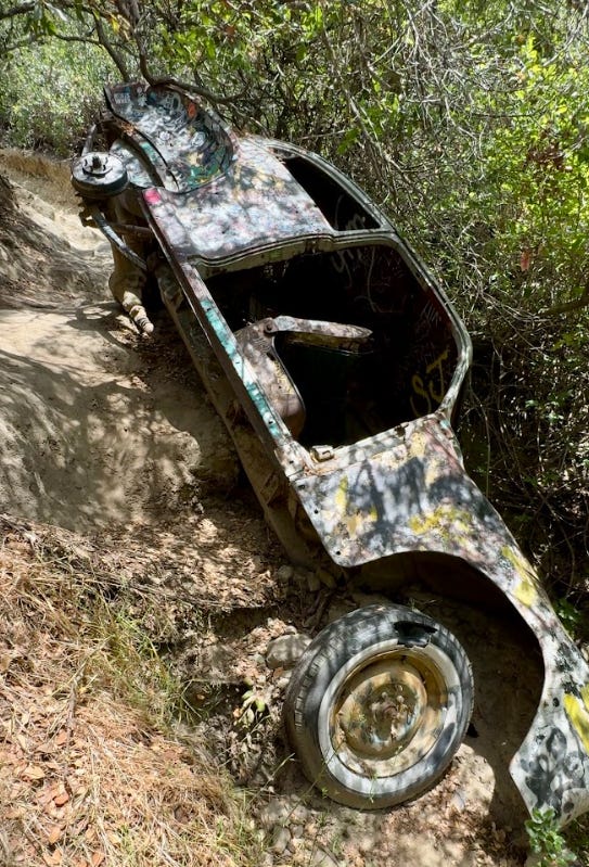
I first did this one in the heat of summer, when the sun pressed down so hard it felt like the hillside itself was radiating. The climb out near the Car Wreck Trail is where you start to bargain with the universe: “If I make it to the top without stopping, I’m never eating mozzarella sticks again.” (Narrator: he will absolutely eat mozzarella sticks again.)
But here’s the catch: depending on which route map you pull, Dripping Cave might not be clearly included in your loop. Make sure to intentionally add the spur, otherwise you’ll hike right past one of the coolest features without realizing it.
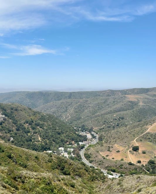
This is the trail for those of you who added fried apps to your plate and now want a hike that feels like it’s actually doing something about it.
Marin County – Mill Valley to Stinson Beach
Stats (your version): 11.3 miles, 2,493 ft elevation, ~2,765 calories
Turkey Level: 🦃🦃🦃🦃 (4 turkeys – full pecan pie clearance) | AllTrails: Link
Hot take: it’s pee-CAN, not “pee-con,” not “pick-in,” and definitely not whatever unhinged hybrid your uncle said at the dessert table.
Pecan pie is my personal kryptonite. It’s also the reason I finally sat down and asked:
What trail would actually wipe this out?
Enter: the Dipsea Trail.
Even though I’ve mentioned Mt. Tam plenty of times, it’s kind of wild that I haven’t featured what might be the most famous Bay Area trail: the path of the Dipsea Race, America’s oldest trail race, first run in 1905 and still held annually on the second Sunday in June.
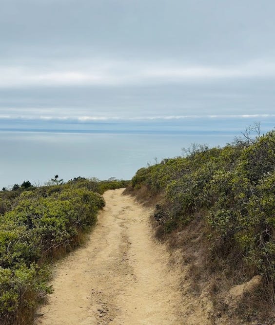
The traditional race route is about 7.4–7.5 miles from Mill Valley to Stinson Beach, but the way I tackled it this November turned it into something bigger: a kind of “back door” journey through redwoods and ridges, stretching into an 11.3-mile, 2,493-foot sufferfest in the best possible way.
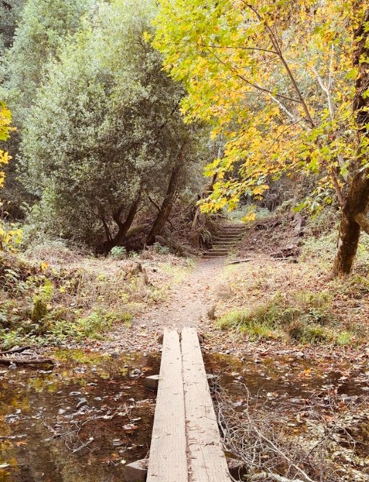
When you hike the Dipsea outside of race day, you feel that history in flashes:
dirt packed by thousands of footsteps, glimpses of the Pacific that must have felt like the finish line long before runners actually reached it, and the hush of Muir Woods-adjacent canyons where the trail passes near towering redwoods.
On my November outing:
I clocked 11.3 miles,
Gained about 2,493 feet,
And burned an estimated 2,765 calories in just about 4 hours of moving time (yes, I checked).
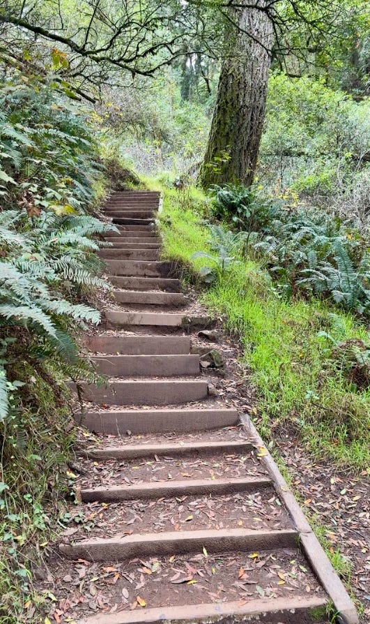
By the end, it felt like I’d erased an entire Thanksgiving: pecan pie, mashed potatoes, extra rolls, second dessert… all gone in a single, glorious slog.
This is not a casual family stroll. This is the hike you choose when you want to end the year with a bang; and when you know exactly how much you ate.
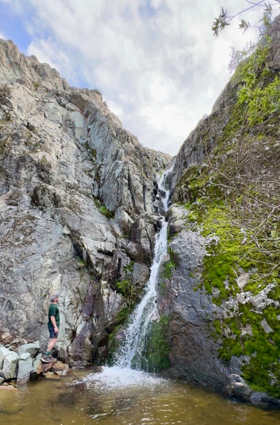
Near Livermore – A waterfall, a permit plot twist, and a whole lot of uphill
Stats (approx): 13.5 miles round trip, ~4,300 ft elevation, ~2,200+ calories
Turkey Level: ☠️🦃🦃🦃🦃 (extreme – beer, brats, and “what have I done?”) | AllTrails: Link
If your holiday plate looked like a competitive eating entry, beer, brats, gravy rivers, the works, this is the hike I’m prescribing: Murietta Falls via the Ohlone Wilderness Trail from Del Valle.
This route is one of the Bay Area’s toughest day hikes: long, exposed, and unrelenting, with steep climbs that seem to go on forever… and then a bit more after that. The payoff is a rare, seasonal waterfall tucked deep into the backcountry, usually flowing strongest in late winter and early spring after storms.
But the big news isn’t just the waterfall anymore, it’s the permit.
For years, hiking the Ohlone Wilderness required a special Ohlone permit, a paper map/permit combo that cost a few bucks and had to be carried with you on trail. It was the only day-use trail in the East Bay Regional Park system with its own access fee. Now, that’s changed.
The East Bay Regional Park District recently announced that:
Day hikers no longer need a permit to access the Ohlone Wilderness Trail.
The paper permit has been discontinued as a way to improve access and recognize that hiking and walking trails are core park resources, not premium add-ons.
Overnight backpacking reservations and fees still apply, so if you’re camping, you still book sites as usual.
It’s a small policy change, but a big signal: opening up one of the region’s most spectacular wilderness routes to more people without the extra friction.
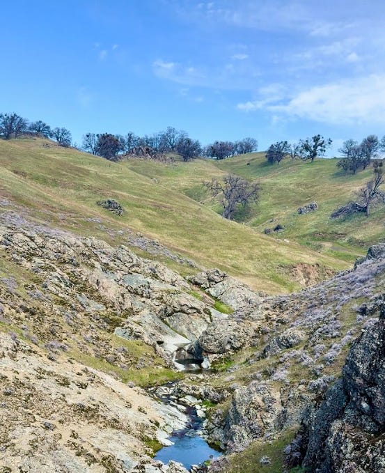
From Lake Del Valle, the trail heads out along rolling ranchland, grazing cattle, and wide-open views. This is a landscape of:
Exposed ridgelines baked by sun,
Wind-carved hills that go from golden to green depending on the season,
And a sense of distance that feels more like a mini-Sierra than a quick drive from the Bay.
The Murietta Falls turnoff dives down into a steep canyon where the waterfall hides. When it’s running, water pours down a dark rock face, a rare sight in the East Bay’s mostly seasonal creek country.
Round trip, you’re looking at roughly:
13.5 miles,
A bit north of 4,300 feet of elevation,
And something in the neighborhood of 2,200+ calories burned, depending on your pace and pack weight.
This is the “empty the tank” holiday hike. Your legs will feel it. Your core will feel it. Your arms will feel it from using trekking poles or bracing yourself on steep grades.
If you want one hike to mentally file away as “my year-end reset,” make it this one.
I’ll leave you with this:
Every time I hit “send” on one of these monthly guides, I’m very aware that you could be anywhere else on the internet. The fact that you choose to be here, planning hikes, discovering new corners of California, sharing these with friends and family, means more than you know.
To my paid subscribers, thank you (each and every 434 of you) for making this work more sustainable. You’re the reason I can scout new routes, build maps, and share both the polished guides and the behind-the-scenes mishaps.
If you’re looking for an easy, meaningful holiday gift this year:
A paid subscription gets your friend or family member:
Full access to my California map with secret spots, waterfalls, urbex finds, and more;
Themed maps like the Redwood Map with top hikes and filters;
Deep-dive trail guides and stories they won’t find just scrolling social media.
And if you simply forward this post to someone who might like it? That helps too.
Wherever you end up this season, on a flat redwood stroll with your parents, wandering through Arcata’s mossy forest maze, sweating your way up Laguna’s ridges, grinding out miles on the Dipsea, or chasing a roaring Murietta Falls, I hope you find a moment to breathe, look around, and feel thankful for the body that carried you there.
See you on the trail!
Comments
Nothing yet. Say the first thing.
Sign in to join the conversation.