
California doesn’t reward urgency. It rewards timing.
You can hike year-round here and still miss the moments when places feel alive: when water moves with intent, hills glow instead of crunch, and the landscape feels like it’s meeting you halfway.
From January through May, the state quietly cycles through its best versions of itself. Not all at once. Not loudly. But deliberately.
This isn’t a “best hikes” list (although some of these hidden gems certainly could be candidates for such a list). It’s a when-to-go list. Five months. Five trails. Each chosen not just for beauty, but for the narrow window when it’s truly worth being there.
If you only lace up once a month in early 2026, this is the order I’d follow.
And a quick reminder to subscribe to support this blog and make sure you don’t miss out on more of the best of California:
The long way is the point
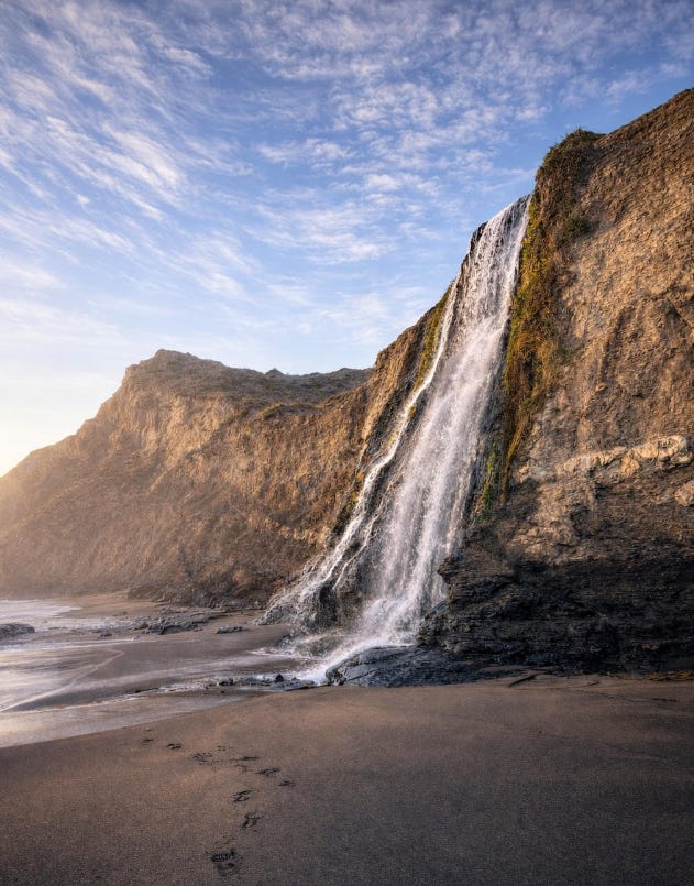
January is when Alamere Falls earns its reputation.
This is the hike people talk about all year, and then often completely underestimate. Starting from the Palomarin Trailhead, the Coast Trail winds through coastal scrub, open bluffs, and a chain of quiet lakes before finally delivering one of California’s most dramatic sights: a waterfall spilling directly into the Pacific Ocean.
Alamere is often mislabeled as one of only two tidefalls in the state. That’s not true. I’ve personally documented six other tidefalls in and around Point Reyes, with three more plotted out to hunt down in 2026. The difference is that Alamere is accessible, reliable, and hits hardest in winter, when rain-fed flow turns it from a trickle into a full coastal spectacle.
You’ll hear about a “shortcut” on this hike, an unofficial route that cuts off roughly three miles. Don’t take it. It’s not sanctioned, it’s not maintained, and it’s responsible for regular rescues, injuries, and wasted National Park Service resources. The cliffs crumble, poison oak thrives, and people get cliffed out far more often than social media suggests.
The long way isn’t just safer, it’s better. The lakes, the Farallon Islands on a clear day, the slow reveal of the coast… that’s the experience. The waterfall is the finale, not the whole show.
January brings fewer crowds, stronger flow, king tides, and moody coastal light that makes the entire effort feel justified.
Distance: 13.8 miles
Elevation Gain: 1,784 ft
Estimated Time: 6–6.5 hours
Route Type: Out & back
Difficulty: Moderate to strenuous
Location: Point Reyes National Seashore (Marin County)
Trailhead: Palomarin Trailhead (end of Mesa Road, near Bolinas). Note: I was there two days ago (12/30), and the last mile of unpaved road has gotten a little worse, however, if you go slow, a high clearance vehicle is not required.
AllTrails: Alamere Falls via Coast Trail
Dog Friendly: ❌ No dogs
Notes:
Arrive early on weekends; parking fills fast
Time for a low tide (negative tide is even better).
Do not attempt the unofficial Alamere Falls Trail (eroding cliffs, poison oak, ticks)
Subscriber note: additional Point Reyes tidefalls are pinned on my paid map under Secret Spot and Waterfall filters. Desktop access unlocks pinned notes with GPS tracks.
A bloom that feels earned, not advertised
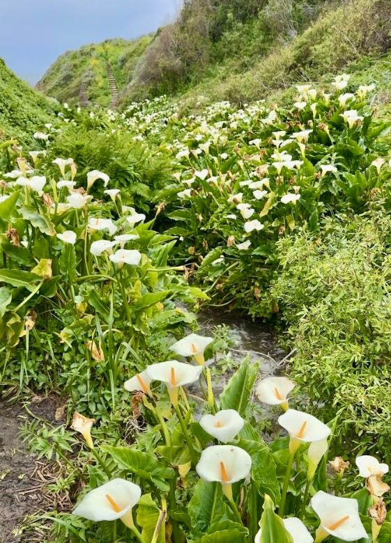
February in Big Sur holds a quiet miracle. For a short stretch, Calla Lily Valley comes alive, white lilies rising from impossibly green grass, tucked into a coastal fold that feels almost protected from the rest of the world.
There’s no guarantee when you’ll hit it right. Some years the bloom peaks early, others late. That uncertainty keeps this place sacred. It’s a reminder that the best moments in nature aren’t permanent. They’re conditional.
Distance: 0.8 mile out & back
Elevation Gain: Minimal, however, there are stairs
Difficulty: Easy
Location: Big Sur coast
AllTrails: Calla Lily Valley Trail
Dog Friendly: ❌ No dogs
Notes: Stay on trail; the lilies are fragile and protected
The waterfall that disappears if you blink
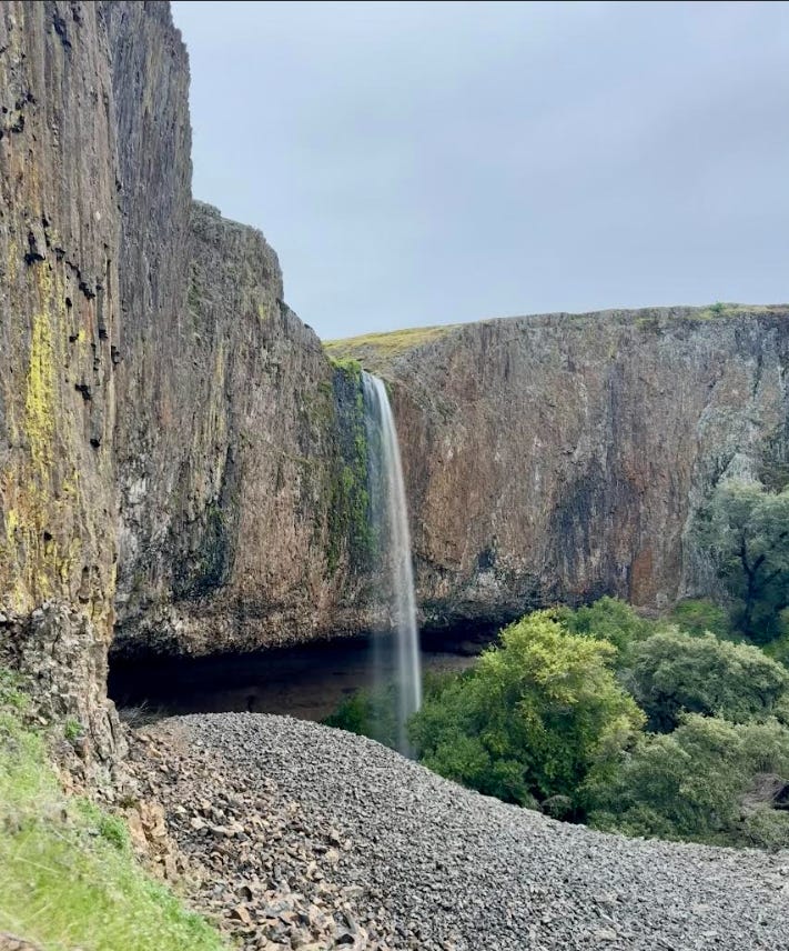
Most of the year, Phantom Falls is just a cliff. In March, it’s a spectacle. After heavy rain, water pours over the volcanic basalt of North Table Mountain, transforming an otherwise dry plateau into one of Northern California’s most dramatic waterfall displays.
The approach feels deceptively calm, with rolling grasslands, open sky. Then the land breaks open, and the falls announce themselves with force.
This is a reminder hike: a reminder that timing can turn something ordinary into something unforgettable.
Miss the window, and there’s nothing left to see.
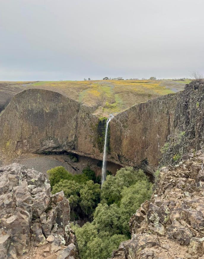
Distance: ~4.5 miles out & back, however I recommend the longer route that allows you to see Hollow Falls, Ravine Falls, and more. Paid subscribers get access to 3 other lesser known but equally (or more) spectacular waterfalls via my California Map.
Elevation Gain: ~400 ft
Difficulty: Moderate
Location: Oroville / Butte County
AllTrails: Phantom Falls Trail or Longer route.
Dog Friendly: Dogs on leash
Notes: Stay well back from cliff edges; pay fee online in advance of going.
Wildflowers, water, and a quieter side of Gold Country
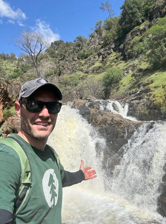
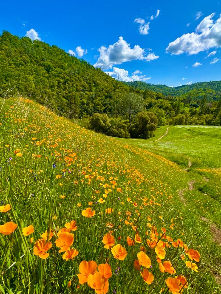
April is when Gold Country surprises people. Most expect dusty foothills and summer heat. Instead, Dutch Creek Falls delivers green slopes, flowing water, and one of the most underrated poppy displays of the season.
The trail itself is short but honest. It drops quickly, threads through oak woodland, and finishes at a seasonal waterfall that hits hardest after winter rain. The route is a bit overgrown in places, and a few rope-assisted sections help with the steeper downhill portions, giving the hike just enough edge to feel earned.
This isn’t a solitude hike, especially on weekends, but it is less trafficked than many nearby waterfall trails, and the payoff-to-effort ratio is excellent. The real star, though, is the timing. Catch this trail in April and you get water and wildflowers before the hills turn gold for a very different reason.
This is spring in the foothills, done right.
Distance: 1.4 miles
Elevation Gain: 272 ft
Route Type: Out & back
Difficulty: Moderate
Location: Marshall Gold Discovery State Historic Park (Coloma, CA)
AllTrails: Dutch Creek Falls Trail
Dog Friendly: Dogs on leash
Notes: Trail can be overgrown; long pants recommended. Ropes assist on steeper downhill sections; not required to see the poppy display. Parking in the museum lot requires a fee.
When winter finally loosens its grip
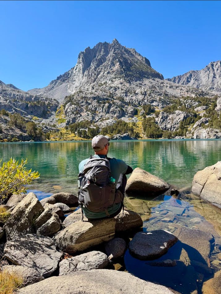
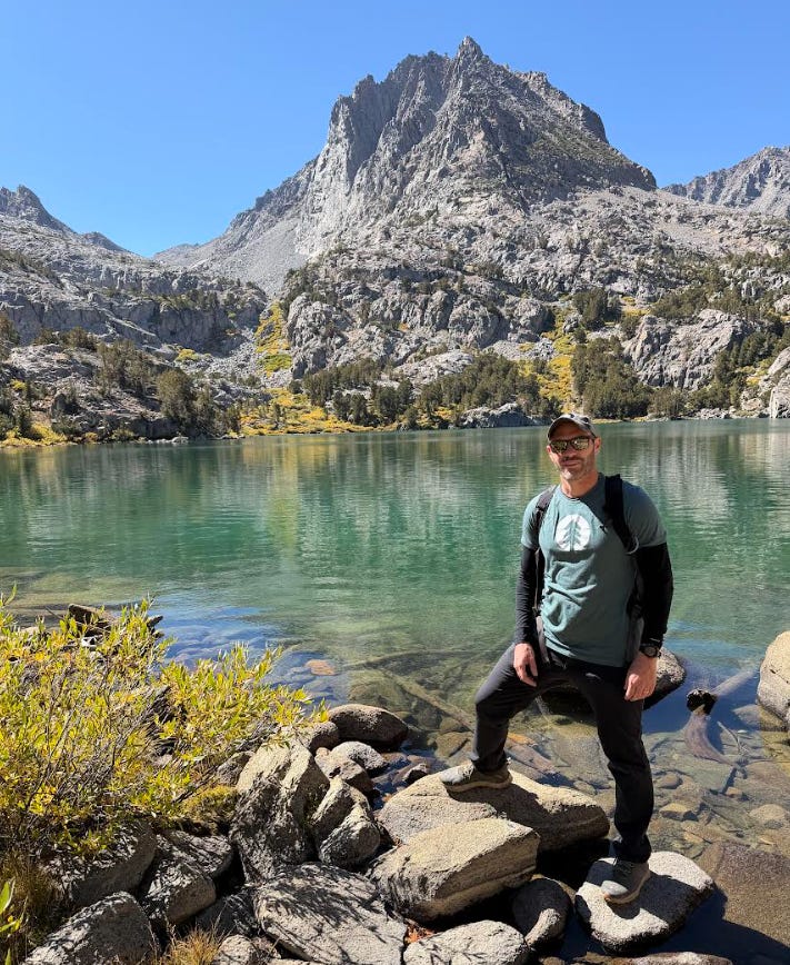
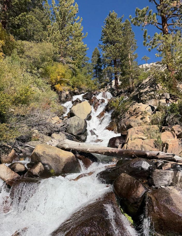
May in the Eastern Sierra feels like a negotiation between seasons. The Big Pine Creek Lake Trail climbs into a basin of turquoise lakes, granite walls, and lingering snowfields. Ice still clings to the shoreline. Peaks remain sharp and white. But the trail is open, the sun is higher, and access returns.
This is where California expands. Each lake feels earned. Each switchback opens more space, more quiet, more perspective. It’s a hike that reminds you why the Sierra has such a gravitational pull; once you experience it like this, summer crowds feel optional.
Distance: ~12 miles out and back to Second Lake (longer if continuing)
Elevation Gain: ~4,000 ft
Difficulty: Hard
Location: Inyo National Forest
AllTrails: Big Pine Creek North Fork Trail
Dog Friendly: Dogs on leash
Notes: Snow possible; check conditions before going. Backpacking permit required.
There’s something powerful about how a year begins. Not the resolutions we forget by February, but the rhythms we choose to return to. Getting outside once a month. Watching the landscape change instead of rushing past it. Letting effort, timing, and curiosity shape the year instead of noise.
These five hikes are all about starting well. If someone in your life has been saying “we should hike more this year,” send them this. Pick a month. Put it on the calendar. Let the trail do the rest.
California has a way of meeting you where you are, especially when you give it the space to unfold slowly. And this January-to-May window is one of the best invitations the state offers.
I’ve got a lot more coming as 2026 unfolds: new trail discoveries, seasonal timing notes, and a few surprises I’ve been sitting on for a while. I can’t wait to share them with you out there, one well timed hike at a time.
Hope to see you on the trail - be sure to drop a comment to let me know which one in this list looks most appealing! And for those looking for a bit more, be sure to checkout my California Map.
Comments
Nothing yet. Say the first thing.
Sign in to join the conversation.