
Hey All,
This week I’ve been testing something that honestly feels a bit like the future of site visits and existing condition work.
As designers and engineers, we’ve all done it at least at some point in our careers.
Walking around a site with a tape measure, taking dozens of photos, scribbling notes on printed plans, and then inevitably realizing back at the office that we missed something important. Whether it was on us, surveyors or even the client, missing data/info can cause issues.
It usually leads to:
another site visit
missing dimensions
uncertainty
or trying to piece together incomplete information later
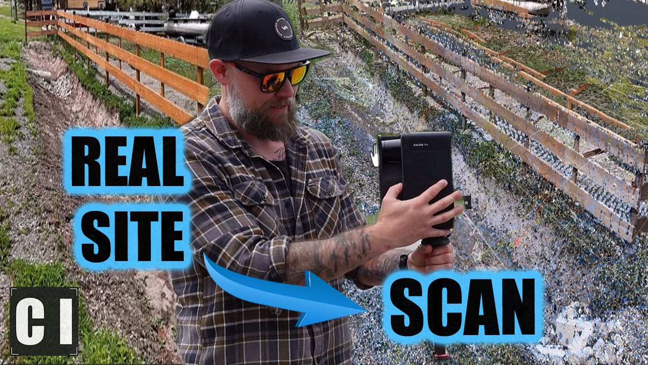
Recently I had the chance to test a 3D LiDAR scanner called the Realsee Galois P4, and it completely changed how I think about capturing existing conditions.
Instead of manually documenting everything, the scanner creates a full digital twin of the site that can then be brought directly into CAD workflows.
Honestly… seeing a real site turned into a usable point cloud and CAD-ready data in minutes was pretty impressive.
Quick Tip: Use Existing Condition Data to Improve Design Accuracy
One of the fastest ways to improve drawing quality and reduce costly rework is improving the quality of your existing condition information.
Even simple things like:
accurate measurements
current site imagery
elevations/slopes
surrounding objects and utilities
vegetation and landscaping
roadway geometry
…can drastically improve concept planning and reduce design conflicts later on.
Modern tools like LiDAR scanning and point clouds are making this easier and more accessible than ever before, especially for smaller firms and consultants.
Even if you don’t use a full 3D scanner, getting more complete and organized site information upfront will almost always save time later in the project.
Featured Video: I Scanned a Real Site in 3D… Then Brought It Into AutoCAD
In this week’s video I test the Realsee Galois P4 on a real outdoor site to see how useful 3D LiDAR scanning could be for engineers, architects, landscape designers, and consultants.
We go through:
scanning a real site
processing the scan data
generating floorplans and point clouds
bringing the scan into Recap/Civil 3D
and testing real workflow applications
This is one of the more interesting workflow tools I’ve tested in a while, especially for existing condition documentation and early planning work.
Learn more about the scanner here: https://cadintentions.com/realsee
Use code: CADINTENTIONS to geto $300 off the P4 as well.
Watch the full video here: Stop Measuring Sites Manually — I Tested 3D LiDAR Instead (Realsee Scanner)
Tech Tool of the Week
Realsee Galois P4 + Realsee Software
This week’s featured tech tool is the Realsee platform, apart from the scanner. One cool feature I found when testing this scanner was the fact that Realsee’s platform was great, and it works with a variety of other scanning options even if you don’t have the P4 I used in the video.
The software lets you:
create digital twins of real spaces
generate floorplans
create walkthrough tours
export point clouds and CAD-ready files
and bring scan data into design workflows
I was especially impressed by how quickly you can move from a real-world site to usable design data.
You can learn more here:
https://cadintentions.com/realsee
That’s it for this week!
Have you used a scanner for your projects yet? Let me know how it works and what you liked about the process!
Cheers and happy drafting,
Brandon
P.S. If you’ve got a colleague always looking for new cool new design tech or higher quality point clouds, be sure to forward them this email or send them a link!
They’ll thank you later.
Design x Technology is a reader-supported publication. To receive new posts and support my work, consider becoming a free or paid subscriber.
Comments
Nothing yet. Say the first thing.
Sign in to join the conversation.