
I spent the last 10 years of my career in the technology industry doing something called Forward Deployed Engineering. My job was to travel to clients around the world to companies like Airbus, BP, or Novartis and work closely with experts, decision-makers and front-line workers to create new tools to help them radically change their work. The FDE process involves building a deep understanding in both technical capabilities as well as the workflow of a business, and then building tools that help solve complex problems directly. I loved the challenge of re-imagining a traditional business in a “software-defined” way, making data and tooling a critical component and competitive advantage.
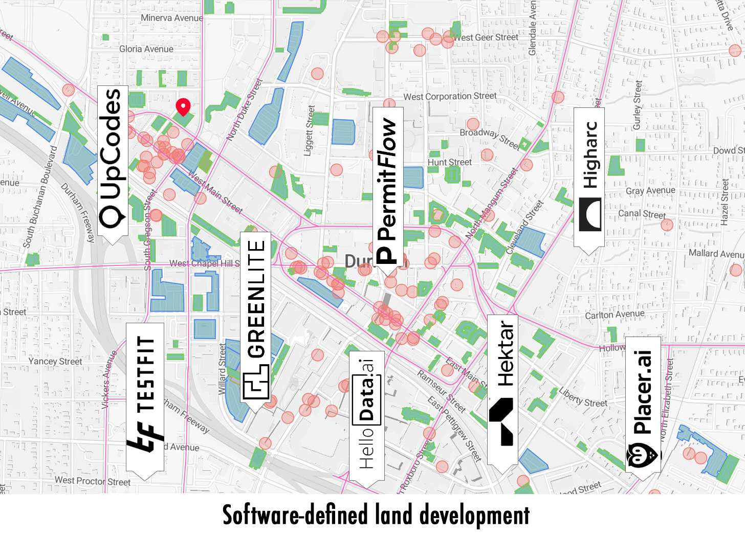
With the emergence of AI as a major accelerator in many industries, I’ve started looking around at companies that are building AI-powered tools and offering interesting data products that could be valuable in land development and urban planning. An important principle of my approach to Forward Deployed Engineering has always been empowering human decision makers. How can we give people the tools to scale their expertise, reach their goals faster, or better understand the impact of their work? In the spirit of building a “software-defined” real estate development company, here are some tools that I’ve found particularly interesting and valuable.
In real estate development the cost of making a wrong decision is high and there is increasing urgency to make decisions to fend off competitors and to reduce costs. The traditional model for software in the space is largely data driven, that is GIS systems, CoStar data reports, massive PDFs of regulations and codes. The ability to analyze and make decisions based on this data is left to experts and often requires highly specialized knowledge of data analysis tools and years of experience applying them. LLMs present an interesting opportunity to create value in urban development and construction because they can parse the messy and complex world of real estate data quickly and lower the barrier of expertise.
A few ways to think about the application of AI in real estate vs. traditional data products:
Characterize opportunities by assessing multiple-variables simultaneously (such as plots of land in proximity to points of interest)
Interpret dozens of complex rules or codes and apply them to a hypothesis (such as a code review)
Create an example based on a series of parameters and adapt that example based on feedback (create a test fit for feasibility analysis)
Generate cohesive language that reflects complex or variable information (writing permit applications, or marketing material)
If we think about major phases of development: site selection, pre-acquisition due diligence, feasibility analysis, code review, test fits and permitting, having the right data to confidently make a decision at every point is critical. Using this framework I’ve identified a few interesting tools.
Site selection sets the tone for everything that follows in a development project. It’s a bet on the future shape of a neighborhood, a city, even a region. This phase involves identifying developable parcels with strong fundamentals depending on the thesis of the project, for example: access to amenities, appropriate zoning, local support, and favorable demographics. Developers are asking: Which real estate markets are likely to grow or contract? Where is rental demand heating up, or delinquency low? Should this parcel support housing, retail, or office? Historically, answering these questions meant navigating zoning portals, public data portals, and broker relationships. It has traditionally been a slow and manual process, but new tools are introducing unprecedented speed and accessibility to geospatial insight.
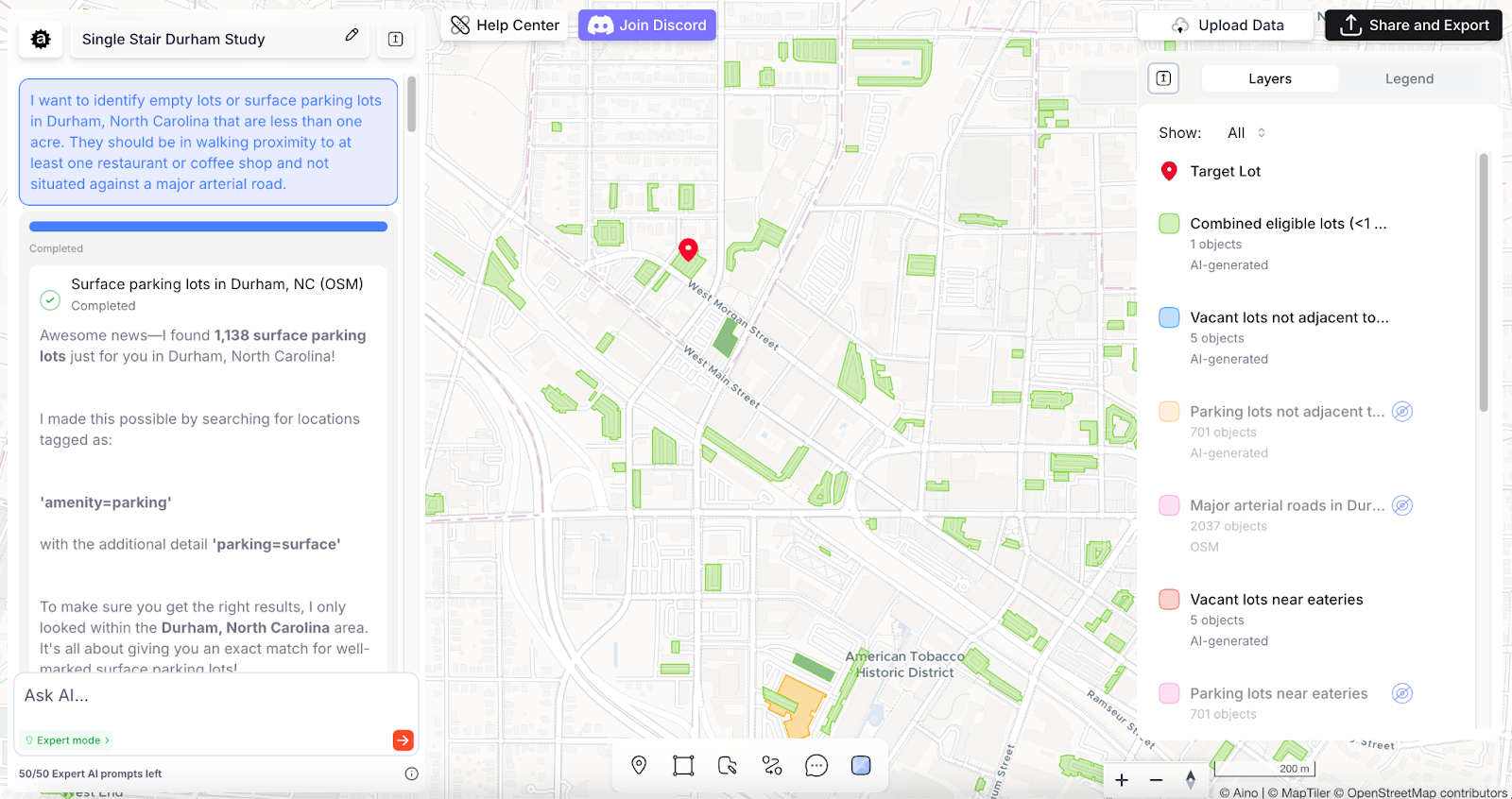
Aino is a browser-based AI mapping tool that lets users explore urban data through natural language. In my evaluation of the platform I wanted to identify potential plots using several factors such as proximity to restaurants and whether or not they were a surface parking lot. I was able to prompt the tool and it automatically produced layers and logic to help me identify dozens of plots.
How it helps: With Aino, users can perform detailed site screening in a few clicks and use interactive prompts to highlight areas and identify points of interest. The platform makes it easy to compare multiple sites side by side, layering relevant data to understand which one best fits the business case. Teams can explore development constraints early and avoid weeks of research.
What’s different and where it falls short: The interface is conversational and intuitive. Aino removes the friction of traditional GIS software and opens up complex data to non-specialists. It helps users discover relationships between location, zoning, and demand that might not be obvious with manual tools. While the map can be useful at identifying plots and projects, knowing what’s for sale or actively being developed is obviously a critical component and needs to be sourced from other tools.
Before money changes hands, the focus shifts to evaluating risk and potential. This is where developers ask: What’s the path to entitlement? Are there easements, topography, or soil issues? Does the zoning truly support the use, or will variances be needed? Historically, this phase involved long email chains with consultants and hours pulling data from disparate sources. Now software is helping teams uncover constraints and red flags earlier in the cycle.
Placer An advanced location intelligence platform that analyzes foot traffic and consumer behavior for physical properties. Placer aggregates anonymized mobile data to reveal how people move and spend time in and around a site.
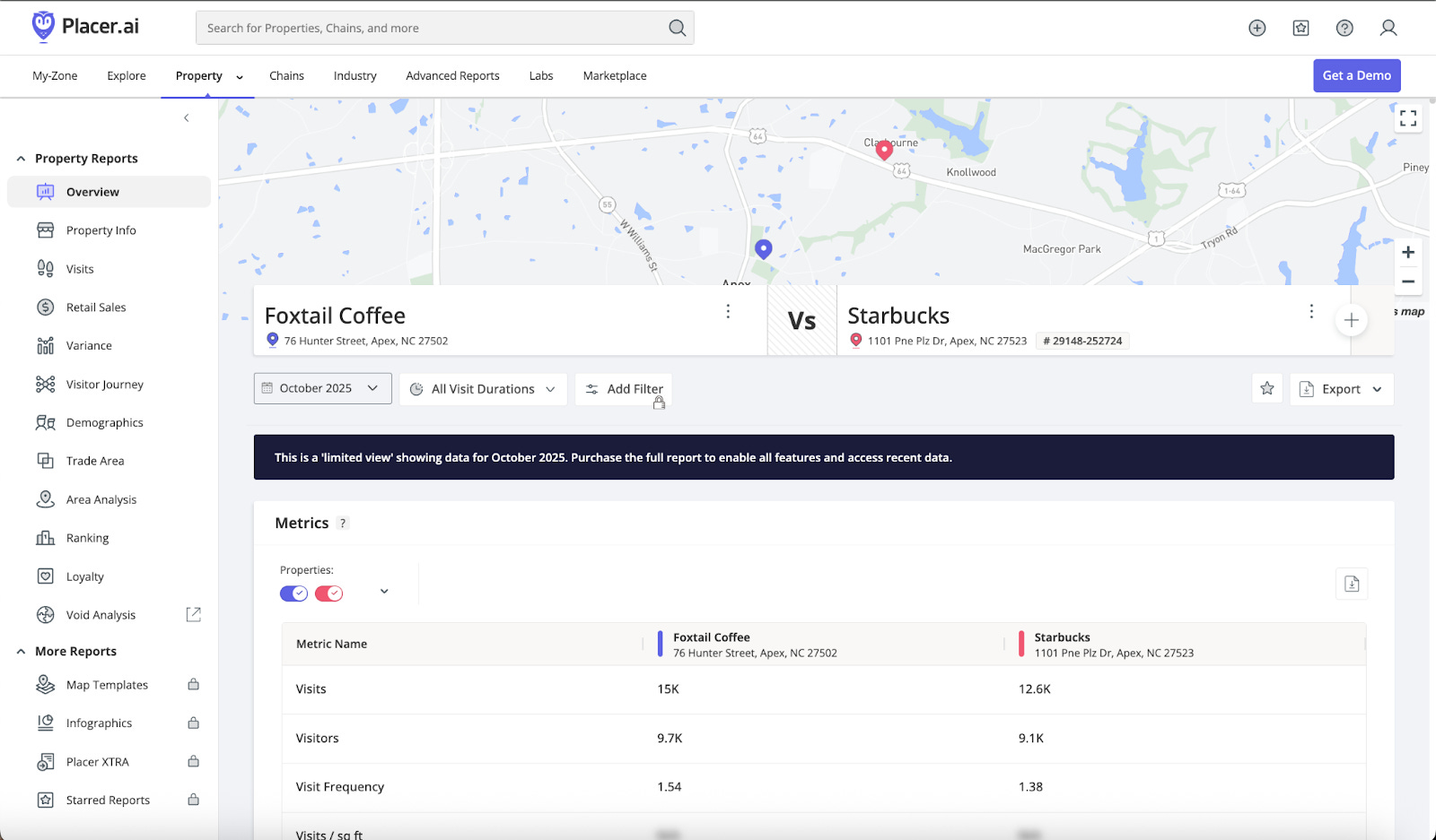
How it helps: In the due diligence stage, Placer.ai provides real-world data on a potential site’s visitor counts, demographics, and competitive landscape. Developers can enrich their site evaluations with near real-time visitation trends and audience insights to gauge a property’s true demand and revenue potential. Instead of relying solely on surveys or gut feeling, the team gets concrete metrics (e.g. peak foot traffic, dwell times, trade areas) to validate whether a location is viable. This data-driven approach can surface hidden gems or warn of weak spots early, improving acquisition decisions.
What’s different and what falls short: Placer.ai replaces weeks of manual research with instant analytics. It continuously tracks thousands of locations, so it can optimize investment strategies and limit real-estate risks by grounding decisions in actual behavioral data. Essentially, it allows developers to perform “X-ray vision” on any site, identifying patterns like customer loyalty or migration trends, which greatly reduces the risk of unpleasant surprises after purchase. While Placer’s capability can appear magical, a lot of it is based on mobile data sources which are only really a sample of true activity and contain their own biases. Depending on the kinds of customers or foot traffic you target consider that it might not be the full picture.
HelloData is a multifamily real estate analytics platform that uses AI to gather and analyze up-to-date rent, sales, and expense data for properties across the U.S. It aggregates daily information on millions of units, from rents and vacancies to concessions, into a centralized system for market and financial analysis.
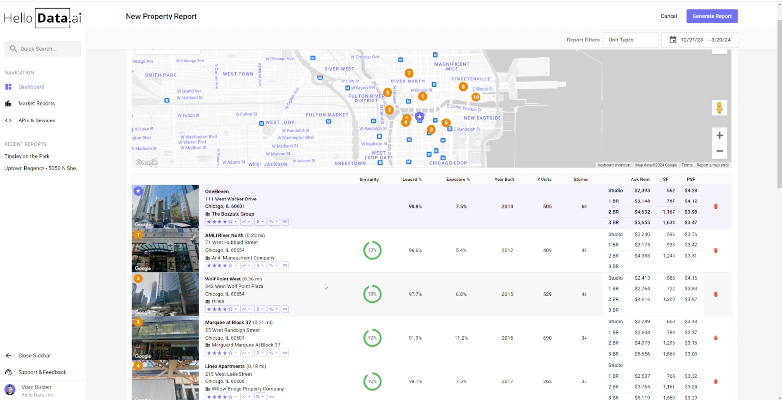
How it helps: When assessing a project’s feasibility, HelloData.ai automates the grunt work of market research and pro forma prep. Developers can instantly pull accurate comp sets, market rent benchmarks, and expense estimates, instead of manually calling brokers or combing through reports. For example, with a few clicks you can get the average rents for similar projects, recent lease-up velocities, or expense ratios in the target area. These real-time insights let you underwrite multifamily deals in minutes while allowing you to test different scenarios. By having reliable numbers on demand, teams can screen more deals faster and zero in on those that pencil out.
Why HelloData is different and where it’s limited: HelloData’s data pipeline tracking 35M+ units daily across 99% of U.S. markets means feasibility studies are built on live market conditions, not stale comps. This breadth of data and AI-powered analysis replaces hours of manual rent surveys and spreadsheet updates with an on-demand dashboard. It also reduces risk by flagging trends like falling occupancy or new supply coming online that a traditional feasibility study might miss. Though the data collection and aggregation capabilities of the platform are powerful, in markets that don’t have a lot of turn over and “mom-and-pop” landlords with low technical skills might present gaps depending on the product offering you’re interested in.
Zoning and building codes shape what’s possible, but they’ve long been one of the hardest parts of the process to navigate. Teams are asking: What’s allowed here by right? What’s the threshold for triggering inclusionary housing or parking minimums? Do our current plans run afoul of fire access, egress, or ADA rules? This phase is increasingly supported by tools that surface answers fast and flag problems before they reach city plan checkers.
UpCodes is a comprehensive building code compliance platform that offers a searchable library of codes and AI-driven code checking tools. UpCodes aggregates construction regulations (building, fire, accessibility codes, etc.) into one constantly updated database, and provides features like an AI “Copilot” for code research and plugins to flag issues in BIM models.
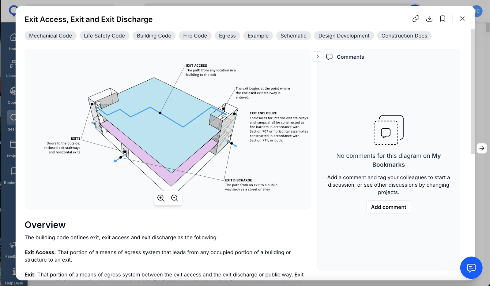
How it helps: In the zoning and code review phase, UpCodes acts as a smart assistant to ensure your design concept meets all the rules before you submit for permits. Rather than paging through thick code books, an architect or developer can type questions into UpCodes (e.g. egress requirements for a stairwell) and get instant answers with references. The platform also lets you search local zoning ordinances and building codes by keywords or project-specific filters, so verifying height limits, setbacks, occupancy loads, etc. is much faster. Moreover, with the AI compliance plugin, you can run an automated check on your 3D model or drawings. This feature is like a “spellcheck for buildings” that highlights code errors in real-time as you design. This early feedback catches compliance problems (say, an insufficient corridor width or missing ADA clearance) when they’re still easy to fix.
Why UpCodes is different and where it’s limited: UpCodes fundamentally changes the code review workflow from manual and reactive to automated and proactive. Traditionally, teams might discover code violations late in the game or worse, during plan check leading to costly redesigns. UpCodes, by contrast, draws on a constantly updated, searchable database of regulations (updated thousands of times a month) and uses AI to interpret them, ensuring you’re always working with current rules. It frees up hours of staff time by eliminating tedious cross-referencing and reduces reliance on outside code consultants and avoiding nasty surprises in the approval process. The biggest limitation of the platform is keeping its database up to date and compliant with local changes to code. Ultimately, managing the complexity of code compliance is still a complex, human-driven task. Users expecting a bulletproof review still need to rely on professional eyes.
With zoning constraints understood, schematic design can begin in earnest. Developers and architects ask: What mix of units delivers the right yield? Where do the elevators and stairs go? Can we still make the numbers work with a shifted unit layout? This stage is iterative and quick-moving. New tools help generate options in minutes and evaluate tradeoffs between form, code compliance, and financial performance.
TestFit is a real estate feasibility software that automates site planning and “test-fit” building design using generative algorithms. TestFit can rapidly create floor plans, unit layouts, and parking configurations based on a site’s constraints (zoning, lot size, height limits, etc.), effectively serving as a digital massing study tool.
How it helps: TestFit lets developers and architects answer “Will it fit and yield what we need?” by inputting basic parameters like a parcel boundary, desired unit mix, and parking requirements. The software instantly generates optimized building layouts that meet both design criteria and the pro forma targets and allows users to modify the layout in real time. During feasibility, this means you can iterate on dozens of scenarios (e.g. different building heights, or podium vs. wrap parking) in minutes. The tool will tell you unit counts, gross floor area, parking ratios and even do basic cost and revenue estimates for each scheme. This rapid prototyping helps teams assess whether a project is viable given local regulations and financial goals before spending weeks on hand-drawn plans.
Why TestFit is different and where it’s limited: Traditionally, early site planning is a slow back-and-forth between design and finance teams, sketching layouts, calculating yields, and revising. TestFit compresses that into a real-time, interactive process. It’s been called a “feasibility study in minutes” solution allowing users to iterate faster and make informed decisions earlier in the project lifecycle. By automatically respecting zoning rules and highlighting conflicts, it also reduces false starts (e.g. discovering late that your design violates a setback). This dramatically accelerates the workflow and gives developers a data-backed foundation for go/no-go decisions.
While TestFit has support for many building and parking types it’s less useful for unusual product types, complex phasing, or bespoke architectural moves, the generative engine can become more of a sketching aid than a reliable layout tool. While TestFit can respect come constraints around zoning and code, it’s not a detailed code review tool, meaning that it can produce designs that are not compliant and still require significant human effort to be permit-ready.
Hektar by Parametric is a generative design platform that helps architects and developers create and evaluate early-stage urban design options using parametric algorithms. It’s essentially an “augmented drafting” tool for master planning where you input site data and project goals, and Hektar produces multiple feasible massing studies or site layouts that obey built-in rules for various building typologies. The product is highly focused on the European market but it’s principles could be applied broadly in time.
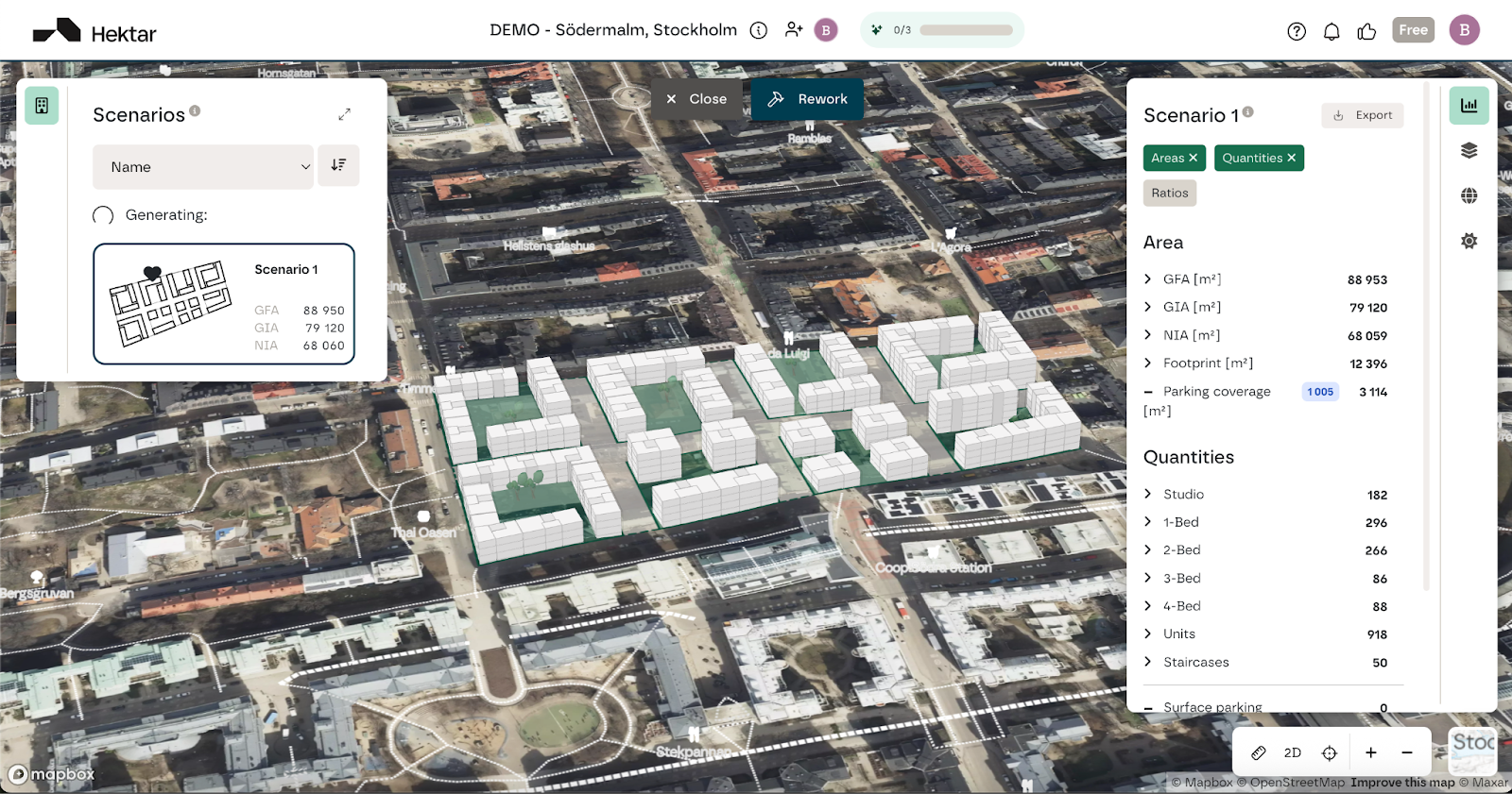
How it helps: Once a project moves into conceptual/schematic design, Parametric’s Hektar allows the team to explore creative design alternatives quickly while still respecting real-world constraints. For example, if you’re planning a mixed-use development on a city block, Hektar can generate dozens of schemes (towers, courtyards, rowhouses, etc.) and calculate key metrics for each, like unit count, FAR, open space, sunlight angles in minutes. The tool also encodes zoning parameters and building logic (e.g. how far apart buildings should be, street grid alignment), so every option it presents is grounded in practicality. By filtering and fine-tuning these generated options, stakeholders can zero in on a design that balances density, cost, and livability before committing to detailed drawings.
Why Hektar is different and where it can expand: Parametric’s approach allows developers and architects to evaluate options quickly and with minimal effort. Instead of manually sketching and calculating each iteration, the software’s generative algorithms create, evaluate, and even share early-stage designs. Hektar bakes data into the process: you get a comprehensive overview of alternatives with quantifiable outcomes, which brings more rigor to schematic design decisions. By handling complexity and automating monotonous, time-consuming tasks, the tool lets the human designers focus on the bigger picture. The result is a faster, richer schematic design phase where decisions are informed by instant feedback on feasibility, helping reduce false starts and ensuring the chosen concept is robust ahead of investing more time and resources. The platform is highly geared towards the European market, and while it’s more accessible than TestFit, the same limitations of compliance and production ready specs apply.
Higharc is a cloud-based home design platform that uses generative design to create full building plans (particularly for single-family homes and subdivisions built by medium to large scale home builders) much faster than traditional CAD drafting. Higharc’s system produces editable 3D models, complete with floor plans and elevations, based on parametric inputs – and it can automatically update the design if you change parameters (like swapping out a room or altering the lot size).
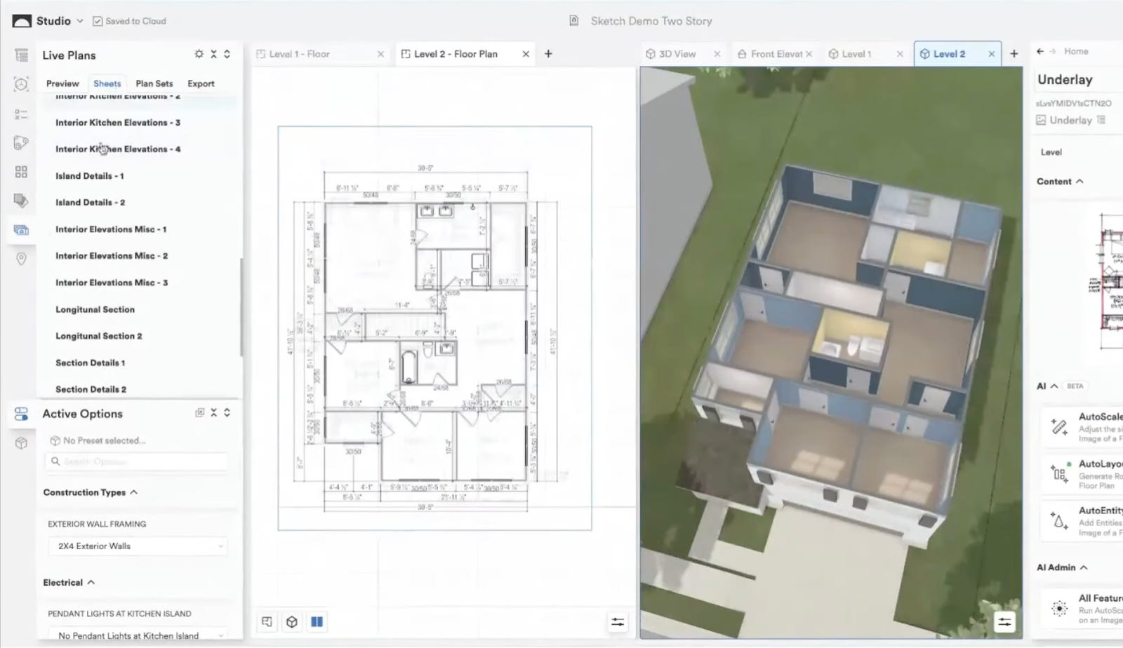
How it helps: In the test-fit and schematic design stage, especially for single-family residential projects, Higharc serves as a productivity booster for architects and homebuilders. Rather than drawing each plan from scratch, a user can input requirements (number of bedrooms, square footage, lot dimensions, style preferences, etc.) and Higharc will generate a compliant, buildable plan in minutes. This is invaluable for developers who need a library of design options to evaluate or present. For example, a subdivision developer might rapidly produce several home models to see which mix optimizes the site or appeals most to buyers. The platform ensures that each design meets building codes and structural logic, so even these preliminary schematics are technically sound. Higharc also integrates things like instant material takeoffs and pricing estimates, which feeds into feasibility and value-engineering during schematics.
Why Higharc is different: Higharc aims to “design homes…100X faster than CAD”, fundamentally changing the speed of schematic design for houses. It blends tasks that used to be separate (design, visualization, and even some engineering) into one process. This means fewer back-and-forth cycles between architects, drafters, and estimators. Moreover, Higharc’s generative approach ensures consistency and compliance. The platform also enables a level of customization and option testing that would be prohibitively time-consuming by hand: developers can easily test “what-if” scenarios (e.g. different elevations or unit mixes) and even use Higharc’s interactive VR/web interfaces to let stakeholders or buyers visualize designs in real time. By connecting design to selling and building in one solution accelerates schematic design and also smooths the handoff to marketing and construction.
As the building concept takes form, the project enters public review. Developers ask: How does our plan align with the city’s stated goals? What precedent projects can we reference? Where are we likely to face pushback and how do we address it? Modern tools are helping teams model policy alignment, visualize the project’s impact, and communicate in ways that build trust with the community.
ReZone is a nationwide zoning and municipal decision tracking tool. ReZone uses AI to monitor City Council and Planning Department meetings across the country, extracting every real-estate-related decision and turning that “unstructured” info into a searchable database. It acts like a custom news feed for zoning changes, code amendments, development approvals, and other policy shifts that could affect property development.
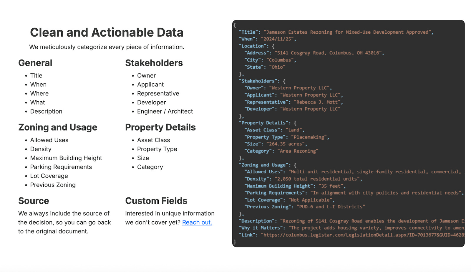
How it helps: Entitlements often hinge on knowing the local regulatory climate and precedent. ReZone gives developers a strategic edge by exposing exactly that. Users can receive alerts or search the system to find out, for example, if a city is discussing an impact fee increase, or how a planning commission voted on similar projects in the past. It essentially “attends” city meetings for you, analyzing decisions and making them queryable. When preparing an entitlement application, a developer can leverage ReZone to craft a winning strategy: you might discover that the council tends to favor projects that include a certain public benefit, or you could find a new rezoning initiative that makes your project more feasible. ReZone also helps de-risk the process by flagging potential roadblocks, for instance, if a moratorium or code change is being proposed that could impact your timeline, you’d know immediately. This kind of intelligence enables proactive community engagement and lobbying before issues escalate.
Why ReZone is different: Prior to tools like ReZone, staying on top of local legislative changes was labor-intensive or prone to misses (who can monitor “a thousand city meetings at once”?). ReZone’s innovation is to automate municipal monitoring by tracking every jurisdiction’s agendas, minutes, and transcripts, then uses AI to filter out the noise and highlight what matters to real estate. This means no more being caught off guard by a new ordinance or a last-minute zoning code tweak. By turning local knowledge into a digital, accessible resource, ReZone.ai significantly reduces the uncertainty in the entitlement phase. Developers can approach hearings with a clear picture of the political landscape and even reference precedents (“City X approved a similar rezoning last year”) to strengthen their case and accelerate approvals.
After winning approvals, the task becomes execution. Teams ask: What documents are required for permit submission? What details are we missing? What does the plan checker typically flag in this jurisdiction? Permitting has long been slow and unpredictable, but new platforms are working to automate the paperwork, coordinate submissions, and even simulate plan reviews in advance.
PermitFlow is a workflow software platform designed to streamline construction permitting from application to approval. Often described as “TurboTax for construction permits,” PermitFlow guides users through identifying the right permit process and forms for their project and helps auto-fill and organize the submission package. Essentially, PermitFlow acts as a personal permit expediter, centralizing all your permit tasks and communications and keeping permits on schedule.
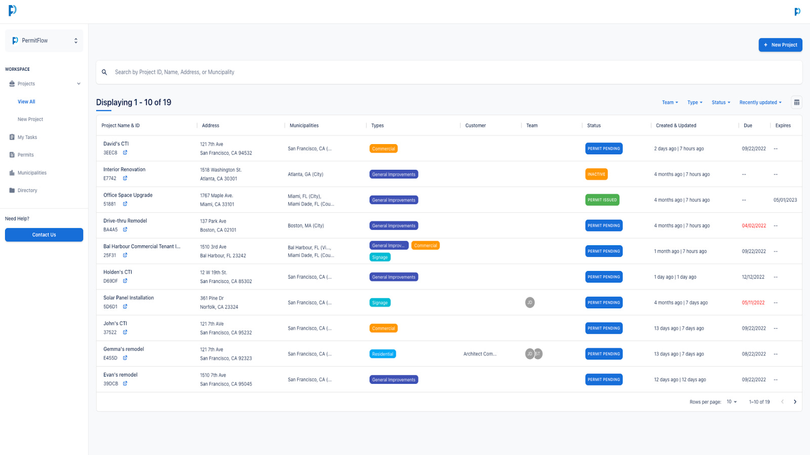
PermitFlow also provides a dashboard to track all your permits across different jurisdictions in one place.
How it helps: Obtaining building permits involves juggling paperwork, differing city requirements, and deadlines. PermitFlow simplifies this complexity by helping determine exactly what permits you need and gathering the proper forms based on your project scope and location (for example, whether you need a separate electrical permit, or which local building department handles your project). It then enables you to prepare “requirement-ready,” error-free applications quickly by walking you through each field and attachment. Common mistakes such missing documents, incorrect fee calculations, or incomplete info are flagged before submission, which significantly cuts down on rejection cycles. Once submitted, PermitFlow continues to add value by tracking the permit’s status with the city. Instead of repeatedly checking a clunky municipal portal or making phone calls, you get updates and notifications in the app. If the city requests revisions or additional info, that’s logged and can be managed through the platform as well.
Why PermitFlow is different and it’s ongoing challenge: The traditional permitting process is notorious for its complexity and city-specific rules and forms that often create delays. PermitFlow changes the game by anticipating requirements, flagging potential issues, and even auto-filling repetitive information. The tool can allow developers to scale quickly, especially for groups that are considering operating in multiple markets. Because codes and zoning rules evolve, any AI or rules engine that “anticipates requirements” is only as good as the underlying data; incomplete or outdated local regulations can lead to missed items or incorrect assumptions that still create comments and resubmittals and the same will be true for PermitFlow. By automating the entire permitting process, it enables teams to start construction sooner and with greater confidence. Compared to handling permits via spreadsheets and emails, PermitFlow’s unified platform drastically reduces human error (no more forgetting a document) and prevents things from slipping through the cracksGreenLite
GreenLite is an AI-powered permitting and plan review service that fast-tracks building permit approvals by combining proprietary software called LiteTable with human experts with domain expertise (in a way very similar to FDEs). GreenLite effectively offers a “private plan check” whereby their code specialists and algorithms review your plans for compliance, handle corrections, and even liaise with local building departments to get the permit issued in a fraction of normal time.
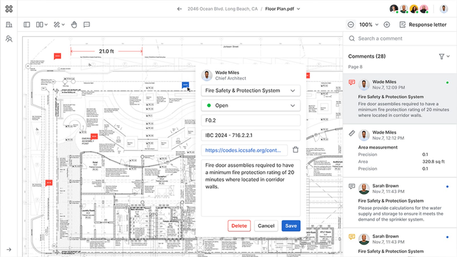
How it helps: GreenLite is often engaged when time is of the essence or a project is complex. From the moment you have permit-ready drawings, you can hand them to GreenLite’s teams. They use their AI platform to ingest and analyze the plans, flagging any code or zoning issues early. Their expert reviewers then fix or advise on these issues before submission, which means the plans are far more likely to sail through the city’s review with zero or minimal comments. Permits that might normally take months can often be obtained in weeks or even days. For example, GreenLite often touts cutting timelines by 60% or more, and case studies show projects that normally need 3-4 months getting approved in under 30 days.
Why GreenLite is different and where it’s limited: GreenLite’s model is unique in that it’s not just software, but software plus a professional team that “owns” the permit process in the same way an FDE works towards building an outcome. By ensuring compliance before submission and leveraging their relationships and knowledge of local codes, they eliminate costly permitting delays. This dramatically reduces carrying costs and schedule risk for developers. GreenLite is geared toward large developers, national brands, and firms with portfolios across multiple jurisdictions, so its cost and workflow may not suit small builders or single-project developers. The platform integrates best with clients who have a need for centralized, scalable permitting management, but it does not replace all other construction software or project management systems.
One of the challenges that I often saw while working as a Forward Deployed Engineer is that in most companies, systems are designed to solve discrete problems and thus when trying to tie together successive steps or decisions that are generated across different systems, a lot of manual work and iteration is involved. Imagine being able to do site-selection by searching across Aino, validation of the plots using HelloData and Placer to understand their potential, generating a test fit based on the zoning and code in that area using testfit.io with a few simple prompts, taking a process that could take weeks of work down to a few minutes and a far higher number of permutations or potential iterations. From my point of view, many companies that might attempt to master the entire workflow often end up being uncompetitive compared to the best-in-class niche tools, so perhaps some future software-defined land development project would involve using AI agents to combine these tools in meaningful ways.
I’ve worked with many companies that are exploring how LLMs can be used to solve the complexity of the real world. Significant effort is involved in getting AI to answer even simple customer service questions, and as the risk of a decision increases, so does the security and need for reliability in AI. Ultimately human judgement and experience is still the major determining factor in many high-risk decisions, but the tools we’ve looked at today represent opportunities to scale our resources, to build better places faster and at lower cost.
No posts
Comments
Nothing yet. Say the first thing.
Sign in to join the conversation.