
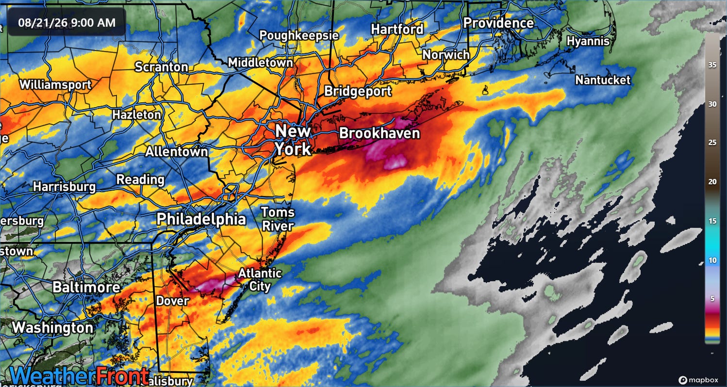
As expected, Thursday afternoon and evening were very busy with thunderstorm activity in the Northeast and Mid-Atlantic. Several inches of rain in a short period of time caused significant flash flooding in the New York City metro area and parts of New Jersey, eastern Pennsylvania and Delaware. Severe weather including tornadoes impacted the region as well, with tornadic waterspouts causing damage in parts of Long Island.
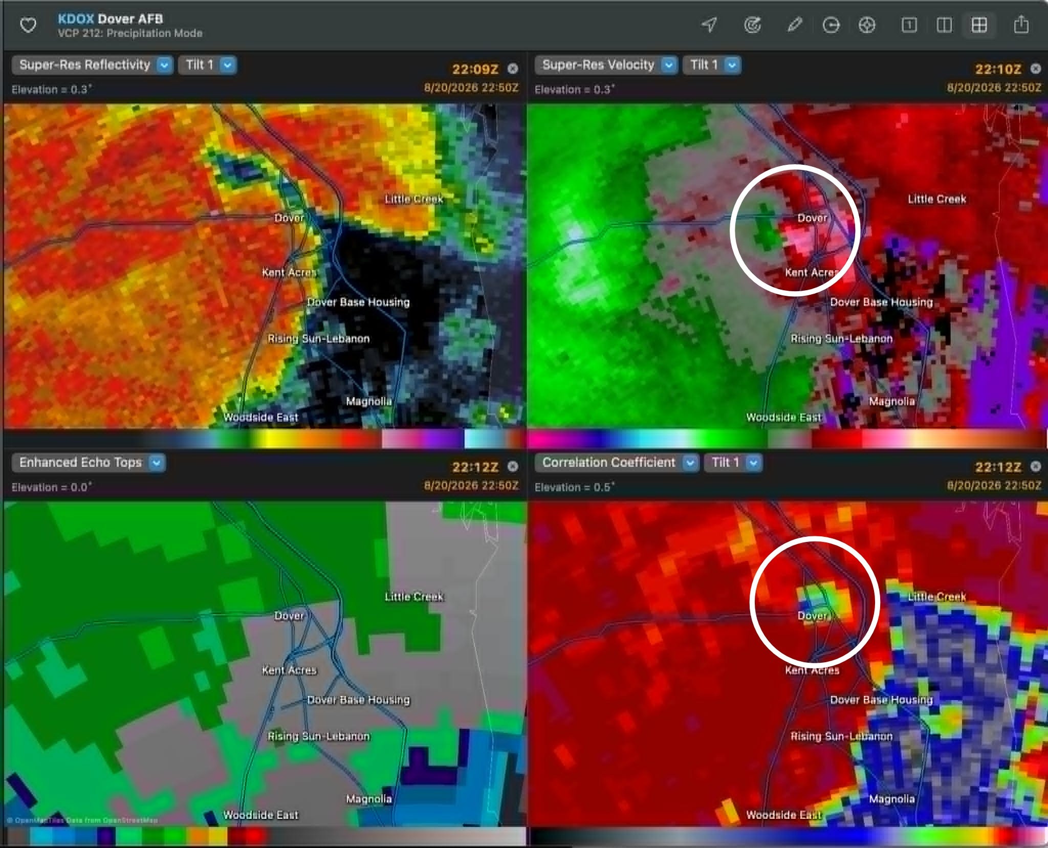
The most impactful tornado appears to have been in Dover, DE, where Doppler radar data showed a clear tornadic debris signature with a tornado that caused significant damage across the city.
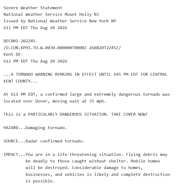
Thankfully, there were apparently not any injuries, possibly in part due to what looked to be good NWS tornado warnings with lead time — and the use of the “considerable” impact-based warning tag for a large, confirmed tornado, something that has to be pretty rare for Delaware.
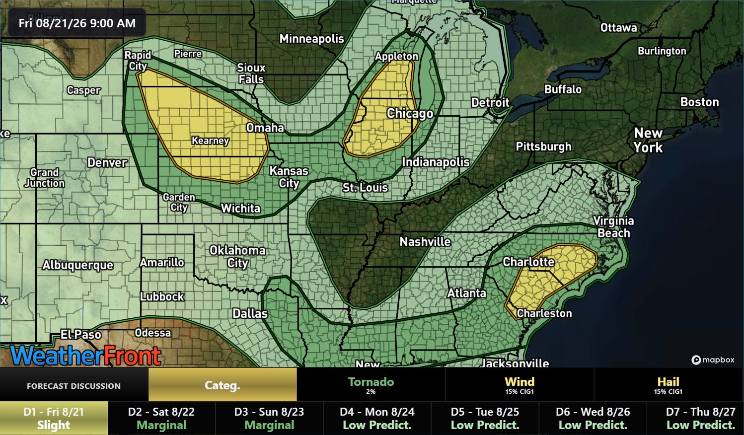
The risk of strong to severe storms along the East Coast will shift to the Carolinas today, where there will also be a risk of flash flooding as thunderstorms develop ahead of a disturbance rotating around the developing upper level trough of low pressure across the East. Meanwhile, disturbances along the northeast edge of the upper level dome of high pressure bringing excessive heat to parts of the western and south central United States will also bring a slight (level 2 of 5) risk of severe weather to parts of the central Plains and Midwest.
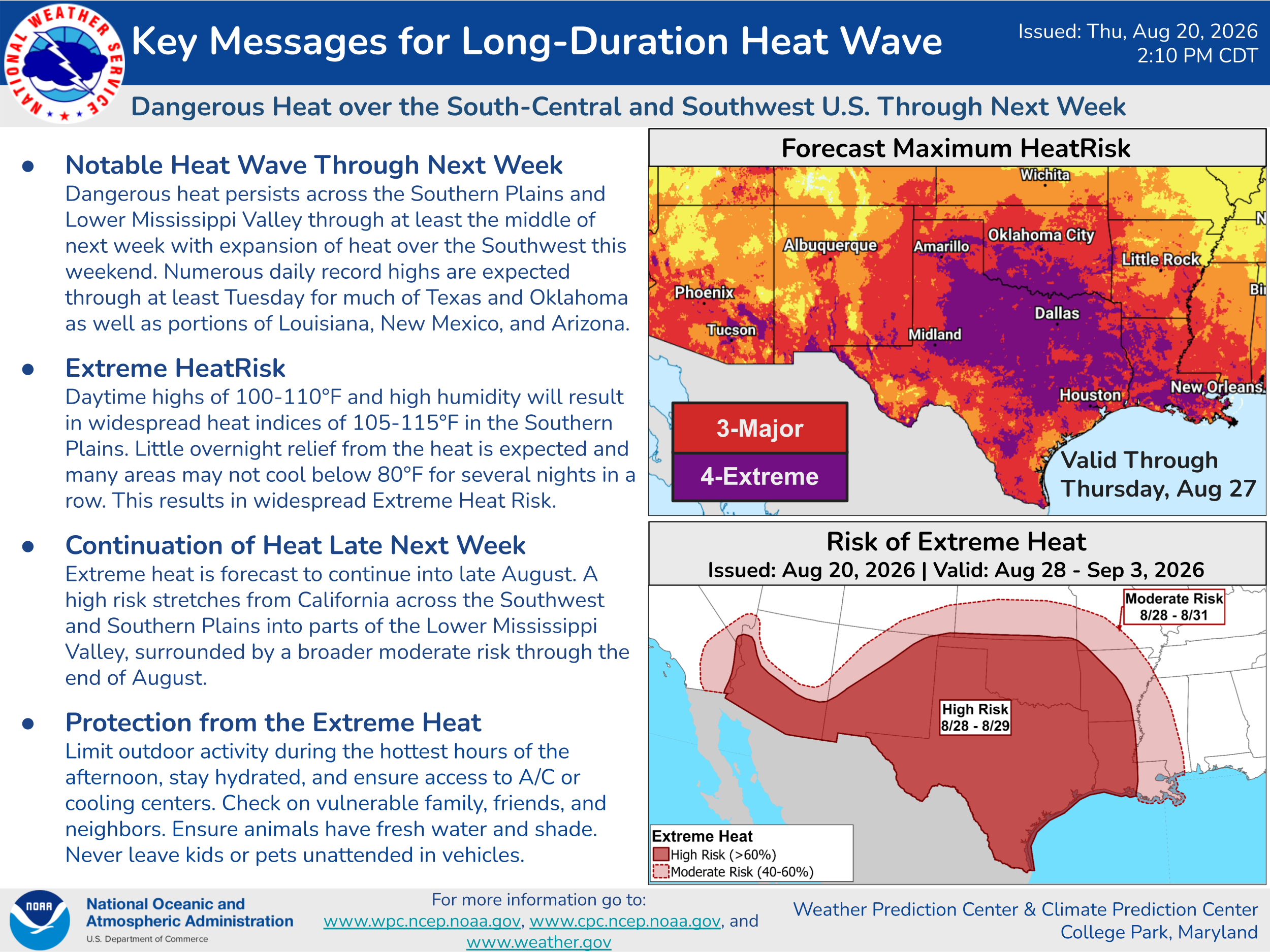
Unfortunately, that heatwave looks as if it will persist in the foreseeable future. The upper level high pressure area will oscillate in intensity over the next 10 days, resulting in periodic peaks in temperatures — but overall, well above normal temperatures with a number of record highs are expected.
![[Key Messages]](https://substackcdn.com/image/fetch/$s_!RgK9!,f_auto,q_auto:good,fl_progressive:steep/https%3A%2F%2Fsubstack-post-media.s3.amazonaws.com%2Fpublic%2Fimages%2F9fdbf3eb-8ef9-4123-ba7c-24454bf679b1_897x736.png "[Key Messages]")
The tropical depression southeast of Hawaii has not yet strengthened — but environmental conditions are expected to support intensification into a strong tropical storm over the next few days as the system moves west-northwest.
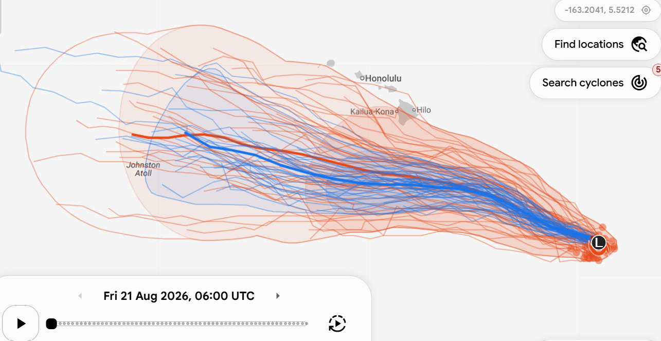
The models have overall shifted a bit to the south in the last 24 hours, keeping the center of the storm well south of the islands. Even so, enhanced easterly flow on the northern side of the tropical storms should bring potentially heavy rainfall to eastern sides of Maui and especially the Big Island, as well as the potential for rough surf for the state’s beaches (especially the south sides).
Balanced Weather is made possible by the generous support of paid subscribers, who as thanks get access to live Balanced Weather chats and videos as well as the ability to post comments and ask questions on posts. To become a paid subscriber or a free subscriber (also very much appreciated and you will automatically receive new posts in your email), please click below.
No posts
Comments
Nothing yet. Say the first thing.
Sign in to join the conversation.