
I am traveling today, but wanted to get a quick update out about a couple of ongoing weather situations.
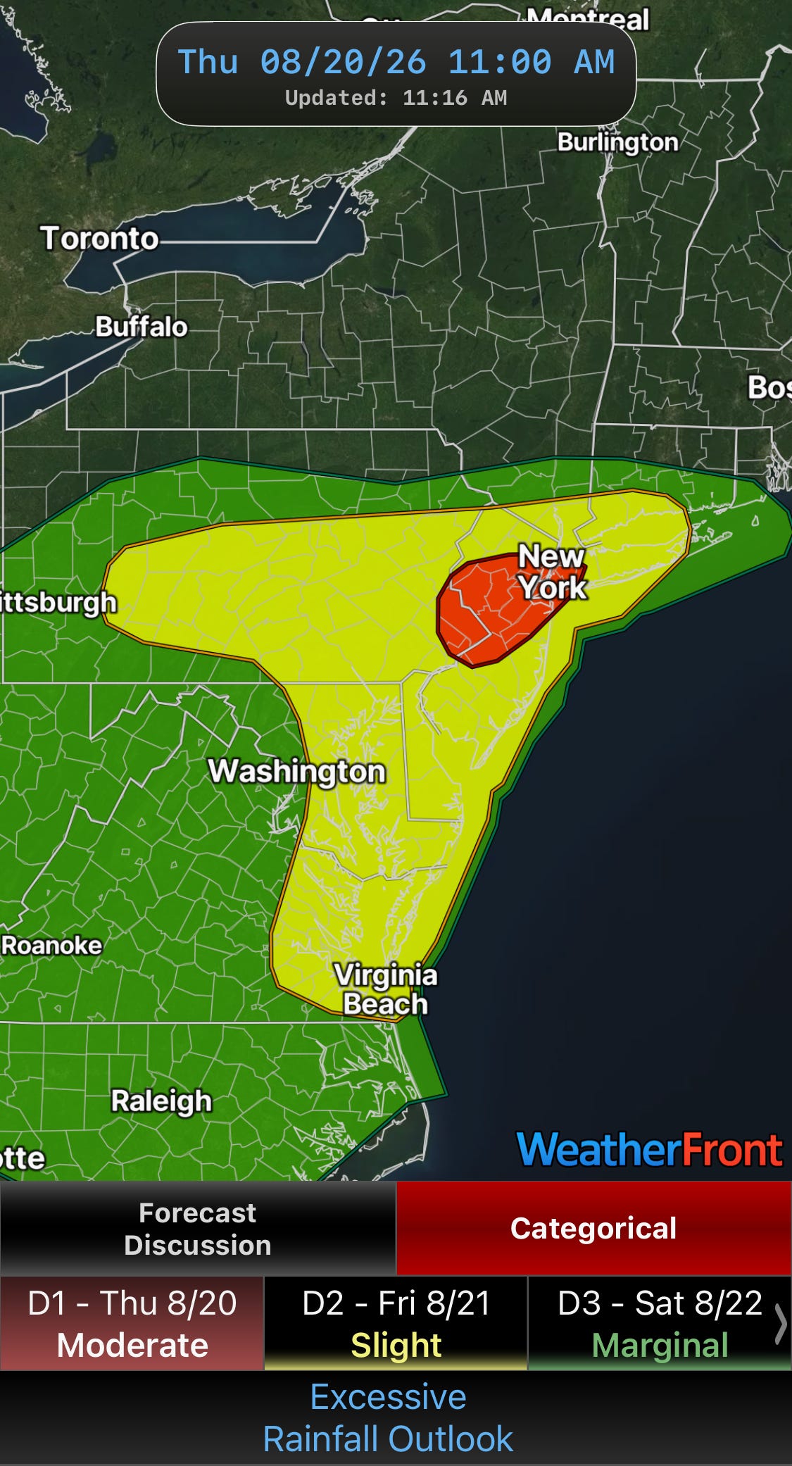
An active day of strong thunderstorms is expected in the Northeast and Mid-Atlantic today as the upper level trough that we have been discussing begins to evolve. Flash flooding is a particular concern as tropical moisture will be pulled north ahead of the upper trough, supporting storms with torrential rainfall rates. A moderate (level 3 of 4) risk of flash flooding is in place across central New Jersey and adjoining eastern Pennsylvania where high resolution models show the highest probability for these high rainfall rate storms.
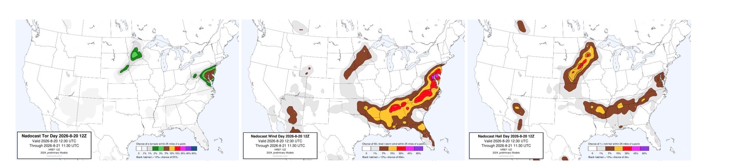
Severe weather will also be probable as the developing upper level trough brings increasing wind shear to support stronger storms. Damaging winds and a few tornadoes will be the primary risks. Severe storms will also be possible in the Northern Plains with large hail potential.
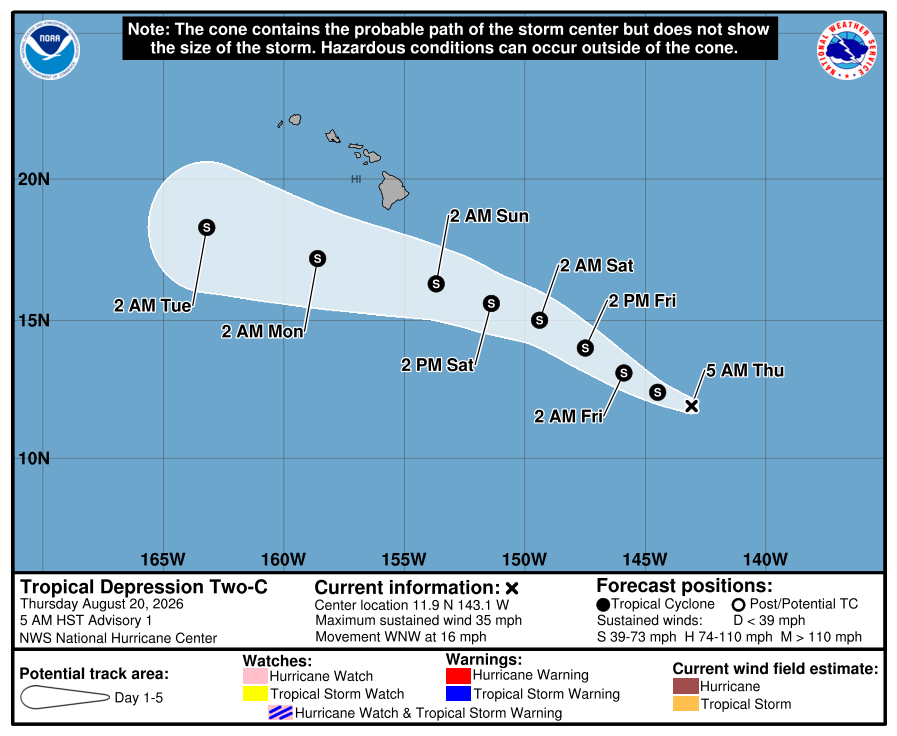
In the tropics, a new tropical depression has formed in the central Pacific to the southeast of Hawaii. This system is expected to intensify to a tropical storm as it moves west-northwest and passes south of the islands over the next several days.
While the models are in pretty good agreement that the storm should stay farther south than Lala, it does appear as if it will pass close enough to bring a threat of heavy rainfall, particularly for windward sides of Maui and the Big Island. There is still some uncertainty in the track of this system, and the closer it ends up to the islands the more significant the impacts could be. More on this system in the coming days.
No posts
Comments
Nothing yet. Say the first thing.
Sign in to join the conversation.