
The economic costs of disasters in the United States keeps rising, and a large part of that story is that we are putting more people, houses, infrastructure, and economic assets in the path of predictable hazards. A flood in an empty field is a weather event. A flood in a neighborhood is a disaster. The difference between the two is a land use decision.
Land use planning, or the public authority to decide where, whether and how we build things, is perhaps the single most powerful tool we have for managing disaster and climate risk. And yet land use planning is one of the tools that state and local governments are most reluctant to use for that purpose. Why? That is the question that I asked and attempted to answer in a lecture at the Aspen Global Change Institute this week. I am not suggesting that land use is never used for hazard mitigation and climate adaptation efforts. Clearly it is, and in significant ways. But compared to other tools like infrastructure investment or spending on disaster response and recovery, land use comes in a very distant second.
It is tempting to say that local officials are short-sighted, captured by developers, or simply don’t know better. I think these explanations are mostly wrong, and lead to some fairly vague prescriptions (something something political will). So what is happening? Why aren’t local governments prohibiting development in places prone to fires and floods and hurricanes, or putting much stronger conditions on that development?
Over the past several decades, researchers across many different fields have diagnosed a piece of our collective planning inaction. Here I describe eight explanations, though there are likely many more. These aren’t competing theories but overlapping ones, and context maters a lot. That is to say, no one explanation or group of explanations is right, per se, but all are plausible in different places and contexts. To give away the punchline up front, not planning for hazards is often a rational response to the situation that local governments and especially elected officials actually face.
To head this off at the pass…I’m not claiming that this list is exhaustive, and look forward to additions. Let me hear them in the comments.
When a local government approves a subdivision in a floodplain and it floods, the bill is largely covered by federal disaster relief and federally subsidized flood insurance — not by the local government that green-lit it, and not fully by the household that bought in. Economists call this moral hazard, when you’re insulated from the cost of a risk, you take on more of it. Worse, the federal levees and relief meant to protect us make hazardous places feel safe, which draws still more development into them — what the late planning scholar Raymond Burby called the “safe development paradox” and what Gilbert White famously documented in his dissertation. The deepest version of the problem is that our disaster system runs the incentives backwards: it socializes the losses while keeping the gains of risky development local.
One study to read: Raymond J. Burby, 2006, “Hurricane Katrina and the Paradoxes of Government Disaster Policy,” Annals of the American Academy of Political and Social Science.
Local governments often run on growth. Property and sales taxes pay for the schools, roads, and services voters demand, and the surest way to expand the tax base is to approve development. The people who profit most from that development, i.e. landowners, builders, and real estate interests, are also among the most organized and influential voices in local politics. Sociologists call this coalition the growth machine, and it carries a structural bias toward saying yes to development. It is also worth noting that some hazard-exposed land can also be the most valuable, i.e. near the water or in the sparsely populated forest. Asking a local government to leave its best tax base undeveloped means asking it to act against its own fiscal interest, against its most powerful constituents, on behalf of a disaster that may not arrive for many years.
One study to read: John Logan & Harvey Molotch, 1987, Urban Fortunes: The Political Economy of Place.
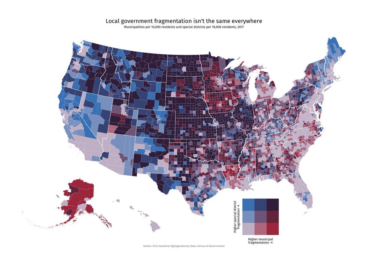
Land use authority is spread across roughly 38,000 general-purpose local governments, each making decisions within the varying guardrails set by state governments. That fragmentation can create a race to the bottom re: risk: if one town imposes tough rules on floodplain development, the builder simply moves to the next town over. The first town loses the tax base without reducing the regional risk, because floods and wildfires don’t stop at municipal lines. Restraint by any single jurisdiction is individually costly and collectively futile. This is why the research keeps finding that what actually works is a higher level of government setting the floor. This also helps with what local officials describe as the “grocery store” problem - tough decisions are tougher when you run into your voters at the grocery store. Higher levels of government sometimes give useful political cover.
One study to read: Raymond Burby & Peter May, 1997, Making Governments Plan: State Experiments in Managing Land Use.
You can’t regulate a hazard you can’t see or, just as importantly, can’t defend regulating in court. And the data we have is uneven, which might explain why we’ve made progress on some hazards and not on others. Floods are the best case for hazard information nationally, even if FEMA’s floodplain maps are genuinely flawed. But they exist nearly everywhere, have an important aligned incentive (the NFIP program), and give a local government a clear, legally defensible line to regulate to.
From there things get a lot less reliable. A few states have built statewide wildfire hazard maps their localities can regulate against (California, Colorado, and now Utah). For landslides, extreme heat, drought, subsidence, and other threats, authoritative, regulation-ready hazard data are much less consistent. In the U.S. the absence of defensible data is a hugely important consideration, and points to how confident a jurisdiction might be when limiting a private property owner’s use of their land.
The study to read: Siders, AR et a.l, 2024, “How local governments avoid floodplain development through consistent implementation of routine municipal ordinances, plans, and programs" Oxford Open Climate Change, 4(1).
Voters reward disaster relief, not prevention. In the most-cited study on the subject, political scientists found that voters reward incumbents for disaster relief spending after a catastrophe, but give no electoral credit for preparedness spending that prevents one. A rational elected official, responding to the incentives voters actually create, will underinvest in mitigation every time. Prevention that succeeds looks exactly like nothing happening, and nothing happening wins no votes.
One study to read: Andrew Healy & Neil Malhotra, 2009, “Myopic Voters and Natural Disaster Policy,” American Political Science Review.
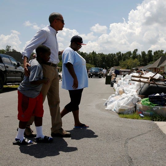
Suppose we fixed every incentive for hazard mitigation. Research suggests that we might still underprepare because of how human minds perceive rare, catastrophic risk. Specifically, we tend to value short-term gains and discount long-term risk. Collectively we also tend to pay attention to hazards mostly in the brief window right after a disaster, but only for a short period of time. Behavioral scientists call that latter tendency the availability bias, and the broader pattern the ‘ostrich paradox’: we have more information than ever to anticipate disasters and still systematically fail to prepare for them. This matters because it means the problem isn’t only structural. Even the homebuyer with perfect information, the voter with good intentions, and the official with the right incentives might be fighting their own cognition.
One study to read: Robert Meyer & Howard Kunreuther, 2017, The Ostrich Paradox: Why We Underprepare for Disasters.
The people who understand hazard risk and the people who do land-use planning aren’t always the same and don’t always work together. In most communities, emergency management and land use planning are separate worlds, with different departments, responsibilities, and professional cultures. When researchers score a community’s various plans - like their hazard mitigation and land-use plans - for how well they align, they routinely find them working at cross-purposes, with one plan steering growth into the very places another plan flags as dangerous.
One study to read: Philip Berke et al., 2015, “Evaluating Networks of Plans and Vulnerability to Hazards and Climate Change,” Journal of the American Planning Association.
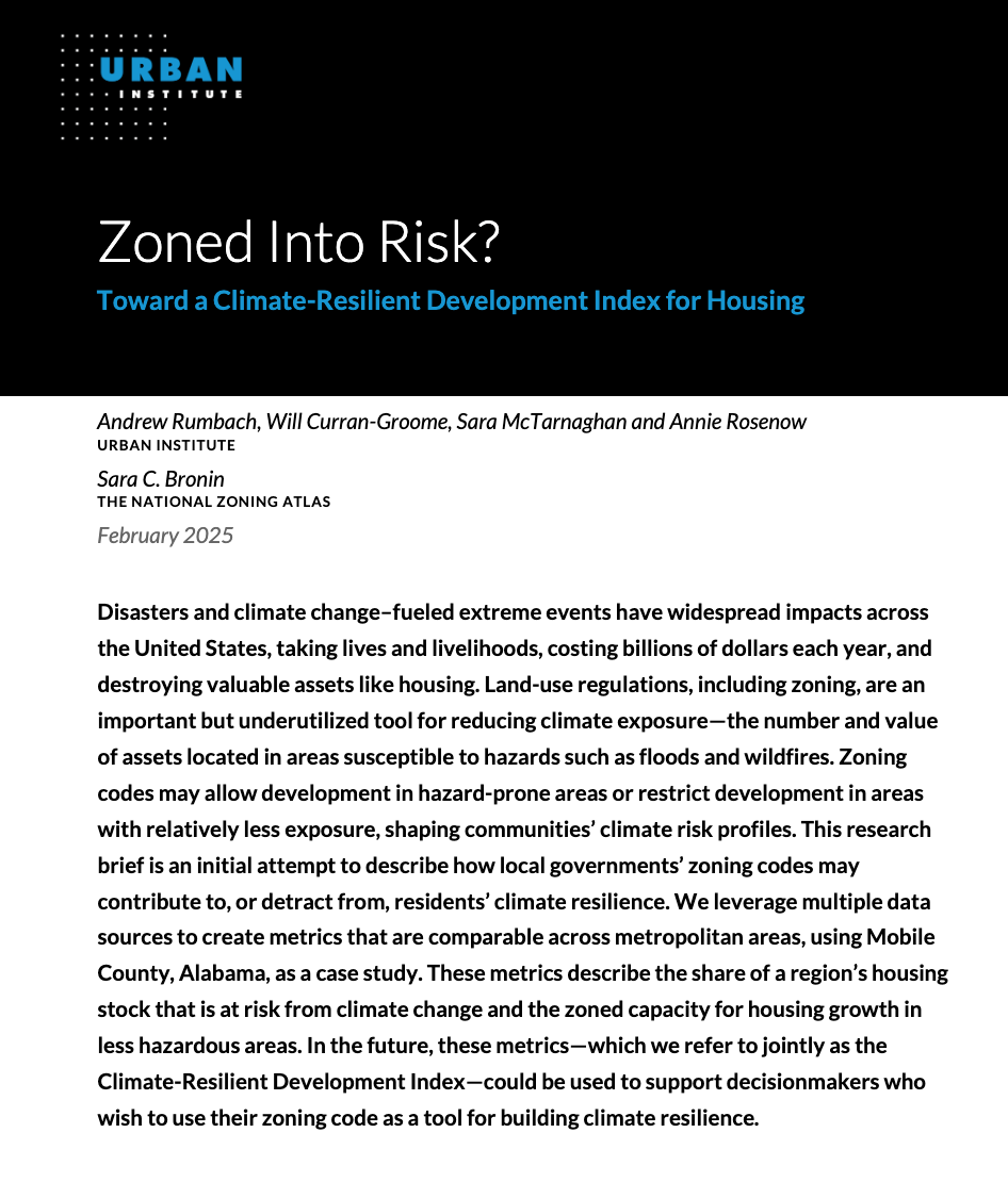
Here is a bit of a contrarian argument, and one that my colleagues and I are working on describing. What if the problem isn’t that we use zoning too little, but that we use it for the wrong ends that might compete with goals of resilience? American zoning is, in most places, aimed at mandating low-density development and especially single-family housing. The result is urban sprawl, and often onto hazarous land like the wildland-urban interface. It therefore also prevents the kinds of compact settlement patterns that would shrink or restrict our exposure. Organizations like Smart Growth America have been making this case for years, but there is a lot of room for empirical analysis of just how much zoning is contributing to, or potentially reducing, our capacity to develop with resilience in-mind.
One Two studies to read: Volker Radeloff et al., 2018, “Rapid growth of the US wildland-urban interface raises wildfire risk,” PNAS. This is a example of low-density growth driving exposure. As I mentioned above, the larger zoning-reform argument is still taking shape. See our study at Urban, Zoned Into Risk?
So there you have it, eight science-backed explanations. Which resonate? Which interact and compound? What are you seeing where you live, work or do research? What did I miss or get wrong? The comments are open, looking forward to the discussion.
Comments
Nothing yet. Say the first thing.
Sign in to join the conversation.