
Welcome to new readers of the American Geographical Society’s weekly, the AGS Globe! The Globe shares articles on geography and geospatial, along with exciting opportunities and news from our network. As the world revolves, geography evolves. The mission of the AGS Globe is to bring our storied legacy of exploration and thought leadership into the frontiers of the future.

By Lynn Cai
Imagine the daunting task of mapping Latin America in the late 19th and early 20th centuries, long before computers and geographic information systems (GIS). For much of the early twentieth century, vast portions of Latin America remained poorly mapped by modern standards. National surveys varied widely in quality, borders were often disputed, and reliable geographic information was difficult to obtain. Into this challenge stepped the American Geographical Society (AGS), which launched one of the most ambitious cartographic projects in its history: the Millionth Map of Hispanic America. What began as a mapping initiative evolved into a 40-year-long effort that reshaped geographic knowledge across the Western Hemisphere and demonstrated the power of maps as tools of science, diplomacy, and development.
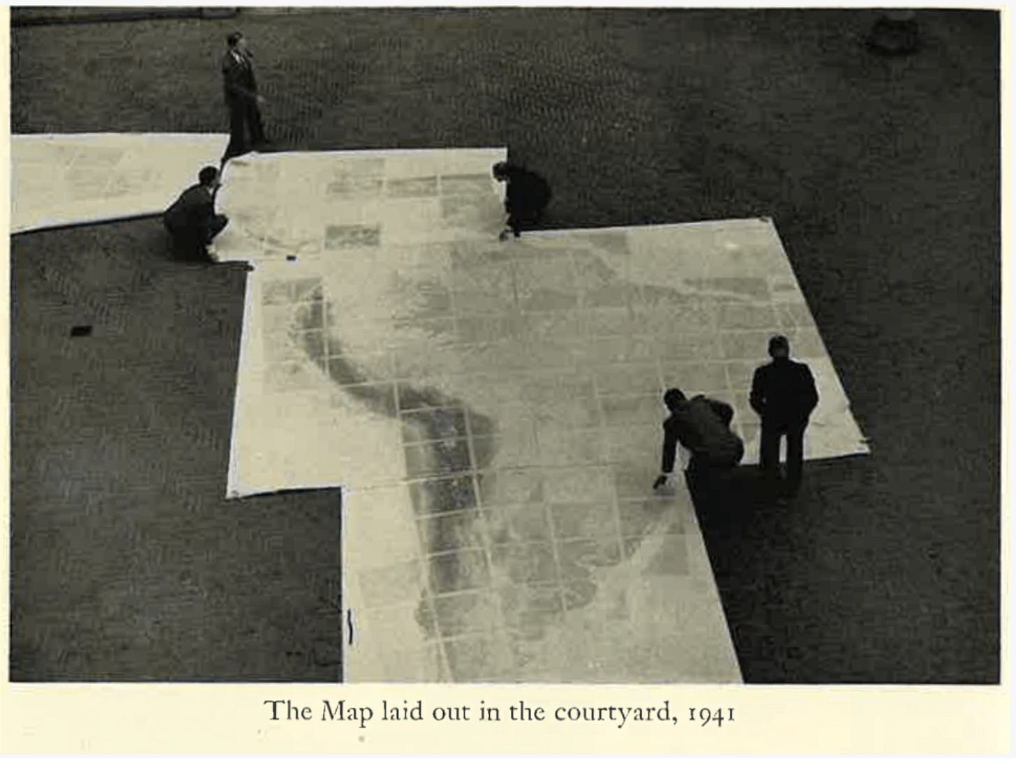
This was no ordinary map—but a series of regional maps on a scale of 1:1,000,000 spanning from the United States-Mexico border to the southern tip of Chile. The project was inspired by German geographer Albrecht Penck, who first proposed creating a world map on a millionth scale in 1891 at the fifth International Geographical Conference in Bern, Switzerland. By 1899, cartographers had already mapped much of Europe, Asia, and Africa, but a large-scale project dedicated to mapping Latin America had yet to commence. It was not until 1920 that Isaiah Bowman, a former student of Penck, announced that the American Geographical Society would undertake the drafting of a millionth map for Latin America. The result was the largest mapping project completed by a private organization.
The Millionth Map project sought to create a standardized map series of Latin America at a scale of 1:1,000,000. This was done by meticulously collecting and compiling surveys, articles, field notes, photographs, and other publications. To map the entire 8-million-square-mile region of Latin America on a scale of 1:1,000,000, the cartographers had to draft over 100 sheets of individual regional maps.
The project unfolded over more than two decades. Beginning with the first completed sheets in the early 1920s, a steady stream of map publications followed until the final sheet—representing Bogotá—was completed in 1945. By the project’s conclusion, the full series consisted of 107 map sheets that, when assembled, measured approximately 34 by 28 feet.
Each map was created through a laborious process involving a series of back-and-forth drafts between a draftsman and a lithographer. The draftsman was responsible for sketching out and drafting a map, while the lithographer was tasked with typesetting and printing. The production of each map was very expensive, with each sheet costing at least $769 (worth $18,407.83 today). The first map was produced in 1922 and depicted La Paz, Bolivia. The final maps on Cuba, southern Argentina, and Haiti were created in the early 1940s, concluding the 20-year project.

The completion of the final sheet marked a major milestone for AGS and for cartography in the Americas. A celebratory dinner was held in New York City’s Rainbow Room in December 1945 to commemorate the achievement.
While the project initially went by “Hispanic America”, the name was changed to “Latin America” in 1923 to reflect the inclusion of non-Spanish-speaking countries, including Brazil. The team working on the project was diverse—there were not only cartographers from the United States and Latin America, but also from the Russian military. Women were crucial to the mapping project.
This AGS map served as a crucial diplomatic tool in resolving boundary disputes, acting as a key cornerstone to negotiations and treaties. Notable examples include the Honduras-Nicaragua border, the Venezuela-Colombia border, and the Ecuador-Peru border. Economic surveys were used to settle the border dispute between Honduras and Guatemala, with the Special Boundary Tribunal formally adopting the AGS-produced map of the region in 1933.
The map series was also used in the settlement of the Tacna-Arica dispute between Chile and Peru, where a Millionth Map sheet was reproduced and employed by boundary commissions working toward the 1929 resolution. Similarly, AGS cartographers prepared specialized maps for the Bolivia–Paraguay Chaco dispute, providing critical geographic information that was later incorporated into maps used by the League of Nations. In extreme cases of disputes, revisions continued after the map’s completion in 1945; for instance, the Iquitos map was revised in 1962 at the behest of the Peruvian government.
The influence of the Millionth Map reached beyond diplomacy. Pilots, scientists, military planners, and government agencies all found uses for the detailed geographic information it provided.
One notable early user was famed aviator James Doolittle, who used the Atacama sheet during demonstration flights in South America in 1926—one of the earliest recorded uses of the map series for aerial navigation.
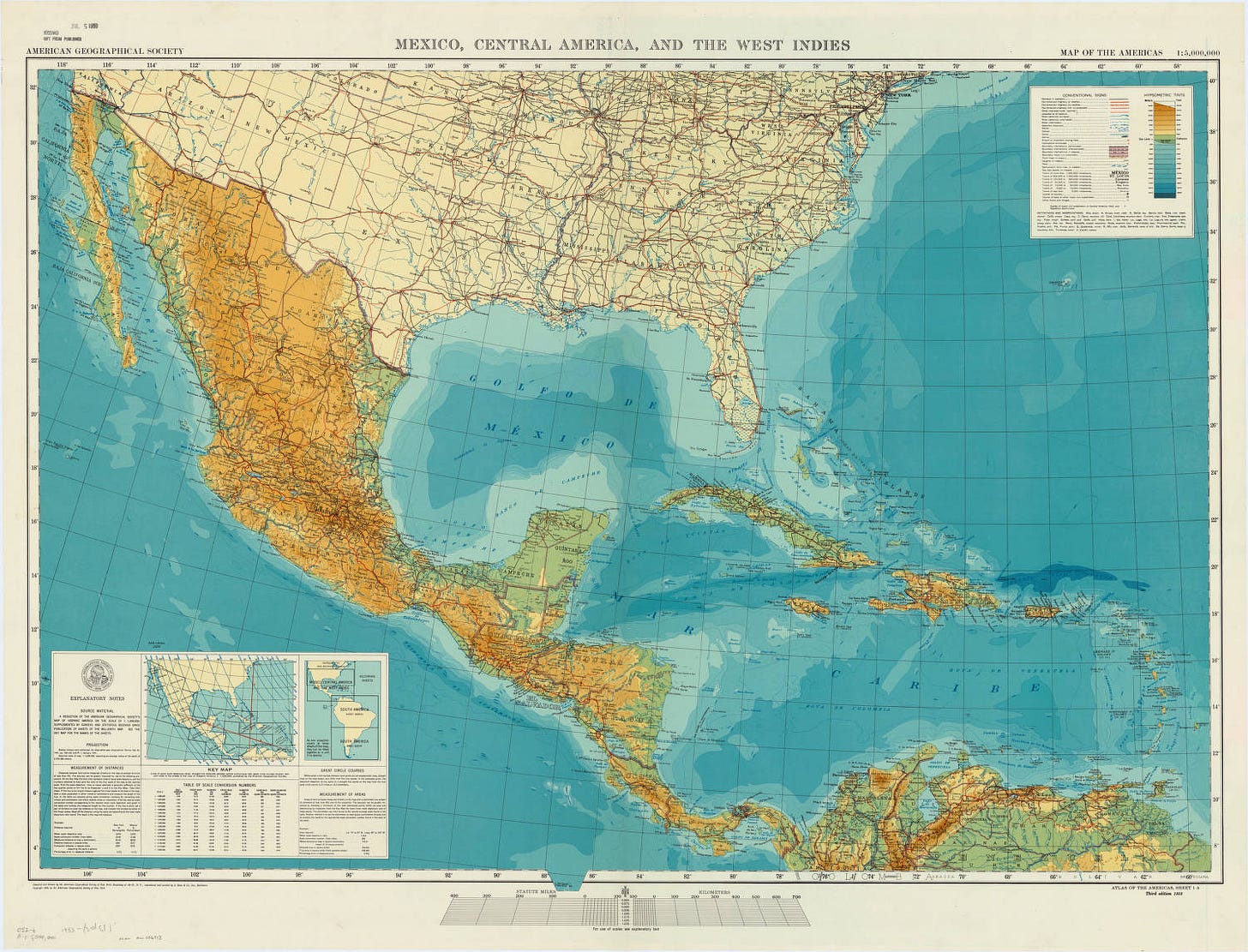
The maps attracted significant attention during WWII when U.S. officials needed clear navigation routes in the wake of threats of invasion by the Axis Powers. With funding from the U.S. government and published by the Pan American Union (the precursor to the Organization of American States), the map was redone on a scale of 1:2,500,000, producing the three-set Map of the Americas. Produced in English, Spanish, and Portuguese editions, the maps became important tools for hemispheric planning and cooperation.
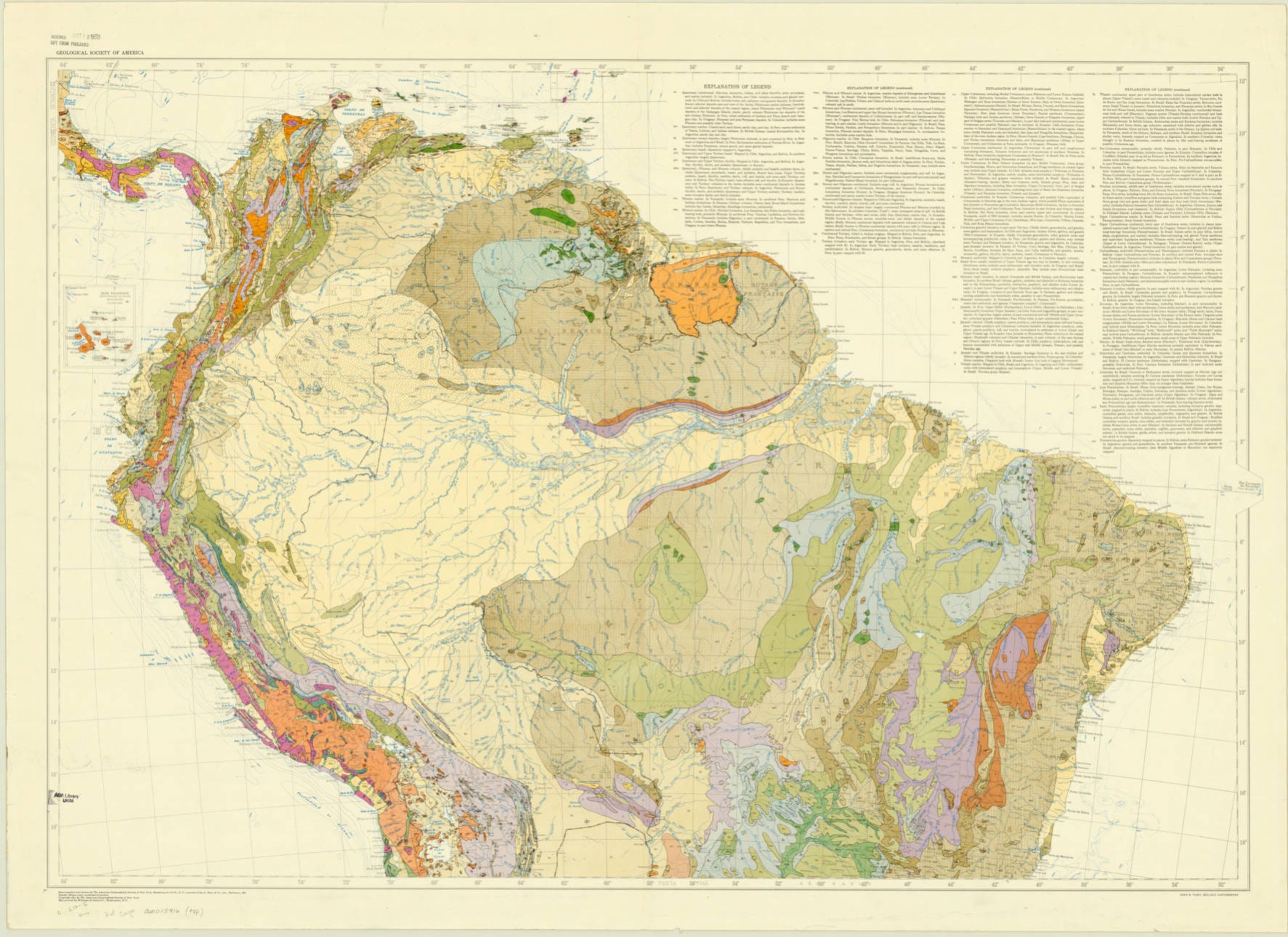
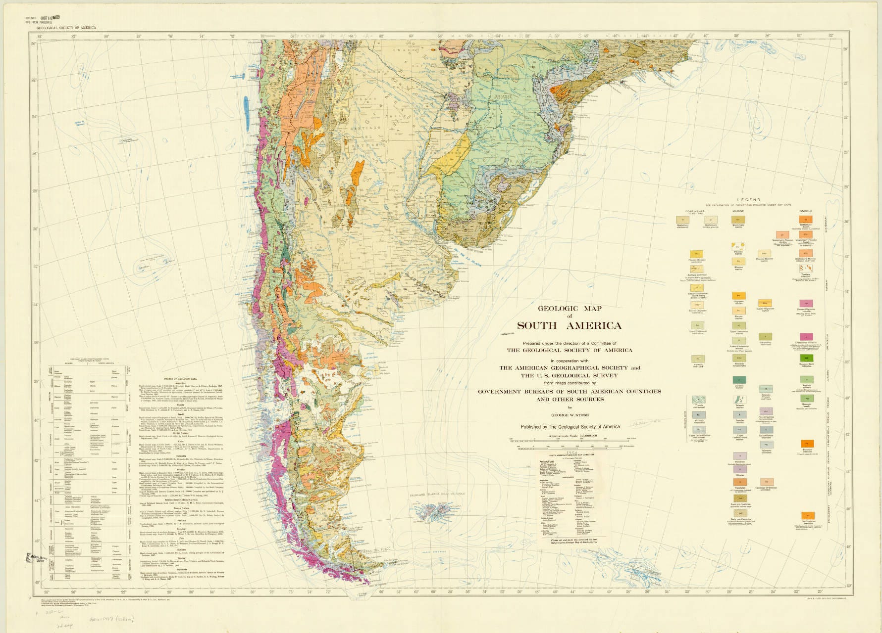
These maps later served as foundations for geological maps, aviation charts, and military planning documents. After 1945, the U.S. Army Map Service continued reproducing and revising many of the sheets for operational and navigation purposes.
Legacy
The Millionth Map of Hispanic America demonstrated that maps are far more than geographic representations. They are instruments of scientific inquiry, international cooperation, infrastructure planning, and conflict resolution. The project helped establish AGS as a leading center for cartographic research and created a geographic framework that would influence mapping across the Americas for decades.
Even after its completion, the project’s data continued to inspire new maps, commercial products, government publications, and international mapping efforts. From helping settle borders to guiding pilots through the Andes, the Millionth Map became one of the most consequential cartographic undertakings in the history of the Western Hemisphere.
As the American Geographical Society celebrates its 175-year legacy, the Millionth Map of Hispanic America remains a powerful reminder of geography’s enduring ability to connect knowledge, policy, and people across borders.
References
Thanks for reading The AGS Globe! This post is public, so feel free to share it.
Did you enjoy reading this? Support the American Geographical Society today with a donation of $50 to help us support Geography education.

Members of the American Geographical Society enjoy reduced-price access to AGS events and free access to the online version of Geographical Review.


Submit Lightning Talk and Exhibition Poster Proposals Today! Speak at our annual fall symposium, Geography 2050: Africa Shaping Tomorrow, taking place this November 19-20, 2026, at the Schomburg Center for Research in Black Culture in New York City! By 2100, over one-third of the world’s population will live in Africa, already the world’s youngest and fastest-growing continent, with profound implications for the interconnected human and environmental dimensions of the transformative demographic and technological boom across Africa. Submit proposals to speak at Geography2050 here.
Read the most recent Focus on Geography article, “Getting Lost: Reflections on Geographical Imagination” by Dr. Joseph Wood. Click here to learn more.
The AGS is sad to share the news of the passing of Executive Director Emerita, Mary Lynne Bird, on Saturday, June 13, 2026. Mary Lynne faithfully served AGS from 1983 until 2010, the longest-tenured Executive Director in AGS history. Learn more about her extraordinary life and career here.
Comments
Nothing yet. Say the first thing.
Sign in to join the conversation.