
Short post from me today –
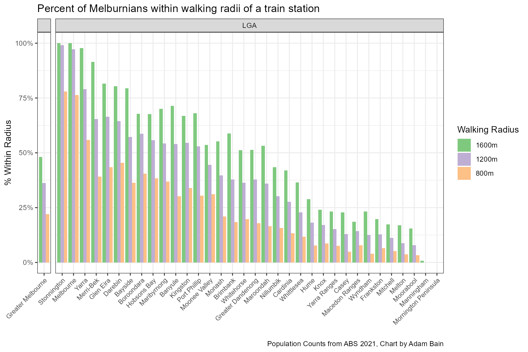
I ran the numbers and found that only 48.1% of Melburnians live within 1600 meters of a train station, only 36.2% live within 1200 meters and just 22.0% live within 800 meters of a train station. Which one you determine to be walking distance is up to you, but the trend recently has been towards a wider walking catchment radius – however I would personally lean towards the smaller radii.
Of course this is not uniform across Melbourne, with some LGAs, especially Stonnington, City of Melbourne and Yarra having a much larger share of their population within walking distance of a railway station. Manningham (Doncaster/Templestowe area) and the Mornington Peninsula, stand out with essentially no residents within a walking distance of Railway Stations. (No, I did not count the Stony Point line stations in these measurements due to the essentially unusable once-every-2-hour service levels.
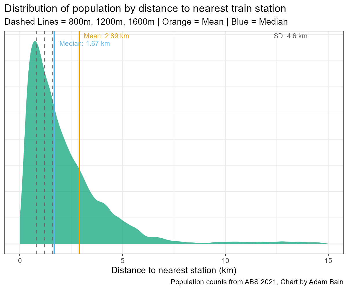
This chart represents the distribution of the population by the distance to the railway train station. This is a strongly positively skewed distribution, with the median resident living 1.67km away from the nearest train station, but the average distance from a railway station is 2.89km, due to the impact of outlier populations. This is broadly representative that the residential density clumps around railway stations.
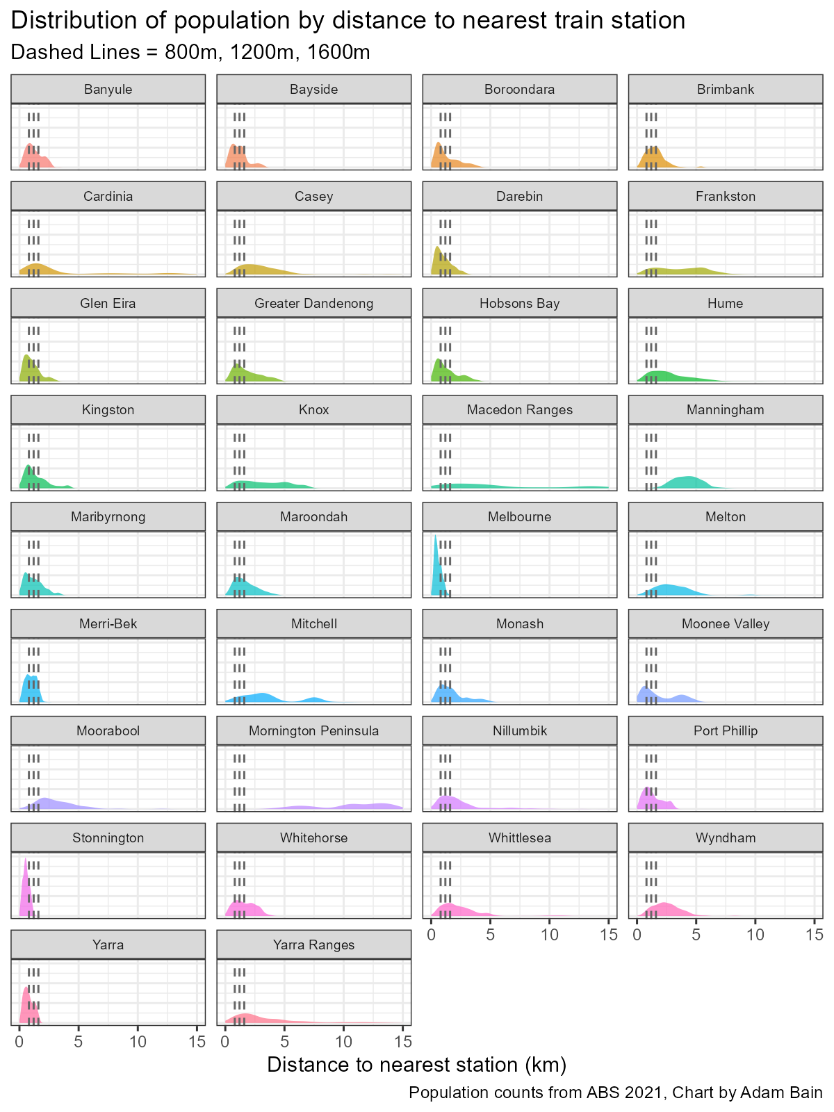
Across the LGAs (Local Government Areas) there is a distinct difference in distribution – note the peaks happen at different spots, I mean just look at Manningham and compare to Stonnington. Curious is that some LGAs have two peaks, such as Moonee Valley, representing two population centres, one closer and one further from railway stations. Keilor East station – part of the Melbourne Airport Rail Project (MARL) will change this in a couple of years.
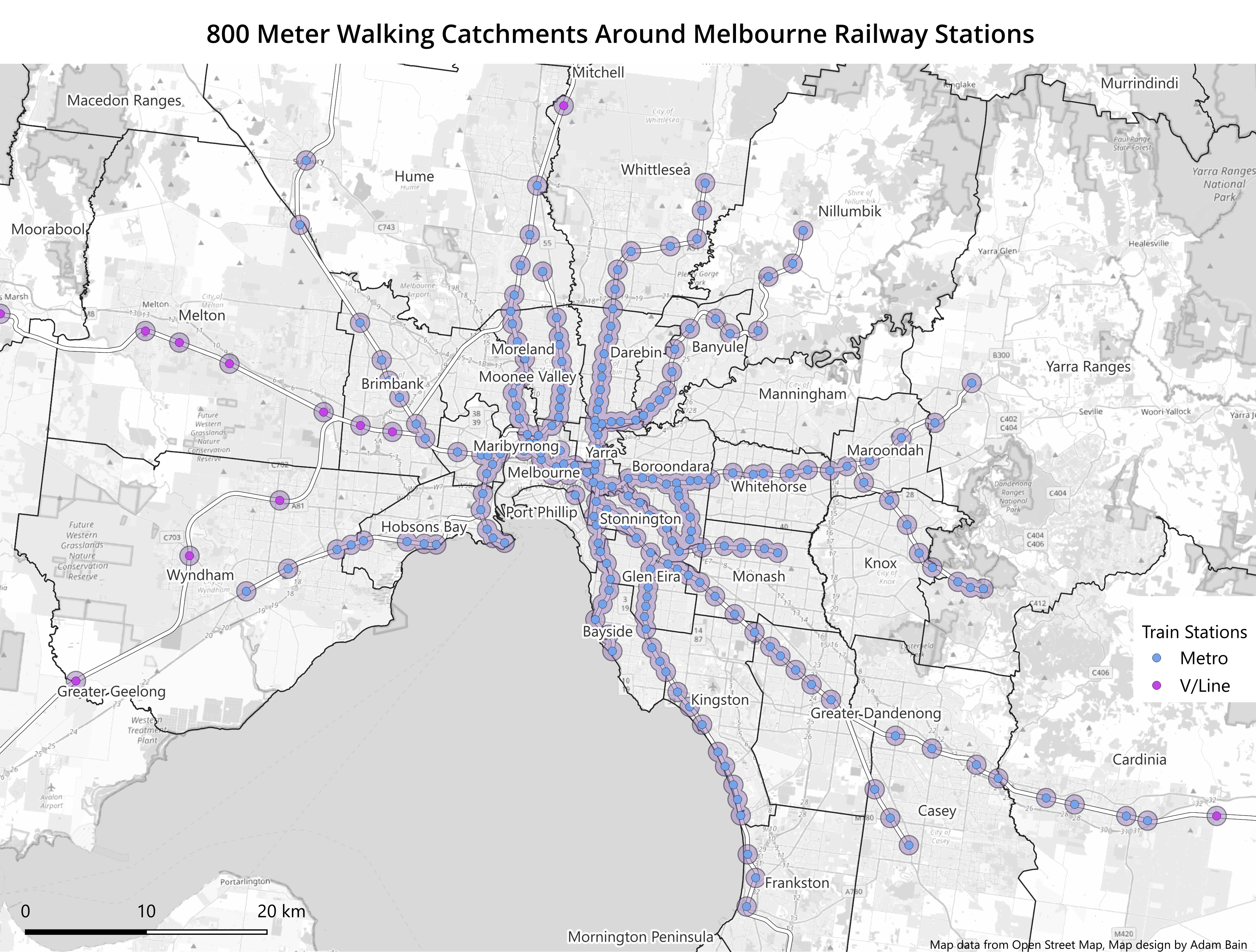
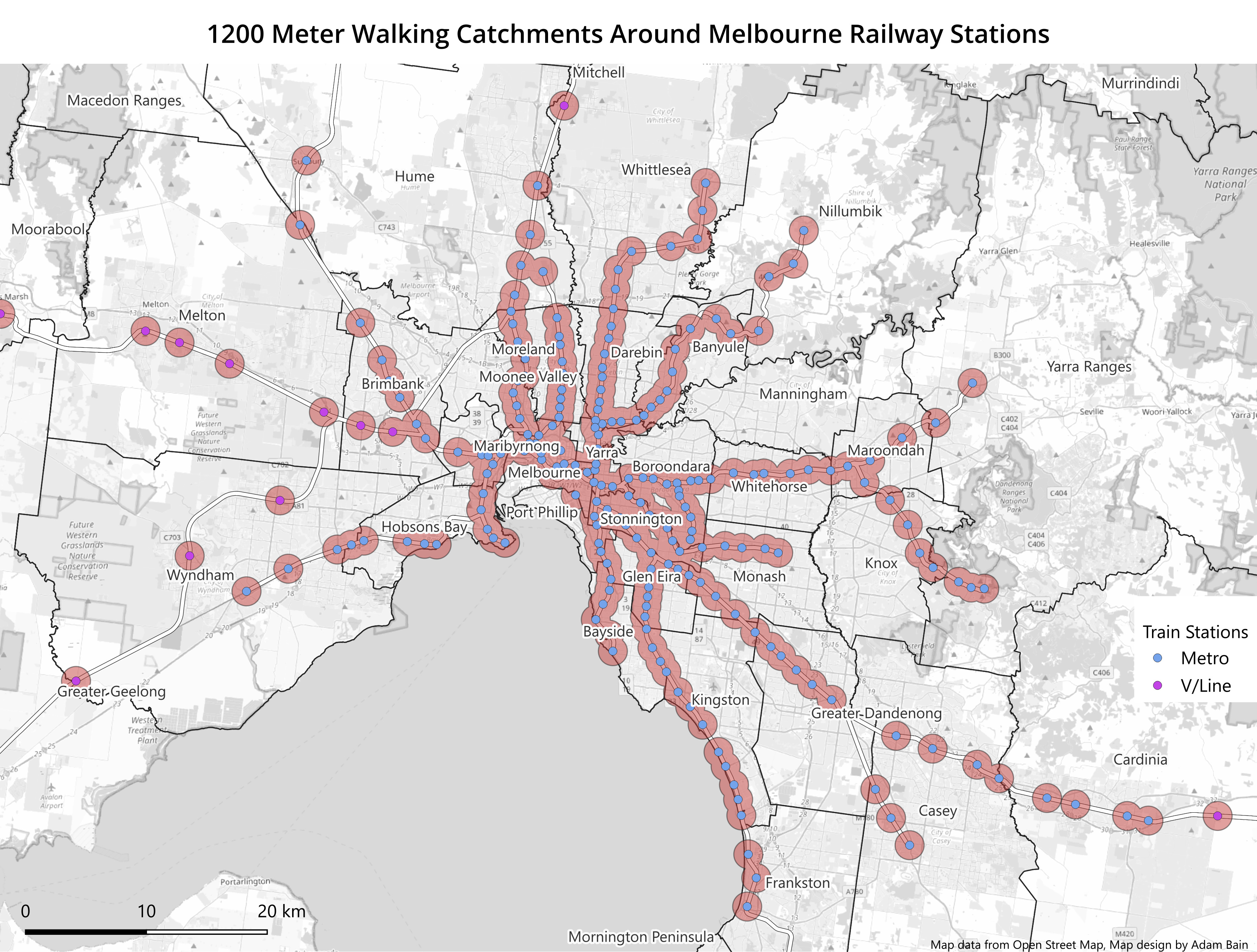
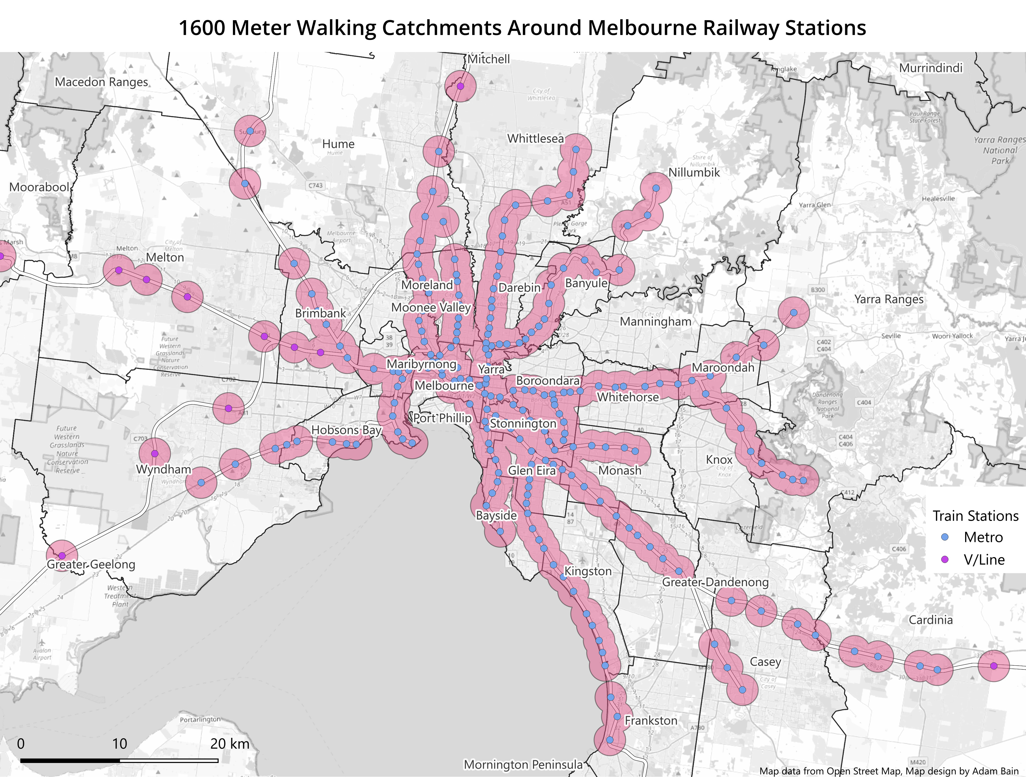
And here are some images for your enjoyment, showing the areas covered by the three different radii. I find it amusing how Manningham narrowly avoids being covered even by the 1600m radius in any significant way. These charts also highlight areas where perhaps we could consider infill stations, between Lilydale and Mooroolbark; Upfield and Gowrie amongst others.
Whilst it would be ideal to fill all these gaps with railways – in the current budgetary climate in our state this is highly improbable. Traditionally we have bridged the gap by building ever expanding station car parks, but with Victoria’s population exploding, it is often hard to find a park outside of the earliest slice of peak hour. Instead, the only truly viable all-day solution is a network of frequent buses, linking into frequent trains which run long hours across the day.
For a more in depth and comparative account of this across Australian cities analysis of this topic, please read the good work of Charting Transport. :)
No posts
Comments
Nothing yet. Say the first thing.
Sign in to join the conversation.