

This is forecast post number 1002 — Day 223 of 2026.
Day 72 of Atlantic Hurricane Season | Still only 2 Named Storms
Author: Dr. Ryan Maue (X @RyanWeather X @weathertrader)
Welcome to 1 new annual subscriber, and 3 renewing paid subscribers, plus other new followers. Your trust and support is greatly appreciated.
Weather Trader is entirely reader-supported publication (no ads). To receive all new posts and support our platform, consider becoming a paid subscriber / supporter. Satellite imagery from Squall Cloud.

Sorry, but today has been very hectic and I’m rushing to get this out by 10 PM ET … and there is a LOT going on in both the Atlantic and Pacific — so I’m going to flood the zone with imagery, and come back earlier tomorrow with another Tropical Update.
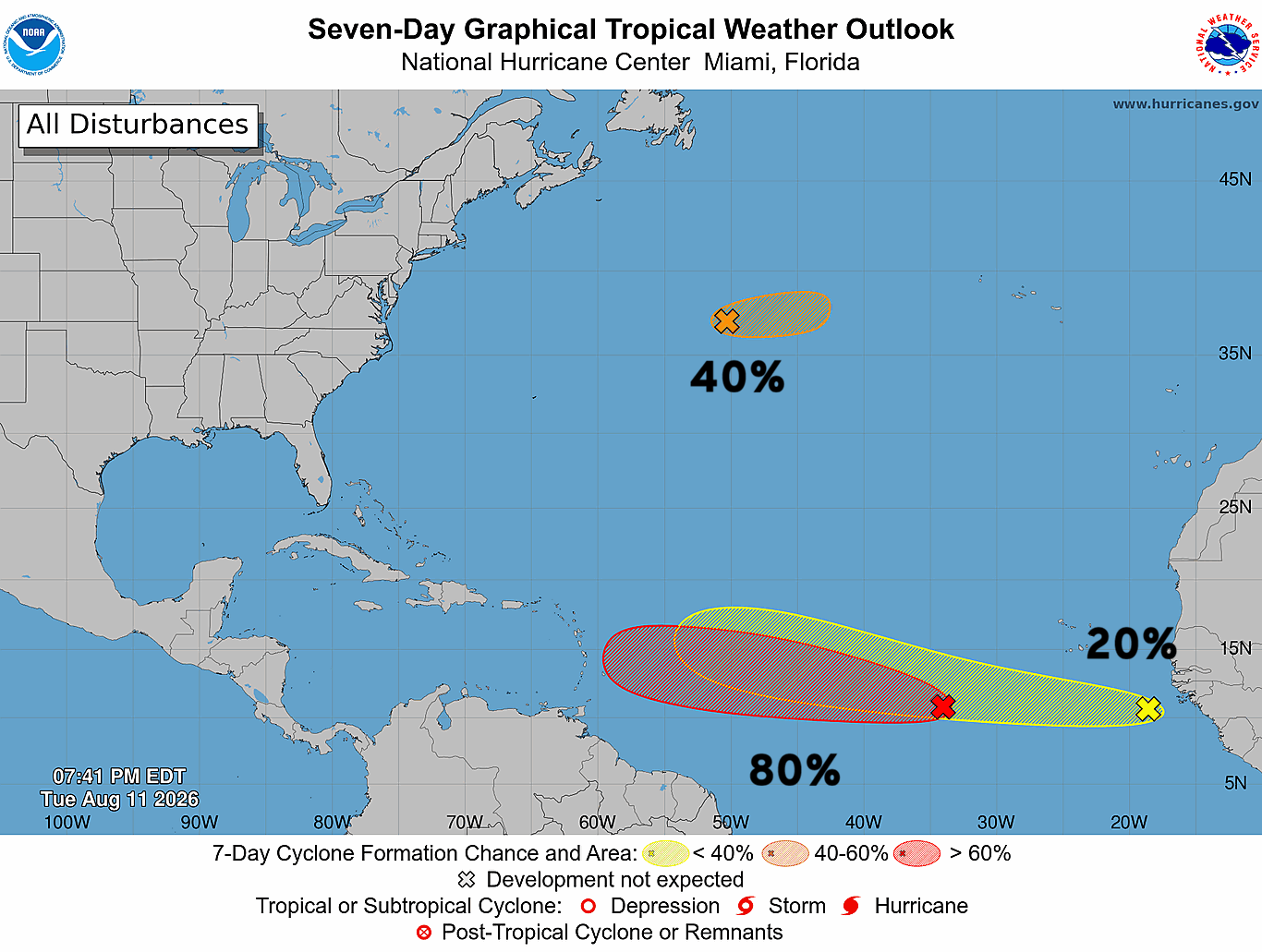
We are watching 3 areas of interest across the Atlantic basin this evening with a tropical wave (Invest 92L) along 35°W at 80% chance of tropical cyclone formation according to NHC, and Invest 93L in the middle of the north subtropical Atlantic (40%), and then another tropical wave just emerging off Africa (20%).
At this time, plenty of convection with both waves in the Main Development Region. Invest 93L up in the nearly the mid-latitudes looks healthy and probably should be named.
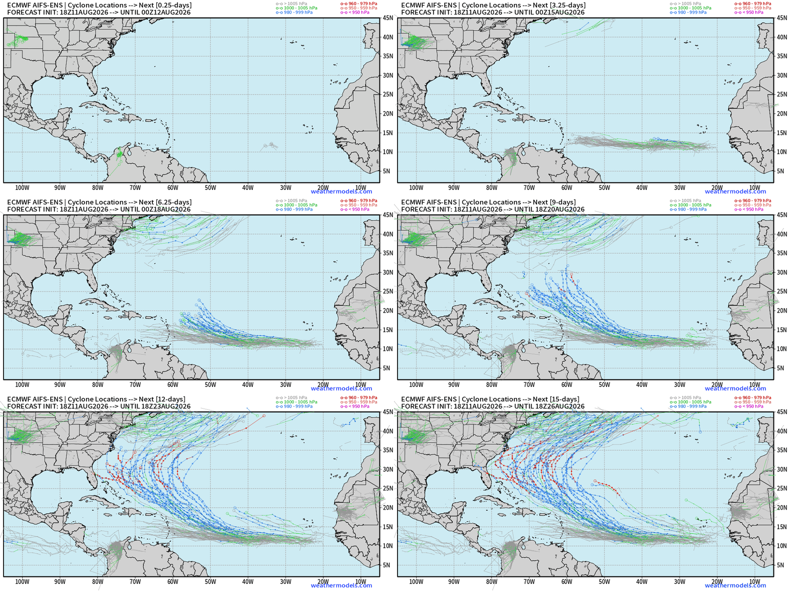
Invest 92L might be the sacrificial lamb and head due westward into the Caribbean graveyard. But, holy moly is AIFS-ENS 18z excited by the following wave (the 20% yellow one) with it blowing up into a major hurricane (high chance in this model)
This is a huge signal for a major Cape Verde Hurricane. Will be watching closely tomorrow 00z/06z updates.
Invest 92L —> tropical depression or storm with the EPS full physics but only a low chance of further development of the next wave (just off Africa).
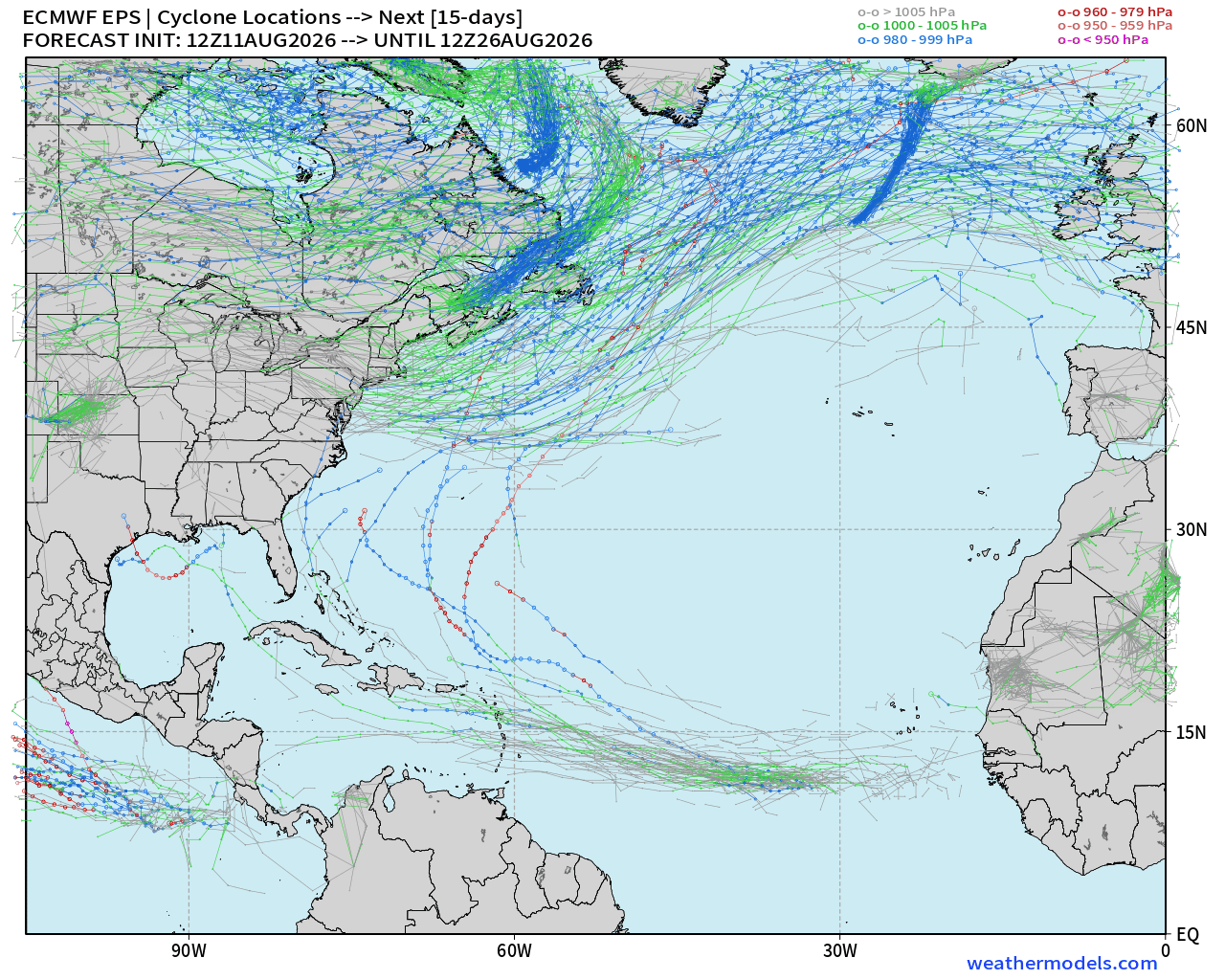
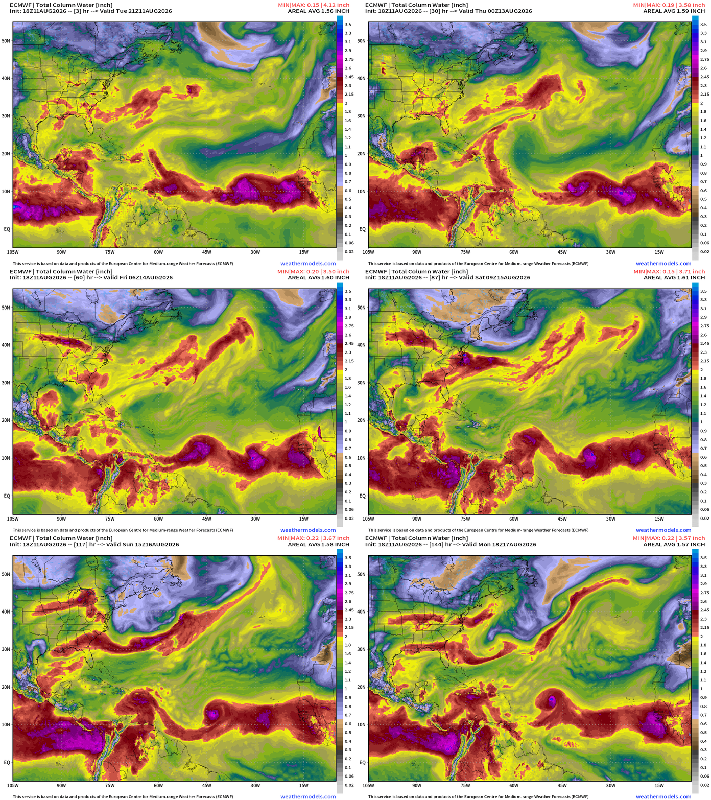
2 tropical waves at lower latitudes in the Main Development Region being watched for development.
And ECMWF HRES 18z seems to dial up an additional 2 more = 4 total.
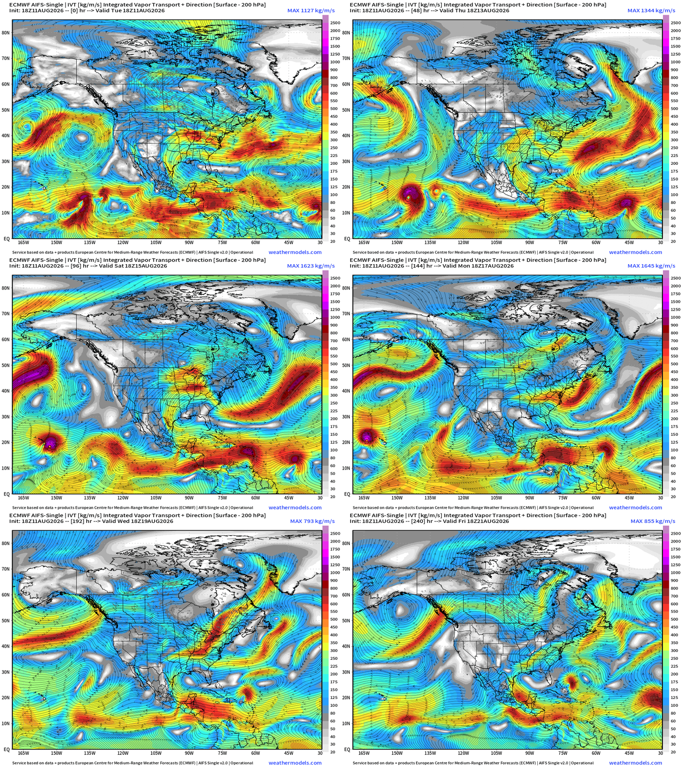
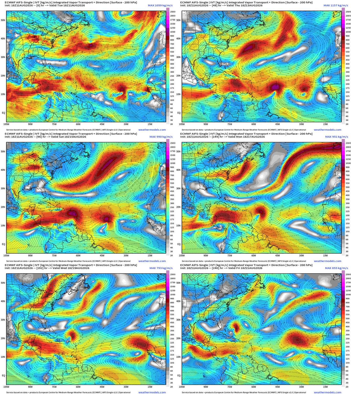
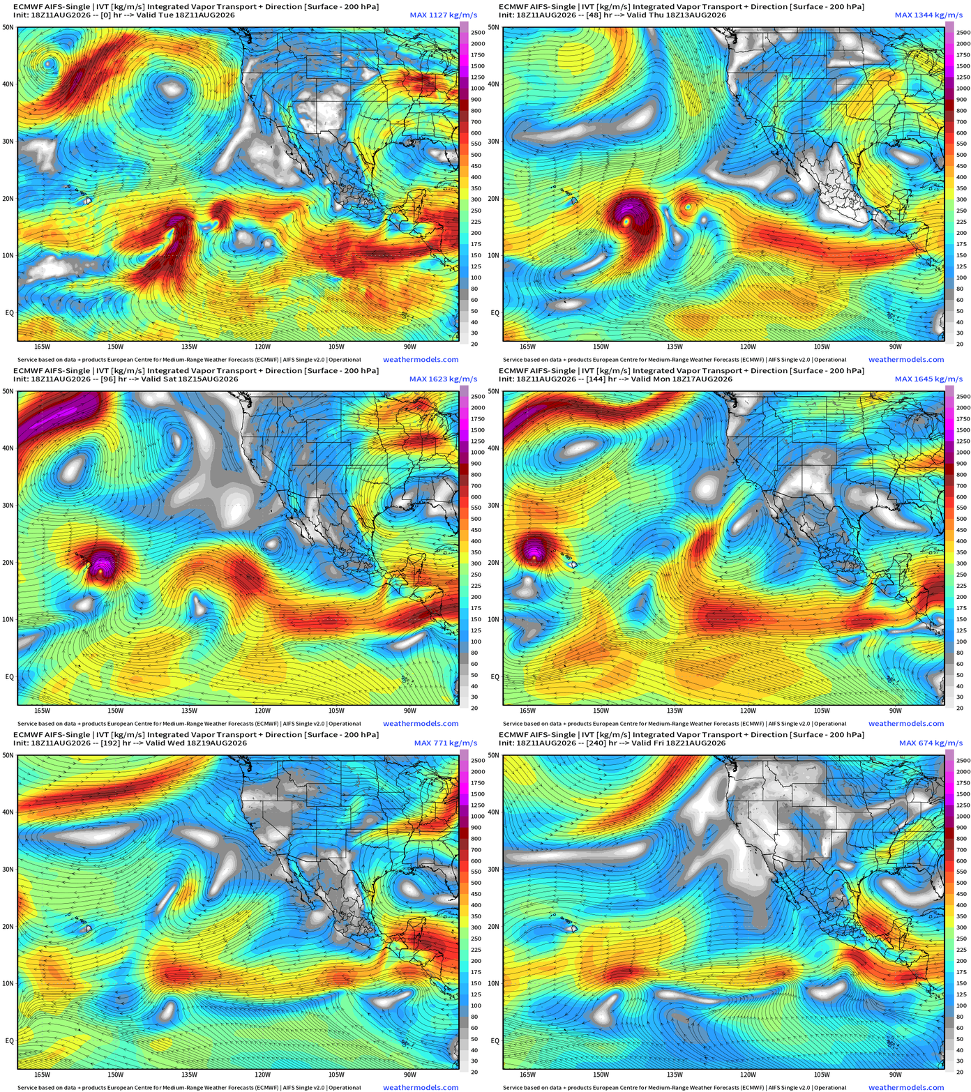
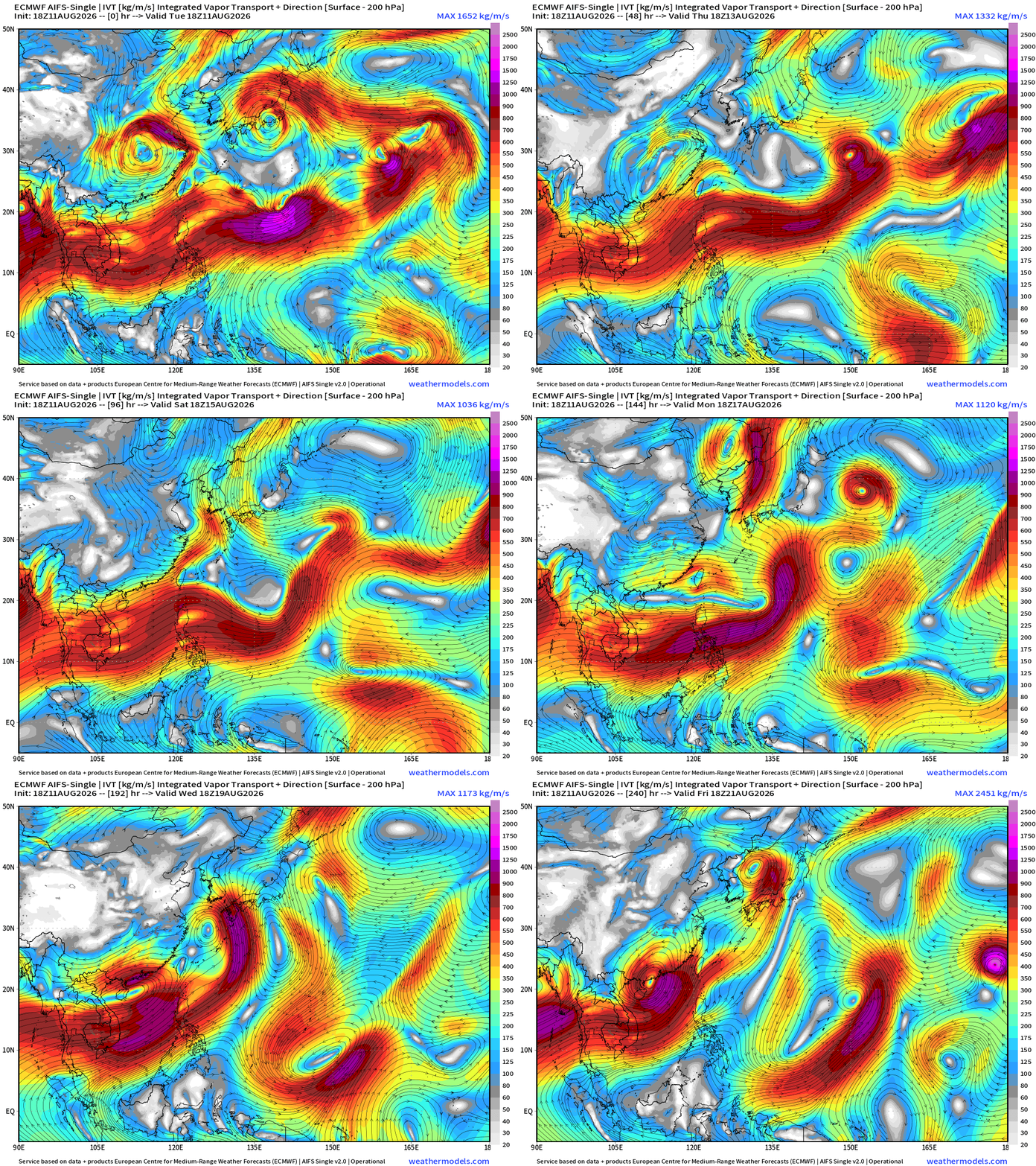
Flagship model: ECMWF AIFS 18z —> Integrated Vapor Transport next 10-days
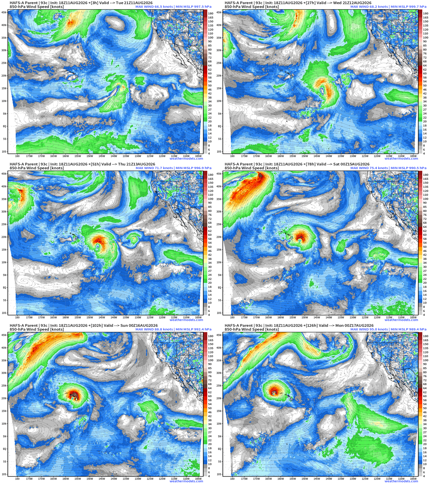
Hurricane Lala will likely roll through the Hawaiian Islands this weekend.
Multiple robust Atlantic tropical waves lighting up the Atlantic MDR
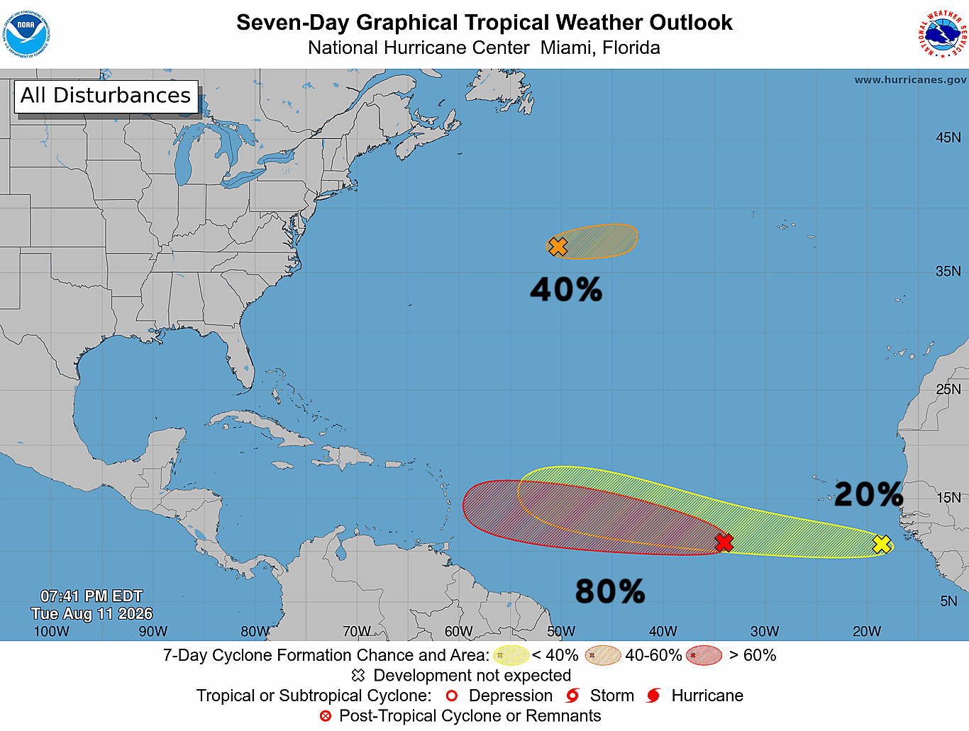
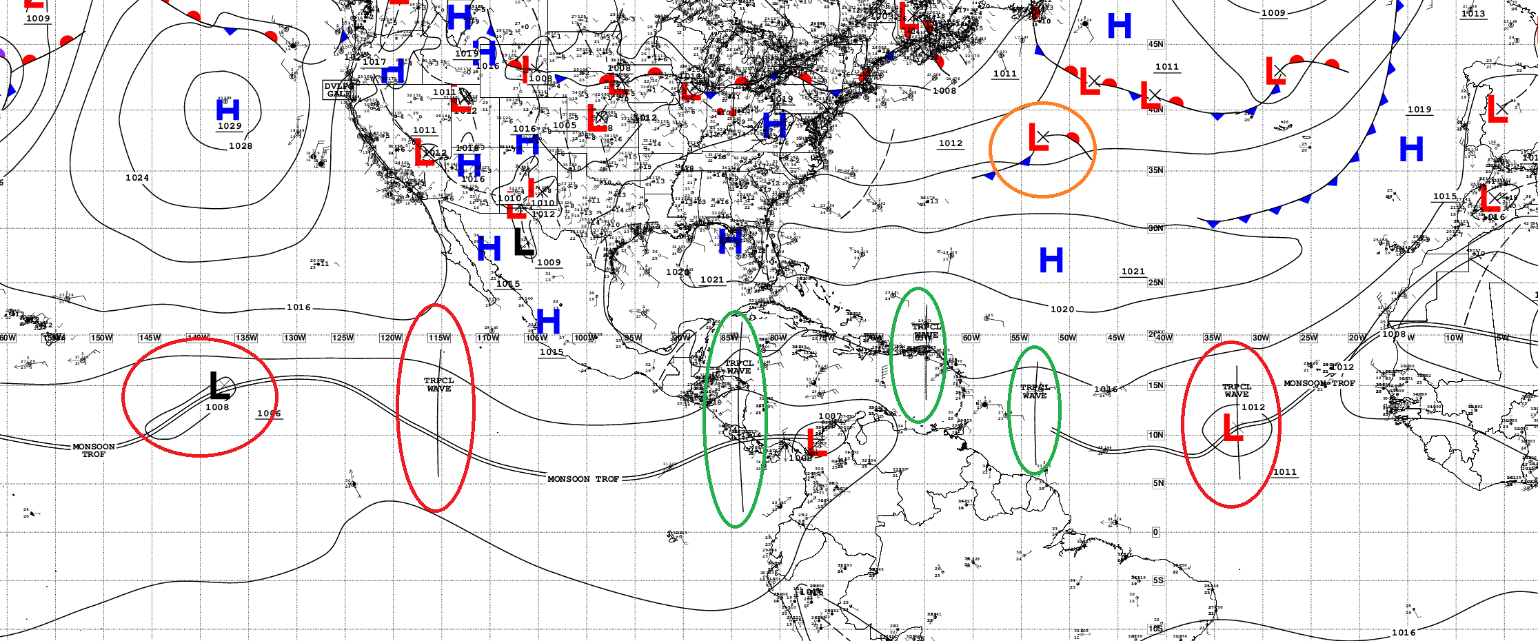
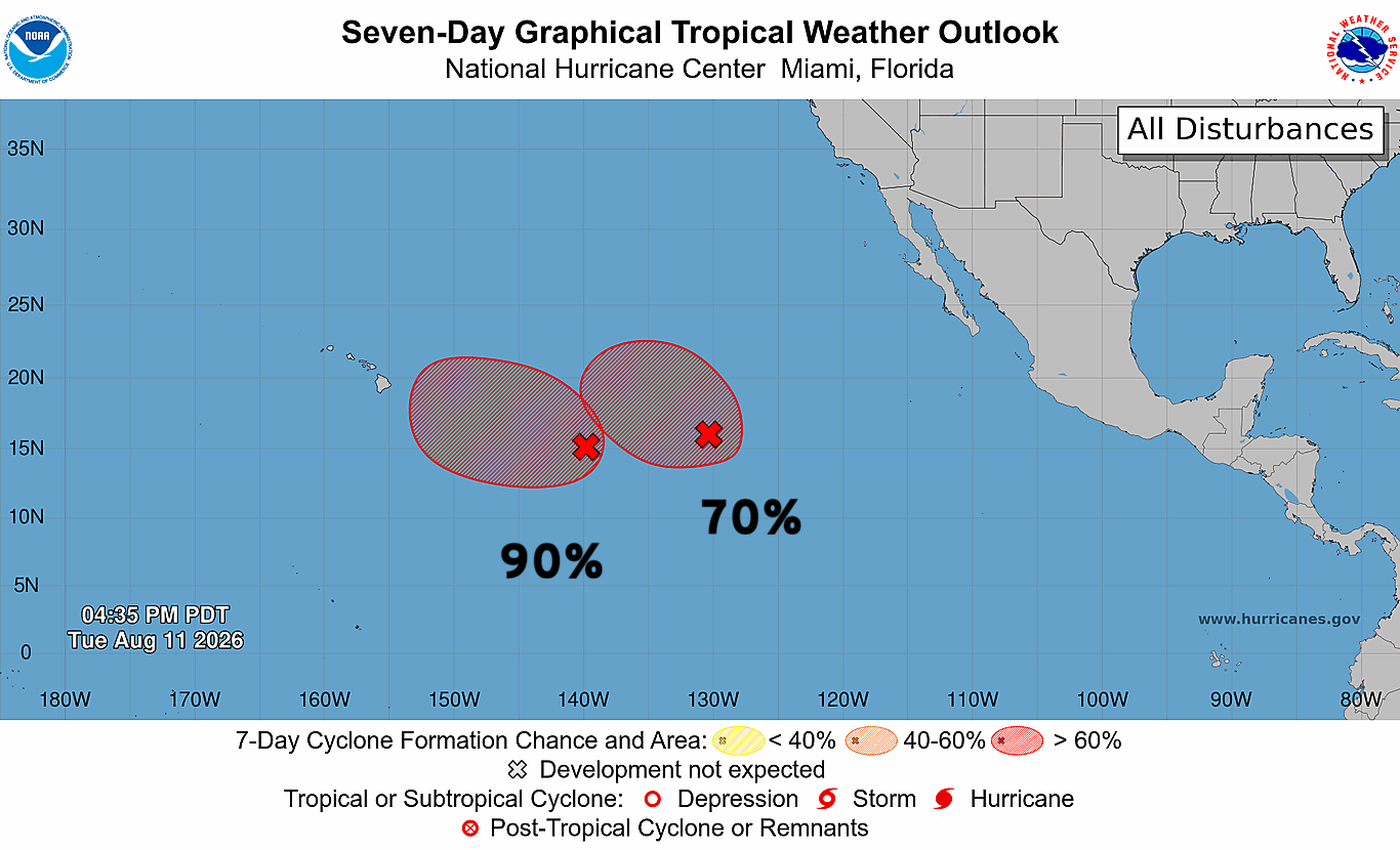
2 of the waves in the parade in the Central/Eastern Pacific are now marked with 60% to 90% chance of development in next 7-days. And, 2 in the Atlantic at 10% and 70%.
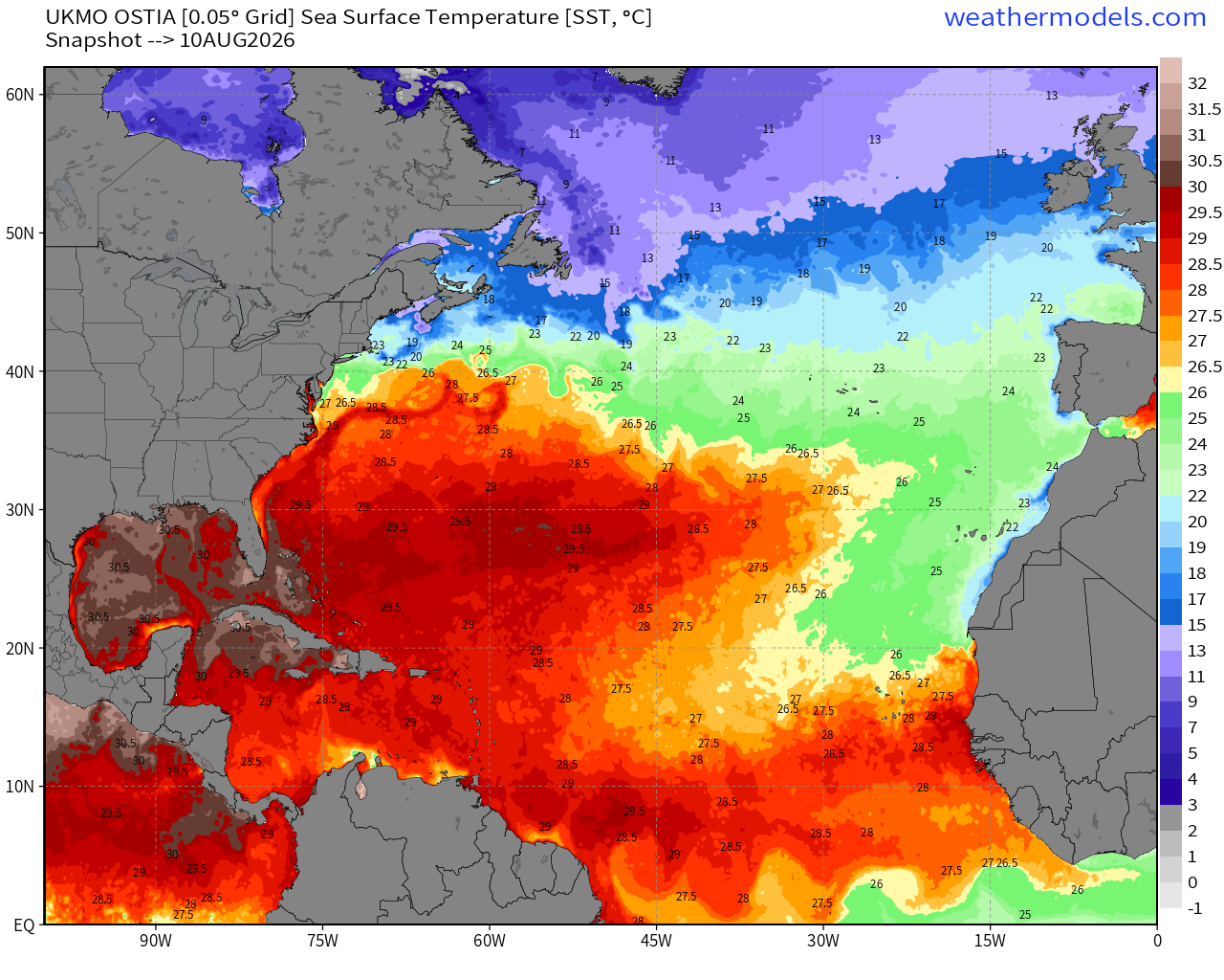
The warmth in the MDR is quickly expanding to carve into the cool <26°C water from the cold Canary Current, so I think any tropical waves that stay below 20°N latitude will have sufficient warm water to develop.
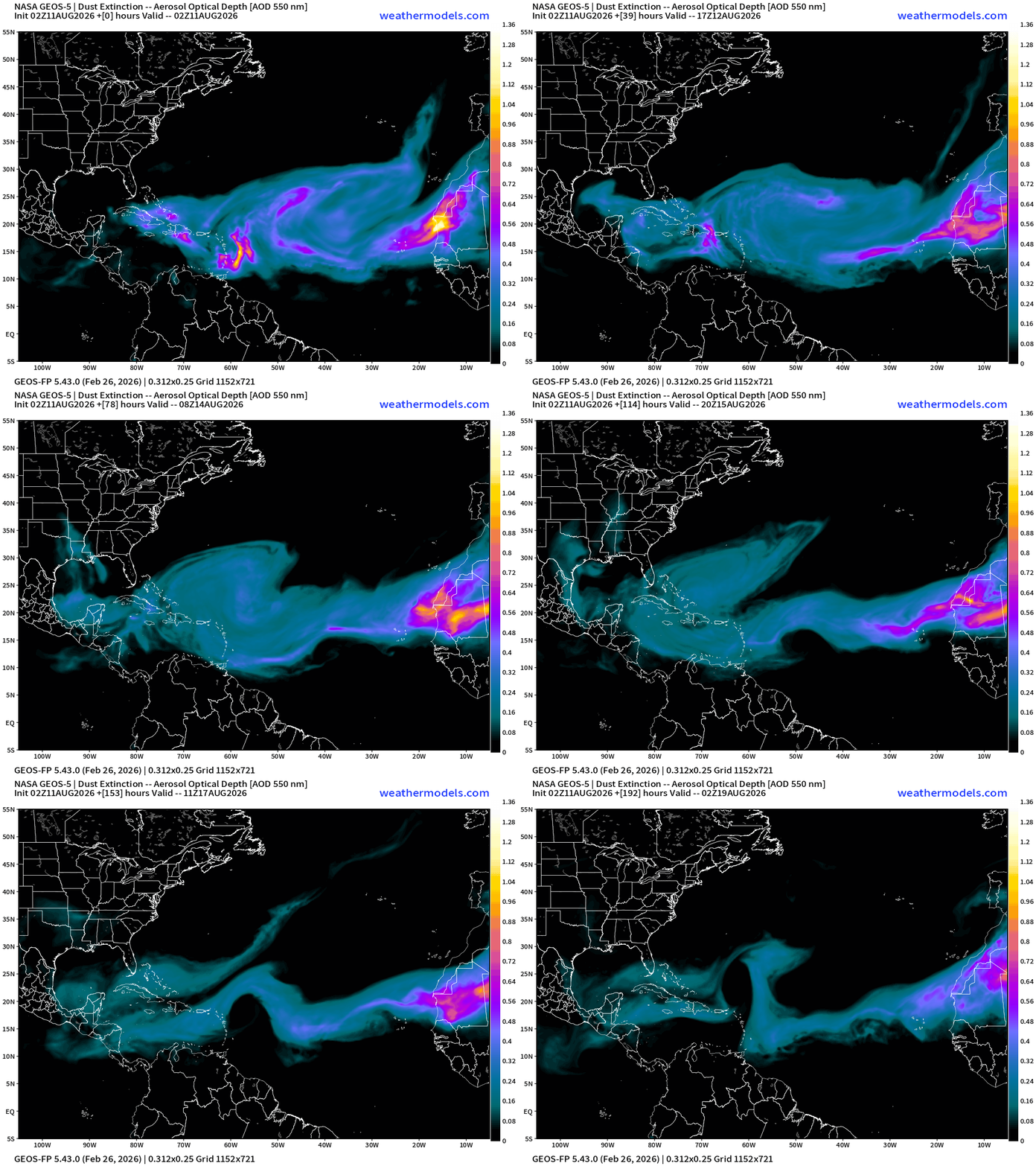
NASA Dust (GEOS-5) — Saharan Air Layers continue to cruise across the Atlantic doing damage to tropical waves and stabilizing the tropical environment with warmth at lower levels. The SAL weakens significantly into next week.
Flagship AIFS Integrated Vapor Transport next 10-days —> tropical waves churn westward, and into second week of August, quite a few tropical waves in the MDR that look healthy enough, and we’ll have to watch into next week. I see at least 3 candidates with 2 better chance of survival. Even if they do not form or catch fire in the deep tropics, they need to be watched as they gain latitude and get closer to Bahamas, as the ECMWF ensembles showed.
More Tropical Waves Lined up over Equatorial Africa — big honking waves
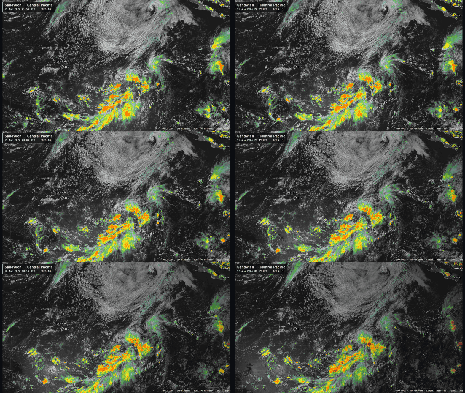
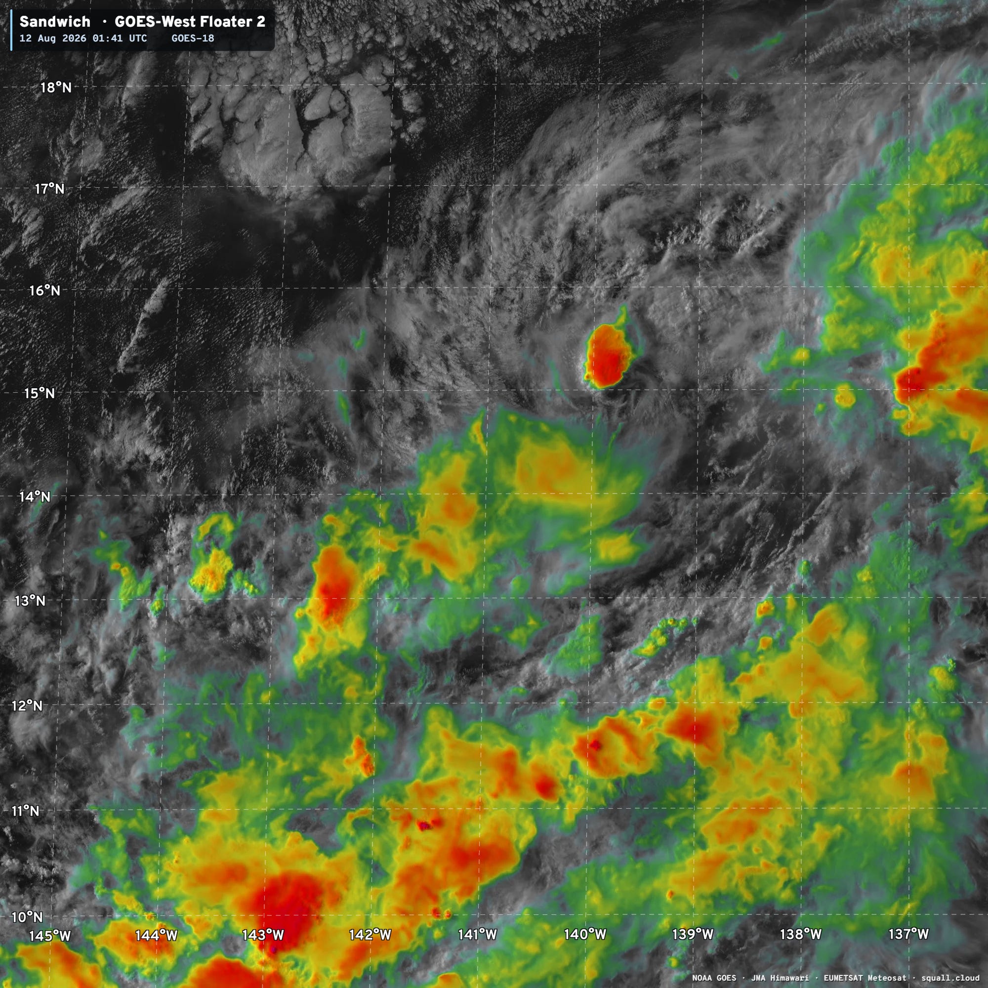
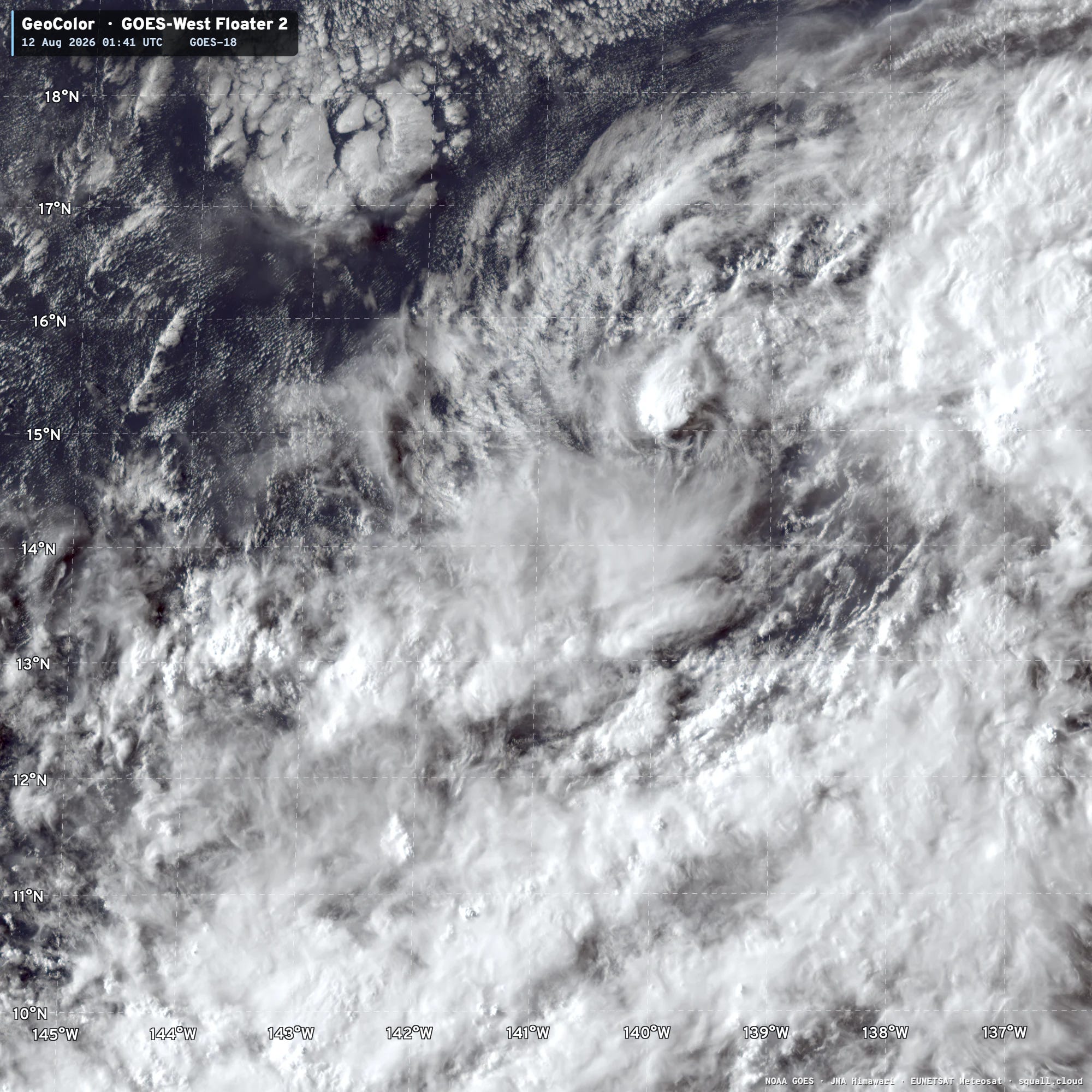
Small circulation was largely naked / no convection an hour ago, but is now firing storms and could be the incipient vortex of soon to be Tropical Depression 01C —> TS/Hurricane Lala —> more satellite loops at Squall Cloud
Right over the whole Hawaiian Island Chain!
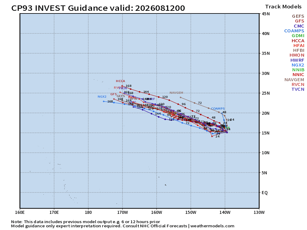
HAFS-A & B —> Hurricane Lala right into the Big Island of Hawaii and then westward track right through the island chain
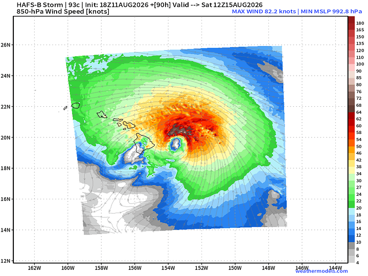
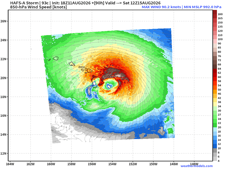
Large scale view shows the considerable impacts of Hurricane Lala to every Hawaiian Island.
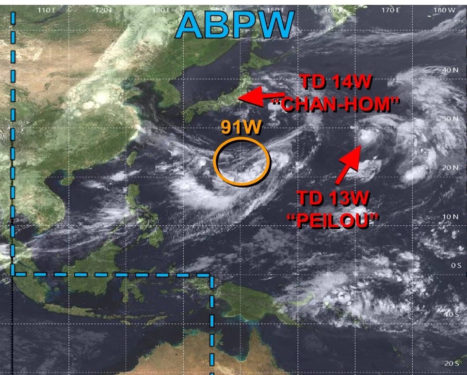
Quite a mess with the monsoon trough … multiple swirls with names but remaining relatively weak.
Integrated Vapor Transport from ECMWF AIFS 18z
My Atlantic Hurricane Season Forecast (2026)
From April 7, 2026: Atlantic Seasonal Hurricane Forecast: (11/5/2)
9-13 Named Storms (11 most likely)
4-7 Hurricanes (5 or 6 most likely)
1-3 Major Hurricanes (2 most likely)
Accumulated Cyclone Energy: 75-85 (well below normal)
NOAA 2026 Atlantic Hurricane Season Forecast
Comments
Nothing yet. Say the first thing.
Sign in to join the conversation.