

This is forecast post number 1001 — Day 222 of 2026.
Day 71 of Atlantic Hurricane Season | Still only 2 Named Storms
Author: Dr. Ryan Maue (X @RyanWeather X @weathertrader)
Welcome to 3 new annual/monthly subscribers, and 5 renewing paid subscribers, plus other new followers. Your trust and support is greatly appreciated.
Weather Trader is entirely reader-supported publication (no ads). To receive all new posts and support our platform, consider becoming a paid subscriber / supporter. Satellite imagery from Squall Cloud.

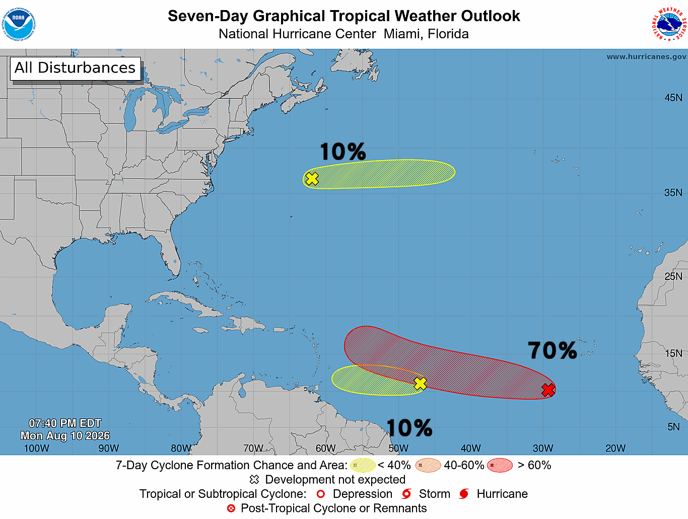
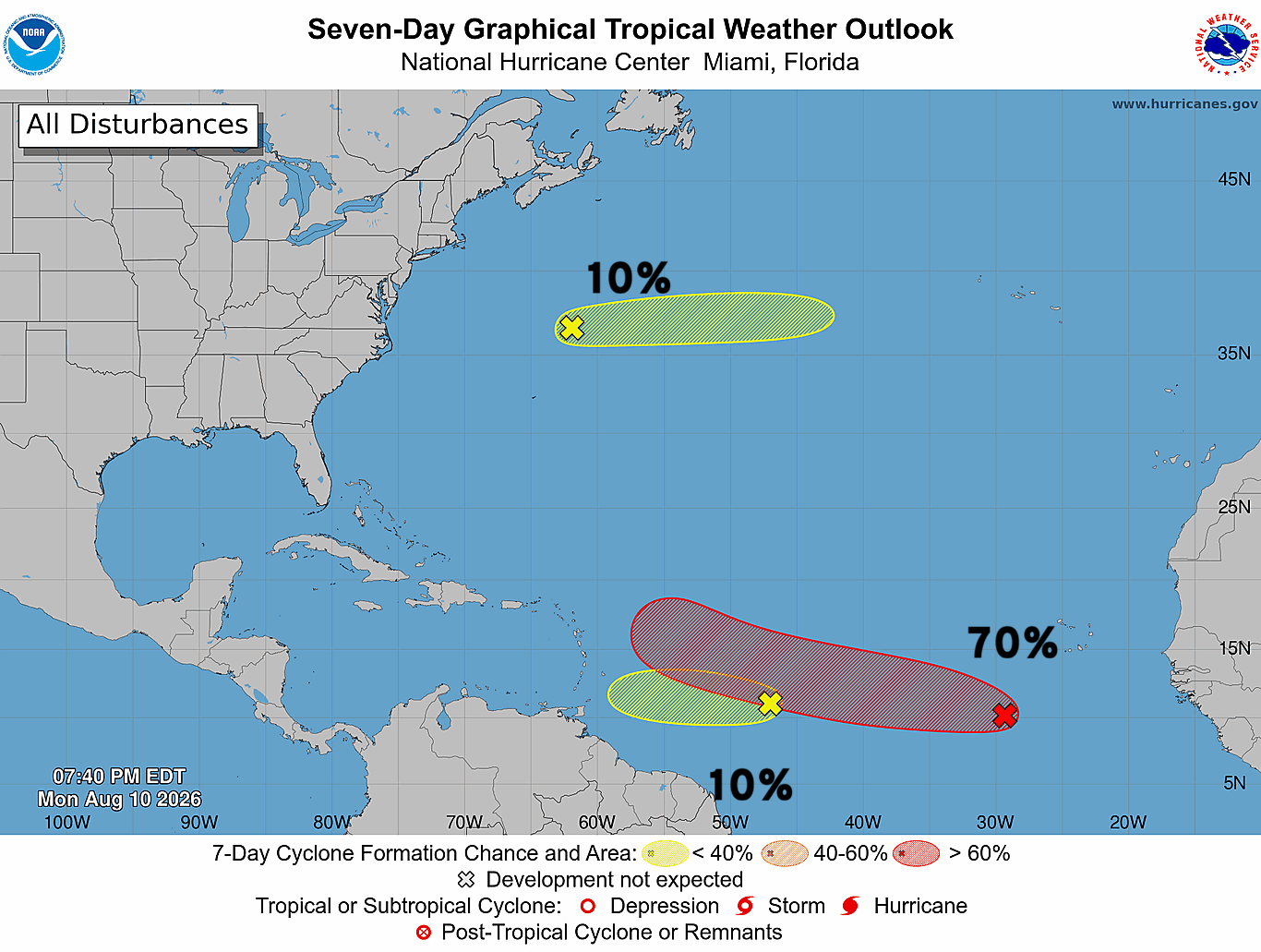
We are still watching 3 areas of interest across the Atlantic basin this evening with a tropical wave along 30°W at 70% chance of tropical cyclone formation according to NHC.
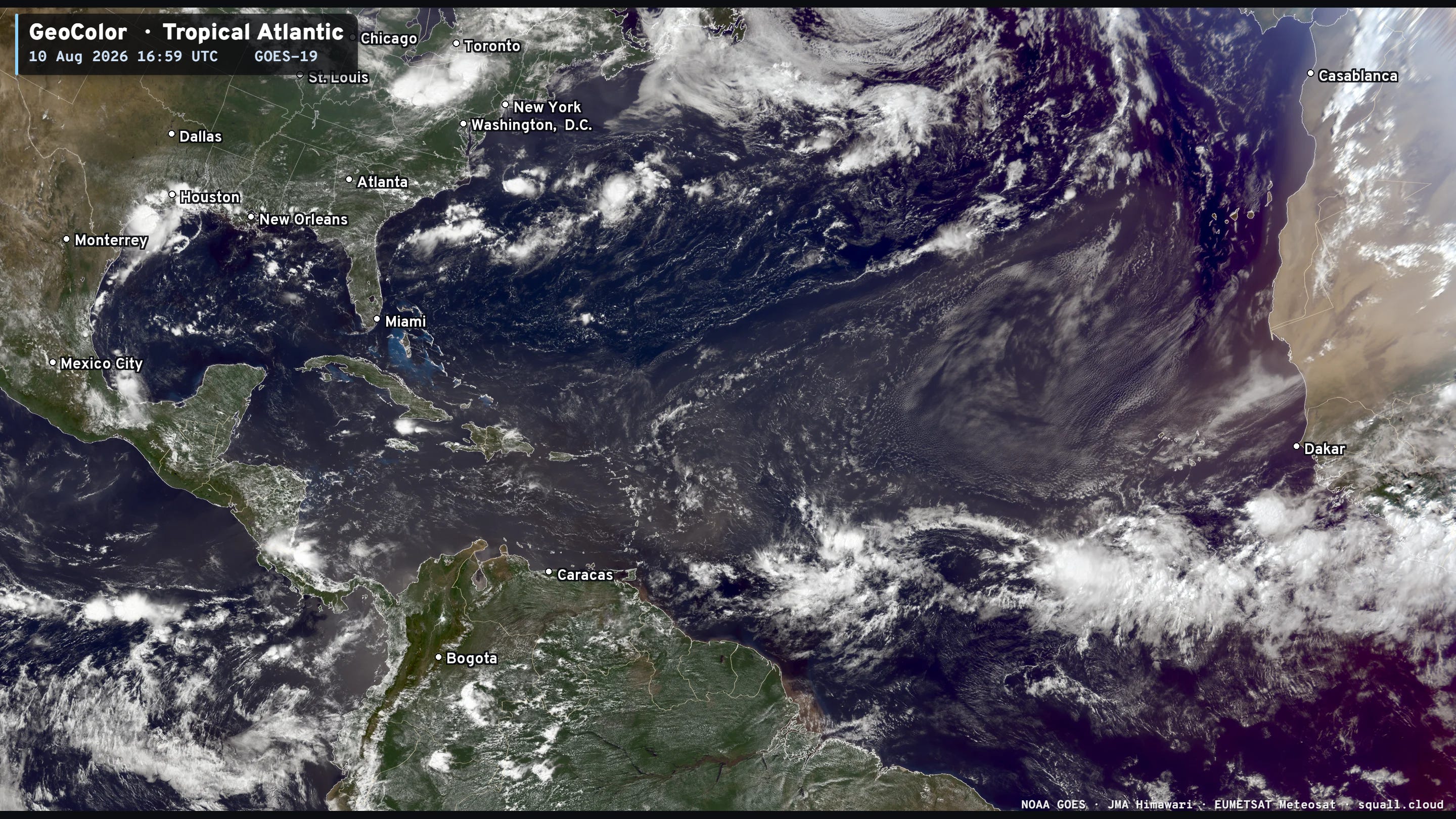
However, the environment is hostile with dry air to the north with a Saharan dust layer. We have plenty of time to watch these systems as they travel around the sprawling Bermuda subtropical high.
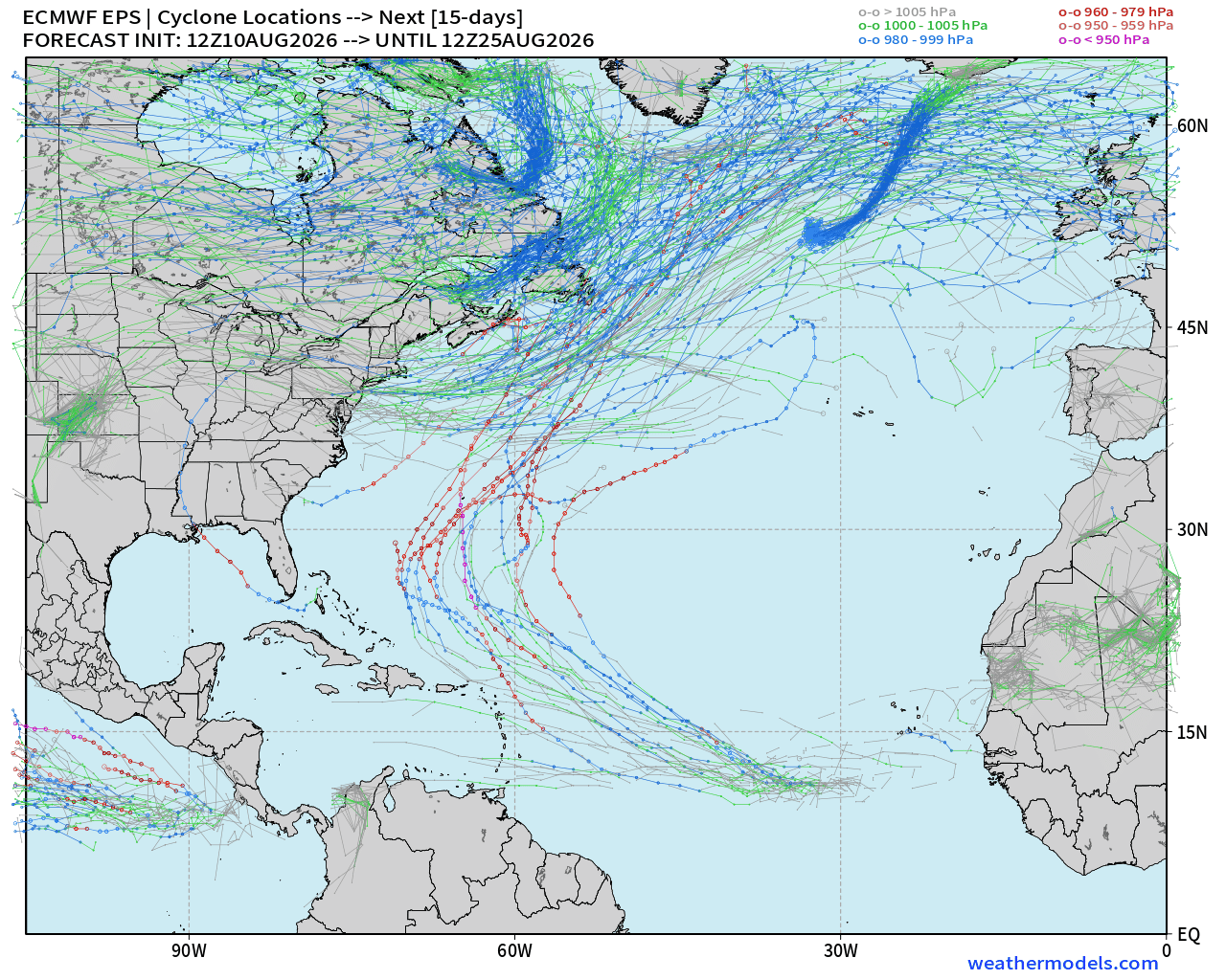
Even if these waves don’t develop right away in the MDR, they still have opportunity to “catch fire” down the road closer to the Caribbean or in the western Atlantic. Plenty of ensembles show major hurricane potential with “survivors” that make it out of the MDR.
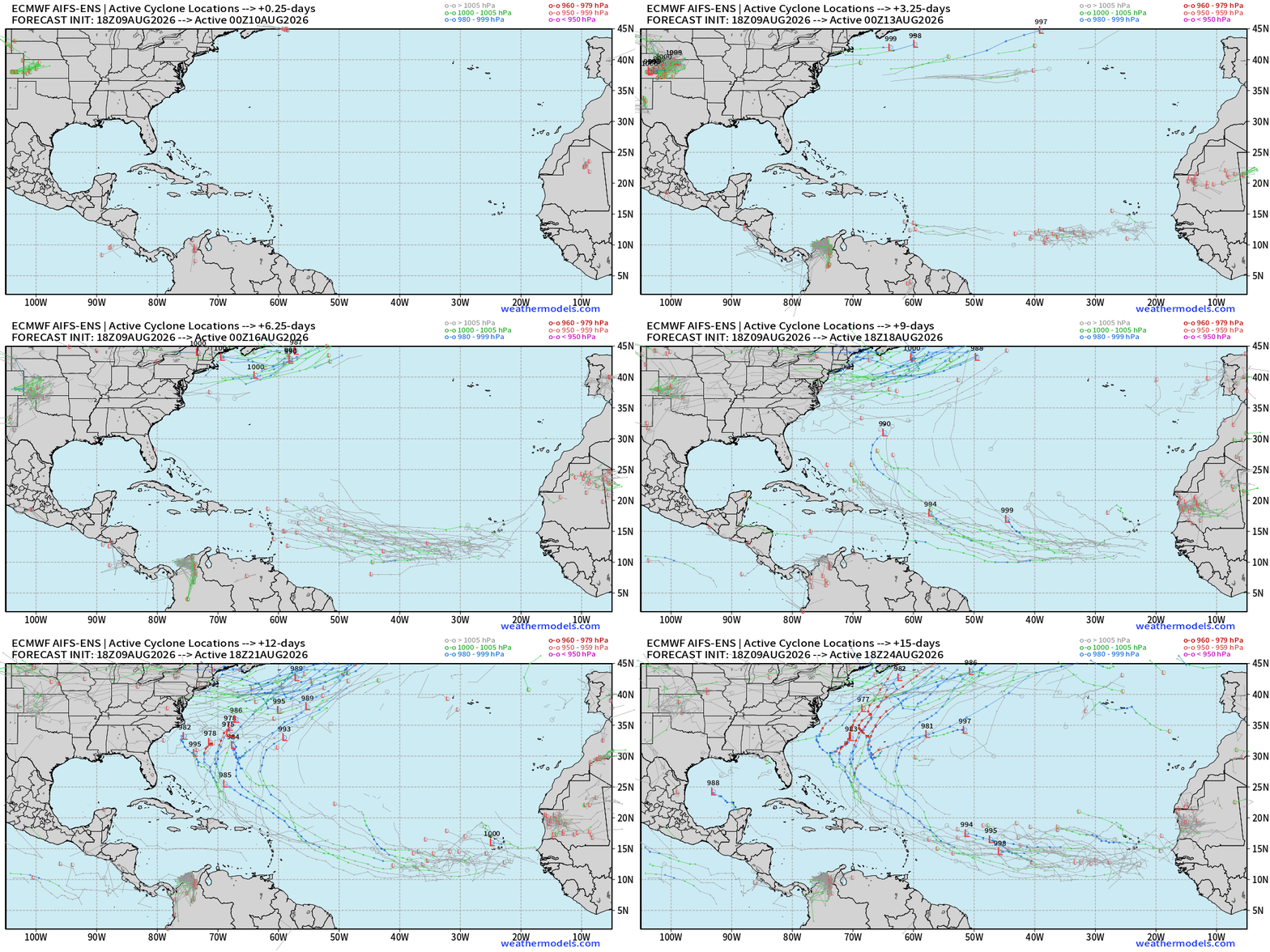
The AIFS Ensembles show this situation, too. Plenty of opportunity for a recurving major hurricane near Bermuda, and then more tropical waves coming off Africa into late August. The peak of the season is still a month away.
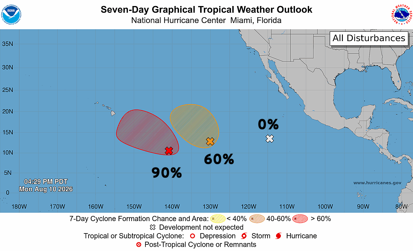
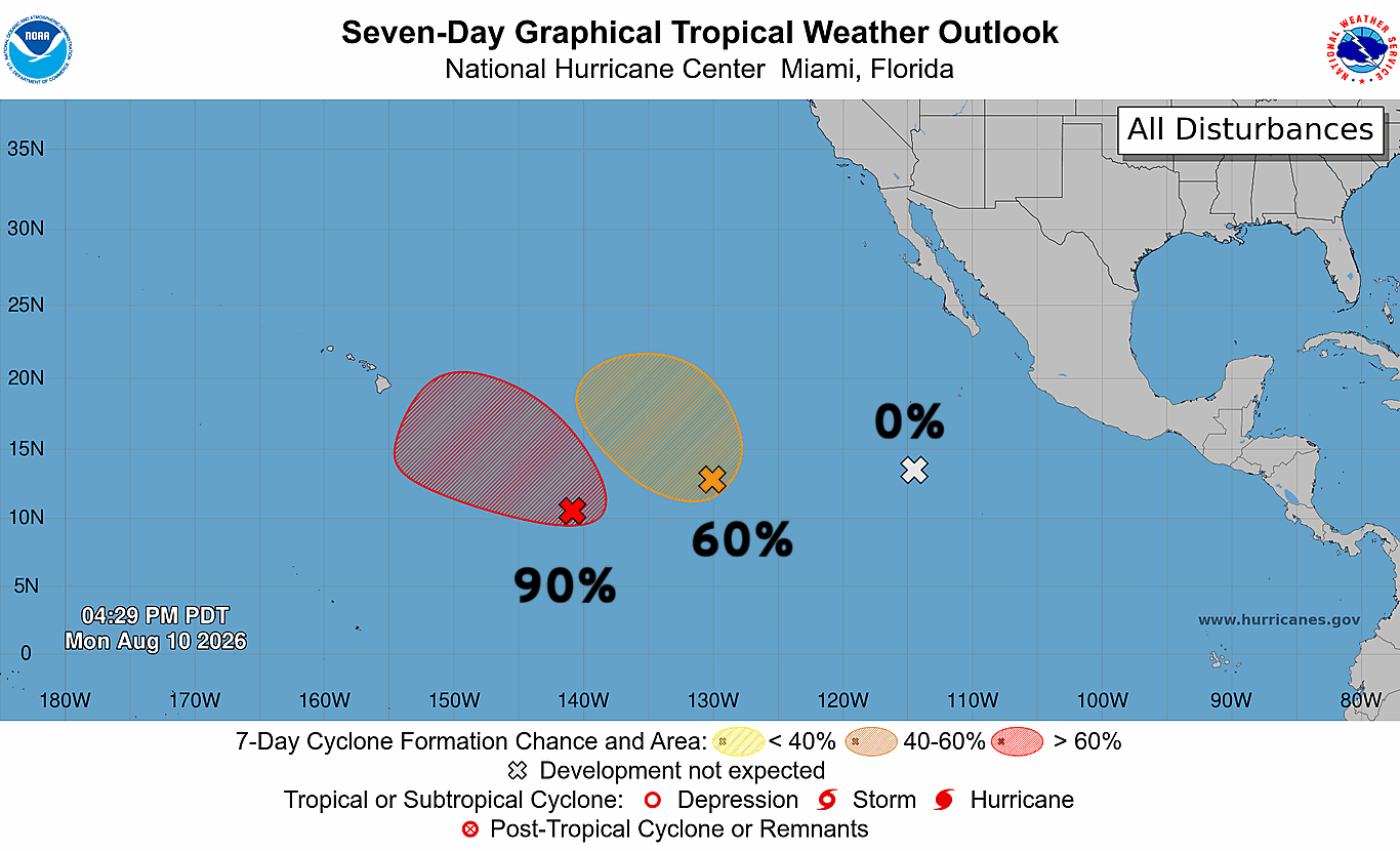
Still waiting on Tropical Depression 01C just within the Central Pacific basin —> and all indications that it will become TS & then Hurricane Lala.
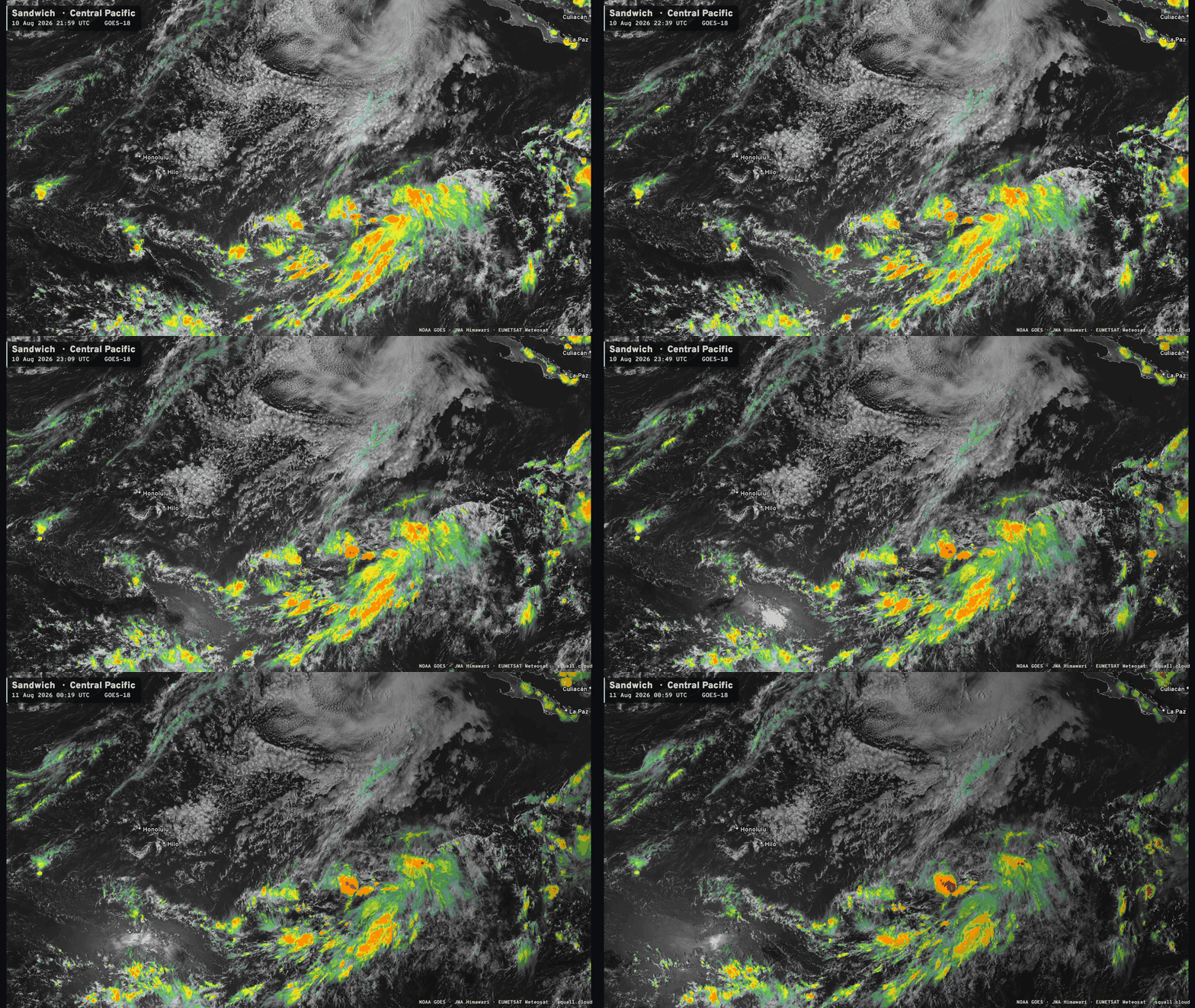
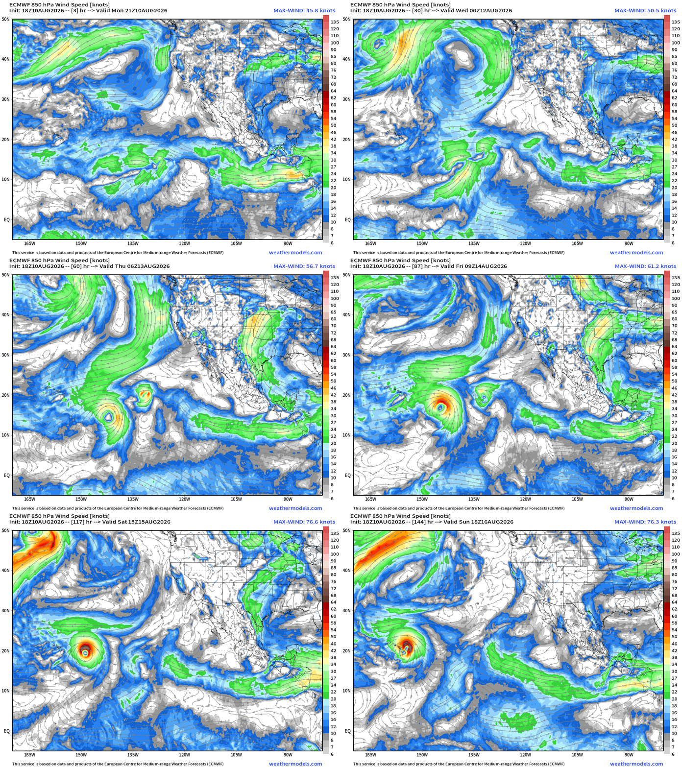
Ensembles show the track of Lala right over the Hawaiian Island chain in 4-5 days.
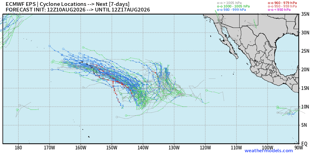
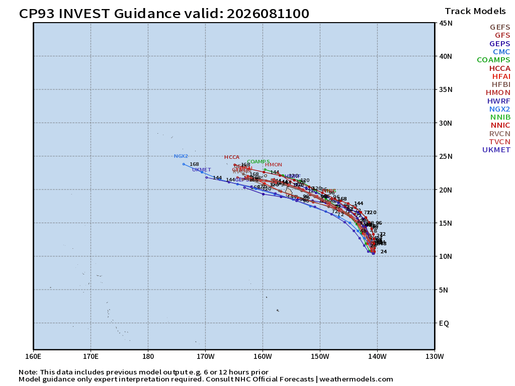
And, the rest of the statistical + dynamic ATCF model suite —> consensus
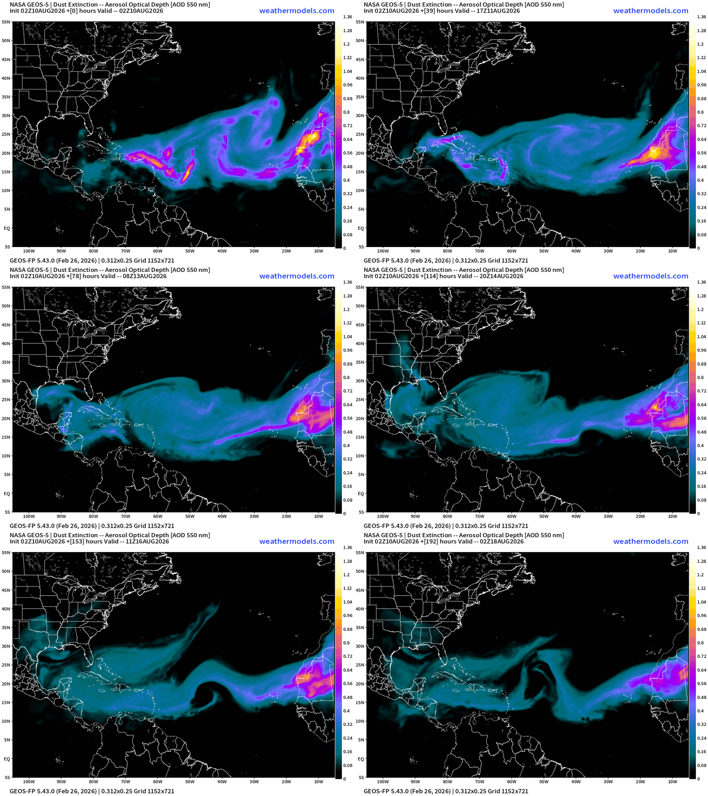
African Dust —> Saharan Air Layer from Caribbean to the coast of Africa
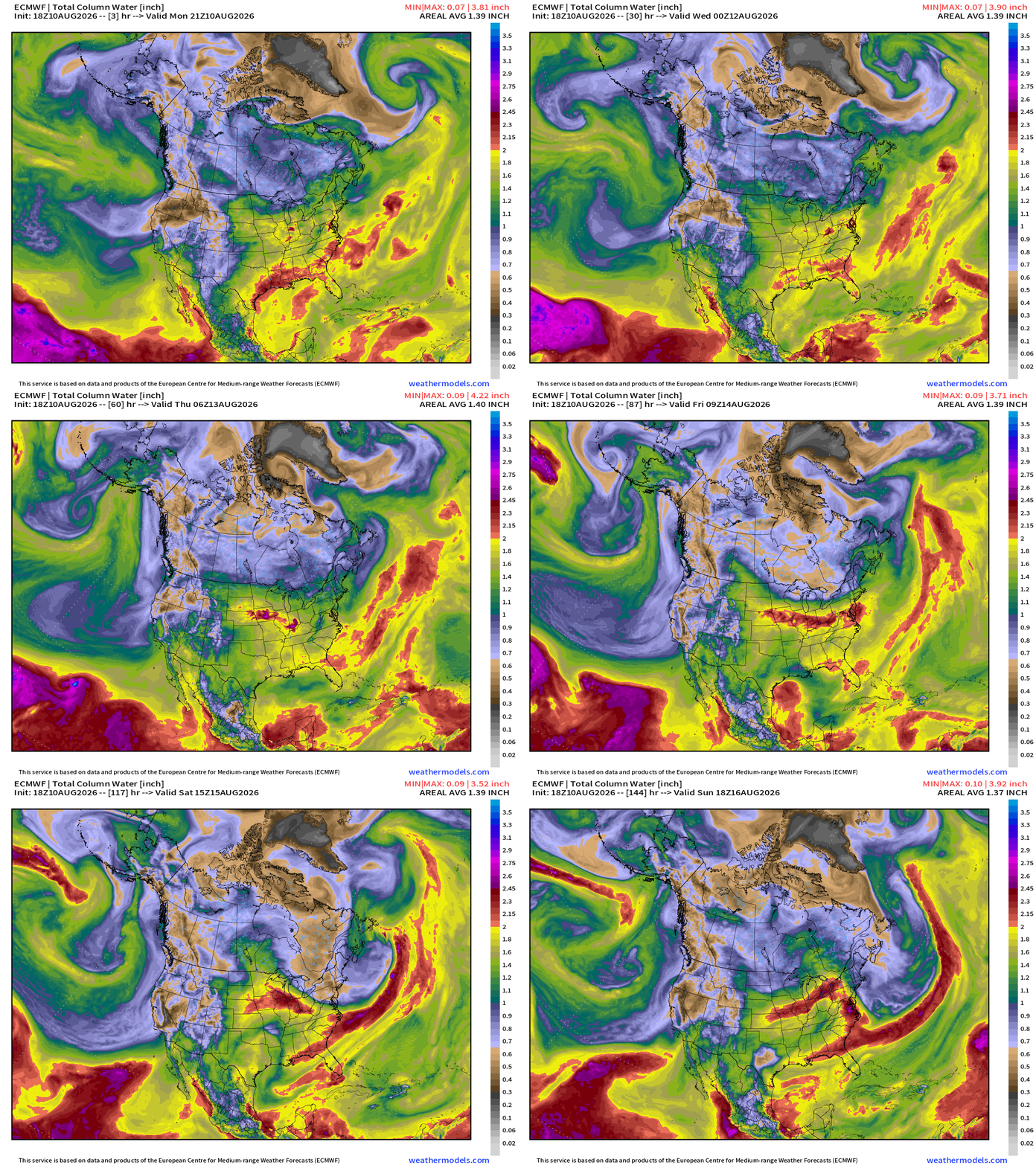
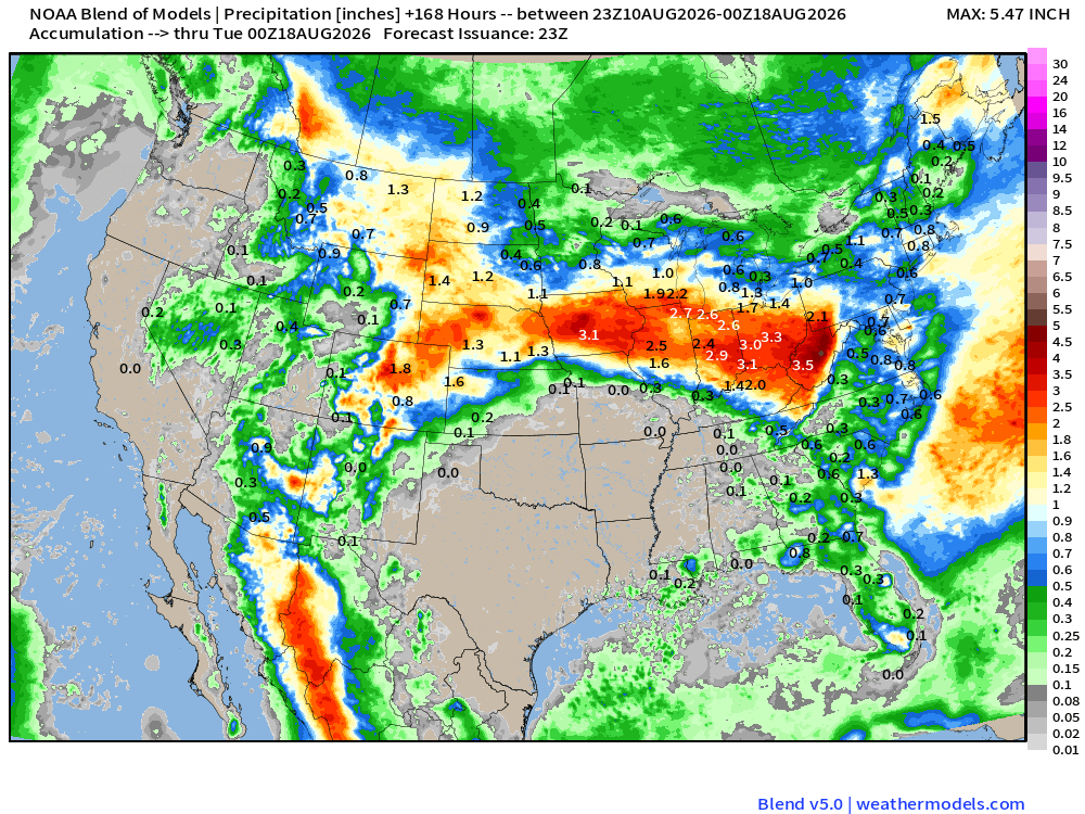
Heavy rain around a building ridge from the Southwest through Rockies into the central Plains then southern Great Lakes into the Ohio River Valley.
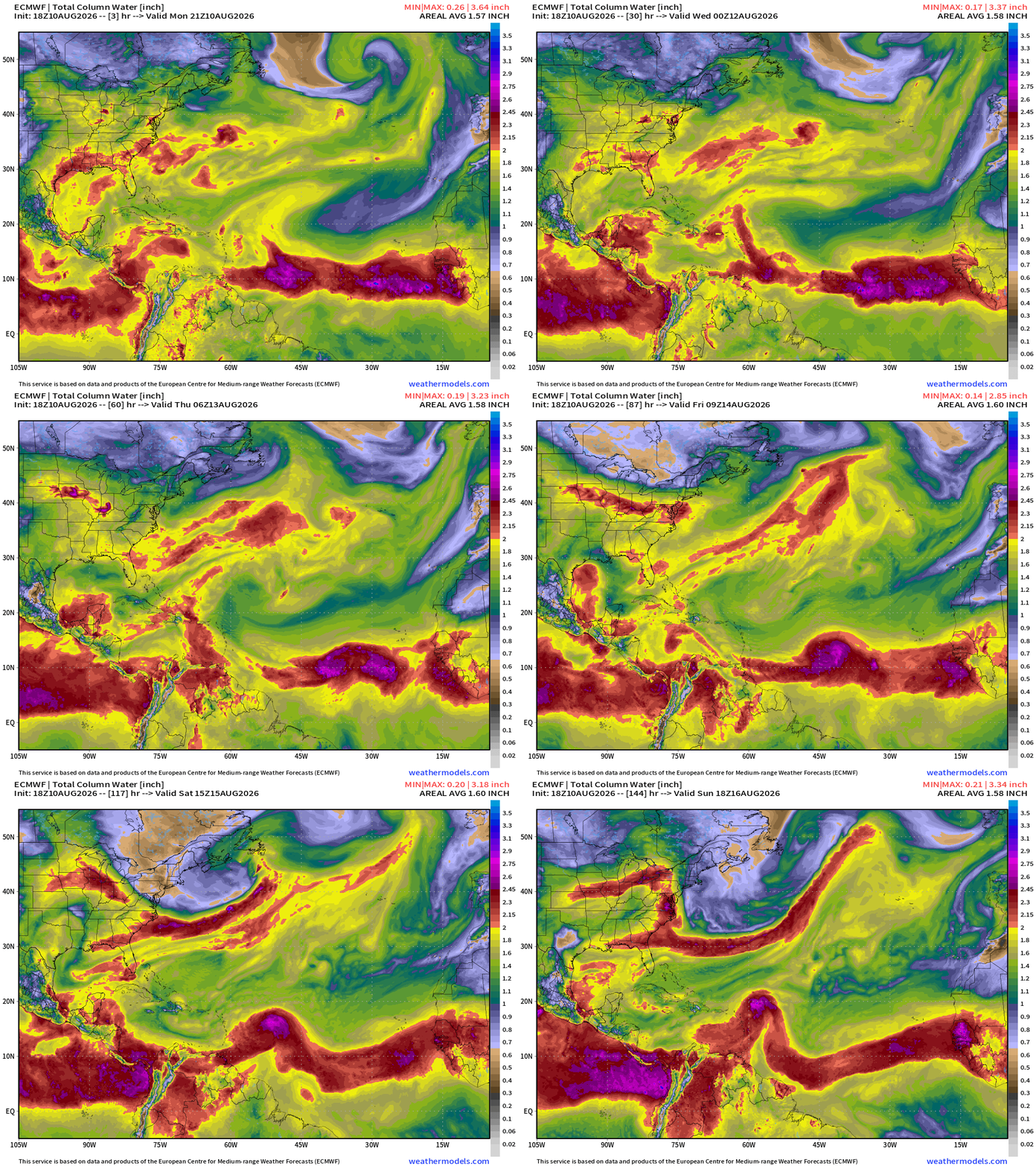
2 strong tropical waves at lower latitudes being watched for development.
The SAL leads the way and in 4-5 days, we’ll have a potential TD/TS east of the northern Leeward Islands.
Then, another system comes off Africa and has a chance of developing. The waters are quite warm out here!
You can easily see Saharan Air Layers as giant frontal boundaries sweeping through the northern half of the Main Development Region with tropical waves to the south in the ITCZ/monsoon trough which is absolutely loaded with tropical moisture.
The cyclonic vorticity isn’t that exciting but probably enough for at least 1 named storm in the deep tropics.
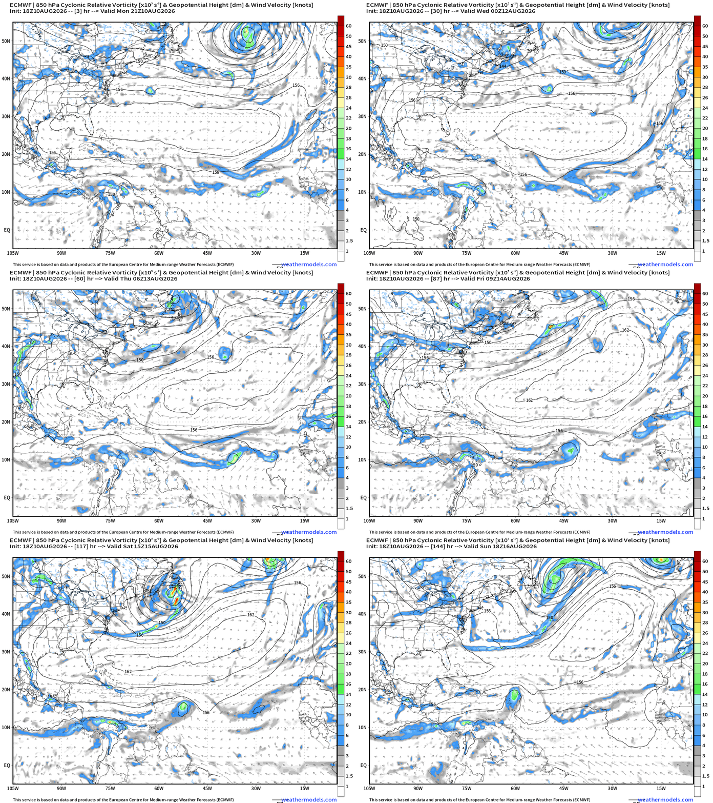
The little area of vorticity north of Bermuda so far has not qualified as a named tropical system.
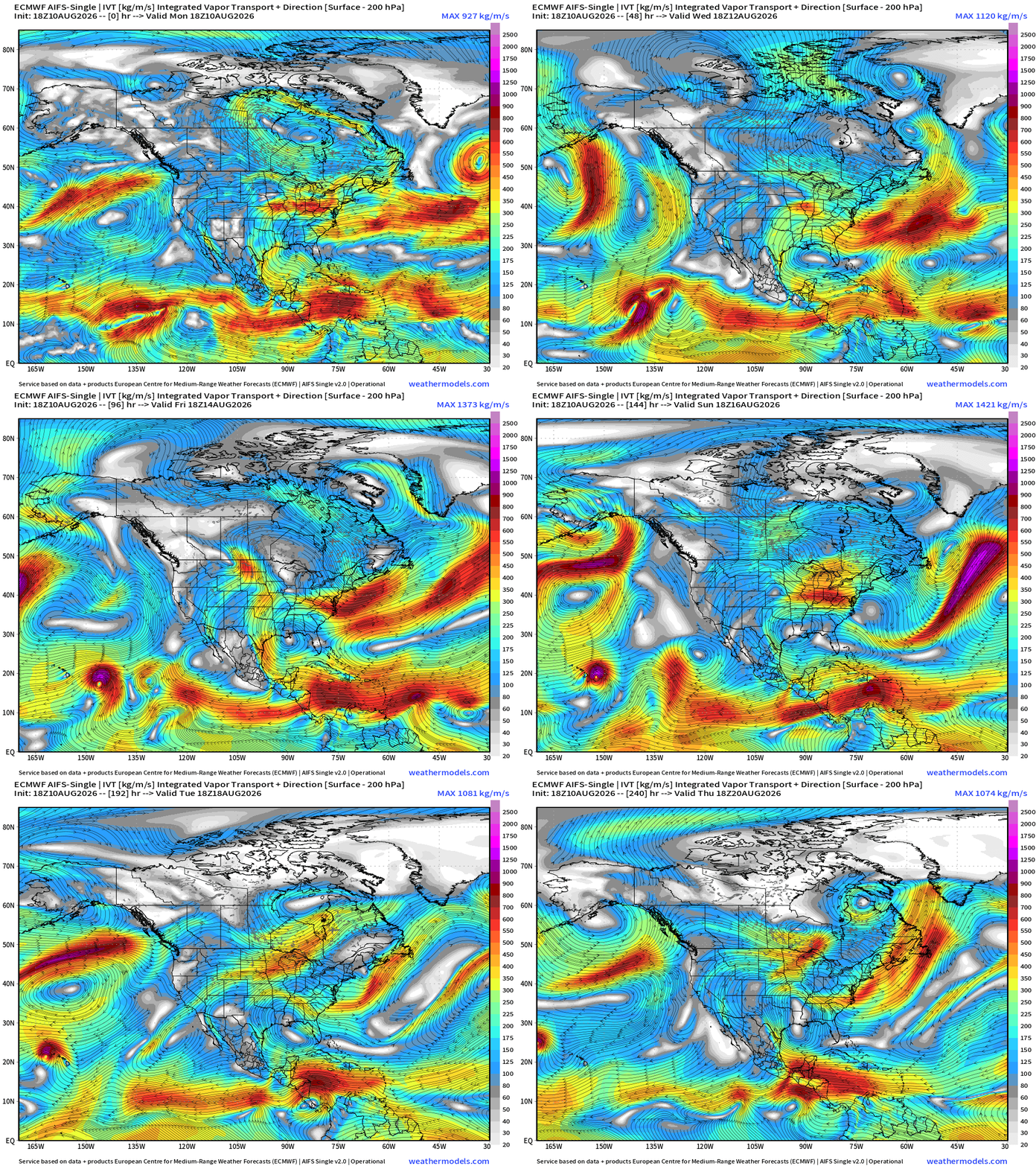
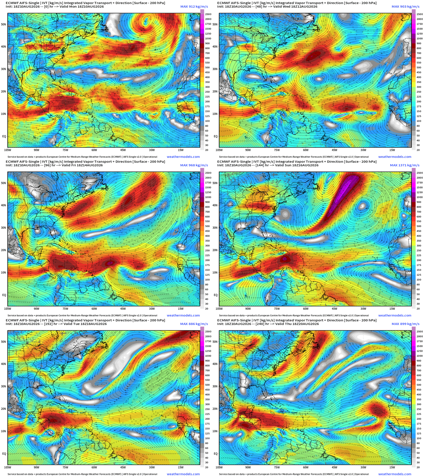
Flagship model: ECMWF AIFS 18z —> Integrated Vapor Transport next 8-days
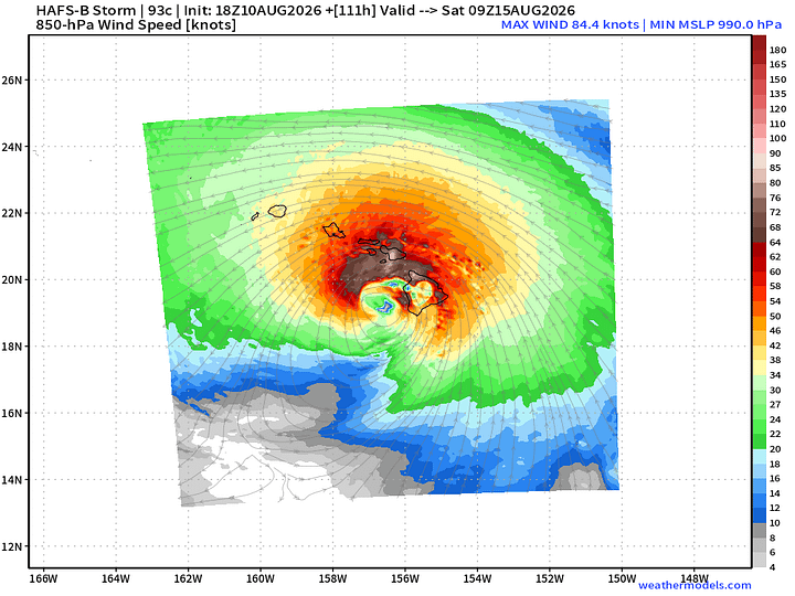
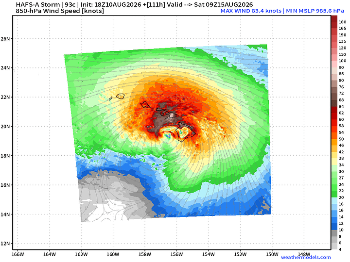
A hurricane likely to form out of the ITCZ SE of Hawaii and threaten the islands by this weekend.
Multiple robust Atlantic tropical waves but not quite catching fire like they could in a more favorable environment sans El Niño.
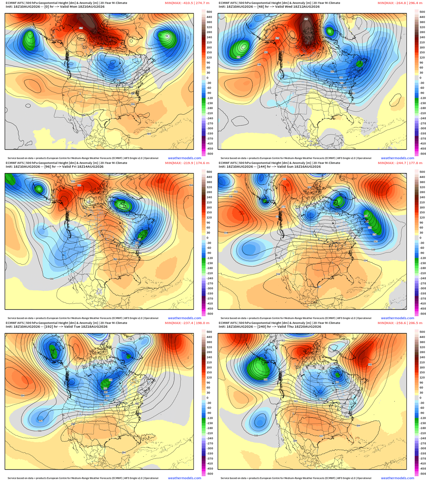
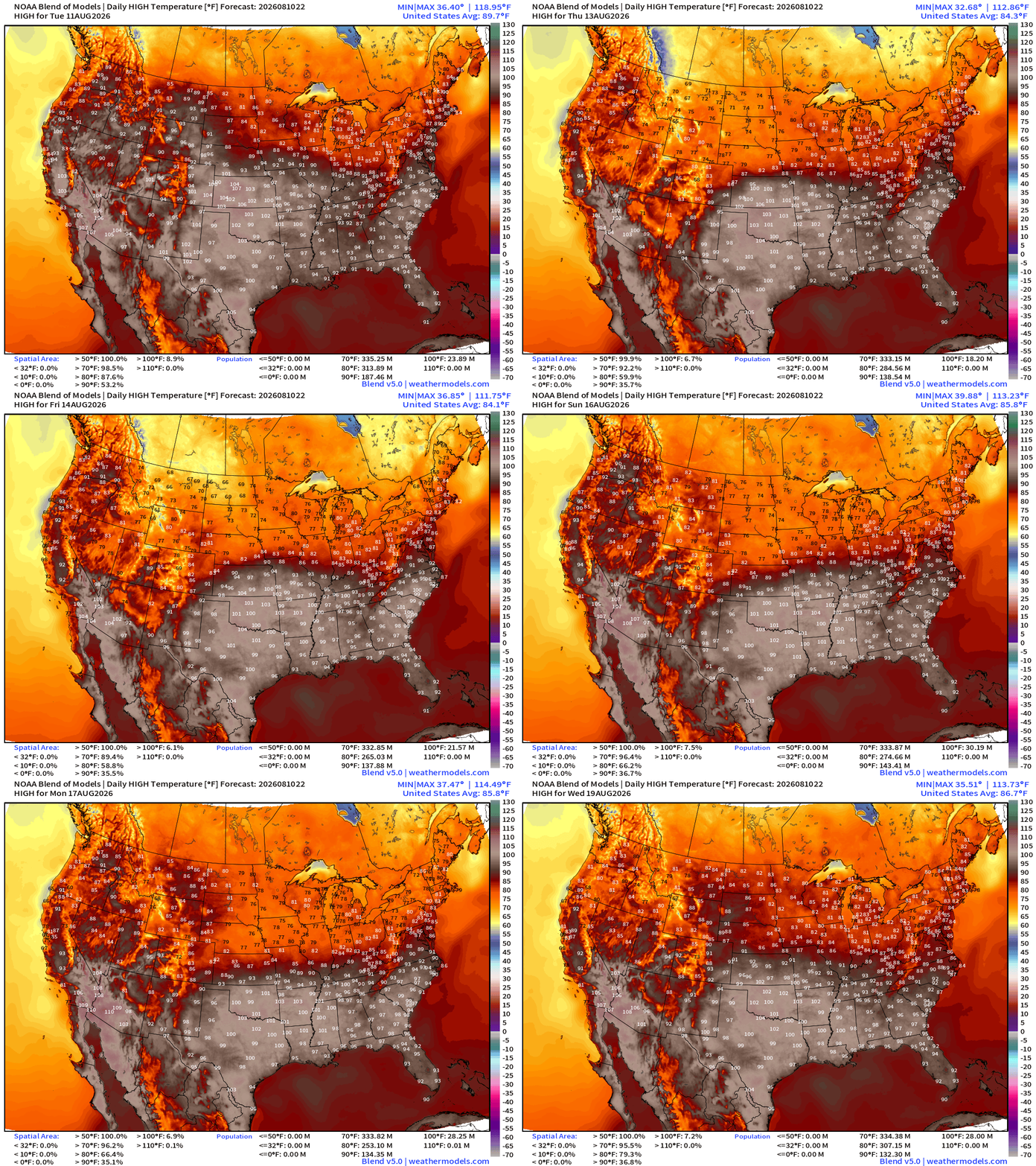
Hudson Bay —> eastern Canada trough gives way to a “heat dome” centered on Texas and the Southeast
Tropical Waves — Lined up 6 deep from the Central Pacific to coast of Africa
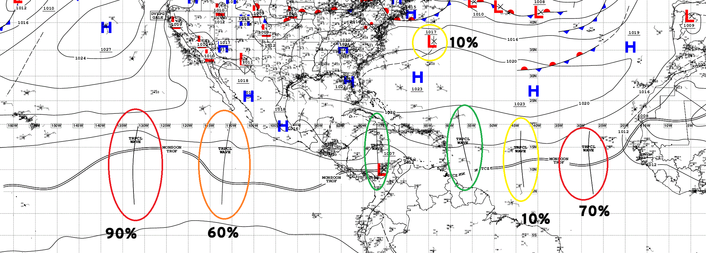
2 of the waves in the parade in the Central/Eastern Pacific are now marked with 60% to 90% chance of development in next 7-days. And, 2 in the Atlantic at 10% and 70%.
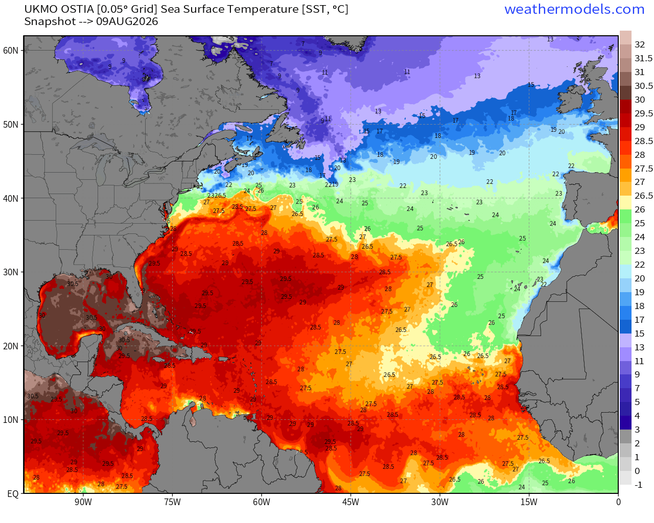
The warmth in the MDR is quickly expanding to carve into the cool <26°C water from the cold Canary Current, so I think any tropical waves that stay below 20°N latitude will have sufficient warm water to develop.
NASA Dust (GEOS-5) — Saharan Air Layers continue to cruise across the Atlantic doing damage to tropical waves and stabilizing the tropical environment with warmth at lower levels. The SAL seems to tail off significantly into next week. Perhaps the end of the road for SAL.
Flagship AIFS Integrated Vapor Transport next 12-days —> tropical waves churn westward, and into second week of August, quite a few tropical waves in the MDR that look healthy enough, and we’ll have to watch into next week. I see at least 3 candidates with 2 better chance of survival. Even if they do not form or catch fire in the deep tropics, they need to be watched as they gain latitude and get closer to Bahamas, as the ECMWF ensembles showed.
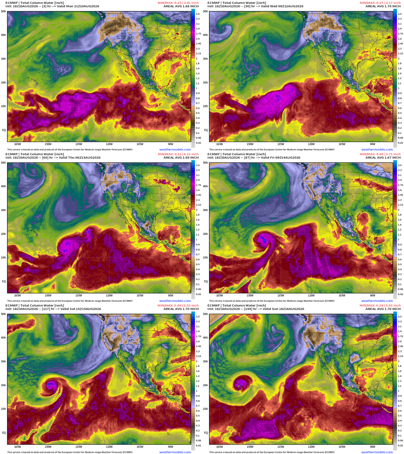
ECMWF 18z takes Hurricane Lala around the Big Island and turns west on Sunday.
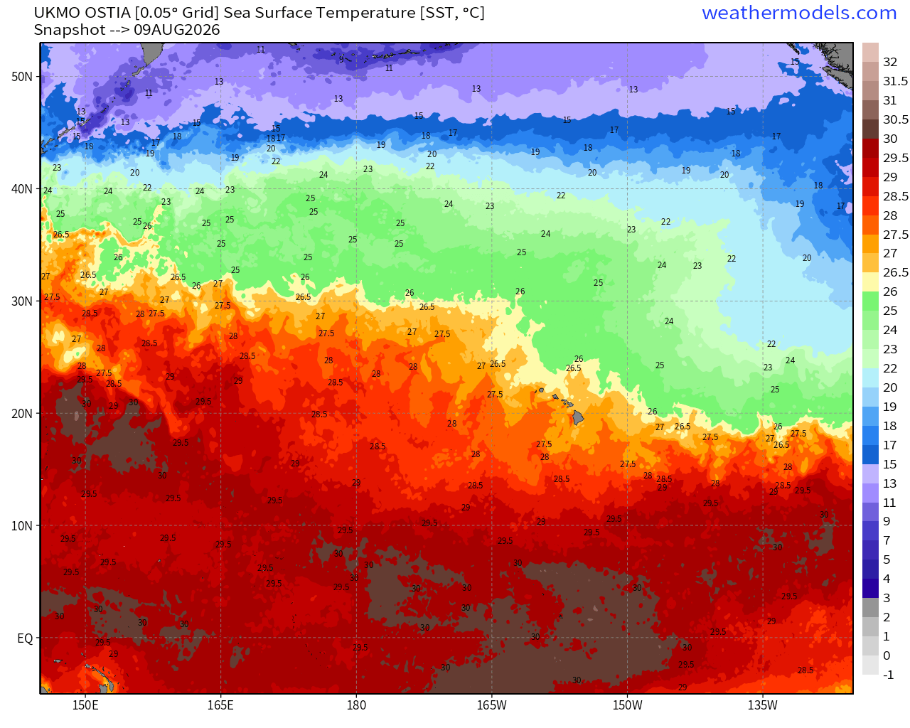
SST > 27°C around Hawaii — enough for a minimal hurricane
HAFS-A & B —> Hurricane Lala curving to the west of Big Island
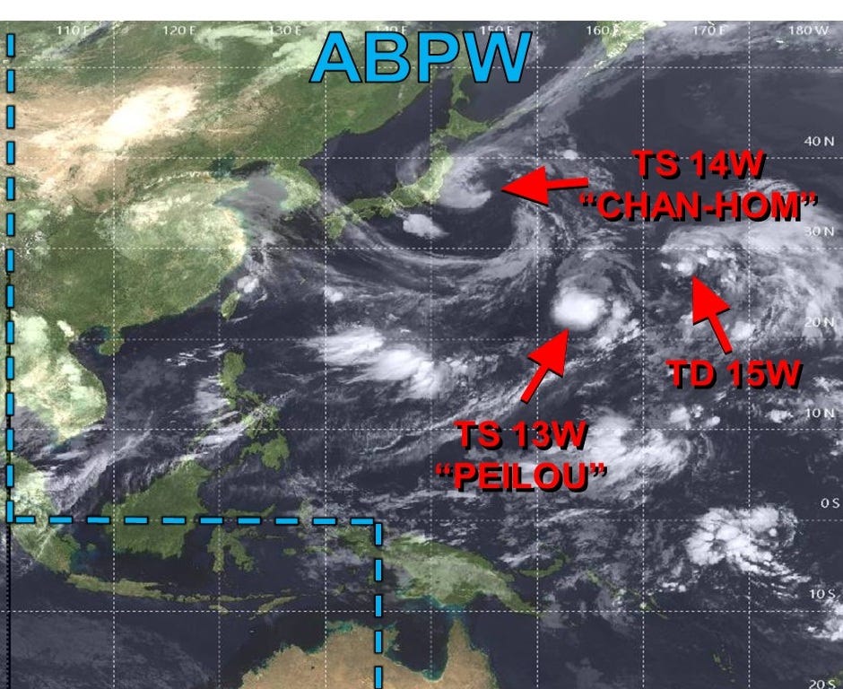
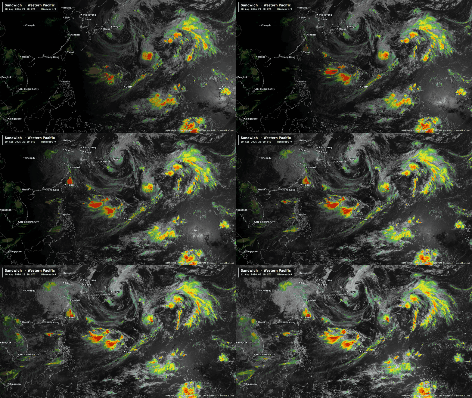
Quite a mess with the monsoon trough … multiple swirls with names but remaining relatively weak.
Integrated Vapor Transport from ECMWF AIFS 18z
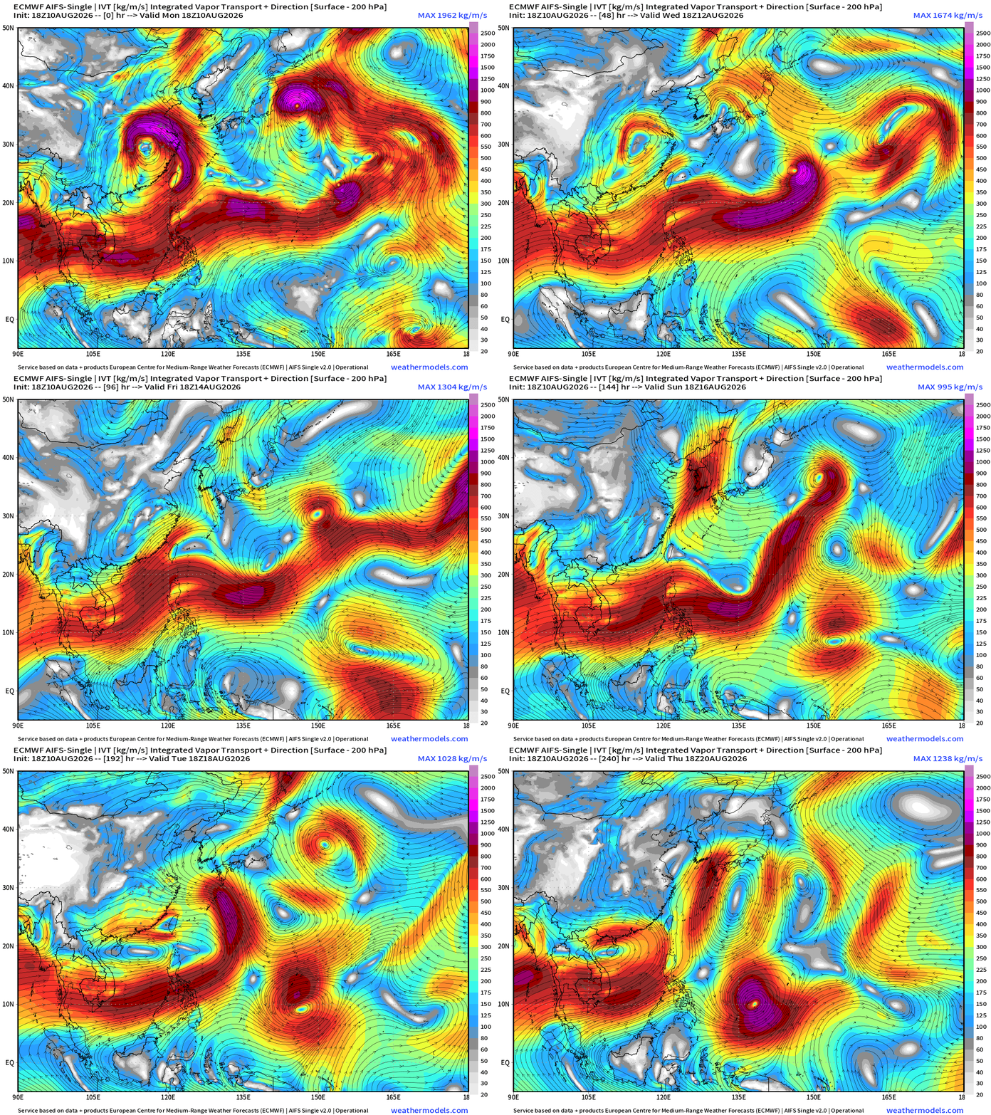
Very busy basin with Chan-hom heading into Japan and then who knows how many more TCs will spawn out of the monsoon trough before it finally breaks down.
My Atlantic Hurricane Season Forecast (2026)
From April 7, 2026: Atlantic Seasonal Hurricane Forecast: (11/5/2)
9-13 Named Storms (11 most likely)
4-7 Hurricanes (5 or 6 most likely)
1-3 Major Hurricanes (2 most likely)
Accumulated Cyclone Energy: 75-85 (well below normal)
NOAA 2026 Atlantic Hurricane Season Forecast
Comments
Nothing yet. Say the first thing.
Sign in to join the conversation.