

This is Weather Wires Post 4: Day 219 of 2026.
Day 68 of Atlantic Hurricane Season | YTD: 2 Named Storms
Author: Dr. Ryan Maue (X @RyanWeather X @weathertrader)
Welcome to 1 new annual subscriber, and 4 renewing paid subscribers and other visitors. Even with this so-far quiet hurricane season, we continue to grow! Your trust and support is greatly appreciated. Forecast post 1,000 will wait as I finish a major project with newly open-sourced Google Deep Mind WeatherNext 2 data.

Weather Trader is entirely reader-supported publication (no ads). To receive all new posts and support our platform, consider becoming a paid subscriber / supporter. Satellite imagery from Squall Cloud.

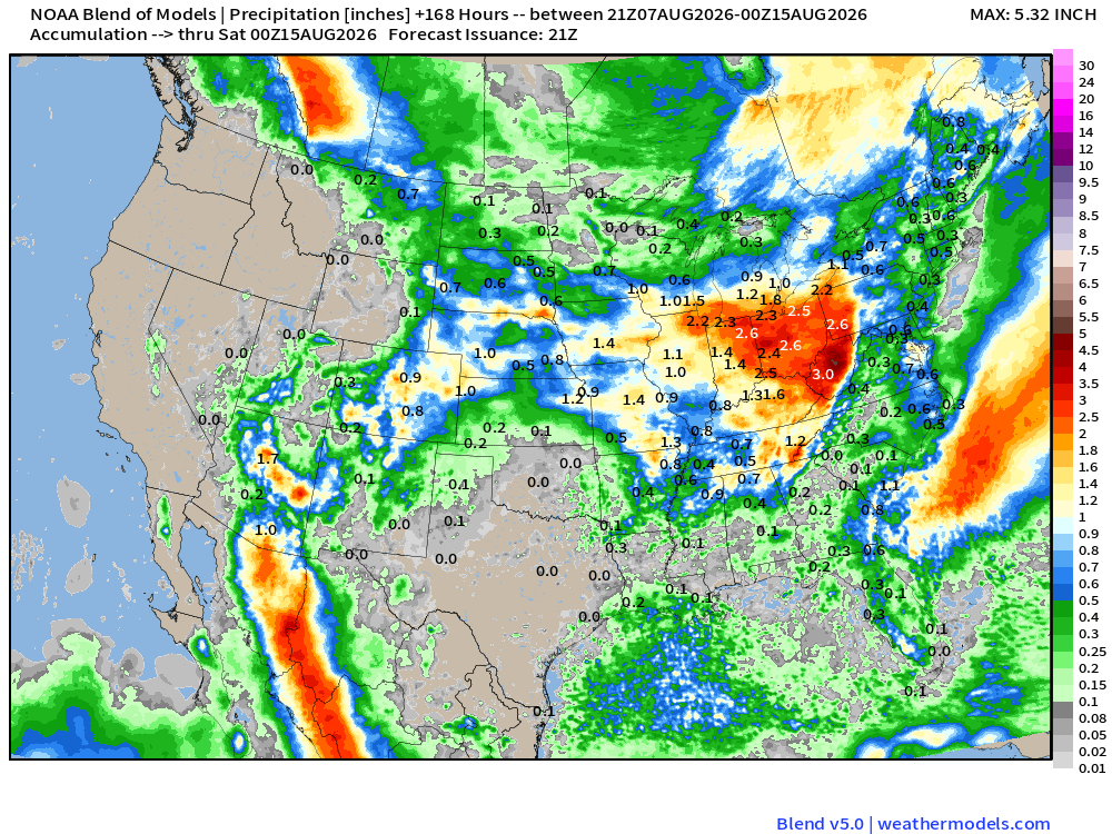
Tropical disturbance off the Florida / Southeast U.S. coastline is enhancing rainfall but there is no organized surface circulation, and no further development is expected. Strong storms with a frontal boundary are moving through NYC this evening to help cool off the sultry / humid air mass stuck over the big cities.
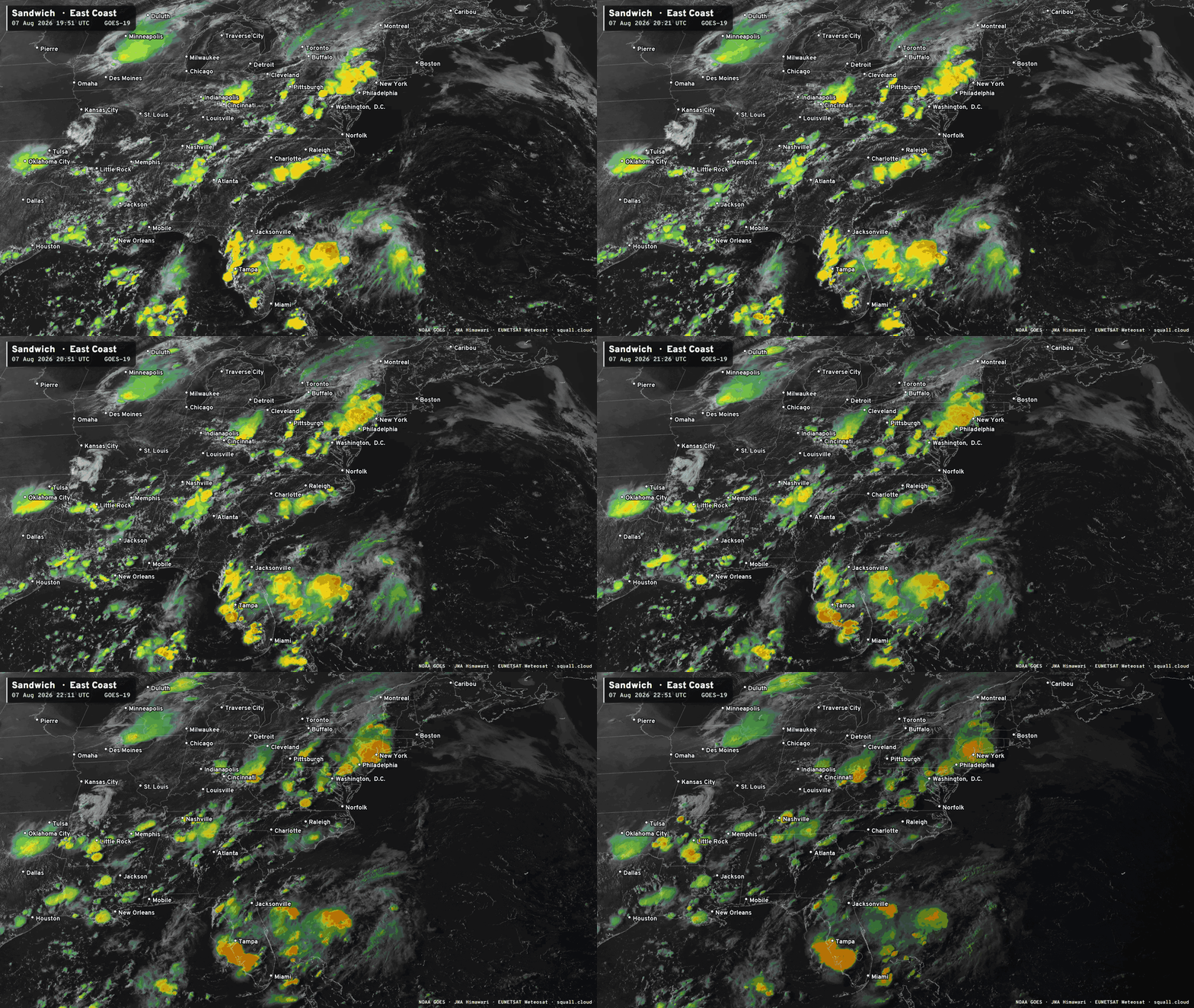
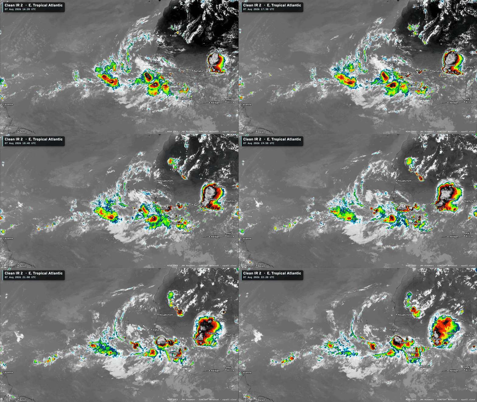
Overall, the tropical Atlantic is mostly quiet. Some areas of convection in the far eastern Main Development Region related to a tropical wave that’s hold on, and another just about to come off the African coast. The latter is very robust with massive thunderstorms.
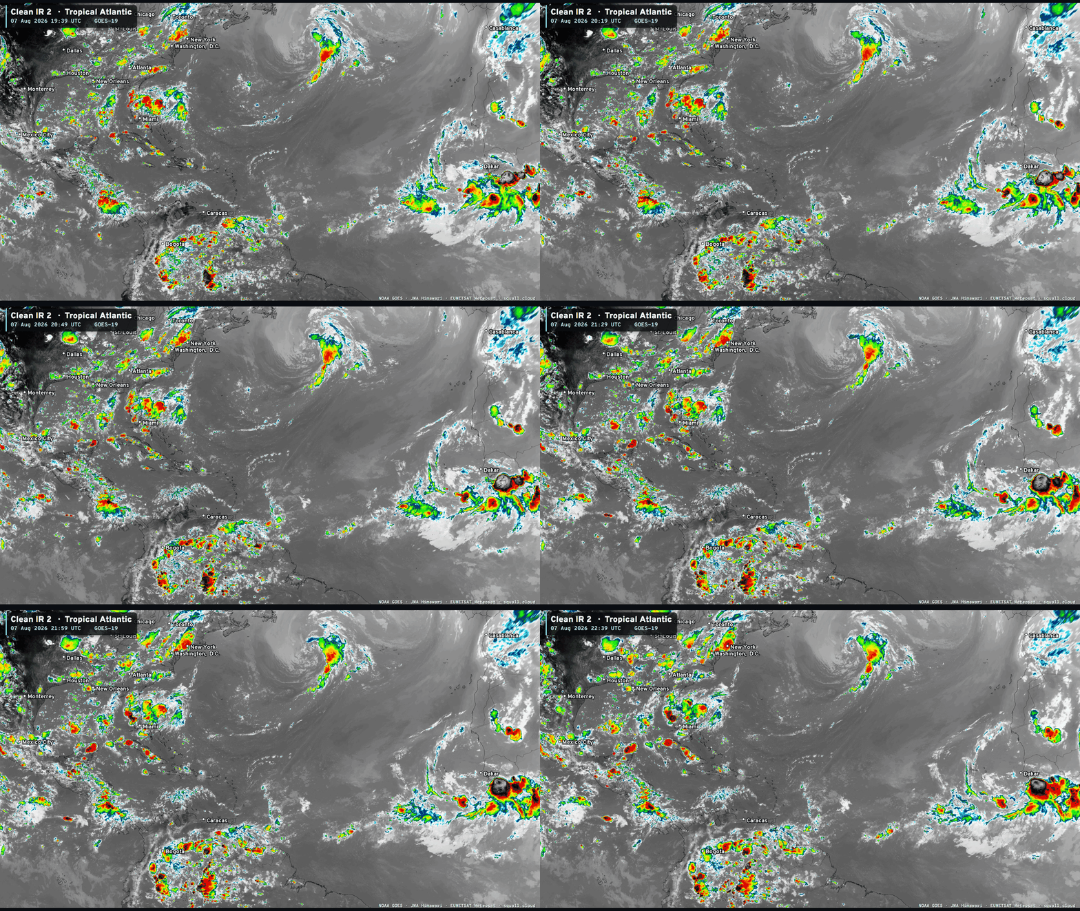
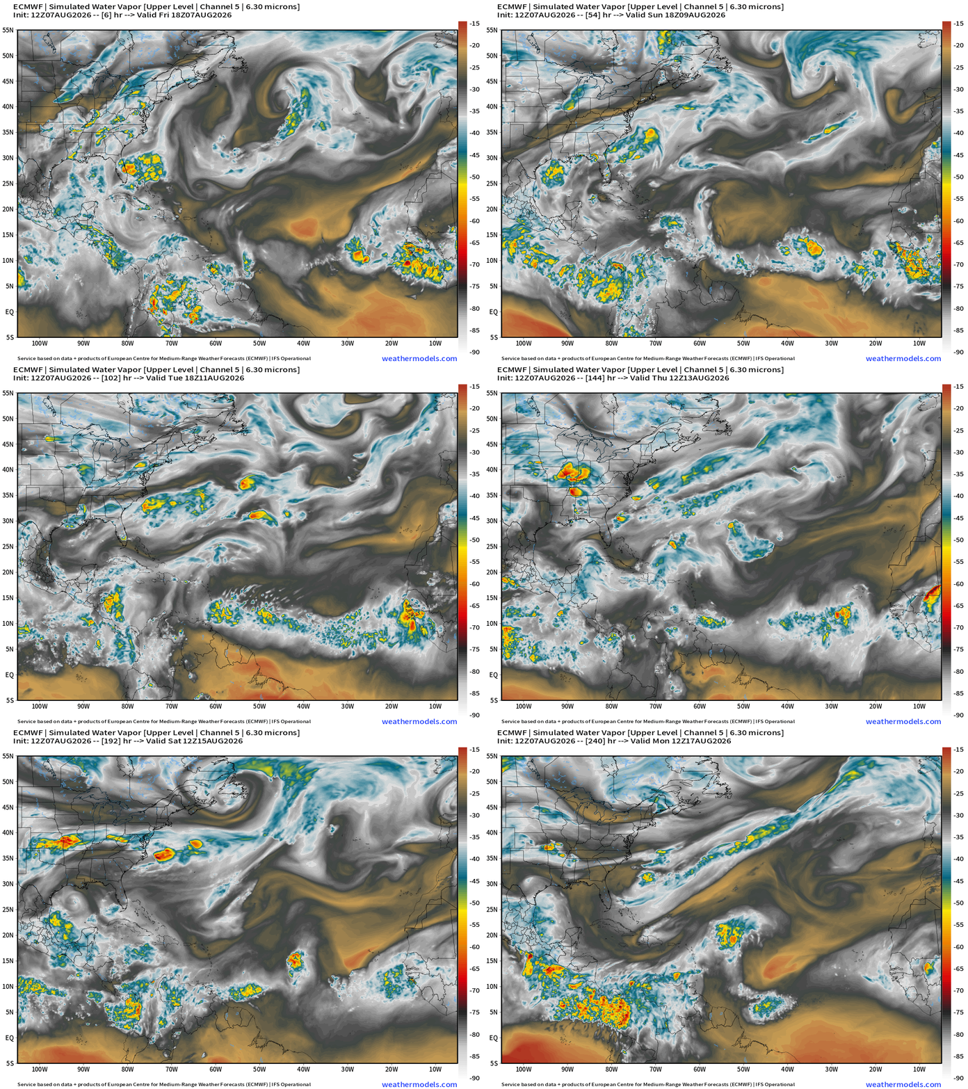
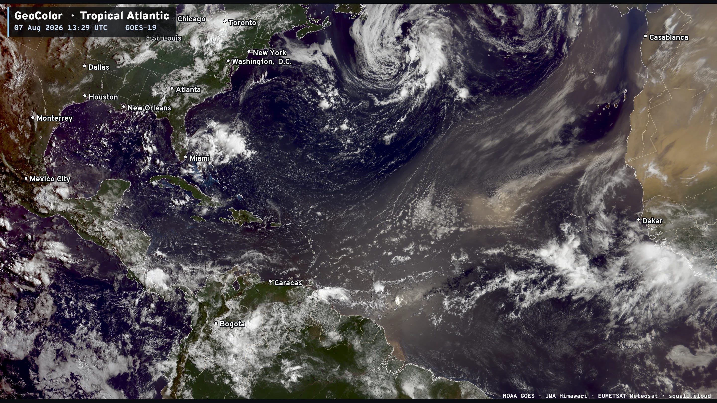
The main features in the tropics: Saharan Air Layers (very dry) and the ITCZ with embedded tropical waves. The timing needs to be just right for the tropical waves to avoid being wiped out by the SAL (and dust) which is stable and very warm at lower-levels. We have 2 main opportunities in the next 7-10 days.
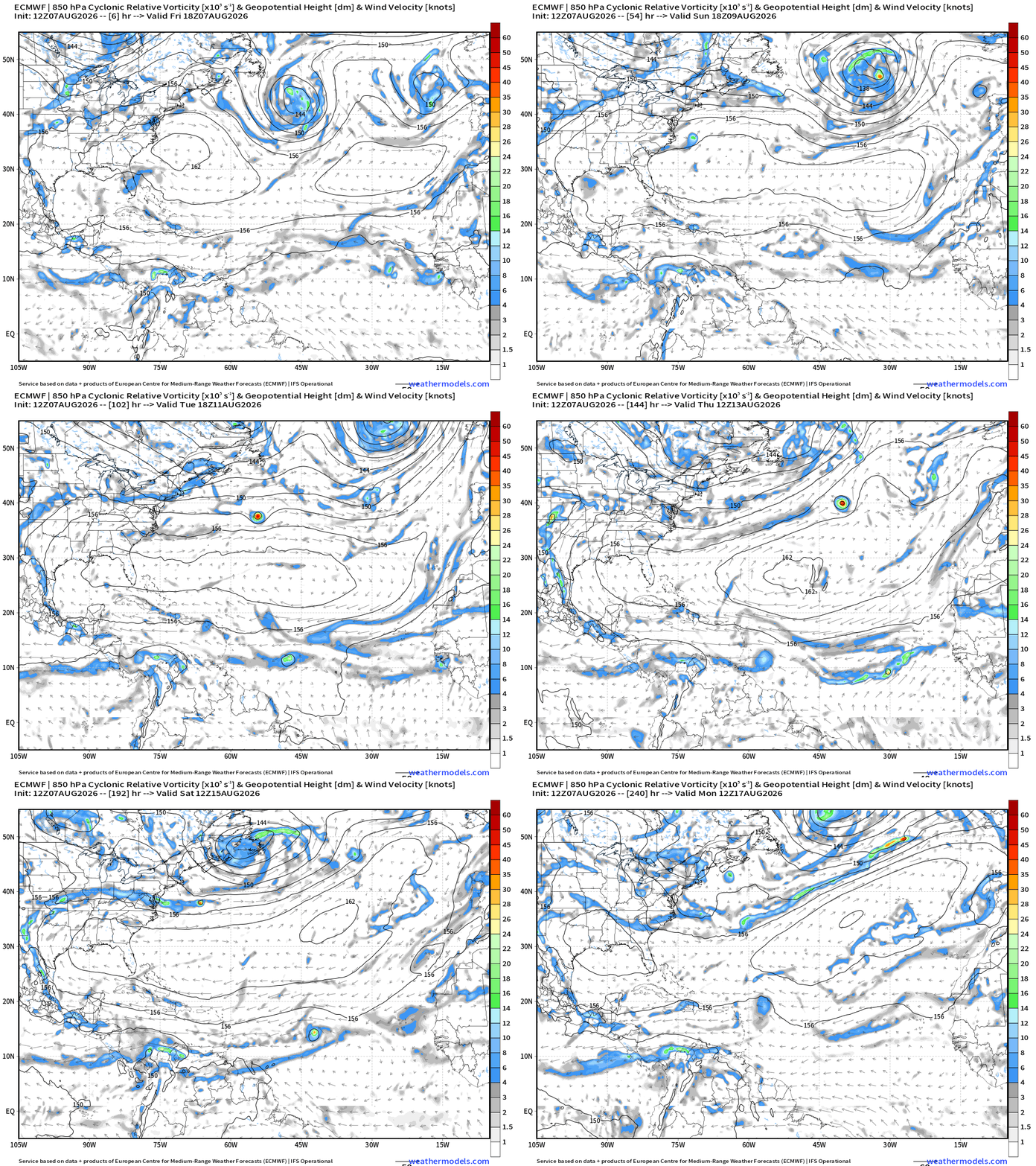
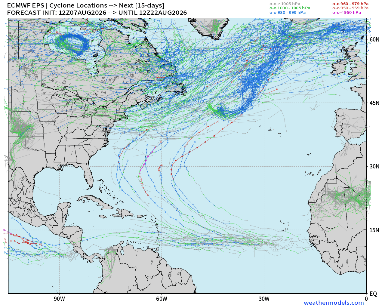
The 12z forecast of ECMWF HRES shows two tropical waves with low-pressure and circulation sufficient for at least tropical depression or storm classification, but just barely.
Candidate #1 tracks westward at lower latitude into the Caribbean —> not going to survive there.
Candidate #2 heads WNW to east of the northern Lesser Antilles into Day 10.
The Atlantic basin is hostile mainly with dry and stable Saharan Air Layers + dust cutting into the top half of the Main Development Region (MDR).
We’re heading into mid-August —> so overall conditions/environment in MDR improve with climatology, and even the strong wind shear from El Niño won’t wreck the eastern half of the tropical Atlantic basin so much as the shutting down the Gulf and Caribbean.
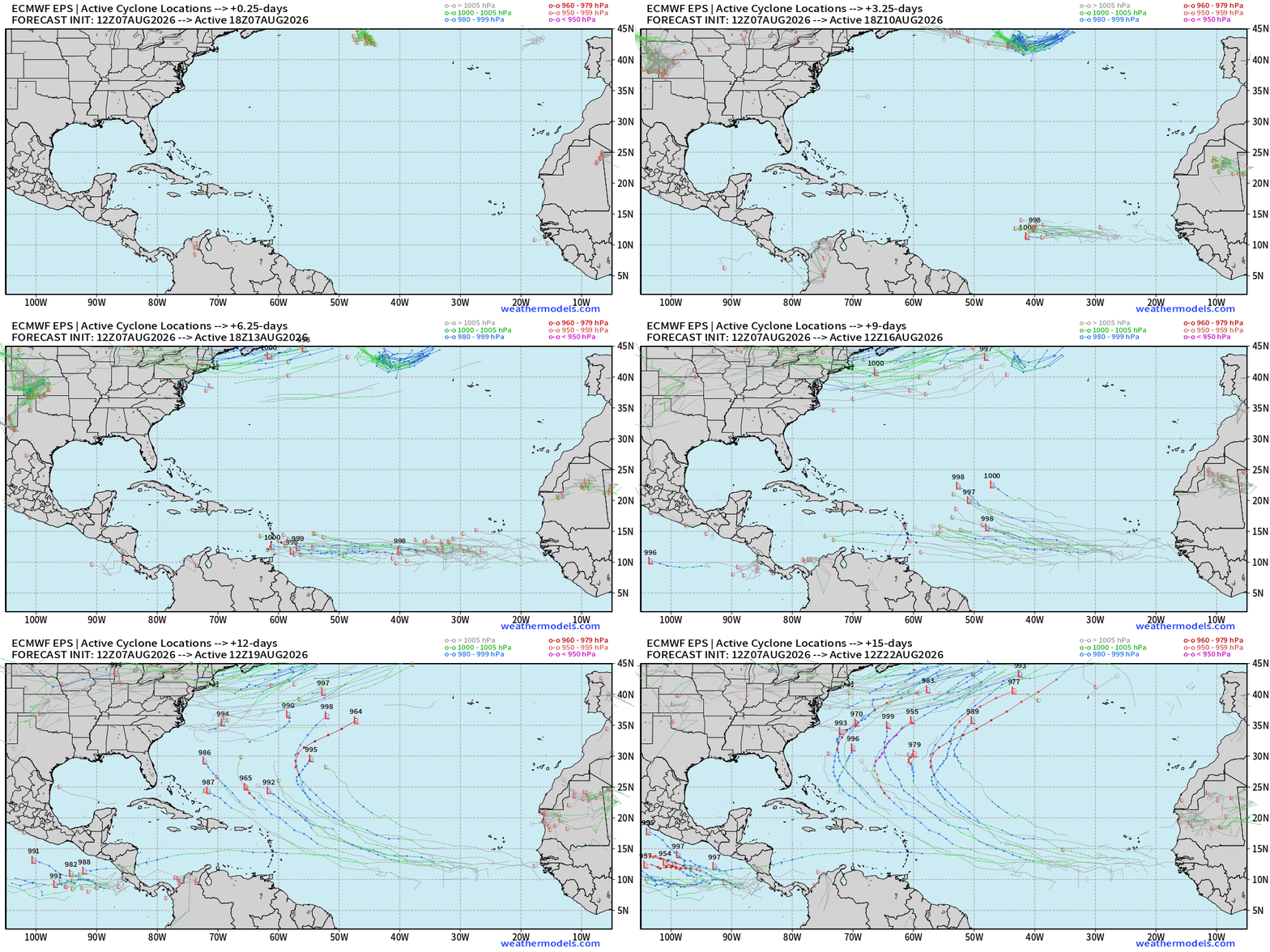
The two candidate tropical waves have good ensemble support. The second (next week) will have a better opportunity to turn into a hurricane or even a major hurricane into August 15-17. I’d put the chance of a H/MH at 20%.
Chance of 2 named storms in the next 15-days? I’d say 50%
ECMWF HRES | Precipitable Water | My Favorite Parameter | Atlantic Tropics
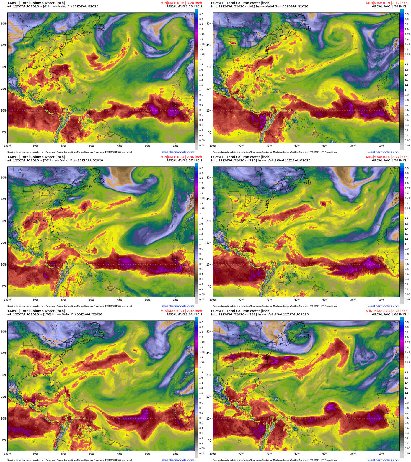
Saharan Air Layers like giant frontal boundaries sweeping through the Main Development Region with tropical waves to the south in the ITCZ/monsoon trough which is absolutely loaded with tropical moisture.
2 strong tropical waves at lower latitudes moving west but the SAL to the north will work hard against them.
We’re heading into Cape Verde season with tropical waves more robust and conditions in the MDR better even in the face of the El Niño, so we need to monitor everything regardless of the negative background environment.
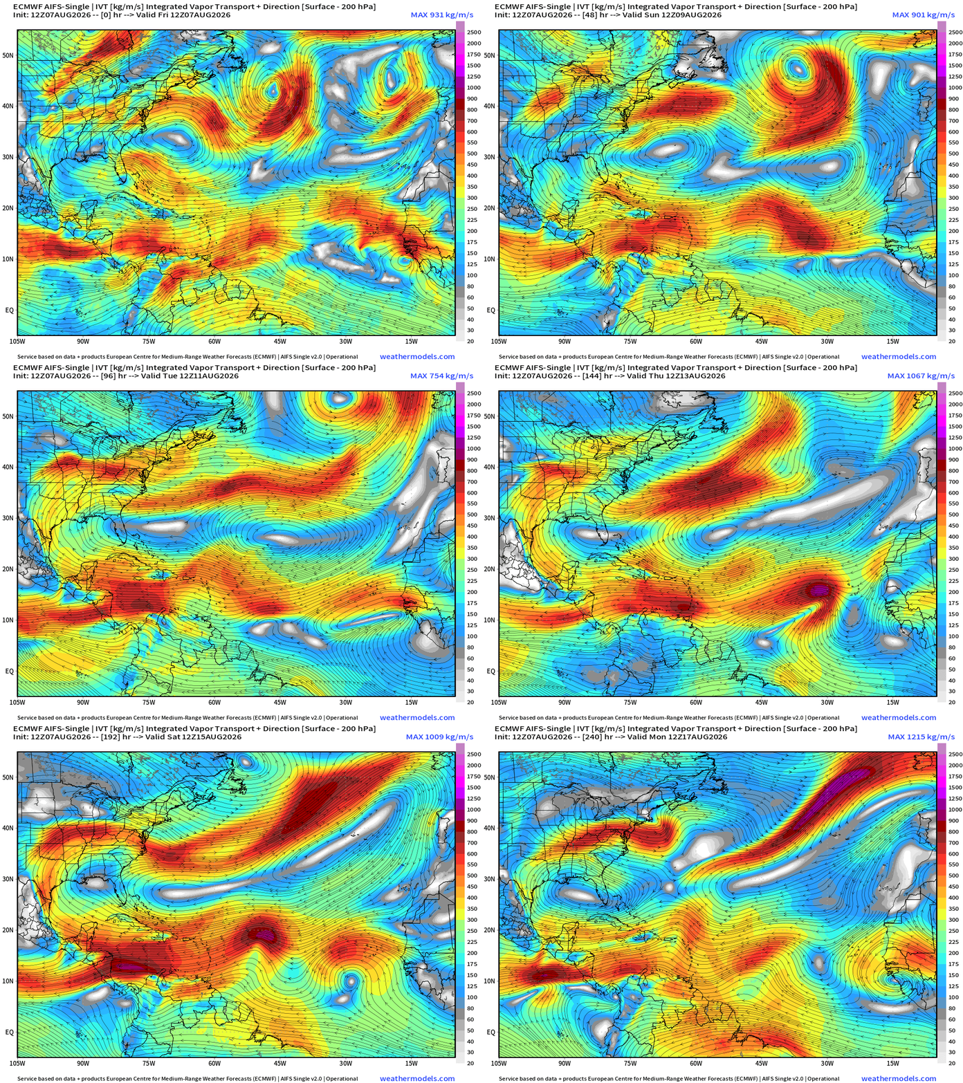
Flagship AIFS Integrated Vapor Transport next 10-days —> tropical waves churn westward, and into second week of August, quite a few tropical waves in the MDR that look healthy enough, and we’ll have to watch into next week. I see at least 3 candidates with 2 better chance of survival.
Huge Saharan Dust Layer coming into the Atlantic — image from earlier Friday
Tropical Waves — Lined up 7 deep from the Eastern Pacific to coast of Africa
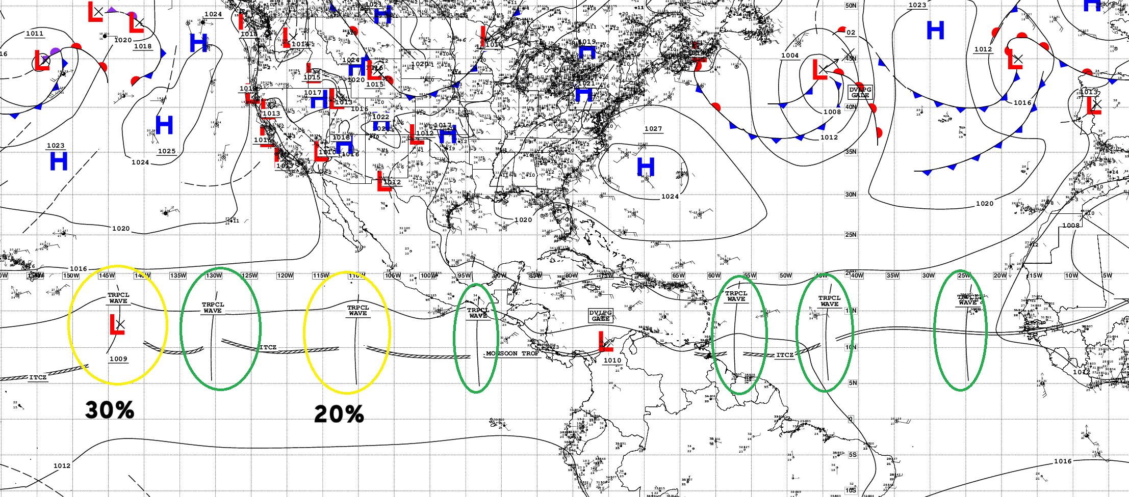
2 of the waves in the parade in the Central/Eastern Pacific are now marked with 20% to 30% chance of development in next 7-days. None in the Atlantic (yet).
Here’s our Tropical Wave coming off Africa with a massive convective blowup, and another upstream in 2-days
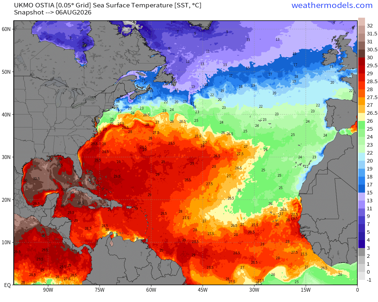
The warmth in the MDR is quickly expanding to carve into the cool <26°C water from the cold Canary Current, so I think any tropical waves that stay below 20°N latitude will have sufficient warm water to develop.
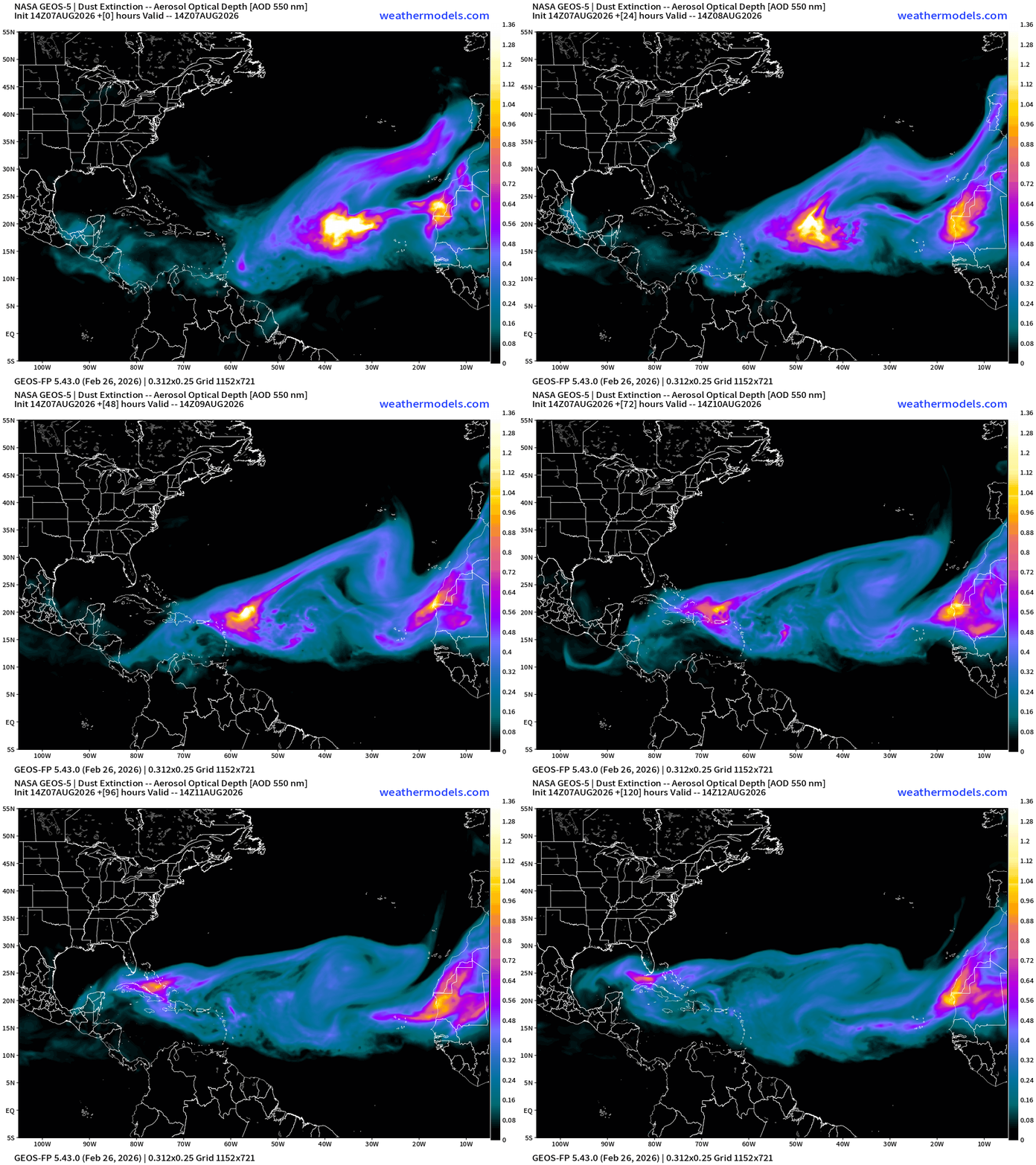
NASA Dust (GEOS-5) — Saharan Air Layers continue to cruise across the Atlantic doing damage to tropical waves and stabilizing the tropical environment with warmth at lower levels.
SAL events will continue for the next 5-days with this major plume reaching Florida in into early next week. HUGE.
Tropical Equatorial Africa — More waves in the pipeline or “wave train”
Now Operational: Squall Cloud global weather satellite viewer. Paid subscribers support these services, and I am very appreciative as well as the rest of Earth that can use them for free.
Building Weather Trader is underway — archive + real-time weather forecast markets. It assembles the last 10-15 years of my private sector experience and expertise. I’ve stored about 250 TB of NWP data over the past year, and it’s being processed to help provide the best possible forecast guidance, at least within my capabilities. I don’t really know what the quant shops are doing.
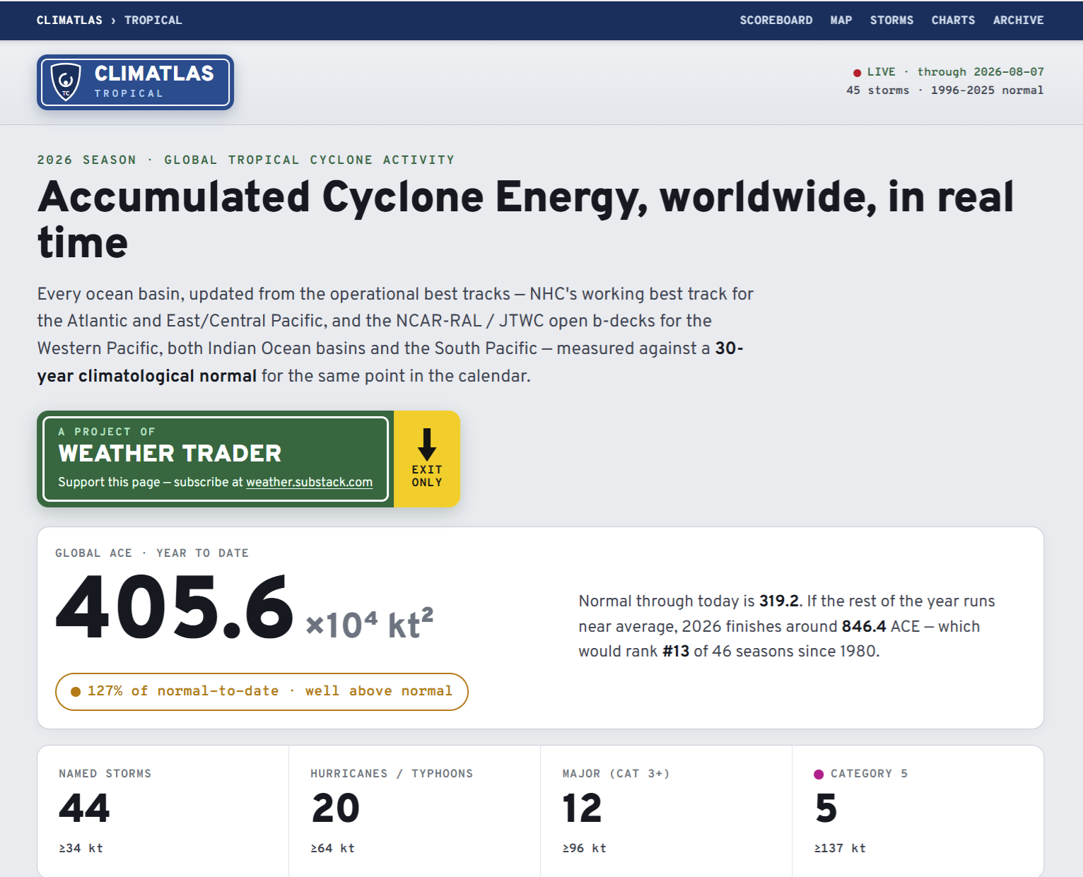
Global Tropical Cyclones for more ACE information, as well as my original climatlas.com/tropical site.
Maps sourced from weathermodels.com designed and innovated by yours truly! Please subscribe there for real-time access to the newest maps, charts from all of the weather models including ECMWF and AIFS, and NOAA GFS/GEFS, HRRR/RRFS and Blend of Models (NBM). NOAA WPC and SPC for fronts/convective outlooks. Our own content is now sourced from hottestsince.com and weather.city and celsius.earth, and squall.cloud and weather.football and global-tropical-cyclones.com
My Atlantic Hurricane Season Forecast (2026)
From April 7, 2026: Atlantic Seasonal Hurricane Forecast: (11/5/2)
9-13 Named Storms (11 most likely)
4-7 Hurricanes (5 or 6 most likely)
1-3 Major Hurricanes (2 most likely)
Accumulated Cyclone Energy: 75-85 (well below normal)
NOAA 2026 Atlantic Hurricane Season Forecast
Comments
Nothing yet. Say the first thing.
Sign in to join the conversation.