
It’s time for a full post-mortem on this stubborn atmospheric pattern. Strap in.
In an obvious departure from recent guidance, weather forecast models have sharply scaled back the anticipated frontal system (27th-30th) for south-eastern Australia over the coming days.
What makes this shift particularly compelling is the rapidity of the correction within the medium-range window, just ~100 hours out from its arrival. In modern numerical weather prediction (computer modelling), forecasts at this short range usually demonstrate strong agreement and stability. Rather than a minor weakening, however, we are seeing a classic near-range “flip” as persistent high-pressure ridging asserts dominance over the region.
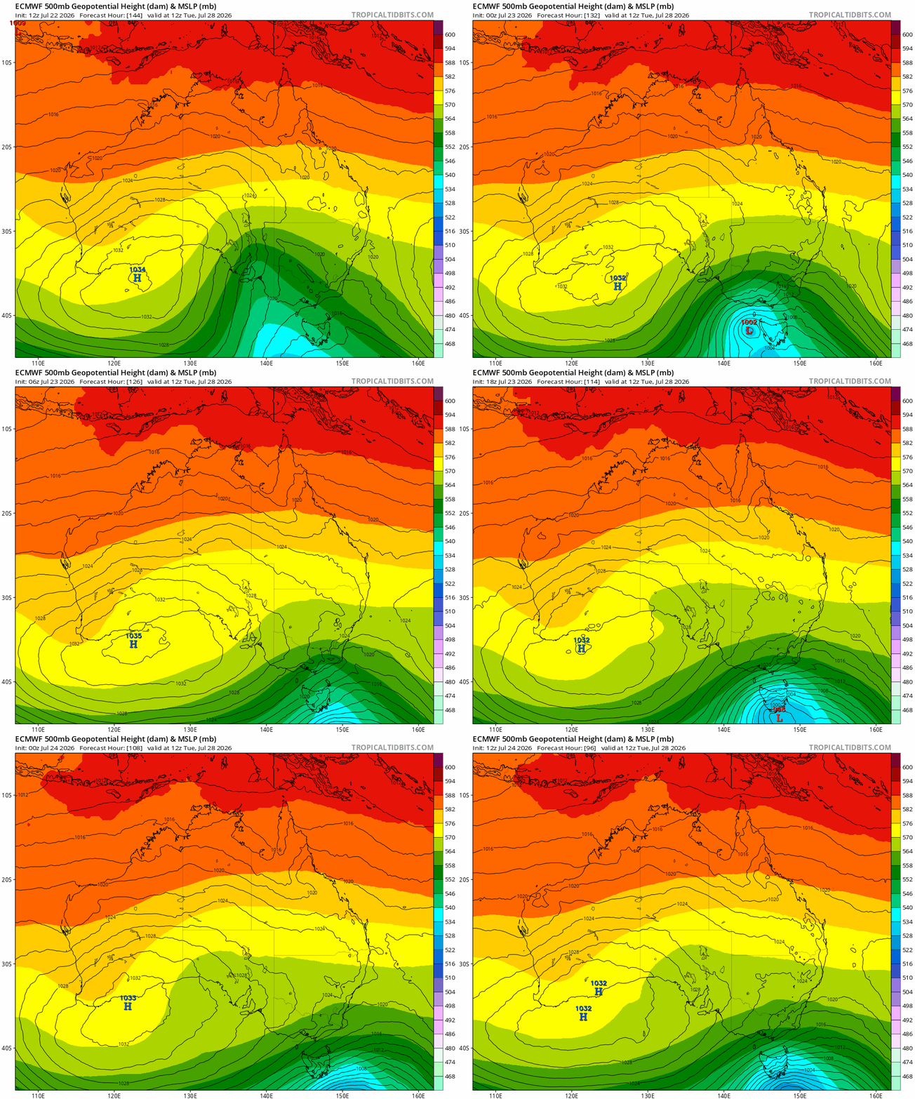
In the wake of these model adjustments, the Aussie alpine is expecting ~5 cm above 1600m with an outside chance of up to 10cm for southern ski areas (Buller et al.). There are signs suggesting there may be a brief opportunity for some low-level falls in Victoria (sub-1000m).
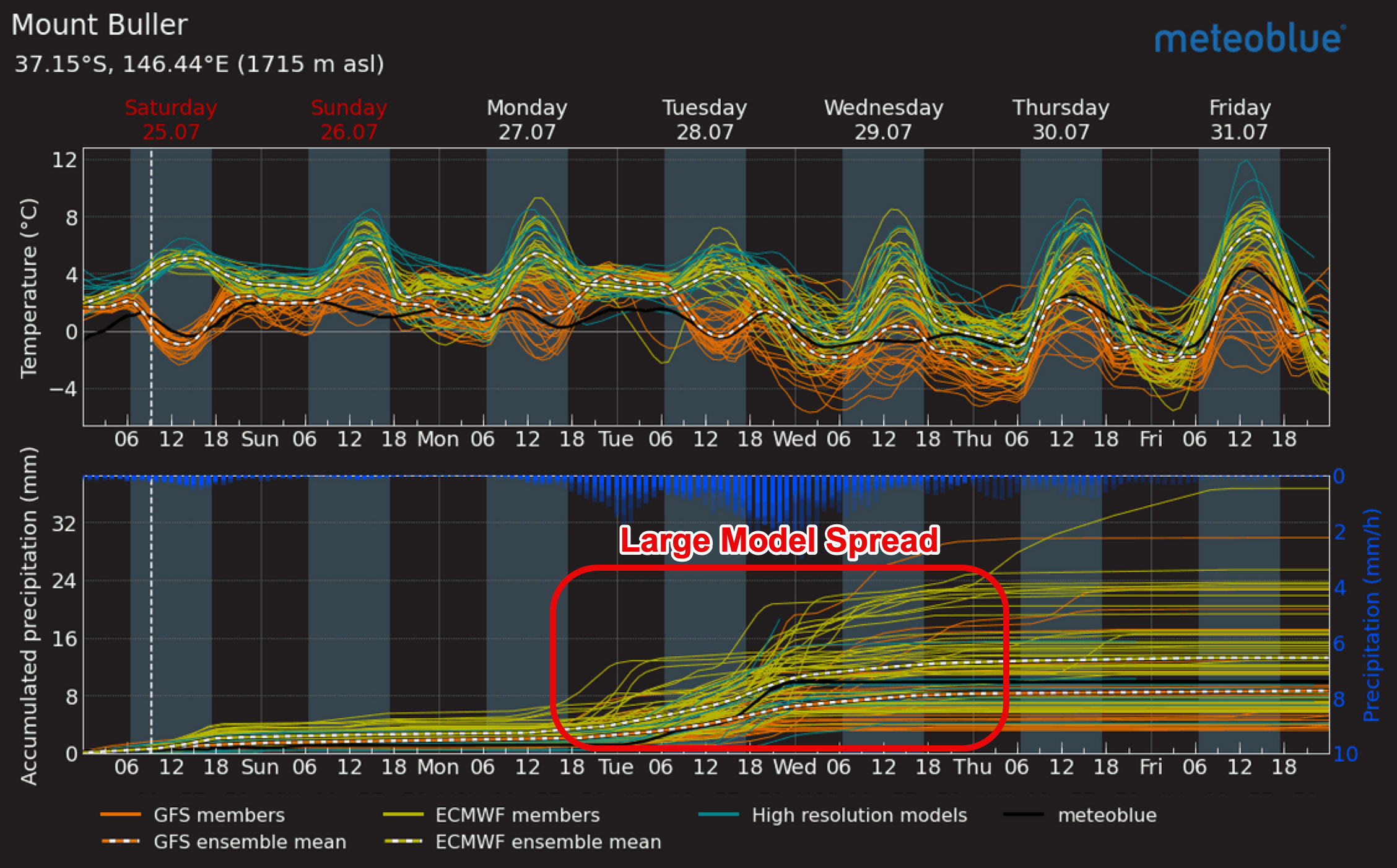
The latest guidance has the system arriving early Tuesday morning with a clearing trend to establish itself through the region by early Wednesday morning.
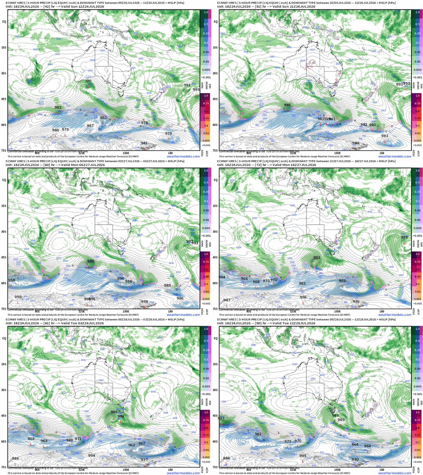
The Tasmanian sub-alpine, on the other hand, is expected to see more extensive snowfall with falls of up to 20-30 cm above 1500m, and extensive low-level falls throughout the south west of the Apple Isle.
Comments
Nothing yet. Say the first thing.
Sign in to join the conversation.