
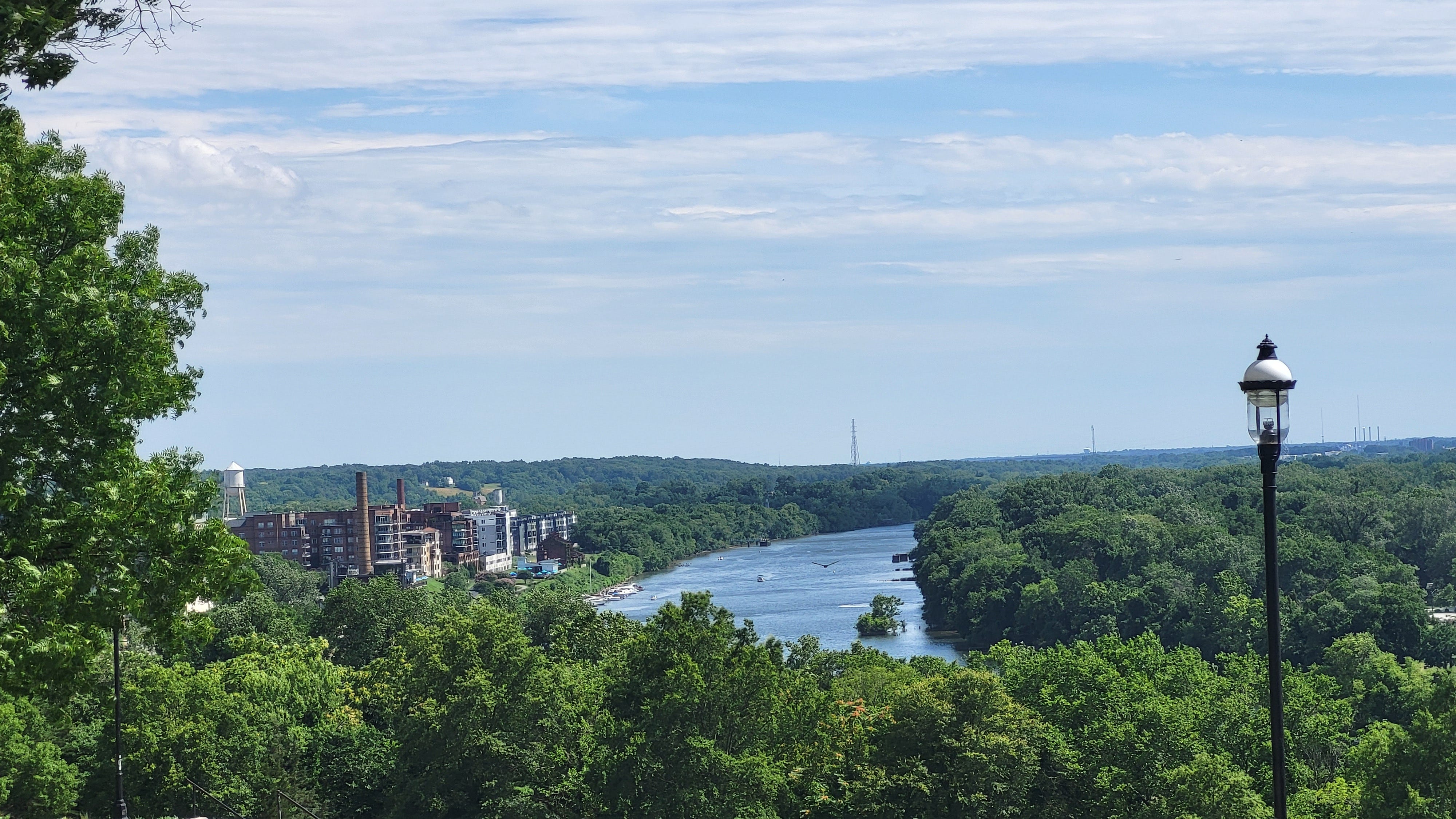
5pm Wednesday, August 19, 2026
Today offered a short-lived break in the high humidity, although it returns Thursday, bringing with it numerous showers and thunderstorms. Another break comes early next week.
Humidity climbs tomorrow, and an approaching system will spawn showers and thunderstorms. The damaging storm risk is a level 2 out of 5 (aka Slight Risk).
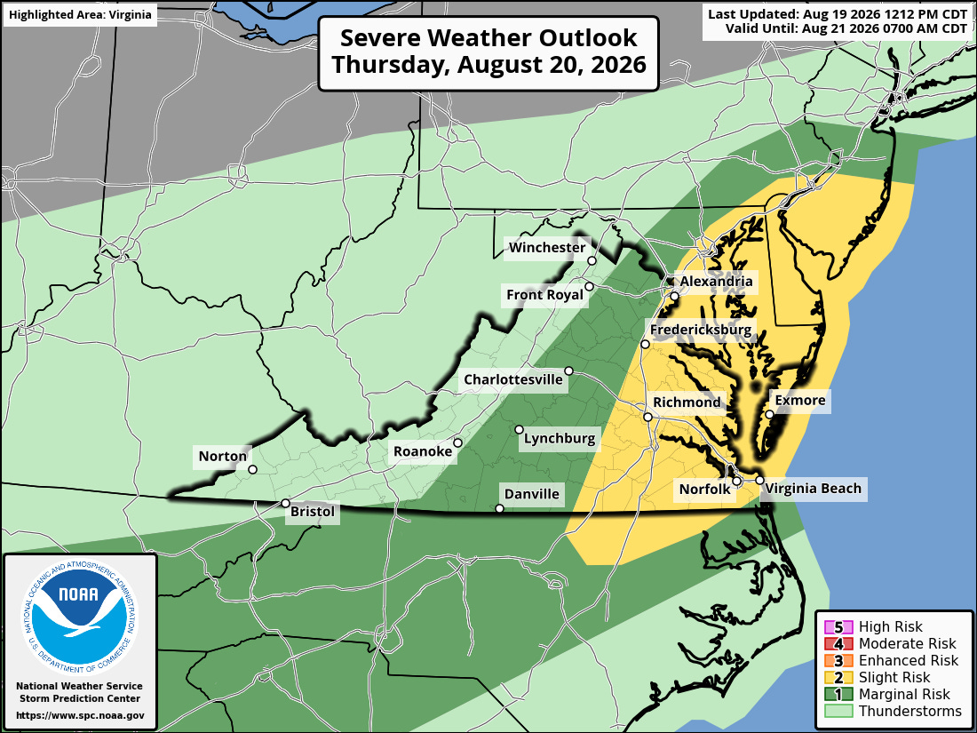
Storms will develop late in the afternoon and remain in the area well into the evening before dissipating, but they will leave clouds in place, making Friday mostly cloudy with scattered showers and thunderstorms just about any time starting in the late morning.
There is some concern about especially heavy rain in the storms on Friday, perhaps enough for small scale flash flooding — standing water on highways and other areas that do not drain well, so file that away for Friday evening.
Tomorrow will reach about 90 degrees, but the additional clouds Friday will keep us closer to the mid 80s.

Both days hold in the 80s, and the humidity will remain high through Saturday, keeping a good chance of showers and thunderstorms in the forecast during Saturday afternoon and evening.
And while it will be close, it looks like just enough dry air moves in on Sunday to nibble away at the humidity and make it sunnier than Saturday.
Total rain in the storms between Thursday and Saturday will average 1.00 to 1.50 inches across Metro Richmond, but there will be some neighborhoods that get more, and some that get less.
Monday and Tuesday next week bring a more significant and noticeable break in the humidity, so the chance for showers and storms backs off substantially. Both days look mostly sunny with afternoons in the 80s and nights more reliably into the 60s.
Between the rain a few nights ago, the upcoming rain this weekend, and the prevailing weather pattern into next weekend — the drought is effectively over in Richmond. Since July 4, we’ve had 80% more rain than normal.
However, western parts of the state have not been so lucky, and there is still a lingering drought from Staunton to Danville.
We are losing more than 2 minutes of daylight each day, as autumn is just over the horizon. Some early data suggests fall will be near or warmer than normal, and likely near or wetter than normal.
Part of this has to do with the building El Niño — which continues to make headlines for its intensity — but its impacts in Virginia will likely be felt more this winter, as we expect it wetter (not snowier) and warmer than normal.

Now that we have reached mid-August, the next 60 days are the heart of the Atlantic hurricane season. But for the moment, the Atlantic, Caribbean, and Gulf all remain quiet.
There are signs in the computer guidance of a system taking shape in the central Atlantic early next week and getting within a few hundred miles of the Southeast coast in about 8-10 days, but it is too early to fret about it right now. The broader steering wind forecast by that time remains consistently from the west, which would turn any system back out to sea before reaching the coast.
To be fair, it is always worth a daily check-in this time of year, but there is no reason to change any beach plans for next weekend (Aug 29-30).
The high humidity has kept low temperatures at or above 70 degrees every morning since August 2 — 18 days in a row (the chart below does not include today).
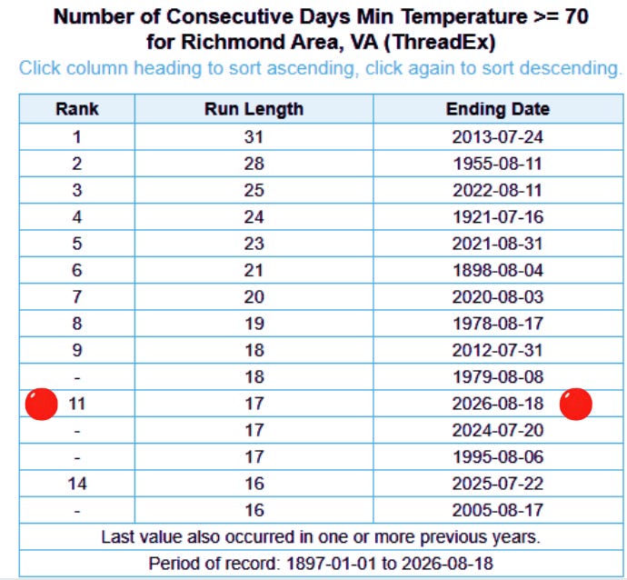
We might squeak into the upper 60s one of the next few nights, but Monday and Tuesday nights are our best chance to get into mid-upper 60s. We will not approach the record.
As an aside, Miami reached 100° on Tuesday — for only the second time on record.
We think of Miami being hot, which is true, but it is also on the coast, so a sea breeze usually develops during the summer, keeping the city below the upper 90s.
As you might guess, the air is also very humid in South Florida, and it takes more energy to raise the temperature of humid air compared to dry air (this is why Phoenix can get to 120°F).
So, reaching 100° in Miami requires a lack of a sea breeze and an unusually low relative humidity. One of those elements is difficult in August. Getting both is exceptionally rare, although it was the case this time.
But the warming climate also means the ocean is warming, so its afternoon cooling effects are not as strong. The normal (aka 30-year average) high temperature in Miami 100 years ago was 88.3 degrees, but it is now 91.2 degrees. And rising.
I had the chance to join the National Wildlife Federation last week for a brief tour of the offshore wind farm 27 miles east of Virginia Beach.
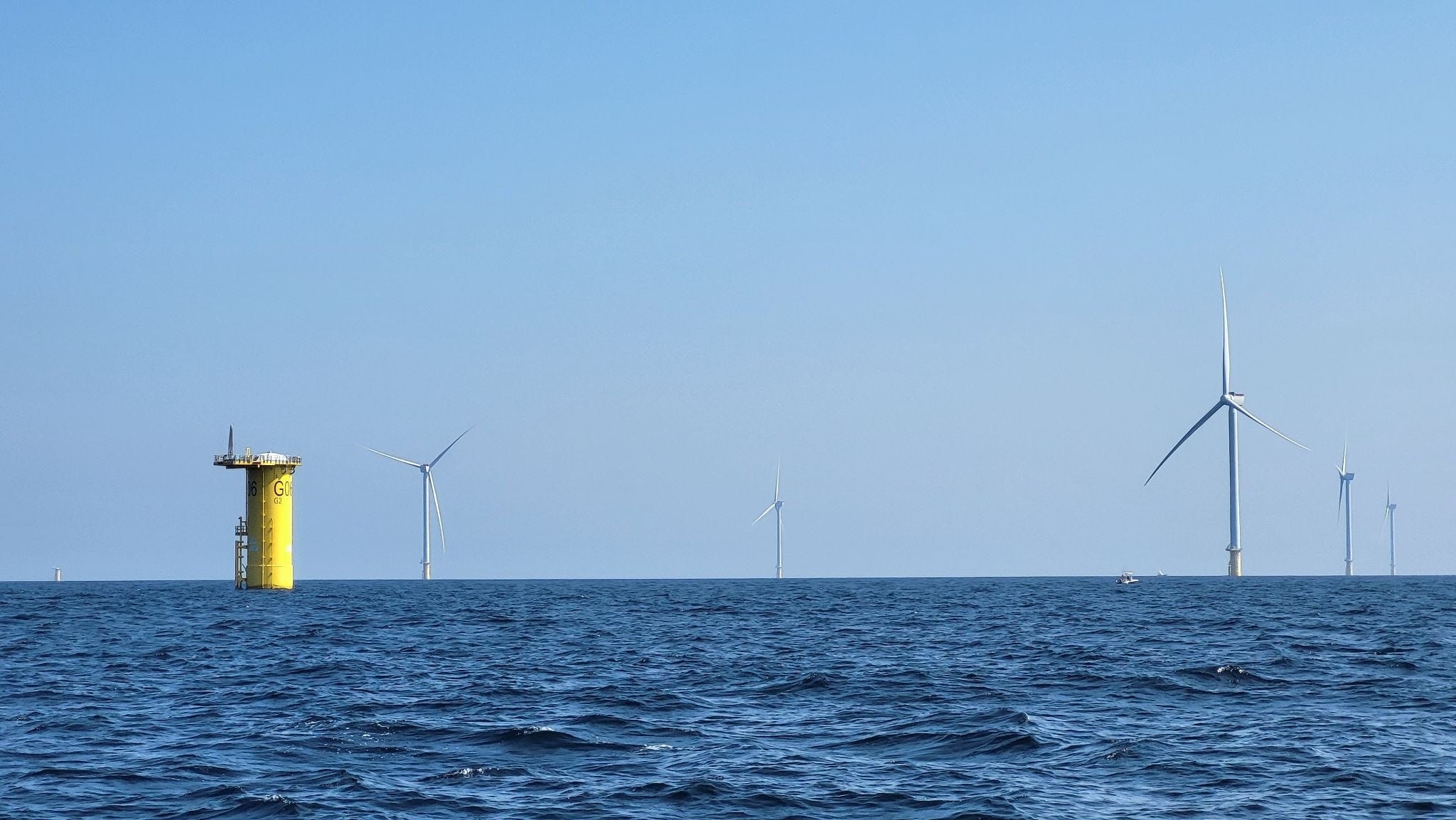
Built by Dominion Energy and known as the Coastal Virginia Offshore Wind Project, it started delivering energy back to shore last spring and is scheduled to be fully functional in early 2027.
For a sense of scale, one turbine can deliver more than 14 megawatts of energy — capable of powering more than 3000 homes, and a single spin of the turbine can power an average home for a day.
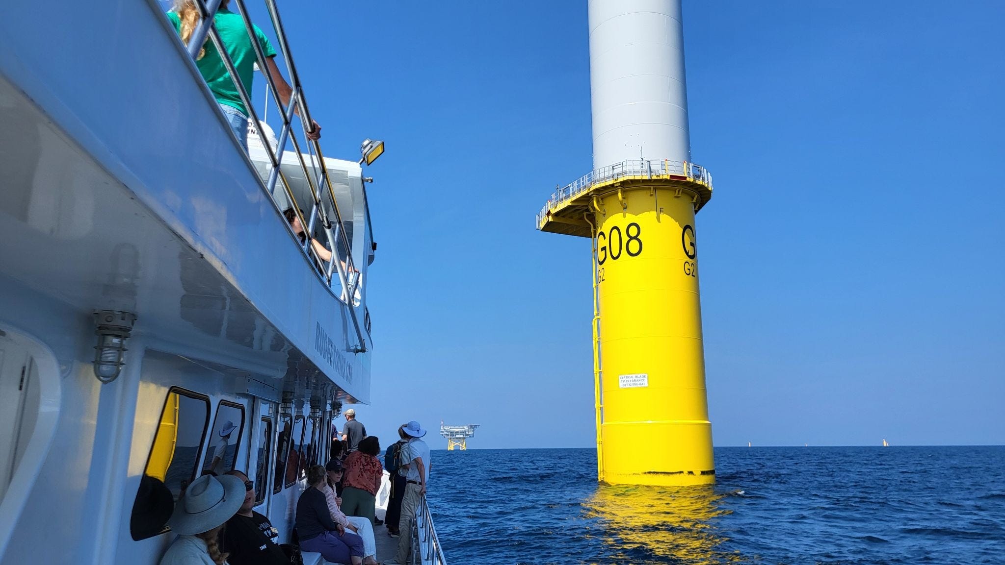
The yellow pieces are the structures connecting the foundations (aka monopiles) to the actual turbines. Most of these transition segments are in place, and additional turbines will be installed over the coming year. A total of 176 turbines are planned, enough to power up to 660,000 homes.
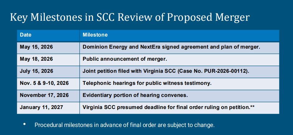
The momentum continues to grow to oppose the NextEra takeover of Dominion Energy, Virginia’s regulated electric utility monopoly.
A rally against the merger was held across from the General Assembly Building on Broad Street yesterday, with several dozen in attendance. Fredericksburg Delegate Joshua Cole and Chesterfield Supervisor Jessica Schneider both spoke at the event.
Afterwards, the group attended the Virginia Energy Commission meeting, where this was the only thing on the schedule. Numerous people provided public comments, including yours truly (90 seconds).
Yesterday’s meeting was for a specific legislative subcommittee, and broader public comment is still being solicited via the State Corporation Commission website.
Learn more about what the merger means at stopnextera.com.
No posts
Comments
Nothing yet. Say the first thing.
Sign in to join the conversation.