
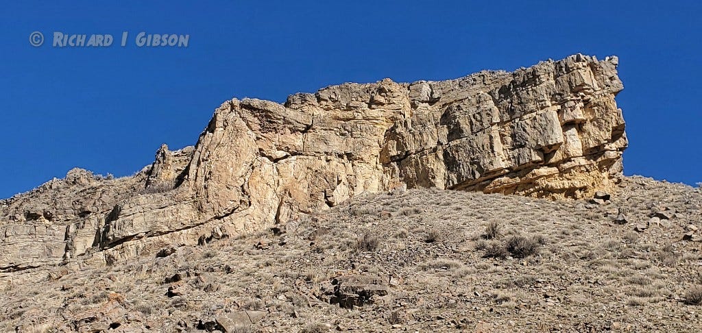
Life in the USA is not normal. It feels pointless and trivial to be talking about small looks at the fascinating natural world when the country is being dismantled. But these posts will continue, as a statement of resistance. I hope you continue to enjoy and learn from them. Stand Up For Science!
The Kootenai formation in southwest Montana is a package of mostly terrestrial (as opposed to marine, deposited in an ocean environment) rocks laid down in early to middle Cretaceous time (Aptian to Albian Stages), about 120 to 107 million years ago.
The Kootenai rocks include conglomerates, sandstones, siltstones, shales, mudstones, and limestones. The environments in which they were deposited were dominated by fluvial (river) processes and include channels on a wide range of scales as well as extensive mud flats (river flood plains). Typical river system phenomena include point bars, crossbedding, mud cracks, ripple marks, and rip-up clasts. Dinosaur fossils are known from the Kootenai, albeit much more rarely than in the underlying Jurassic Morrison formation. There are two relatively thin units that are mostly limestone, one in the middle of the Kootenai and one near or at the top, with abundant gastropods (snails). The limestone beds are usually interpreted to represent deposition in lakes, although they are considered by some workers to be the result of restricted marine incursions.
The base of the Kootenai is in most parts of southwestern Montana a fairly thick conglomerate with large pebbles that are predominantly rounded fragments of chert derived from the much older Phosphoria Formation, which had to be exposed and eroding into an active river system during Kootenai time. The basal Kootenai conglomerate represents the initial wash of coarse detritus off the mountain uplifts that were the result of tectonic collisions and thrust faulting to the west. After that initial intense erosion and deposition, systems of smaller, low-gradient rivers (sometimes braided streams) and mud flats were the norm.
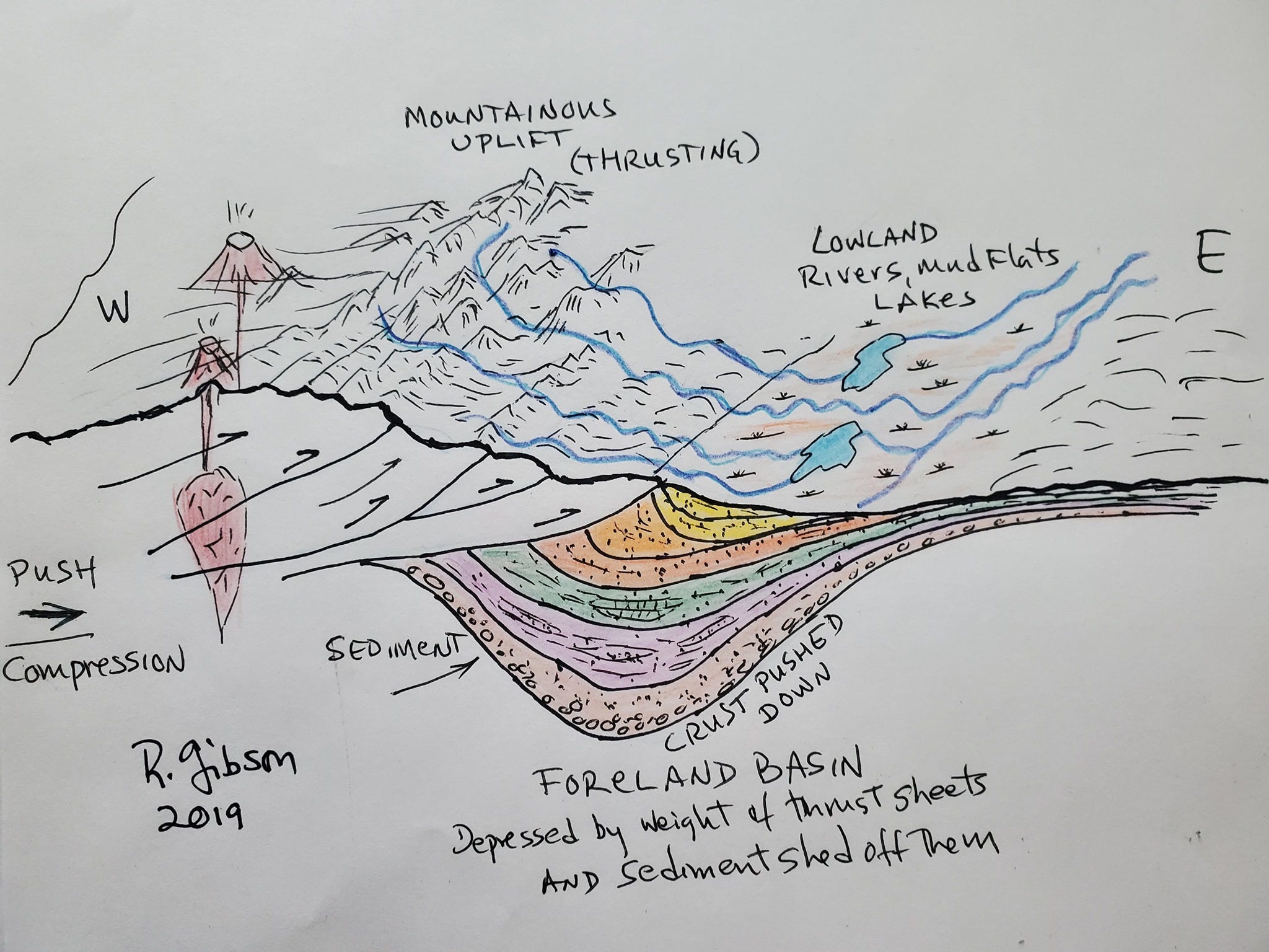
So much detritus was shed off the rising uplifts in far western Montana that its weight (together with the weight of the rocks that were pushed, thrusted, to the east and piled there) actually bowed the crust of the earth downward. The crustal subsidence due to this overweighting is called a foreland basin, because it lies in the immediate foreland, the position just beyond (in this case, east of) the tectonic uplift that is the cause of the excess weight. Foreland basins are typical in fold-thrust belts around the world. Some present-day examples are the Persian Gulf, in the foreland of the Zagros Thrust Belt in Iran; the Ganges Plain in northern India, the foreland of the Himalayas; and a whole suite of basins developed on the foreland, the east side, of the Andes.
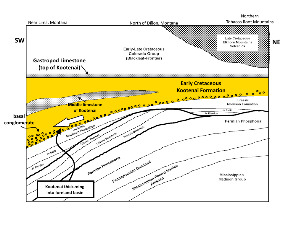
The foreland basin became a self-fulfilling event, because as the crust sank, it created more lowlands into which even more sediment could be deposited, weighing it down even more. The consequence of this is that in the deepest part of the foreland basin, which out here is not too far from the Sandy Hollow area along the Big Hole River near Notch Bottom, the Kootenai formation reached thicknesses approaching 1,000 feet (and to 2,000 feet further west), while just 50 miles to the east, the Kootenai is more like 350 feet thick and some portions, such as the middle limestone you see on the correlation diagram above, are completely missing. It’s as if the bottom dropped out, which it sort of did as the foreland basin subsided. The crustal depression, at least the deep part of it, did not extend as far east as the Cardwell (northern Tobacco Roots) area.
As usual, there are complications. While the whole package of Kootenai rocks seems to reflect well the developing foreland basin, the basal conglomerate actually is more extensive than it would be expected to be in the early stages of the basin’s history (Heller & Paola, 1989, The paradox of Lower Cretaceous gravels and the initiation of thrusting in the Sevier orogenic belt, United States Western Interior: Geo. Soc. Amer. Bulletin 101:864). One idea to explain that is that the conglomerate pebbles eroded from a broad uplift to the west rather than from the thrusted rocks that began to depress the crust to make the foreland basin.
The basin subsided even more profoundly in later Cretaceous time as the tectonic activity to the west intensified, so the package of rocks after the Kootenai, the Colorado Group, is nearly 8,000 feet thick in parts of western Montana but as thin as 2,300 feet in central Montana.
The crustal subsidence (the foreland basin) didn’t really end until the collisions to the west slowed and stopped so that mountains were no longer actively rising and vast volumes of sediment were no longer being shed eastward. That did not happen abruptly; the active subsidence that began about 120 million years ago reached its peak around maybe 70 to 80 million years ago and probably tapered off to be nearly over about 60 million years ago. Erosion continued (as it does today), just not on such a scale that the deposits bowed the crust down — and eventually, the sediments in this region began to be carried further eastward, ultimately to the Missouri-Mississippi River system and the Gulf of Mexico.
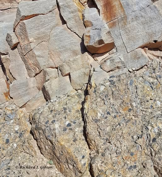
The photo immediately above, taken near Notch Bottom along the Big Hole River east of Glen, Montana, shows the contact between the coarse basal Kootenai conglomerate and the overlying fluvial sandstone in which cross-beds are visible. The dark chert pebbles in the conglomerate are mostly two to four cm across.
Comments
Nothing yet. Say the first thing.
Sign in to join the conversation.