
The fresher or cooler northerly flow will continue this weekend. Over the next few days, you will notice a change in the air, away from the humid warmth to something with a bit of a nip for the early mornings. Midweek, it has felt a bit close at times when the sun breaks through the cloud. That will be gone as the wind comes down from the north.
After the showery midweek low pressure, high pressure will build in from the north Atlantic. This brings a change to more sunshine and fewer showers but not a completely dry picture.
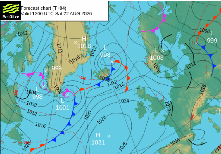
Friday’s showers will have faded overnight, leaving drier weather for Saturday. There will be a low pressure near Iceland and the frontal cloud will reach NW Scotland with some showery outbreaks of rain here. Otherwise it will be a fair day with sunny spells, light winds and it will feel pleasantly warm in the sunshine. Temperatures around 17 to 24C. However the air isn’t hot any more, and in the shade and by the evening it will feel cooler. Not the sultry nights that many have experienced this summer.
Saturday night
The thicker cloud in the northwest could bring rain overnight but it keeps the temperatures from falling too far. For much of Britain and Northern Ireland away from the north coast it will turn clear and cool, even chilly.
Sunday
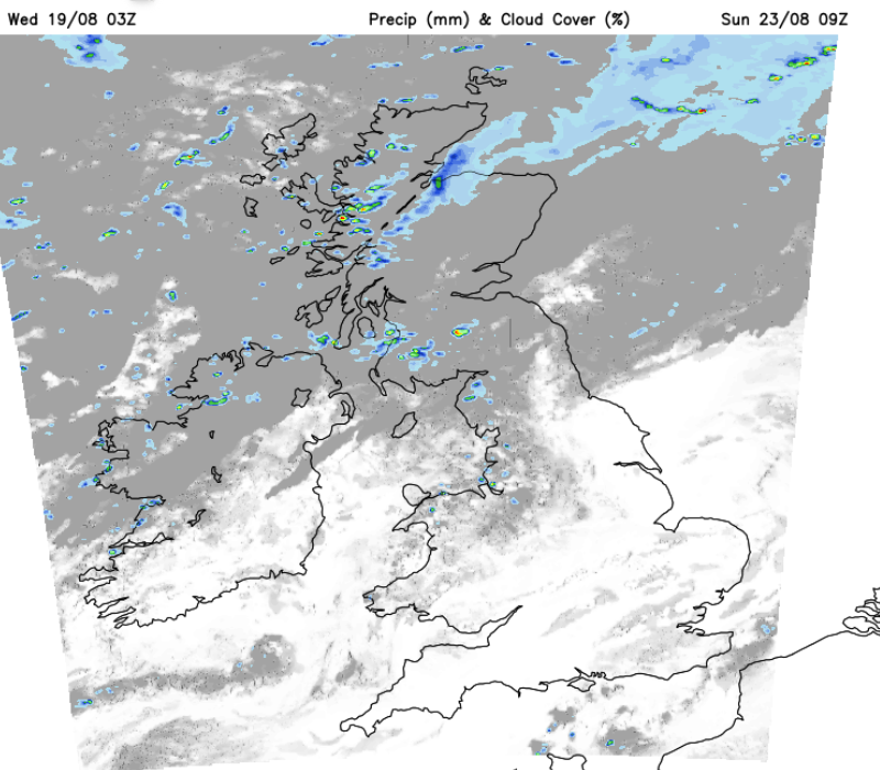
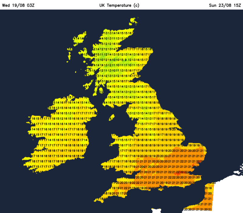
For much of England and Wales the day will be fine, dry and often sunny. For Scotland and Northern IReland there will be more cloud first thing with damp or showery weather, especially in the west. GRadially Northern Ireland will see more bright spells and GRampian will warm up with sunny spells thanks to lee breaks in the westerly flow. It will be a blustery day for the Islands but elsewhere around 18 to 23C.
Sunday night
There will be more cloud for the northwestern half of the UK, with clearer skies and a chilly night for the south and east. So once more there is little rain for the areas hit by drought.
Further ahead
Thinking further ahead into the late August Bank Holiday weekend, there will be some rain from the Atlantic midweek onwards. The ECM model shows an Atlantic low pressure creeping over the UK later next week and leaving showery flow for Saturday. Friday could feel warmer but the weekend will cool off. Sunday looks to have a similar mix with bright spells but showers from the northwest before high pressure tries to build for Monday 31st. That would settle the weather down with fewer showers, but it is a long way off.
The GFS model looks a bit flabby and indistinct for Friday into Saturday but shows a deeper Atlantic low pressure reaching Ireland on Saturday night. The frontal rain from this could move across Britain early on Sunday bringing proper rain to SE Britain for Sunday morning. As the low centre continues to churn away to the northwest there will be more showers in the west, and bright spells further east and there could be trailing weather fronts for Bank Holiday Monday. Much like on Wednesday 19th, there were bands of rain and cloud, it’s difficult to pinpoint where will see any rain and where there could be a brighter gap at this stage. The GFS model has cooler air for the end of the working week with some warmth drawn up from the south on Saturday night into Sunday.
So for this coming weekend, a drier prospect after the week day showers, although more cloud and showery bits in the far northwest. A cooler edge to the air but warm in any sunshine.
The outlook for Bank Holiday weekend is rather mixed with low pressure nearby and showers. We’ll have to wait and see how the forecast develops.
Comments
Nothing yet. Say the first thing.
Sign in to join the conversation.