
Every day, billions of people move through an invisible grid.
It tells governments where they live. It tells delivery companies where to go. It tells tax authorities which property belongs to whom. It helps determine who owns land, who receives mail, and even whether an old historical artifact is worth millions of dollars at an auction.
Most people assume these systems emerged naturally because they make life easier.
They didn’t.
For most of human history, these lines simply did not exist. Houses had no numbers. Streets had no official names. Entire empires ruled over massive territories that were talked about but never actually measured.
We are usually taught that the modern world was built by big inventions, like the steam engine, the telegraph, or computers. But the real shift happened when early states realized they could not tax, recruit, or govern a society they could not see.
To run a country, you first have to turn reality into something you can count.
It was a massive shift. For the first time, a central government could actually find people, measure a piece of land, send mail, and prove who owned what over huge distances. Everything we take for granted today, from banking and property taxes to Amazon deliveries and Google Maps, is built right on top of that old setup.
Once governments learned how to number houses, map land, standardize routes, and document ownership, they created something entirely new: a world that could be searched, measured, taxed, and controlled. We still live inside that system today.
I used to think house numbers existed just to help people find houses. It makes sense. You want to mail a letter or visit a friend, so you look for a number on the door.
But turns out, for a very long time, nobody had an address.
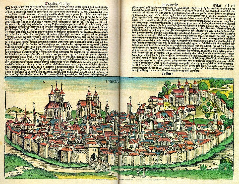
Cities grew, millions of people lived together, and nobody used numbers on doors. If you wanted to find someone in London or Paris in the early 1700s, the directions sounded like a riddle: walk past the big church, look for the shoemaker with the blue sign, turn toward the river until it smells bad, and ask around for the house behind the well.
It worked fine for the locals who lived there. But it drove governments crazy.
From what I’ve read, early states were basically blind. They could see big crowds, but they couldn’t see individuals. If a tax collector cannot find your house, you do not pay taxes. If a military recruiter does not know who lives behind your door, you cannot be forced into the army. In the old days, the confusing layout of a city was a great shield against anyone in power.
In 1770, an Austrian empress named Maria Theresa decided she had enough of this. Her army needed soldiers, and people were slipping through the cracks of unmapped streets.
She sent out soldiers and clerks to march through every single town. They didn’t care about street names because streets didn’t have fixed definitions yet. Instead, they just walked in a long, continuous zig-zag pattern through neighborhoods, painting a giant number on every single door frame.
The first house at the edge of town got a 1, the next got a 2, and they just kept going until every structure was recorded in a big notebook.
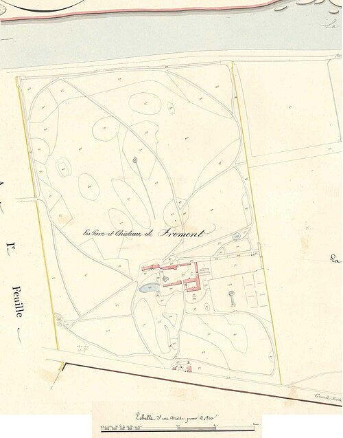
It was a strange way to do things, but it worked. Suddenly, you couldn’t hide in the local neighborhood noise anymore. Private homes became visible, searchable coordinates.
Later on, Napoleon took this crude idea and cleaned it up, giving us the odd and even numbers on opposite sides of the street. Apparently, it was never about making it easy for the mailman. It was just a way for the state to track people and collect resources.
I ended up reading a lot more about this and wrote down some notes on why door numbers exist if you want to see how it changed daily life.
The exact same thing happened with land.
When the United States was a brand new country, it suddenly owned millions of acres of wild land out west. The government wanted to sell it to raise money, but they had a weird problem: they had no idea how to divide it up.
Back in England, people used a method called metes and bounds. You would measure your property by pointing at things like a big oak tree, a pile of rocks, a river bend, or your neighbor’s fence.
That works fine until the tree rots or the river shifts after a major storm. Out in the American wilderness, it was a complete mess. People were constantly arguing over who owned what because the property maps looked like a bunch of messy, overlapping shapes.
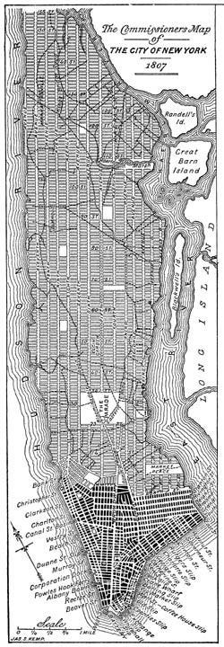
Thomas Jefferson came up with a wild solution in 1785. He decided the government should just draw a giant, perfectly straight grid across the entire continent, completely ignoring the hills, rivers, and forests.
Surveyors went out into the woods with long metal chains and compasses. They carved out neat, square blocks across the landscape, turning the wilderness into a giant spreadsheet. This is why America looks like a massive checkerboard when you fly over it today.
Funny enough, this grid became a massive money maker during the transcontinental railroad boom. The government didn’t give the railroad companies cash to build tracks. Instead, they gave them alternating square mile sections of land along the route. The government kept the pieces in between, and the railroads sold their sections to settlers.
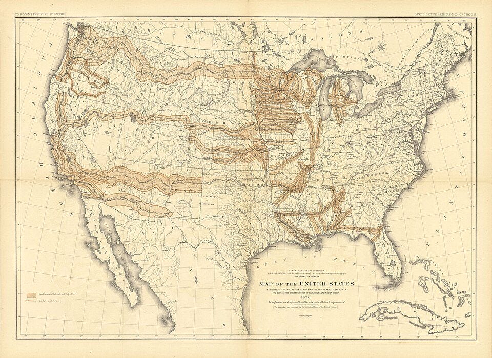
It created a strange puzzle piece map that made private companies wealthy. The Northern Pacific Railroad grant alone handed over 40 million acres of land, which is just about the size of Florida.
I tracked down the original maps and transaction files for the biggest land deals in US history, and I put together the full breakdown of these massive land deals if you want to look at the numbers.
A straight line on a map doesn’t mean much if you cannot actually get there.
I used to think of roads and canals as just simple ways to move people, but turns out they were the missing link that connected the whole mapping project to reality. Without a physical way to move information, those straight lines drawn by Jefferson’s surveyors were just useless marks in a distant government file.
In the early 1800s, getting from New York to Ohio took weeks of traveling on terrible mud trails. Shipping heavy goods inland was so expensive it barely made sense to try. The country was just a loose group of isolated towns that slept in their own little worlds.
If a central government wanted to collect taxes or enforce a land deed, it could take a month just for the paperwork to arrive. The information grid was constantly breaking down because the physical world was too slow.
Building things like the Erie Canal and the National Road changed everything. Suddenly, heavy barges could move freight easily, and the post office could set up real, predictable schedules.
Think about why that matters: a businessman in Boston could now safely buy a piece of land in Illinois because the mail riders could actually deliver the legal deed and the payment back and forth at a reliable speed. The physical routes finally caught up with the map lines.
It turns out that roads and canals didn’t just move wagons and boats. They carried the data. They allowed the census takers to count the newly numbered houses, let the land offices update their spreadsheets, and allowed the whole government machine to run on time.
Once you start tracking houses and land, it seems like you cannot stop. Eventually, this obsession with putting things into logs spread to old objects too.
I kept wondering why some old items sell for tens of millions of dollars at big auctions while other things that look exactly the same end up in a garage sale.
Take an old violin made by Stradivari or an ancient book like the Codex Sassoon. The crazy prices people pay do not have much to do with the wood or the old paper. It comes down to something called provenance.
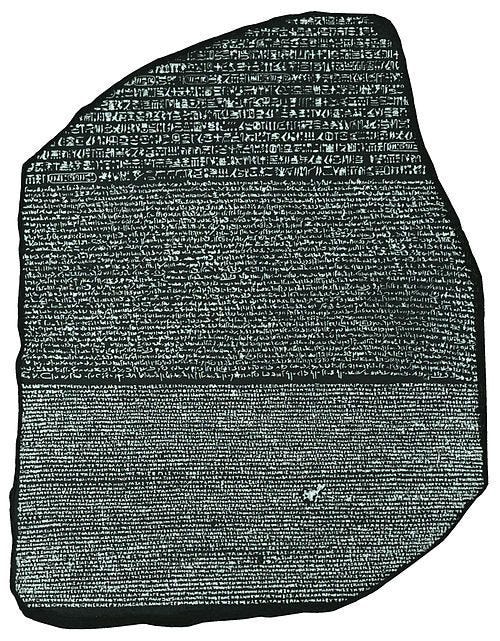
Provenance is just a paper trail of who owned the object over hundreds of years. It is an unbroken list of names that proves the item is real and has been locked away safely in mansions, archives, or museums since it was made.
If an old object does not have this paper trail, it is basically worthless on the open market. New international laws make it almost impossible to sell anything rare unless you can prove exactly where it was before 1970. Major auction houses won’t touch it, and governments might even seize it.
So, a piece of ancient stone or an old book becomes a multimillion-dollar prize because of the paperwork behind it. The same urge that turned wild forests into numbered squares on a map turned old objects into financial holdings.
I looked into how these auction rooms and old laws actually decide what things are worth, and you can browse the full list of the historical items to ever cross an auction block if you are curious.
We often imagine that civilization was built by kings, inventors, and generals.
Yet much of modern life was shaped by surveyors, clerks, and mapmakers.
They numbered the houses.
Drew the property lines.
Standardized the roads.
Recorded the ownership records.
And in doing so, they transformed a messy world into something governments could finally see.
The strange thing is that most of us never notice it. We inherit the numbers, the maps, the boundaries, and the records as if they were natural features of the world.
They aren’t.
Someone built them. And we still live inside the machine they created.
If you enjoy these deep-dives and want to clear the clutter, becoming a member directly funds the weeks of research it takes to track down these hidden stories.
By upgrading to a premium membership, you unlock the full extension of this project across both the newsletter and our main site:
🚫 Ad-Free Website Experience: Completely strips away all display ads, pop-ups, and clutter when you read the deep archives on thehistoricalinsights.page.
📄 Downloadable PDF “Archive Editions”: Beautifully formatted, print-ready versions of our long essays with all high-resolution historical maps and diagrams intact for your personal digital library.
🗄️ The Raw Data Dossier: Direct access to the actual primary sources we uncover, old land survey records, GLO patent files, and historical map coordinates.
🗳️ Topic Voting Power: Get a direct say in our next research cycle by voting on which strange historical anomaly or hidden system we look into next.
Upgrade to Archive Member: $4.99/mo
If you want to see how early transport networks and postal routes physically locked this system together, check out our full study on America Before Infrastructure: The Hidden Systems That Built the Early United States.
No posts
Comments
Nothing yet. Say the first thing.
Sign in to join the conversation.