
I kept noticing something strange while researching Roman land surveying, the Jeffersonian grid, and the history of house numbers.
At first, they looked like completely unrelated topics. One belonged to classical archaeology, another to eighteenth-century frontier economics, and the third to nineteenth-century urban mail delivery.
Eventually, I realized they were all solving exactly the same problem.
We usually assume modern technology works by replacing old systems. We swap horses for locomotives, telegrams for fiber optics, and paper ledgers for cloud databases.
In the physical world, infrastructure rarely works like that.
When you type a street destination into your smartphone, the digital app is not navigating an abstract space created by computer scientists. It is laying code directly over property lines established by nineteenth-century postal clerks, section lines drawn by eighteenth-century surveyors carrying iron chains, and transit corridors carved out by ancient road builders.
Modern software changes every few months. The spatial systems beneath it have endured for thousands of years.
History books love to credit battles, generals, and royal dynasties with building empires. Archaeology tells a much quieter, more clinical story.
The primary bottleneck facing every early state was not military power: it was an information crisis.
Conquest expands a border, but it does not tell a central government who lives inside that border, how much grain they harvest, where their fields end, or how quickly a royal decree can reach them.
As political scientist James C. Scott noted in Seeing Like a State:
“Certain forms of knowledge and control require a state to transform a complex, chaotic, and illegible social reality into a standardized format that can be read from a distance.”
Without this transformation, an empire is not an empire at all. It is simply an armed group collecting protection money until the local geography swallows it whole.
To govern space beyond the line of sight, early states had to solve five basic data problems:
Legibility: Who owns this patch of earth, and where does it end?
Quantification: How much taxable value does this land produce each season?
Identification: Who lives here, and what do they owe the central authority?
Logistics: How fast can state orders travel out, and how fast can physical revenue flow back in?
Continuity: How does this record survive when the local clerk dies or the harvest fails?
Consider how ancient Egypt solved quantification along the Nile. Long before written legal codes existed, priests and royal scribes carved Nilometers into stone riverbanks.
By measuring the exact height of the annual flood waters before planting began, scribes could predict harvest yields months in advance. Herodotus recorded this exact transition in Book II of his Histories:
“King Sesostris divided the country among all the Egyptians, giving each an equal square parcel of land, and from this he levied his revenue. If the river carried away any part of a man’s lot, he appeared before the king and signified what had happened, and the king sent overseers to measure by how much the land was diminished.”
What surprised me while researching these early systems was how quickly states realized that laws were useless without physical standardization.

As investigated in The Engineering of Trust: Ancient Measurement Systems Before Written Law, the Indus Valley civilization engineered polished chert weights and standardized 1:2:4 ratio bricks across a million square kilometers long before statutory law existed.
In East Asia, the Qin Dynasty achieved administrative control through absolute paper legibility.
When Qin Shi Huang unified China in 221 BCE, his administration instituted the Huji, a household registration system that recorded every family member’s name, age, physical status, and landholding.
The state converted its population into a searchable database long before electronic networks existed.
ANCIENT MEASUREMENTS
        │
        ▼
CADASTRAL LAND REGISTRY
        │
        ▼
SYSTEMATIC TAXATION
        │
        ▼
PHYSICAL ROAD NETWORK
        │
        ▼
STATE POSTAL SYSTEM
        │
        ▼
DIGITAL SATELLITE NAVIGATION
We build monuments to weapons, palaces, and temples. We almost never build monuments to the most transformative technology in human history: administrative geometry.
Administrative geometry is the radical idea that physical land can be abstracted into standardized data.
In an unmapped landscape, property boundaries are organic and messy. They rely on natural features like a fallen oak tree, a curved creek, or a pile of loose limestone.
Historian Fernand Braudel described this pre-modern reality as a world where distance was measured in human fatigue rather than fixed units:
“Space was an obstacle, a weight, a drag on human action, until mathematics converted terrain into measurable lines.”
Organic boundaries create constant disputes. Creeks shift course, trees rot, and local memories conflict. More importantly, an organic boundary cannot be read from a distant capital.
A central tax office cannot calculate the exact acreage of a curved field described as “three hours’ walk from the mill.”
To make land legibly administrative, the state must disconnect property from local memory and attach it to geometry.
When land becomes geometric, three things happen simultaneously:
It can be bought and sold remotely: A buyer in a capital city can purchase a field thousands of miles away without ever stepping foot on the soil, because the deed references a standardized coordinate on a master grid.
It can be taxed automatically: Every square unit carries an assigned productivity value based on its geometric class.
It survives local collapse: If an entire village disappears in a war or plague, the central land office retains the original blueprint and can reassign the plot to new settlers without field negotiations.
Instead of viewing ancient empires as separate historical chapters, it is more accurate to view them as iterative software updates to the same core spatial engine. Three master systems in particular defined the modern grid.
The Roman Empire was essentially a massive civil engineering firm backed by an army.
Whenever a province was pacified, Roman surveyors (agrimensores) deployed into the field carrying the groma, a cross-shaped sighting instrument designed to shoot perfect ninety-degree angles.
Surveyors dropped a rigid orthogonal grid across conquered valleys, a process known as centuriation.
They established two master axes: the cardo maximus (north-south) and the decumanus maximus (east-west). They divided the territory into square blocks of 200 jugera, marked each corner with stone boundary markers (termini), and carved the master coordinates onto bronze maps stored in Rome’s central record office, the Tabularium.
To move administrative data across these surveyed grids, Augustus established the cursus publicus.
Using a network of state-maintained staging posts (mutationes) and official inns (mansiones), the imperial court moved dispatches and tax revenues at predictable daily rates.
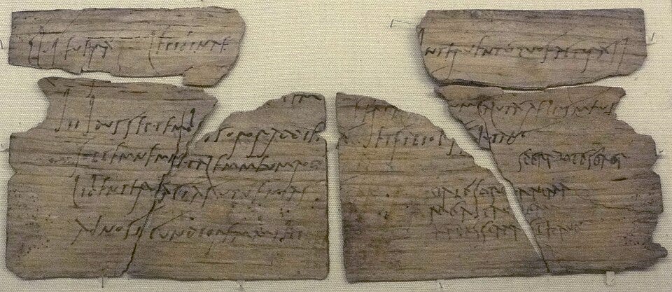
We can hear the real-time panic of this administrative network in the letters of Pliny the Younger to Emperor Trajan (Epistulae 10.120), where he defends his emergency decision to issue an official post pass (diploma):
“Up to the present time, my lord, I have not issued an official post pass to anyone... but my wife having heard of the death of her grandfather, I thought it hard to refuse her a pass, since speed is of the essence in such family duties.”
Trajan replied approvingly, demonstrating that even the Emperor personally audited the bandwidth of his postal network.
Centuries after Rome collapsed, European land management remained a chaotic tangle of feudal customs, church exemptions, and unmapped property boundaries.
When William the Conqueror commissioned the Domesday Book in 1086, he took a major step toward quantifying England, but the maps were still primitive.
In 1807, Napoleon Bonaparte took administrative auditing to its ultimate mathematical conclusion by decreeing the creation of the Napoleonic Cadastre.
Napoleon did not just request a list of land owners: he ordered his engineers to measure and classify every individual plot of soil across France and its annexed territories.
Over 100 million distinct land parcels were measured using triangulation, classified by crop capacity, and drawn onto uniform cadastral maps.
Every field in Western Europe was assigned a permanent identification number in a state database. Feudal ambiguity was erased by geometry.
When the young United States gained independence, it faced a massive land crisis. It held nominal claim to millions of acres of unmapped western territory, but no clear way to sell, distribute, or govern it.
In 1785, Thomas Jefferson and the Continental Congress passed the Land Ordinance, establishing the Public Land Survey System (PLSS).
Instead of allowing settlers to venture west and claim land based on irregular trees and river bends, the federal government imposed a uniform grid across the entire continent west of the Appalachian Mountains.
Survey crews were dispatched into the wilderness carrying Gunter’s chains: 66-foot iron measuring devices composed of 100 links. Eighty chains made a mile. Ten square chains made an acre.
As detailed in America Was Designed Before It Was Built, surveyors divided the wilderness into six-mile-square townships, subdivided into 36 one-square-mile sections.
When transcontinental aviation emerged in the 1920s, the US government built a physical navigation network directly over this landscape: giant yellow concrete arrows poured into the dirt every ten miles, paired with 50-foot light beacons.
The full record of this network is documented in The Giant Concrete Arrows That Guided America Before GPS.
And when urban populations exploded, municipal clerks created standardized house numbering systems to resolve postal dead-letter bottlenecks, as explained in Why Addresses Have Numbers.
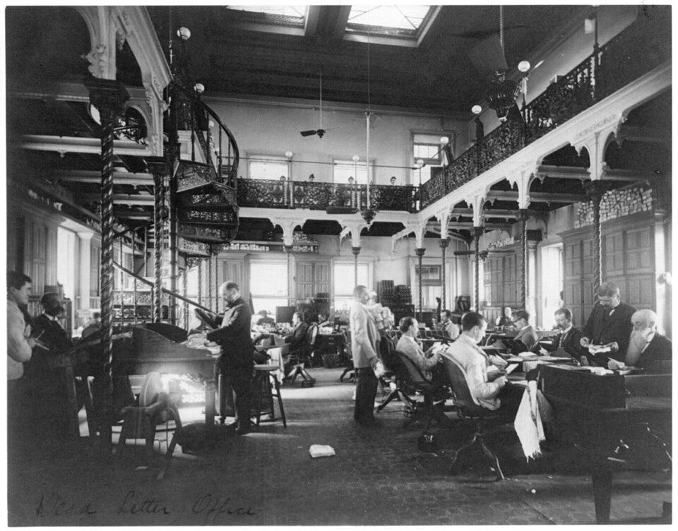
When you look beneath the hood of human history, the physical storage media shifts dramatically, but the administrative schema remains completely unchanged.
Scribes wrote on wet clay tablets in Uruk, parchment rolls in imperial Rome, paper registers in Napoleonic France, and punch cards in mid-century postal sorting facilities. Today, we write those same records to cloud databases.
The hardware changes every few generations. The underlying data schema is immortal.
Whether an administrative record is carved into stone or rendered in JavaScript, it still requires the exact same structural components: a unique spatial identifier, an verified property boundary, a logged transaction date, and an authoritative state ledger to enforce it.
Why haven’t we redesigned our property lines, postal codes, or road layouts using modern satellite computing?
Because infrastructure possesses a property called Infrastructure Inertia. Rebuilding a physical coordinate system is infinitely more expensive than designing new software to run on top of the old one.
Late-anthropologist David Graeber pointed out in Debt: The First 5,000 Years:
“The core administrative structures of human societies are surprisingly durable. Once an accounting unit, a survey line, or a legal definition takes hold across a population, it becomes virtually impossible to erase.”
Consider what happens when a modern city attempts to alter its underlying spatial grid:
Every property deed held in bank vaults must be re-registered.
Underground utility conduits (water, gas, fiber-optic) mapped to existing road lines must be relocated.
Tax registries, emergency response routes, and postal databases must be rewritten.
Local zoning laws and jurisdictional boundaries must be re-legislated.
The financial cost of resetting a foundational grid is astronomical. So, we don’t reset it. We build new technology around it.

When an autonomous vehicle navigates a city street using LiDAR, radar, and artificial intelligence, it is executing high-tech maneuvers inside a spatial frame designed by nineteenth-century municipal engineers, laid over an eighteenth-century land grid, running along a transit corridor carved out by horses.
The vehicle is modern. The coordinate system is ancient.
We live with an illusion that our modern world is fragile, that if our servers go dark, our civilization instantly vanishes into chaos.
Server logs are fragile. Digital databases can be wiped. Physical infrastructure is almost indestructible.
Governments fall. Dynasties collapse. Languages die out and drop out of daily speech. The survey lines remain.
The Roman roads built two thousand years ago still form the main highway corridors of modern Western Europe.
The centuriation grids laid down in Northern Italy by imperial surveyors using wooden gromas are still visible today in aerial imagery, defining agricultural field boundaries for modern Italian farmers.
The Public Land Survey System drawn in 1785 still dictates where every power line, water main, and interstate highway is placed across the American interior.
You do not need an archaeological dig to see ancient administrative algorithms operating in the physical world. You can spot them from an airplane window or a highway drive:
Emilia-Romagna, Italy: Drive along the Via Aemilia (built in 187 BCE) and look at the surrounding farmland. The agricultural field boundaries still strictly follow Roman centuriation grids laid out by agrimensores over 2,200 years ago.
The U.S. Midwest: Fly over Ohio, Iowa, or Kansas. The perfect 1-square-mile agricultural grid stretching to the horizon was drawn directly by surveyors using 66-foot Gunter’s chains under the Public Land Survey System of 1785.
The Nevada & Wyoming Deserts: Hike near early transcontinental flight paths to find giant yellow concrete arrows embedded in the earth, built in the 1920s as physical visual beacons for night airmail pilots.
Paris & Rural France: Request a local land registry document (plan cadastral). The field parcel numbers and boundary layouts still trace back directly to the cadastral survey ordered by Napoleon in 1807.
The next time you type an address into your phone, consider the chain of decisions behind it.
That simple sequence of numbers and street names is not a modern digital feature: it is the latest version of an administrative technology refined over nearly five thousand years.
Civilizations are remembered for their monuments, but they survive through their paperwork.
Braudel, Fernand. Civilization and Capitalism, 15th-18th Century: The Structures of Everyday Life. Harper & Row, 1981.
British Museum. Vindolanda Tablets Collection & Cuneiform Administrative Records. London, UK.
Graeber, David. Debt: The First 5,000 Years. Melville House, 2011.
Harley, J.B., and David Woodward, eds. The History of Cartography, Volume 1: Cartography in Prehistoric, Ancient, and Medieval Europe and the Mediterranean. University of Chicago Press, 1987.
Herodotus. The Histories. Book II (On Egyptian Land Surveying and Taxation).
Library of Congress. Geography and Map Division: Public Land Survey System Maps & Cadastral Records. Washington, D.C.
National Archives and Records Administration (NARA). Record Group 28: Records of the Post Office Department & Dead Letter Office Reports.
Pliny the Younger. Epistulae (Letters). Book X, Letter 120 (Correspondence with Emperor Trajan regarding post passes).
Scott, James C. Seeing Like a State: How Certain Schemes to Improve the Human Condition Have Failed. Yale University Press, 1998.
UNESCO World Heritage Centre. Roman Centuriation Monuments & Historic Cadastral Landscapes.
If you want to examine the specific engineering records, primary documents, and physical tools behind these hidden administrative networks, these deep-dives audit each layer of the system:
Examines how nineteenth-century postal bottlenecks forced municipal clerks to convert physical homes into a numerical data vector.
✈️ The Giant Concrete Arrows That Guided America Before GPS
Audits the physical transcontinental flight corridors poured directly into the American landscape during the 1920s.
📏 The Forgotten Surveying Tools That Measured a Continent
Investigates Gunter’s chains, solar compasses, and Roman gromas used by field crews to measure wilderness.
🧱 The Engineering of Trust: Ancient Measurement Systems Before Written Law
Explores how Indus Valley chert weights and standardized bricks created scaled commerce long before statutory law.
🗺️ America Was Designed Before It Was Built
Details how the 1785 Public Land Survey System turned an unmapped continent into a mathematical grid.
If this kind of long-form historical investigation interests you, consider joining The Forensic Archive.
Your support directly funds weeks of primary-source archival research and field documentation without relying on clickbait or ad networks.
🚫 Zero Display Ads: Clean, unfiltered reading across our entire research index.
📄 Downloadable PDF Archive Editions: Print-ready dossier files formatted for your personal offline library.
🗳️ Topic Voting Power: Direct input on which historical anomaly or hidden system we audit next.
No posts
Comments
Nothing yet. Say the first thing.
Sign in to join the conversation.