
Keywords: Rural–Urban Connectivity, Kalimas River, River Heritage, Infrastructure Transformation, Spatial Justice, Southeast Asia
Introduction
For centuries, the Kalimas River in Surabaya served as the liquid thread weaving the city together with the villages upstream. Along this narrow waterway, vegetables, timber, fish, and stories from the hinterland flowed into the urban marketplace, carried by small boats that moved with the rhythm of the tide. Today, however, Kalimas feels quieter almost detached its waters no longer echoing the presence of the rural communities it once embraced. Standing on its banks, one realizes that the transformation of a river is never just about water; it is about how mobility, space, and rural life are reshaped when a city changes
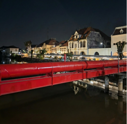
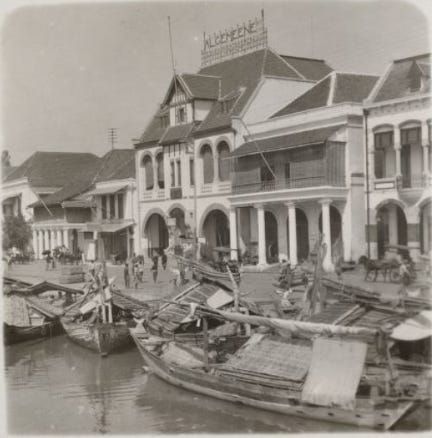
Kalimas: An Urban Node That Once Connected Rural Hinterland
Kalimas has never been a rural landscape. It is, and always has been, an urban node an essential part of Surabaya’s commercial structure since the colonial period. But precisely because of its position as an urban center, Kalimas once played a crucial role in linking the city with its rural hinterland.
At a time when river transport was the main mode of distribution, villages across inland regions - today corresponding to areas susch as Mojokerto, Gresik, Lamongan, as well as communities along the Brantas River basin maintained direct connections with Surabaya through the river system. Kalimas functioned as the entry point: agricultural produce was unloaded along its edges, small traders docked their boats, and the riverfront architecture evolved to support this lively exchange.
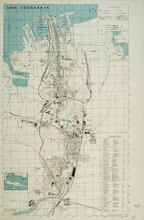
The river was not just an economic artery it was a social corridor. For generations, villages and the city were interdependent, bound together by this moving line of water.
When a River Forgets Its Villages
But the 20th-century shift from water-based to land-based transport changed everything. The flow of goods that once followed the currents gave way to trucks, highways, and centralized logistics. This was not simply a technological shift; it marked a deeper transformation in the spatial and social relationship between the urban core and the rural periphery.
So what happens when a river no longer serves the communities that once relied on it?
First, villages lose direct access to the city. What used to be a fluid connection becomes rigid, centralized, and heavily dependent on urban-controlled infrastructure. For rural communities, this often means losing autonomy over mobility and distribution (Tjia et al., 2025).
Second, Kalimas’s urban riverfront transformed. Old façades lost their purpose. Small docks disappeared. The dynamic economy that once animated the riverbanks faded, leaving behind a landscape of memory rather than production (Agustianti & Dharmatanna, 2025).
Third, the rural memory embedded in the river stories of boat routes, seasonal trade, and interdependence slowly vanished from the city’s narrative. In many ways, the city forgot its villages, and the river followed.
Rethinking Rural-Urban Connectivity in the 21st Century
Today, rural-urban relationships are far more complex than simple flows of goods from village to city. Modernization has layered new forms of mobility: logistics hubs, multilane highways, and distribution chains that prioritize speed over equity. As a result, rural areas often experience uneven access, their mobility shaped by infrastructures designed primarily for urban growth.
This phenomenon is not unique to Surabaya. Across Southeast Asia - from Bangkok’s Chao Phraya to Manila’s Pasig and Ho Chi Minh City’s Saigon River - waterways that once supported rural livelihoods now stand as quiet relics of past connectivity. Villages upstream lose their spatial autonomy as rivers become sidelined by metropolitan development.
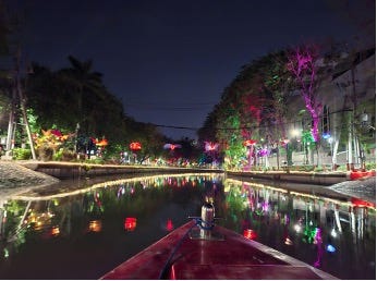
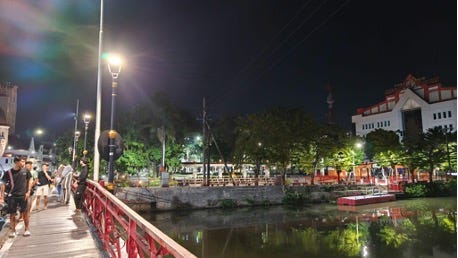
These forgotten rivers offer an important reminder: rural urban connectivity is not only about infrastructure. It is about how landscapes, memories, and access are shaped and unshaped over time.
Toward More Just Rural Futures
Reimagining the future of rural-urban relations does not mean restoring the past exactly as it once was. Instead, it requires understanding the value of what has been lost and imagining new forms of connection that are socially, economically, and ecologically more just.
Kalimas, in this sense, can be read as a living archive a space that stores the memory of rural-urban interdependence while offering clues for imagining a more equitable future.
Several pathways emerge:
● Reinterpreting rivers as connectors, not merely urban beautification projects or recreational corridors.
● Reintegrating rural narratives into the city’s historical and spatial consciousness.
● Using digital tools-mapping, visualization, historical reconstruction to better understand past networks and explore future possibilities.
● Reclaiming rivers as social spaces where interaction and movement can occur beyond car-dominated infrastructures.
A just rural future requires more than building new infrastructure. It calls for rediscovering forgotten connections and acknowledging the uneven geographies that modernization has intensified.
Conclusion: Rivers Remember, Even When We Forget
A river never truly forgets. Beneath its calm surface lie layers of movement, exchange, and rural memory. It is often the city not the river that forgets first.
Reimagining Kalimas means reimagining the futures of the villages that once traveled with its tide. And perhaps, if we learn to listen again to the stories carried by water, we might discover new ways to rebuild connections that honor both the city and the rural landscapes that shaped it.
References
Agustianti, S. W., & Dharmatanna, S. W. (2025). Transportation Route Shifts Impacts on The Deterioration of Facades in Kalimas Timur. Journal of Artificial Intelligence in Architecture, 4(1), Article 1. https://doi.org/10.24002/jarina.v4i1.10128
Tjia, D. I., Ariyanto, K. D., & Dharmatanna, S. W. (2025). FROM HISTORY TO DECAY: CONDITION SURVEY OF FACADES ON KARET STREET, SURABAYA. Border: Jurnal Arsitektur, 7(2), 193–206.
— Stephanus Wirawan Dharmatanna
Author Bio
Connect with us at:
Thanks for reading Just Rural Futures! Subscribe for free to receive new posts and support my work.
Comments
Nothing yet. Say the first thing.
Sign in to join the conversation.