
La route historique is one of the most meaningful projects I have ever worked on so I always intended to commemorate the process in a blog post. Having finished the maps a couple of years ago, this post is long overdue.
I have a deep love for the place where I grew up. It’s a small french-speaking village called Zenon Park in north-east Saskatchewan. It’s a farming community, and it’s tiny; the population is only about 200 people. It means a lot to me because my family has been in the area since 1912. My great grandfather moved his wife and children from Quebec to a plot of land near Zenon Park that they cleared by hand, built a house and a barn, farmed grain, and made a life. I spent half of my childhood on that same farm, and the rest of it in the nearby village.
A lot has changed since I moved away in the late 90’s. Both the farmhouse my grandfather built and the original barn from the homestead are gone, many of the local businesses in town have closed, and some of my favourite old buildings had to be demolished. But Zenon Park continues to be a place that fills me up every time I go home to visit.
Needless to say, I was thrilled when the committee for La route historique reached out to see if I would be interested in making a couple of maps for a project they had in the works. The project included the installation of monuments at many of the sites from the original settlement, the creation of a virtual tour, and the updating of a booklet about all of the original businesses and institutes of Zenon Park. The maps would be part of each monument and also appear in the booklet.
I was given access to the committee’s archive of old photos of Zenon Park, which was an absolute delight. I spent hours pouring through it, marvelling at images of buildings I have only ever known to be old and surrounded by large trees. I got to see what they looked like when they were new or under construction, before there were any trees around them. There were even images of the town from when it was just a couple of streets on flat land and no trees. It was fascinating to see all that had changed over roughly 110 years. (Many of the photos can be seen on the Vive Zenon Park Facebook page).
Then I got to work.
I created a framework in Photoshop based on the dimensions of the booklet and I started roughly plotting out the roads and the sites so I could get a feel for what I was working with. I used the same little drawing of a house as a place holder for each of the buildings I would later draw.
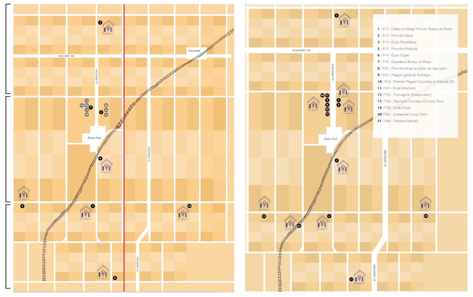
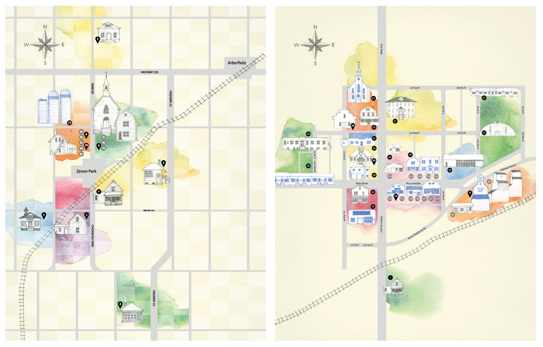
The map was going to be used by tourists and so I needed to show the sites as accurately as possible to the actual locations. I decided to use little black circles to show the actual locations so that I would be less restricted with where I could place my drawings of the buildings. Some of the sites were clustered together while other areas of the map were sparse. Having some freedom in regards to where I placed the drawings would allow me to make the map feel more balanced.
Another issue I encountered was that some areas contained a lot of sites, while other areas were farther away, but they all needed to fit within the boundary of the map. I decided to solve this by compressing the top and bottom areas of the map, where I only needed to show 1 building per site, and by stretching out the middle section, where I needed to fit in a lot more.
I decided to use a checkerboard pattern to represent the different fields.
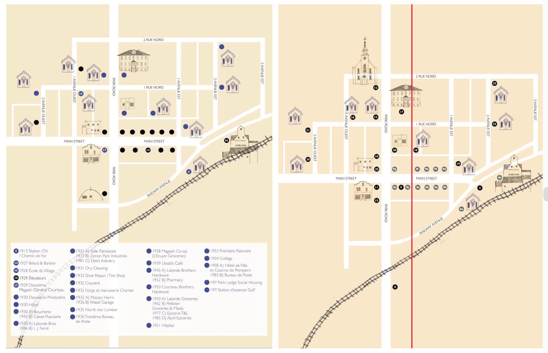
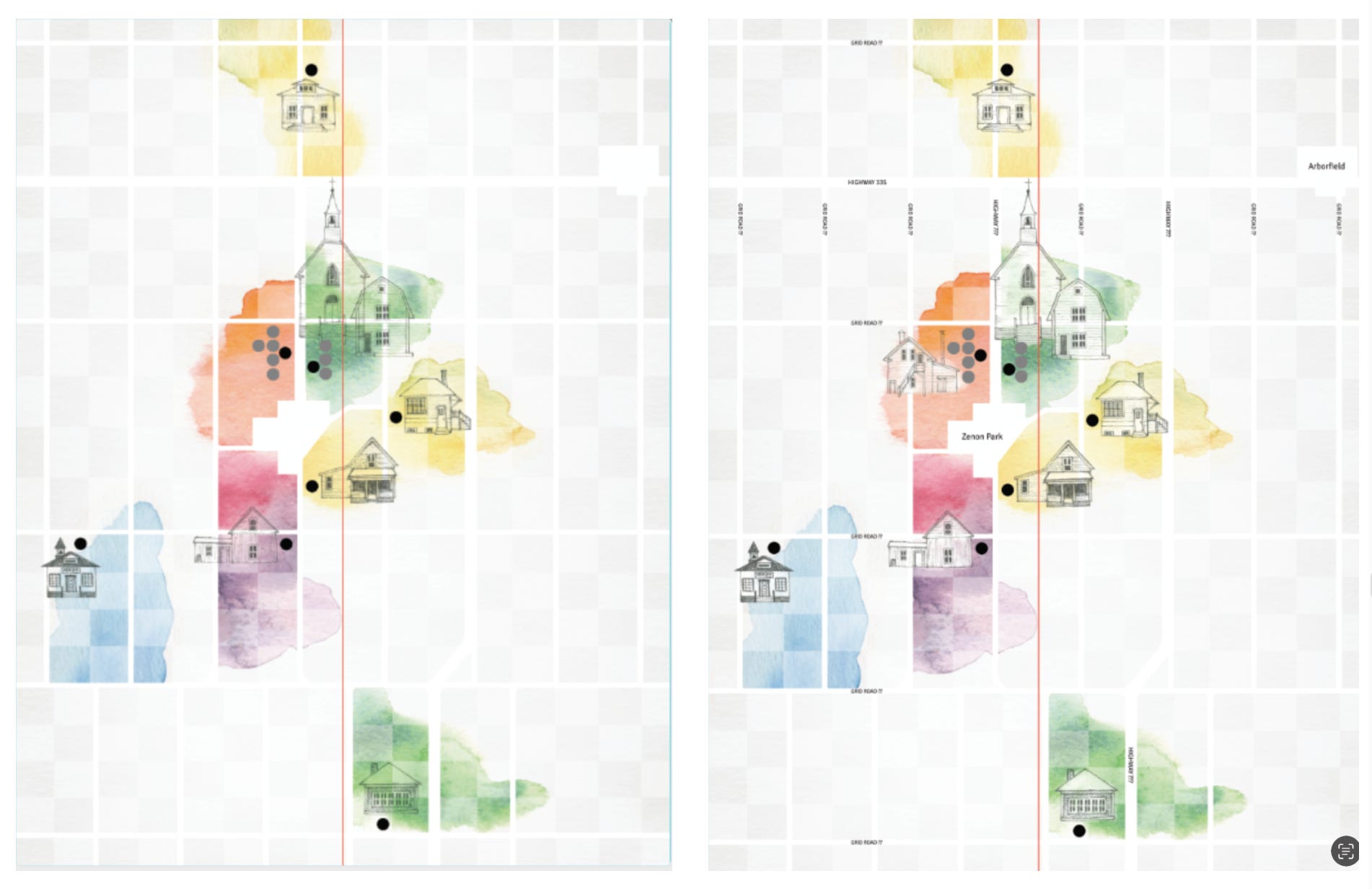
My maps were going to be printed across a 2 page spread in the booklet which meant I had to keep the location of the gutter in mind so that I wouldn’t loose any important details in the fold (shown as a red line in some of the following images).
These are early iterations of the map of the area surrounding Zenon Park (top 2) and the map of the town (bottom 2):
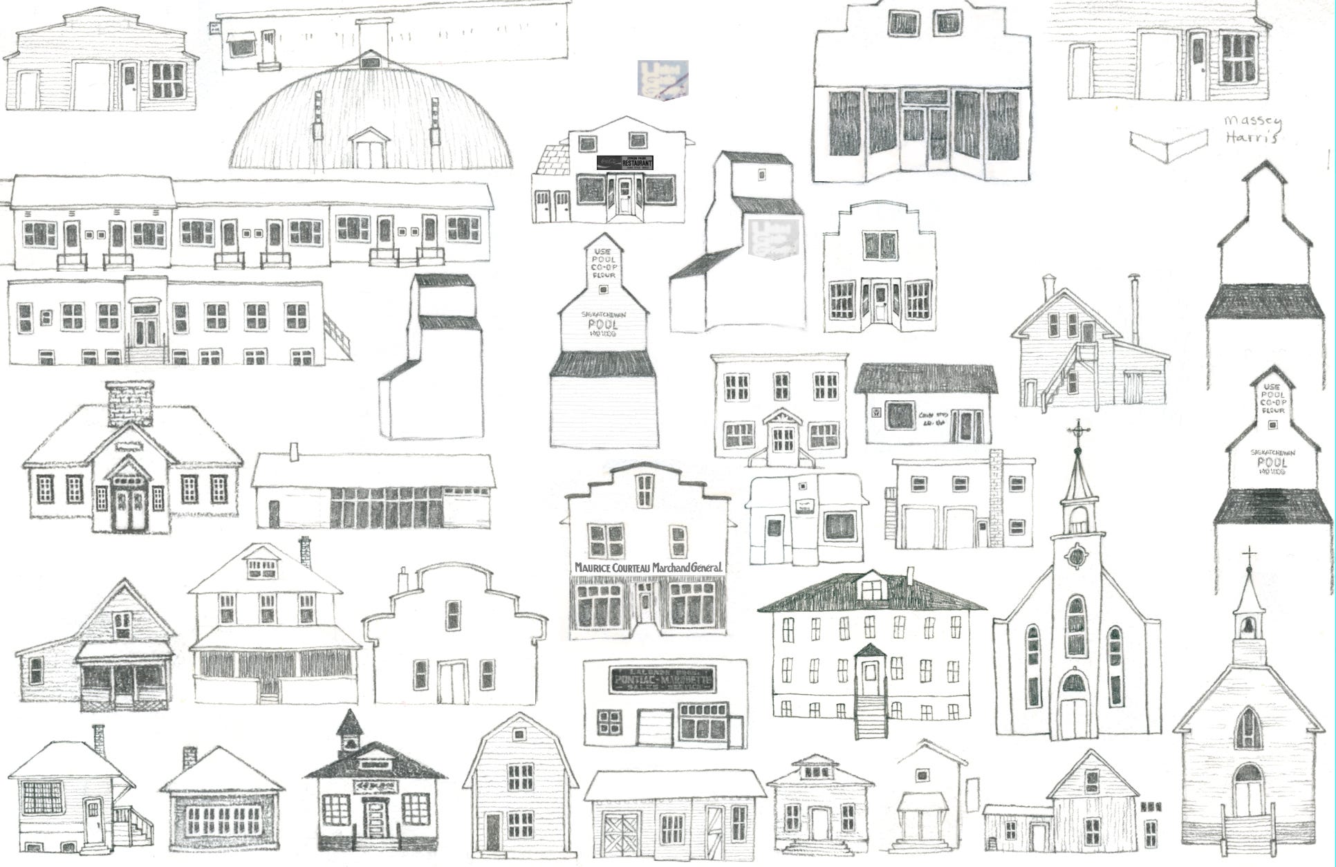
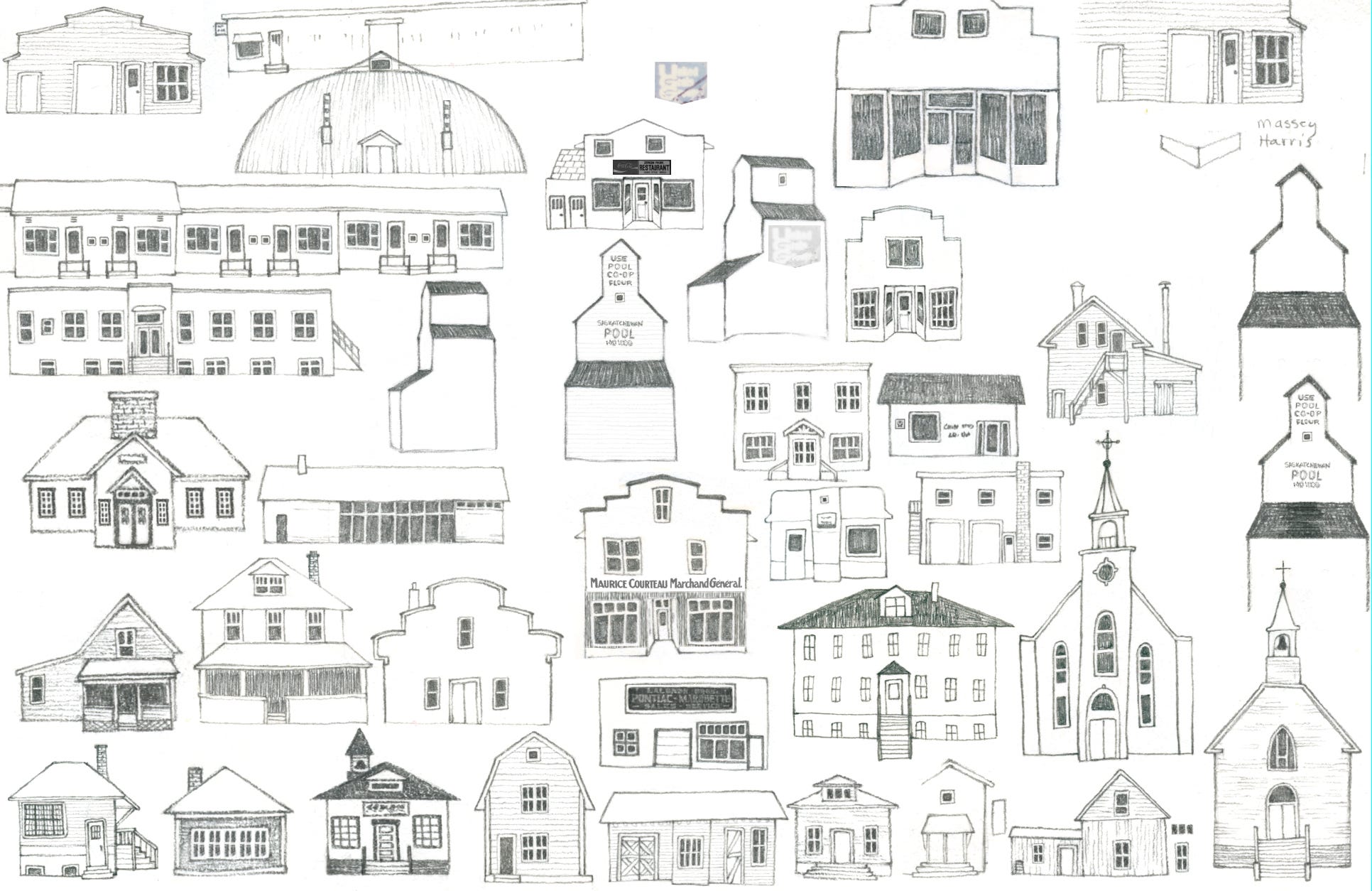
I used the archive to find reference photos and made tiny drawings of 34 buildings in my sketchbook. I added them digitally to my layouts as I finished each drawing.
The vibrant colour palette for the project was determined by the designer and supplied to me. I wanted the maps to fit with the rest of the design, so I needed to incorporate the same colours. I really struggled with how best to do this.
At first I thought about keeping the background black and white and only using colour on the drawings of the buildings. Then I thought it might work better to choose one main colour for the background and keep the buildings neutral. I made a bunch of water colour stains to match the colour palette and started experimenting, but I wasn’t happy with the way any of it was turning out.
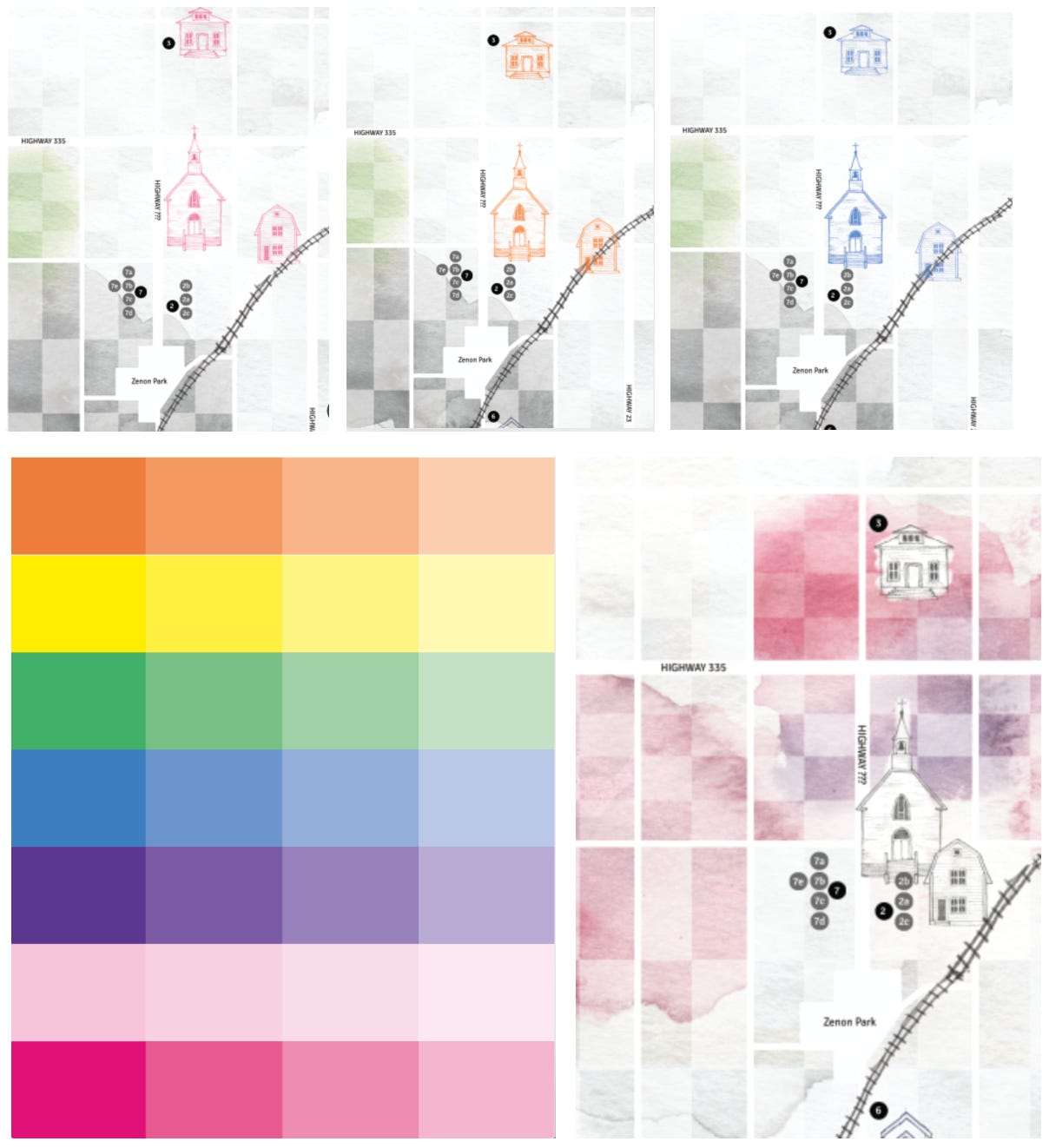
My breakthrough finally came when I tried using a different colour in the background for each site. As a bonus, that solution also ended up providing another way to balance the layout.
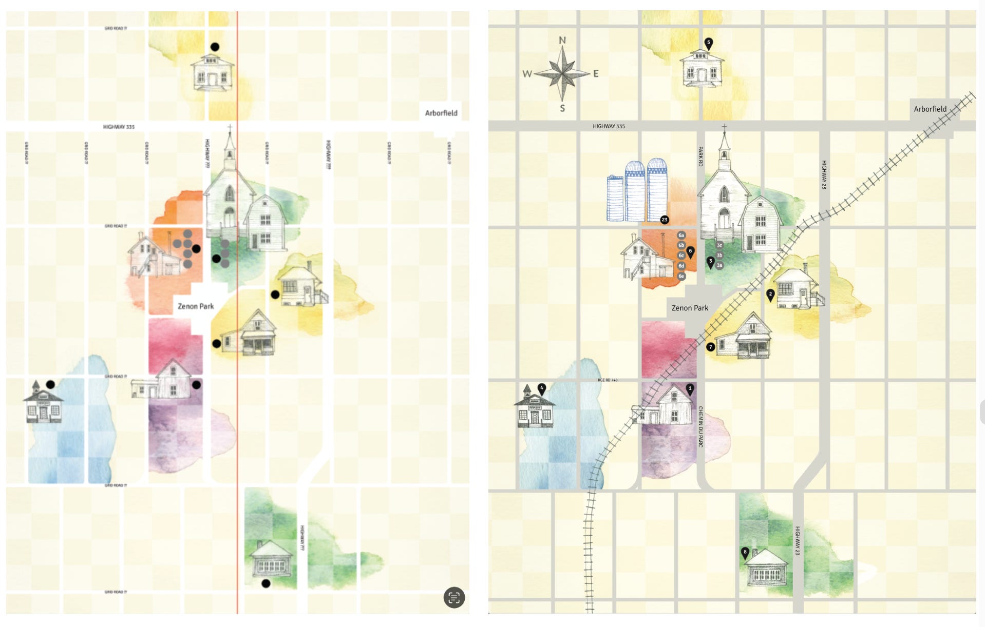
Once I had figured out the way colour would be applied to the map of the surrounding area, I did the same process to the map of the town. We decided to make the roads darker so they’d be easier to see, and made the buildings that are still standing blue to differentiate between the ones that are no longer there.
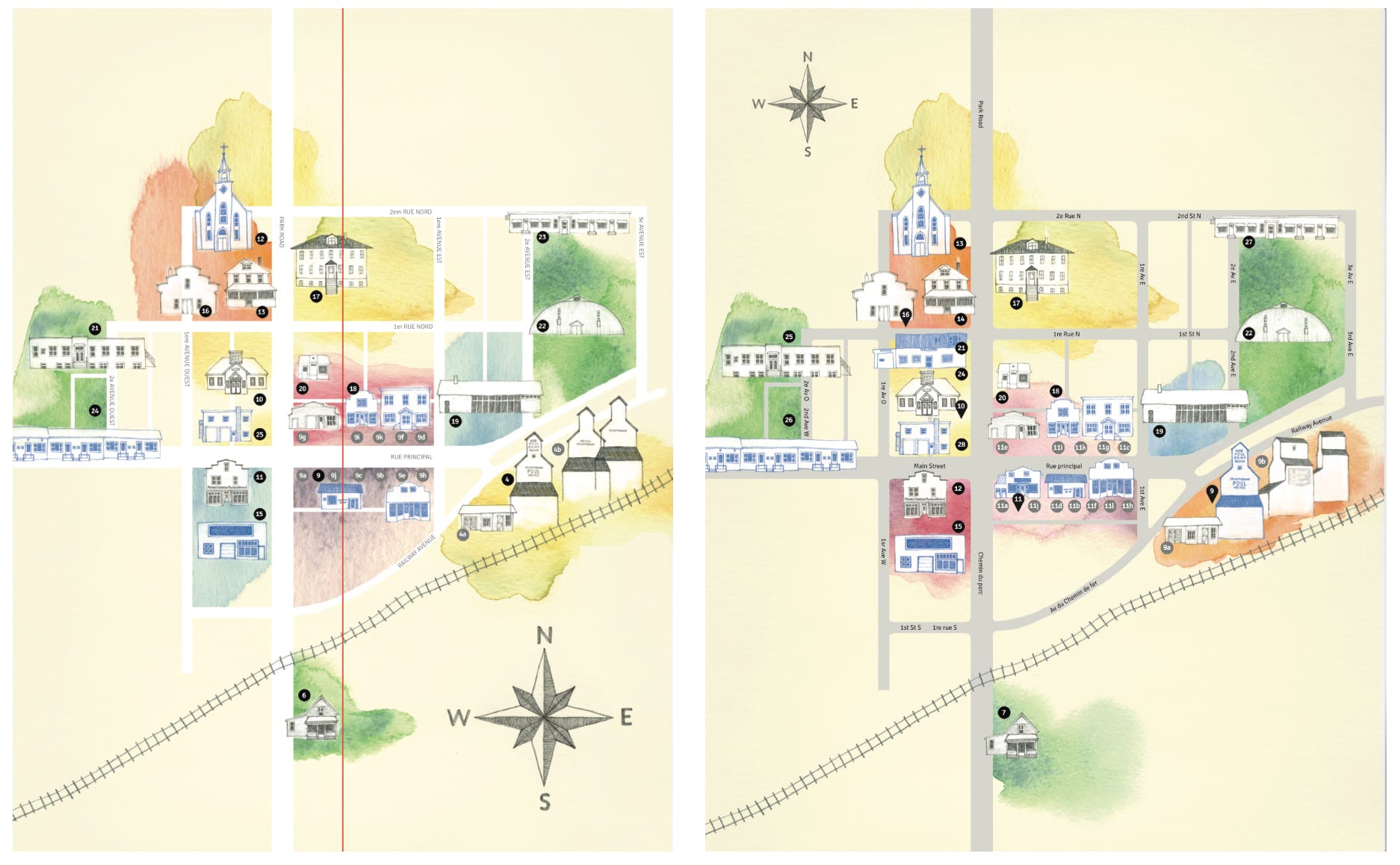
Here are the final maps side by side:
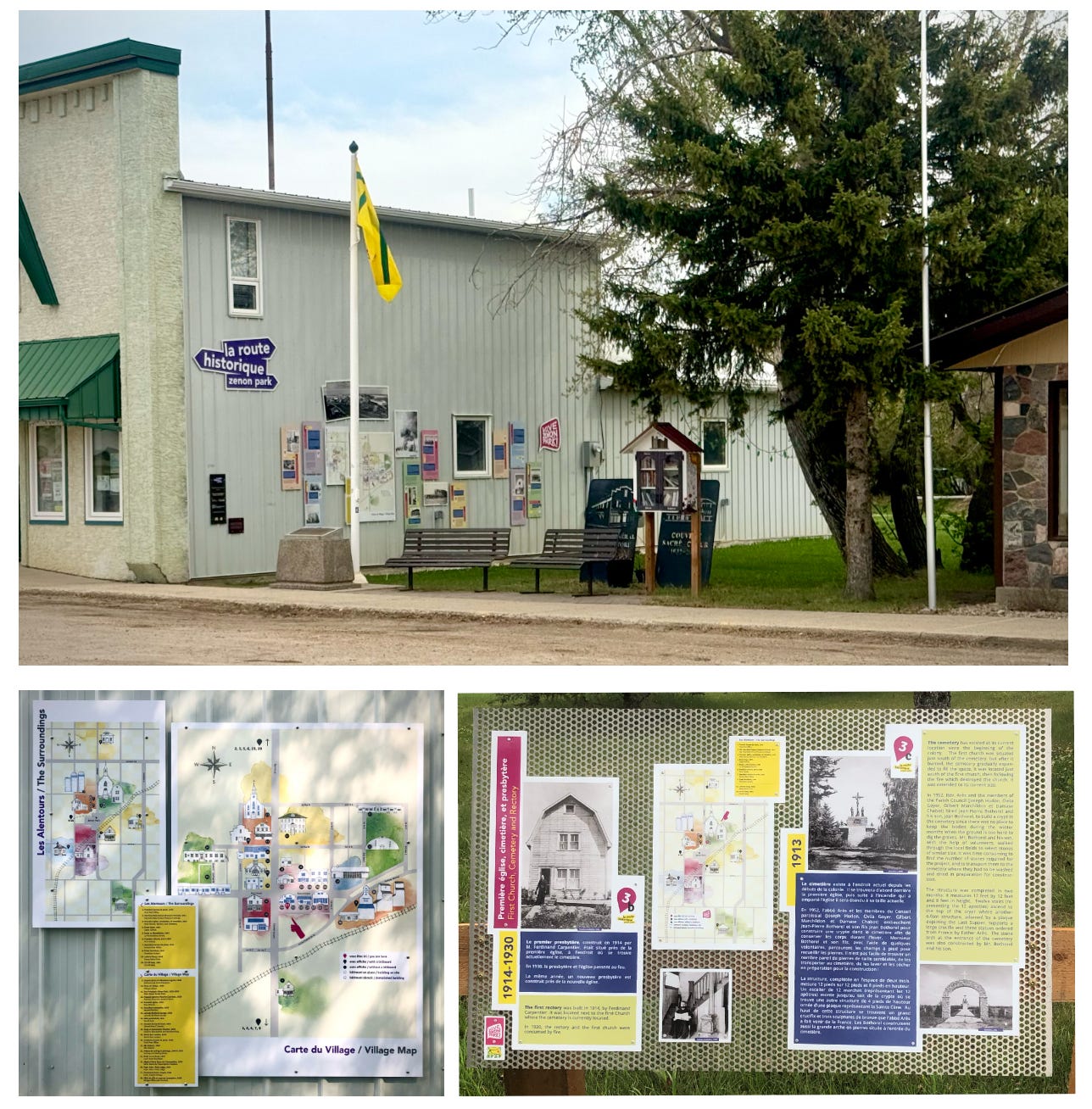
The committee has since launched the app with the virtual tour and has started putting up the monuments. I have yet to do the tour, but I have seen some of the sites and they look great. I especially love that they’ve taken over the side of the AFZP building on main street Zenon Park and have covered it with historical information, including my maps. It adds so much vibrancy and interest to the area.
(The photo on the bottom left is a close up of my maps on the side of the building; the photo on the bottom right is the monument at the cemetery site.)
Although it ended up being much more work than I had anticipated, this project was just so much fun and wonderful to be part of. A huge thank you to the committee for thinking of me to do the illustrations, and for being such great collaborators, especially the designer/ art director, Adrian Becerra.
I have always loved learning about local history; it was one of the topics I could really dive into with my late father. No conversation made him light up the way talking about local history did. I have so many memories of driving down backroads while he told stories and talked about the farms and buildings that were around when he was growing up. I know he would have loved this project too.
Comments
Nothing yet. Say the first thing.
Sign in to join the conversation.