
The Pieterpad is the longest hiking route in the Netherlands, linking the village of Pieterburen in the north to Sint Pietersberg, a hill near Maastricht in the southeastern corner of the country. It stretches for roughly 500 km across the country and is divided into 26 stages plus a prologue. I’m hiking the Pieterpad one stage at a time and will recount the experience here.
Link to Stage 6
I may have dodged the thunderstorms during the previous stage, but I was much less successful at avoiding the cold that was doing the rounds that summer. I fell ill two days before the date I had planned for walking stage 7, and was debating whether to go or stay home. When the day dawned, I was feeling somewhat better, so I decided to go for it anyway. I set off from Sleen with a still somewhat stuffy nose and my sense of temperature a bit off, but looking forward to finally reaching Coevorden, a city I had long wished to visit due to its historic relevance. Before that, I had a 21 km hike ahead of me, through what seemed to be mostly agricultural land.
I set off southwards from De Brink, in Sleen, in the footsteps of Vincent van Gogh. The great painter spent three months in Drenthe in 1883, painting and sketching the hard lives of the peat workers. One day he hiked to Zweeloo, a walk he described as poetic and almost dream-like. He was especially enraptured by the vision of an old lady working at a spinning wheel in a small inn, whose dark silhouette against a light background was like something out of a fairy tale, and even made a sketch that has unfortunately been lost. That old lady was most likely the widow Lammegien van den Horst-Sanders who ran an inn right there on De Brink, in Sleen.
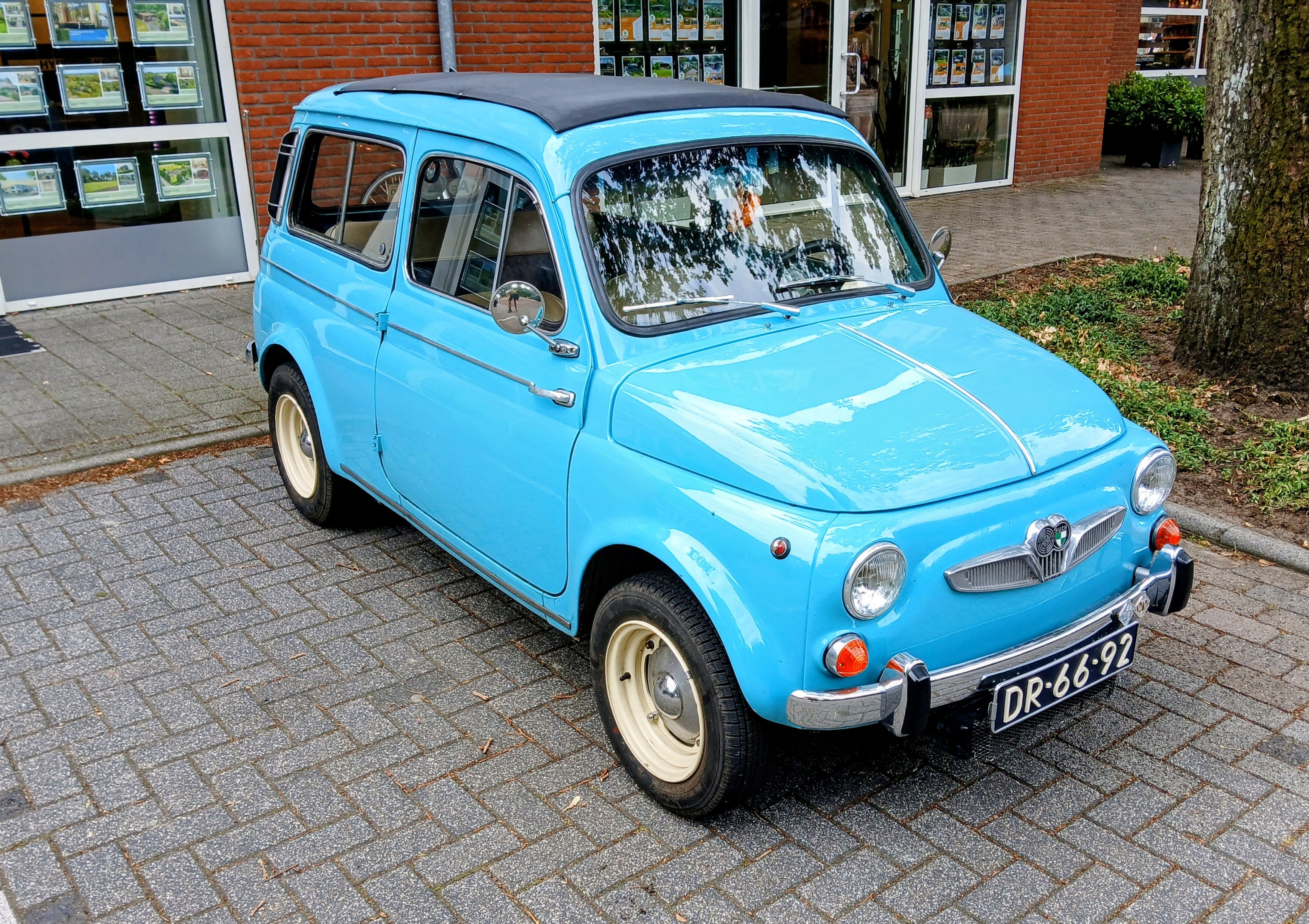
I didn't walk long. My first stop was at Lunchroom 't Veurhuys, a stone's throw away from De Brink. I had travelled almost two hours to reach the start of the stage and needed a restroom break and some coffee before taking on the hike. A bit recovered, I set off again, admiring the pretty houses, and waving at the people having breakfast in their well-tended gardens. I am no car enthusiast, but the most surprising sight along the streets of Sleen was a pair of perfectly maintained classic cars: a DAF 44 from the early seventies and a Steyr-Puch 700C from 1964. Beautiful machines from a more colourful era of automotive history.
I left Sleen along a paved road, walking past a camping site and a riding school where several youngsters were practicing on horseback. After some 500 metres, the trail left the paved road to follow a narrow track between some trees and a few very dry meadows. The summer had been unusually dry, leaving some parts of the Netherlands looking more like my native Portugal. Beside the track, there were quite a few brambles, but unfortunately I couldn't find any ripe enough to taste. Maybe because of the drought, the trees already had quite a bit of yellow, sending a rain of golden leaves down onto the path with every hard gust of wind.
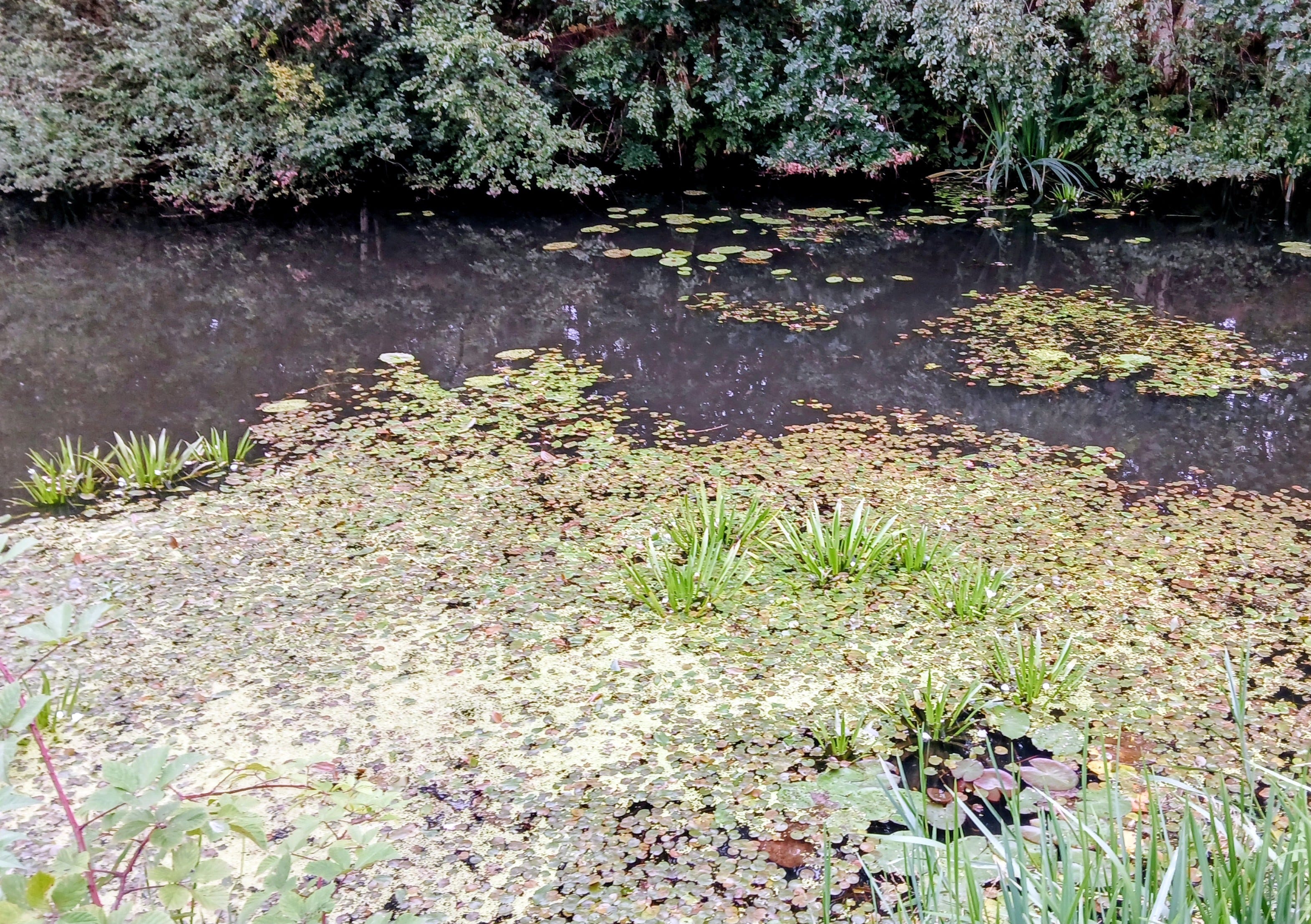
Eventually, I reached another paved road, this one running parallel to the Jongbloedvaart, a narrow canal linking Sleen to the larger Verlengde Hoogeveense Vaart canal. The canal had a very peaceful look to it, overshadowed by trees and overgrown with emergent vegetation. In between the lilies and cattails, water striders skated over the water on their long legs. I assumed the canal was no longer used for navigation. Along the canal were again many brambles, but once again disappointingly unripe. Eventually, I did find one that I judged was dark enough to eat, and was rewarded with its sweet taste when I tentatively bit into it.
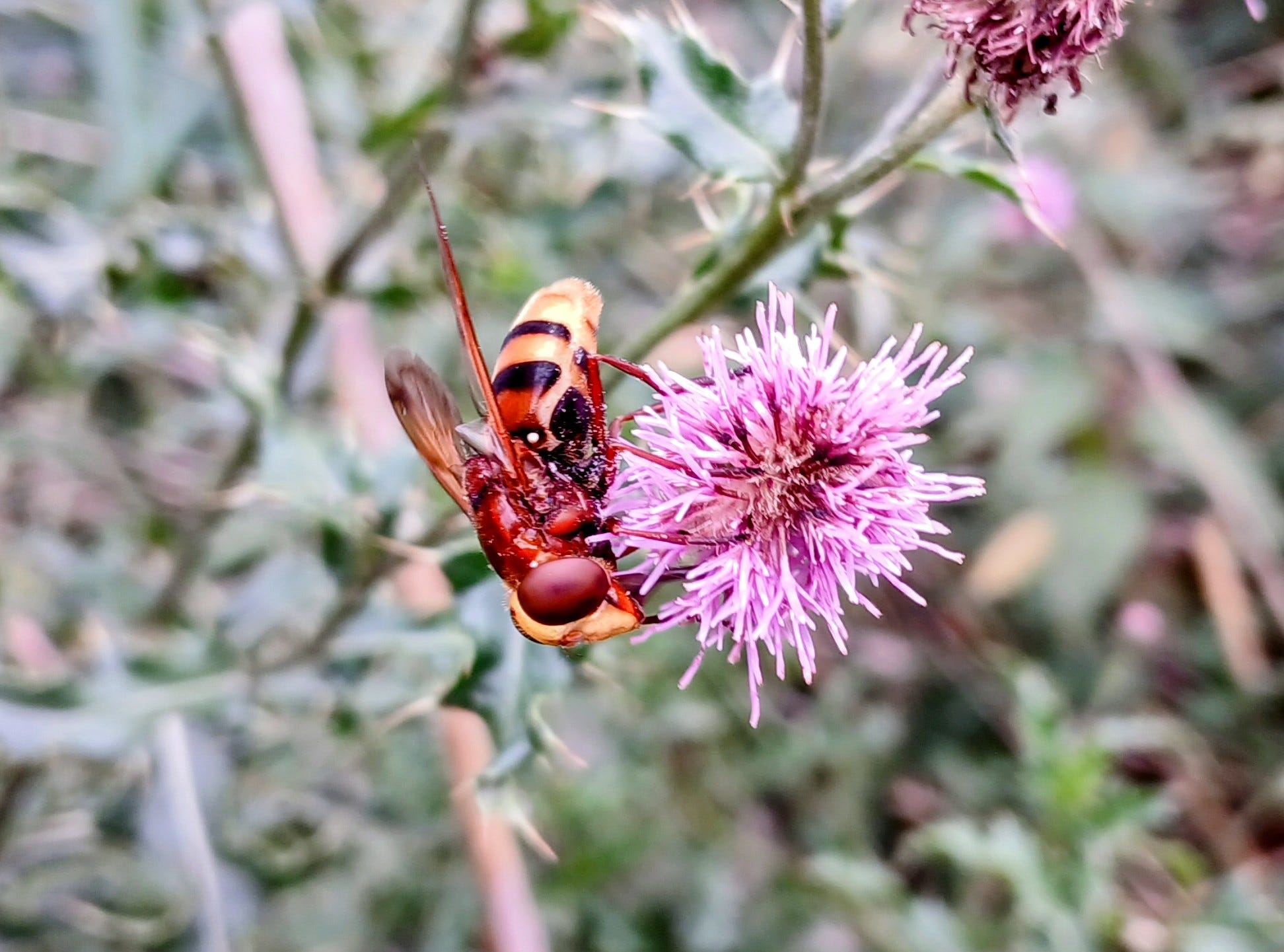
On the other side of the road, vast fields of maize stretched almost as far as the eye could see. These were eventually replaced by wide meadows of green where cows grazed placidly under the morning sun. There were quite a few insects among the brambles and thistles next to the canal, amidst which I found a remarkable one: a hornet mimic hoverfly. A completely harmless pollinator that evolved to look like a menacing hornet to keep its predators at bay. There were also quite a few butterflies fluttering about, namely red admirals, green-veined whites and small heaths.
With my cold, the hike was going a bit slower than usual. I was sweating a lot more that would be expected for a day that wasn't particularly warm, and the occasional fits of coughing also didn't help. Still, overall I felt well and was happy with the decision to come. After some 2,5 km I reached the spot where the smaller canal met the Verlengde Hoogeveense Vaart, and turned left in the direction of Holsloot, but not before noticing the unusual sight of an alpaca farm. Over thirty of these woolly cousins of the llama roamed freely over a meadow wedged in the angle between the two canals.
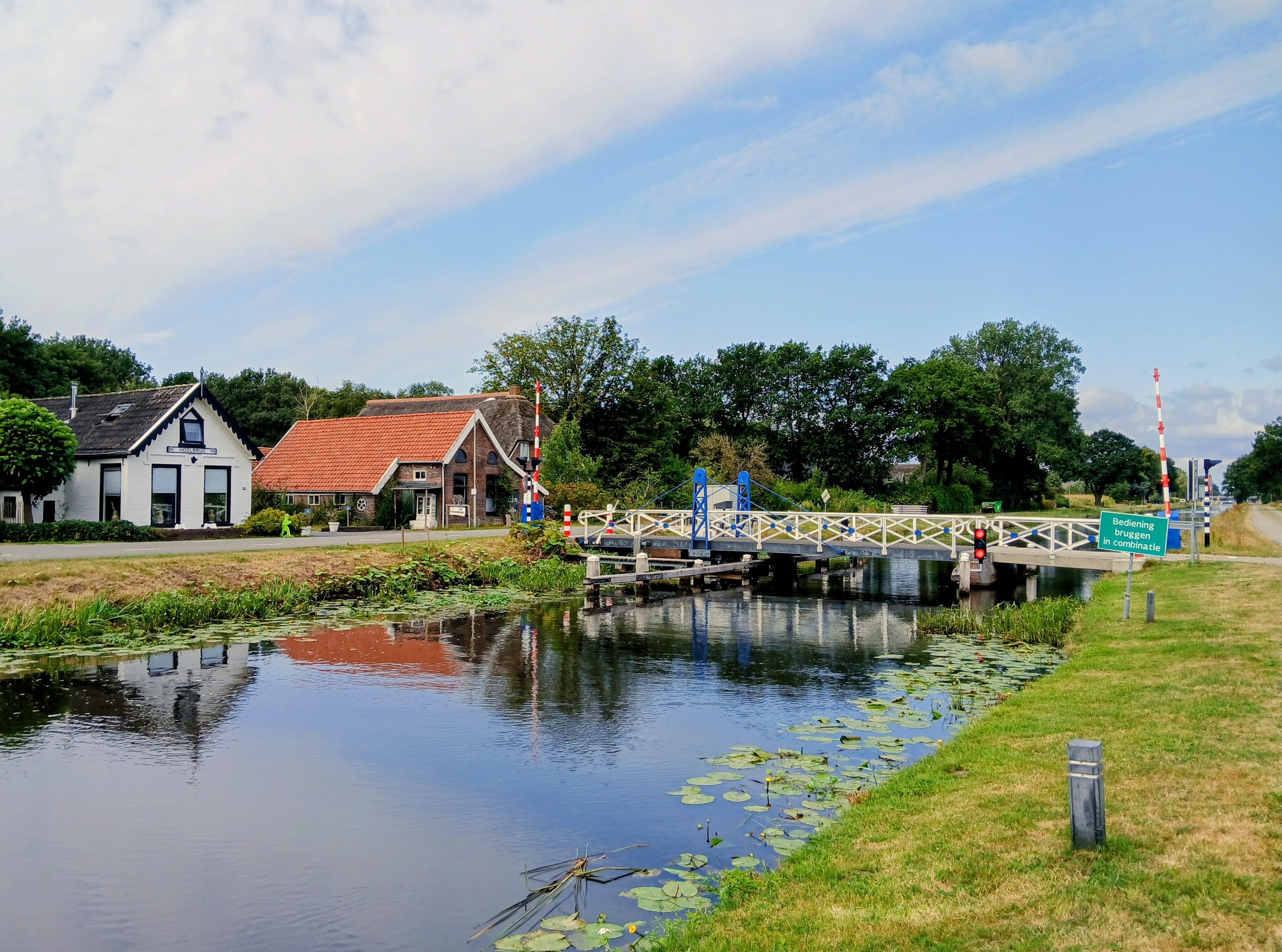
The village of Holsloot was just a handful of houses spread along the Verlengde Hoogeveense Vaart, and was originally a community of canal workers who took care of the canal and of the bridges across it. This canal was indeed a shipping lane, much wider than the Jongbloedvaart and with clear banks. As I progressed along the canal, a couple of recreational boats sailed past me, probably with people enjoying their summer holidays. After about 2 km I crossed one of the old metal drawbridges to head southwards towards Den Hool.
I now walked along a paved road lined with green meadows grazed by cows, with the chirping of crickets filling the air around me. I soon reached Den Hool, a collection of old farmsteads, most of which were seemingly dairy farms. I stopped for a while at the lovely terrace of B&B en Theetuin De Kastanjehoeve, where I enjoyed some refreshing iced tea and a walnut pie, surrounded by flowers of many colours, butterflies, and bees. A few other hikers also shared that cheerful place with me. It was a welcome rest, but I quickly departed as there was plenty of road still ahead of me.
After Den Hool, it was another 2 km to Dalerveen, the next village on the route to Coevorden. I traversed a wide expanse of farmland, with a mixture of maize, sugar beet and asparagus, and halfway between the villages crossed the railway that links Zwolle and Emmen, which seemed to extend in an endless straight line in both directions. As the name indicates, Dalerveen lies in an area of reclaimed peatland (veen is the Dutch word for "bog"). This village was larger than the previous one, with many beautiful country houses, several of which were selling honey, jam and other local products in lovely makeshift shops on their front lawns. Here, I also came across a curious collection of birdhouses, including one made out of an old clog.
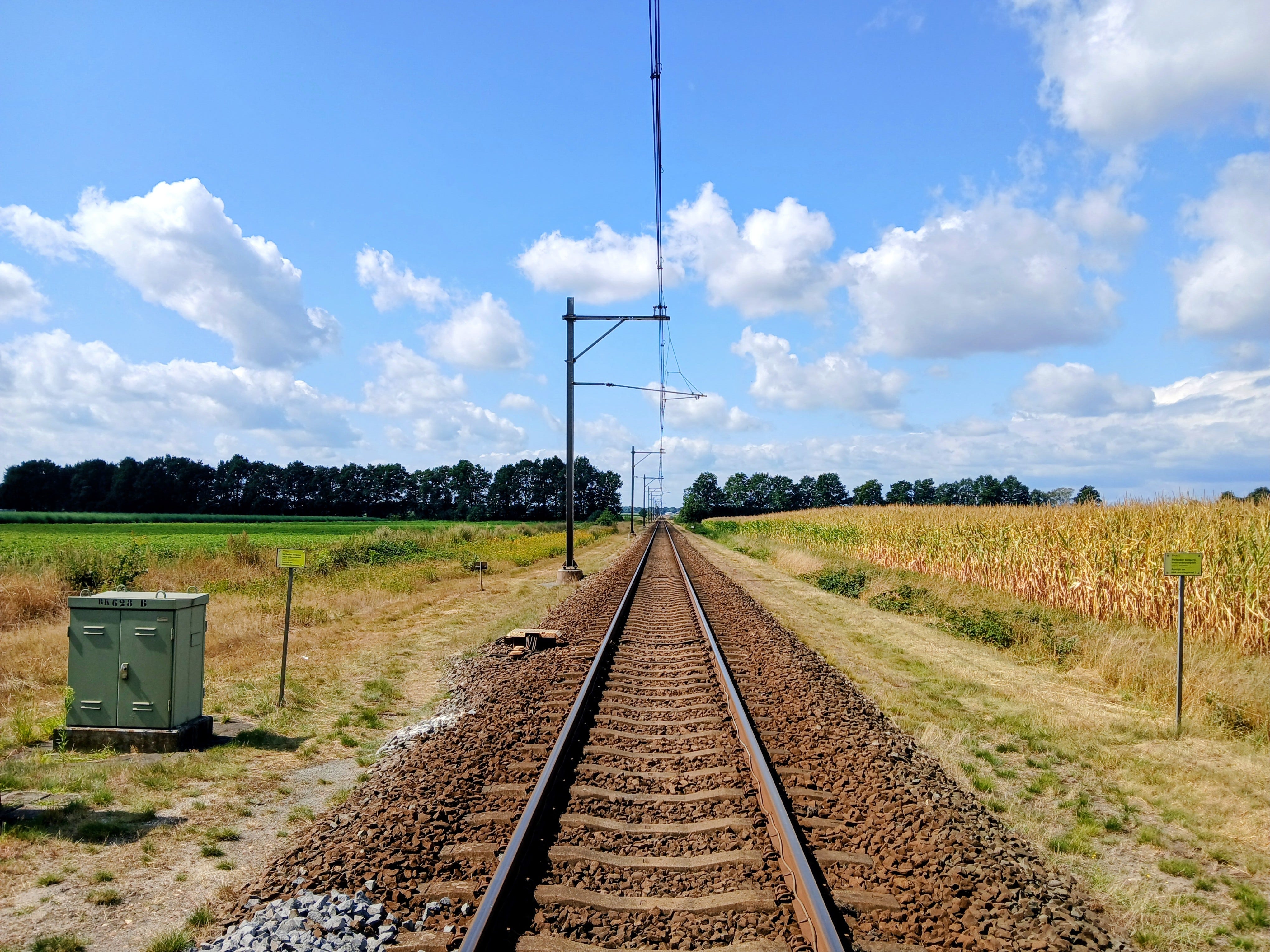
After the last houses of Dalerveen, I turned right into another paved road. The sign on the road said 5,5 km to Coevorden, so I was closing in on the day's goal. This part of the hike went through a wide open area of reclaimed land, once a vast swampy expanse that encircled Coevorden almost completely. The city rose to importance in the Middle Ages exactly because it commanded a small sandy hill that offered the only safe passage through the swamps. The treacherous nature of those swamps became famous in the Battle of Ane, a few kilometres southwest of Coevorden, where in 1227 a heavily armoured army of knights sent by the Bishop of Utrecht was defeated by a force of lightly armed Drenthe rebels and farmers organized by Rudolf II van Coevorden. Rudolf and the free farmers of Drenthe rebelled against the church taxes and feudal interference, and used the swamps to their advantage to defeat the powerful army sent to crush them.
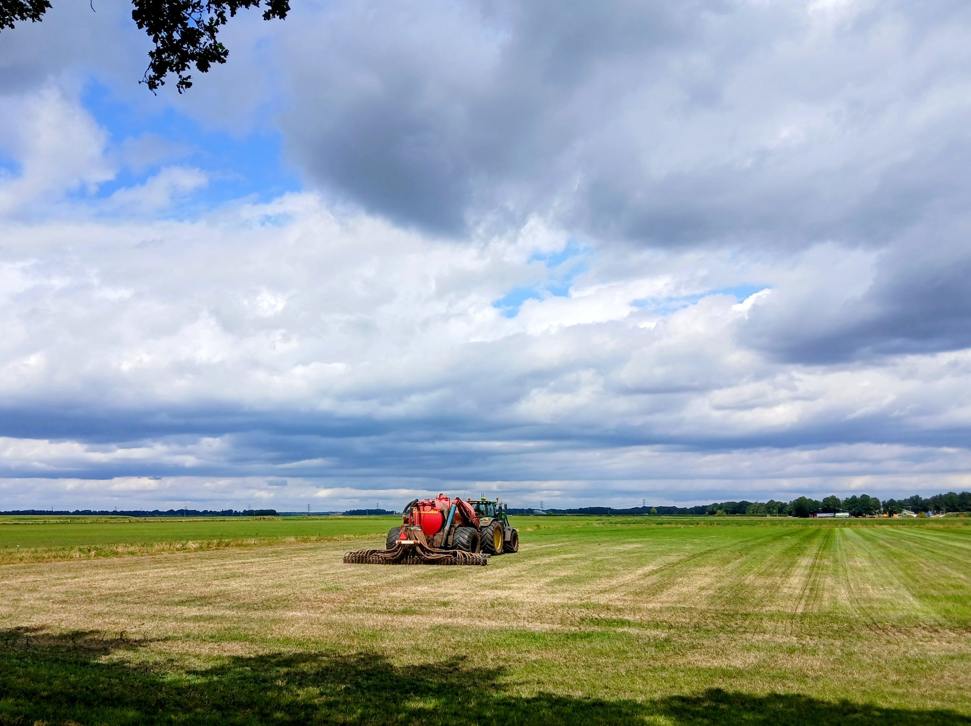
Nothing remains of the swamps today, all of them drained and turned into intensively managed farmland. As I walked, several large tractors passed me by on the narrow road, busily driving back and forth: some were ploughing fields, while others were spreading manure with contraptions made of dozens of manure spouts that clattered against each other as the tractors made their way over the rough ground. After a while, I crossed the Drostendiep, the stream that once flowed from the ancient swamps and was canalised in the nineteenth century to help drain the landscape. Shortly after, I passed a gas extraction area, a reminder that a good part of the northern Netherlands lies above natural gas fields, and yet another example of the many ways this landscape has been bent to the will of man.
After some twists and turns, the trail left the paved road to follow a shell path through the fields. With the crushed shells crunching under my feet, I now crossed a patch of more extensively managed meadows that form breeding habitat for meadow birds such as curlews, godwits, and lapwings. The breeding season was long past, so no such meadow birds remained, and the only birds I spotted there were barn swallows, white wagtails, carrion crows and grey herons. Eventually, this path hit the Drostendiep and continued along its bank for several hundred metres. The waters were covered with water lilies, some with large yellow blossoms emerging from the surface, and many dragonflies buzzed all around me.
I crossed the Drostendiep two more times, first over a wooden bridge, and later over a sturdier bridge when I reached another paved road. The trail now went past green meadows and large black and white cows, and after a couple kilometres turned onto a grassy path running parallel to the ring road around Coevorden. This path brought me to the Stieltjeskanaal, a wide waterway linking Coevorden and Nieuw-Amsterdam. I followed the canal into the streets of Coevorden, going past some green and airy outer neighbourhoods, before reaching the canal that encircled the city centre.
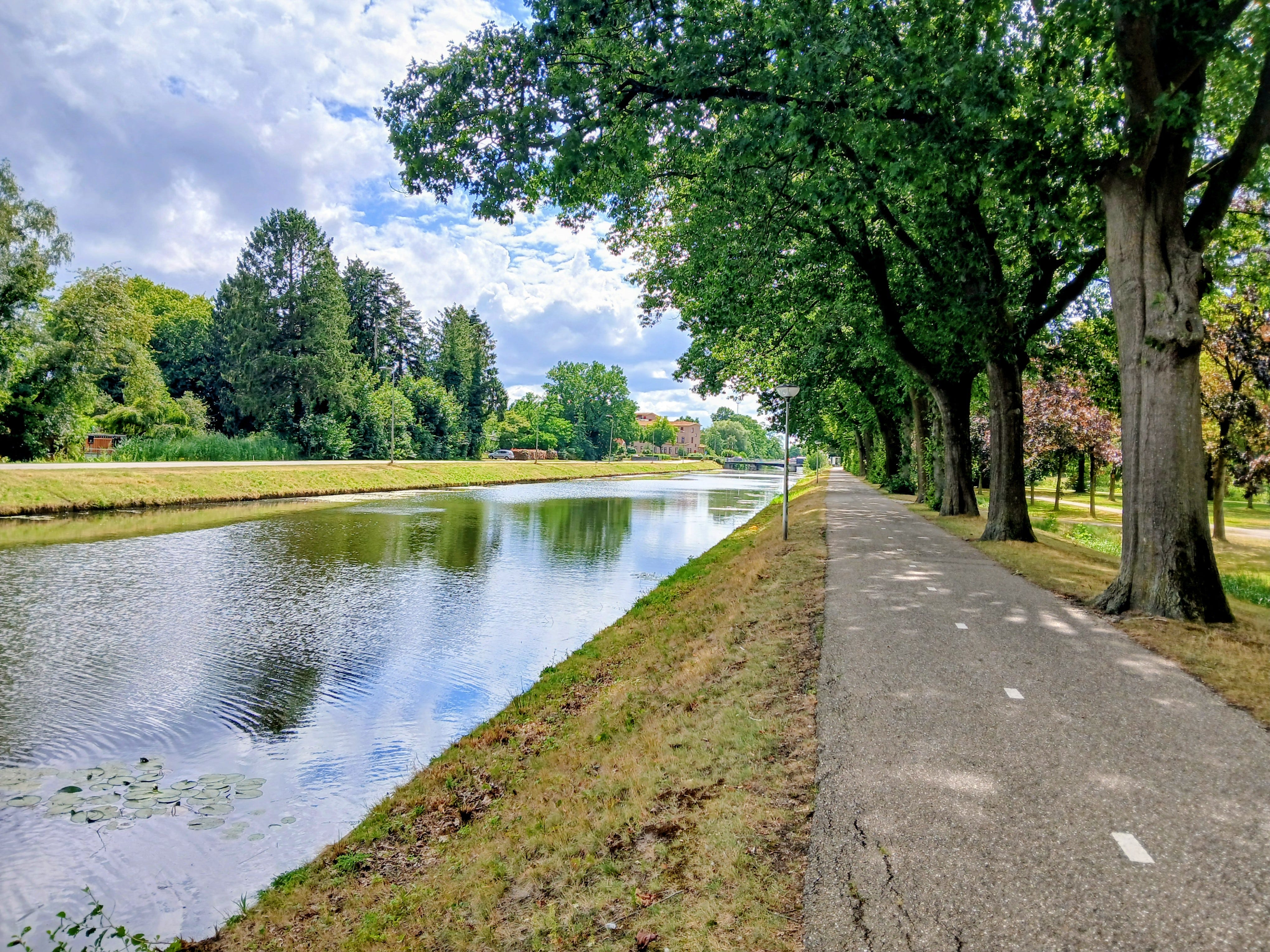
Although the fortifications are long gone, the canal still follows the star shape of the old ramparts. It's bordered by a green area, the Van Heutszpark, a peaceful area of many trees, flowers and lawns that couldn't be any more contrasting with the belligerent function of the fortified wall that once stood in its place. My route followed three arms of that star before going deeper into the city centre. While crossing the park, I spotted many tits and a few nuthatches, as well as the city's 32 m tall water tower.
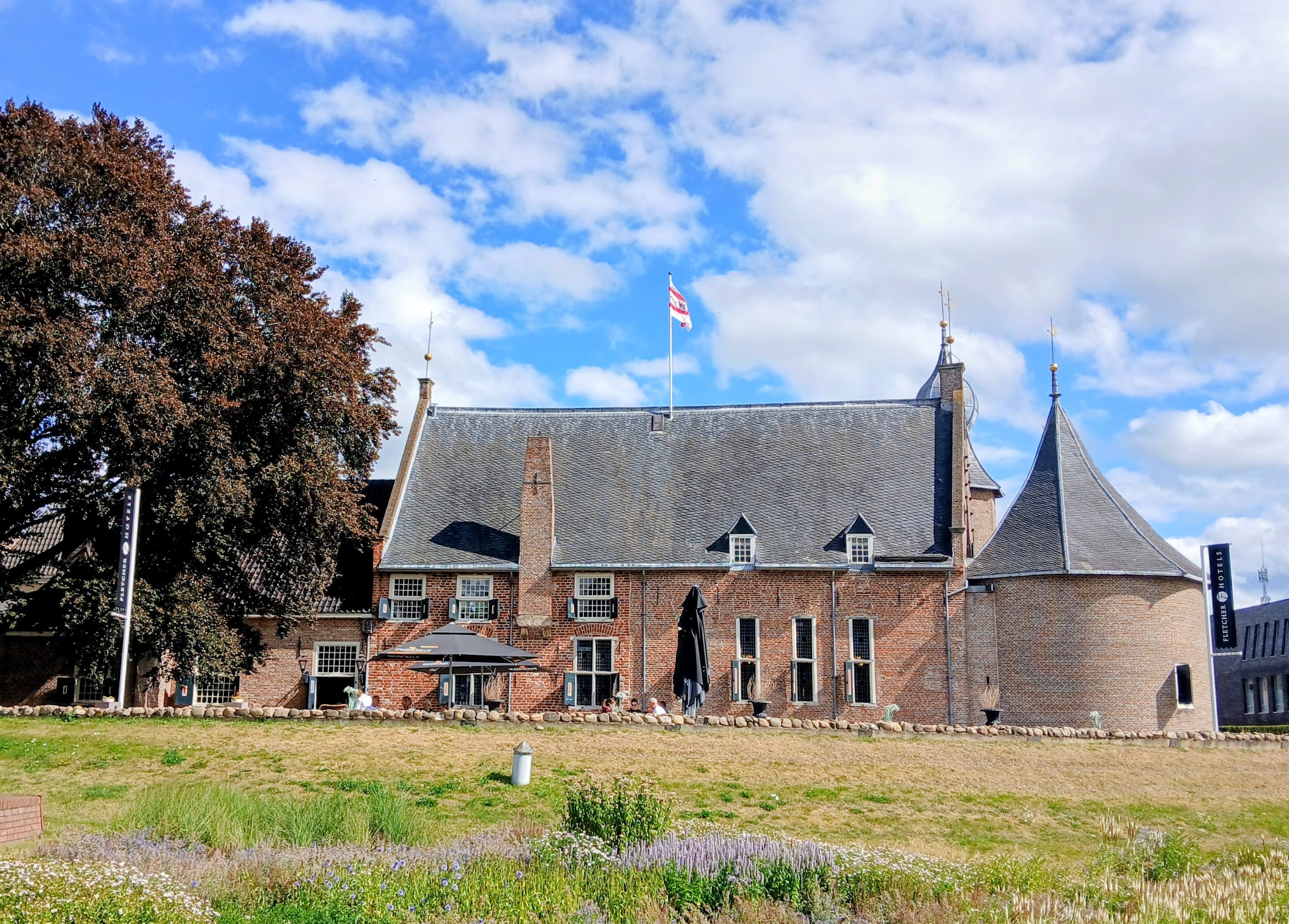
After the park, the trail crisscrossed the streets of Coevorden, past dark brick houses, an old school building, and a curious Baptist church that seemed to be housed in an old barn. I eventually reached the castle, now converted into a hotel. Aside from a lone cannon, little seemed to remain of the city's martial past. Even the former garrison building that I came across a bit further along is now a trendy-looking café called Het Garnizoenshuys. While I could understand the practical logic behind repurposing historic buildings, I couldn't help feeling that turning a castle into a hotel, or a garrison into a café, strips away a piece of the local heritage. And after all, what is a people or a nation without its history?
The stage came to a close in front of the local train station, after walking along the Friesestraat, Coevorden's main shopping street. I reached the end not without a tinge of disappointment, having expected a stronger sense of history from a city with such a remarkable past, but happy to have completed another stage. I was now very close to the German border, as well as the border between the provinces of Drenthe and Overijssel, and was looking forward to the next stage that would take me into a new province and another landscape. Ahead of me lay the Vechtdaal, the valley of the Vecht, the smallest of the great Dutch rivers. But that would be a story for another day.
If you enjoyed reading about my Pieterpad hiking experience, consider buying me a coffee to support my work.
No posts
Comments
Nothing yet. Say the first thing.
Sign in to join the conversation.