
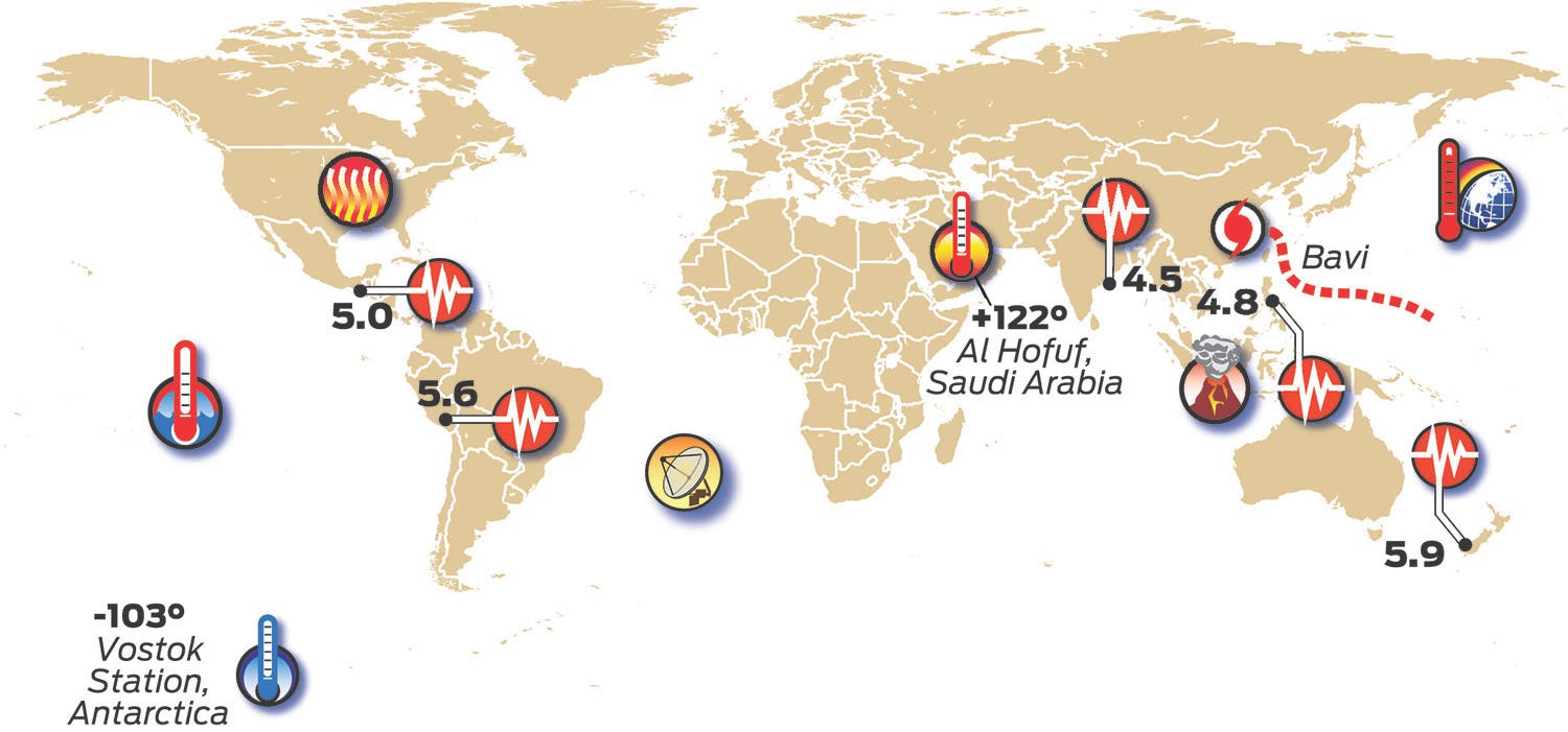
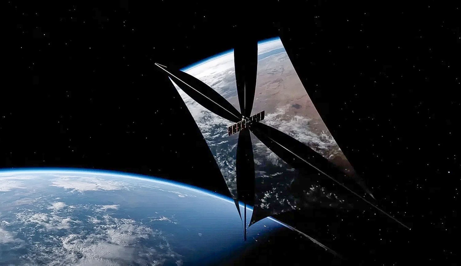
A U.S. company has received federal authorization to test an enormous orbital mirror intended to deliver “sunlight on demand” to selected locations on Earth after dark.
Reflect Orbital’s experimental Eärendil-1 satellite would deploy a steerable, thin-film reflector measuring about 59 feet by 59 feet (18 by 18 meters) in low-Earth orbit. By changing the mirror’s angle, operators hope to redirect sunlight onto a moving area approximately 3 miles (5 kilometers) wide for several minutes at a time.
The company says the technology could extend the generating hours of solar farms, illuminate disaster zones during rescue operations and provide temporary lighting in remote industrial or agricultural areas. Its early test would produce illumination comparable to moonlight, although Reflect Orbital eventually hopes to deploy increasingly powerful systems capable of producing much brighter light.
The proposal drew more than 1,800 public comments and strong opposition from astronomers and environmental groups. Critics warn that unexpected flashes could distract aircraft pilots and motorists, overwhelm sensitive telescope equipment and interfere with the natural light-and-dark cycles that regulate human sleep as well as wildlife migration, feeding, reproduction and plant growth.
The Federal Communications Commission authorized only the radio communications required to operate one demonstration satellite—not the vast constellation envisioned by the company. The agency also said that many objections concerning the mirror’s environmental and optical effects fell outside its principal responsibility for regulating radio frequencies.
That regulatory divide may become increasingly important. Reflect Orbital says it hopes to expand from its initial satellites to more than 50,000 orbital mirrors by 2035, with some future systems theoretically capable of producing light approaching daytime brightness for hours.
The experiment therefore involves far more than one unusual new satellite. It could become an early test of who controls darkness, how much artificial alteration of the night sky society is willing to accept and whether existing laws are equipped to regulate commercial projects that affect the shared environment above the entire planet.
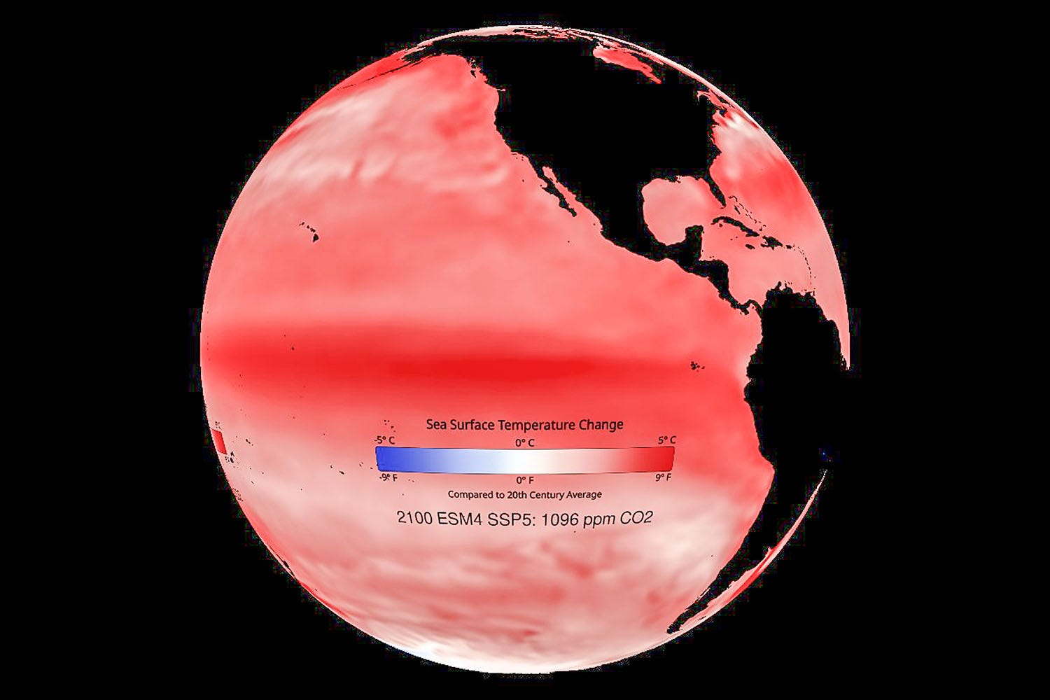
For much of modern history, scientists could say that greenhouse gases were warming the planet but had greater difficulty determining how much climate change influenced a particular flood, wildfire or deadly heat wave.
That is rapidly changing.
More powerful computers, improved observations and a deeper understanding of the climate system now allow researchers to compare the world people actually inhabit with a simulated world in which fossil-fuel emissions had never altered the atmosphere. In some cases, scientists can calculate the human contribution to an extreme event before it has ended.
Those findings are becoming valuable to emergency planners, governments and insurance companies trying to prepare for risks that can no longer be estimated from the climate of the past. They could also help courts decide whether corporations or governments should bear some responsibility for climate-related losses.
Yet the clearer the science becomes, the more fiercely some political leaders attack it. President Donald Trump has repeatedly dismissed climate change as a “hoax” or “con job” and has declared climate models unreliable, while his administration has weakened federal climate research and placed outspoken skeptics in influential positions.
But a report released on Thursday by the U.S. National Academies of Sciences, Engineering and Medicine outlines how climate models are becoming more precise in identifying climate change’s fingerprints on individual disasters. The report finds that improved climate models, satellite measurements and decades of additional observations have substantially strengthened the science of extreme-event attribution.
Researchers have the greatest confidence when assessing heat waves and cold extremes, followed by heavy rainfall and drought. Progress has also been made with tropical cyclones and wildfires, although their complex causes make attributing individual storms or fires more difficult.
Scientific models will never reproduce every cloud, storm or drought perfectly. That is not their purpose. They calculate probabilities, test explanations and reveal how the odds are changing. Their improving accuracy is making the consequences of continued fossil-fuel use harder to dismiss — which may be precisely why the attacks against them are growing louder.

During a Northern California heat wave in the summer of 1977, I switched on the television in the early evening and unexpectedly found myself watching The Tonight Show with Johnny Carson” from an NBC affiliate in Texas.
The distant broadcast remained clear for a couple of hours before disappearing as mysteriously as it had arrived. At the time, it seemed like little more than an atmospheric curiosity—a faraway signal briefly reaching across hundreds of miles of mountains and desert.
A similar phenomenon had more serious consequences this month in northeastern Indiana.
At about 3 a.m. on July 1, an outdoor emergency siren sounded across part of Huntington County. There was no tornado, severe thunderstorm or other threat anywhere nearby. County officials later determined that the siren had apparently received a radio signal from approximately 300 miles (480 kilometers) away in Iowa that happened to match its activation code.
The signal had likely traveled through what meteorologists and radio operators call tropospheric ducting. Under certain conditions, layers of sharply differing temperature, pressure and humidity can form invisible channels in the lower atmosphere. Radio waves become trapped inside them, bouncing far beyond the distance they would normally travel before emerging hundreds of miles away.
The effect can cause distant radio stations to replace local broadcasts and television signals from other regions to appear without warning. Amateur radio operators sometimes welcome the phenomenon because it enables them to contact people far beyond their usual range. But stray signals can also disrupt radar, maritime communications, emergency networks and other systems that depend upon carefully separated radio transmissions.
The Indiana incident occurred as a sprawling heat dome settled over much of the Midwest and eastern United States. Persistent high pressure and strong temperature inversions can create conditions favorable for ducting.
Scientists expect human-caused climate change to make many extreme heat events more frequent and intense. That does not mean every wandering radio signal can be blamed on global warming, but increasingly persistent heat domes could create more opportunities for unusual atmospheric conditions to interfere with communications.
Huntington County officials say its sirens can also be shut down manually. Their greater concern is that repeated unexplained alarms could create “alert fatigue,” causing residents to hesitate or ignore a warning when a genuine tornado or other disaster is approaching.
For most listeners, a distant station suddenly breaking through the static is a fleeting novelty. But when an invisible tunnel in the sky can carry the wrong command hundreds of miles and awaken an entire community, the atmosphere is reminding us that even the signals surrounding us are less securely contained than they appear.
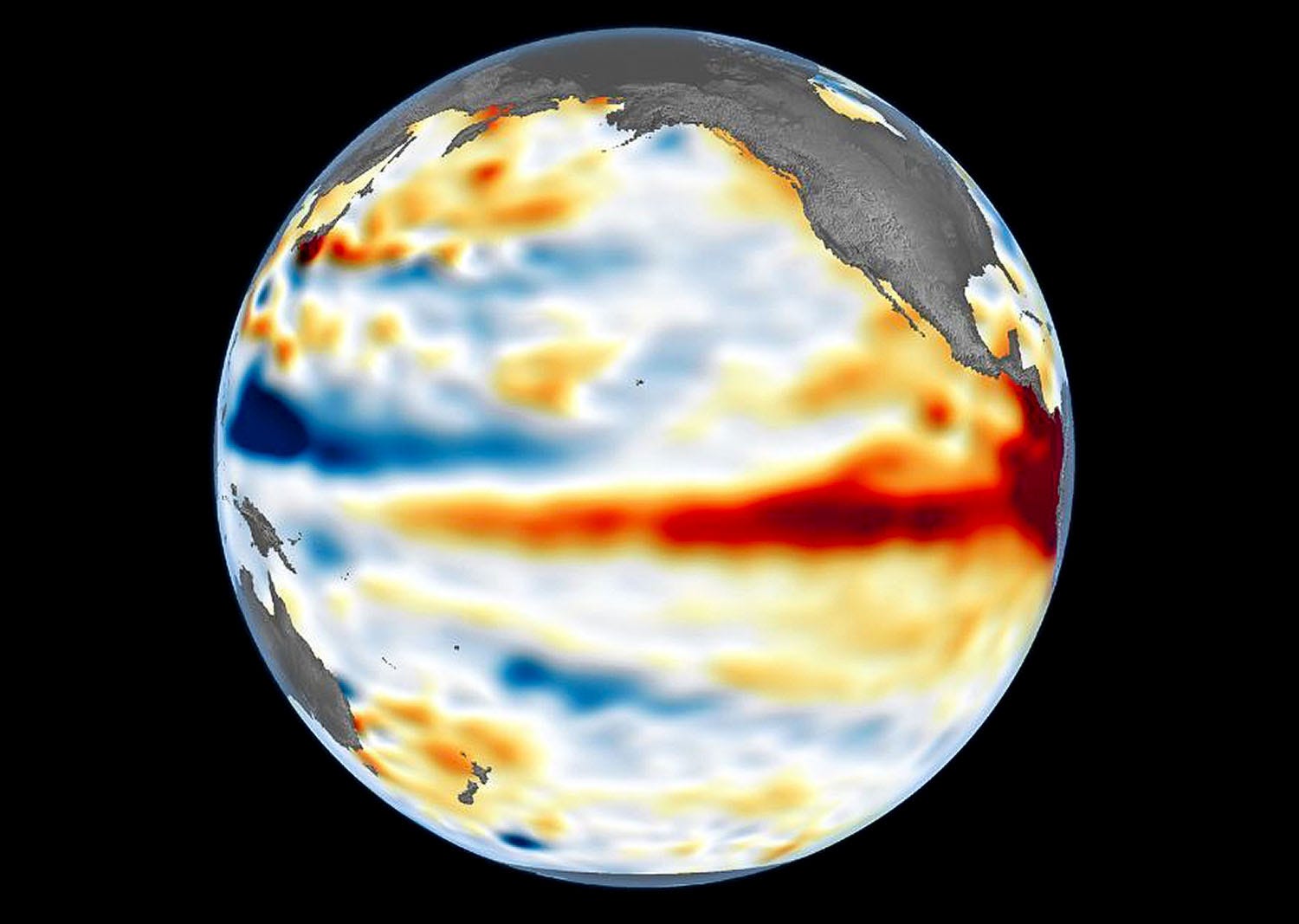
As a potentially record El Niño develops across the tropical Pacific, scientists are examining whether an extraordinary form of geoengineering could someday be used to weaken such events before they reach full strength.
The proposed technique, known as marine cloud brightening, would use ships to spray microscopic sea-salt particles into low clouds over the ocean. The added particles would make the clouds brighter and more reflective, sending additional sunlight back into space and cooling the sea surface below.
Researchers at the Scripps Institution of Oceanography and collaborating institutions used a seasonal forecasting model to test how the intervention might have affected the powerful El Niños of 1997–98 and 2015–16. In their most aggressive simulations, cloud brightening began early in the development of each event and continued for several months. The resulting cooling was strong enough to nearly eliminate both super El Niños.
The study was inspired by an unintended natural experiment created by Australia’s catastrophic “Black Summer” bushfires of 2019 and 2020. Vast quantities of smoke drifted across the southeastern Pacific, where the particles interacted with clouds and made them more reflective. Earlier research found that this cooling effect helped strengthen the unusually persistent La Niña that began in 2020.
That discovery raised an intriguing question: If smoke from wildfires could influence the Pacific climate cycle, could a carefully targeted human intervention do the same thing deliberately?
The simulations suggest that it might. Weakening El Niño could potentially reduce destructive floods, droughts, crop failures and extreme heat that can cause thousands of deaths and trillions of dollars in economic losses. But the findings remain a computer-model proof of concept, not evidence that the technique is ready for use.
The engineering requirements alone would be enormous. Researchers estimate that thousands of specially equipped ships might be needed to spray enough sea salt into the atmosphere, and the technology has not been demonstrated at anything close to that scale.
The environmental and political risks could be even greater. El Niño does not affect every region in the same way, and weakening it could benefit some countries while harming others. The simulations indicated possible unintended warming over parts of Europe and Asia, while an intervention might also accelerate the transition into La Niña and shift rainfall patterns elsewhere.
Marine cloud brightening would therefore involve more than manipulating clouds. It would require international decisions about who controls a planetary weather system, which risks are acceptable and who would be responsible when the consequences cross national borders.
Researchers emphasize that the method would not address the underlying accumulation of greenhouse gases. At most, it might temporarily blunt one natural climate cycle whose effects are being intensified by human-caused warming. Reducing emissions would still be essential, even in a future where society gains the ability to influence El Niño itself.
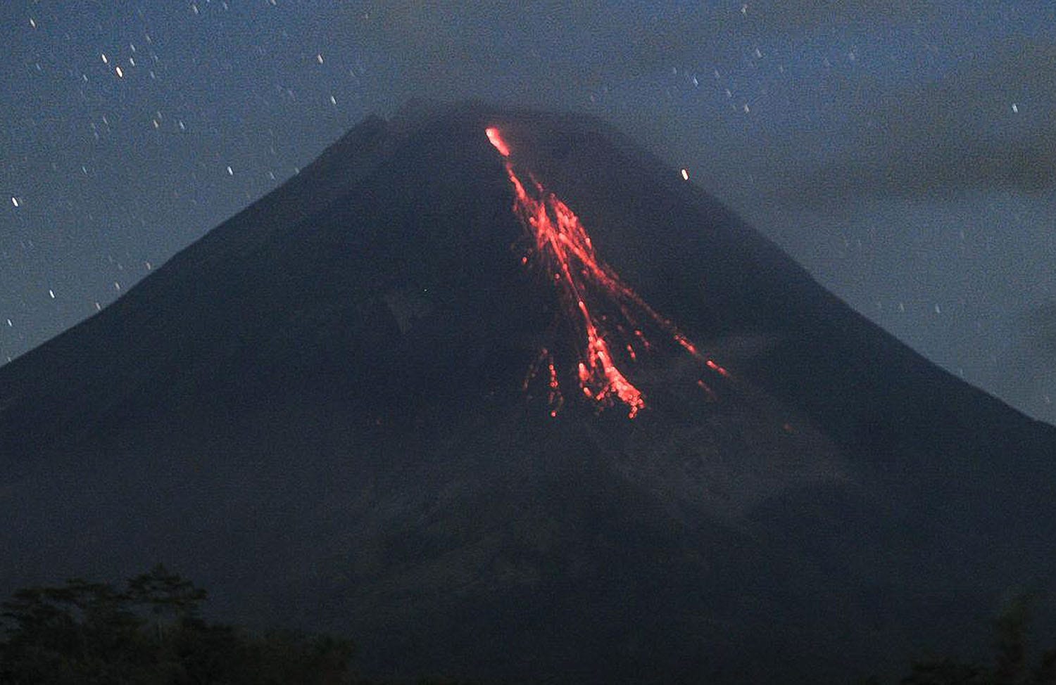
Indonesia’s Mount Merapi sent glowing lava avalanches tumbling down its western flank during the early hours of Saturday, the latest dangerous pulse in the volcano’s long-running eruption.
Volcanologists recorded five lava collapses from Merapi’s active summit dome, with incandescent material traveling as far as 1.2 miles (1.9 kilometers) along the Krasak River channel. No casualties or damage were immediately reported.
Merapi remains at Alert Level III, the second-highest level on Indonesia’s four-tier warning system. Residents, tourists and climbers have been told to remain outside exclusion zones extending between 1.9 and 4.3 miles (3 and 7 kilometers) from the summit, depending on the direction of the hazard.
The activity does not mark the beginning of a new eruption. Merapi has remained persistently active since 2020 as lava continues to accumulate in unstable summit domes. Their repeated collapse can generate glowing rockfalls and, at times, far more dangerous pyroclastic flows of superheated gas, ash and debris.
Communities along river valleys draining the volcano also face the threat of lahars when heavy rain remobilizes loose volcanic material. With large populations living on and around its slopes, Merapi remains one of the world’s most closely monitored volcanoes.
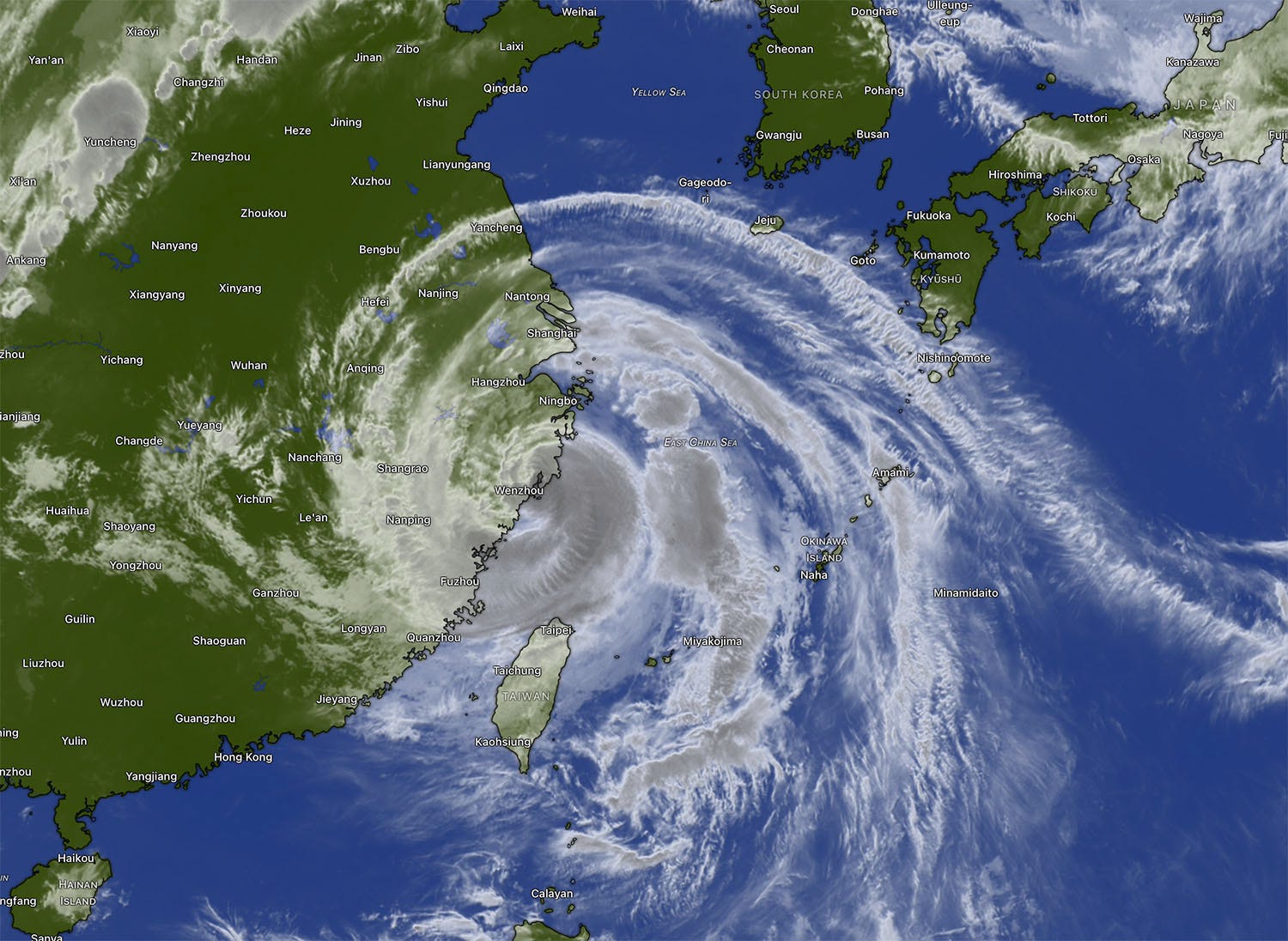
After devastating the Northern Mariana Islands as a Category 5-equivalent super typhoon, Bavi crossed the western Pacific and slammed into China’s eastern Zhejiang province as the country’s strongest landfalling storm of the year. More than 2.8 million people were evacuated, including 2.2 million in Zhejiang, while airports and railway stations in Shanghai, Hangzhou and other cities canceled hundreds of flights and train services.
Violent winds uprooted more than 700 trees in Yueqing, flooded coastal communities and triggered landslides in mountainous areas. No deaths were immediately reported in China, although at least 134 people were injured as the storm passed northern Taiwan.
Earlier, rainfall enhanced by Bavi and the southwest monsoon caused landslides and flooding that killed at least 18 people in the Philippines and affected more than half a million residents.
Although Bavi weakened after moving inland, its circulation—about 620 miles (1,000 kilometers) wide—was forecast to bring several more days of torrential rain and heightened flood risks across eastern and northern China.
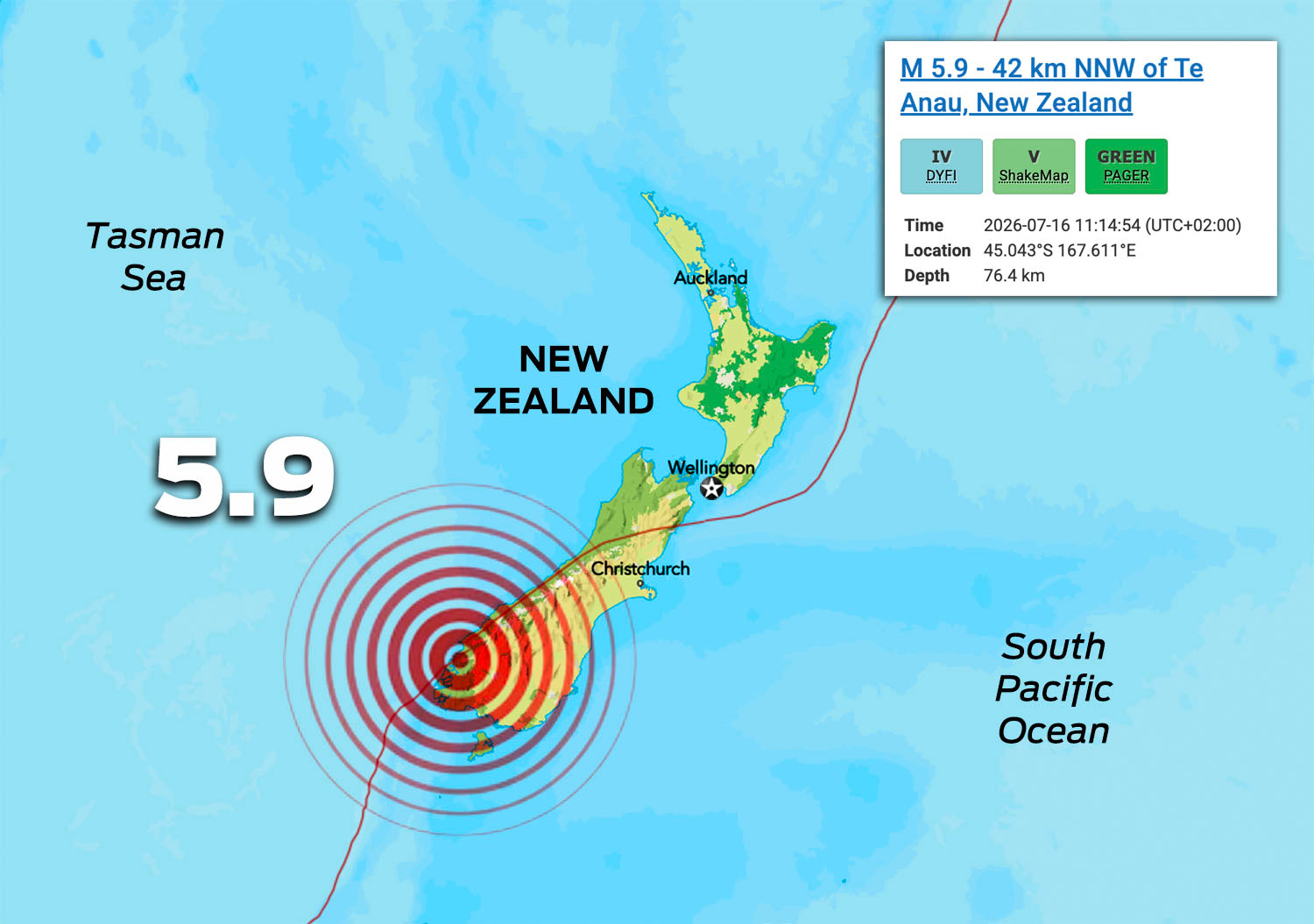
A strong earthquake jolted New Zealand’s South Island on Thursday night local time, prompting authorities to briefly order coastal evacuations along part of the Fiordland coast.
The country’s GeoNet agency initially estimated the quake at magnitude 6.3 before revising it downward to 5.9. It struck about 25 miles (40 kilometers) north of Te Anau at a depth of roughly 33 miles (53 kilometers), producing strong shaking that residents described as long, loud and severe.
New Zealand’s National Emergency Management Agency initially warned that a damaging tsunami and coastal flooding were possible between Milford Sound and Puysegur Point. People near the coast were told to move immediately to higher ground and, where possible, evacuate on foot to avoid traffic congestion.
The warning was later downgraded and then canceled after monitoring detected no tsunami. Authorities nevertheless cautioned that strong currents and unpredictable surges could persist near beaches, harbors, marinas and river mouths.
No casualties or significant damage were immediately reported. The quake struck near Fiordland, a mountainous and glacier-carved tourist region on the boundary between the Australian and Pacific tectonic plates, where earthquakes are frequent.
Earth movements were also felt during the week in:
India’s central Bay of Bengal coast (4.5)
The central Philippines (4.8)
Southern Peru (5.6)
Far southern Mexico (5.0)
• The hottest temperature recorded this week by the World Meteorological Organization’s 7,600 land-based synoptic weather stations was 122° Fahrenheit (50° Celsius) at Al Hofuf, Saudi Arabia.
• The coldest temperature in an inhabited location was -103° Fahrenheit (-72° Celsius) at Russia’s Vostok Station, located in the middle of the East Antarctic Ice Sheet. The station normally hosts 30 scientists and engineers during the summer. In winter, their number drops to 15.
©MMXXVI Earth Environment Service
No posts
Comments
Nothing yet. Say the first thing.
Sign in to join the conversation.