
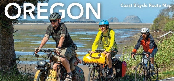
I confess. I’m sometimes leery while cycling on the Oregon Coast Bike Route. I’ve seen stretches where the two-lane road is so narrow that I wince when a recreational vehicle squeezes around a curve.
And I’ve also savored miles of Highway 101 with road shoulders so wide they appear as wide as a full traffic lane. Nothing concerns me there as I flow with a tailing sea breeze along on the South Coast.
I share both my trepidation and unbridled exhilaration as the Oregon Department of Transportation (ODOT) prepares for next week’s release of its Oregon Coast Bicycle Route map, a refreshed edition loaded with updated maps and information about the 365-mile course.
Ian Davidson, ODOT’s bicycle and pedestrian program manager, met me this week at a downtown Salem coffee shop to discuss the route, the map, and the transportation department’s overarching goal to make cycling safer. A awareness campaign is being launched to remind motorists how they can safely share the road with people on bikes.
It all takes place on June 11 in celebration of the 55th anniversary of the state’s first-of-its-kind “bike bill.”
Please share this article with your cycling friends.
Find more than 70 posts in the complete “Why We Ride” destination cycling guide here.
A little background: The Oregon Bike Bill, which passed in 1971, requires that at least 1 percent of money spent on any highway project be dedicated to bicycle and pedestrian infrastructure. With sidewalk and bike lane improvements included in every project, the state has since become known as a cycling-friendly state.
More than 40 years later, 2012 to be exact, a study showed Oregon had become a cycling destination. Here were two key findings by the research group, Dean Runyan Associates: Bicycle recreation was a motivating factor for 1.2 million trips here that year, and bicycle tourism accounted for more than $400 million in tourism spending.
Referencing that survey, Ian logically concluded that “I expect that number is much larger more than a decade later.”
“This map invites people on bicycles to experience Oregon’s stunning coastal landscape,” he said, “while providing essential information for a safe and enjoyable trip.”
The state’s safety initiative, meanwhile, reminds drivers to slow down, give riders extra space, and be patient while passing. ODOT’s safety campaign includes billboard messaging along major travel corridors and popular coastal routes to help educate travelers about safely sharing the road.
Following the Oregon Coast
Anyone who has ridden or driven Highway 101 has seen the ever-changing landscape as they passed by. The Oregon Coast’s diverse geography – wide, sandy beaches alternating with high shoreline peaks, thick forests, and even sand dunes – becomes an evolving postcard image.
The new map, an updated version of the 2017 edition, explains in detail how to travel from Astoria to Brookings, from the Columbia River to the California line. Four sub-maps locate state parks and amenities, and note where to find campgrounds, dedicated hiker/biker camping, yurts, cabins, and hot showers.
Other map markers point out federal Bureau of Land Management and U.S. Forest Service camping, lighthouses, wildlife viewing areas, covered bridges, summits, and alternate route options.
And, of course, there are elevation profiles.
Most importantly, road lines are color-accented to indicate both wide and narrow road shoulders. And while it’s still narrow in some places, ODOT is working to improve as many tight spots as possible over time.
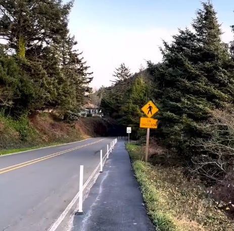
“Using the bike bill (funding), we’ve widened the shoulder in places like Yachats (along the Central Coast),” Ian said. “We put in vertical delineators there, too.”
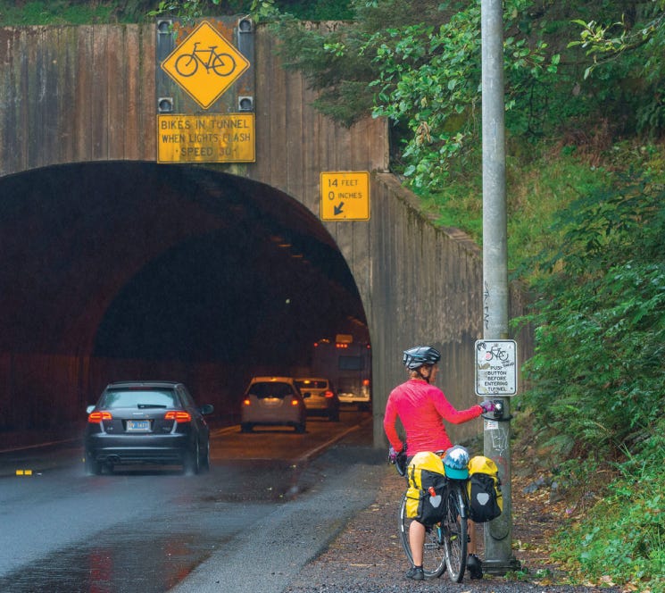
In other places, longstanding safety strategies are still in play. Blinking caution lights, for example, are employed at tunnels and narrow bridges to warn motorists that bicyclists are ahead.
These locations are pinpointed on the map as well.
Economic Motivation
The bike route is there for cyclists to experience and enjoy the Oregon Coast. It’s also there for local communities. Much like the state’s 18 official scenic bikeways, the route is an economic driver for rural communities along the way.
“We want to improve Highway 101,” Ian said. “But thinking about it holistically, there are multiple benefits beyond just improving our infrastructure. We can think about economic development and the livability in those social communities as well.
“We have thousands of people, likely tens of thousands of people, riding the Oregon Coast Bike Route, in whole or in part, and they’re frequenting local businesses, which is wonderful,” he said. “We want to be able to support that, too.”

Dan Shryock is a travel writer and career journalist who focuses on cycle tourism. Based in Oregon, his work has appeared in magazines and websites in California and the Pacific Northwest. His book, “Cycling Across Oregon: Stories, Surprises & Revelations Along the State’s Scenic Bikeways” is available on Amazon.
Comments
Nothing yet. Say the first thing.
Sign in to join the conversation.