
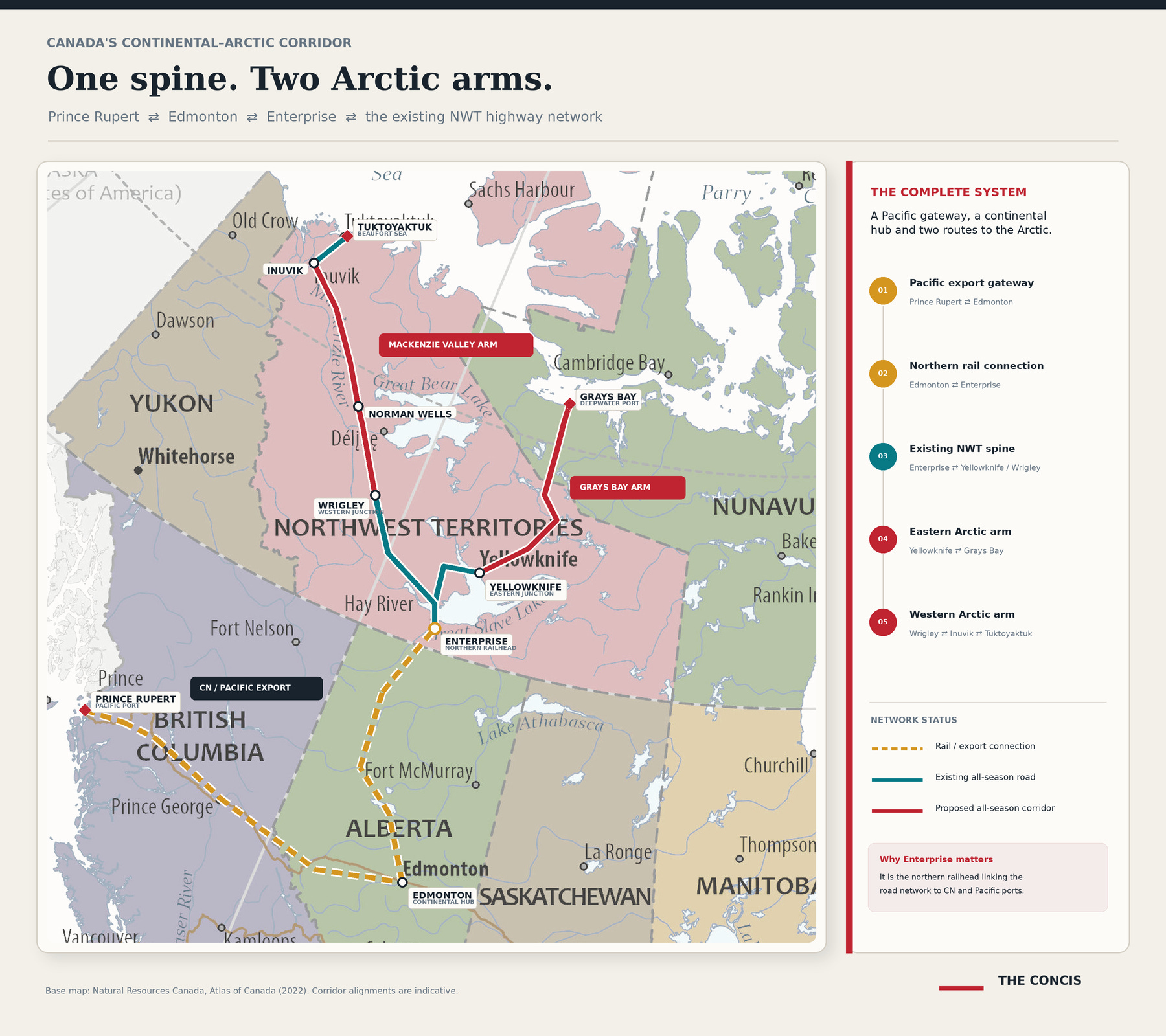
It is rather satisfying to look at that map, isn’t it? I do not know why the Canadian government uses so many words to explain what it is actually trying to do.
It could have said this: Canada’s northern transportation network remains broken, so we are adding two enormous extensions.
The western extension will carry the existing highway north from Wrigley through the Mackenzie Valley to the Dempster Highway near Inuvik. From there, the existing road reaches Tuktoyaktuk and the Arctic coast.
The eastern extension will run from the Yellowknife network to the proposed deepwater port and airfield at Grays Bay. It is being developed as two separate projects, but the completed sections will form one continuous highway from Yellowknife to the Arctic Ocean.
Through the existing Northwest Territories highway network—and then Enterprise and Edmonton—both extensions will connect with Canada’s wider road-and-rail system and routes leading to the Port of Prince Rupert.
That is the plan: connect two major parts of Canada’s fragmented North to the rest of the country.
Comments
Nothing yet. Say the first thing.
Sign in to join the conversation.