
A new website and dataset search tool were launched, including a public dataset metadata json.
In the web app, USGS Historical Topography maps were added as a Custom Base Map option. Also, the MRRMaid Monthly classification dataset was updated to the entire sagebrush biome version.
New API functionality was introduced for making POST requests. Additionally, the raster/export/percentiles endpoint rank functionality was separated into its own endpoint raster/export/ranks.
The Climate Engine team held workshops for the Bureau of Land Management (BLM) focused on Riparian & Wetlands, Upland Ecosystems, and Drought & Production. They also held a project kickoff meeting for enhancing tribal drought monitoring at the Oka Institute which included workshops on the Climate Engine UI and API.
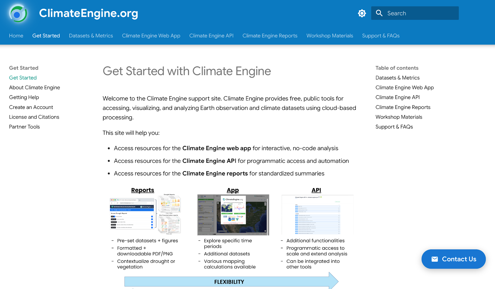
The new Climate Engine website climateengine.org combines three previous sites, the initiative site, the support site, and API documentation site, into one. This update improves the navigation of resources and documentation materials, standardizes the dataset documentation process, and introduces a section for workshop materials. The support.climateengine.org and docs.climateengine.org sites will be discontinued after May 1, 2026.
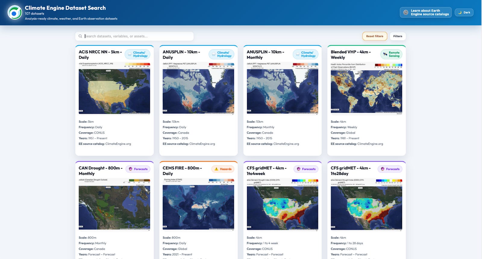
The new dataset search tool allows users to find and select from Climate Engine’s 100+ datasets. Users are able to filter by dataset type, variables, data frequency, spatial resolution, coverage, source, and year range. For example, filtering by the variable Snow Depth shows 7 datasets. Further filtering those to Global coverage reduces that to 5 datasets. By clicking on a dataset card, users can see the documentation for the dataset and link to the Climate Engine website. In addition to the search tool, a json of the dataset metadata (documentation details) was made public - https://app.climateengine.org/dataset_search.json.
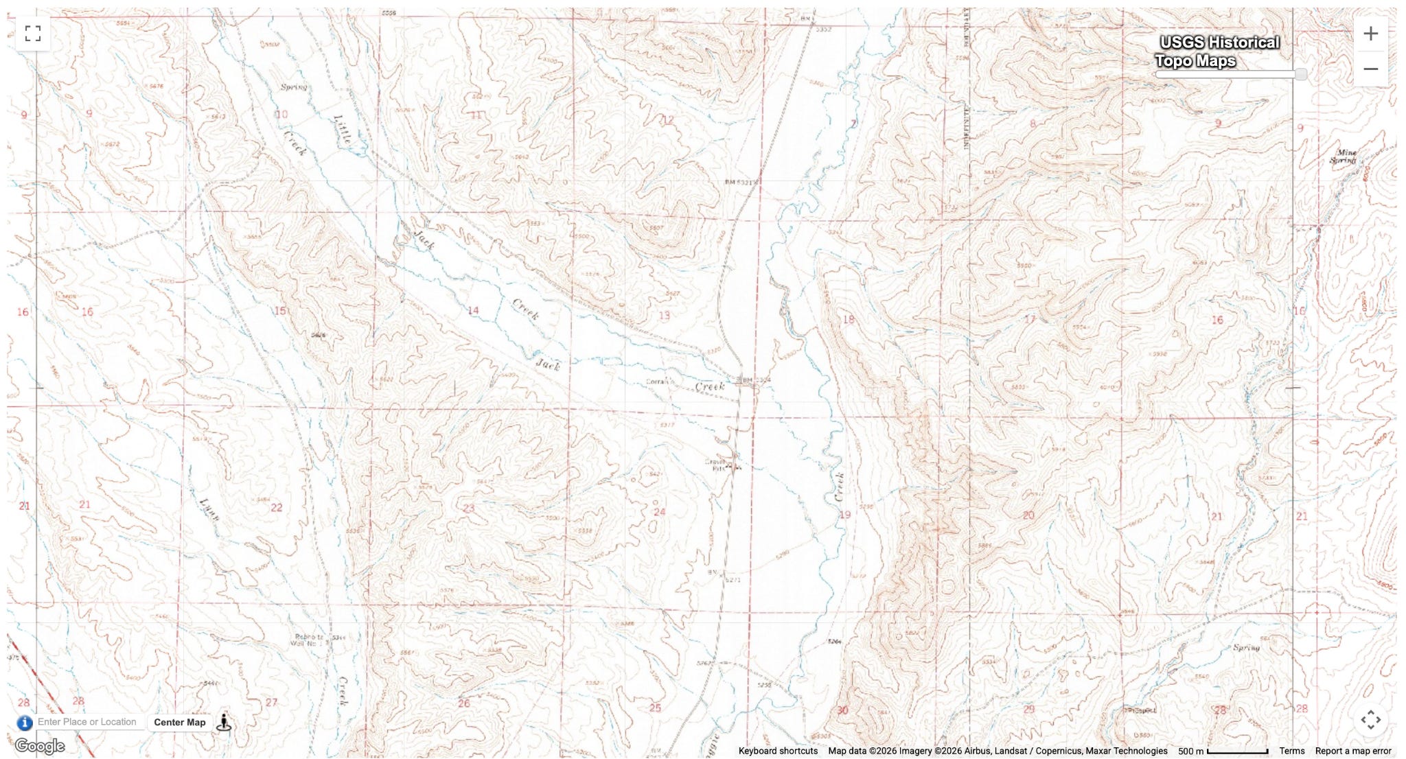
The addition of USGS Topographic Maps as a custom basemap option in the web app expands the range of contextual layers available to users.
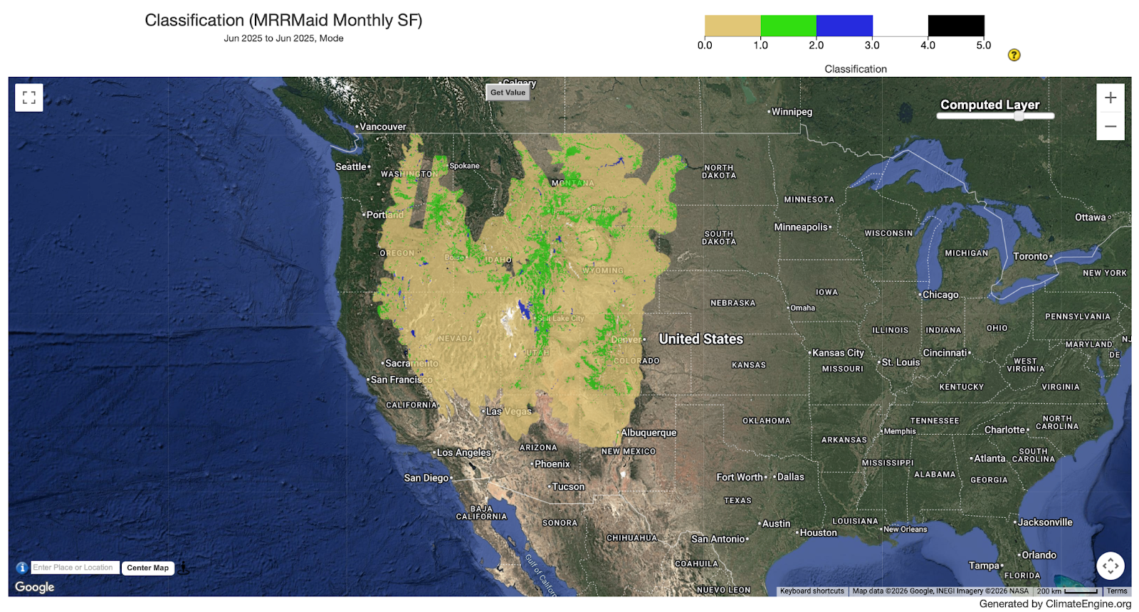
The MRRMaid Monthly Classification Dataset, developed by a Boise State University research team, has been expanded to cover the entire sagebrush biome. With this broader coverage, users can now more easily monitor water resources, identify mesic vegetation, and assess upland areas across a wider range of landscapes to support more informed land management, conservation planning, and ecological research.
The addition of POST requests as an option in the Climate Engine API allows users to submit more complex queries, particularly larger geometries that may exceed URL length limits in GET requests. With POST, request parameters are sent in the request body as a JSON payload. To send a POST request through the api.climateengine.org swagger page, users navigate to the endpoint, click Try it out, update the values in the json, click Execute.
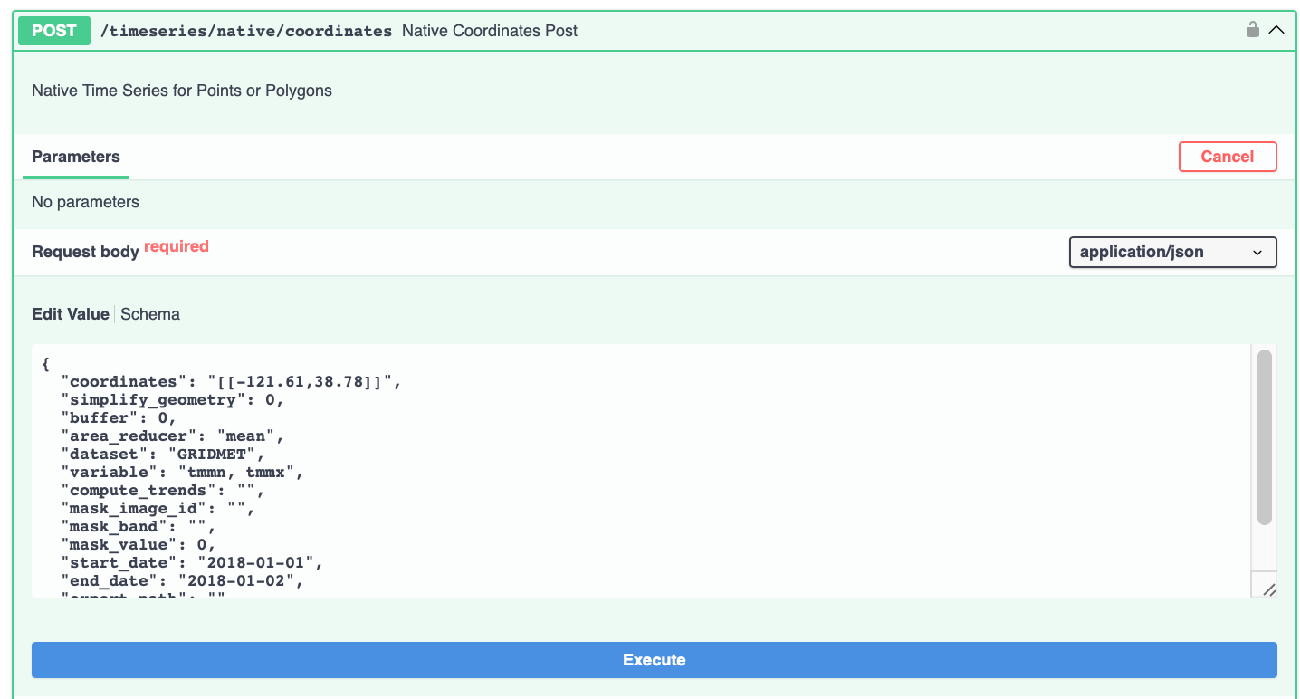
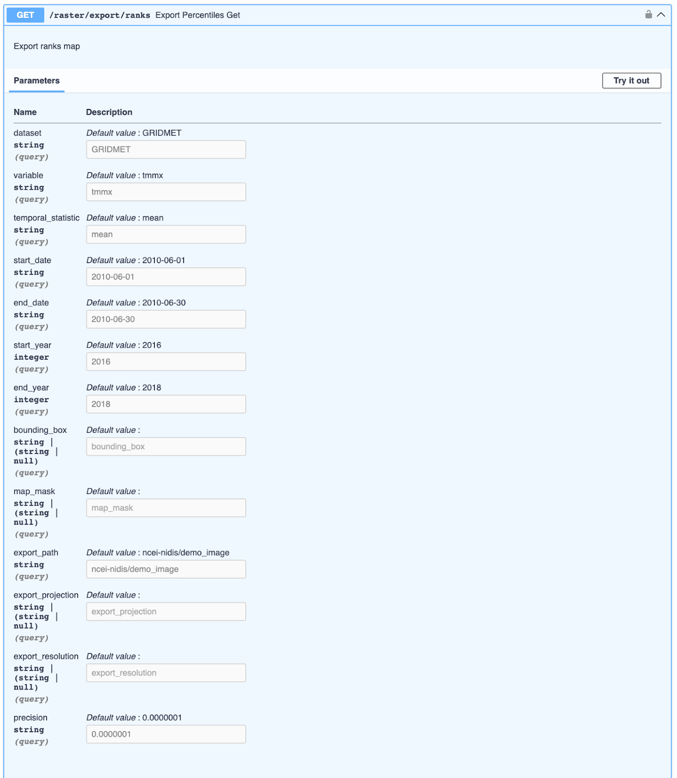
Previously, users could decide if they wanted percentiles or ranks returned from the raster/export/percentile endpoint. However, the underlying methods that were used for each calculation began to make separating the endpoints more viable. The ranks endpoint required precision as well as an updated method on how ties were handled in the ranking system. The percentile endpoint did not require precision and thus did not have ties to contend with. Due to the fundamental difference, we decided it was more simple to separate the two endpoints.
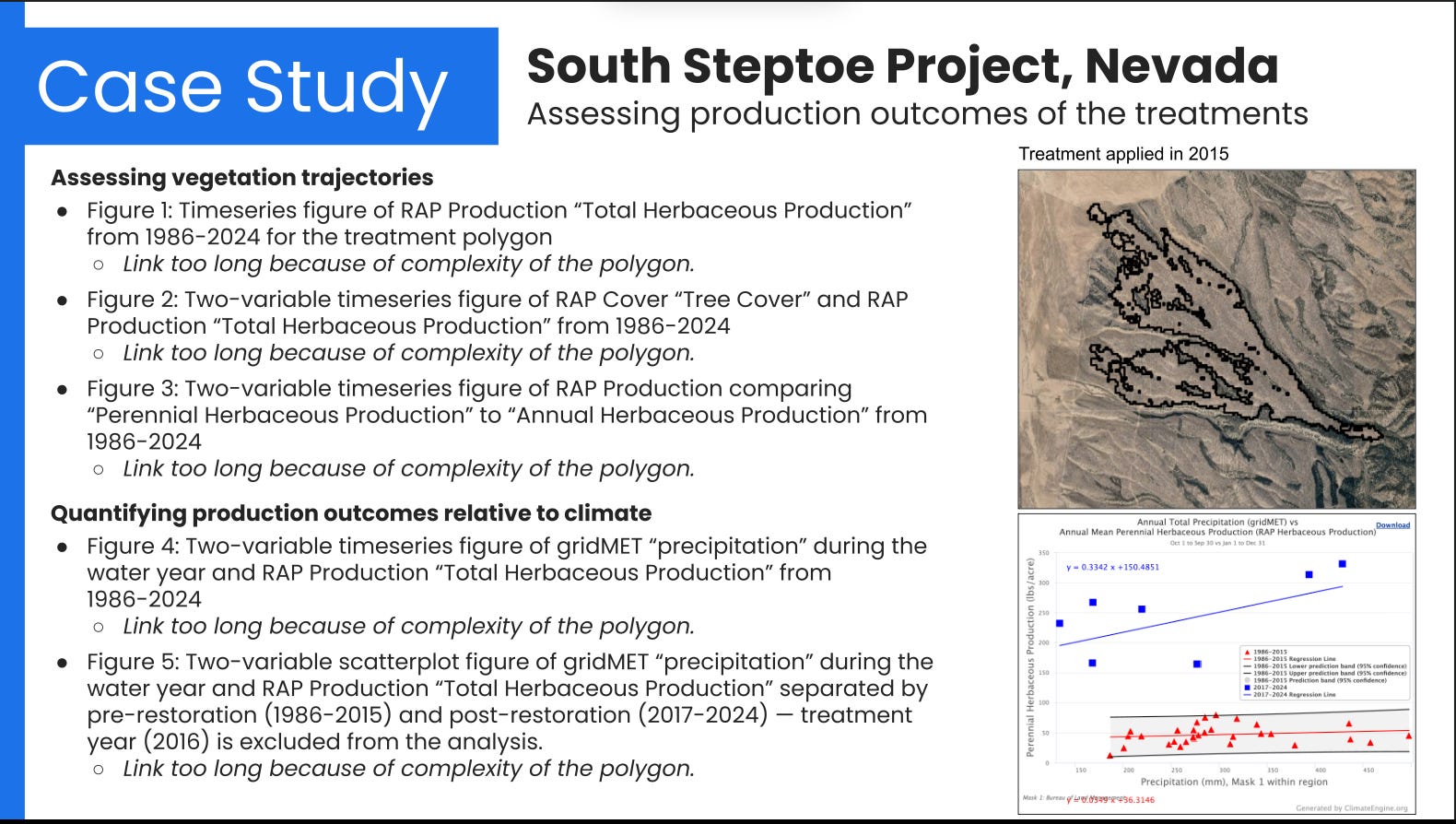
The Climate Engine team held three online workshops for the Bureau of Land Management (BLM) and partners focused on thematic areas of Riparian & Wetlands, Upland Ecosystems, and Drought & Production. The workshops were designed at the intermediate level and expanded on a previous session called Climate Engine Basics provided in June 2025, with a particular focus on uses of satellite and climate data for land health assessment, adaptive management, resource monitoring, and planning. A highlight of each session was the “BLM Practitioner Highlight,” which featured a presenter from a BLM office discussing how they have used remote sensing data to perform assessments, conduct reporting, and inform decisions. The workshop materials are now available through Youtube and on the Climate Engine website Workshop Materials section.
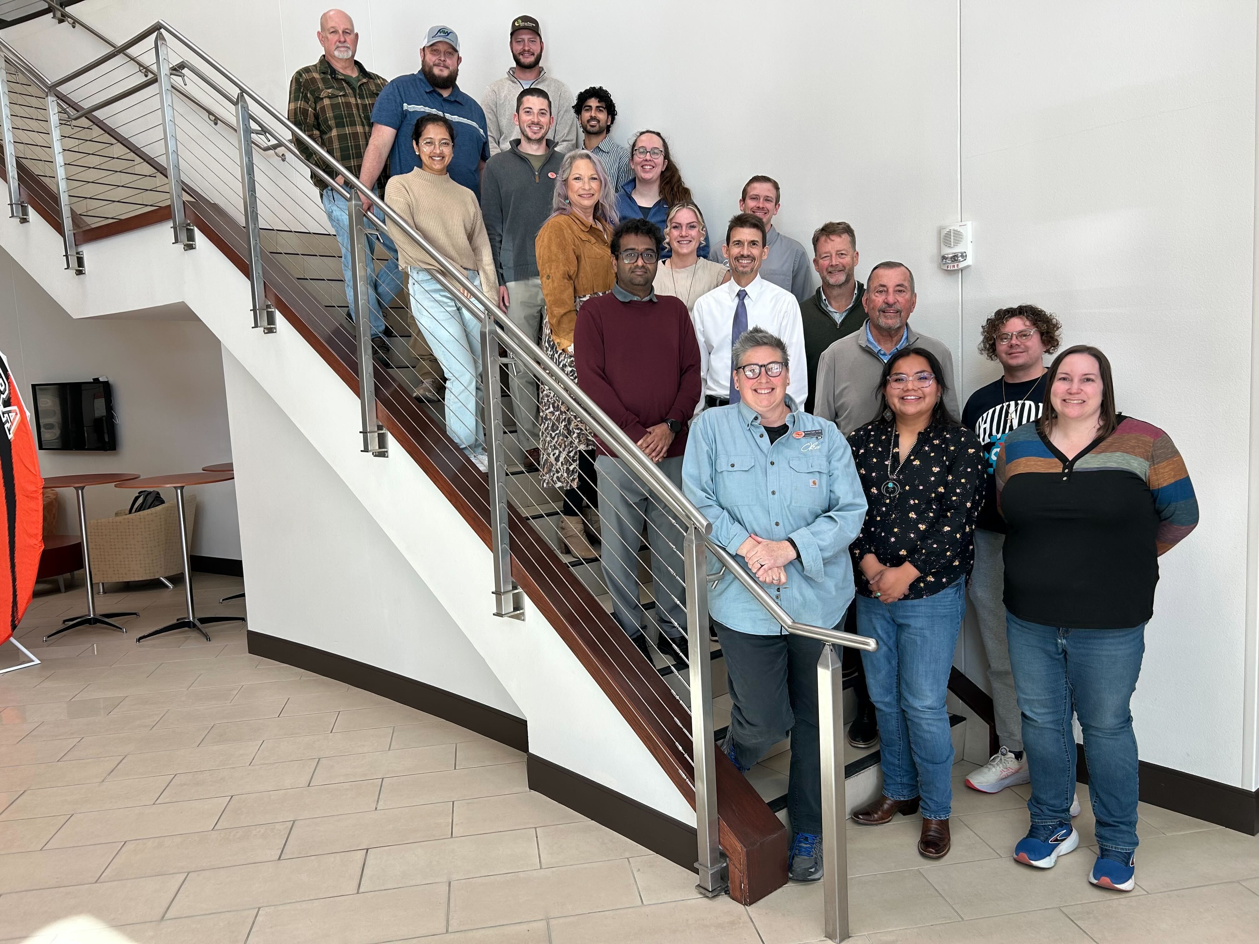
The Climate Engine team participated in a two-day kickoff meeting for a new project focused on enhancing tribal drought monitoring. The event included half-day web app and API workshops, introducing attendees to Climate Engine’s 100+ dataset catalog, mapping and graphing functionalities, and versatile endpoint collection. The project will focus on enhancing data access, delivery, and capacity building around tooling.
No posts
Comments
Nothing yet. Say the first thing.
Sign in to join the conversation.