

We have seen very heavy rainfall in chunk of the area since August 11 with 5-10” in our northeastern counties & 2-7” elsewhere. Historic rainfall & flooding occurred in east-central Indiana on Wednesday morning, August 12, 2026 with up to 12” of rainfall. Flash Flood Emergencies were up in Madison, Henry, Wayne, Union, Delaware to Fayette counties with submerged homes, whole neighborhoods & many roads closed. Some county roads were washed out. This is reminiscent of the flooding June 2008 in western to southwestern Indiana with near record flooding on the West Fork White River with other similar occurrences this time of year in 1982, 1981, 1979, 1875, 2015, 1958.
However, there was a big Flash Flood Emergency scale event that occurred in part of our forecast area way back in July 1896. The pattern was not dis-similar to what we have seen here near the mid-point of August in 2026. Hot upper ridge with endless supply of heat & instability with edge of strong mid & upper level winds atop that ridge into our area & lift via shortwaves, MCVs & boundaries of lift (from warm advection, outflow boundaries) all support the repeated rounds of severe, flooding t’storm complexes.
The pattern is quite similar to the current one:
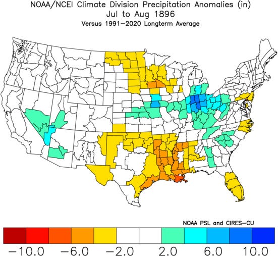
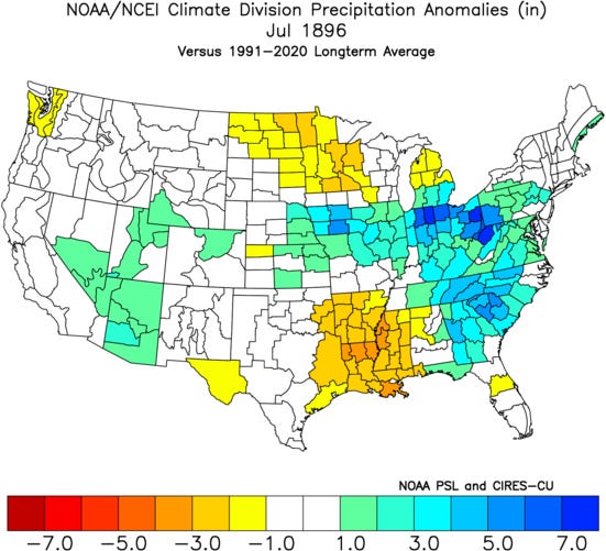
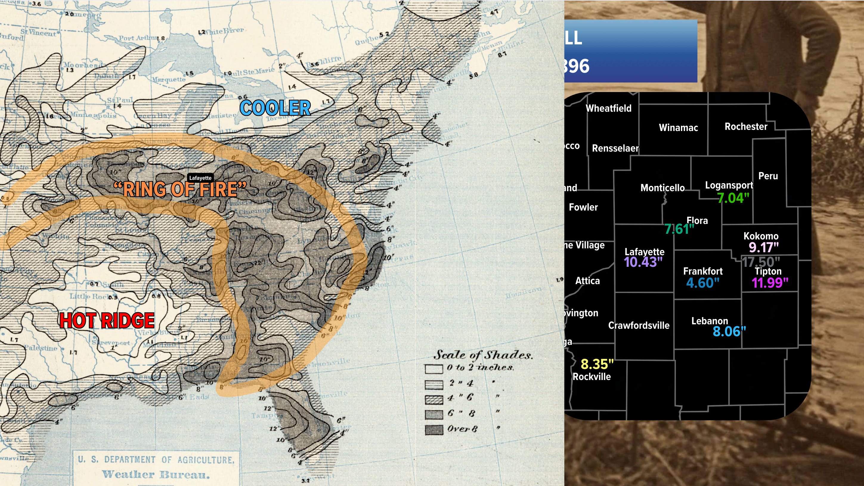
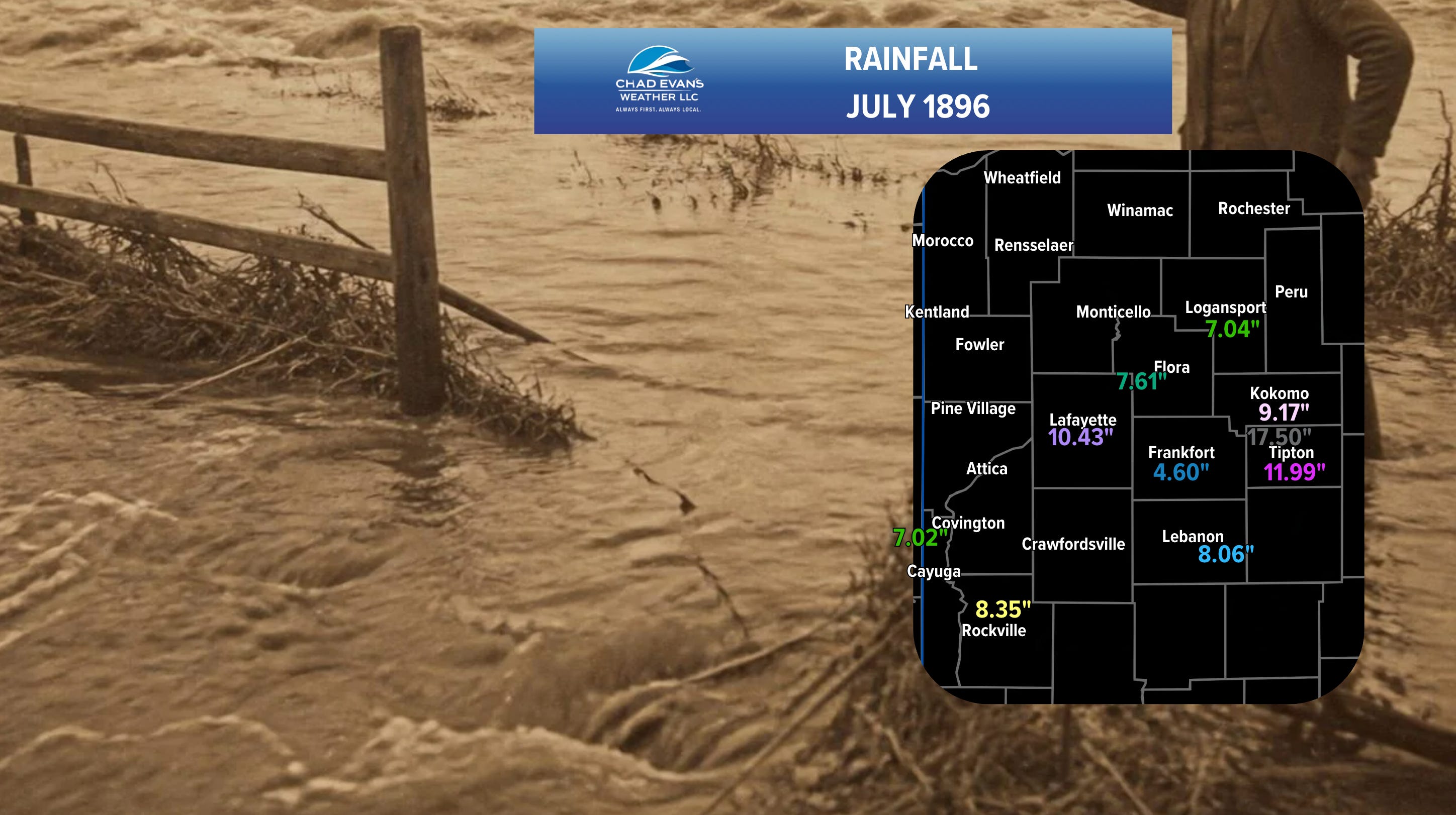
After a drier first half of July, persistent “Ring of Fire” pattern with upper ridge southwest & south of our area developed. As ridge expanded & contracted in a see-saw fashion, there was variability in temperatures of 70s to 90s with dew points to 80. This pattern finally diminished in early August 1896, but 13 days of this regime resulted in a very active weather pattern.
Should this occur today, Flash Flood Emergencies would be issued for our eastern counties.
July 1896 monthly totals:
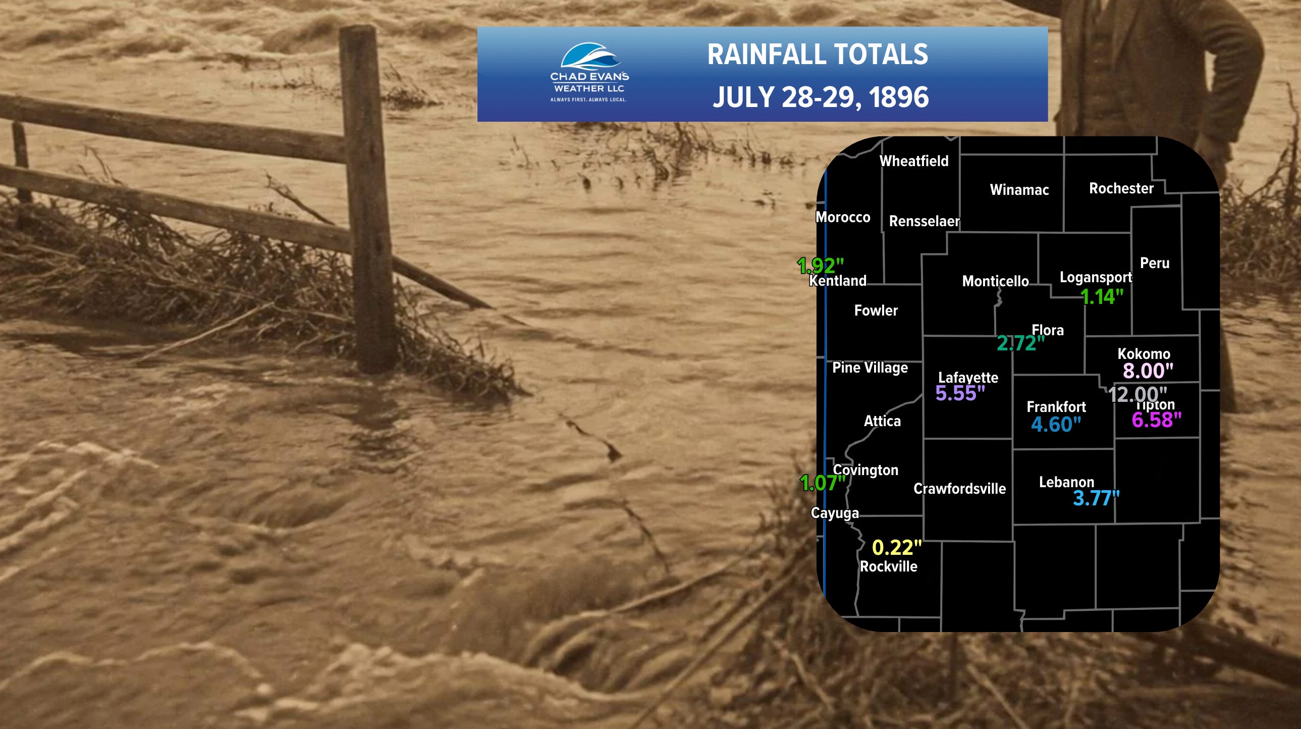
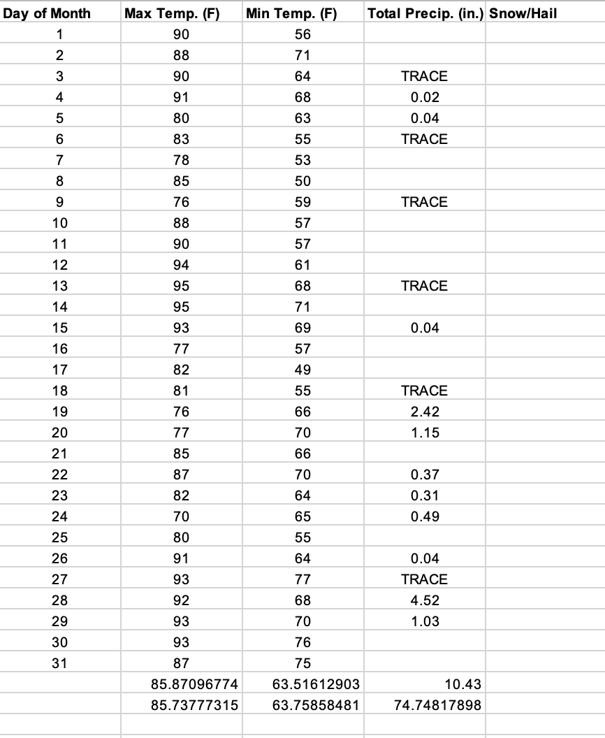
The weather records from Purdue show the extremely stormy, wet pattern peaking July 28-29.
Of important note are the reports of heat deaths & illnesses from St. Louis all the way to Indiana July 27 & 29-30 when it would seem likely that dew points were 80 or +80, leading to extremely high heat indices.
Purdue University observations for July 1896:
This peak in the rainfall & storminess amidst the active pattern made for much comment in the press. Not only did up to 12” of rain occur in Tipton, Howard & northwestern Hamilton counties on July 28-29, but 3-8” occur Clinton to Tippecanoe counties & 1-3” elsewhere (per reports found).
Many roads & parts of railroads were washed out, especially in that Tipton, Howard area. Crops were washed away & considerable creek flooding occurred. Many cornfields were flattened by the rain & wind. Parts of railroads were washed out as far west at Tippecanoe County with 1/2 mile of railroad track & embankment completely washed away between Mulberry & Dayton. Other large sections of track were swept away in eastern Clinton to Tipton & Howard counties. In Tippecanoe County, the Wea & Wildcat Creek flooded extensively.
Amidst this pattern, a tornado, up to a 1/2 mile wide tracked at least 15 miles through Huntington County, northeast of our area on July 29. Other areas of wind damage occurred at intervals July 22 & July 26-29 in the forecast area.
Comments
Nothing yet. Say the first thing.
Sign in to join the conversation.