
Based on urgency, this is the first in the “Vancouver’s plan to die” series of posts around the 22 issues degrading Vancouver. I started writing about view protection in March 2021—almost 5 years ago. And yet here we are.
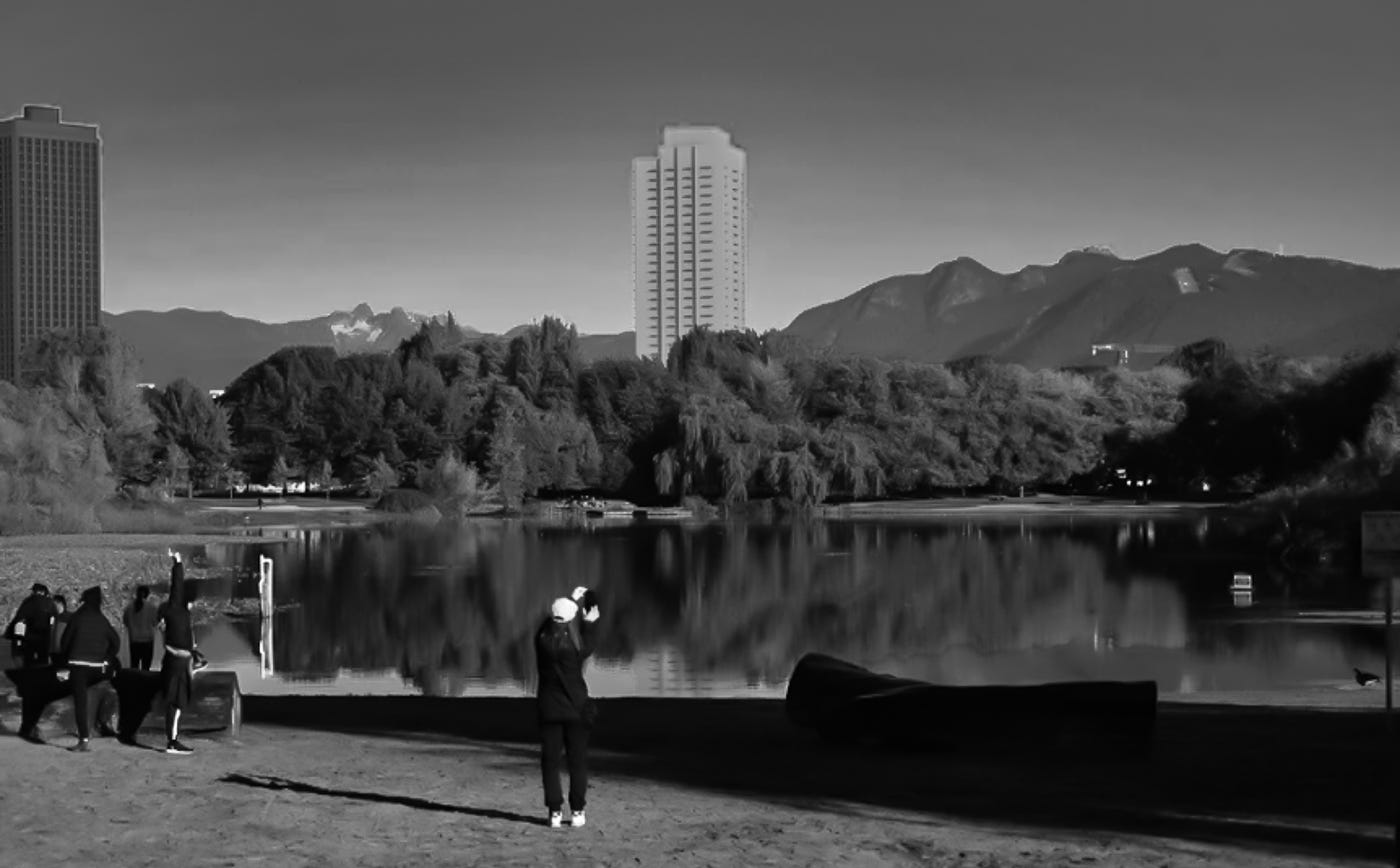
Above: Rezoning application at 1926-1978 East Broadway shown as a massing model (tower in centre). This is in the currently-protected view from Trout Lake that staff are looking to amend. One of the Safeway towers at 1780 East Broadway can be seen at the left (this project is located just outside the extent of the current view cone; the tower at the left of this image is the easternmost tower). Massing model and photo description by CityHallWatch, who are currently working on the modelling of another tower proposal that will block yet more of this view.
CityHallWatch has done an exhaustive job of analyzing all of the problems with this proposal in relation to the city’s existing view cones—please read it. The development proposal may be referred to public hearing as early as February 4th.
For me the lead illustration above, created by Stephen Bohus because the city won’t1, says all that needs saying. Without public consultation City staff are proposing to alter the already altered view cones from Trout Lake to allow this building. And it’s not the only proposed/approved interlopers:
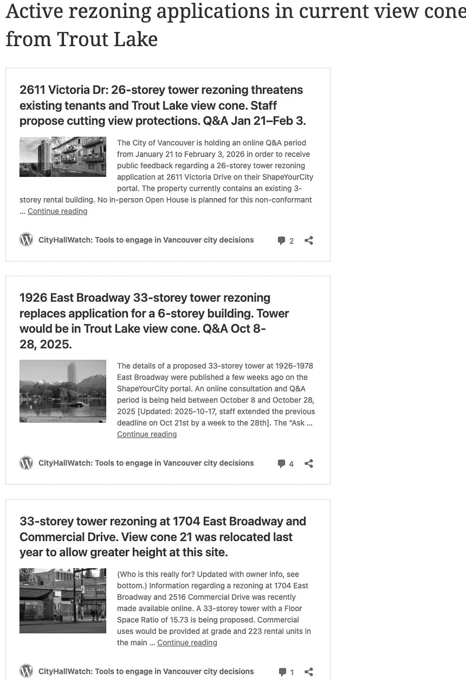
My question is simple: when will this stop? When there are no views left from Trout Lake seems the obvious answer. It appears every time a proposed high-rise rezoning is brought forward, city staff simply alter protected views. They’ve done it in the past so we know what to expect.
What’s just as interesting for me is that a mid-rise proposal for the same site was brought forward by the applicant—they would not have done so if the proposal did not work financially—I’ll leave you to draw your own conclusions.
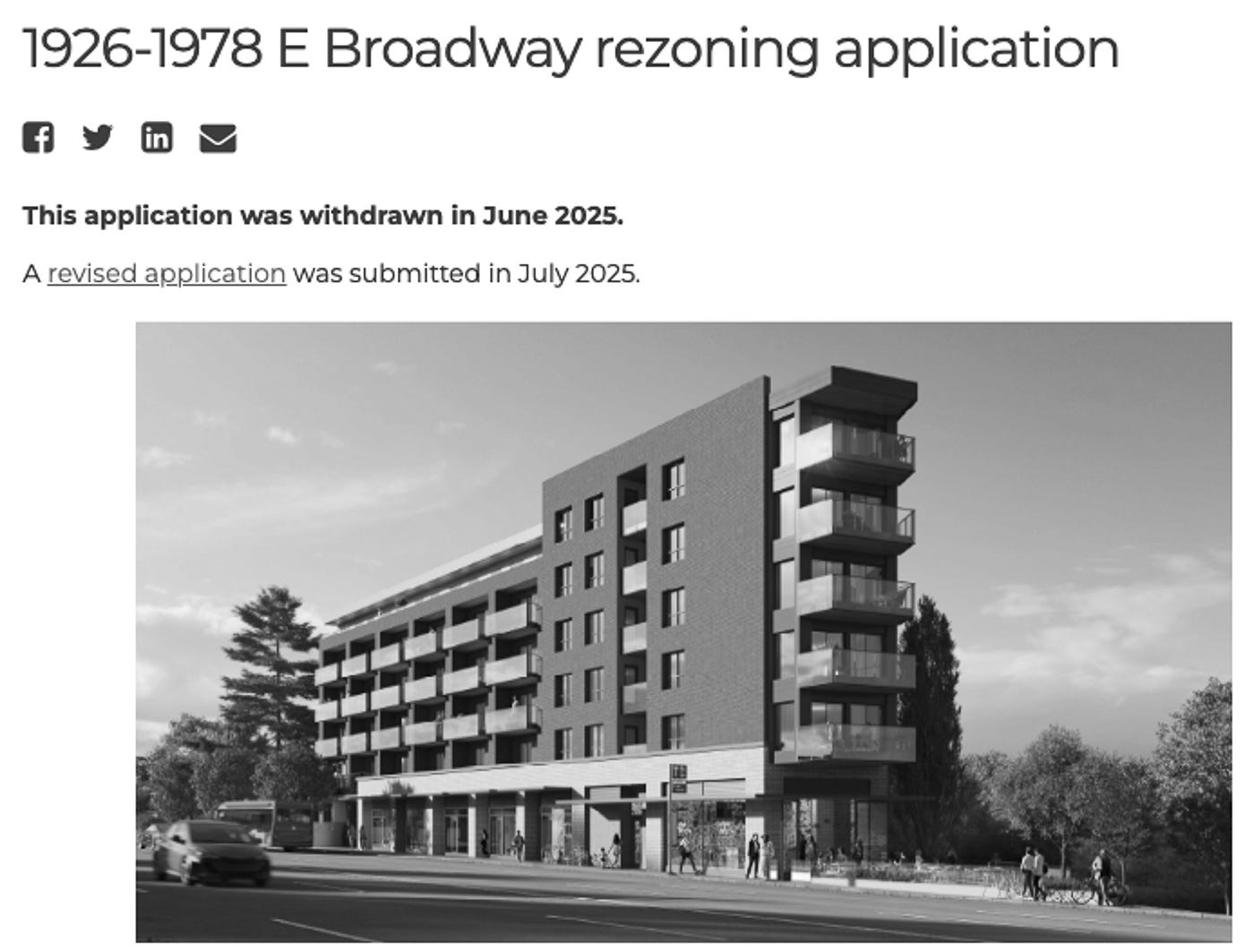
Shape Your City photo of original proposal
A final issue for me with this application comes from the application itself. There are no graphics in the proposal that even admit that there are mountains somewhere in the background—out of sight, out of mind:
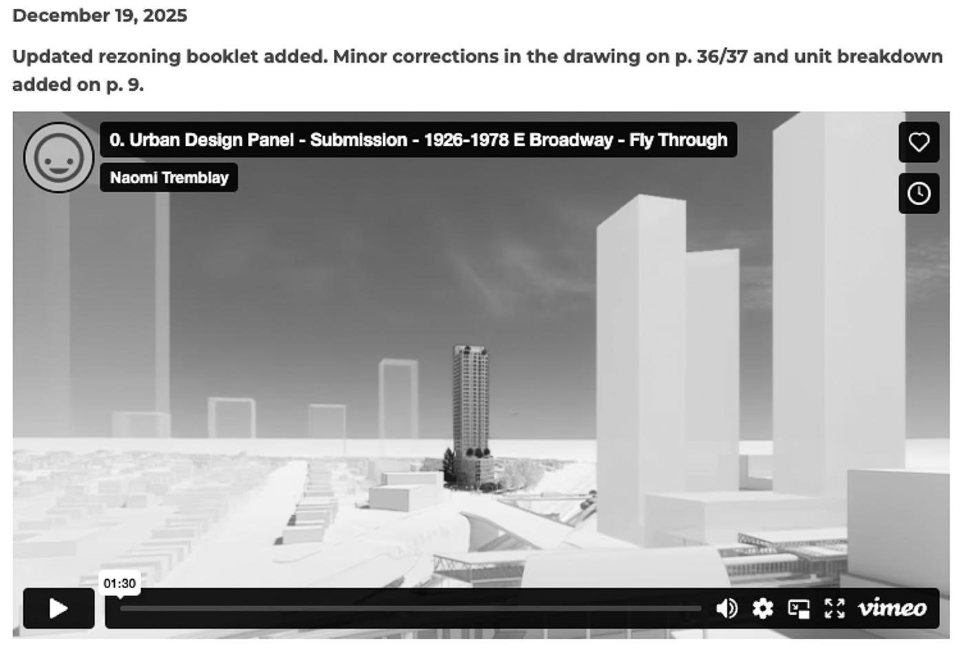
I’m not sure what the ghost buildings are to the right and left of the proposal, but the background sure looks like the prairies.
Why View Cones Anyway?
In 1988, during the planning process for False Creek North, a.k.a. the Expos Lands, city planning staff were concerned that potential development might forever obscure views to the mountains behind the city from False Creek South and elsewhere in the city. Following public consultation and much staff work, a set of view cones was developed by staff and approved by Council. Lest you think these prevent development, I can verify as Managing Architect for the False Creek North Official Development Plan (FCNODP) that every one of the 50 towers in the initially approved FCNODP fit within these view cones. And last I heard those developers did just fine.
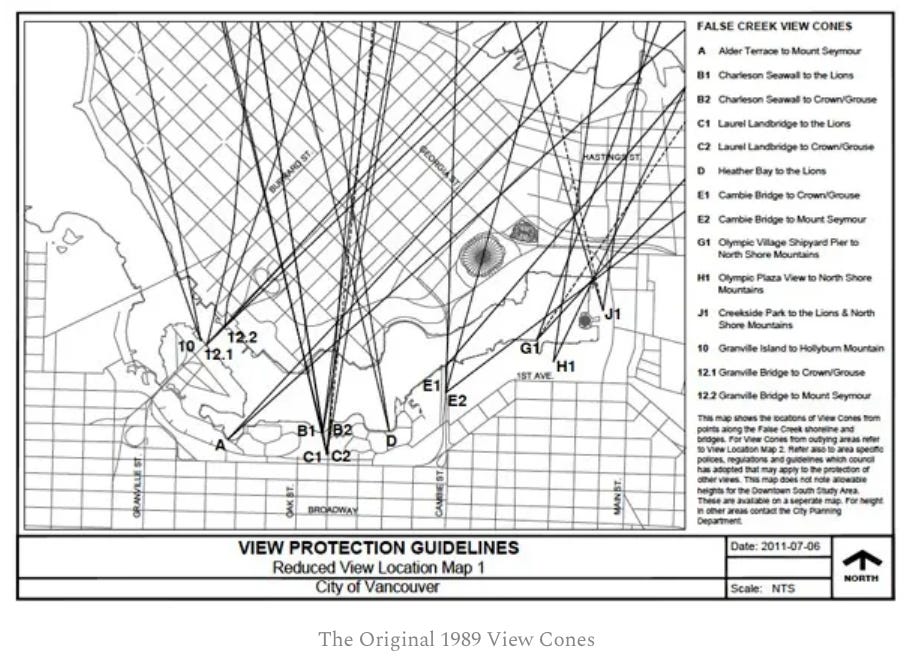
Perhaps anticipating future development, an additional view cone protecting views from Trout Lake was approved at about the same time. That’s the one city staff want to amend to permit the tower (and others) in the illustration at the top.
Some folks have argued from the beginning that the view cones are arbitrary—I agree. Many are taken from spots along the False Creek South waterfront walkway—one is even from Vancouver city hall. Choklit Park has a protected view. Granville Island has one. The Granville and Cambie Bridges have protected views as pedestrians walk over them. But together with other planning policies, these have preserved many mountain views for citizens as they move through the city, for almost 50 years. Until recently they were sacrosanct.
But for the past few years they have been under attack by many development proponents, including several Broadway Plan proposals, the northeast end of False Creek North and several single building proposals in the downtown area and West End. Why not ask to block, seeing as city staff so easily sets the view cones aside and City Council approves whatever specious logic staff use to whittle away at the public realm?
What to do? Act before February 4th.
If you want to see at least glimpses of the mountains from any of the places you thought were protected—major streets and bridges, waterfront walkways, beaches, etc., you need to rise up to stop this insanity. For the 1926-1978 East Broadway application, which is the most urgent we are aware of, send a handwritten letter or email to each Councillor and the Mayor to arrive before February 4th—copy/paste is fine. Avoid city staff’s Shape Your City— they will aggregate comments into anonymous notes like “several respondents were concerned about view loss; others felt it was justified to create more housing.” Remember, these are the folks who change the rules for the public whenever asked by a private developer.
If view protection is important to you, and this being a municipal election year, ask every candidate of every party: “Are you in favour of protecting existing public views —yes or no?” Then vote accordingly.
Photographic Coda
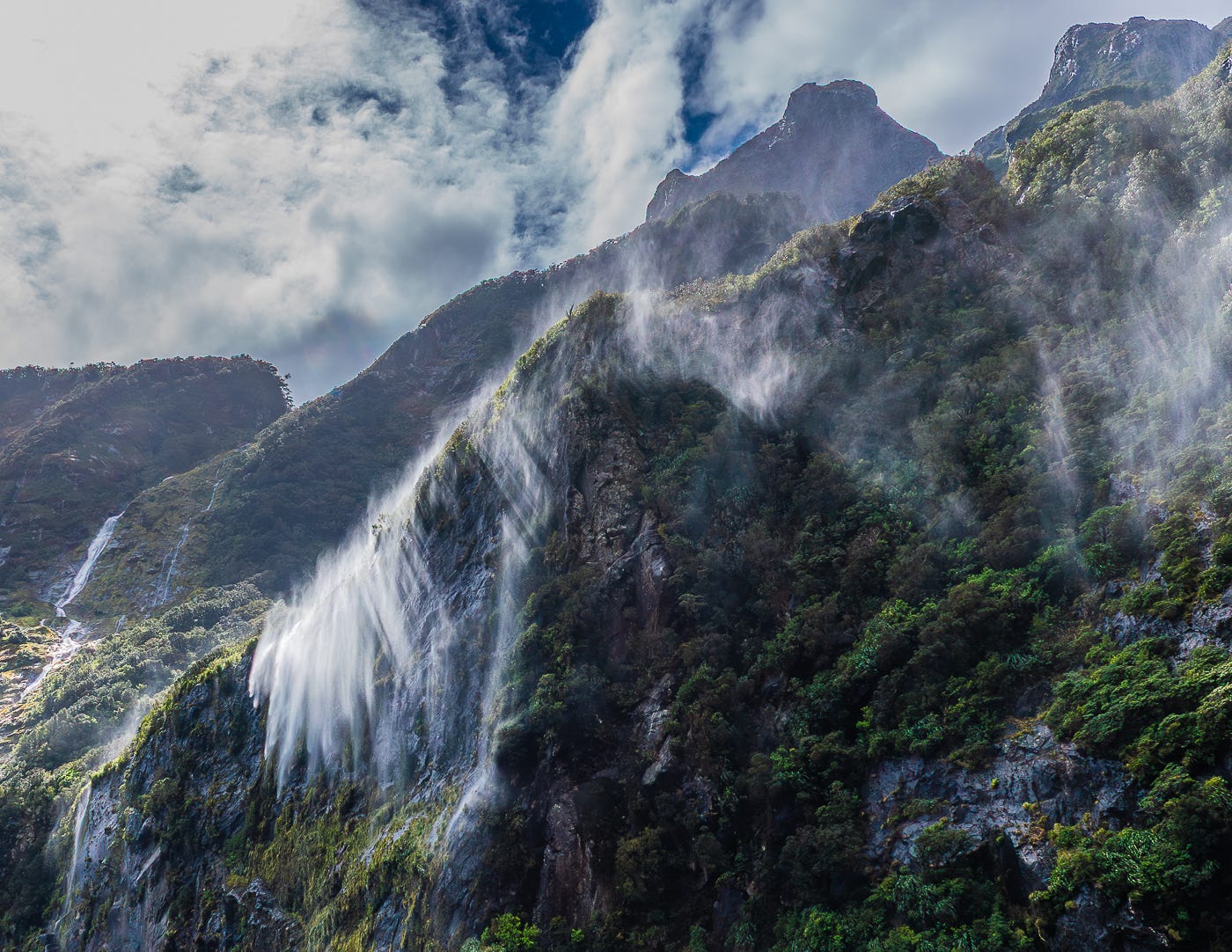
Disappearing Falls, Milford Sound, New Zealand
This post is just over 800 words not including footnotes, somewhat more than the 3-5 minutes citizens are allowed when they speak to the current Vancouver City Council, in their efforts to suppress democracy. If you appreciated this post, please share to your social media and consider becoming a free subscriber to City Conversations at
Brian Palmquist writes in the ancestral lands of the Musqueam people. He is a Vancouver-based architect, building envelope and building code consultant and LEED Accredited Professional (the first green building system). He is semi-retired, still teaching, writing and consulting a bit, but not beholden to any client or city hall. City Conversations mix real discussion with research and observations based on a 50-year career including the planning, design and construction of almost every type and scale of project. He is the author of the Amazon best seller and AIBC Construction Administration course text, “An Architect’s Guide to Construction.” A glutton for punishment, he is threatening to write a book about how we can Embrace, Enhance and Evolve the places where we love to live. Some of its content may appear above.
Toronto and Calgary have computer models of all existing and proposed development in their city limits, which models they maintain and make freely available to citizens. Vancouver does not.
Comments
Nothing yet. Say the first thing.
Sign in to join the conversation.