
My posts are usually focused on cataloguing the challenges of navigating the world without a car. Naturally, these articles tend to be negative. They highlight what’s broken. Today, let’s try something different: I will share some routes that I am really looking forward to!
For me a route that I am likely to use connects multiple destinations. It might have some natural beauty but more importantly, it has well-protected infrastructure. What better way to get to your local grocery store if not on two wheels through the local park, fresh air in your hair and with no risk of a crash?
In this blog, I’ll cover four projects at various stages of construction that are slowly filling out a map of connected trails throughout the Bay and the state of California.
Napa Valley is one of those quintessential “world-famous” regions that you don’t realize is so close by. Known for the vineyards, you could imagine having a French, “Vineyards By Bike”, experience riding through the various farms sipping wine (or in my case, grape juice).
This is exactly the goal of the Napa Valley Vine Trail. The trail will start at the Ferry Terminal in Vallejo and continue north 47 miles deep into the Valley ending in Calistoga. The trail should serve both recreational and utilitarian purposes as it passes through Vineyards in addition to key city destinations, like markets and high schools. It will make taking a trip from SF via the ferry for a bike ride in the Vineyards more seamless.
Like most other trails on this list, it is being built in segments. Two segments, St Helena to Calistoga and Napa to Yountville, are already open, a the most recent section from the Vallejo Ferry Terminal to the Newell Open Space opened in March 2025 which makes the trail now reachable via an easy Ferry ride from San Francisco.
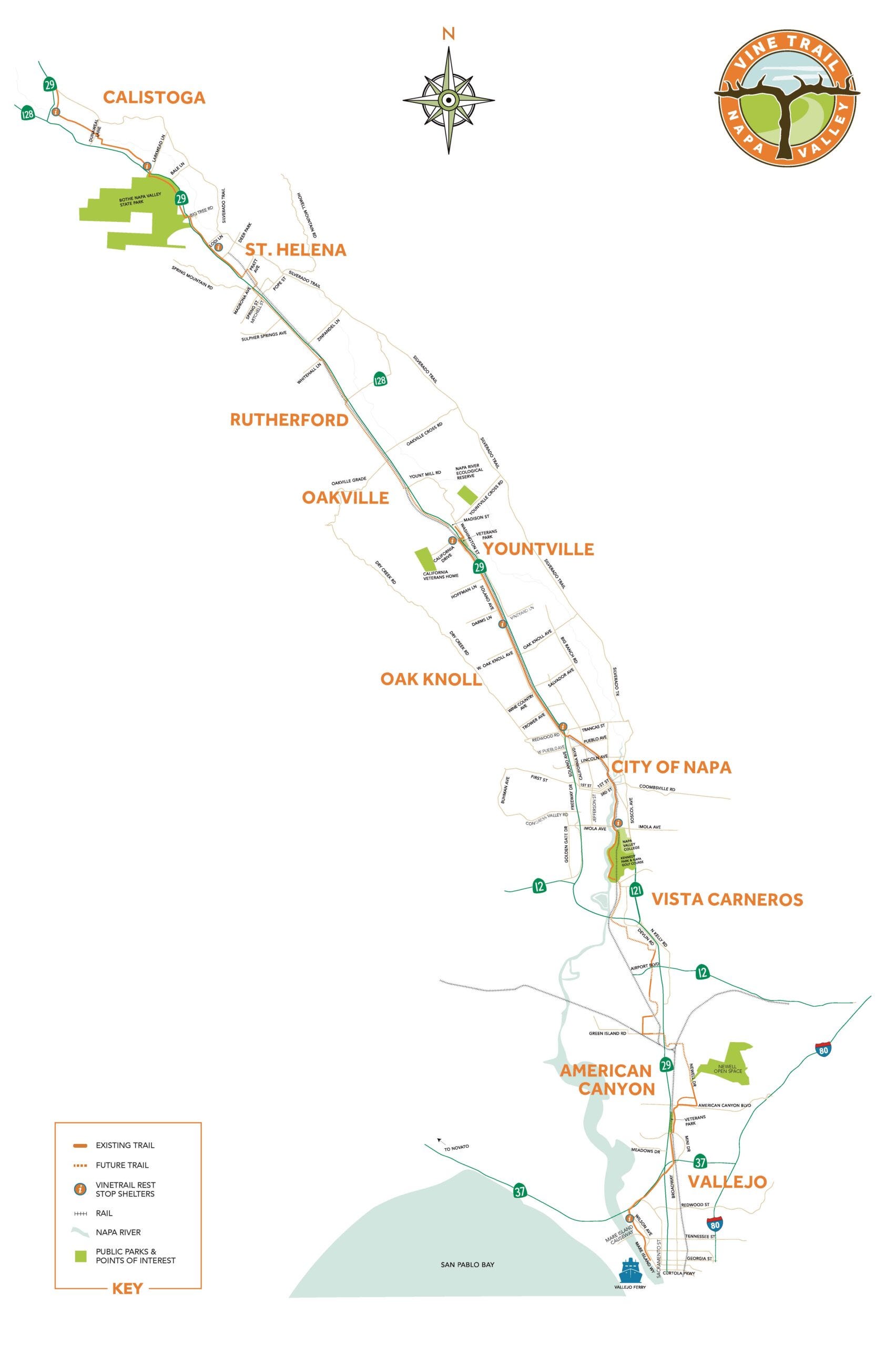
Despite being incomplete, the disconnected segments of the trail already provide lots of opportunities for recreation and mobility in the area. For example, high schools are now connected to a protected bike path through the neighborhood. Tourists can now visit many destinations within the City of Napa by parking near the trail and then going onwards to a vineyard all by bike. Similarly, a weekend getaway trip to the Bothe-Napa Valley State Park for camping and hiking can be paired with biking to nearby cities of Calistoga or St. Helena for lunch.
The trail is already having success. Recently it was noted as one of the top places to visit in California by the SF Chronicle and guided bike tours and rental services already available. I plan to ride it sometime in the next few months!
I first heard about the Santa Cruz Rail Trail from the KSQD podcast, The TRUE story of Santa Cruz Rail & Trail. This trail will convert a disused rail right-of-way from Davenport to Watsonville, threading through the heart of Santa Cruz.
“Rail to Trails” are active mobility routes that are built on abandoned train tracks. These are usually successful because they convert a disused space that usually goes through key destinations into a mobility corridor. The Santa Cruz Rail Trail is particularly interesting because they are preserving the old right-of-way for a future rapid transit system while building the trail today. This is wonderful foresight but it comes with its own drama!
While the trail itself is uncontroversial, the real drama focuses on whether space along the trail should also be preserved for a future rapid transit system. Some argue that the transit system would not actually solve congestion, while simultaneously supporting a new million-dollar expansion of Highway 1, that definitely won’t solve congestion by giving people an alternative to driving.
It will be interesting to see how the debate evolves. I would love to see rapid transit within Santa Cruz. If completed, it would fit into a grand plan for more rail in California. In the year 2050, I could catch Amtrak or Caltrain all the way to Watsonville/Pajaro and transfer to the Santa Cruz rapid transit system to enjoy time on the boardwalk or downtown Santa Cruz.
The future rail and trail share a common corridor going right through the heart of Santa Cruz, connecting the Oceanfront, far flung beaches, residences, schools, businesses and parks as well as the Santa Cruz Riverwalk. This puts 135,000 people within 1 mile of a high quality protected network!
Three out of 20 segments of the trail are already built with the most recent, Segment 7, opening in 2025 right at the Santa Cruz Wharf. In 2026, the 7.5 mile Segment 5 (North Coast Rail Trail) will open further creating a continuous path from Davenport beach all the way to the Santa Cruz Wharf. I can’t wait to try it out!
While the Santa Cruz County Rail Trail connects a single County, our next route is a 50+ mile dream crossing THREE counties and connects two major cities of the Bay Area and every suburb in between. Yes, I’m talking about the plan to add protected bike lanes all along El Camino Real, the only uninterrupted (non-freeway) road between San Francisco and San Jose.
A historic thoroughfare, El Camino Real was once a highway that spanned California. Today, this street passes near or through many of the downtowns of Peninsula suburbs and already hosts many homes and businesses. Going forward it is slated for more housing and densification and will require mobility upgrades sooner rather than later.
Silicon Valley Bicycle Coalition’s El Camino for All is a campaign to get momentum on this vision. Both SamTrans and VTA are also actively working on plans and various projects to get this done (Grand Boulevard Initiative , “Central Bikeway” , Bike Superhighway initiative) .
The first protected section has finally opened connecting Palo Alto and Mountain View with a (mostly) protected bike way. This sets the scene of what can come and sets the bar so cities can’t chicken out and it shows: Several new sections are actively and enthusiastically being discussed in various cities along the peninsula. For example, South San Francisco is actively working on their plan and even the infamously dark stretch of ECR in Atherton is considering two designs with protected bike ways.
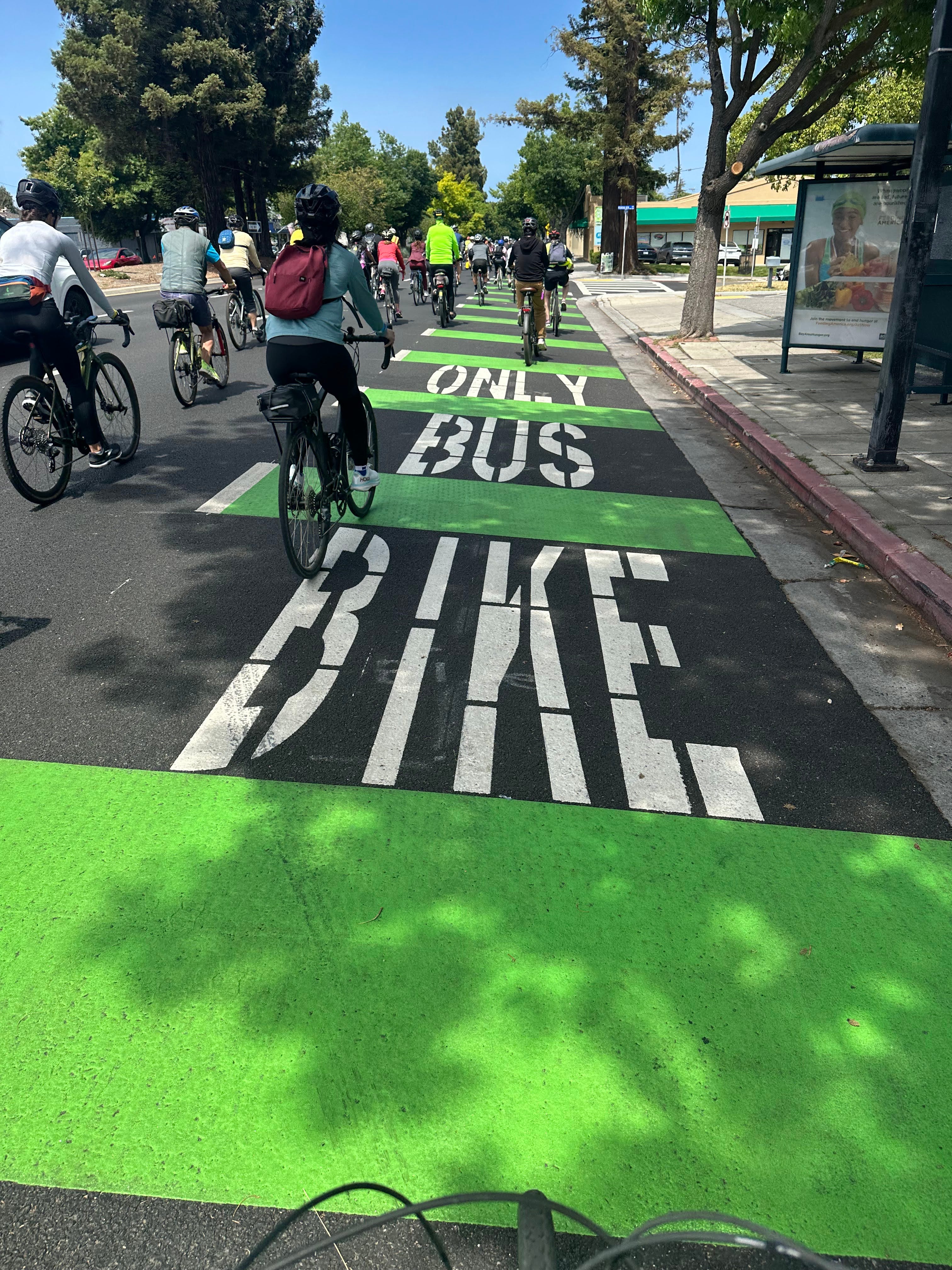
I covered the section between Palo Alto and Mountain View on this blog and it opens up the ability to ride to a whole bunch of local businesses on that street and between the cities. However, it is paramount to keep the momentum going. There are tons of nice shops (and ironically the American Automobile Association) in Menlo Park that I would love to access that are literally 10 min bike from my house!
The scale and ambitions of the trails we’ve discussed so far have been growing, but none compare with 1,200-mile California Coastal Trail that stretches from Oregon to Mexico. The slow goal is to create continuous high-quality non-motorized trail along the California coast to encourage mobility, recreation and conservation of the coast.
Several sections are slated to be high-quality protected trails, making it theoretically possible to bike all the way from San Francisco to Los Angeles.
The idea was born from conservation attempts to protect coastal access for all Californians from several development-driven projects in the 1960s. Activism eventually led to the passage of the 1972 California Proposition 20 which established the California Coastal Commission tasked with protecting the coastline from industrialization and urbanization and mandating the creation of the trail. In 2003, it was estimated that another 548 miles of trail were needed to complete the whole project: it will probably be completed after my time on earth runs out.
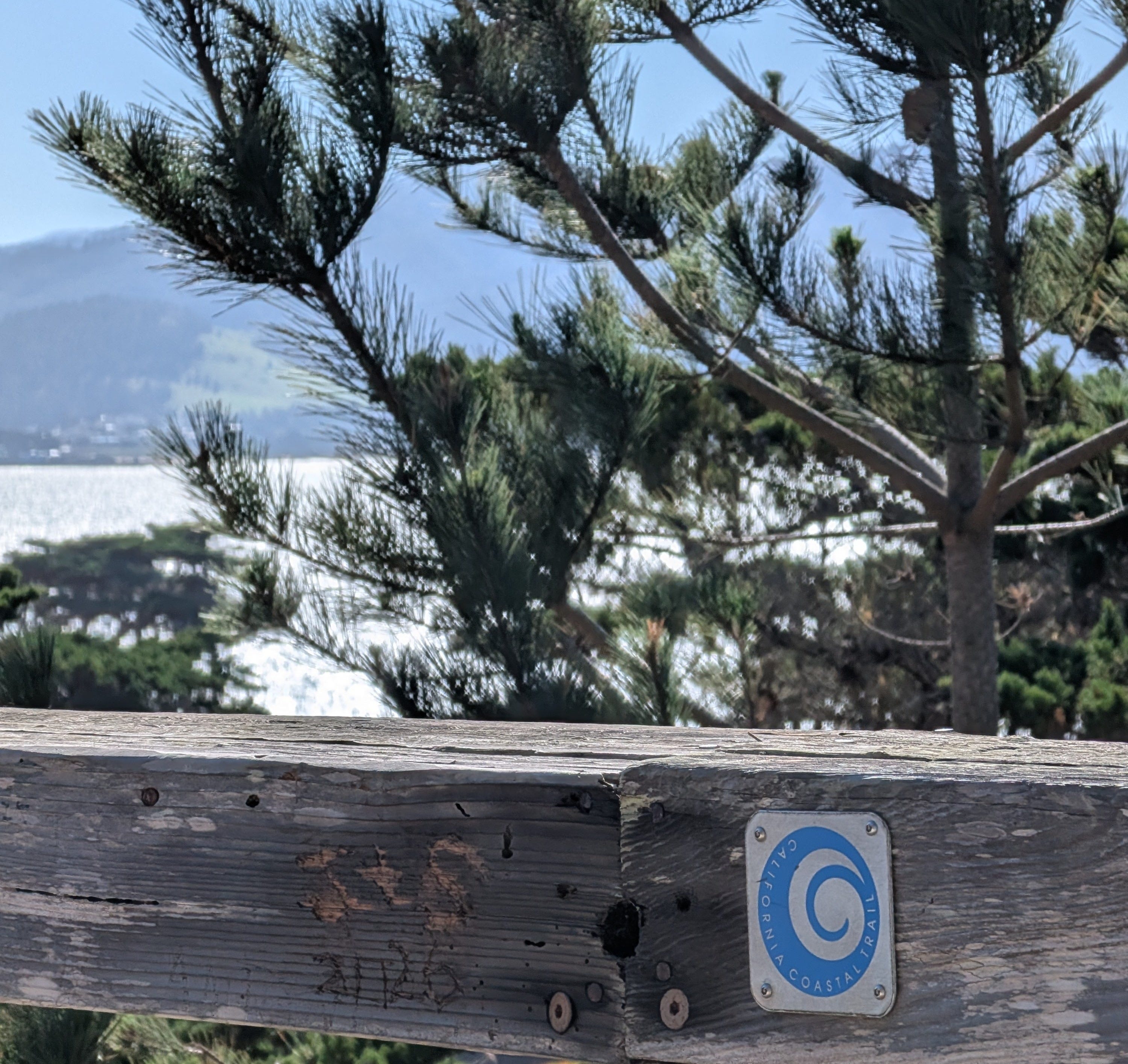
Some sections are already christened to be part of this trail in HMB/ El Granada, Monterey and Santa Cruz. Look for the iconic blue insignia! However, significant challenges exist including property acquisition and public dedication disputes before it will get finished.
When this trail is completed, it would totally unlock multi-day bike packing adventures for a wider audience (including me) who are not comfortable riding along Highway 1 increasing access to what I have heard is a beautiful ride.
The projects outlined in this post aren’t just individual trails, they are pieces of something bigger: a network! There are several projects that I did not mention, like the long overdue Bay Skyway, which puts a bike path on the western span of the Bay Bridge. All these plans and visions are evidence that the region is becoming a more attractive and livable place:
Want to take a school field trip from Napa to SF MOMA via the Ferry? No problem.
Want to walk from San Francisco to Oakland? Be my guest.
Spend a day at the Santa Cruz Wharf? Absolutely.
Run errands on ECR without fearing for your life? Soon!
Many of these routes have been in the making for decades. They will get delayed and defunded when budgets get tight or debated in city council for years. Progress is slow, but the trails will eventually be complete.
Until then, even the disconnected sections will already have value for us. This year, I’ll get to go to the grocery store more safely on ECR, and I’ll get to ride all the way to Davenport beach from the Santa Cruz Wharf and ride deep into Napa Valley — none of this was possible even just two years ago.
No posts
Comments
Nothing yet. Say the first thing.
Sign in to join the conversation.