
Good evening, all — getting back into things after a couple of days off, and wanted to get out a quick weather update.
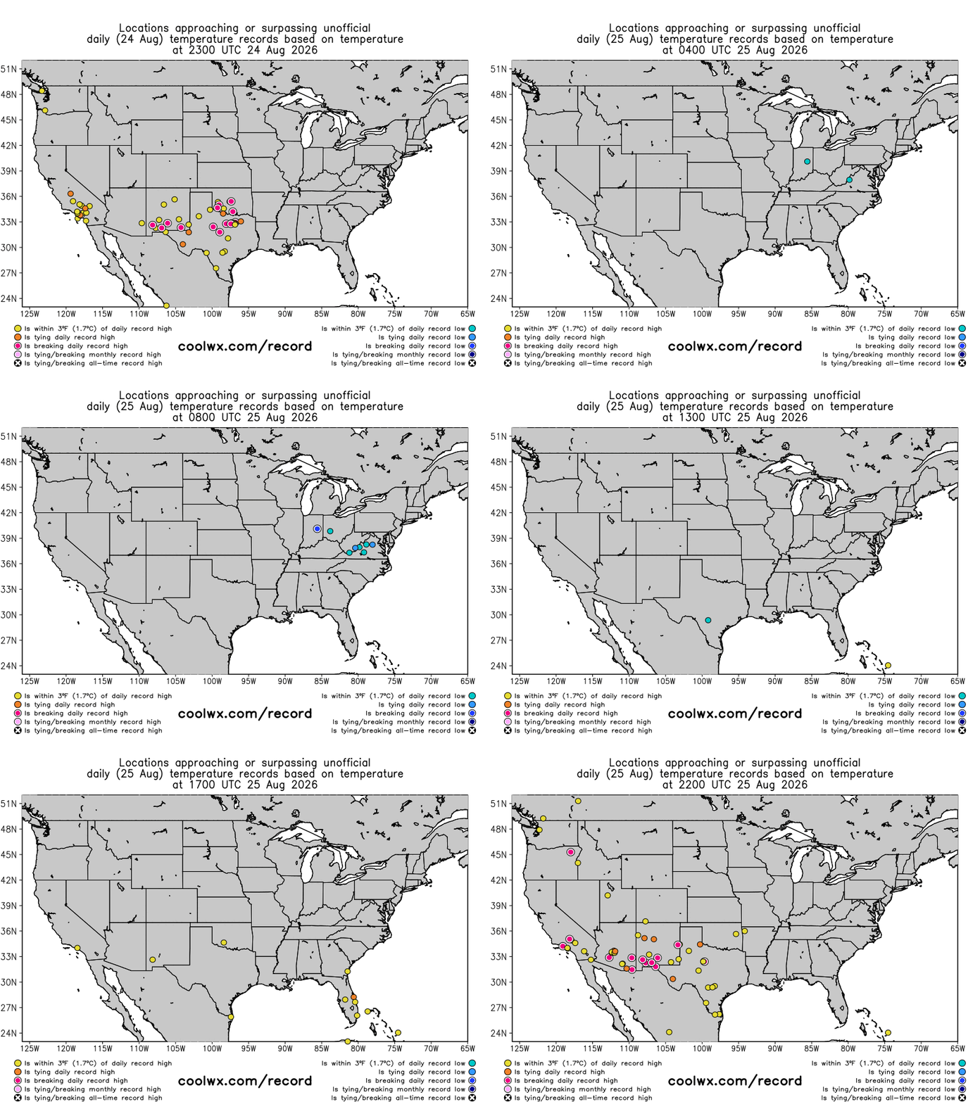
Unusually hot temperatures continue to dominate the south-central and southwestern United States, with a number of record high temperatures set again today (note though that a couple of record lows were set in the Mid-Atlantic as cool and dry air settled into this region).
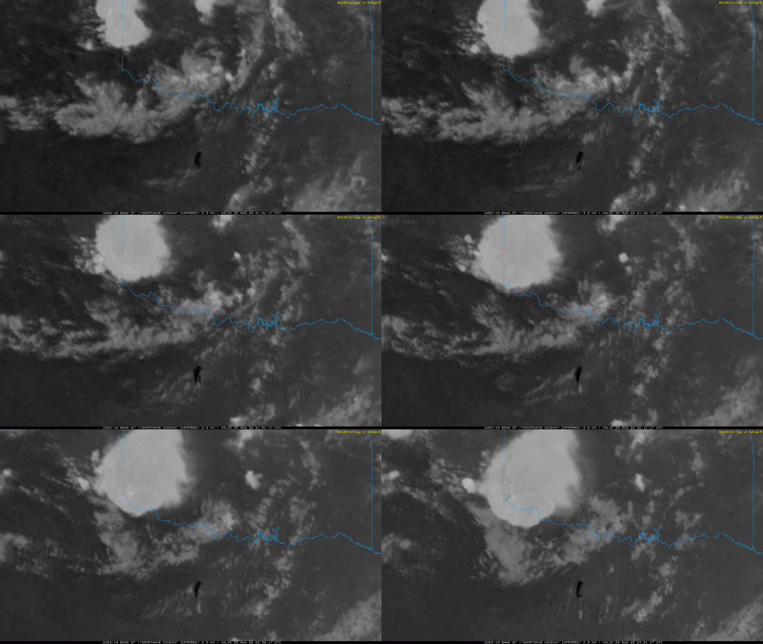
Weeks of unusually hot and dry conditions across the Southern Plains has been leading to increasing issues with wildfires, including the huge Ross Fire in Palo Pinto and Jack counties in north Texas. The fire quickly grew to more than 50,000 acres in the last 24 hours and is clearly visible in the shortwave infrared satellite loop above as the large, dark area south of the Red River. The fire forced numerous evacuations overnight last night.
Also visible in the satellite animation are thunderstorms across the Texas Panhandle and western Oklahoma. These storms are being triggered by a weak cold front moving into the region which will bring a bit of a reprieve to the record heat in the region, but the storms will also bring some severe weather — particularly damaging straight line winds — this evening.
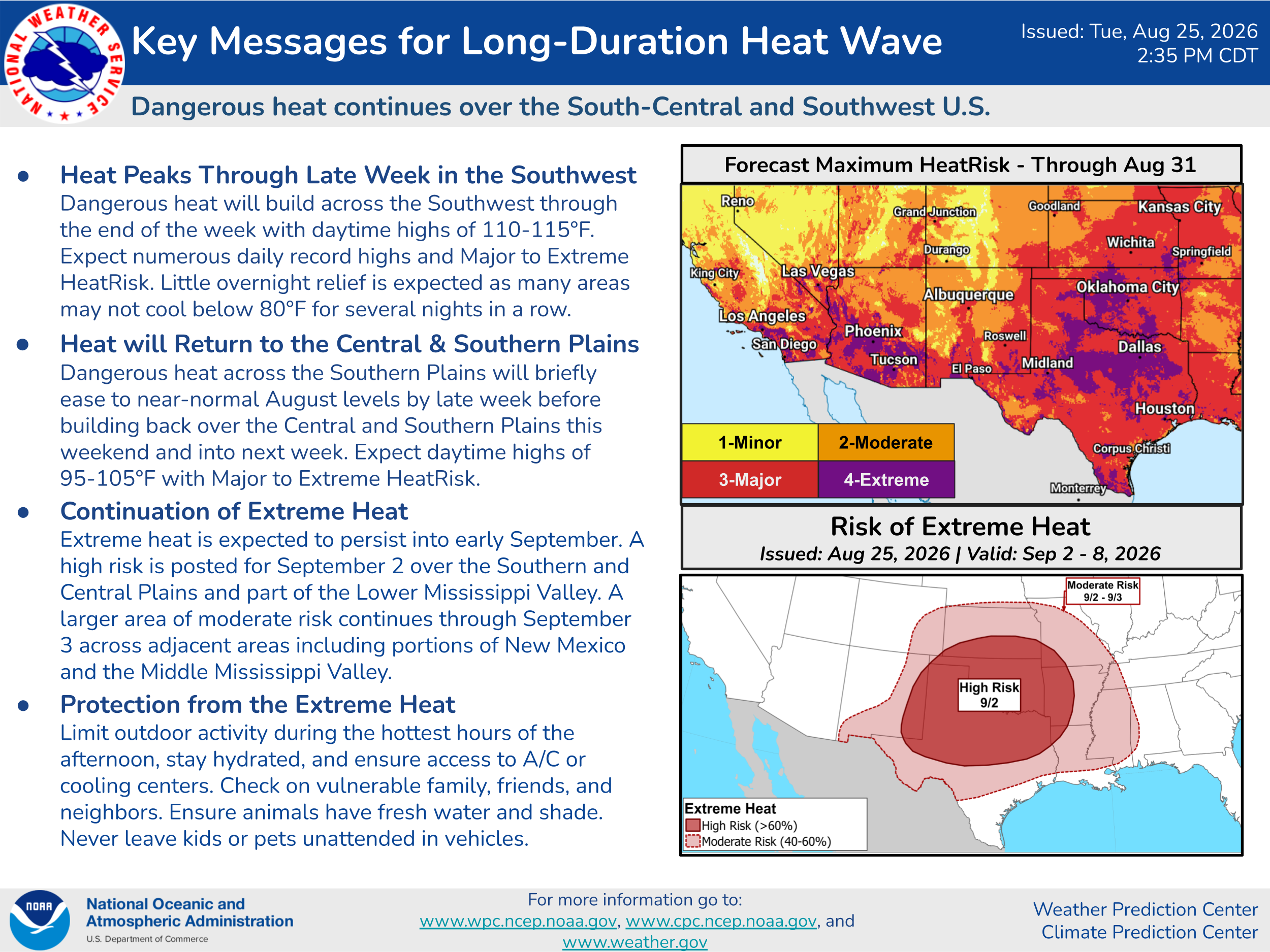
However, that reprieve will be temporary. Record heat will build and peak over the Southwest the remainder of this week. Phoenix set a record high today, reaching at least 114F — and will see temperatures near 115F each day the rest of the work week. Extreme and record heat will build over southern California and other Desert Southwest locations the next couple of days, along with some concern for increased wildfire activity. Eventually, this extreme heat will once again expand east into the Southern Plains by early next week.
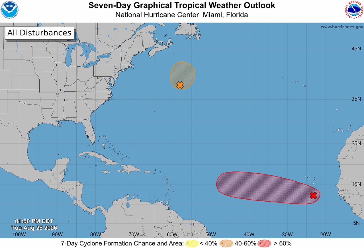
In the tropics, the National Hurricane Center is monitoring a strong tropical wave south of the Cabo Verde islands which it shows as having a high (70%) chance of development into a tropical cyclone this week. However, conditions are only marginally supportive and today’s models have backed off showing much in the way of development — and given the continued hostile conditions in the tropical Atlantic due to the strong El Nino, it will not be a surprise if this system continues to struggle. The Google DeepMind AI model actually shows the system having some increase in potential development a week from now when it gets north of the eastern Caribbean islands into an area where conditions have not been as unfavorable — we will keep an eye on it.
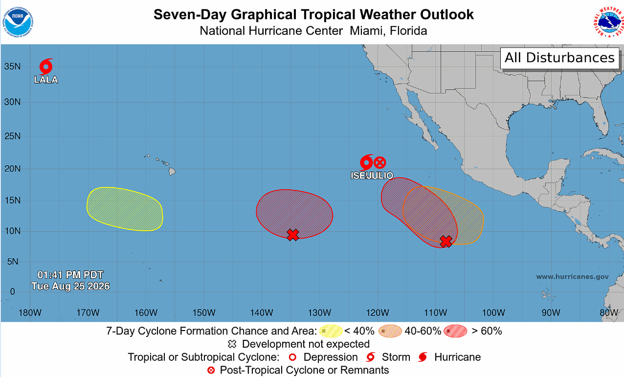
Meanwhile, the Pacific continues to crank out systems — including Lala which is still holding on as a tropical storm as it approaches the International Date Line around 35N latitude. As of now, none of the various disturbances and systems are expected to directly impact land — but some of the moisture from the eastern Pacific will be periodically working into parts of California and the Southwest at times which will be something to monitor.
More details and info on other weather happenings tomorrow…
Balanced Weather is made possible by the generous support of paid subscribers, who as thanks get access to live Balanced Weather chats and videos as well as the ability to post comments and ask questions on posts. To become a paid subscriber or a free subscriber (also very much appreciated and you will automatically receive new posts in your email), please click below.
No posts
Comments
Nothing yet. Say the first thing.
Sign in to join the conversation.