
Here is rain coverage from last night’s storms that developed from the southwest (an important point, by the way). The Indian School / Bullard station is now up to 1.56” for the season, almost all of it (1.46”) falling in just 72 hours.
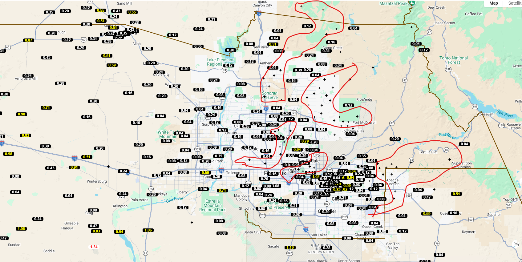
There is ample rain coverage across the county - notice the red shapes - those poor folks did not receive rain. Monsoon storms/showers are scattered in nature. Remember how I lamented the fact that, in July, the West Valley largely missed out on rainfall. In August I’m not complaining - though somebody in Apache Junction could complain after a rainy July.
This week, we celebrate.

After tonight?

Our unique Monsoon, a weather phenomenon that turns the Desert Southwest into a storm-generating thrill-fest, is driven by a change in location of a High Pressure system. In July and August, High Pressure location moves daily, but is generally in a location that fuels east-to-west winds that rotate through Arizona, then rotate north through Utah, then rotate east across the Midwest, then dive south somewhere in the Eastern United States.
You can see the rotation from a satellite image from earlier this week.
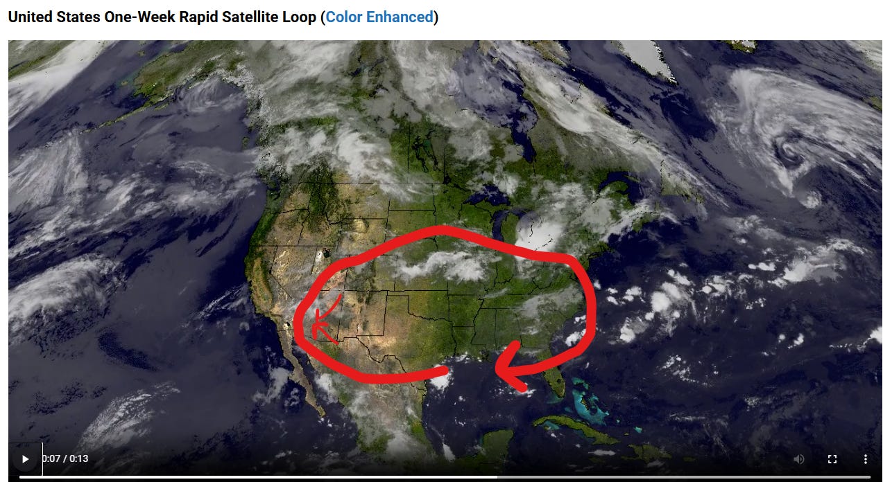
It’s common in July/August for moisture from the Desert Southwest Monsoon to rotate across the Upper Midwest, resulting in storms there. Fun!
Look at the image again. In Arizona, I added two arrows. Storms frequently come off the Rim and move Northeast-to-Southwest, due to easterly/northeasterly winds in the middle of the atmosphere. Storms also move up from the Tucson / Casa Grande area, due to southeasterly winds in the middle of the atmosphere.
What happens if the High Pressure system moves east, if it is pushed east because of Low Pressure in the Pacific? Or what happens if the High Pressure system moves southeast, and starts to recede back home as summer ends?
Our upper level winds shift to the Southwest.
That is what is happening, both yesterday/today and for the next week. Instead of being in a situation where the small arrows in the image control our weather, we’ll be to the left of the big red band of circulation, meaning our winds are from the Southwest.
During Transition Season (September/October), we reside to the left of the big band of circulation in the image. We are no longer controlled by the “small arrows”.
The next week is a preview of coming attractions. After tonight, we take a rain break.
The Monsoon high “should” eventually return for a last gasp.
And then?
We say goodbye for another year, as we enter Transition Season … a season where Monsoon moisture interacts with Pacific systems and (especially in a strong El Nino year) Pacific Tropical Storms / Hurricanes. We can still get storms, but the storms are largely not driven by the “small arrows” in the image above.
Let’s take a 4-8 day break, then hopefully get ready for a final Monsoon push. After that, it’s time for football.

Comments
Nothing yet. Say the first thing.
Sign in to join the conversation.