Hackaday Europe 2026: Open Source Hardware Goes Underground, Literally

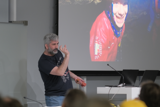
These days open source is everywhere, and frankly, we couldn’t be happier about it. But even with as prevalent as open software and hardware has become, we still occasionally hear about a project that takes the concept somewhere unexpected. Which is precisely why we were so eager to hear more about the fascinating work [Phil Underwood] has been doing.

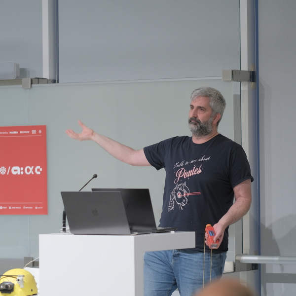
In his talk Open Source Caving: 20 Years of Making Cave Mapping Tools at Hackaday Europe 2026, [Phil] takes us through a series of progressively more advanced open hardware devices that he’s designed to increase the speed and accuracy of underground mapping efforts. Along the way, he’s learned a number of valuable lessons about designing hardware that’s robust enough to handle the uniquely challenging environment underground while still being accessible enough for a hobbyist to build and use.

Continue reading “Hackaday Europe 2026: Open Source Hardware Goes Underground, Literally”

Real-Time 3D Room Mapping With ESP32, VL53L5CX Sensor And IMU

ST’s VL53L5CX is a very small 8×8 grid ranging sensor that can perform distance measurements at a distance of up to 4 meters.  [Henrique Ferrolho] demonstrated that this little sensor can also be used to perform a 3D scan of a room. The sensor data can be combined with an IMU to add orientation information to the scan data. These data streams are then combined by an ESP32 MCU that streams the data as JSON to a connected computer.

Of course, that’s just the heavily abbreviated version, with the video covering the many implementation details that crop up when implementing the system, including noise filtering, orientation tracking using the IMU and a variety of plane fitting algorithms to consider.

Note that ST produces a range of these Time-of-Flight sensors that are more basic, such as the VL53VL0X, which is a simple distance meter limited to 2 meters. The VL53L5CX features the multizone array, 4-meter distance range, and 60 Hz sampling speed features that make it significantly more useful for this 3D scanning purpose.


Continue reading “Real-Time 3D Room Mapping With ESP32, VL53L5CX Sensor And IMU”

Misleading GPS, Philosophy Of Maps, And You

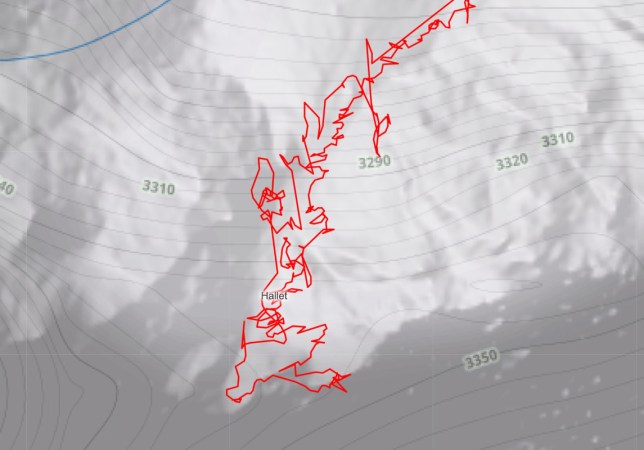
The oft-quoted saying “all models are wrong, but some are useful” is a tounge-in-cheek way of saying that at some level, tools we use to predict how the world behaves will differ from reality in some measurable way. This goes well beyond the statistics classroom it is most often quoted in, too, and is especially apparent to anyone who has used a GPS mapping device of any sort. While we might think that our technological age can save us from the approximations of maps and models, there are a number of limitations with this technology that appear in sometimes surprising ways. [Kyle] has an interesting writeup about how maps can be wrong yet still be incredibly useful especially in the modern GPS-enabled world. Continue reading “Misleading GPS, Philosophy Of Maps, And You”

Three Norths Align, And It’s Not Even Up North

Sometimes here at Hackaday we bring you stories from slightly outside our world of tech, because they have an interesting angle. Maybe they relate to science or astronomy, or in the case of the UK’s Ordnance Survey explaining how Britain’s three Norths will align, geography.

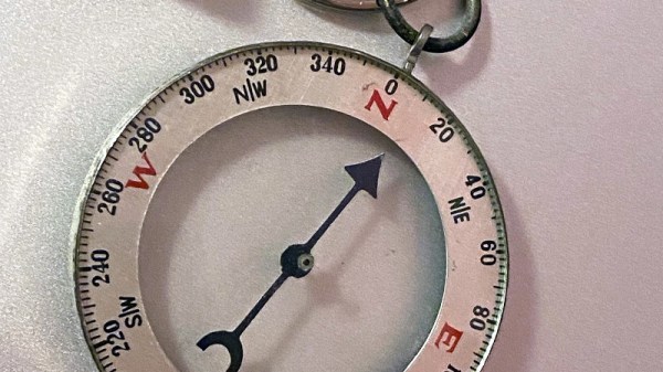
Some of you may know that the British monarch has two birthdays, but three Norths, what on earth is going on? You’ll guess that two of them are true North, pointing to the North Pole, and magnetic North, pointing to the Earth’s north magnetic field, but how about the third? It’s grid North — the north of the country’s mapping grid system in which the curved surface is projected onto a flat sheet.

It aligns with true North at 2 degrees West of Greenwich, and the news is that for the first time ever due to movement of the magnetic North Pole, the three different Norths will align at a point in the south of England. Magnetic North has been on the move at some pace over the last few decades, from a position somewhere in the Canadian Arctic islands northwards, and it so happens that for Brits its direction is briefly aligned with our view of the Pole. The Ordnance Survey story is of some interest, but for a wealth of information it’s worth consulting NASA. Take a look at the video below the break.

Continue reading “Three Norths Align, And It’s Not Even Up North”

South Korean Mapping Satellite Reaches Orbit

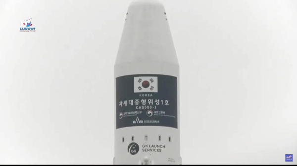
South Korea’s space program achieved another milestone yesterday with the launch of the first Compact Advanced Satellite 500 (CAS500) in a planned series of five vehicles. A second-generation Russian Soyuz 2.1a lifted the Korean-made CAS500-1 from historic Baikonur Cosmodrome in southern Kazakhstan and successfully placed it into a 500 km sun-synchronous orbit, inclined by 97.7 degrees or 15 orbits/day. Living up to its reputation as a workhorse, the Soyuz then proceeded to deposit multiple other satellites into 600 km and 550 km orbits. The satellite is pretty substantial, being 2.9 m tall and 1.9 m diameter and topping the scales at 500 kg. (Don’t be confused, like we were, by this Wikipedia article that says it is a 1.3 kg CubeSat.)
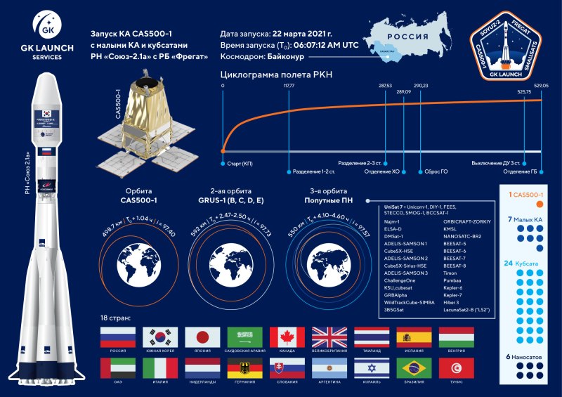
South Korea already has over a dozen satellites in orbit, and the CAS500 adds a modular space platform to the mix. It was designed by the Korea Aerospace Research Institute (KARI) to provide a core backbone which can be easily adapted to other missions, not unlike a car manufacturer that sells several different models all based on the same underlying chassis. Another down-to-earth goal of the CAS500 program was to foster the transfer of core technologies from state-owned KARI to private industry. We wonder how such figures are calculated, but reportedly 91.3% of CAS500-1 was made in Korea. Subsequent flights will further involve local services and industry.

The purpose of the first two satellites is to provide images to the private sector, for example, online mapping and navigation platforms. How popular this will be is yet to be determined — as one local newspaper notes, the 2 meter image resolution (50 cm in monochrome) pales in comparison to Google’s advertised 15 cm resolution. The next three satellites will focus on space science imagery.

The Soyuz launch is shown below, and this short video clip from KARI shows a nice animation of the satellite. Try not to cringe at the simulated whooshing sound as two satellites pass each other in the vacuum of space — turn down the volume if you need to.

Continue reading “South Korean Mapping Satellite Reaches Orbit”

Hardware Keymapper Routes Through Raspberry Pi

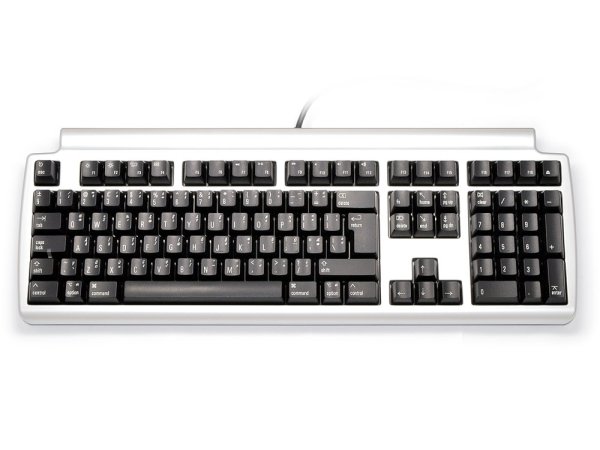
There are a lot of keyboards to choose from, and a quick trip through some of the forums will quickly show you how fanatical some people can be about very specific styles or switches. [Crdotson] doesn’t seem to be too far down the rabbit hole in that regard, but he does have a keyboard that he really likes despite one small quirk: it’s built for Mac, and some of the modifier keys aren’t laid out correctly for Windows. Since Windows has limited (and poor) options for software keymapping, he took an alternative route and built a keymapper in hardware instead.

The build uses a Raspberry Pi as a go-between from the keyboard to his computer. The Pi watches the USB bus using usbmon, which allows inspection of the packets and can see which keys have been pressed. It then passes those keypresses through to the computer. His only modification to the keyboard mapping is to swap the Alt and Super (Windows) keys for his keyboard of choice, although using this software would allow any other changes to be made as well. Latency is only on the order of a few microseconds, which is not noticeable for normal use cases.

While we have seen plenty of other builds around that can map keyboards in plenty of custom ways, if you don’t have the required hardware for a bespoke solution it’s much more likely that there’s a Raspberry Pi laying around that can do the job instead. There are a few issues with the build that [crdotson] is planning to tackle, though, such as unplugging the device while a key is being pressed, which perpetually sends that keystroke to the computer without stopping. But for now it’s a workable solution for his problem.

Really Useful Robot

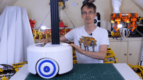
[James Bruton] is an impressive roboticist, building all kinds of robots from tracked, exploring robots to Boston Dynamics-esque legged robots. However, many of the robots are proof-of-concept builds that explore machine learning, computer vision, or unique movements and characteristics. This latest build make use of everything he’s learned from building those but strives to be useful on a day-to-day basis as well, and is part of the beginning of a series he is doing on building a Really Useful Robot. (Video, embedded below.)

While the robot isn’t quite finished yet, his first video in this series explores the idea behind the build and the construction of the base of the robot itself. He wants this robot to be able to navigate its environment but also carry out instructions such as retrieving a small object from a table. For that it needs a heavy base which is built from large 3D-printed panels with two brushless motors with encoders for driving the custom wheels, along with a suspension built from casters and a special hinge. Also included in the base is an Nvidia Jetson for running the robot, and also handling some heavy lifting tasks such as image recognition.

As of this writing, [James] has also released his second video in the series which goes into detail about the mapping and navigation functions of the robots, and we’re excited to see the finished product. Of course, if you want to see some of [James]’s other projects be sure to check out his tracked rover or his investigations into legged robots.

Continue reading “Really Useful Robot”