
Welcome to new readers of the American Geographical Society’s weekly, the AGS Globe! The Globe shares articles on geography and geospatial topics, as well as exciting opportunities and news from our network. As the world revolves, geography evolves. The mission of the AGS Globe is to bring our storied legacy of exploration and thought leadership into the frontiers of the future.
By Dr. Lee Schwartz, AGS CEO
As the former Geographer of the U.S. Department of State, I was, together with a talented team of analysts and cartographers, responsible for reviewing, promoting, and enforcing U.S. government policies and practices depicting all international boundaries and names appearing on U.S. government maps. With the advent of widely available unofficial websites and, more recently, the use of artificial intelligence to do work that is best done by trained specialists, that task has become more challenging. Moreover, the position I occupied for 20 years (and which has resided at the State Department for just over 100 years) remains vacant. Which is why I found it both alarming and disturbing when the State Department, at a global AIDS conference last week in Brazil, displayed a map with virtually all of the listed African country names misplaced.
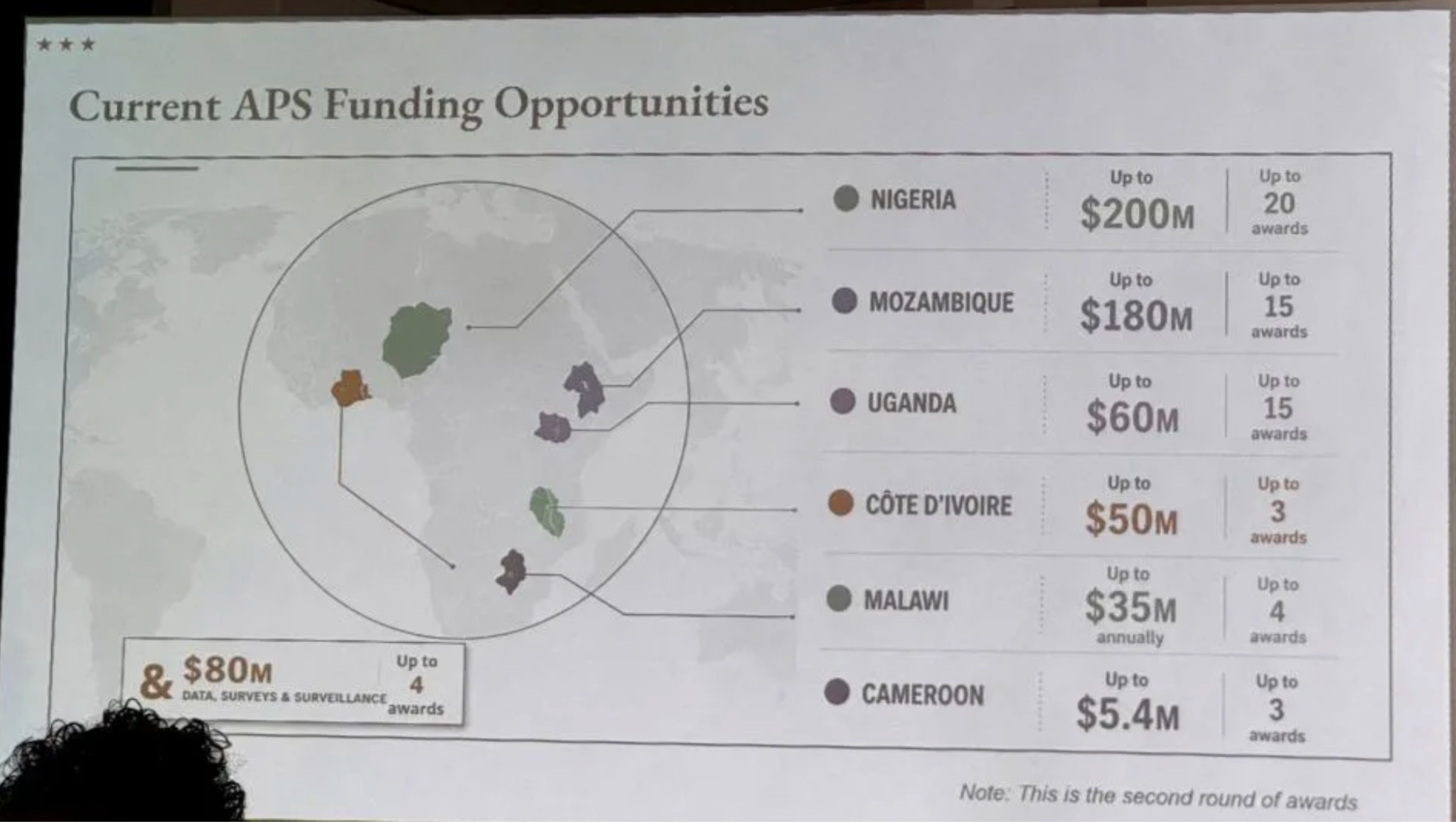
This was not the first time a map was produced that contained errors (though I cannot recall any quite as egregious as this most recent example). Maps are occasionally used that have an incorrect border or outdated name. A word misplaced or a typo can lead to a serious misunderstanding between both friendly and rival governments. Careless human mistakes, or a lack of guidance and oversight, are usually the reason. In this case, blame can apparently be placed firmly on the careless use of artificial intelligence rather than castigating an entire diplomatic corps with incompetence. The fact that this map made it to the light of day may be more reflective of failures and shortcomings in our institutions charged with representing U.S. foreign policy than a cartographer’s slip of the pen.
Borders and names remain viscerally important to the people living on lands that often have shifted sovereignty over years of tribal, imperial, colonial, autocratic, or democratic rule. There are real-life implications over the incorrect or inaccurate depiction of geographic names and their associated boundaries, particularly in areas without signed treaty agreements between bordering states, sometimes even leading to armed conflict. Maps are commissioned, designed, reviewed, approved, and displayed for a variety of diplomatic purposes. So when the U.S. State Department displays a map of Africa in which country names are mismatched across the continent, the problem is not simply cartographic. It is institutional. It points to a breakdown in basic oversight and, more troublingly, an assumption that no one would notice—or that it wouldn’t matter if they did. Which suggests that the problem in this case is more one of how Africa is understood and viewed than geographic ignorance in general (which is another problem altogether).
Most Americans receive remarkably little education about Africa. With 54 internationally recognized countries, more than a dozen of which are smaller in size than the state of Virginia, constructing a map of Africa is a challenge to any mapmaker. And much of the news about Africa in Western media focuses on humanitarian crises, droughts, food insecurity, wildlife and habitat decimation, infectious diseases, civil war, and ethnic conflict. All of which are serious problems that African leaders will be forced to face in the coming years. But Africa is also home to over 1.5 billion people, thousands of languages, critical mineral resources, and some of the world’s fastest-growing economies. It is a continent central to global supply chains, climate policy, technological innovation, public health, migration, and international security. Africans are pioneering digital financial services, producing globally recognized entrepreneurs, expanding renewable energy, negotiating free-trade agreements, and flexing their muscles in international institutions.
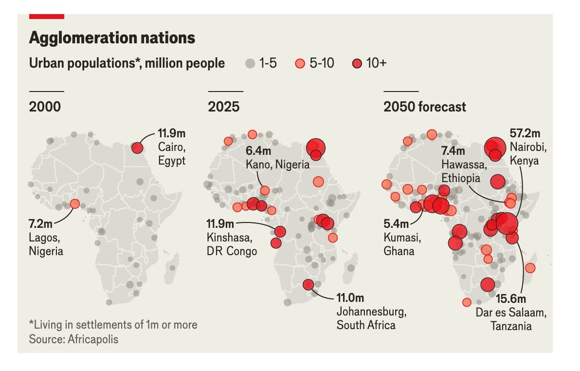
The irony of the map faux pas is that it comes at a moment in time when Africa deserves our attention rather than being ignored, with strategic competition among other global powers on the rise. Maps shape how we see the world. When they are wrong, they reveal more than misplaced borders—they expose misplaced priorities. Which is why the State Department map mistake raises an uncomfortable question: How seriously is recognizing the importance of the future of Africa reflected inside the institutions responsible for American foreign policy?
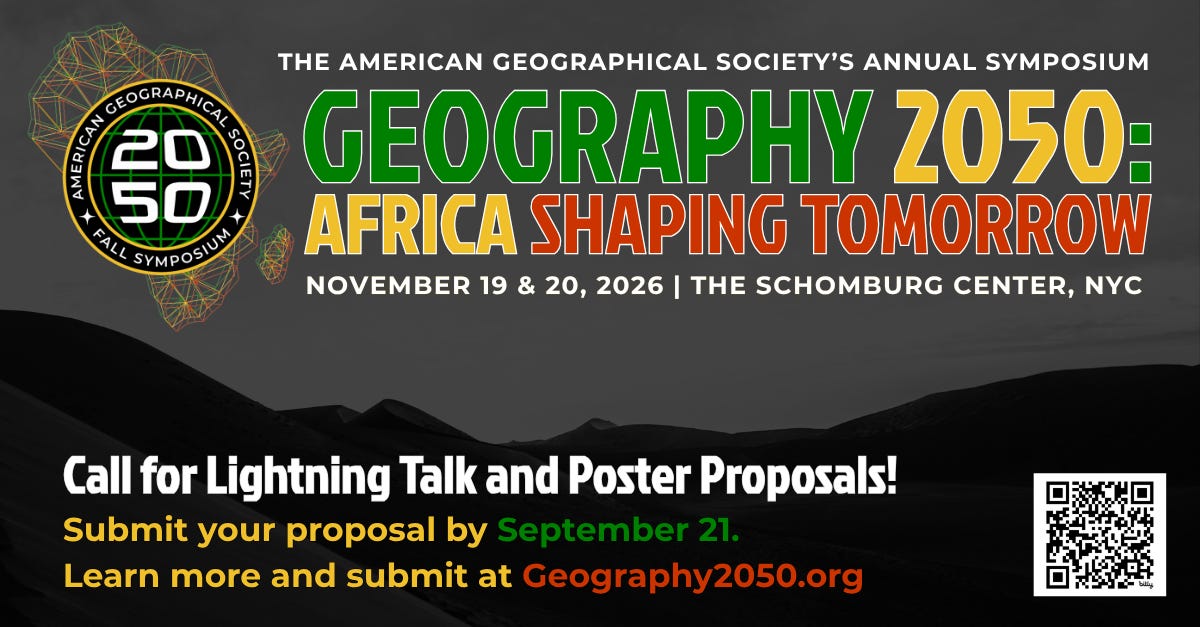
The American Geographical Society, of which I was recently named its Chief Executive, has chosen Africa as the theme of its flagship annual Symposium – Geography 2050. The fact that the AGS Symposium this year, for the first time in a decade, will have a regional theme reflects the recognition that Africa’s future is essential to the health of our planet and its people. (Ironically, the theme of last year’s Symposium was Artificial Intelligence – the very culprit in the State Department’s mislabeled map!). Geography 2050: Africa Shaping Tomorrow will view the future of Africa through the lens of six geographic-focused themes: Population Dynamics; Spatial Futures of Human Health; Environment, Conservation and Collaboration; Spatial Futures of Food Systems; Geopolitics; and Geospatial Innovation and Technology. This annual meeting in New York City brings together thought leaders from business, civil society, government, and academia to explore how the continent’s dynamic transformations are having global impacts.
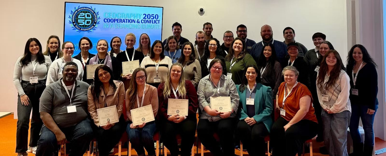
The fact that the Symposium is held during National Geography Awareness Week (the third week of November) puts an emphasis on the importance of geographic literacy among our students, teachers, citizens, and policymakers. And a core part of this annual Symposium is the participation of dozens of committed Advanced Placement Human Geography high school teachers from all over the country. This past spring, the AP Human Geography exam was taken by over 300,000 students, a number that has grown dramatically over the past decade but still represents only two percent of high school students in America.
In international diplomacy, every recognition decision, every treaty map, every territorial dispute, and every official representation as rendered in maps depend on getting geography right. While software can presumably generate maps useful for a variety of purposes, geographic literacy is still required to provide historical understanding, socio-cultural context, and precision in conflict resolution negotiations. Not accurately locating or naming countries that can be potential allies for partnership agreements, investments, or security cooperation reflects a low priority placed on understanding them – and their unique people, places, and relationships. It’s time to applaud and pay attention to what organizations like the American Geographical Society are doing to champion a renewed commitment to building geographic expertise whereby maps become instruments of diplomacy rather than mere visual accessories.
Lee Schwartz is the Chief Executive of the American Geographical Society, which is celebrating its 175th anniversary this year. Prior to his joining the AGS, he served for 20 years at the State Department as the GOTUS (Geographer of the United States).
Donati, J. (2026, July 30). US government map of Africa mislabels every country at global conference. Reuters.
Hansler, J. (2026, July 30). State Department says it made ‘an unfortunate error’ when it mislabeled countries on map of Africa. Yahoo News.
Muia, W. (2026, July 31). Africa map: US admits “unfortunate error” after mislabelling countries. BBC News.
The Economist. (2026, July 2). Africa’s new middle class is putting down roots in the suburbs. The Economist.
Thanks for reading The AGS Globe! This post is public, so feel free to share it.
Did you enjoy reading this? Support the American Geographical Society today with a donation of $50 to help us support Geography education.

Members of the American Geographical Society enjoy reduced-price access to AGS events and free access to the online version of Geographical Review.


You are invited to our 175th Anniversary globe signing event on September 15th at the Explorers Club in New York City, featuring renowned explorer, oceanographer, and astronaut Dr. Kathy Sullivan. Support the Society’s 175 Campaign with a gift of $175 or more and receive an invitation to this exclusive event, where you’ll have the opportunity to see one of the world’s most extraordinary historical artifacts gain its newest signature. Join us on September 15 as we celebrate the explorers who have shaped our understanding of the world—and help ensure that the spirit of exploration continues to inspire future generations.
Submit Lightning Talk and Exhibition Poster Proposals Today! Speak at our annual fall symposium, Geography 2050: Africa Shaping Tomorrow, taking place this November 19-20, 2026, at the Schomburg Center for Research in Black Culture in New York City! By 2100, over one-third of the world’s population will live in Africa, already the world’s youngest and fastest-growing continent, with profound implications for the interconnected human and environmental dimensions of the transformative demographic and technological boom across Africa. Submit proposals to speak at Geography2050 here!
Our Geography 2050 Trip Planning Page is Up! You can view information about this year’s venue and our partner hotels with Special Symposium Rates. Early birds can register for the lowest ticket price and book their stay at Aloft Harlem or the Renaissance New York Harlem Hotel at this special rate TODAY by going to the Geography 2050 Trip Planning page.
Comments
Nothing yet. Say the first thing.
Sign in to join the conversation.