
Welcome to new readers of the American Geographical Society’s weekly, the AGS Globe! The Globe shares articles on geography and geospatial, along with exciting opportunities and news from our network. Our pieces fall under four categories: Exploring the World, Championing Geography, Mapping the News, and EthicalGEO. As the world revolves, geography evolves. The mission of the AGS Globe is to bring our storied legacy of exploration and thought leadership into the frontiers of the future.

By Christian Mey Boudoug
Wildlife corridors are critical lifelines for biodiversity, allowing species to move across landscapes, adapt to environmental changes, and maintain viable populations. Africa’s exceptional diversity and expansive landscapes make it uniquely suited to ambitious conservation strategies. However, fragmentation from development, agriculture, and infrastructure poses challenges to connectivity. Building on regional and international models, this article expands the vision of African wildlife corridors, focusing on the Congo Basin, Eastern Africa, Southern Africa, and other critical sub-regions. It also highlights the importance of community-driven mapping, funding mechanisms, and collaborative governance, drawing lessons from global initiatives like the Mesoamerican Biological Corridor.
The Multifaceted Importance of Wildlife Corridors
Wildlife corridors transcend ecological function; they are cultural, economic, and geopolitical assets. For Africa, these corridors connect ecosystems of global significance, such as the Congo Basin and the Serengeti, while supporting vital ecosystem services. These include carbon sequestration, water cycle regulation, and biodiversity maintenance, all of which underpin human livelihoods.
However, achieving ecological connectivity on the continent is fraught with challenges, including:
Fragmentation: Infrastructure development and urbanization often sever natural landscapes.
Resource Scarcity: Conservation initiatives require significant funding, technical capacity, and community buy-in.
Governance Barriers: Transboundary corridors demand alignment among countries with diverse legal, political, and economic systems.
Despite these challenges, Africa has several sub-regional initiatives that serve as foundational models for broader continental connectivity.
Major Wildlife Corridors: A Sub-Regional Analysis
1. Congo Basin Corridors (Cameroon-DRC-CAR-Gabon-Equatorial Guinea)
The Congo Basin, as the second-largest rainforest globally, plays an irreplaceable role in global biodiversity and climate regulation. Wildlife corridors in this region aim to protect key species such as forest elephants, gorillas, and chimpanzees while sustaining local livelihoods.
Sub-regional initiatives like the Congo Basin Forest Partnership (CBFP) emphasize transboundary collaboration, but mapping corridors remains a challenge due to limited resources and the complexity of overlapping land uses. Efforts to establish corridors between Cameroon and the Republic of Congo, for example, involve reconciling logging concessions, mining sites, and protected areas. To strengthen these corridors, participatory mapping that integrates indigenous knowledge with remote sensing data is crucial. Indigenous communities often act as stewards of biodiversity, and their involvement ensures that corridors are not only ecologically functional but also socially equitable.
2. Eastern African Corridors (Kenya-Uganda-Tanzania)
The savannas of Eastern Africa are home to iconic migrations, such as the annual wildebeest movement in the Serengeti-Mara ecosystem. These landscapes also support elephants, lions, and other species whose ranges span national borders.
Efforts to map and maintain corridors here face challenges from expanding agriculture, infrastructure projects like the Standard Gauge Railway, and urban encroachment. Notable initiatives include the Kenya-Tanzania Borderlands Project and Uganda’s Community Wildlife Corridor program. These projects highlight the potential of community-led conservation, where local stakeholders participate in mapping and protecting migration routes.
However, achieving connectivity across the broader Kenya-Uganda-Tanzania region requires harmonized policies and substantial funding. Lessons can be drawn from the Mesoamerican Biological Corridor, where governments, NGOs, and international donors collaboratively fund and manage cross-border connectivity.
3. Southern African Corridors (South Africa-Botswana-Namibia-Zimbabwe-Zambia)
Southern Africa’s Kavango-Zambezi Transfrontier Conservation Area (KAZA TFCA) is the world’s largest transboundary conservation initiative, encompassing over five countries. It supports species such as African elephants, which rely on extensive landscapes to thrive.
KAZA’s success lies in its multi-stakeholder governance structure, which includes national governments, local communities, and international donors. The initiative’s collaborative approach to mapping corridors ensures that conservation priorities align with human development needs, such as tourism and agriculture.
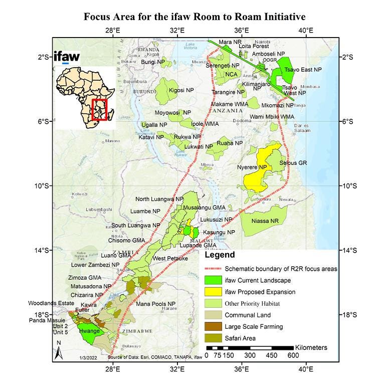
Despite its successes, KAZA faces funding and resource allocation challenges. Corridor mapping here requires continuous updates to address threats like climate change, poaching, and land conversion.
4. Cross River Gorilla Corridor (Cameroon-Nigeria)
The critically endangered Cross River gorilla inhabits fragmented forests along the Cameroon-Nigeria border. Conservation efforts focus on creating corridors to connect isolated gorilla populations and prevent genetic bottlenecks. This initiative underscores the importance of localized mapping and community involvement.
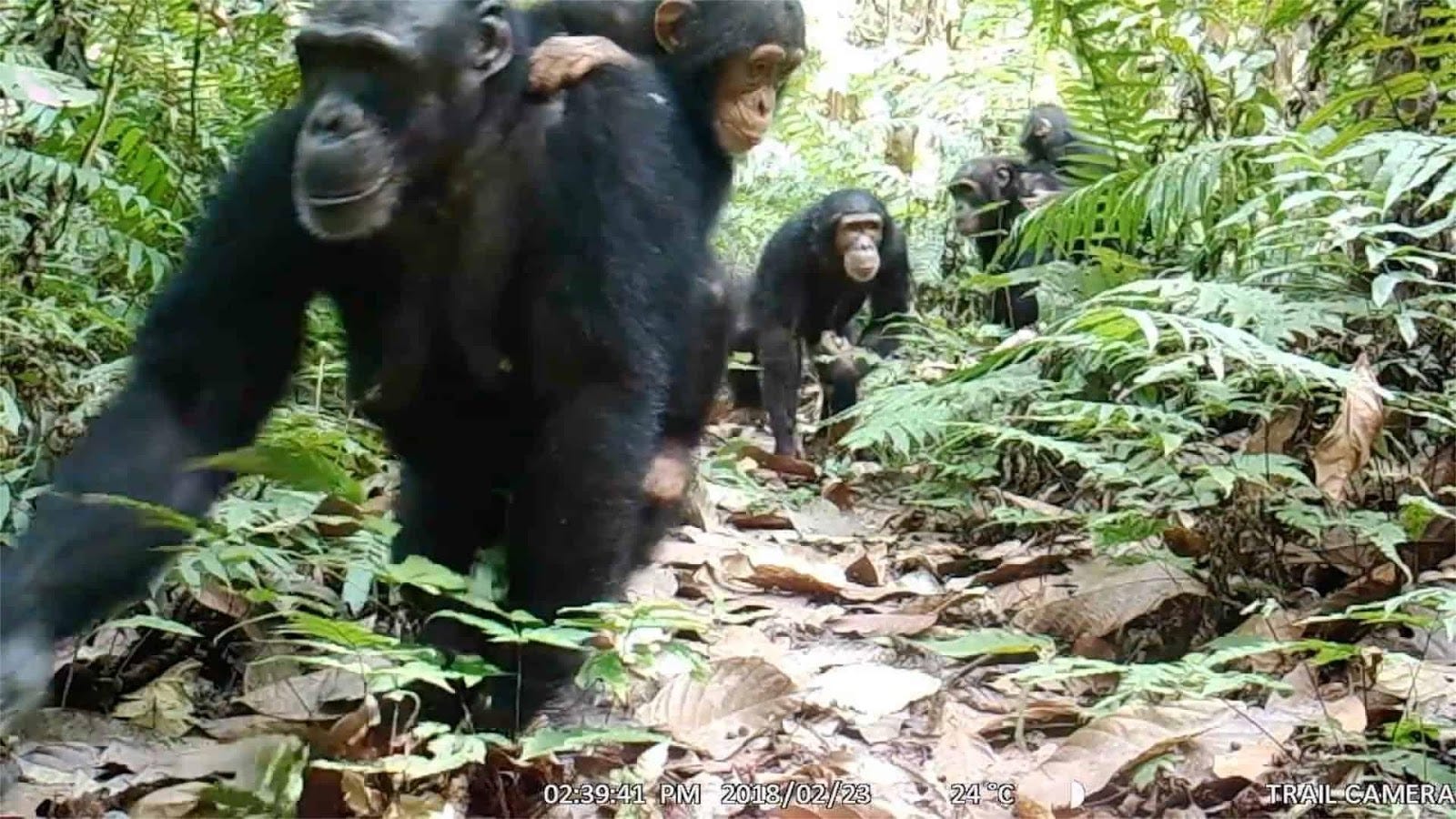
Collaborative efforts have used participatory GIS to identify critical connectivity zones and involve local communities in reforestation and monitoring activities. To ensure the long-term success of this corridor, sustainable funding mechanisms and stronger legal protections are essential.
5. Lake Chad Basin Corridors (Cameroon-Chad-Nigeria-Niger)
The Lake Chad Basin supports diverse ecosystems and human populations that depend on its resources. However, habitat fragmentation and desertification threaten both wildlife and livelihoods. Corridor initiatives in this region often intersect with humanitarian efforts, addressing conflicts over water and land use. Programs such as the Great Green Wall project aim to combat desertification while restoring ecological connectivity. Collaborative mapping that integrates ecological and socio-economic data is essential for balancing these competing priorities.
Zooming In and Out: The Role of Community, Collaborative, and Multi-Strata Mapping
Creating reliable wildlife corridor maps at multiple scales requires an integrative approach:
Community Mapping: Local communities hold critical knowledge about wildlife movements and habitat use. Participatory mapping ensures that corridors align with on-the-ground realities, fostering local stewardship.
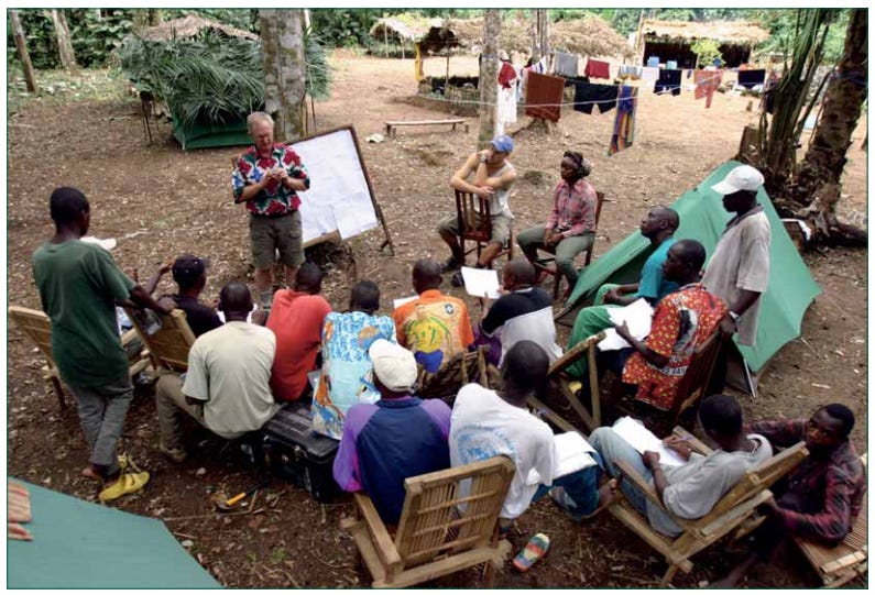
Collaborative Mapping: Involving multiple stakeholders—governments, NGOs, researchers, and private landowners—ensures that corridors are both ecologically viable and politically feasible.
Multi-Strata Mapping: High-resolution remote sensing and GIS enable fine-scale mapping, while broader regional models provide a strategic overview. This layered approach addresses the challenge of fragmentation when “zooming in” on corridor maps.
However, these efforts are resource-intensive. Funding remains a major obstacle, as demonstrated by the Mesoamerican Biological Corridor, where multi-million-dollar investments were required to integrate national and regional priorities. Africa must adopt similar funding strategies, leveraging international donors, public-private partnerships, and conservation trust funds.
Lessons from the Mesoamerican Biological Corridor
The Mesoamerican Biological Corridor (MBC) is a landmark initiative connecting forests from southern Mexico to Panama. Key lessons for Africa include:
Governance: The MBC succeeded by aligning policies across multiple countries while respecting national sovereignty.
Funding: International donors, including the World Bank and Global Environment Facility, provided critical support for corridor implementation.
Community Involvement: Local participation was integral to ensuring that corridors supported both biodiversity and human livelihoods.
Africa’s diverse landscapes and socio-political contexts require tailored approaches, but the MBC provides a valuable model for overcoming the complexity of transboundary conservation.
Toward a Unified Vision
A continental cartography of African wildlife corridors is both an ecological imperative and a diplomatic opportunity. By connecting fragmented initiatives, leveraging advanced mapping technologies, and fostering cross-border collaboration, Africa can position itself as a global leader in conservation.
The challenges are significant—fragmentation, funding gaps, and governance barriers—but the rewards are immense. Protecting Africa’s wildlife corridors sustains not only biodiversity but also the livelihoods and cultural heritage of millions of people.
As Africa works toward this vision, the lessons of successful regional initiatives, coupled with innovative mapping and funding strategies, will light the way. By embracing the power of maps and community collaboration, the continent can achieve a future where wildlife and people thrive together.
References
Congo Basin Forest Partnership (CBFP) Reports (2023).
Kavango-Zambezi Transfrontier Conservation Area: Annual Report (2022).
Kenya-Tanzania Borderlands Project: Progress Review (2023).
Mesoamerican Biological Corridor: Lessons Learned (2021).
Cross River Gorilla Conservation Action Plan (2022).
Thanks for reading The AGS Globe! This post is public, so feel free to share it.
Did you enjoy reading this? Support the American Geographical Society today with a donation of $50 to help us support Geography education.

Members of the American Geographical Society enjoy reduced-price access to AGS events and free access to the online version of Geographical Review.


Attention APHG Teachers - Join AGS in New York City this November as a Geography 2050 Teacher Fellow! In addition to regular symposium sessions, our fellows participate in 2 days of specialized workshops where they can connect with other educators, get access to new classroom tools, and learn about college and career pathways for their students. Applications will be open from April 6th to June 14th and can be found on the Geography Educator Initiative page of our website.
A new Focus on Geography photo essay titled “Beyond the Postcard: Counter-Mapping Australia’s Cultural and Environmental Terrain” has been published! The continent of Australia presents a striking cartography, from expansive coastlines to a vast arid interior. A sustained presence on location reveals not only Australia’s expansiveness and environmental diversity—from interior deserts to tropical rainforests—but also the social, environmental, and political questions inscribed within place. Read more here.
This year’s Geography 2050 website is up! Save the date for our annual fall symposium, Geography 2050: Africa Shaping Tomorrow, taking place this November 19-20, 2026, in New York City! By 2100, over one-third of the world’s population will live in Africa, already the world’s youngest and fastest-growing continent, with profound implications for the interconnected human and environmental facets of the transformative demographic and technological boom across Africa. You can view this year’s Geography2050 website here.
Comments
Nothing yet. Say the first thing.
Sign in to join the conversation.