
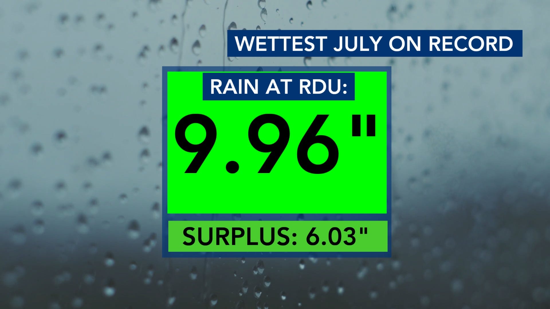
After such a dry start to the year, it has been a blessing to have such a wet month of July. It has been the wettest July on record with 9.96 inches of rain.
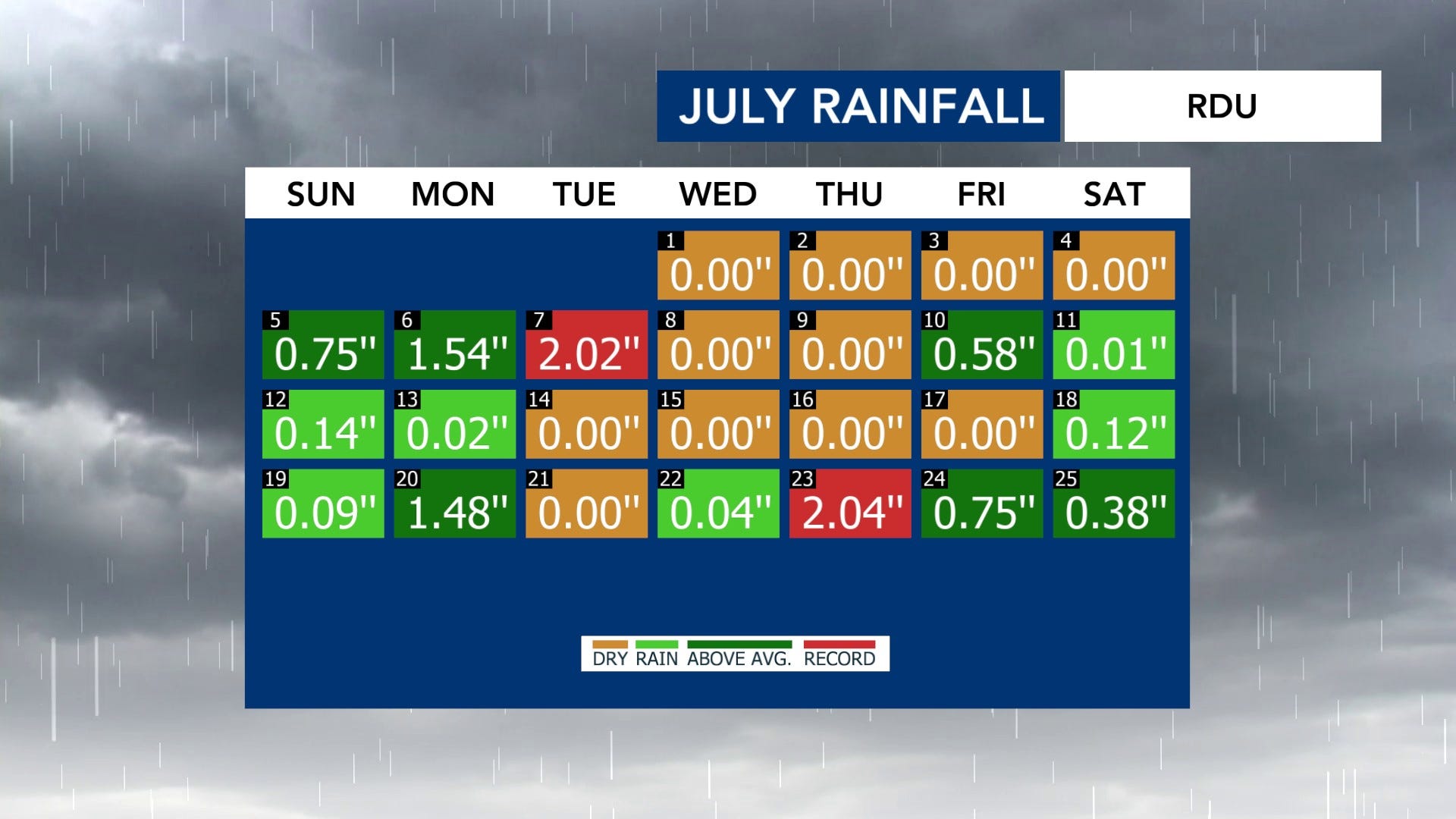
That is 6.03 inches in surplus for the month.
Obviously, in general, we do not have a surplus of rain. We do have some chances for storms, though, during the first part of the week. Let’s walk through those storms, the severe threat they could bring, and how warm we’ll stay throughout the week.
First, as always, I want to make sure you watch Elizabeth Holmes and my video from this week. I think it is a good mix of me being a goofball and some interesting information about the rain/drought situation. I also talk in more detail about our storm chances this week. Check it out!
Our first chance for storms is overnight and into early Monday.
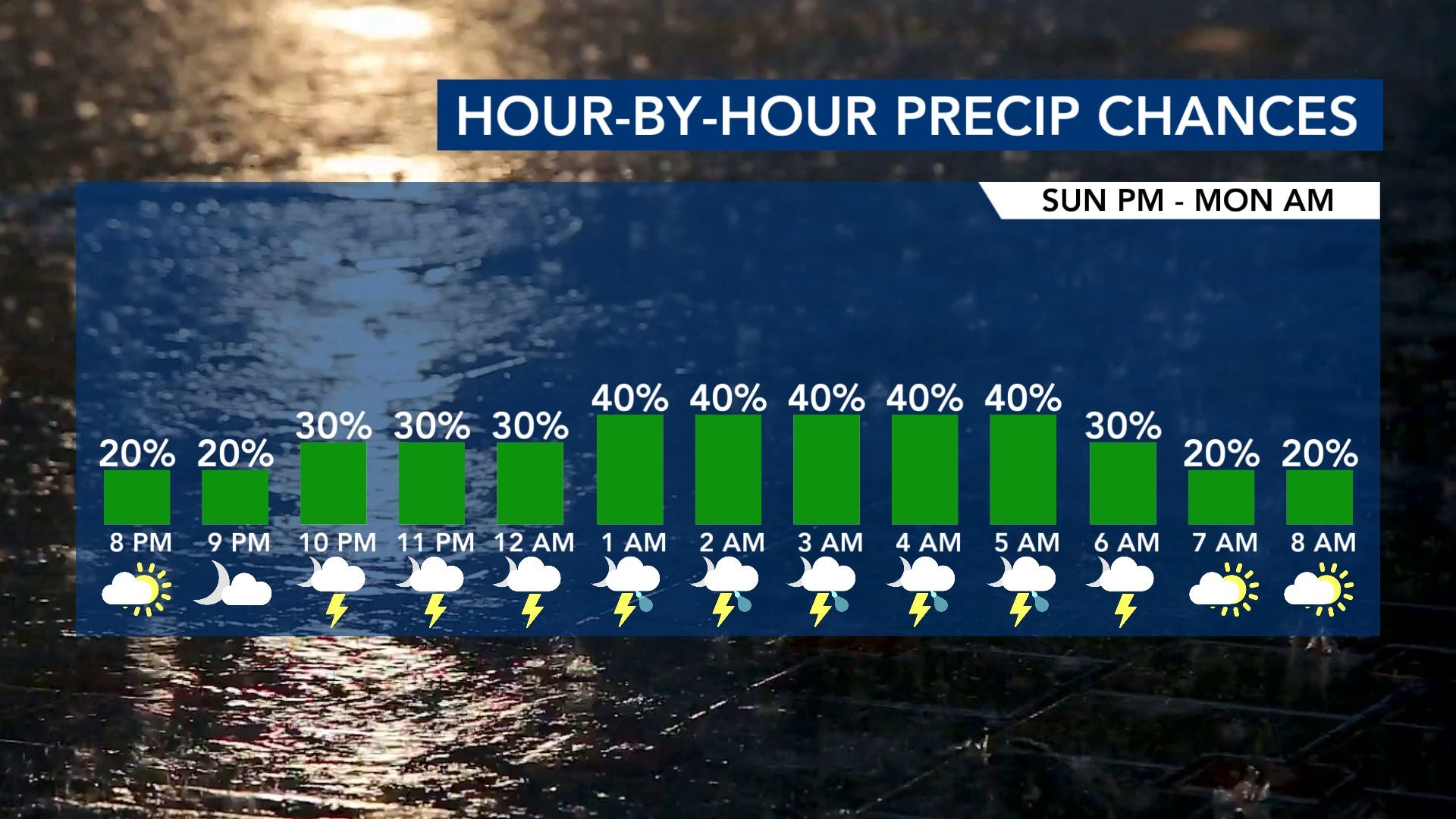
Some isolated storms are expected to develop north of the area and dive south. The best chance will be in our northern spots as models have storms fizzling as the move towards the Triangle and the Sandhills. If they can hold onto their intensity, then some brief wind gusts can’t be ruled out.
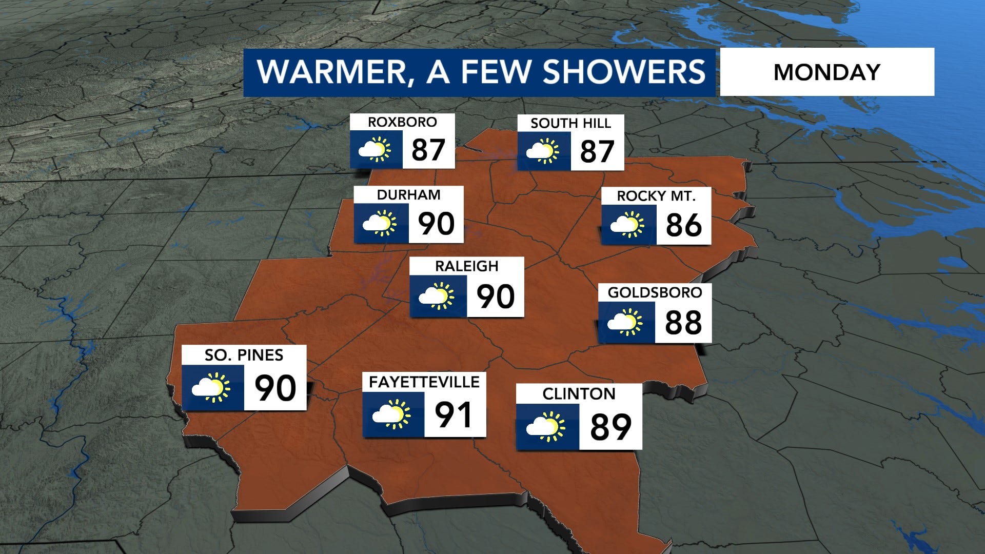
Highs on Monday will be warmer reach to around 90° by the afternoon. We could see some brief showers/storms, but we should be mostly dry with partly cloudy skies.
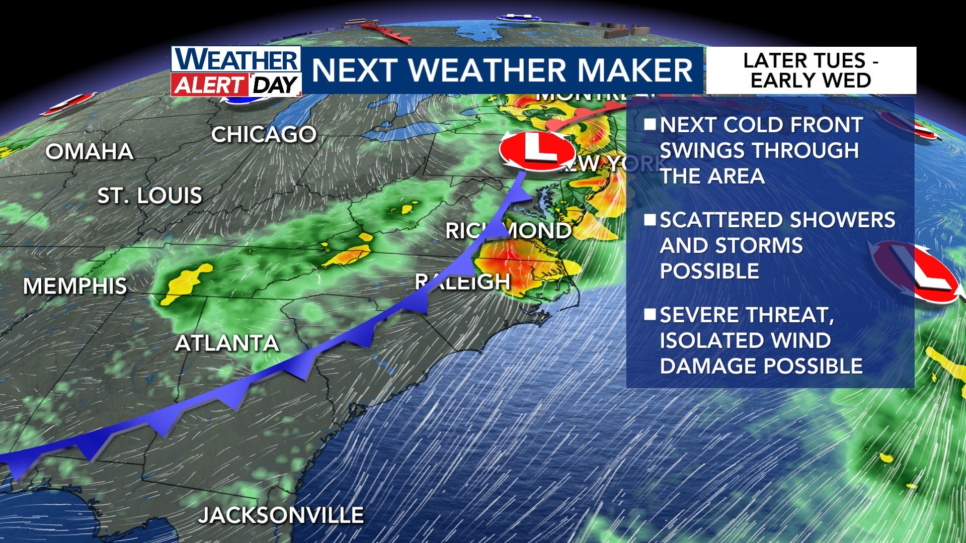
Our next best chance of showers and storms will be ahead of our next weather maker. It’s a cold front that will swing through the area later Tuesday into Wednesday, and scattered storms will be possible mainly later Tuesday evening through early Tuesday night.
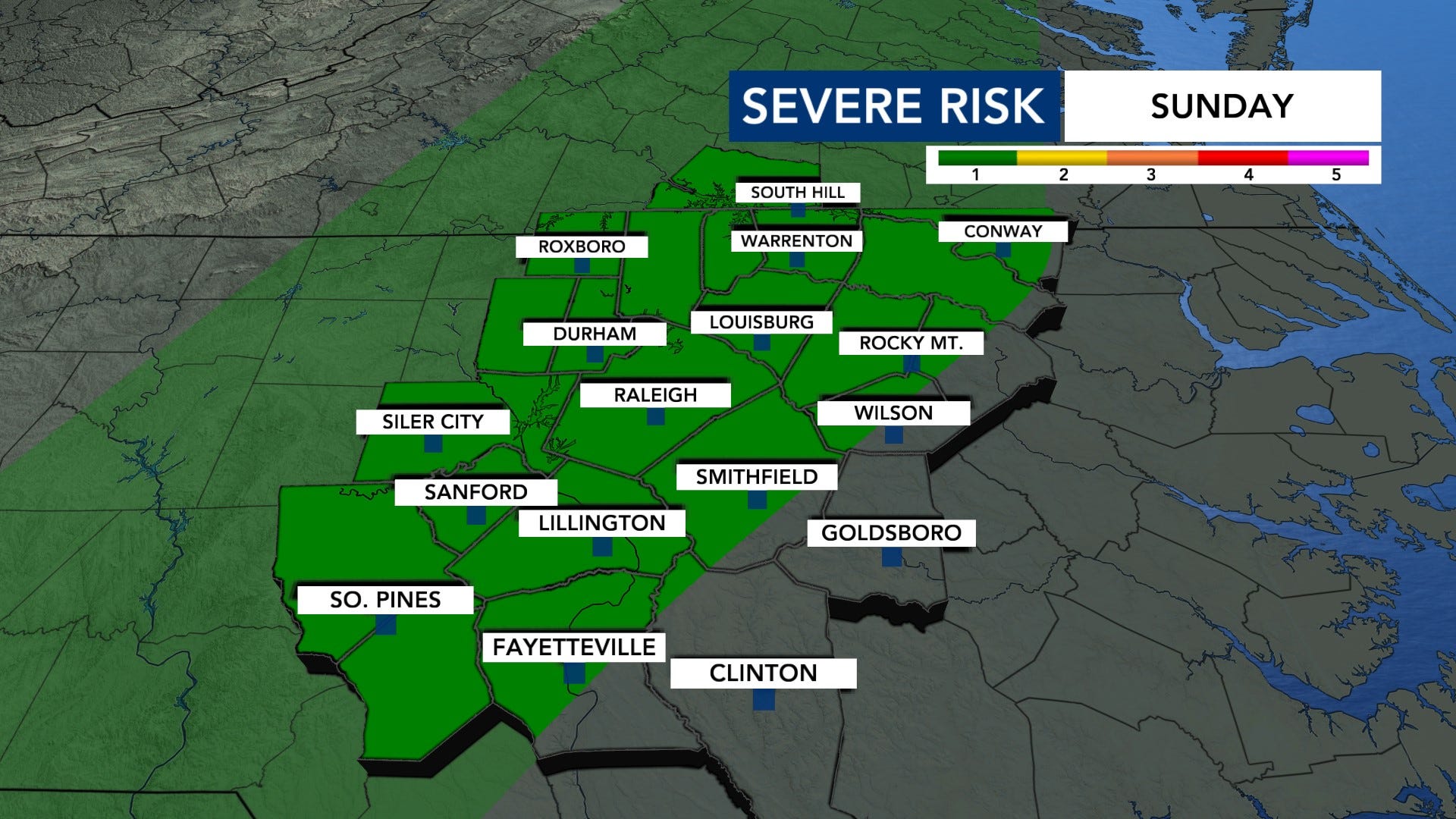
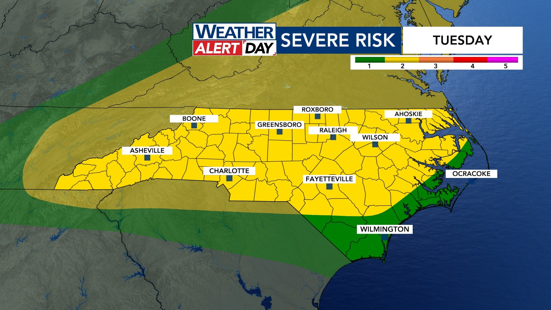
We have a level 2 of 5 risk of severe weather across much of the state which means some localized wind damage is possible.
Model guidance as of Sunday evening has the storms crossing the NC/VA border around 7 p.m. Tuesday, making it to the Triangle around 9-10 p.m., and then finally moving out or fizzling near the Sandhills by around 3 a.m. Wednesday.
Behind that system, we’ll be drier through Saturday. We don’t see another good chance for rain till the end of the week. A stalled front south of us is expected to move northward a bit by then.
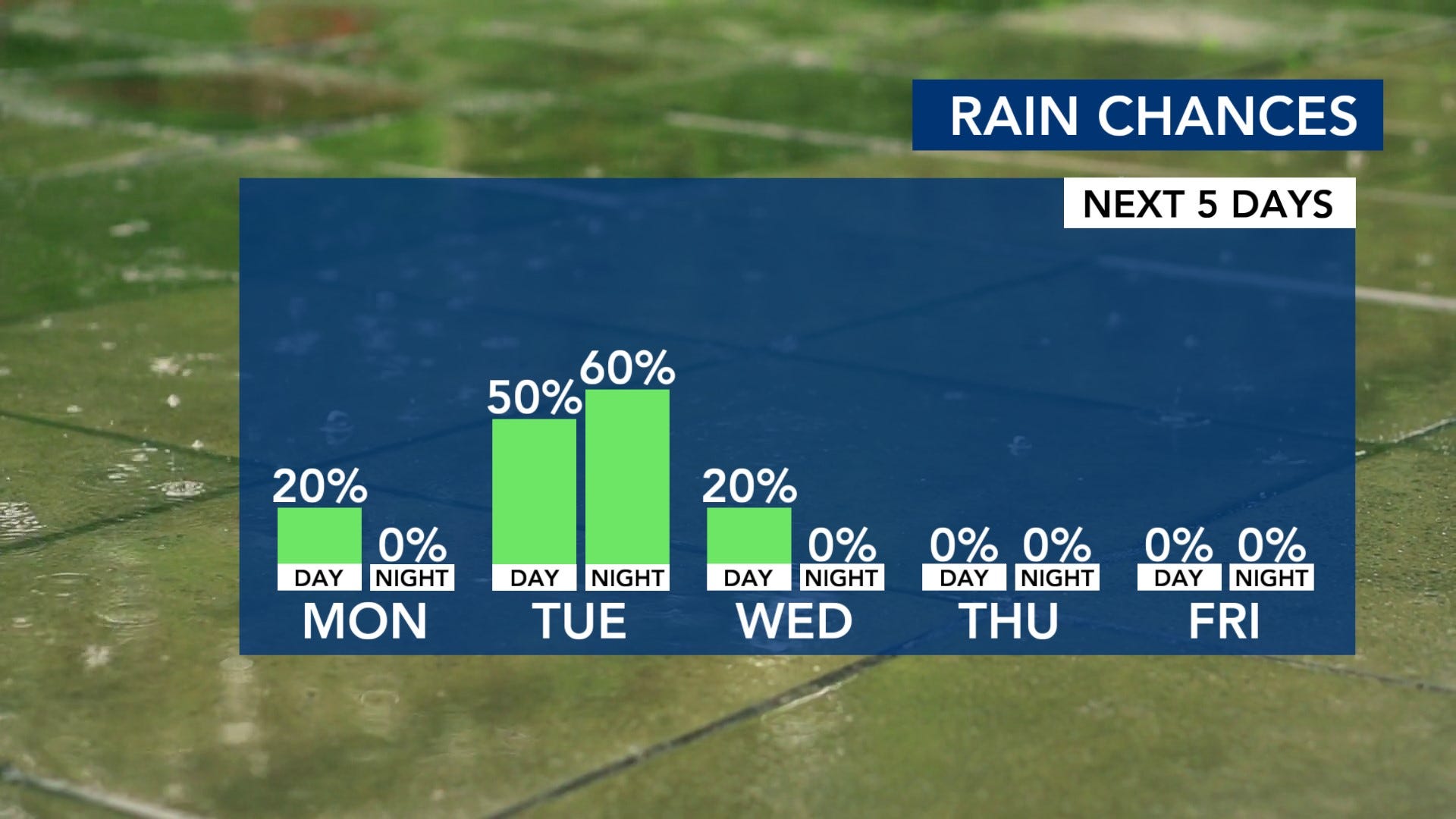
We could see anywhere from 1-1.25 inches of rain over the next week across central North Carolina with some higher amounts possible towards the coast. Some locally higher amounts can’t be ruled out with any heavier rain.
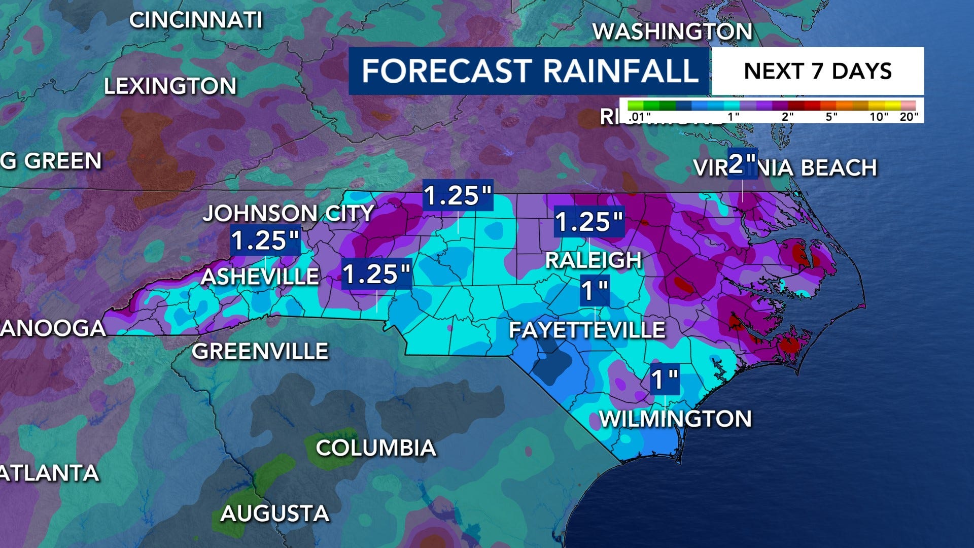
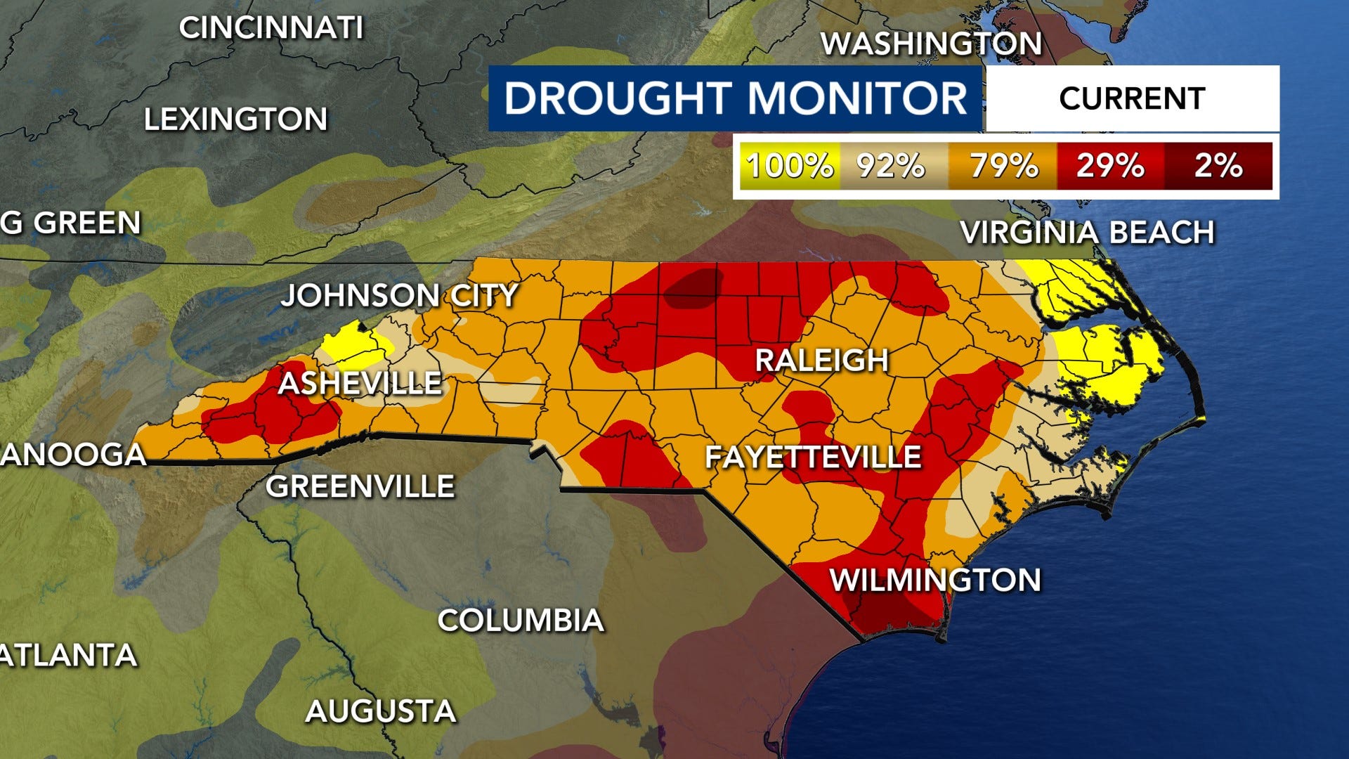
Regardless, we should definitely see at least a bit more improvement with the drought monitor on Thursday given that the last one only went through Tuesday morning. We had over 3 inches of rain beyond Tuesday morning. We did some improvements with Thursday’s (7/23/2026) drought monitor with the exceptional drought no longer in our area. Wake county is now in severe drought. There are still a lot of spots in extreme drought, though; we still have a ways to go to end the drought.
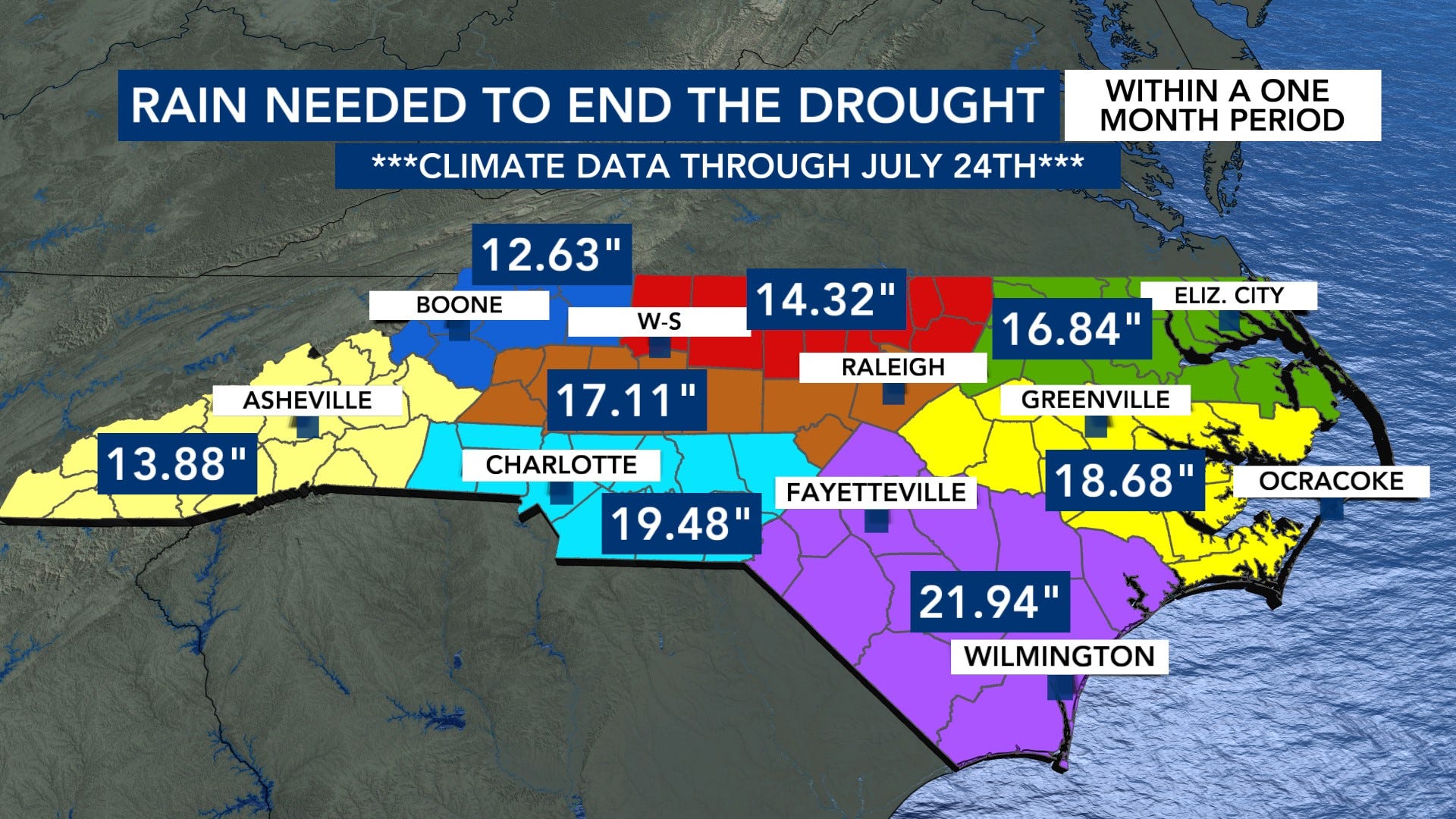
We still need between 14-22 inches of rain across our area to get out of the drought within a one month period.
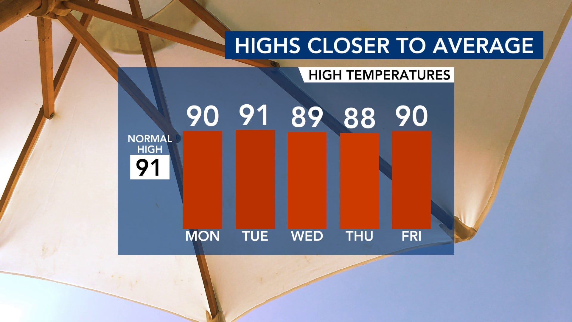
What’s wild about this past week is we had a few days that felt like fall! We had highs in the 70s, and we even had a record minimum high temperature on Thursday of 74°. It will likely not be that cool this week. Highs will hover around 90°.
Let’s hope we can keep getting some consistent rain going forward to help pull us further and further out of the drought!
Comments
Nothing yet. Say the first thing.
Sign in to join the conversation.