
After a very hot start to July, we had a break from the intense heat for the end of the month. Now, we are kicking off the second week of August with more high heat. I could not be more ready for fall. Get ready for the heat index values this week to approach heat advisory territory! I’ll talk through how hot it will feel this week plus when we’ll see temperatures finally drop a bit.
I was solo today, so you should still check out my Week of Weather video breaking down the heat that we’ll see this week, our rain chances, plus I have a closer look at our drought conditions and the improvements we have seen.
After some isolated lingering storms early Sunday night, we should be warm through Monday morning, and it will be another humid start to the day. Highs by the afternoon will reach the mid 90s, and heat index values will climb to 103-105° over parts of our area.
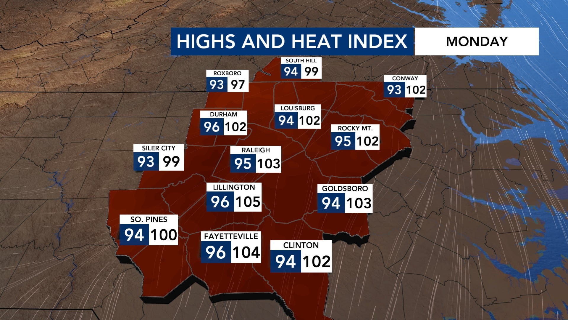
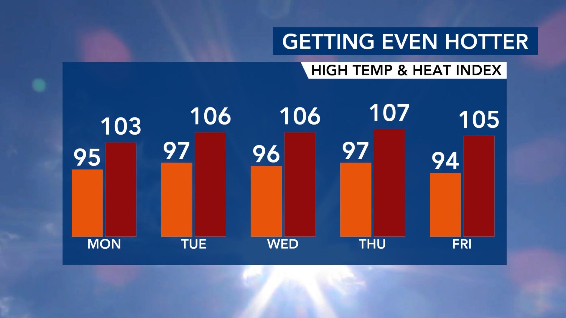
As an upper-level high continues to build over the southeastern U.S. through the middle of the week, highs will climb into the mid-upper 90s, and heat index values could reach as high as 106-107°. We could see heat advisories for a few days for at least parts of our area. Please stay hydrated and take those breaks in the A/C and shade when possible.
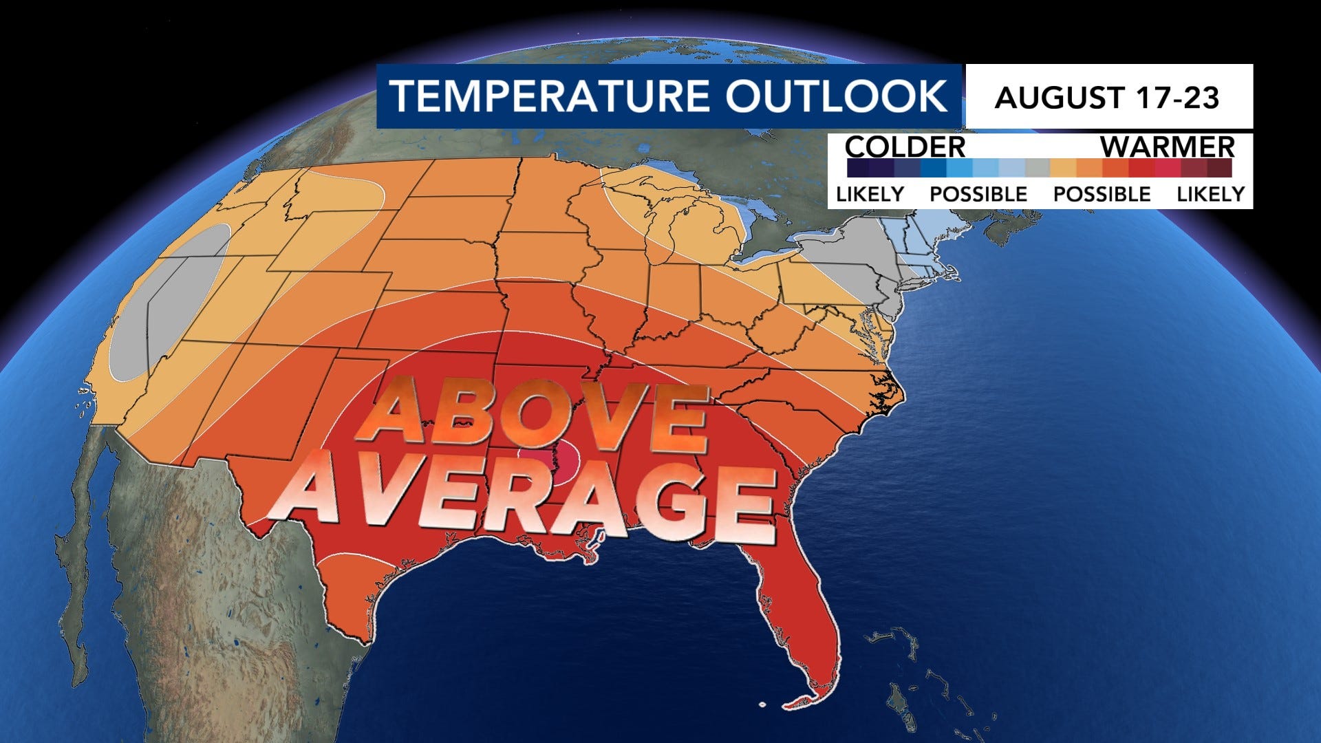
Even though we get a break over the weekend, temperatures trend above average again into next week. It is still summer after all.
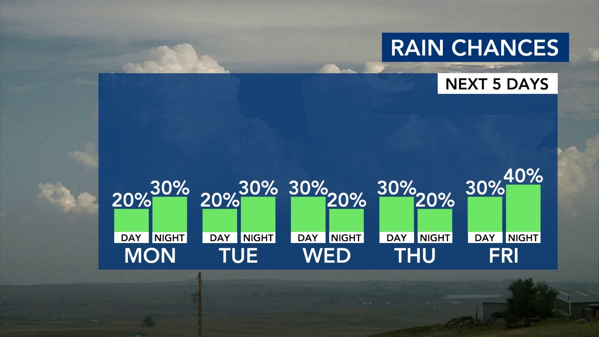
Thanks to that upper-level high, our storm chances will be pretty isolated throughout the week. The best chance for storms as of now looks like later Friday into Saturday with a front approaching the region. With any of these summertime storms, we could se brief, strong wind gusts, heavy rain, and frequent lightning.
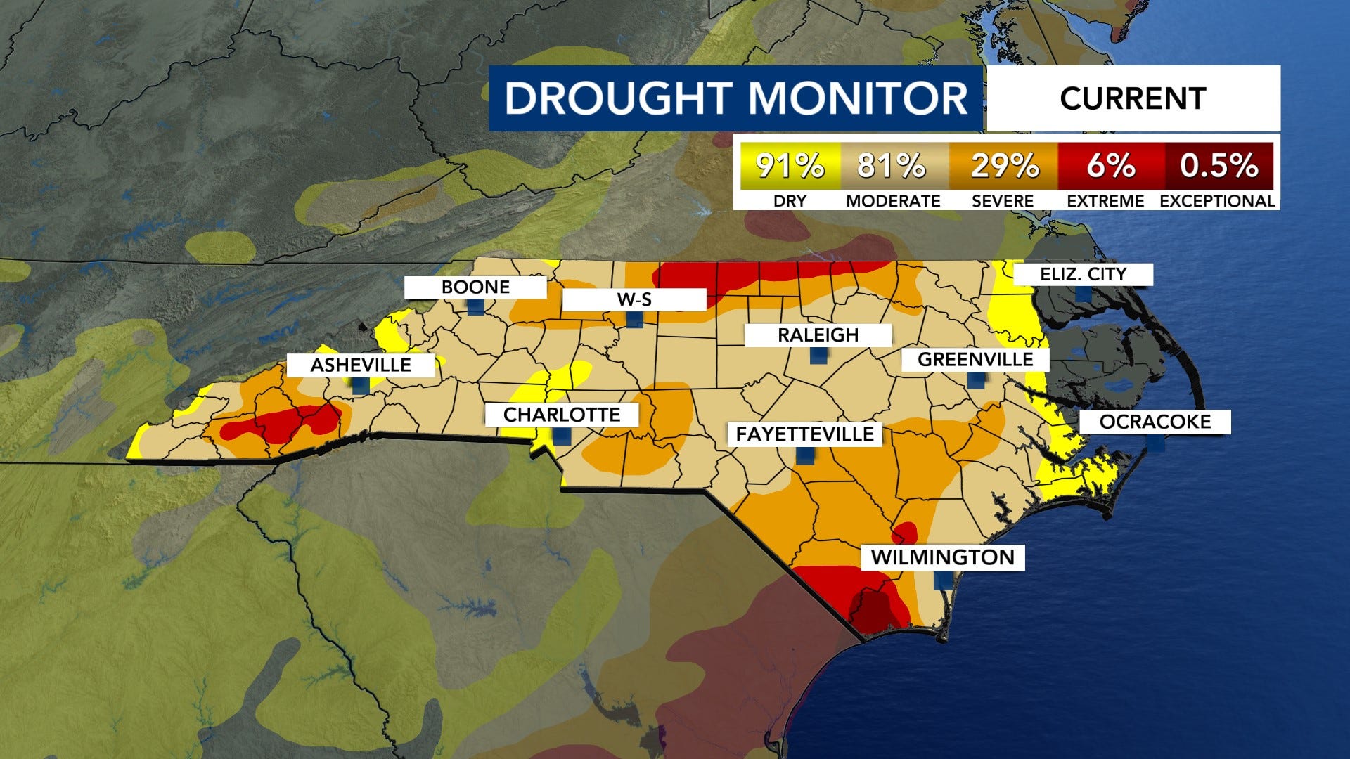
We saw some more improvement with our drought conditions with the latest drought monitor update. Much of our area is under moderate drought conditions, and the severe drought dropped from 41% to 29%. Hopefully, we can have some decent rainfall totals over the next handful weeks to continue to chip away at this drought.
As of Sunday evening, we are watching three different areas in the tropics. I know; this looks very active, but two areas to watch have a low chance of formation. None of these systems are a threat to our area. These are just areas to watch.
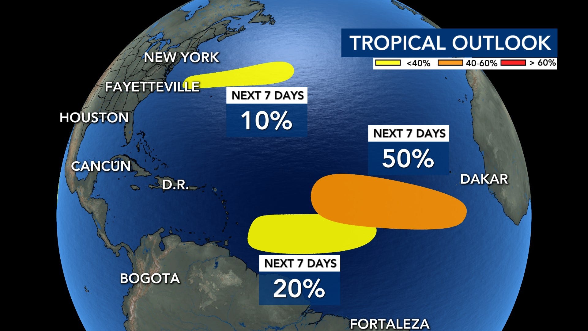
There is a new area in the northwestern Atlantic that is moving eastward AWAY from the US. It has a 10% chance of developing into a tropical system over the next 48 hours and seven days, and it is expected to move into cooler waters and weaken by the middle of the week. The second area is in the central Atlantic and is moving towards the Leeward Islands. It has a 20% chance of formation over the next seven days, and upper-level winds will likely shred this system apart as it moves toward the islands. The third area is in the central and eastern Atlantic, and it has a medium chance (50%) of formation over the next seven days. It could slowly develop into a tropical depression by later this week.
Be careful out in the heat this week, and make sure to have the WRAL Weather App to track any storms that pop up!
Comments
Nothing yet. Say the first thing.
Sign in to join the conversation.