
WeatherTiger’s Hurricane Watch is a reader-supported publication. Paid subscribers get Florida-focused daily tropical briefings, plus coverage of every U.S. hurricane threat, our exclusive real-time seasonal forecast model, and the ability to comment and ask questions. And check out our WeatherTiger Pro service for market- and trading-oriented data solutions.
As Hurricane Season 2026 limps into its alleged peak season primetime, there is precisely one tropical disturbance in the Atlantic, Caribbean, or Gulf with a chance of development over the next ten days. And while odds are minimal of any eventual threat to land from that system, close-to-zero chances are, I suppose, non-zero. It’s not much, but it’s all there is.
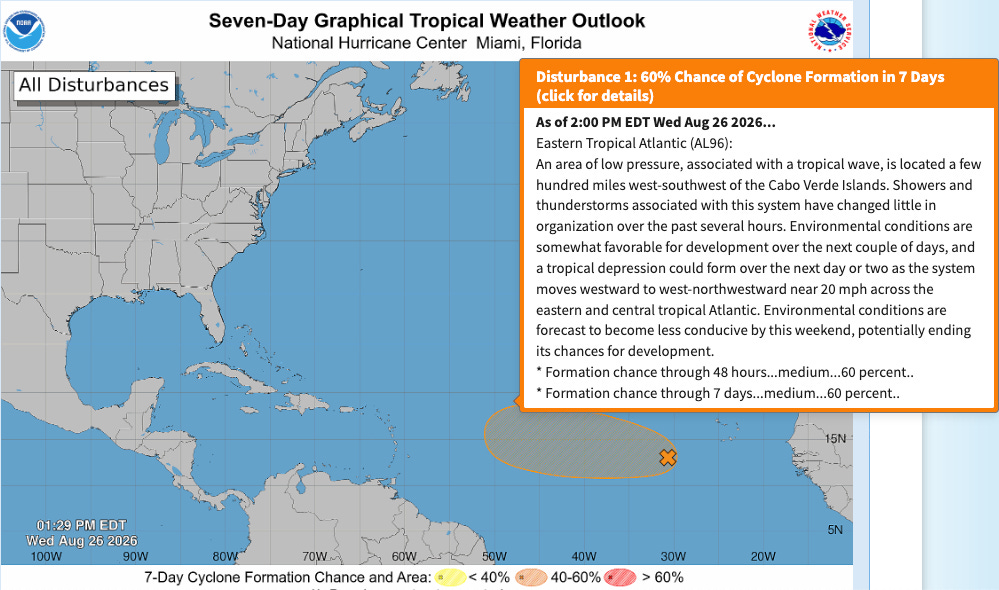
That disturbance is Invest 96L, a tropical wave churning westward across the eastern Tropical Atlantic between Cape Verde and the Lesser Antilles. This wave has been the proverbial pain in the liver just short of jaundice, generating decent thunderstorm activity around a broad area of rotation, but remaining too disorganized to merit tropical depression or storm status. As of Wednesday afternoon, the NHC gives 96L a generous 60% chance of development through Friday, as shown above.
The wave will continue west-northwest at a brisk pace and should be in the vicinity of the northern Lesser Antilles by late this weekend. Beyond that time, the eventual fate of 96L becomes unclear. There are three main possibilities, ranging from nothingburger to something to keep an eye on:
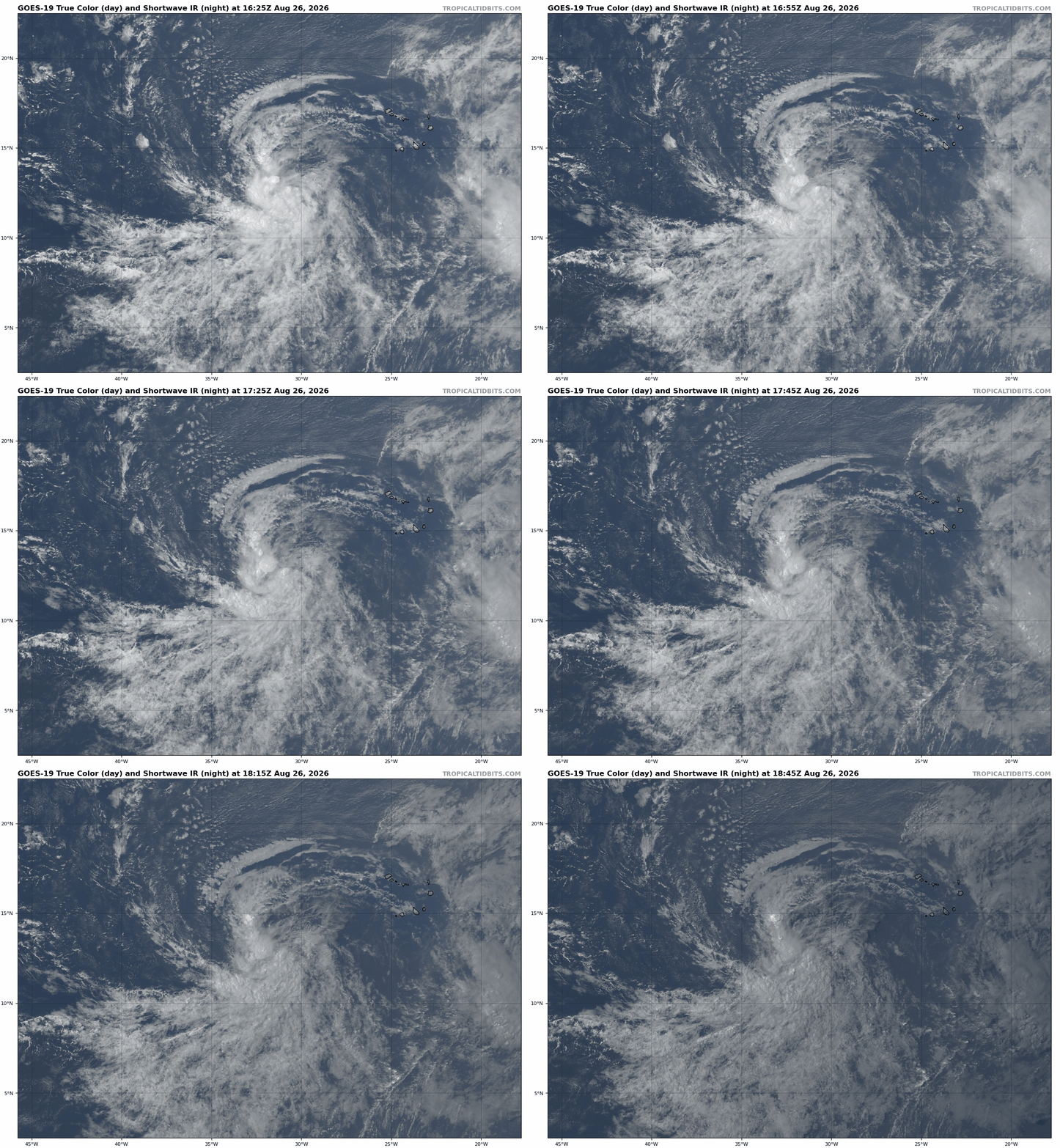
The most straightforward scenario is the most likely: 96L flops, like every other tropical wave this year. That outcome is backed by a preponderance of real-world and model evidence. The wave may look formidable from a distance, but high-resolution satellite imagery continues to show multiple low-level swirls fighting for dominance beneath the thunderstorms, hampering inflow and causing the disturbance to fritter away the most favorable environment it’s going to encounter.
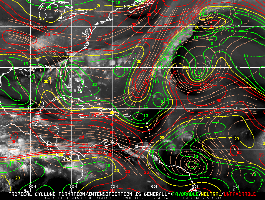
By late Friday, wind shear increases as 96L races west-northwest at an unhealthy 20-25 mph, and the drier airmass surrounding the disturbance should begin to overspread the circulation and weaken the associated convection. Formerly bullish models started backing off on this wave once it hit the water, a late summer tradition since 2024; disturbances generally don’t come back from that downtrend kiss of death, at least in the short-term. Next week, there shouldn’t be much left of 96L to rebuild, and any remaining twist may never find a low-shear, high-moisture environment.
Thus, I think the most probable outcome is that 96L never develops and merely spreads higher rain chances and blustery winds wherever it washes out, but…
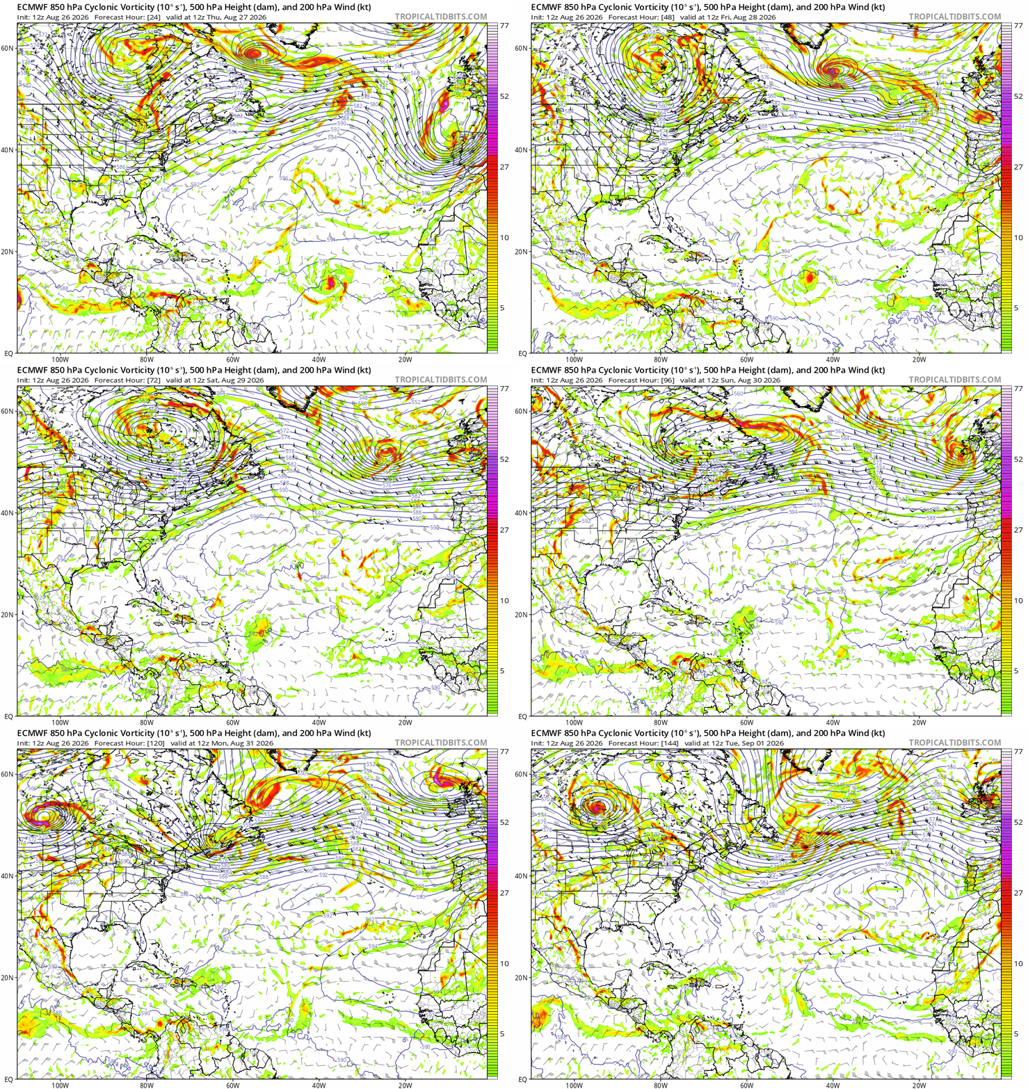
…I could be wrong. Invest 96L isn’t all that far from tropical depression status as of Wednesday afternoon. If a low-level swirl on the south side of the circulation becomes dominant and triggers a diurnal convective burst, the system could still become a depression or modest tropical storm between Thursday and Saturday. However, even if that happens, 96L will be a stoppable force encountering the immovable object of high wind shear near the Lesser Antilles this weekend. Most of the minority of model ensemble members that develop 96L over the next few days weaken it back to a humble tropical disturbance as it reaches the islands for this reason.
Practically, the Eastern Atlantic short-lived storm scenario is the same as no development, but…
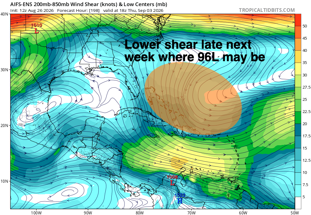
…it’s worth considering the outside chance that 96L might re-organize later next week, a possibility if it can pass through the higher wind shear zone and emerge northwest of Puerto Rico. Such a scenario would, theoretically, pique our interest in Florida and Southeast U.S.
Of course, that’s many steps away from reality. Yet, should the wave would remain north of the Caribbean shear axis, hang on to some kind of low-level rotation, and not be completely annihilated by dry air, ensemble models suggest that upper-level winds could be supportive for slow, eventual organization in the subtropical western Atlantic or even the Gulf. Water temperatures there are running above average, and with 96L’s forward speed expected to slow down starting Monday or Tuesday, there could be a mid- or late-week window for the disturbance to recover from its weekend encounter with dry air. It’s a bankshot, but can’t be ruled out.
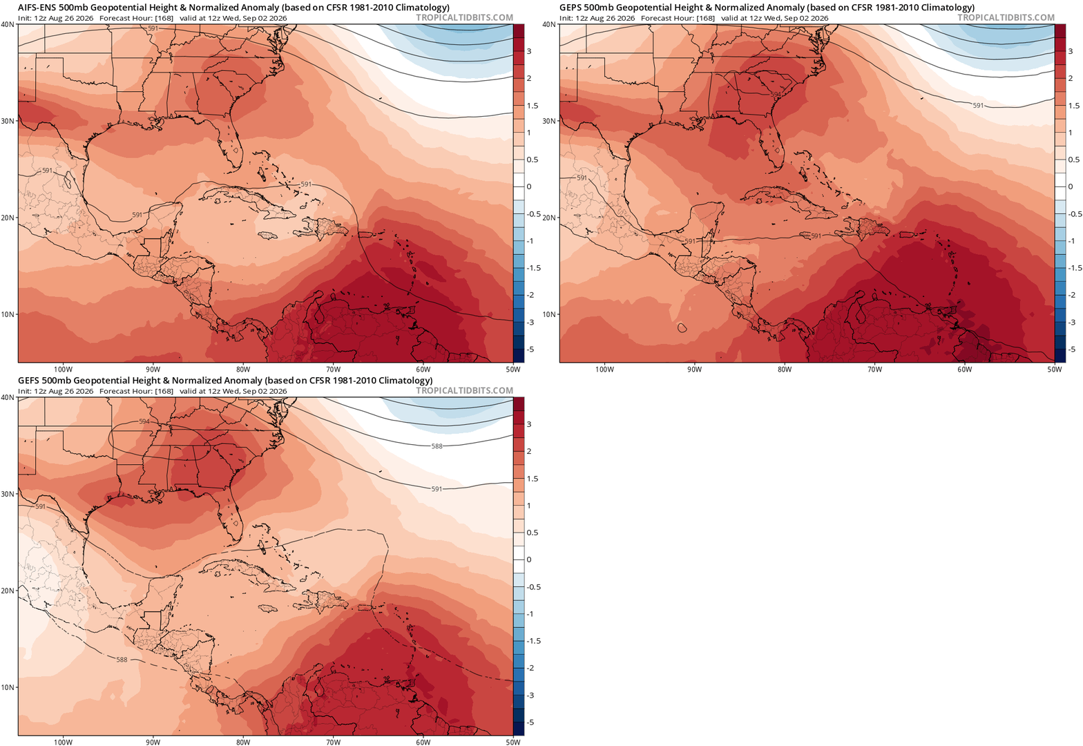
Steering currents are also tricky. The consensus of model guidance shows a weak dip in the jet stream in the west-central Atlantic, with an intermittent ridge of high pressure aloft over the Southeast through the first week of September. That means that on the off-chance 96L does get it together in the western Atlantic, its next move could be to turn out-to-sea, keep moving west-northwest, or just meander for a while. That all depends on where a circulation consolidates and the relative strengths and locations of the ridge and trough, unknowable details beyond a week out.
Overall, I would not be even a little concerned about 96L at this stage, though I would check back early next week if you’re in Florida or the Southeast. We should know more about the steering situation by then, as well as whether 96L itself has been eradicated or merely decimated by shear and land interaction. WeatherTiger’s real-time model of seasonal U.S. hurricane risks predicts well below average total landfall activity, but still suggests a greater than 50% chance of one or more continental U.S. hurricane impacts this year. I am not saying that 96L will be a threat, but… a weirdo wave that bumbles into the subtropical western Atlantic, then forms closer to home is the kind of thing we do need to watch for during El Niños. Thus, even though they have given us thankfully little to watch in 2026 and may well continue to do so, keep watching the skies.
No posts
Comments
Nothing yet. Say the first thing.
Sign in to join the conversation.