

This is forecast post number 1006 — Day 229 of 2026.
Day 78 of Atlantic Hurricane Season | Up to 3 Named Storms, ACE = 3
Author: Dr. Ryan Maue (X @RyanWeather X @weathertrader)
1 new subscriber, and 2 renewals, plus more free tier followers. Your trust and support is greatly appreciated.
Weather Trader is entirely reader-supported publication (no ads). To receive all new posts and support our growing platform, consider becoming a paid subscriber / supporter.
A large “heat dome” is stuck across the Southern U.S. but plenty of moisture is leaking through the lid into the Southeast, leading to powerful storms developing in Tennessee and sliding southward into north Georgia this evening.
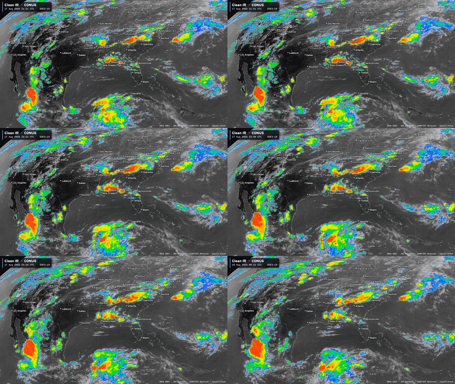
Another batch of severe weather is along the Gulf coast including Mobile. We’ll see how much of these storms last the trip through Metro Atlanta down I-75 as the air mass is quite dry with temperatures pushing upper-90s earlier this afternoon.
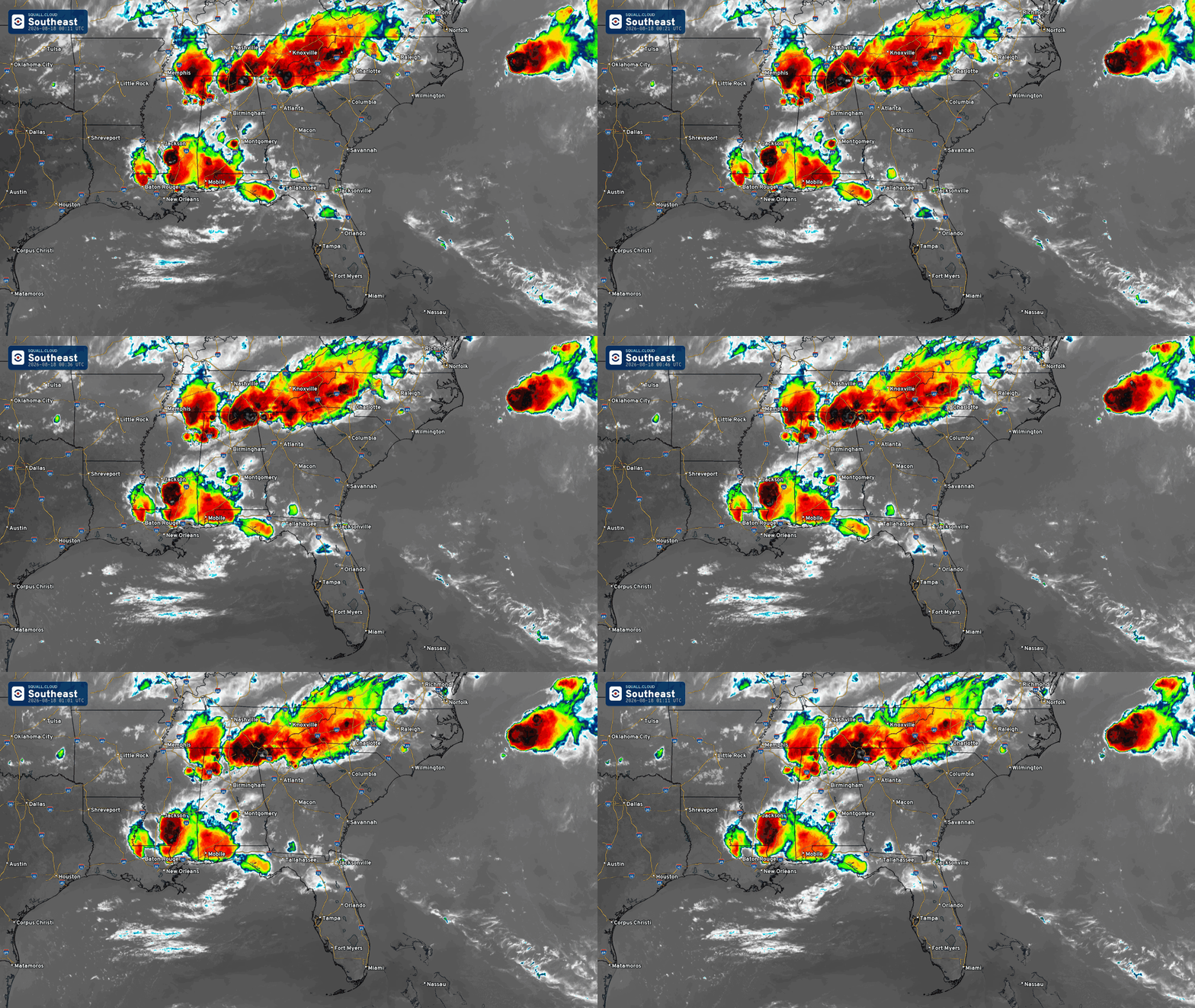
The storms represent a slight weakness in the ridge (heat dome) but temperatures still expected to push into the 90s and 100s through the week from TX/OK into Southeast.
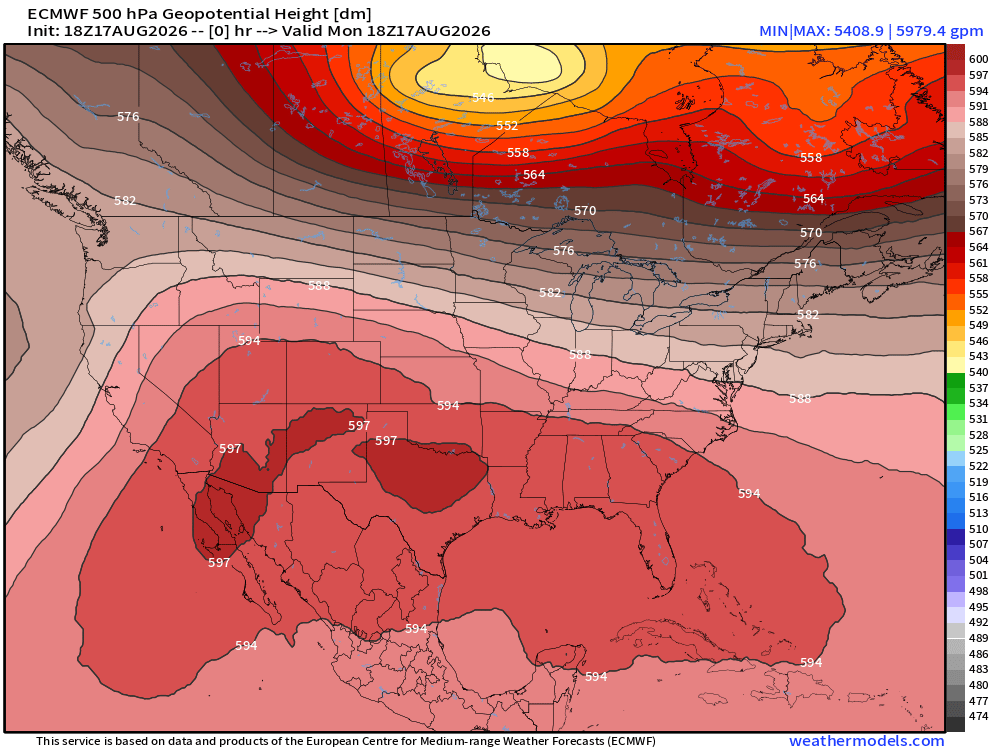
The “heat dome” remains settled across the southern 1/2 of the Lower 48 from the Southwest into Florida. Height (500 mb) at 18z
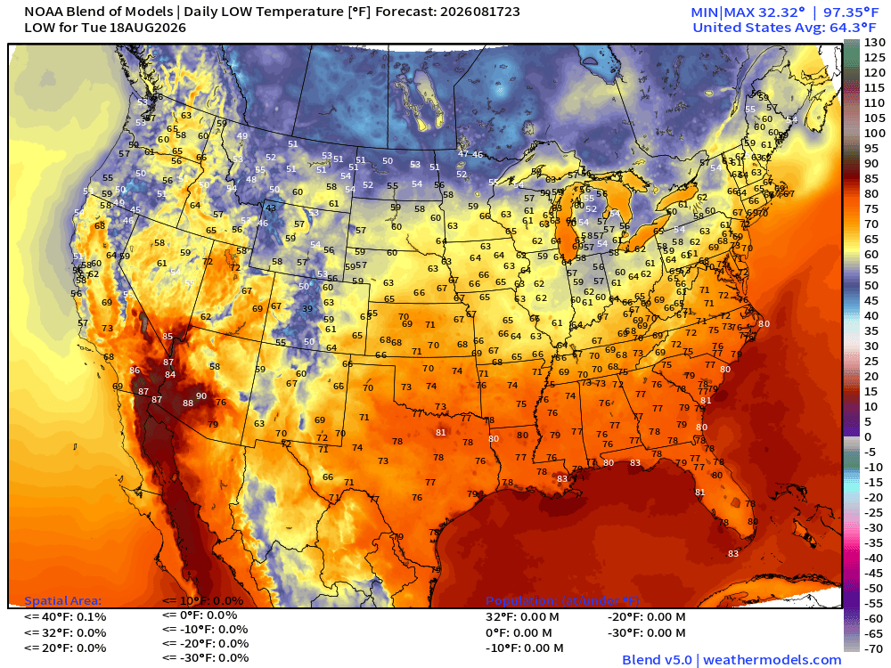
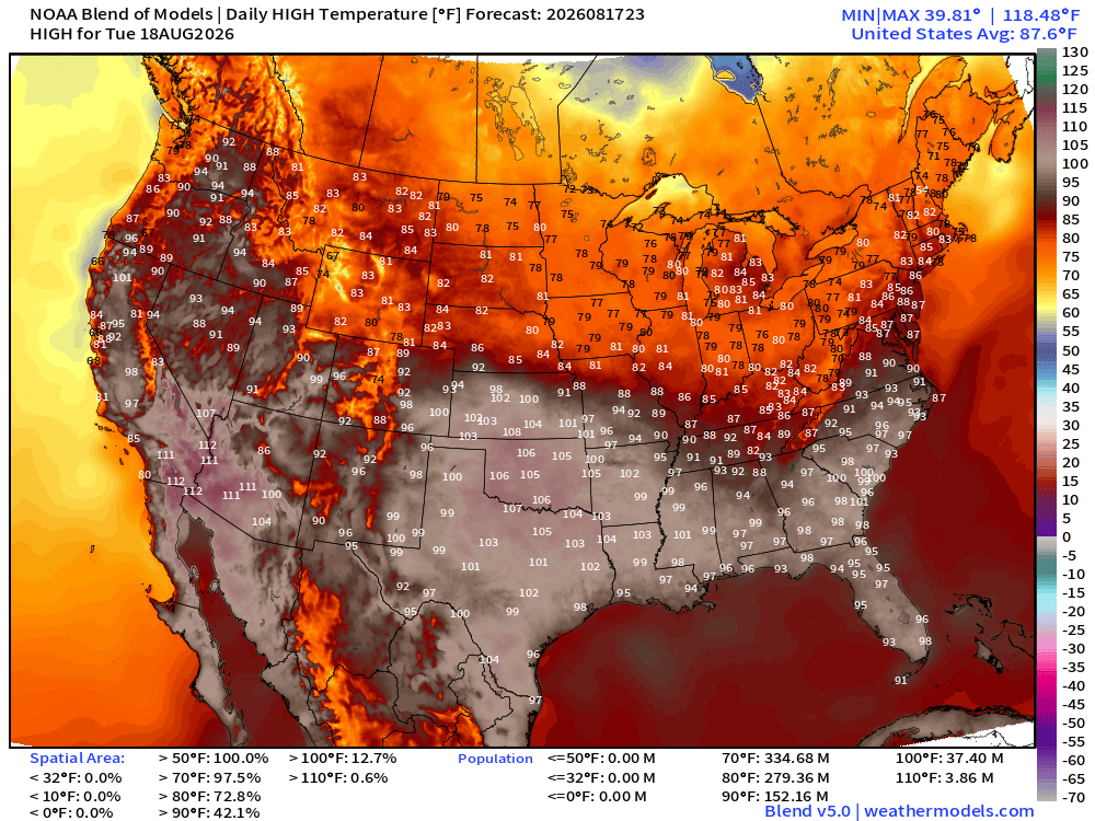
Widespread 90s and 100s from Texas into the Carolinas with 37 million population at least 100°F
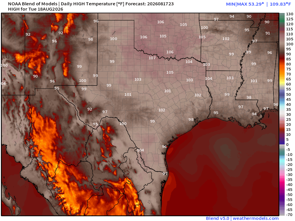
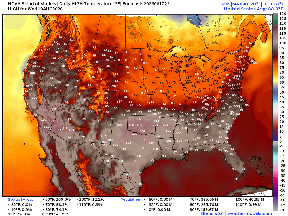
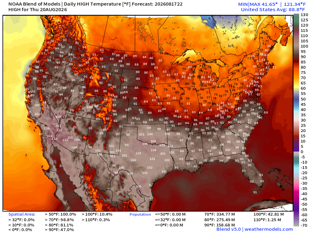
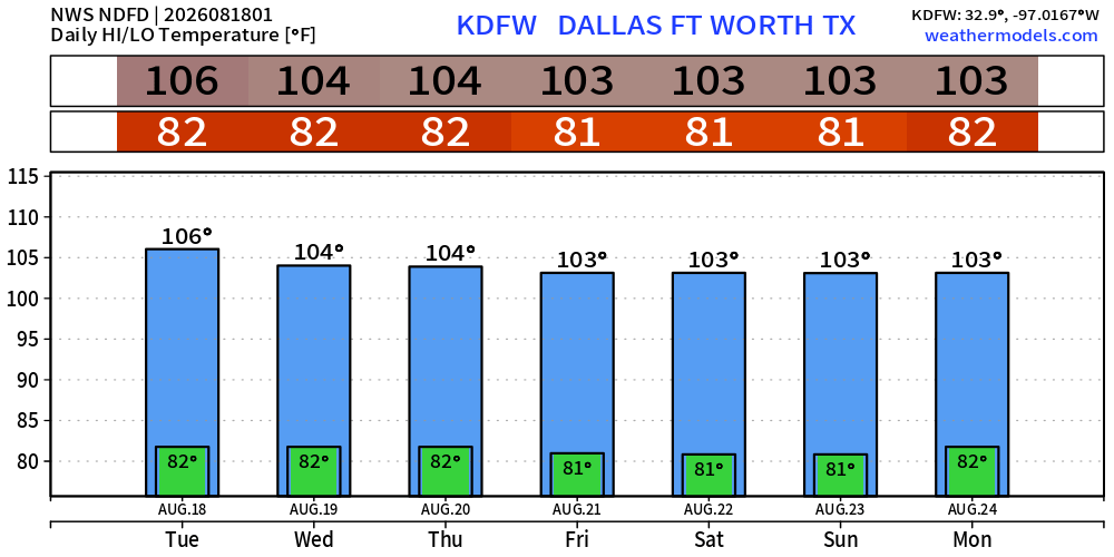
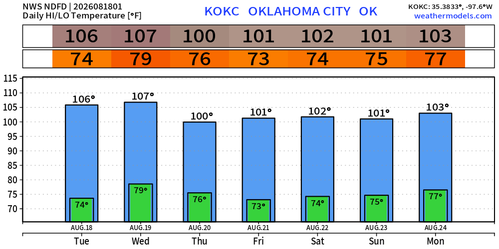
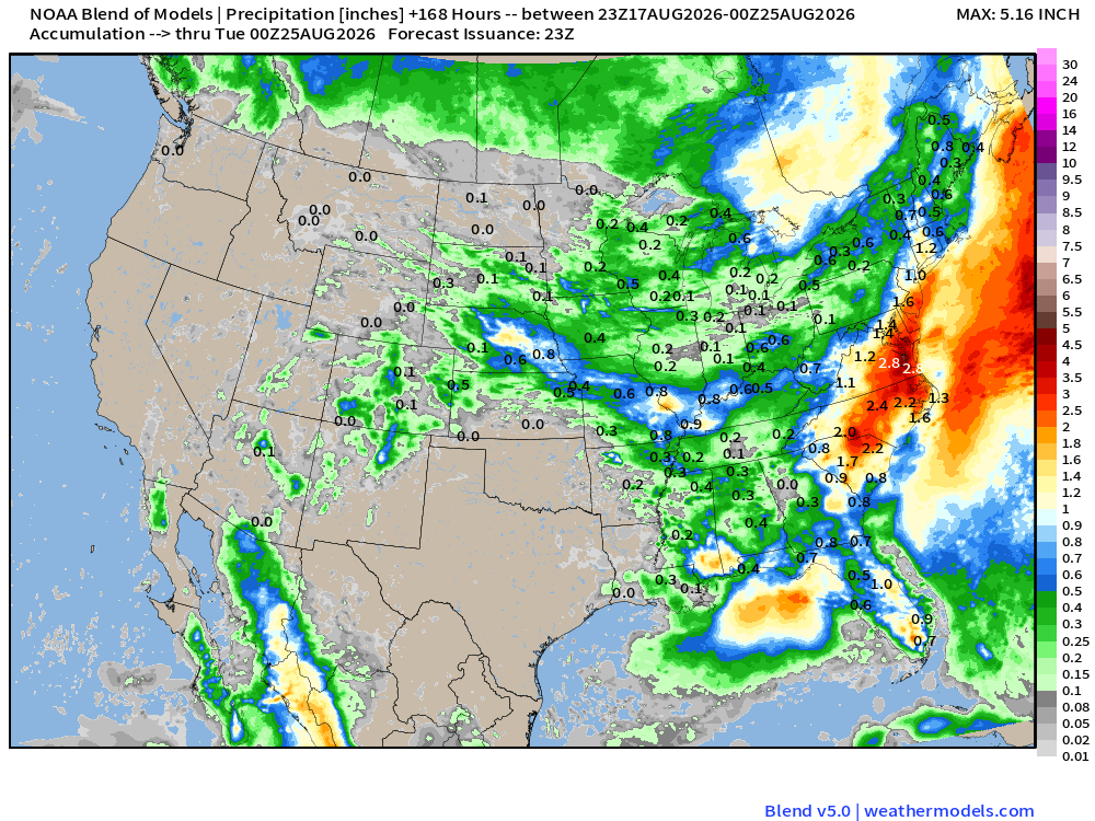
Texas looks dry as a bone. Not much western mountain monsoon moisture either.
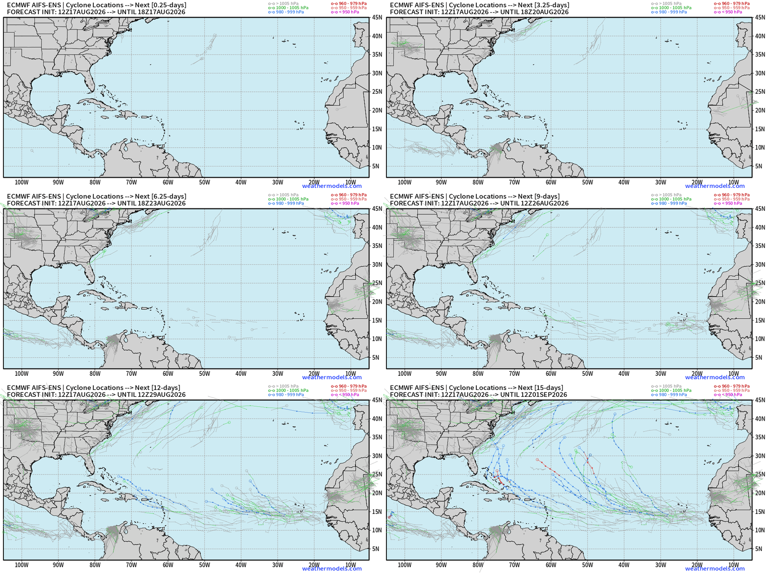
AIFS-ENS 18z does pick up tropical waves in the MDR but not until Days 8-10, with two low chance opportunities at this juncture. A wave coming off Africa in 8-days seems to be the strongest signal.
Comments
Nothing yet. Say the first thing.
Sign in to join the conversation.