

This is forecast post number 1004 — Day 225 of 2026.
Day 74 of Atlantic Hurricane Season | Still only 2 Named Storms
Author: Dr. Ryan Maue (X @RyanWeather X @weathertrader)
Welcome to 1 new annual subscriber, and 1 renewing paid annual subscriber, plus other free tier followers. Your trust and support is greatly appreciated.
Weather Trader is entirely reader-supported publication (no ads). To receive all new posts and support our platform, consider becoming a paid subscriber / supporter. Satellite imagery from Squall Cloud.

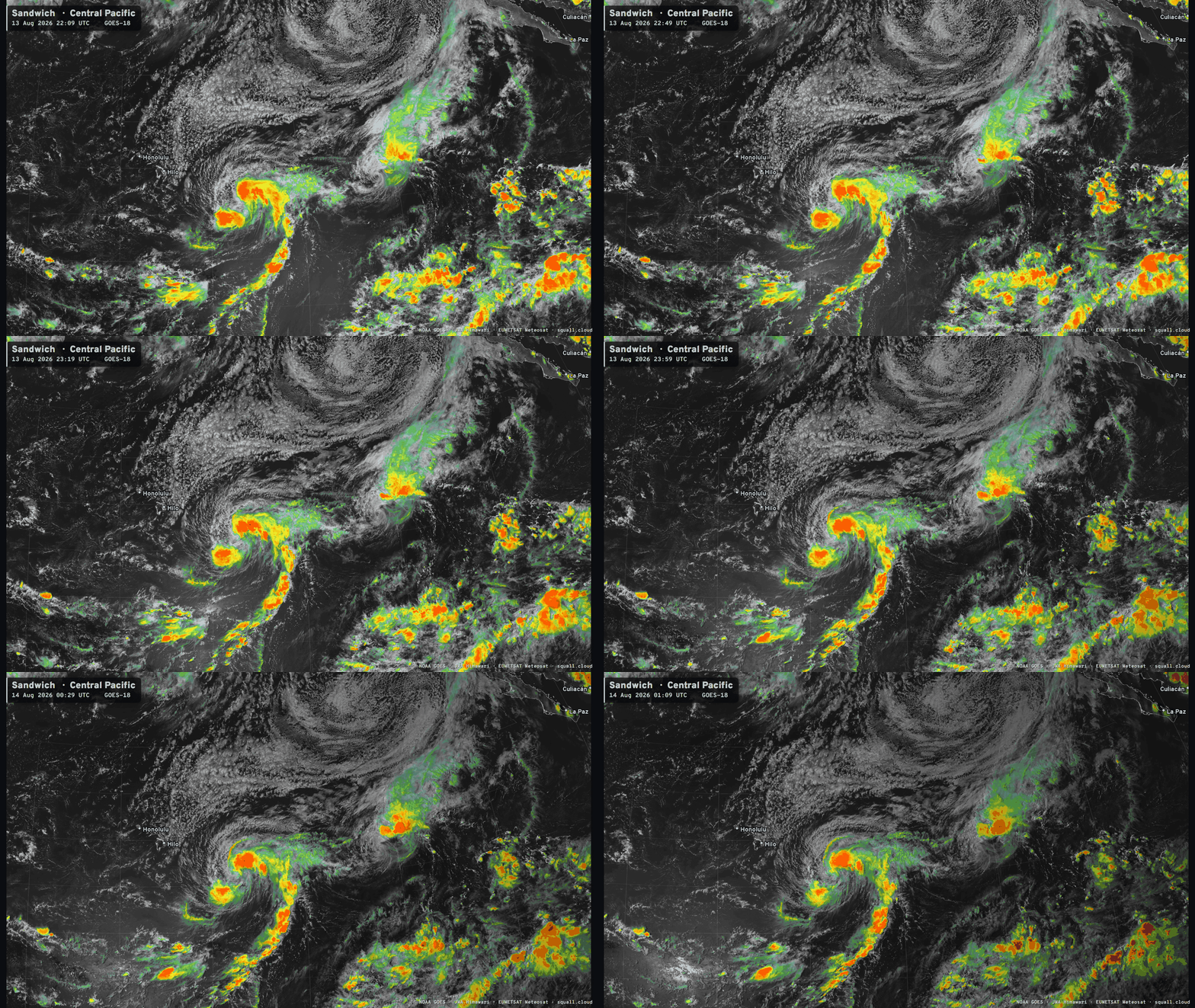
Tropical Storm Lala is underway and slowly intensifying with 40-45 knot winds. The environment is not ideal with strong wind shear out of the west and dry air at the same time.
Another Eastern Pacific tropical storm formed, too —> named Hernan. It is also having trouble with wind shear, and seems to have decoupled from its convection.
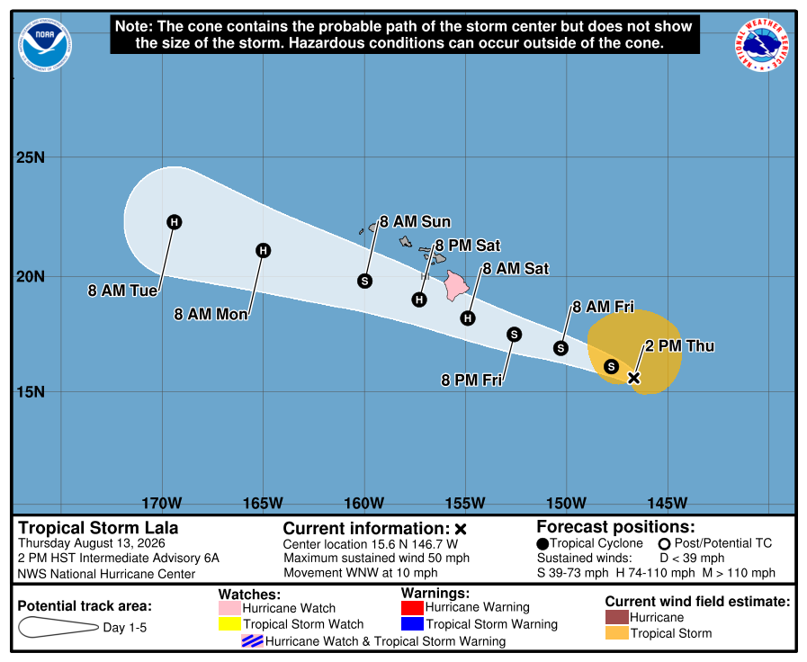
Forecast Track from NHC for Tropical Storm Lala now calls for a Hurricane near the Big Island (on the south side) early Saturday morning Hawaii time.
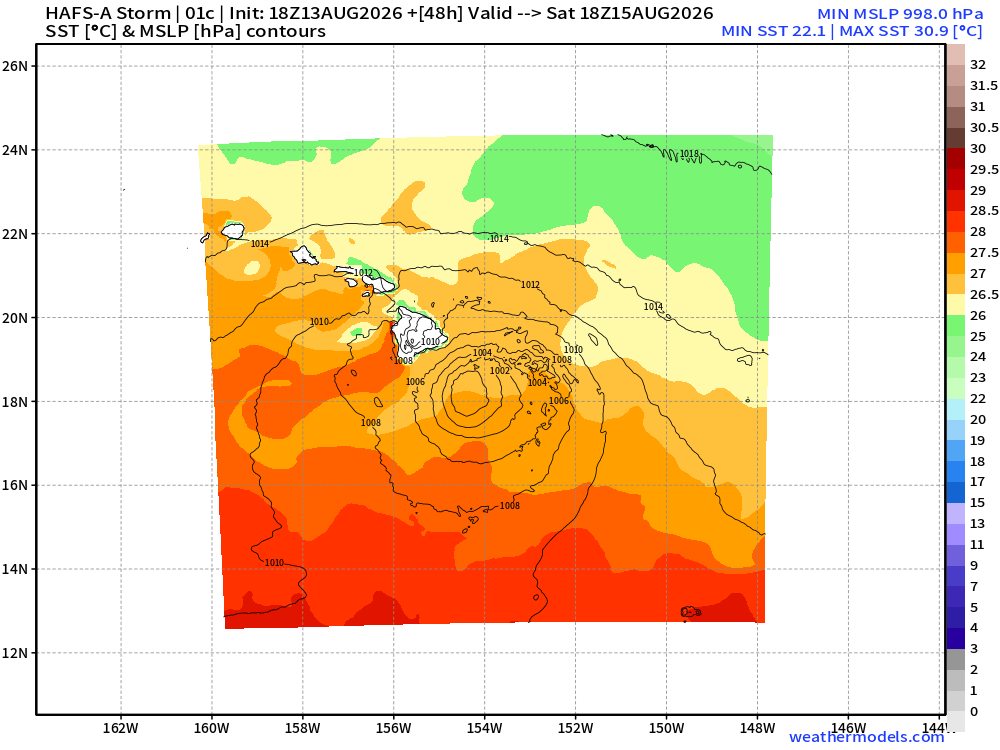
SSTs are plenty warm for a hurricane but the dry environment and wind shear will limit Lala’s potential.
HAFS-A still shows a strong circulation consistent with a hurricane … and the strongest winds would be on the north side of the circulation —> worst for islands.
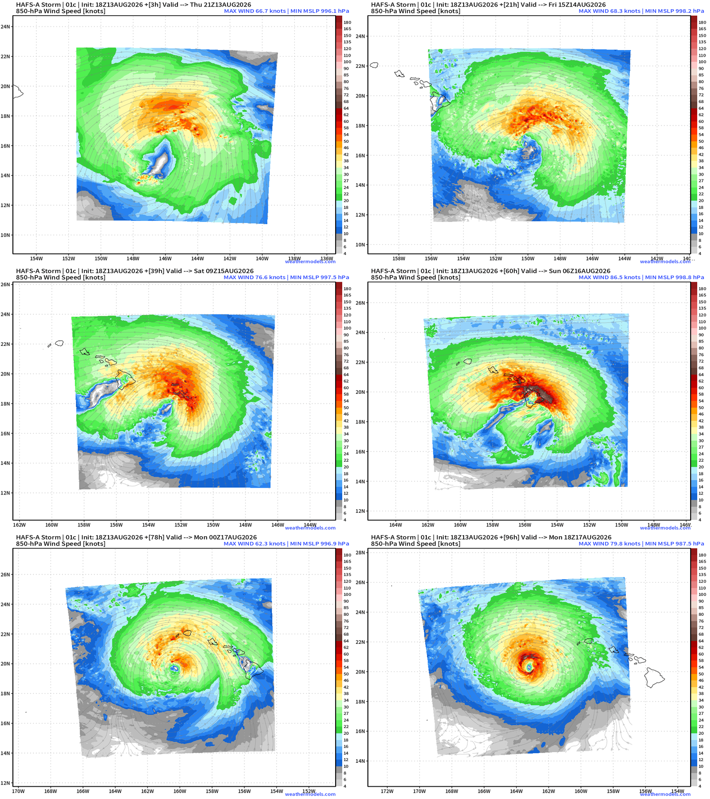
HAFS-A mesoscale model takes Lala to the lower 990s (hurricane intensity) right through the islands, and the Big Island volcano (Mauna Loa) would disrupt it.
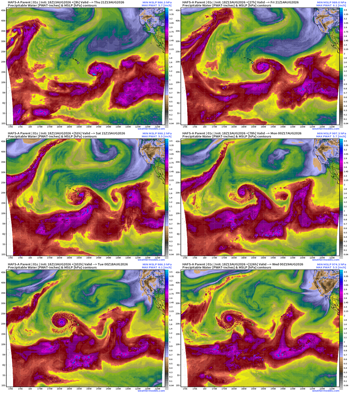
Pull this deep tropical moisture northward and then into Lala across the Hawaiian Islands —> extreme rainfall totals / flooding risk with upwards of 1-2 feet of rain on Big Island and Maui
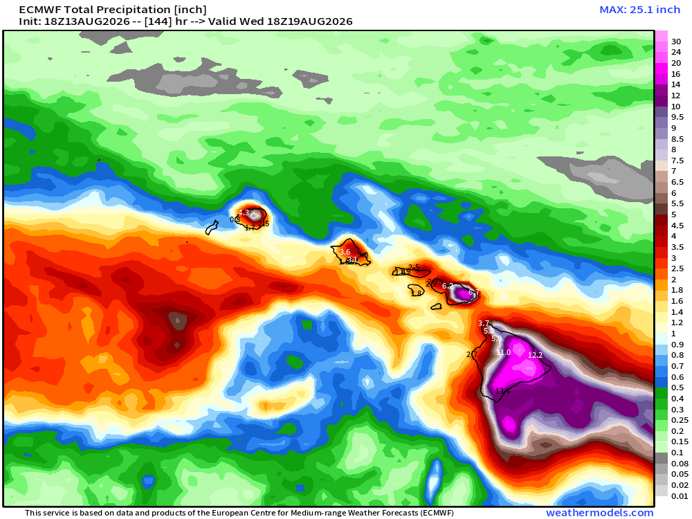
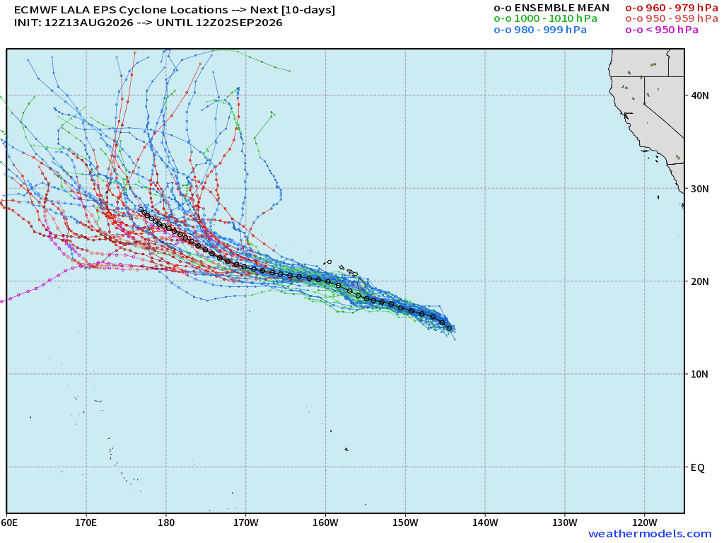
ATCF tracks are south of the Big Island
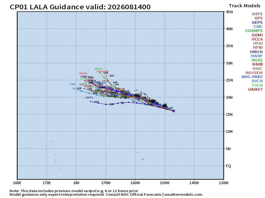
Tracks are just south of right through the Hawaiian Islands. I was wrong about the northward excursion, yesterday’s prediction.
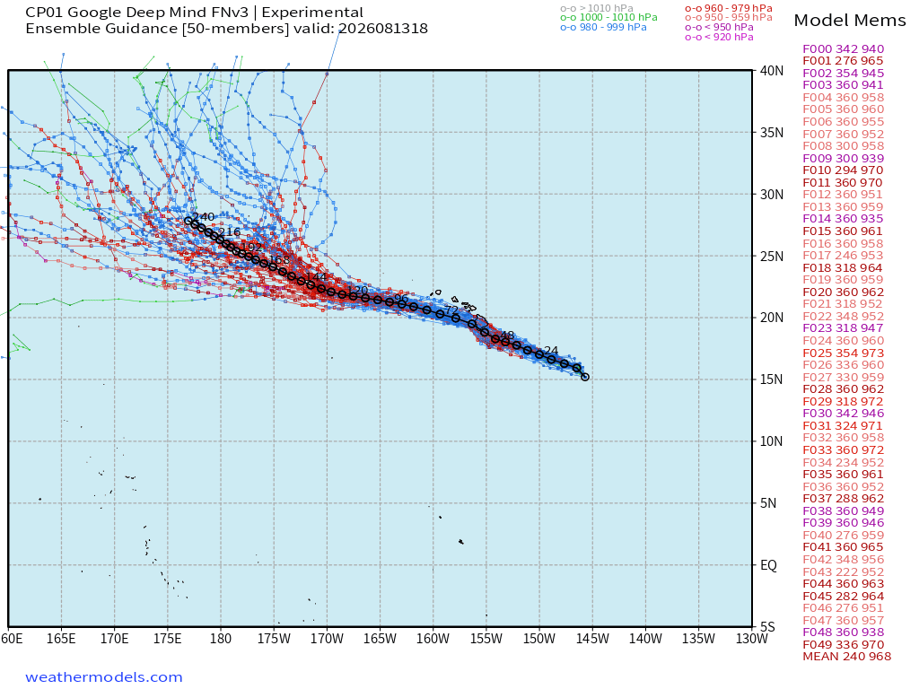
Lala could become a powerful Typhoon in 7-days crossing into the Western Pacific over the International Dateline
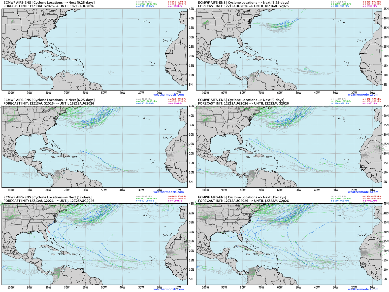
Tropical Waves in the Atlantic are not doing very well tonight — at least for their development potential. Invest 92L blew a tire and might be obliterated by the wind shear shredder. Invest 94L to the east has lost most of its convection. So, we’ll watch the next tropical wave come off Africa and likely become Invest 95L.
The AIFS-ENS 12z tracks now show a minimal chance of survival of Invest 94L into the western Atlantic (10%) and roughly the same for 95L.
Comments
Nothing yet. Say the first thing.
Sign in to join the conversation.